Browse Listings in America > North America > Florida
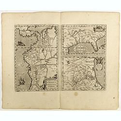
La Florida/ Peruviae Auriferae regionis Typus/ Guastecan.
The Chaves map of Florida is a prime example of an explorer's map since it records the recent discoveries of Cabeza de Vaca, De Soto, and Moscoso. The map revealed little...
Date: Antwerp, 1598
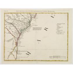
Parte Orientale della Florida, della Giorgia, e Carolina. . .
Attractive map covering the coast from S.Augustine till Long Bay, including Jacksonville, Savannah. From Zatta's Atlante Novissimo.
- $350 / ≈ €306
Date: Venice, 1778
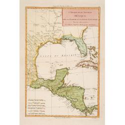
L'Ancien et le nouveau Mexique avec la Floride..
Covering Florida, Texas, western part of Cuba and central America. Showing dozens (100+) of place names, extensive river systems, mountain ranges and featuring the Gulf o...
Date: Paris, 1781
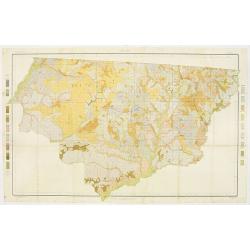
Soil map - Florida, Gadsden County sheet.
Early color lithographed soil map by Julius Bien & Co. in New York for the Department of Agriculture. Legends at the side give detail on soil type, etc. They also inc...
- $40 / ≈ €35
Date: New York, 1903
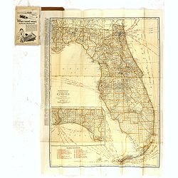
Rand Mc.Nally indexed pocket map Tourits' and Shipper' Guide of Florida. . .
This fine pocket map has on both side a map of Florida. Folding color map (approximately 640 x 495mm) is titled "Rand McNally standard map of Florida" and one h...
Date: Chicago & New York, ca.1915
