Browse Listings in Asia

1564 listings found. Showing results 1521 to 1564
Du sang à l'aube.

Original lithographed poster for the Spanish movie "Blood at dawn" (1948) directed by Rafael Gil, based on the novel by Blasco Ibanez. Poster designed by Duccio...

$130 / ≈ €122
Maker / Publisher: PARIS AFFICHES ET PUBLICITES
Place & Date: Paris, 1948


Plan commercial de la Région Saïgon-Cholon.

Decorative publicity plan of Ho Chi Minh City, also known by its former name of Saigon and Cholon, prepared by Ngo-Trinh, surrounded by advertisements of local stores. Th...

$2500 / ≈ €2339
Maker / Publisher: NGO - TRINH
Place & Date: Saigon, 1948


Key Map of Hong Kong Relative to Canton and Macao.

A nice folded map of Hong Kong and the surrounding areas. Produced by the British Crown Lands Survey Office just after WWII. Physical features are shown by contour. Railw...

$750 / ≈ €702
Maker / Publisher: CROWN LANDS & SURVEY OFFICE.
Place & Date: Hong Kong, 1948


Carte de l'Indochine au 1 : 2.000.000. Carte ethnolinguistique.

Map showing Vietnam, Cambodia, and Laos, prepared under the direction of "l'Ecole Française d'Extrême-Orient". Relief shown by spot heights. With a colored ke...

$400 / ≈ €374
Maker / Publisher: SERVICE GÉOGRAPHIQUE DE L'INDOCHINE.
Place & Date: Hanoï, 1949


Official War map of Korea.

A large folding map of Korea published in the year of the outbreak of the Korean War, published by the Rand McNally Company. The map is extremely detailed and features a ...

$225 / ≈ €211
Maker / Publisher: RAND MCNALLY and CO.
Place & Date: America, ca 1950


Ilustrated Map of The Holy Land for use in schools…

A visually striking and impressive pictorial map of The Holy Land, as issued by the National Savings Movement / Committee during the 1950s. In the upper left quadrant of...

$250 / ≈ €234
Maker / Publisher: NATIONAL SAVINGS COMMITTEE.
Place & Date: London, ca. 1950


Southeast Asia Compiled and Drawn in the Cartographic Section of the National Geographic Society for the National Geographic Magazin Gilbert Grosvenor. . .

Map of the Southeast Asia, with inset map of Taiwan an map with Australia. The first issue of National Geographic Magazine was published on September 22, 1888, nine month...

Maker / Publisher: NATIONAL GEOGRAPHIC SOCIETY MAGAZINE
Place & Date: Washington, 1952
Selling price: $50
Sold in 2018


The Far East Compiled and Drawn in the Cartographic Section of the National Geographic Society for the National Geographic Magazine Gilbert Grosvenor. . .

Map of Far East Asia, with inset map of Korea. Scale 1:7.500.000. The first issue of National Geographic Magazine was published on September 22, 1888, nine months after t...

$75 / ≈ €70
Maker / Publisher: NATIONAL GEOGRAPHIC SOCIETY
Place & Date: Washington, 1952


Political Map of Asiatic Coastal Area.

A strongly colored, large map of the Asiatic Coastal countries. All countries are color coded. Maps coverage is from China and Japan in the north, south to the tips of Su...

$450 / ≈ €421
Maker / Publisher: GEOGRAPHICAL PUBLISHING COMPANY.
Place & Date: Chicago, ca 1952


Pacific Stars and Strips Map of the War.

A detailed map of the Korean War. Several silhouetted flying military aircraft are shown in formation. The map shows the Korean Peninsula from its northern border with Ru...

$600 / ≈ €561
Maker / Publisher: THE PACIFIC STARS AND STRIPES.
Place & Date: America, 1953


Chine - Angleterre.

A large, vintage French school poster map from the 1950s, showing China on one side and the United Kingdom on the reverse. As you would expect content and detail and basi...

$350 / ≈ €328
Maker / Publisher: COOPERATION PEDAGOGIQUE.
Place & Date: Nalliers, ca 1955


Indonesia.

Original vintage travel advertising issued by the Indonesian Council for Tourism featuring a colorful pictorial map marking the islands and oceans with images of local pe...

$1500 / ≈ €1404
Maker / Publisher: INDONESIAN COUNSIL OF TOURISM
Place & Date: Jakarta, ca. 1955


China sea. Tong King Gulf Compiled from the latest British and Foreign Government surveys to 1886. . .

Detailed Map of Chart of Annam Gulf or Tong King Gulf, in the China Sea. Chart with legend and scale. British Admiralty chart No. 2062, published June 1881, large correct...

$400 / ≈ €374
Maker / Publisher: HYDROGRAPHIC OFFICE
Place & Date: London, 1881 updated to 1957


Singapore. - Sheet 134h Keppel harbour.

Map of Singapore. Map with legend and scale. According to a note "Prepared under the direction of the Surveyor General Malaya from the following sources materials : ...

$750 / ≈ €702
Maker / Publisher: SURVEY DEPT. FEDERATION OF MALAYA
Place & Date: Kuala Lumpur, 1958


Festivals of India.

A large eye-catching poster of five women, dancing against a black background, dressed in stunning sari's of red, yellow and blue, produced in India by the Government, wi...

$750 / ≈ €702
Maker / Publisher: GOVT OF INDIA - DEPT OF TOURISM.
Place & Date: Calcutta, 1959


Balinees watercolor on paper, fisherman.

Decorative export painting from Bali of a more than average quality.

$150 / ≈ €140
Maker / Publisher: ANONYMOUS
Place & Date: Bali, ca 1960


Balinees watercolor on paper, fishermen.

Decorative export painting from Bali of a more than average quality.

$150 / ≈ €140
Maker / Publisher: ANONYMOUS
Place & Date: Bali, ca 1960


Balinees watercolor on paper, fishermen.

Decorative export painting from Bali of a more than average quality.

$150 / ≈ €140
Maker / Publisher: ANONYMOUS
Place & Date: Bali, ca 1960


The Road Map of Southern Korea.

Offset printing. A large scale, comprehensive road map of South Korea, with a symbol legend and an inset map of 'The Republic of Korea', and inset of the island of Jeju D...

$200 / ≈ €187
Maker / Publisher: THE YUNGMOONSA PUBLISHING COMPANY.
Place & Date: Seoul, ca 1960


Dia-Do Viet-Nam.

Economic map of Vietnam published in 1960 (not for sale), gift from Japan paper committee. Scale : 1:2 400 000. With a key at lower right part.Features Vietnam, Cambodia,...

$400 / ≈ €374
Maker / Publisher: GIFT FROM JAPAN W/F PAPER COMMITTEE.
Place & Date: 1960


[US Army map of a part of Vietnam.]

A large aerial US Army map of a portion of Vietnam, taken during the war between the two countries. As you might expect the map is highly detailed, highlighting settlemen...

$150 / ≈ €140
Maker / Publisher: US NAVAL OCEANOGRAPHIC OFFICE.
Place & Date: Washington D.C., 1967


Inde.

Decorative poster advertising flights to India made by Georges Mathieu. The poster is one of a series of 15 composed of posters of Greece, Israel, Germany, Great Britain,...

$200 / ≈ €187
Maker / Publisher: MATHIEU, G. / AIR France
Place & Date: Paris, 1967


Japan (poster signed by Georges Mathieu)

Dedicated "Pour Benijs Boulanger" and signed "Georges Mathieu", in black marker. Decorative poster advertising flights to Japan made by Georges Mathie...

$1750 / ≈ €1638
Maker / Publisher: MATHIEU, G. / AIR France
Place & Date: Paris, 1967


Israel.

Decorative poster advertising flights to Israel made by Georges Mathieu. The poster is one of a series of 15 composed of posters of Greece, Israel, Germany, Great Britai...

$450 / ≈ €421
Maker / Publisher: MATHIEU, G. / AIR France
Place & Date: Paris, 1967


Hong Kong.

Decorative poster advertising flights to Hong Kong made by Georges Mathieu. The poster is one of a series of 15 composed of posters of Greece, Israel, Germany, Great Bri...

$950 / ≈ €889
Maker / Publisher: MATHIEU, G. / AIR France
Place & Date: Paris, 1967


Compania General De Tabacos De Filipinas - (Certificate) Accion ordinarias de 500 Pesetas, Barcelona, 27.10.1969.

Beautifully engraved certificate from the Compania General De Tabacos De Filipinas issued in 1985. This historic document has an ornate border around it with a vignette o...

$50 / ≈ €47
Maker / Publisher: Compania General De Tabacos De Filipinas.
Place & Date: Barcelona, 1969


Hành Chính Việt Nam.

Uncommon map of Vietnam published in 1976, one year after the end of the Vietnam War. In April 1976, the National Assembly decided to reiterate Hanoi as the capital of th...

$300 / ≈ €281
Maker / Publisher: ADMINISTRATIVE MAP.
Place & Date: Hanoï, 1976


To Quoc Viet Nam Giau Va Dep (Vietnam).

Economic map of Vietnam published in 1976.Features Vietnam, Cambodia, Laos and part of Thailand. With a key referring to agricultural productions and fauna…The map show...

$600 / ≈ €561
Maker / Publisher: OFFICIAL PUBLICATION.
Place & Date: Hanoï, 1976


U.R.S.S. Industrie. Sibérie et Extreme-Orient. (4)

Map of Siberia. Propaganda poster for Russia's in and export of industrial goods from Siberia. Editions de l'Agence de presse Novosti".More about War Maps & Prop...

$150 / ≈ €140
Maker / Publisher: AGENCE DE PRESSE NOVOSTI
Place & Date: USSR, 1978


India west coast Gulf of Cutch to Vijaydurg . . .

Chart of India's west coast map surveyed by the hydrographer Captain JF Parry. A highly corrected version of Admiralty chart 2736 originally published 1st July 1915. Date...

$200 / ≈ €187
Maker / Publisher: HYDROGRAPHIC OFFICE
Place & Date: London, 1915-1980


[Afghanistan].

A scarce Russian relief map (in Russian) of Afghanistan published in Moscow during the Soviet occupation of the country during the early 1980s. Complete with a separate b...

$250 / ≈ €234
Maker / Publisher: UNKNOWN.
Place & Date: Moscow, 1982


Anamu Buru to Latakia including Iskenderun Körfezi.

A highly corrected version of Admiralty chart 2632 originally published 25 November 1955 under the Superintendence of Captain K.SB. Collins. Edition Date 1984 Detailed ch...

$100 / ≈ €94
Maker / Publisher: HYDROGRAPHIC OFFICE OF THE ADMIRALTY.
Place & Date: London, 1955 - 1984


Persische Teppichknüpfgebiete und Stämme.

Map of Iran and neighboring countries in German language, published in limited edition probably in France : "Gravée à l'eau-forte et au burin. Edition limitée&quo...

$1500 / ≈ €1404
Maker / Publisher: ANONYMOUS.
Place & Date: France ?, after 1935 - before 1991


China Sea Luzon Strait between Luzon and Tai-Wan from the United States & Japanese Government chartsto 1929. . . (3804)

A highly corrected version of Admiralty chart 3804 originally published 18 September 1925 under the Superintendence of Captain P.H. Douglas. New Editions 18th December 19...

$150 / ≈ €140
Maker / Publisher: LONDON ADMIRALTY.
Place & Date: London, 1929 / 1992


China sea Gulf of Tongking (Southern sheet).

A highly corrected version of Admiralty chart 3989 originally published 11 Mai 1962 under the Superintendence of Captain EG Irving. Detailed chart including the coasts of...

$80 / ≈ €75
Maker / Publisher: HYDROGRAPHIC OFFICE OF THE ADMIRALTY.
Place & Date: London, 1962 - 1992


China Sea Philippine Islands - San Bernandino Strait and approaches. (3370)

A highly corrected version of Admiralty chart 3370 originally published 14th November 1924 under the Superintendence of Captain H.P. Douglas. Edition Date 1982 with furth...

$150 / ≈ €140
Maker / Publisher: LONDON ADMIRALTY.
Place & Date: London, 1924 / 1996


Philippine Islands - Semirara, Ilin and Ambulong 1.s with part of Mindoro. (971)

A highly corrected version of Admiralty chart 971 originally published 15th February 1866 under the Superintendence of Captain G.H. Richards. Edition Date 1991 with furth...

$150 / ≈ €140
Maker / Publisher: LONDON ADMIRALTY.
Place & Date: London, 1866 / 1999


Philippine Islands - Mindanao West Coast - Basilan Strait to Camiguin Island including Tubbataha Reefs. . . (3811)

A highly corrected version of this oversized Admiralty chart 3811 originally published 26th February 1925 under the Superintendence of Captain P.H. Douglas. Edition Date ...

$150 / ≈ €140
Maker / Publisher: LONDON ADMIRALTY.
Place & Date: London, 1925 / 2005


Philippine Islands - Luzon - west and east coast. Cabra I. to S.n Fernando P.t. Diapitan B. to S.n Miguel B. . . (3806)

Detailed chart of Luzon Island with Manila Bay, Cabra Island to S. Fernando Point Diapitan Bay to S. Miguel Bay.A highly corrected version of Admiralty chart 3806 origina...

Maker / Publisher: LONDON ADMIRALTY.
Place & Date: London, 1922 / 2006
Selling price: $100
Sold in 2018


Carte géologique détaillée. Beyrouth.

Geological or soil map showing part of Lebanon with Beyrouth, including in top a colored legend with signs of the different geological ages. Provenance : Fondation P. Fal...

$300 / ≈ €281
Maker / Publisher: DUBERTRET, Louis.
Place & Date: Liban, Service geographique des F.F.L., 1945.
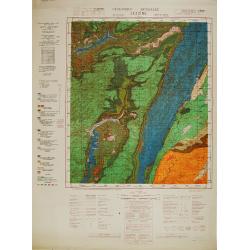


Carte géologique détaillée. Jezzîne.

Geological or soil map showing part of Lebanon with Jezzîne, including a legend with signs of the different geological ages and giving many information of greatest inter...

$300 / ≈ €281
Maker / Publisher: DUBERTRET, Louis. / HEYBROCK, Friso.
Place & Date: Liban, Service geographique des F.F.L., 1945.
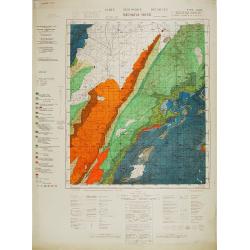


Carte géologique détaillée. Râchaïya Nord.

Geological or soil map showing part of Lebanon with Râchaïya , including a legend with signs of the different geological ages and giving many informations of greatest i...

$300 / ≈ €281
Maker / Publisher: DUBERTRET, Louis.
Place & Date: Liban, Service geographique des F.F.L., 1945.
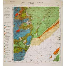


Carte géologique détaillée. Zahle.

Geological map showing part of Lebanon with Zahle. , including a legend with signs of the different geological ages. Provenance : Fondation P. Fallot

$300 / ≈ €281
Maker / Publisher: DUBERTRET, Louis.
Place & Date: Liban, Service geographique des F.F.L., 1945.
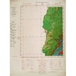


Carte geologique detaillee. Jbail.

Geological or soil map showing part of Lebanon with Jbail antique Byblos Ancien Port phenicien / scale 1 : 50 000., including a legend with signs of the different geologi...

$300 / ≈ €281
Maker / Publisher: DUBERTRET, Louis.
Place & Date: Liban, Service geographique des F.F.L., 1945.