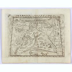
Tabula Asiae IIII. (Cyprus, Holy Land, Syria, Jordan, Iraq)
Gastaldi's map showing Cyprus, the Holy Land, Syria, Jordan and Iraq, based upon Ptolemy's map It is one of the earliest obtainable maps of the region.From Giacomo Gastal...
- $350 / ≈ €328
Place & Date: Venice, 1548
Cyprus Insula / Candia, Olim Creta.
Two maps on one sheet. Copper engraving illustrating Cyprus and Crete, with Latin text on verso. From 1584 onwards editions of the Ortelius atlas no longer included this ...
Place & Date: Antwerp, 1575
Cyprus - Insular Aliquot Aegaei maris antiqua descrip.
Ten maps on one sheet. With large map of Cyprus. Provenance: This map is from the personal collection of dr. Marcel van den Broecke, author of Ortelius Atlas Maps An...
Place & Date: Antwerp, 1595
Cyprus Insulae.
Janssonius' beautiful map of Cyprus embellished with a very decorative title cartouche.
Place & Date: Amsterdam, 1640
Selling price: $1800
Sold in 2008
Cyprus Insula.
Blaeu's beautiful map of Cyprus is embellished with a very decorative title cartouche, a scale cartouche, two coats of arms, two wind roses and three sailing ships. From...
- $1800 / ≈ €1684
Place & Date: Amsterdam, 1644
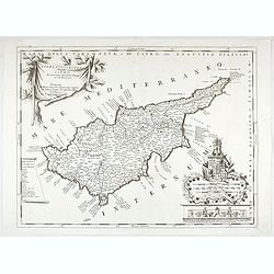
Acamantis insula hogidi Cipro . . .
Decorative map of Cyprus. The remarkable Vincenzo Coronelli (1650-1718), was a Franciscan Friar and appointed General of the Order in 1701. He was cosmographer to the Rep...
Place & Date: Venice, 1700
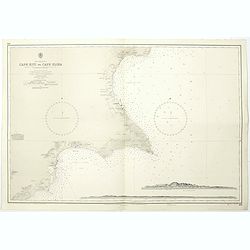
Cyprus south east coast Cape Kiti to Cape Eloea.
An British Admiralty chart of Cyprus south east coast. A highly corrected version of Admiralty chart 971 originally published 15th February 1866 under the Superintendence...
- $100 / ≈ €94
Place & Date: London, 1852
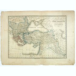
Az Europai és Asiai Torok Birodalom Kozonséges Foldképe
Hungarian map of Turkey, including Greece, Cyprus, etc.
- $150 / ≈ €140
Place & Date: Pesten, 1864