Browse Listings in Africa > North Africa > Canary Islands
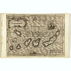
7 listings found. Showing results 1 to 7
Canariae I.

Small map of the Canary Island. Nicolaes de Clerck (de Klerc) was active as engraver and publisher in Delft from 1599-1621.Included in the rare book : Wereld Spiegel, wae...

$125 / ≈ €117
Maker / Publisher: DE CLERCK, N.
Place & Date: Amsterdam, Cloppenburch, 1621


[Attack of Dutch fleet commanded by Pieter van der Does of Gran Canaria in 1599].

Attack of Dutch fleet commanded by Pieter van der Does of Gran Canaria in 1599. Scarce print (150x177mm.) on a German text sheet taken from a first edition of Johann Ludw...

$180 / ≈ €168
Maker / Publisher: GOTTFRIED, J.L. / DE BRY, T.
Place & Date: Frankfurt, M.Merian, 1633


Insulae de Cabo Verde olim Hesperides sive .. Zoute Eylanden.

Original copper engraving, hand colored in outline, when published. Double page chart covering detailed the Cap Verde Islands in the Atlantic Ocean (Isla de San Antonia, ...

$750 / ≈ €702
Maker / Publisher: JANSSONIUS, J.
Place & Date: Amsterdam, 1655


Original copperplate.

Showing the coast of southern Morocco, the Sahara with the Canary Islands. Copperplates that had been used in the production of early maps are of the greatest rarity and ...

$10000 / ≈ €9357
Maker / Publisher: DUTCH
Place & Date: Amsterdam, ca. 1660


.Caarte voor een gedeelte der Canarise Eylanden als Canaria, Tenerifa, Forteventura, etc.

Very rare chart of the Canaries. Showing Palma, Ferro, Tenerife, Gran Canaria, Forteventura, Lancerota. In upper right hand corner inset of harbour of Lancerota.

$1000 / ≈ €936
Maker / Publisher: GOOS, A.
Place & Date: Amsterdam, 1666


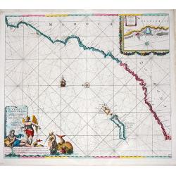
De Cust van Barbaria, Gualata, Arguyn, en Gene..heo, van Capo S.Vincente tot Capo Verde.

An eye-catching chart of the north western coast of Africa. Including Canary Islands, Cape Verde Islands and Azores.Pieter Goos (ca. 1616-1675) was one of the most import...

$600 / ≈ €561
Maker / Publisher: GOOS, P.
Place & Date: Amsterdam, 1666


Nieuwe Pascaert van al de Carnarisse Eylanden. . .

So-called "Blue-back" sea- charts of the Canary Islands.Latitude scale, compass rose and system of rhumb lines, soundings, anchorage's, etc. A wealth of cities ...

$900 / ≈ €842
Maker / Publisher: VAN KEULEN, J.
Place & Date: Amsterdam, 1700