Please login to see price!.
Subscribe to be notified if similar examples become available.
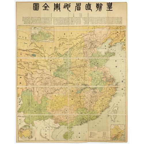
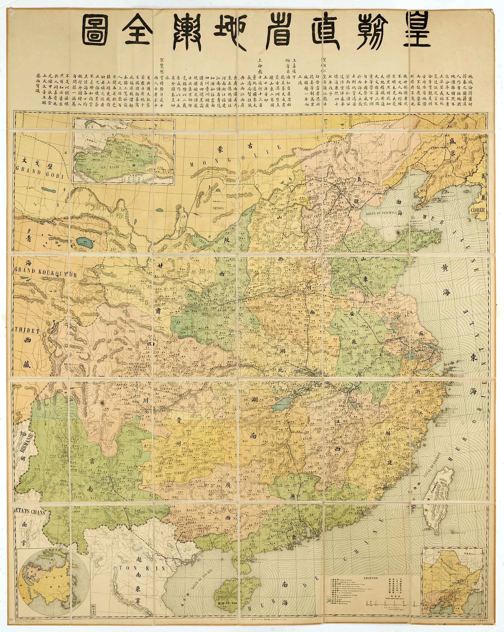
[Title in Chinese - General map of China] |
||||||||||||||||||||
|
||||||||||||||||||||
|
|
||||||||||||||||||||
|
Selling price: $...
Please login to see price! Sold in 2018 Missed this item! Be the first to get notified about our newly added listings. Add your name to our mailing list. Feel free to contact us if you have a question about this item. |
Virtual Collection - Save and collect this or any of your favorite items in one place.
If you want to save the items permanently, please sign in or create account first. |
|||||||||||||||||||
Description
Chromo lithographed map of China prepared by Pêre S. Chevalier and published by Hong-pao-tchai, Shanghai. With 3 colored insets and several index and key tables. The title in top with text (23 cm height).
Showing rail road system, the Great Wall, with French names.
Bottom left of the map, a miniature world map with China in the center. The Chinese note accompanying the map indicates that Emperor Kangxi in the 47th year of his reign sent missionaries Joachim Bouvet (白 晉, 1656-1730), Jean-Baptiste Régis (雷孝思, 1663-1738) for to realize "the map of the ten mile stretch".
This one was realized a year later. The Emperor was satisfied. He sent again the missionaries Guillaume Bonjour (潘 如, 1670-1714), Jean-Baptiste Régis, Pierre Jartoux (杜德 美, 1668-1720) and Jean-François Cardoso (麥 大成, 1676-1723) in order to draw the maps of Mongolia and Manchuria, provinces Zhili (直隸), under direct administration, and that of Shandong (山東).
In the 50th year of his reign, Emperor Kangxi (康熙) ordered the missionaries to travel through the 13 provinces to make the maps.
Jean-François Cardoso and Pierre-Vincent de Tartre (湯尚賢 1669-1724) are in charge of the provinces of Shaanxi (陜西), Shanxi (山西), Jiangxi (江西), Guangdong (廣東) and Guangxi (廣西). Joseph-Francois-Marie-Anne of Moyriac de Maille (馮秉正, 1669-1748) and Romanus Hinderer (德瑪諾, 1668-1744) are responsible for the provinces of Henan (河南), Zhejiang (浙江), Fujian (福建) , Jiangnan (江南). Xavier Fridelli (費 隱, 1673-1743) and William Hello go to the provinces of Yunnan (雲南), Sichuan (四川), Guezhou (貴州) and Huguan (湖廣).
Four years later, the preparatory work and the surveys are completed and the missionaries gathered in Beijing to draw the maps. The work was completed in two years.
The missionaries then submit a map of the fifteen provinces to the Emperor who satisfied with the work rewarded the missionaries. The note goes on to say that Westerners have used these maps, but that a few centuries later, changes in the administrative division of the provinces necessitated revising the map.
The author of this map, Stanislas Chevalier, reports that he has undertaken to update and correct all the errors on the map.
He also added the routes to the seaports. This long note is dated in Chinese 光緒 癸巳 (guang xu gui si, 19th year of the reign of Guangxu corresponding to the year 1893)
FAQ - Guarantee - Shipping
Buying in the BuyNow Gallery
This item is available for immediate purchase when a "Add to Cart" or "Inquire Now" button is shown.
Items are sold in the EU margin scheme
Payments are accepted in Euros or US Dollars.
Authenticity Guarantee
 We provide professional descriptions, condition report (based on 45 years experience in the map business)
Paulus Swaen warrants the authenticity of our items and a certificate of authenticity is provided for each acquired lot.
Condition and Coloring
We indicate the condition of each item and use our unnique HiBCoR grading system in which four key items determine a map's value: Historical Importance, Beauty, Condition/Coloring and Rarity.
Color Key
We offer many maps in their original black and white condition. We do not systematically color-up maps to make them more sellable to the general public or buyer.
Copper engraved or wood block maps are always hand colored. Maps were initially colored for aesthetic reasons and to improve readability. Nowadays, it is becoming a challenge to find maps in their original colors and are therefor more valuable.
We use the following color keys in our catalog:
Original colors; mean that the colors have been applied around the time the map was issued.
Original o/l colors; means the map has only the borders colored at the time of publication.
Colored; If the colors are applied recently or at the end of the 20th century.
Read more about coloring of maps [+]
Shipping fee
A flat shipping fee of $ 30 is added to each shipment by DHL within Europe and North America. This covers : International Priority shipping, Packing and Insurance (up to the invoice amount).
Shipments to Asia are $ 40 and rest of the world $50
We charge only one shipping fee when you have been successful on multiple items or when you want to combine gallery and auction purchases.
Read more about invoicing and shipping
FAQ
Please have a look for more information about buying in the BuyNow gallery
Many answers are likely to find in the general help section.
Virtual Collection
![]()
With Virtual Collection you can collect all your favorite items in one place. It is free, and anyone can create his or her Virtual map collection.
Unless you are logged in, the item is only saved for this session. You have to be registed and logged-in if you want to save this item permanently to your Virtual Collection.
Read More[+]
Register here, it is free and you do not need a credit card.
Add this item to
Virtual Collection
or click the following link to see my Virtual Collection.
| Digital Image Download | |
|
Paulus Swaen maintains an archive of most of our high-resolution rare maps, prints, posters and medieval manuscript scans. We make them freely available for download and study. Read more about free image download |
Click the image for a free small image download. |
![Rare, antique map of [Title in Chinese - General map of China]](/uploads/42891.jpg)
In accordance with the EU Consumer Rights Directive and habitually reside in the European Union you have the right to cancel the contract for the purchase of a lot, without giving any reason.
The cancellation period will expire 14 calendar days from the day after the date on which you or a third party (other than the carrier and indicated by you) acquires, physical possession of the lot. To exercise the right to cancel you must inform Paulus Swaen Inc, of your decision to cancel this contract by a clear statement (e.g. a letter sent by post, or e-mail (amsterdam@swaen.com).
To meet the cancellation deadline, it is sufficient for you to send your communication concerning your exercise of the right to cancel before the cancellation period has expired.
