Subscribe to be notified if similar examples become available.
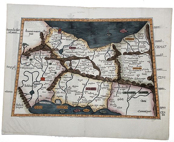
1525 WALDSEEMÜLLER, M. / FRIES, L. - TABULA V ASIAE. (Persia, Iran)
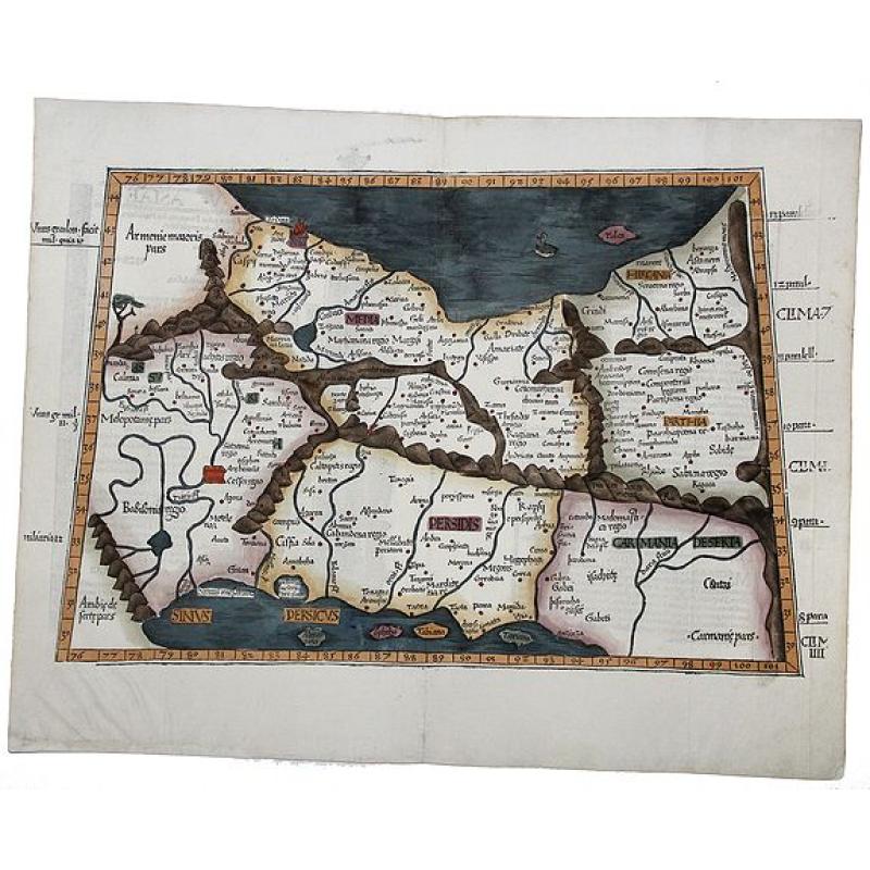
TABULA V ASIAE. (Persia, Iran) |
||||||||||||||||||||
|
||||||||||||||||||||
|
|
||||||||||||||||||||
|
Selling price: $ Please login to see price!
Sold in 2020 Missed this item! Add your name to our mailing list and be the first to get notified about our newly added listings. . |
My Collection +
Add this or any of your favorite items in one place. If you want to save the items permanently, you have to sign in or create an account first.   Add/Remove
 |
|||||||||||||||||||



Description
An early woodcut map after Ptolemy by Lorenz Fries published by Grueninger in Strasbourg , from the rare 1525 edition. The map is a reduced recut of Martin Waldseemueller’s map.
This interesting and detailed woodcut map shows Persia with the Caspian Sea and the Persian Gulf. The verso has the title "Tabula V Asiae", two woodcut borders and initials.
Lorenz Fries (c. 1485/90-1532)
Martin Waldseemüller was a German cartographer and humanist geographer who made significant contributions to the field of cartography during the Renaissance. He is best known for creating the first map to use the name "America" to designate the New World.Waldseemüller was born in Wolfenweiler, a small village in the Breisgau region of present-day Germany. Little is known about his early life and education, though he is believed to have received a solid humanist education, which included the study of Latin and classical texts.
In 1507, Waldseemüller and his colleague Matthias Ringmann produced a groundbreaking map titled "Universalis Cosmographia" This map was part of a larger work known as the "Gotha Manuscript," which aimed to provide a comprehensive description of the world's geography. The map depicted the world in a new and more accurate way, incorporating information from recent voyages of discovery.
Notably, Waldseemüller chose to honor the Italian explorer Amerigo Vespucci by labeling the newly discovered lands in the Western Hemisphere "America" on his map. This decision was based on Vespucci’s travel accounts, which suggested that these lands were part of a distinct continent rather than connected to Asia, as had previously been believed.
Waldseemüller’s map generated great interest and influence, spreading rapidly across Europe and becoming one of the era's most significant maps. It played a crucial role in popularizing the name "America" and establishing it as the accepted name for the New World.
Waldseemüller’s map generated significant interest and influence, spreading rapidly across Europe and becoming one of the era's most influential maps. It played a crucial role in popularizing the name "America" and establishing it as the accepted name for the New World.
Beyond his cartographic work, Waldseemüller was active in the printing and publishing industries. He worked as an editor and publisher for the renowned Strasbourg-based firm of Johannes Grüninger. During this period, he helped publish several works on geography and cosmography, cementing his reputation as an expert and a respected figure in the field.
Unfortunately, Waldseemüller’s life was cut short, and little is known about his final years. He died around 1520, leaving a significant legacy in cartography. His contributions—particularly the naming of America—profoundly and enduringly shaped how the world was perceived and depicted on maps, influencing exploration and geographical understanding for centuries.
Lorenz Fries
Fries was born in Alsace about 1485 or 1490 (Mulhouse in several sources; he described himself once as from Colmar). He studied medicine at Pavia, Piacenza and Montpellier, practised in Alsace and Switzerland, and settled in Strasbourg about 1519. There he met the printer Johann Grüninger, who had printed several of Waldseemüller’s maps and supervised the cutting of the woodblocks for the 1513 Ptolemy. From about 1520 to 1525 Fries worked with Grüninger as a cartographic editor, exploiting the corpus of material Waldseemüller had created.
He is knwown for
- 1520: a reduction of Waldseemüller’s 1507 world map, possibly made in response to Waldseemüller’s death. It appeared in an edition of Solinus published in Vienna, under Peter Apian’s name.
- 1522, Fries’s Geographia (Ptolemy): published at Strasbourg by Grüninger. Nearly all the maps are reductions of the 1513 Waldseemüller maps, in smaller format. Fries added three new maps: the world, China and Japan, and Southeast Asia (these derive from information in Waldseemüller’s 1507 world map). He had originally intended the maps for a new Chronica Mundi by Waldseemüller, but his death shelved the project. The 1522 edition is very rare.
- 1525: Grüninger reissued the edition with Willibald Pirkheimer’s text and the same fifty Waldseemüller/Fries woodcut maps.
- 1525: Fries’s booklet "Auslegung der Mercarthen oder Cartha Marina" accompanied Waldseemüller’s 1516 wall map. In 1525 he left Strasbourg for Trier, Basel and Metz.
- 1541: a later edition of Ptolemy is associated with his name.
FAQ - Guarantee - Shipping
This item is available for immediate purchase when a "Add to Cart" or "Inquire Now" button is shown.
Items are sold in the EU margin scheme
Payments are accepted in Euros or US Dollars.
Authenticity Guarantee
 We provide professional descriptions, condition report (based on 45 years experience in the map business)
Paulus Swaen warrants the authenticity of our items and a certificate of authenticity is provided for each acquired lot.
Condition and Coloring
We indicate the condition of each item and use our unnique HiBCoR grading system in which four key items determine a map's value: Historical Importance, Beauty, Condition/Coloring and Rarity.
Color Key
We offer many maps in their original black and white condition. We do not systematically color-up maps to make them more sellable to the general public or buyer.
Copper engraved or wood block maps are always hand colored. Maps were initially colored for aesthetic reasons and to improve readability. Nowadays, it is becoming a challenge to find maps in their original colors and are therefor more valuable.
We use the following color keys in our catalog:
Original colors; mean that the colors have been applied around the time the map was issued.
Original o/l colors; means the map has only the borders colored at the time of publication.
Colored; If the colors are applied recently or at the end of the 20th century.
Read more about coloring of maps [+]
Shipping fee
A flat shipping fee of $ 30 is added to each shipment by DHL within Europe and North America. This covers : International Priority shipping, Packing and Insurance (up to the invoice amount).
Shipments to Asia are $ 40 and rest of the world $50
We charge only one shipping fee when you have been successful on multiple items or when you want to combine gallery and auction purchases.
Read more about invoicing and shipping
FAQ
Please have a look for more information about buying in the BuyNow gallery
Many answers are likely to find in the general help section.
My Collection+

With My Collection+ you can collect all your favorite items in one place. It is free, and anyone can create his or her virtual collection.
Unless you are logged in, the item is only saved for this session. You have to be registed and logged-in if you want to save this item permanently to My Collection+. Read More[+]
Register here, it is free and you do not need a credit card.
Add this item to My Collection+ or click the following link to see My Collection+.
|
Digital Image Download Paulus Swaen maintains an archive of most of our high-resolution rare maps, prints, posters and medieval manuscript scans. We make them freely available for download and study. Read more about free image download |
Click the image for a free small image download. |
YOUR RIGHT TO CANCEL THE PURCHASE OF A LOT
In accordance with the EU Consumer Rights Directive and habitually reside in the European Union you have the right to cancel the contract for the purchase of a lot, without giving any reason.
The cancellation period will expire 14 calendar days from the day after the date on which you or a third party (other than the carrier and indicated by you) acquires, physical possession of the lot. To exercise the right to cancel you must inform Paulus Swaen Inc, of your decision to cancel this contract by a clear statement (e.g. a letter sent by post, or e-mail.
To meet the cancellation deadline, it is sufficient for you to send your communication concerning your exercise of the right to cancel before the cancellation period has expired.
