Please login to see price!.
Subscribe to be notified if similar examples become available.
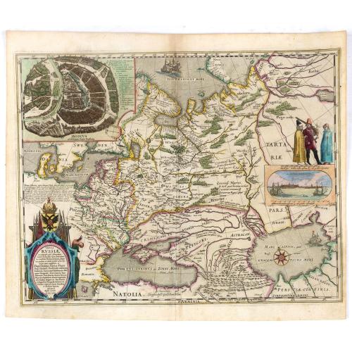
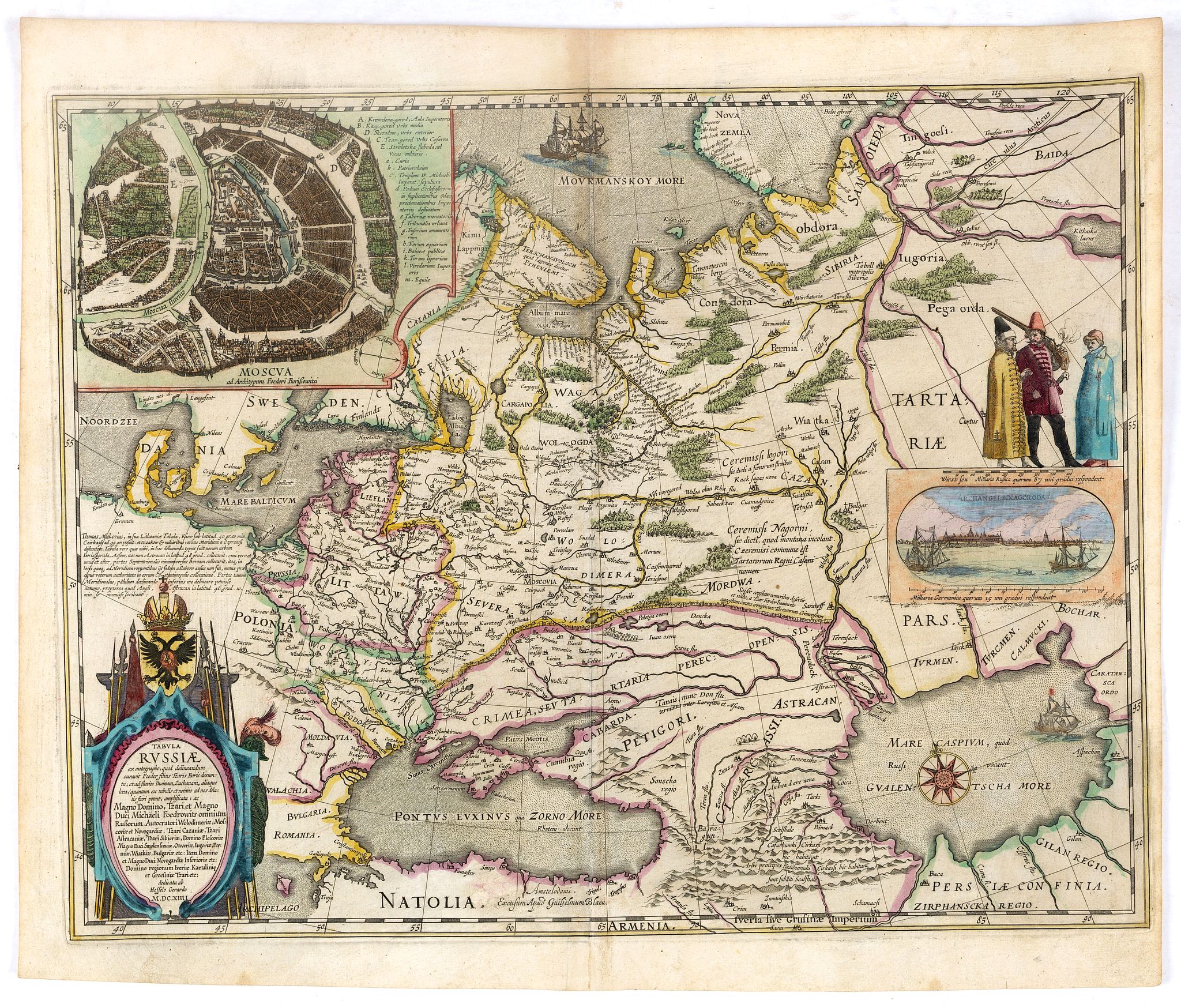
Tabula Russiae ex autographo, quod delineandum curavit Foedor filius Tzaris Boris desums... - Domino regionum Iueriae Kartalinie et Groefiniae Tzari etc: dedicata ab Heselo Gerardo M.DC.XIIII |
||||||||||||||||||||
|
||||||||||||||||||||
|
|
||||||||||||||||||||
|
Selling price: $...
Please login to see price! Sold in 2019 Missed this item! Be the first to get notified about our newly added listings. Add your name to our mailing list. Feel free to contact us if you have a question about this item. |
Virtual Collection - Save and collect this or any of your favorite items in one place.
If you want to save the items permanently, please sign in or create account first. |
|||||||||||||||||||
Description
A re-issue, by Willem Blaeu, of Hessel Gerritsz' rare and influential map of Russia. Dutch text on verso, extending west to east from Emden to Aspachan and north to south from Langenos to Trapesus.
This fine map was compiled from manuscripts brought back from Russia, by Isaac Massa to whom the large inset plan of Moscow is attributed. There is also a small view of Archangel. Russia's only northern port until the founding of St Petersburg in 1700. Three figures in Russian dress stand above. The title is within a martial cartouche.
First issued 1613 and published by Blaeu after he acquired the plate following Gerritsz's death in 1632. The top left corner has an inset plan of Moscow with a 17-point key.
The coat-of arms and the gun and sword carried by the person above the inset of Archangel heightened in gold.
The map originally has Dutch text on the verso and is pasted on a page with Spanish text. A must for the serious collector.
The atlas Major was printed only in small numbers, the Spanish text edition is extremely rare. The Spanish edition was never completed. When fire destroyed the Blaeu printing house at the Gravenstraat in Amsterdam in 1672, the final volume was in the press and consequently lost.
The Atlas Maior is the epitome of decades of achievement by the Blaeu family. Published in five languages (Latin, Dutch, French, German and Spanish) from 1662, it grew to eleven or twelve volumes in its most comprehensive editions, and was as Koeman observes a "costly atlas . . . Exclusively designed for those members of the patriciate who could command both the material and intellectual resources that were needed to buy and appreciate it". Joan's father, Willem Blaeu, commenced publication of his new world atlas, the Theatrum Orbis Terrarum, also referred to as the Atlas Novus, initially in two volumes, published in four languages. After succeeding his father, Joan Blaeu progressively expanded the Atlas Novus to six volumes by 1655, and this formed the first half the Atlas Maior.
Reference: Castner,II,p.52ff & fig.26.
FAQ - Guarantee - Shipping
Buying in the BuyNow Gallery
This item is available for immediate purchase when a "Add to Cart" or "Inquire Now" button is shown.
Items are sold in the EU margin scheme
Payments are accepted in Euros or US Dollars.
Authenticity Guarantee
 We provide professional descriptions, condition report (based on 45 years experience in the map business)
Paulus Swaen warrants the authenticity of our items and a certificate of authenticity is provided for each acquired lot.
Condition and Coloring
We indicate the condition of each item and use our unnique HiBCoR grading system in which four key items determine a map's value: Historical Importance, Beauty, Condition/Coloring and Rarity.
Color Key
We offer many maps in their original black and white condition. We do not systematically color-up maps to make them more sellable to the general public or buyer.
Copper engraved or wood block maps are always hand colored. Maps were initially colored for aesthetic reasons and to improve readability. Nowadays, it is becoming a challenge to find maps in their original colors and are therefor more valuable.
We use the following color keys in our catalog:
Original colors; mean that the colors have been applied around the time the map was issued.
Original o/l colors; means the map has only the borders colored at the time of publication.
Colored; If the colors are applied recently or at the end of the 20th century.
Read more about coloring of maps [+]
Shipping fee
A flat shipping fee of $ 30 is added to each shipment by DHL within Europe and North America. This covers : International Priority shipping, Packing and Insurance (up to the invoice amount).
Shipments to Asia are $ 40 and rest of the world $50
We charge only one shipping fee when you have been successful on multiple items or when you want to combine gallery and auction purchases.
Read more about invoicing and shipping
FAQ
Please have a look for more information about buying in the BuyNow gallery
Many answers are likely to find in the general help section.
Virtual Collection
![]()
With Virtual Collection you can collect all your favorite items in one place. It is free, and anyone can create his or her Virtual map collection.
Unless you are logged in, the item is only saved for this session. You have to be registed and logged-in if you want to save this item permanently to your Virtual Collection.
Read More[+]
Register here, it is free and you do not need a credit card.
Add this item to
Virtual Collection
or click the following link to see my Virtual Collection.
| Digital Image Download | |
|
Paulus Swaen maintains an archive of most of our high-resolution rare maps, prints, posters and medieval manuscript scans. We make them freely available for download and study. Read more about free image download |
Click the image for a free small image download. |
In accordance with the EU Consumer Rights Directive and habitually reside in the European Union you have the right to cancel the contract for the purchase of a lot, without giving any reason.
The cancellation period will expire 14 calendar days from the day after the date on which you or a third party (other than the carrier and indicated by you) acquires, physical possession of the lot. To exercise the right to cancel you must inform Paulus Swaen Inc, of your decision to cancel this contract by a clear statement (e.g. a letter sent by post, or e-mail (amsterdam@swaen.com).
To meet the cancellation deadline, it is sufficient for you to send your communication concerning your exercise of the right to cancel before the cancellation period has expired.
