1618 BRAUN, G. / HOGENBERG, F. - This three-part view presents the Inn Valley, a glacial valley that traverses the eastern Alps
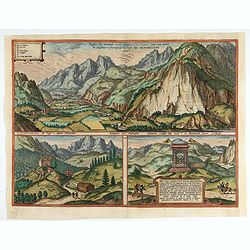
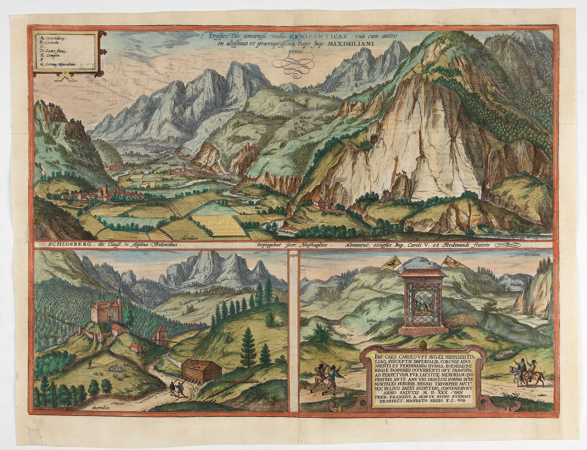
Prospectus amoeniss. vallis Oeniponticae una cum antro in altissima et praeruptissima rupe Imp. Maximiliani primi. [on sheet with:] Schlosberg. die Clause in Alpibus Tirolensibus. .. |
||||||||||||||||||||
|
||||||||||||||||||||
|
|
||||||||||||||||||||
$380 / ≈ €338This item is available for immediate sale! Questions before Buying ?
We are happy to answer your questions. |
My Collection +
Add this or any of your favorite items in one place. If you want to save the items permanently, you have to sign in or create an account first.   Add/Remove |
|||||||||||||||||||



Description
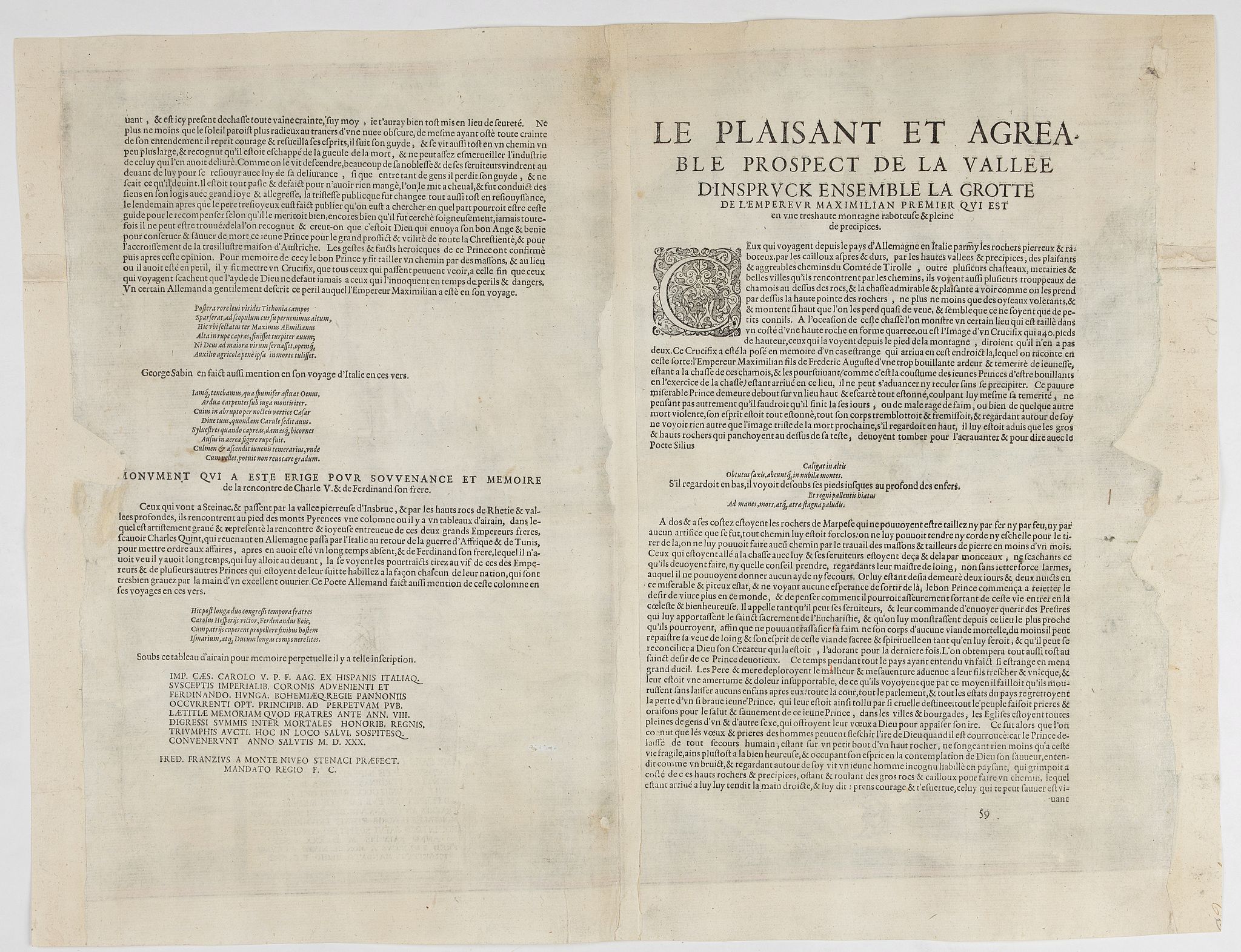
Three views by Braun and Hogenberg: View of the Innvalley; view of the "Schlosberg" and a view of a monument for the emperor Carolus V.
CAPTION: Prospect of the delightful Innsbruck Valley, together with the cave of Emperor Maximilian I in the very high and precipitous cliff.
CARTOUCHE BOTTOM RIGHT: Both noble rulers, the brothers Emperor Charles V, who came from Spain and Italy after his imperial coronation, and Ferdinand, King of Hungary and Bohemia, who came from Pannonia, were showered with the highest honors amongst mortals, with kingdoms and triumphs and met in this place and sound in 1530 to the general joy, after not having seen each other for 8 years.
COMMENTARY BY BRAUN (on verso): "Those coming from Germany over the rugged cliffs of the Alps, passing through the deep and preciptous valleys and also along the pleasant Innsbruck and Tyrolean roads, will see a great many castles along the way and often herds of chamois on the rocky pinnacles, who leap to and from high up on the rock face almost like light birds."
This three-part view presents the Inn Valley, a glacial valley that traverses the eastern Alps and through which the river of the same name flows. The top illustration is seen from Völs, looking down on Kematen € and Perfuss on the left-hand side of the valley and, on the right, Zirl (B), with the ruins of Fragenstein perched above it. The rock wall rising in the right half of the picture is the Martinswand, with the former fortress of Martinsklause (F) at its foot. The Martinswand wall, several hundred meters high, marks the end of the Hechenberg massif, part of the Nordkette range in the Karwendel Mountains.
A cave in the rock face is known as the Kaiser Max Grotto (G), where Emperor Maximilian I took refuge after getting lost while hunting chamois and stayed until a peasant boy found him. The smaller illustration bottom left shows the castle of Schlossberg on the north side of Seefeld, an area inhabited even before Roman times. The Counts of Andechs built the castle in 1248 to protect the road to Scharnitz-Mittenwald. The viewpoint chosen in the engraving only allows a glimpse of the town behind the castle. From the end of the 14th century onwards, Seefeld's St. Oswald's Church was an important pilgrimage destination.
In 1583 Archduke Ferdinand II made a pilgrimage here on foot with a retinue of 2,000 people. The monument illustrated bottom right was erected in 1530 to commemorate the meeting of Emperor Charles V and Ferdinand, King of Hungary, on this site. (Taschen)
Frans Hogenberg (1535 Mechelen - Cologne 1590) was a copper engraver and etcher. Georg Braun (1541 - Cologne - 1622) was a geographer and publisher. Both edited the first comprehensive, systematically designed atlas of town views and plans from around the world. The collection 'Civitates Orbis Terrarum' was published from 1572 until 1618 and ultimately 6 volumes with more than 500 copper engravings, together with a huge amount of textual information
Reference: Nebehay-W. 108 / Bd. 5, Nr. 59
FAQ - Guarantee - Shipping
This item is available for immediate purchase when a "Add to Cart" or "Inquire Now" button is shown.
Items are sold in the EU margin scheme
Payments are accepted in Euros or US Dollars.
Authenticity Guarantee
 We provide professional descriptions, condition report (based on 45 years experience in the map business)
Paulus Swaen warrants the authenticity of our items and a certificate of authenticity is provided for each acquired lot.
Condition and Coloring
We indicate the condition of each item and use our unnique HiBCoR grading system in which four key items determine a map's value: Historical Importance, Beauty, Condition/Coloring and Rarity.
Color Key
We offer many maps in their original black and white condition. We do not systematically color-up maps to make them more sellable to the general public or buyer.
Copper engraved or wood block maps are always hand colored. Maps were initially colored for aesthetic reasons and to improve readability. Nowadays, it is becoming a challenge to find maps in their original colors and are therefor more valuable.
We use the following color keys in our catalog:
Original colors; mean that the colors have been applied around the time the map was issued.
Original o/l colors; means the map has only the borders colored at the time of publication.
Colored; If the colors are applied recently or at the end of the 20th century.
Read more about coloring of maps [+]
Shipping fee
A flat shipping fee of $ 30 is added to each shipment by DHL within Europe and North America. This covers : International Priority shipping, Packing and Insurance (up to the invoice amount).
Shipments to Asia are $ 40 and rest of the world $50
We charge only one shipping fee when you have been successful on multiple items or when you want to combine gallery and auction purchases.
Read more about invoicing and shipping
FAQ
Please have a look for more information about buying in the BuyNow gallery
Many answers are likely to find in the general help section.
My Collection+

With My Collection+ you can collect all your favorite items in one place. It is free, and anyone can create his or her virtual collection.
Unless you are logged in, the item is only saved for this session. You have to be registed and logged-in if you want to save this item permanently to My Collection+. Read More[+]
Register here, it is free and you do not need a credit card.
Add this item to My Collection+ or click the following link to see My Collection+.
|
Digital Image Download Paulus Swaen maintains an archive of most of our high-resolution rare maps, prints, posters and medieval manuscript scans. We make them freely available for download and study. Read more about free image download |
Click the image for a free small image download. |
YOUR RIGHT TO CANCEL THE PURCHASE OF A LOT
In accordance with the EU Consumer Rights Directive and habitually reside in the European Union you have the right to cancel the contract for the purchase of a lot, without giving any reason.
The cancellation period will expire 14 calendar days from the day after the date on which you or a third party (other than the carrier and indicated by you) acquires, physical possession of the lot. To exercise the right to cancel you must inform Paulus Swaen Inc, of your decision to cancel this contract by a clear statement (e.g. a letter sent by post, or e-mail.
To meet the cancellation deadline, it is sufficient for you to send your communication concerning your exercise of the right to cancel before the cancellation period has expired.
