Subscribe to be notified if similar examples become available.
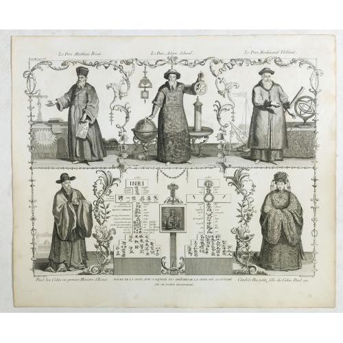
Père Matthieu Ricci / Père Adam Schaal / Père Ferdinand Verbiest. |
||||||||||||||||||||
|
||||||||||||||||||||
|
|
||||||||||||||||||||
|
Selling price: $ Please login to see price!
Sold in 2018 Missed this item! Add your name to our mailing list and be the first to get notified about our newly added listings. . |
My Collection + - Save and collect this or any of your favorite items in one place.
If you want to save the items permanently, please sign in or create account first. |
|||||||||||||||||||
Description
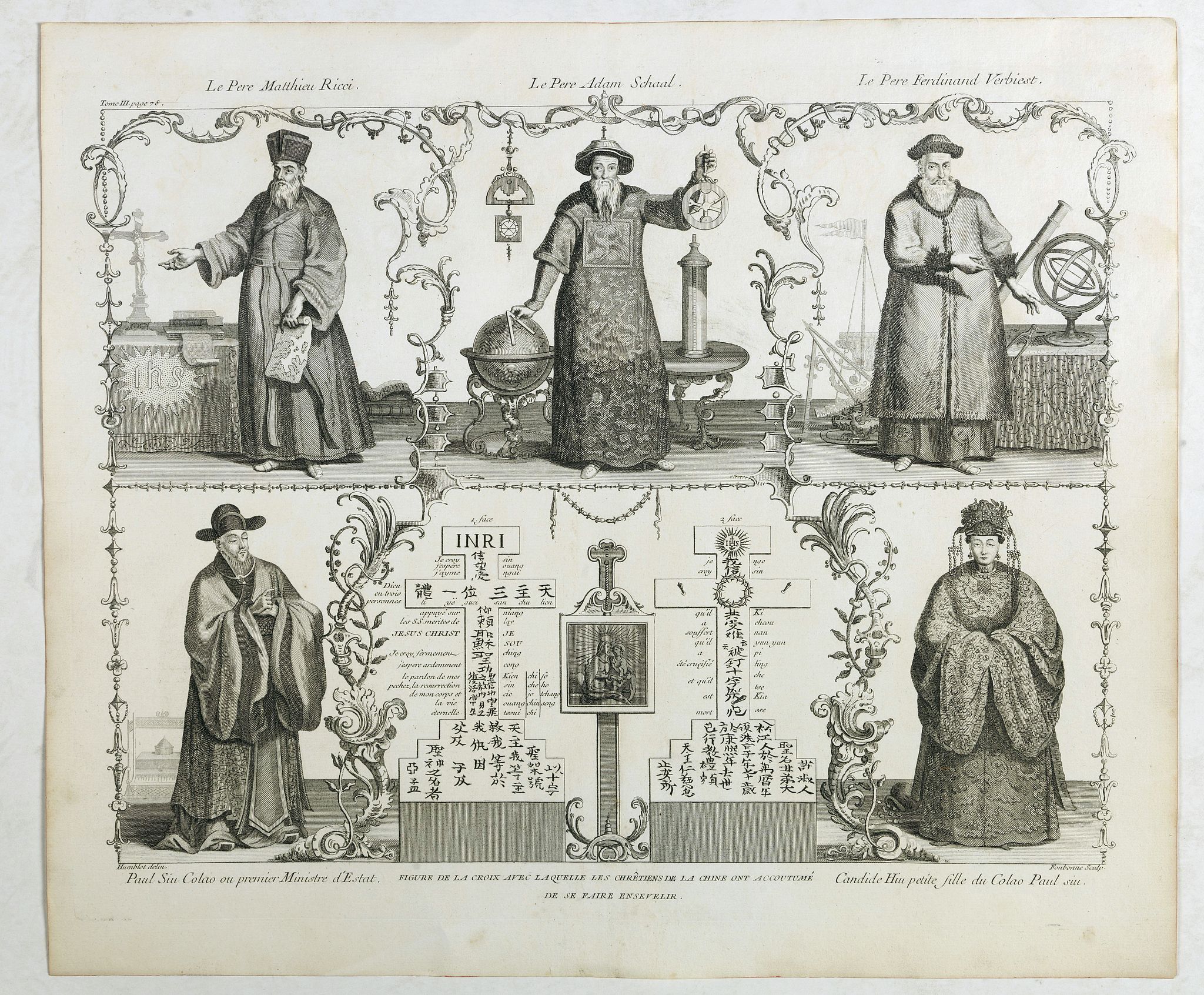
Folding plate of the 3 most important missionary cartographers who worked in China from Jean Baptiste Du Halde's "Description géographique, historique, chronologique, politique, et physique de l'Empire de la Chine et de la Tartarie Chinoise. ".
Figures shown, top (left to right): Le Pere Matthieu Ricci, Le Pere Adam Schaal, Le Pere Ferdinand Verbiest bottom left: Paul Siu (Xu Guangqi), colao or Prime Minister of State. Bottom right: Candide Hiu, grand-daughter of Colao Paul Siu.Mattheo Ricci.
Once the Jesuits were approved by Pope Paul III in 1540, they began to spread as teachers throughout Europe and as missionaries to the new worlds East and West. When they were suppressed by Papal decree in 1773, their churches, schools, missions, and undertakings were lost, and the lives of individual Jesuits, many mentioned on this site, were dramatically changed. When Pope Pius VII restored the Order in 1814, they began from scratch their apostolic work for the good of souls and of the Church. Their efforts before and since the Suppression have been recognized in various ways, among them through the philatelic items mentioned on this site.
The United States of America in 1898 was the first to honor a Jesuit, Fr. Jacques Marquette, with a stamp. And since then many others have been honored as saints and martyrs, missionaries and explorers, educators and scholars, scientists and mathematicians, churchmen, statesmen, pastors and artists. May this collection call to mind their mission, lives and institutions in both the old and the restored Society.In China, the Jesuit role in the introduction of Western maps and cartographic techniques is well known and is the usual starting point for the study of Sino-European interchange.
Jesuit astronomers and cartographers have a long history of service to the Chinese Empire and introduced many new technological and theoretical modifications to traditional Chinese maps. Fr. Matteo Ricci, S.J., pioneer of the first post-medieval Christian mission, was a skilled linguist, mathematician, and cartographer. As early as 1584 Ricci had copied a European map in his possession and translated the names into Chinese.
This work, the Yudi shanhai quantu is now lost, though the outline is preserved in the Tushu bian by Ricci’s friend and associate Zhang Huang. In 1600 a revised version of this map was produced with the slightly altered title Shanhai yudi quantu. With the help of the eminent scholar and friend of the Jesuits, Li Zhizao, in 1603 and 1604 the 3rd and 4th editions titled Kunyu wan’guo quantu were produced, copies of which exist in the National Palace Museum in Beijing and in the Vatican Archives. Ricci introduced longitude and latitude (which was in general harmony with traditional Chinese mapping “grids”) and combined earlier European maps by Ortelius and Mercator as the basis for Europe, Africa, and the Americas.
The sections on China and East Asia were based on a 1579 edition of the Guangyu tu by Luo Hongxian, and local maps culled from gazetteers and illustrated sources. The result provided Chinese scholars with a vastly expanded view of the world, including the first accurate representations of Europe, Africa, the Indian subcontinent, and the Americas on a Chinese map.
Ricci’s maps gave Chinese names for hundreds of foreign locales, and often included detailed physical or topographical information. Ricci’s maps were so influential that many of the Chinese place-names still in use today trace their origin to Ricci’s maps. Many Ming scholars immediately recognized these maps as important improvements on existing cartographic technology. Previously unknown regions were now charted in Chinese style. Strategic implications must have been obvious.
Europeans benefited from this exchange as well, as the Jesuits returned observations, maps, and descriptions of Chinese society, culture, and political philosophy back to a fascinated Europe. Ricci’s fellow Jesuit Michele Ruggieri created a large collection of maps with detailed information on terrain, waterways, and cities. Dictionaries and lexicons were created and the first semi-standard romanizations for Chinese characters were developed. Books and published letters sent to Europe were highly popular and avidly studied by historians and philosophers.
Ricci lived in China until his death in Beijing in 1610, during the late Ming dynasty under the Wanli Emperor. But unlike later Jesuits, he did not directly serve an emperor, but lived and worked as an independent scholar among Chinese scholars. As Dr. Menegon noted this morning, after the establishment of the Qing Dynasty in 1644 the role of the Jesuits in Beijing changed. Jesuit skill at cartography and astronomy (in addition to art, music, and mathematics) brought them to the attention of the Imperial Court.
A Jesuit proposal to map the entire Empire was encouraged by the Kangxi emperor began in 1698 with local topographical maps, including the range of the Ming walls and defenses north of the capital and into the Ordos. A complete set was presented to the Emperor in 1717, copperplate engravings were made and a woodblock edition was published in 1721 under the title Huangyu quanlan tu (or A Map of the Complete Imperial Realm).
Sometimes called the Kangxi Atlas, (or Jesuit Atlas), this became the basis for many other maps: Huangyu shipai quantu (1726-29), Qianlong shisanpai ditu (1760), Huangyu quantu (1844), etc. The Huangyu quanlan tu was the basis for nearly all Western maps of China until the 20th century.
FAQ - Guarantee - Shipping
Buying in the BuyNow Gallery
This item is available for immediate purchase when a "Add to Cart" or "Inquire Now" button is shown.
Items are sold in the EU margin scheme
Payments are accepted in Euros or US Dollars.
Authenticity Guarantee
 We provide professional descriptions, condition report (based on 45 years experience in the map business)
Paulus Swaen warrants the authenticity of our items and a certificate of authenticity is provided for each acquired lot.
Condition and Coloring
We indicate the condition of each item and use our unnique HiBCoR grading system in which four key items determine a map's value: Historical Importance, Beauty, Condition/Coloring and Rarity.
Color Key
We offer many maps in their original black and white condition. We do not systematically color-up maps to make them more sellable to the general public or buyer.
Copper engraved or wood block maps are always hand colored. Maps were initially colored for aesthetic reasons and to improve readability. Nowadays, it is becoming a challenge to find maps in their original colors and are therefor more valuable.
We use the following color keys in our catalog:
Original colors; mean that the colors have been applied around the time the map was issued.
Original o/l colors; means the map has only the borders colored at the time of publication.
Colored; If the colors are applied recently or at the end of the 20th century.
Read more about coloring of maps [+]
Shipping fee
A flat shipping fee of $ 30 is added to each shipment by DHL within Europe and North America. This covers : International Priority shipping, Packing and Insurance (up to the invoice amount).
Shipments to Asia are $ 40 and rest of the world $50
We charge only one shipping fee when you have been successful on multiple items or when you want to combine gallery and auction purchases.
Read more about invoicing and shipping
FAQ
Please have a look for more information about buying in the BuyNow gallery
Many answers are likely to find in the general help section.
My Collection+
![]()
With My Collection+ you can collect all your favorite items in one place. It is free, and anyone can create his or her virtual collection.
Unless you are logged in, the item is only saved for this session. You have to be registed and logged-in if you want to save this item permanently to My Collection+.
Read More[+]
Register here, it is free and you do not need a credit card.
Add this item to
My Collection+
or click the following link to see My Collection+.
| Digital Image Download | |
|
Paulus Swaen maintains an archive of most of our high-resolution rare maps, prints, posters and medieval manuscript scans. We make them freely available for download and study. Read more about free image download |
Click the image for a free small image download. |
In accordance with the EU Consumer Rights Directive and habitually reside in the European Union you have the right to cancel the contract for the purchase of a lot, without giving any reason.
The cancellation period will expire 14 calendar days from the day after the date on which you or a third party (other than the carrier and indicated by you) acquires, physical possession of the lot. To exercise the right to cancel you must inform Paulus Swaen Inc, of your decision to cancel this contract by a clear statement (e.g. a letter sent by post, or e-mail (amsterdam@swaen.com).
To meet the cancellation deadline, it is sufficient for you to send your communication concerning your exercise of the right to cancel before the cancellation period has expired.
