Official War map of Korea. |
||||||||||||||||||||
|
||||||||||||||||||||
|
|
||||||||||||||||||||
$225 / ≈ €197This item is available for immediate sale! Questions before Buying ?
We are happy to answer your questions.
225.00
|
My Collection +
Add this or any of your favorite items in one place. If you want to save the items permanently, you have to sign in or create an account first. |
|||||||||||||||||||
Description
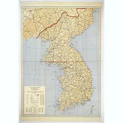
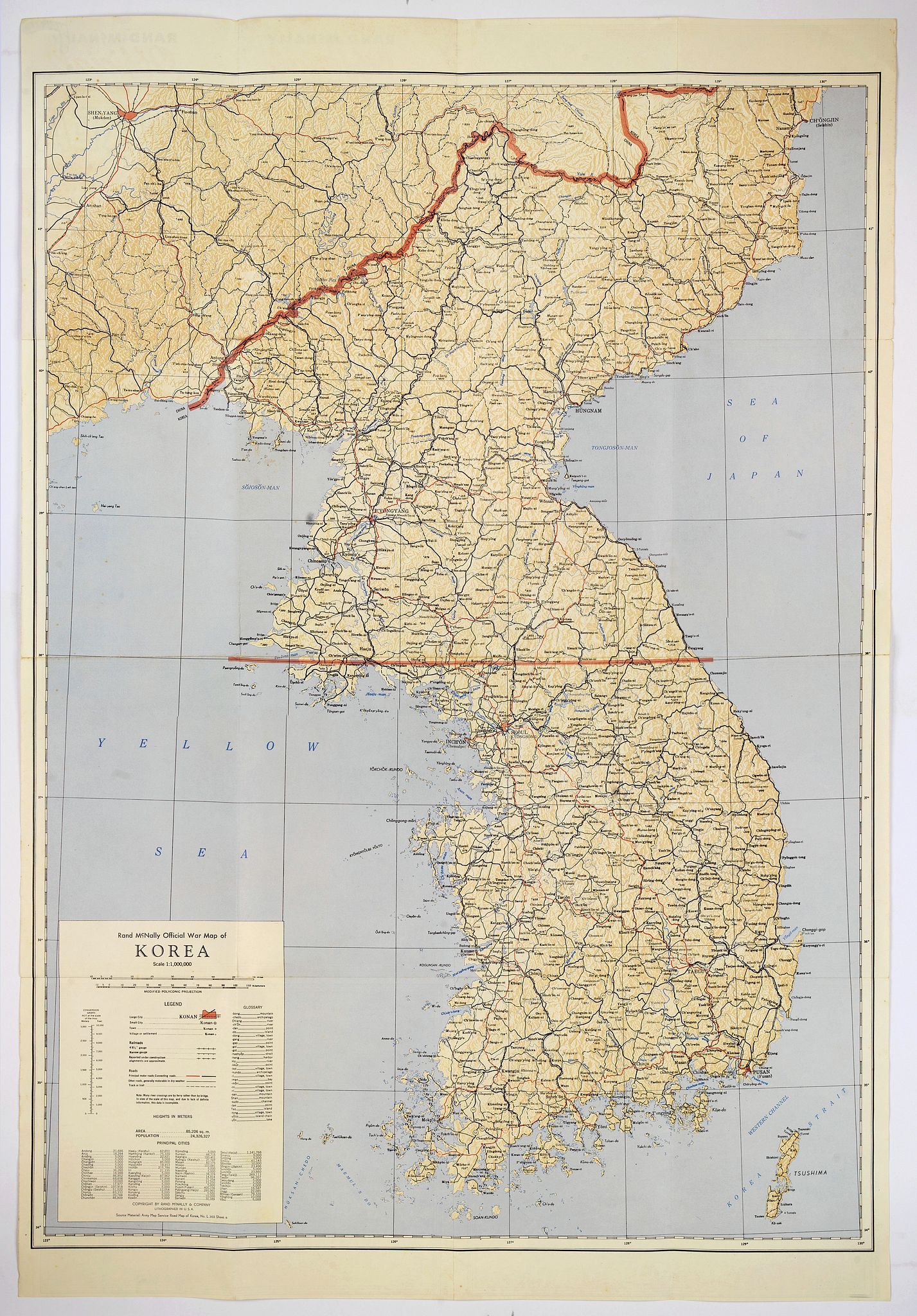
A large folding map of Korea published in the year of the outbreak of the Korean War, published by the Rand McNally Company. The map is extremely detailed and features a large inset key including, a legend, a glossary, mileage scale, heights in meters, principal cities.
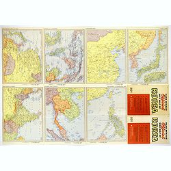
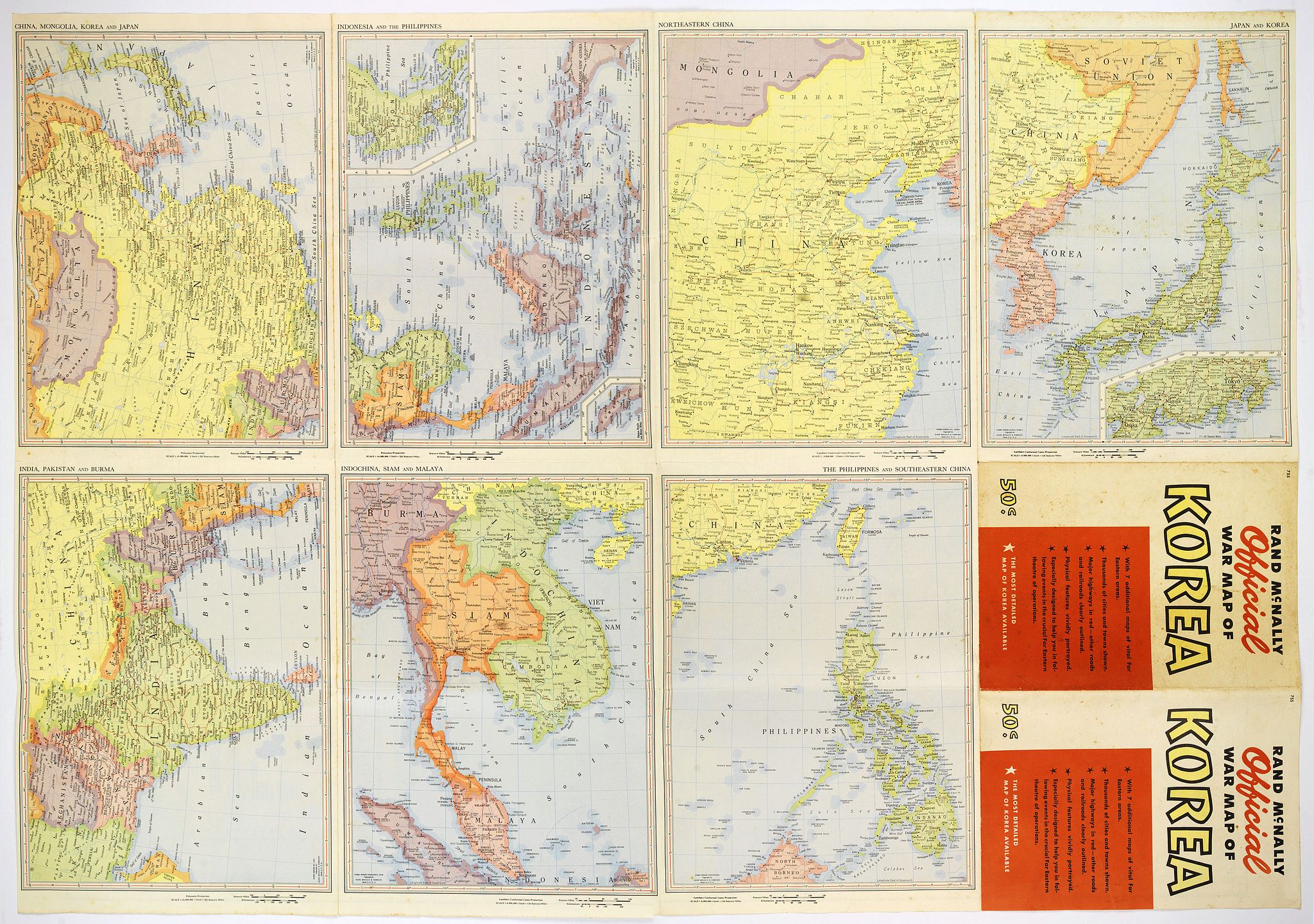
VERSO : The reverse side of the map are a series of several small colored individual maps. These include: India, Pakistan and Burma / China, Mongolia, Korea and Japan / Indochina, Siam and Malaya.
The information provided by Rand McNally to accompany the map proclaims: "Thousands of cities and towns shown", Physical features vividly portrayed", "The most detailed map of Korea available", and Major highways in red - other roads and railroads clearly outlined".
The Korean War reached international proportions in June 1950 when North Korea, supplied and advised by the Soviet Union, invaded the South. The United Nations, with the United States as the principal participant, joined the war on the side of the South Koreans, and the People’s Republic of China came to North Korea’s aid.
The fighting ended in July 1953 with Korea still divided into two hostile states. Negotiations in 1954 produced no further agreement, and the front line has been accepted ever since as the de facto boundary between North and South Korea.
The map with a red boundary line at the 38th Parallel dividing North and South.
Following the unconditional surrender of the Japanese, the victorious Allies split the Korean peninsula into two occupational zones. The United States took over the area to the south of the 38th Parallel, while the Soviet Union took the area to the north.
FAQ - Guarantee - Shipping
Buying in the BuyNow Gallery
This item is available for immediate purchase when a "Add to Cart" or "Inquire Now" button is shown.
Items are sold in the EU margin scheme
Payments are accepted in Euros or US Dollars.
Authenticity Guarantee
 We provide professional descriptions, condition report (based on 45 years experience in the map business)
Paulus Swaen warrants the authenticity of our items and a certificate of authenticity is provided for each acquired lot.
Condition and Coloring
We indicate the condition of each item and use our unnique HiBCoR grading system in which four key items determine a map's value: Historical Importance, Beauty, Condition/Coloring and Rarity.
Color Key
We offer many maps in their original black and white condition. We do not systematically color-up maps to make them more sellable to the general public or buyer.
Copper engraved or wood block maps are always hand colored. Maps were initially colored for aesthetic reasons and to improve readability. Nowadays, it is becoming a challenge to find maps in their original colors and are therefor more valuable.
We use the following color keys in our catalog:
Original colors; mean that the colors have been applied around the time the map was issued.
Original o/l colors; means the map has only the borders colored at the time of publication.
Colored; If the colors are applied recently or at the end of the 20th century.
Read more about coloring of maps [+]
Shipping fee
A flat shipping fee of $ 30 is added to each shipment by DHL within Europe and North America. This covers : International Priority shipping, Packing and Insurance (up to the invoice amount).
Shipments to Asia are $ 40 and rest of the world $50
We charge only one shipping fee when you have been successful on multiple items or when you want to combine gallery and auction purchases.
Read more about invoicing and shipping
FAQ
Please have a look for more information about buying in the BuyNow gallery
Many answers are likely to find in the general help section.
My Collection+
![]()
With My Collection+ you can collect all your favorite items in one place. It is free, and anyone can create his or her virtual collection.
Unless you are logged in, the item is only saved for this session. You have to be registed and logged-in if you want to save this item permanently to My Collection+.
Read More[+]
Register here, it is free and you do not need a credit card.
Add this item to
My Collection+
or click the following link to see My Collection+.
| Digital Image Download | |
|
Paulus Swaen maintains an archive of most of our high-resolution rare maps, prints, posters and medieval manuscript scans. We make them freely available for download and study. Read more about free image download |
Click the image for a free small image download. |
In accordance with the EU Consumer Rights Directive and habitually reside in the European Union you have the right to cancel the contract for the purchase of a lot, without giving any reason.
The cancellation period will expire 14 calendar days from the day after the date on which you or a third party (other than the carrier and indicated by you) acquires, physical possession of the lot. To exercise the right to cancel you must inform Paulus Swaen Inc, of your decision to cancel this contract by a clear statement (e.g. a letter sent by post, or e-mail.
To meet the cancellation deadline, it is sufficient for you to send your communication concerning your exercise of the right to cancel before the cancellation period has expired.
