Please login to see price!.
Subscribe to be notified if similar examples become available.
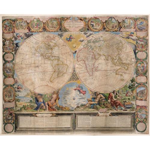
Le Globe Terrestre represente en deux plans-hemispheres dresee. . . |
||||||||||||||||||||
|
||||||||||||||||||||
|
|
||||||||||||||||||||
|
Selling price: $...
Please login to see price! Sold in 2020 Missed this item! Be the first to get notified about our newly added listings. Add your name to our mailing list. Feel free to contact us if you have a question about this item. |
Virtual Collection - Save and collect this or any of your favorite items in one place.
If you want to save the items permanently, please sign in or create account first. |
|||||||||||||||||||
Description
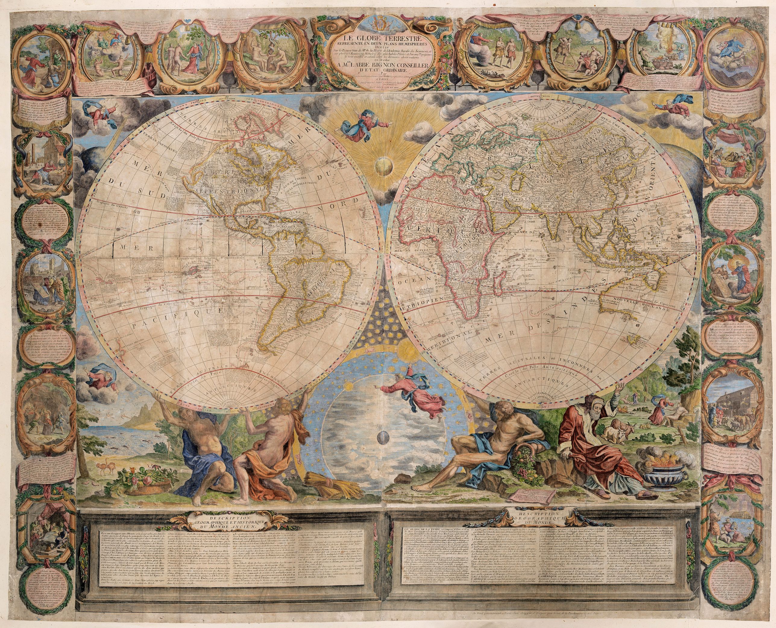
A very fine example of the Jean-Baptiste Crepy version of Jean Baptiste Nolin's striking large wall map of the World. The present example represents the 1775 state of the map, first issued in 1700.
Showing the two divided hemispheres, attached border with sixteen lavishly decorative fully colored vignettes with explanations, each piece depicting in contemporary terms an incident from biblical history.
According to Shirley The 'Globe Terrestre' by J.B. Nolin, dated 1700, is one of the finest large-scale world maps to be produced and is a fitting bridge between the geographical and artistic skills of the seventeenth century and the century to come.
The twin hemispheres and their decorative surround are engraved on four sheets with further strips comprising a broad pictorial border and, at the bottom, architectural columns of text.
Below the map are inches of informative French text explaining both the modern and the ancient worlds. Each of Nolin's detailed hemispheres is supported by figures from mythology. In the corners and between the hemispheres are pictures telling the story of the creation of the world, the heavens, and mankind on earth.
The artist credited with the wonderful, decorative illustrations was the artist Bocquet, who carried out his work as per Nolin's instructions.
Australia is seen with the western half well delineated, while the eastern regions are shown to be an almost complete enigma, and erroneously connected to New Guinea.
Abel Tasman's isolated discoveries in southern Tasmania and New Zealand from his voyage of 1642-1643 are depicted, although the latter is shown to be connected to the mysterious 'Terres Australes', the rumored great southern continent.
In North America, California is no longer shown to be an island, having recently been proven to be a peninsula, following the 1701 expedition of Padre Eusebio Kino.
The eastern regions represent the best knowledge of French and English cartographers, including the delineation of the Mississippi and its tributaries based on the discoveries of the Sieur de La Salle and Louis Joliet.
All in all, a glorious wall map to inspire the soul, and fill the senses!
Reference: Shirley Mapping of the World 605.
FAQ - Guarantee - Shipping
Buying in the BuyNow Gallery
This item is available for immediate purchase when a "Add to Cart" or "Inquire Now" button is shown.
Items are sold in the EU margin scheme
Payments are accepted in Euros or US Dollars.
Authenticity Guarantee
 We provide professional descriptions, condition report (based on 45 years experience in the map business)
Paulus Swaen warrants the authenticity of our items and a certificate of authenticity is provided for each acquired lot.
Condition and Coloring
We indicate the condition of each item and use our unnique HiBCoR grading system in which four key items determine a map's value: Historical Importance, Beauty, Condition/Coloring and Rarity.
Color Key
We offer many maps in their original black and white condition. We do not systematically color-up maps to make them more sellable to the general public or buyer.
Copper engraved or wood block maps are always hand colored. Maps were initially colored for aesthetic reasons and to improve readability. Nowadays, it is becoming a challenge to find maps in their original colors and are therefor more valuable.
We use the following color keys in our catalog:
Original colors; mean that the colors have been applied around the time the map was issued.
Original o/l colors; means the map has only the borders colored at the time of publication.
Colored; If the colors are applied recently or at the end of the 20th century.
Read more about coloring of maps [+]
Shipping fee
A flat shipping fee of $ 30 is added to each shipment by DHL within Europe and North America. This covers : International Priority shipping, Packing and Insurance (up to the invoice amount).
Shipments to Asia are $ 40 and rest of the world $50
We charge only one shipping fee when you have been successful on multiple items or when you want to combine gallery and auction purchases.
Read more about invoicing and shipping
FAQ
Please have a look for more information about buying in the BuyNow gallery
Many answers are likely to find in the general help section.
Virtual Collection
![]()
With Virtual Collection you can collect all your favorite items in one place. It is free, and anyone can create his or her Virtual map collection.
Unless you are logged in, the item is only saved for this session. You have to be registed and logged-in if you want to save this item permanently to your Virtual Collection.
Read More[+]
Register here, it is free and you do not need a credit card.
Add this item to
Virtual Collection
or click the following link to see my Virtual Collection.
| Digital Image Download | |
|
Paulus Swaen maintains an archive of most of our high-resolution rare maps, prints, posters and medieval manuscript scans. We make them freely available for download and study. Read more about free image download |
Click the image for a free small image download. |
In accordance with the EU Consumer Rights Directive and habitually reside in the European Union you have the right to cancel the contract for the purchase of a lot, without giving any reason.
The cancellation period will expire 14 calendar days from the day after the date on which you or a third party (other than the carrier and indicated by you) acquires, physical possession of the lot. To exercise the right to cancel you must inform Paulus Swaen Inc, of your decision to cancel this contract by a clear statement (e.g. a letter sent by post, or e-mail (amsterdam@swaen.com).
To meet the cancellation deadline, it is sufficient for you to send your communication concerning your exercise of the right to cancel before the cancellation period has expired.
