Please login to see price!.
Subscribe to be notified if similar examples become available.
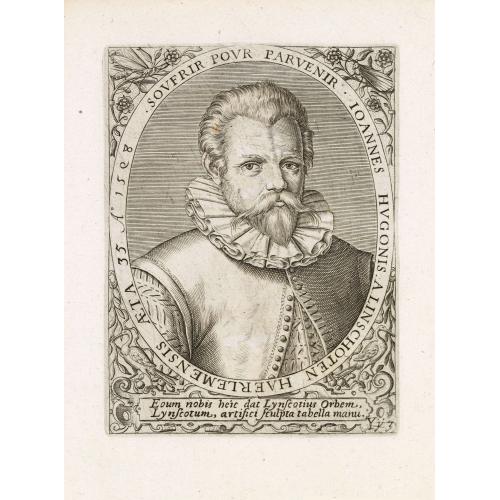
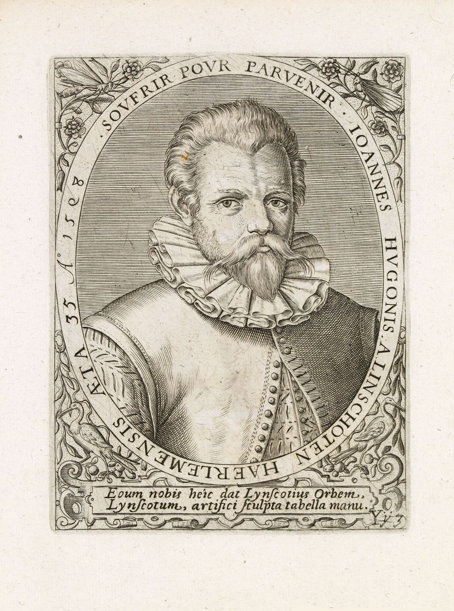
Johannes Hugonis a Linschoten Haerlemensis aeta 35 A° 1598 Soufrir pour parvenir. |
||||||||||||||||||||
|
||||||||||||||||||||
|
|
||||||||||||||||||||
|
Selling price: $...
Please login to see price! Sold in 2018 Missed this item! Be the first to get notified about our newly added listings. Add your name to our mailing list. Feel free to contact us if you have a question about this item. |
Virtual Collection - Save and collect this or any of your favorite items in one place.
If you want to save the items permanently, please sign in or create account first. |
|||||||||||||||||||
Description
Very decorative portrait of Jan Huyghen van Linschoten (1563, Haarlem – 8 February 1611, Enkhuizen), engraved by Theodor de Bry (1528-1593) and published in Jean Jacques Boissard, "Icones Virorum Illustrium".
Jan Huyghen van Linschoten was a Dutch Protestant merchant, traveller and historian. An alternate spelling of second name is Huijgen.
He is credited with copying top-secret Portuguese nautical maps thus enabling the passage to the elusive East Indies to be opened to the English and the Dutch. This enabled the British East India Company and the Dutch East India Company to break the 16th century monopoly enjoyed by the Portuguese on trade with the East Indies.
Jan Huyghen was the son of a public notary from the town of Haarlem in the Netherlands, but the family moved to the town of Enkhuizen when he was young. He left for Spain during December 1576 to be with his brother in Seville, staying in Spain until 1580 when he got a job working with another merchant in Lisbon. A downturn in trade led him to seek alternatives.
With the help of his brother, Willem, who was acquainted with the newly appointed Archbishop of the Portuguese colony of Goa, Dominican Vicente da Fonseca, he was appointed Secretary to the Archbishop. So Jan Huyghens sailed for Goa on 8 April 1583, arriving five months later via Madeira, Guinea, the Cape, Madagascar and Mozambique.
While in Goa, as a result of his position, Jan Huyghens had access to secret information, including the nautical maps that were well guarded for over a century. Misusing the trust in him, for reasons unknown, Jan Huyghens began meticulously copying these maps.
In June 1594, Linschoten sailed from Texel in the expedition headed by Dutch cartographer Willem Barentsz. The fleet of three ships was to enter the Kara Sea, with the hopes of finding the Northeast passage above Siberia. The following year they sailed again in a new expedition of six ships, loaded with merchant wares that they hoped to trade with China. Linschoten was one of the two crewmembers to have published journals on Barentsz' travels.
In 1595, with assistance from Amsterdam publisher Cornelis Claesz, who specialised in shipping, geography and travels, Jan Huyghens wrote Reys-gheschrift vande navigatien der Portugaloysers in Orienten (Travel Accounts of Portuguese Navigation in the Orient). This work contains a large number of sailing directions, not only for shipping between Portugal and the East Indies colonies, but also between India, China and Japan.
Jan Huyghen also wrote two other books, Beschryvinghe van de gantsche custe van Guinea, Manicongo, Angola ende tegen over de Cabo de S. Augustijn in Brasilien, de eyghenschappen des gheheelen Oceanische Zees (Description of the Entire Coast of Guinea, Manicongo, Angola and across to the Cabo de St. Augustus in Brazil, the Characteristics of the Entire Atlantic Ocean) in 1597, and Itinerario: Voyage ofte schipvaert van Jan Huyghen van Linschoten naer Oost ofte Portugaels Indien, 1579-1592 (Travel account of the voyage of the sailor Jan Huyghen van Linschoten to the Portuguese East India) in 1596.
An English text edition of the Itinerario was published in London in 1598, entitled Iohn Huighen van Linschoten his Discours of Voyages into ye Easte & West Indies. A German edition was also printed the same year.
List of Explorers and Mapmakers [+]
FAQ - Guarantee - Shipping
Buying in the BuyNow Gallery
This item is available for immediate purchase when a "Add to Cart" or "Inquire Now" button is shown.
Items are sold in the EU margin scheme
Payments are accepted in Euros or US Dollars.
Authenticity Guarantee
 We provide professional descriptions, condition report (based on 45 years experience in the map business)
Paulus Swaen warrants the authenticity of our items and a certificate of authenticity is provided for each acquired lot.
Condition and Coloring
We indicate the condition of each item and use our unnique HiBCoR grading system in which four key items determine a map's value: Historical Importance, Beauty, Condition/Coloring and Rarity.
Color Key
We offer many maps in their original black and white condition. We do not systematically color-up maps to make them more sellable to the general public or buyer.
Copper engraved or wood block maps are always hand colored. Maps were initially colored for aesthetic reasons and to improve readability. Nowadays, it is becoming a challenge to find maps in their original colors and are therefor more valuable.
We use the following color keys in our catalog:
Original colors; mean that the colors have been applied around the time the map was issued.
Original o/l colors; means the map has only the borders colored at the time of publication.
Colored; If the colors are applied recently or at the end of the 20th century.
Read more about coloring of maps [+]
Shipping fee
A flat shipping fee of $ 30 is added to each shipment by DHL within Europe and North America. This covers : International Priority shipping, Packing and Insurance (up to the invoice amount).
Shipments to Asia are $ 40 and rest of the world $50
We charge only one shipping fee when you have been successful on multiple items or when you want to combine gallery and auction purchases.
Read more about invoicing and shipping
FAQ
Please have a look for more information about buying in the BuyNow gallery
Many answers are likely to find in the general help section.
Virtual Collection
![]()
With Virtual Collection you can collect all your favorite items in one place. It is free, and anyone can create his or her Virtual map collection.
Unless you are logged in, the item is only saved for this session. You have to be registed and logged-in if you want to save this item permanently to your Virtual Collection.
Read More[+]
Register here, it is free and you do not need a credit card.
Add this item to
Virtual Collection
or click the following link to see my Virtual Collection.
| Digital Image Download | |
|
Paulus Swaen maintains an archive of most of our high-resolution rare maps, prints, posters and medieval manuscript scans. We make them freely available for download and study. Read more about free image download |
Click the image for a free small image download. |
In accordance with the EU Consumer Rights Directive and habitually reside in the European Union you have the right to cancel the contract for the purchase of a lot, without giving any reason.
The cancellation period will expire 14 calendar days from the day after the date on which you or a third party (other than the carrier and indicated by you) acquires, physical possession of the lot. To exercise the right to cancel you must inform Paulus Swaen Inc, of your decision to cancel this contract by a clear statement (e.g. a letter sent by post, or e-mail (amsterdam@swaen.com).
To meet the cancellation deadline, it is sufficient for you to send your communication concerning your exercise of the right to cancel before the cancellation period has expired.

