Subscribe to be notified if similar examples become available.
1640 BLAEU, W. - Insulae Americanae in Oceanus Septentrionali cum Terris..
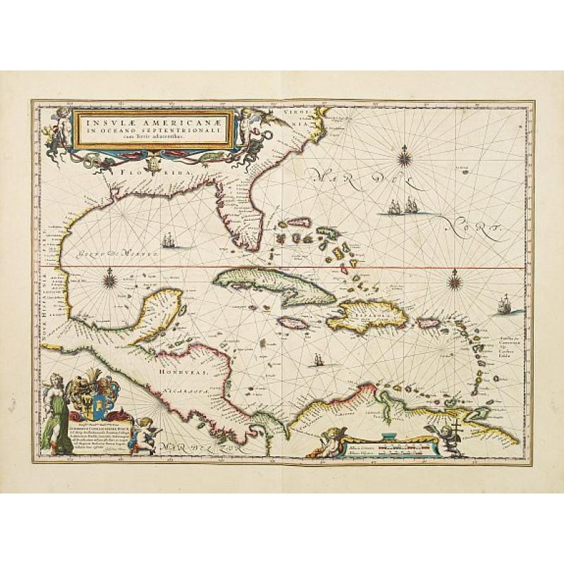
Insulae Americanae in Oceanus Septentrionali cum Terris.. |
||||||||||||||||||||
|
||||||||||||||||||||
|
|
||||||||||||||||||||
|
Selling price: $ Please login to see price!
Sold Missed this item! Add your name to our mailing list and be the first to get notified about our newly added listings. . |
My Collection +
Add this or any of your favorite items in one place. If you want to save the items permanently, you have to sign in or create an account first.   Add/Remove
 |
|||||||||||||||||||



Description
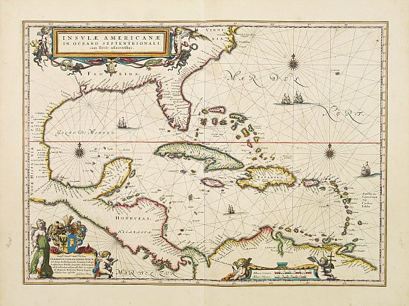
General map of the West Indies extending from Virginia to the mouth of the Orinoco, and destined to be copied in various shapes by many other publishers.
Title cartouche top left incorporates various marine fauna. This is a derivative of Hessel Gerritsz' chart of c. 1631. The nomenclature of the North American part is virtually identical, the only notable addition being the naming of VIRGINIA.
It reflects the firsthand knowledge of Gerritsz during his voyage to South America and the West Indies undertaken in 1628.
Willem Jansz. Blaeu (1571 - 1638)
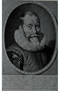 Willem Janszoon (or Jansz.) Blaeu (1571 - 1638) founded a large publishing firm that became famous in cartography under the name Blaeu. The Blaeu family originated on the island of Wieringen, where around 1490, Willem Jacobsz., alias Blauwe Willem, the grandfather of Willem Jansz. Blaeu was born. From the marriage of Willem Jacobsz. and Anna Jansd. came six children. The son Jan Willemsz. (1527- before 1589) was the father of Willem Jansz Blaeu, who continued the family tradition by practicing the herring-packing trade. In his second marriage with Stijntge. Willem Jansz Blaeu was born in 1571. We do not know whether he was born at Alkmaar or Uitgeest.
At an early age, he went to Amsterdam to learn the hearing trade. But Willem Jansz. Blaeu did not like this work very much; as he was more inclined to mathematics. It must have been during this period that he met Adriaan Anthonisz (1541- 1620), a surveyor, astronomer, mathematician, military engineer, and fortifications superintendent of the Dutch Republic. This enthusiast for the liberal arts was the father of the better-known Adriaan Metius, who was also born in 1571 and would later become Blaeu’s scientific adviser. Blaeu moved to Amsterdam at the age of 23 to learn the ins and outs of the herring trade from his family.
Blaeu lived on the Island of Hven for two years, during the winter of 1595/1596, at Tycho Brahe's observatory in Uraniborg. The celebrated Danish astronomer Tycho Brahe (1546-1601), demanded a high standard of his pupils. He invited some; others he undoubtedly took on the special recommendation. We may, therefore, presume that the young Blaeu had reached a high standard of education and technical skill since he was considered worthy to become a pupil of the great astronomer.
After returning to the Netherlands, he applied himself to astronomy for several years in Alkmaar. Very little is known about his stay there, but it was where he married Marretie or Maertgen Cornelisdr of Uitgeest, probably in 1597. It was there, too, that his eldest son Joan was born. On 21 February 1598, Blaeu observed an eclipse of the moon from Alkmaar, which Tycho Brahe simultaneously observed in Wandsbeck near Hamburg. The purpose of their observations was to determine the difference in longitude between the two places.
While in Alkmaar, he made a celestial globe 34 cm in diameter for Adriaan Anthonisz based on Tycho Brahe’s new but unpublished star catalog. The globe was published in 1597/1598 and was masterfully engraved by Jan Saenredam, a pupil of Hendrick Goltzius and father of Pieter Jansz Saenredam, the famous painter of church interiors.
The production of globes was Blaeu’s primary activity at the start of his career, and to set himself apart from the many others called Willem Jansz he dubbed himself ‘Willem Jansz Globi’ or ‘Geloobmaker’. Blaeu followed the tradition of creating globes in pairs: a terrestrial globe and a celestial globe.
AMSTERDAM
Willem Jansz moved to Amsterdam with his family around 1598/1599, and opened a shop selling celestial and terrestrial globes, maps, and astronomical instruments. The great voyages of discovery advanced the science of navigation, and there was a pressing need for astronomical instruments to determine ships' positions at sea. Blaeu had enjoyed excellent training as an instrument maker under Tycho Brahe. He shows considerable interest in maritime instruments in his sea atlases and illustrates or reproduces them by means of movable diagrams.
In 1605, he relocated to new premises on the Damrak, where most of Amsterdam's booksellers and mapmakers had congregated at that time. The building was called In de Vergulde Sonnewyser (In the Gilded Sundial) and here he also set up a printing shop and publishing house. His first publications were in cartography and navigation, and by 1608 he had already published a fine world map and a popular marine atlas. His early works include a globe of 1599, maps of European countries and a world map in 1604-1608.
Blaeu’s early interest in navigation led to his first pilot guide, the Nieuw graetbouck. He occupies an essential position in the history of early Dutch pilot guides. His famous predecessor for describing eastern, western and northern navigation was Lucas Jansz Waghenaer. Blaeu issued two pilot guides: Het licht der Zee-vaert (first edition 1609), which firmly established his reputation as a maritime cartographer, and Zeespiegel (first edition 1623), both of which were reprinted several times.
The voyages of discovery in the 15th and 16th centuries sparked an insatiable interest in cartography. They also advanced the science of navigation, and there was a pressing need for astronomical instruments to determine ships' positions at sea. The newly discovered territories offered trade opportunities, and it was essential not only to know how to reach them but also how to return home safely. Knowledge increased with every voyage, and maps became more accurate. The unfolding of new opportunities increased the demand for good maps.
In addition to charts explicitly used for navigation, an increasing number of people became interested in maps. They wanted to satisfy their curiosity about new countries, even if only on paper. Maps were also used to advertise one’s status, promote a better understanding of history or politics, or serve as a substitute for paintings.
Willem Jansz was not the only publisher of maps and globes in Amsterdam. When Cornelis Claesz (1546/47-1609) and Jodocus Hondius the Elder (1563-1612), both originally from the southern Netherlands, set up their business, they had already made a name for themselves. After Claesz’s death, Willem Jansz succeeded in acquiring much of his estate, which strengthened his position as a map publisher. However, he had fierce competition from his neighbor Jan Jansz, or Johannes Janssonius, another mapmaker, bookseller and publisher who took the premises next door to Blaeu on Damrak.
Willem Jansz Latinised his name to (Guilelmus) Janssonius, following the general custom, which caused much confusion and was later exploited by Jan Jansz. Willem Jansz decided to change his name and chose his grandfather's name, ‘Blauwe Willem’ (Blue William), as his surname in 1621. From then on, he called himself Willem (Jansz) Blaeu and sometimes added the Latinised form ‘Caesius’ (bluish-grey) to his imprints.
BLAEU'S MAPS, ATLAS & GLOBE PRODUCTION
At his start, Blaeu published several separate sheet maps in folio format. Many have figured borders. All are extremely rare. A sample is the following map of Germany, published in 1609. Germanae post omnes in hac forma editiones exactissima locupletissimaq. descriptio. A border on the top represents the seven Electors and the Emperor on his throne.
Willem Blaeu's wall maps are among the most influential and artistically virtuous masterpieces of the great era of baroque cartography. The publication of the first set of his wall maps in 1608 marked the beginning of his ascendancy to the preeminent position in the highly competitive global map market. Blaeu published several wall maps printed on parchment or paper. All editions of Blaeu's wall maps are extreme rarities.
Using maps as wall hangings in contemporary Dutch houses went beyond the desire for cartographic information. Maps were also used to express status, to promote a better understanding of history or politics or to take the place of paintings. Maps were also used to express status, to promote a better understanding of history or politics or to take the place of paintings.
ATLASES & NAVIGATION
Blaeu devoted his attention to navigation needs from an early stage of his career. His first publication in this field was his Nieuw graetbouck, and no copy has been found to this day. In the history of early Dutch pilot guides, Blaeu's work takes a crucial place. His famous predecessor for the description of the Eastern, Western and Northern navigation was Lucas Jansz. Waghenaer. Blaeu issued two pilot guides, named Het licht der Zee-vaert (first edition 1609) and Zeespiegel (first edition 1623). The works were republished several times. In 1621, Janssonius published a plagiarised copy of Blaeu’s pilot guide Het licht der Zee-vaert. He was able to do so with impunity because Blaeu’s copyright had expired. Blaeu then decided to compete with his competitor Janssonius and his brother-in-law Henricus Hondius(1597 - 1651) in the field of atlas production, in which the latter had a monopoly with the Mercator/Hondius/Janssonius atlases. Atlantis Appendix Blaeu's publication of land atlases came late. From early on, Willem Jansz. Blaeu aimed to publish an atlas to compete with the Hondius-Jansson Atlas. By 1630, he had published at least 17 folio-size maps. In 1630, Blaeu was able to realize his plan soon after he had acquired 37 copper plates of the atlas maps by Jodocus Hondius from Jodocus Hondius II. He added these to his own collection and published the Atlantis Appendix, which contained 60 maps. This publication sparked a new trend in Amsterdam atlas production, characterized by competition and increased map output. Blaeu then began planning a major atlas that would include the most up-to-date maps of the entire world.
Theatrum orbis Terrarum, 1634 Blaeu's Theatrum Orbis Terrarum (1634).In 1633, partly due to aggressive competition by Hondius-Janssonius, Blaeu announced his intention to publish a new 'Novus Atlas' in two volumes. According to Gunter Schilder, correspondence between Blaeu and Wilhelm Schickhard, indicated that Blaeu intended to complete the atlas that same year. Blaeu's intention to publish a new 'International edition' of a world atlas is mentioned on February 11th, 1634 in an Amsterdam newspaper. "At Amsterdam is now being printed by Willem Jansz Blaeu the large book of maps, the Atlas, in four languages: Latin, French, German and Dutch. The one in German will appear around Easter, the ones in Dutch and French in May, or early June at the latest, and the one in Latin shortly thereafter. All editions on very fine paper, completely renewed with newly engraved copperplates and new, comprehensive descriptions." Although Blaeu's newspaper announcement early in 1634 stated that the atlas was 'now beining printed', only the German edition of the atlas was completed in that year, though not in its final form. The other editions all have a 1635 publication date. The atlas was published in German (10th March 1634), Latin (13th April 1635), Dutch (22nd April 1635), and French (1st July 1635). Blaeu's plans were ambitious. In the preface to the German edition of 1636, he writes: "Our intention is to describe the entire world, that is the heavens and the earth, in several volumes like these two, of which two more of the earth will shortly follow". But Willem Jansz. Blaeu did not live to see the other two volumes he had prepared issued. These two volumes appeared in 1640 (Italy) and 1645 (England).
GLOBES The production of globes was also a significant and lucrative aspect of the business. In the second half of the seventeenth century, after acquiring the copper plates of all the rival firms, Blaeu became the sole producer of globes in Amsterdam. Blaeu produced his globes in pairs: a terrestrial and a celestial globe. In 1599, Blaeu published his first terrestrial globe with a diameter of 34 cm. In 1602, Blaeu produced a small 9-inch (23,5 cm) globe, which he dedicated to the States of Holland, Zeeland, and West-Friesland. Blaeu's 68 cm globes were made in response to the 53 cm pair issued by the Hondius firm in 1613. Their preparation was announced in 1614, and when finished in 1616, they were presented to the States-General, who awarded an honorarium of 50 guilders. They would remain the largest globes in production for over 70 years until Vincenzo Maria Coronelli (1650-1717) issued his 110 cm pair in 1688.
In addition to his activities as a publisher, Blaeu continued his scientific pursuits. He used his findings to improve his maps and guides, thereby strengthening each discipline. His expertise was recognized when he was appointed official cartographer and examiner of navigating officers to the Dutch East India Company (VOC) Amsterdam chamber in 1633. It was a period when Amsterdam was one of the wealthiest trading cities in Europe and a center for banking and the diamond trade. The VOC (1602-1798) contributed significantly to the wealth and prosperity of the Dutch Republic, and Blaeu’s prestigious appointment firmly established his reputation within the highly competitive world of Dutch mapmakers. As official cartographer of the VOC, as well as of the Dutch West India Company (WIC; 1621-1792), Blaeu had the finest craftsmen at his disposal, and the quality of his own work continued to improve. The artists who drew and colored the maps usually worked on the premises, which meant their work was under constant supervision.
V.O.C.
Willem was appointed cartographer to the Dutch East India Company, Vereenighde Oostindische Compagnie (VOC) in 1633. During this period, Amsterdam was one of the wealthiest trading cities in Europe and a center for banking and the diamond trade. The VOC contributed significantly to the wealth and prosperity of the United Netherlands, and Blaeu's prestigious appointment firmly established his reputation within the highly competitive field of Dutch map makers.
W.I.C.
He became the appointed cartographer for the West Indian Company (W.I.C.), for whom he made his West Indische Pascaert. The largest map printed on vellum at the time.
FAQ - Guarantee - Shipping
This item is available for immediate purchase when a "Add to Cart" or "Inquire Now" button is shown.
Items are sold in the EU margin scheme
Payments are accepted in Euros or US Dollars.
Authenticity Guarantee
 We provide professional descriptions, condition report (based on 45 years experience in the map business)
Paulus Swaen warrants the authenticity of our items and a certificate of authenticity is provided for each acquired lot.
Condition and Coloring
We indicate the condition of each item and use our unnique HiBCoR grading system in which four key items determine a map's value: Historical Importance, Beauty, Condition/Coloring and Rarity.
Color Key
We offer many maps in their original black and white condition. We do not systematically color-up maps to make them more sellable to the general public or buyer.
Copper engraved or wood block maps are always hand colored. Maps were initially colored for aesthetic reasons and to improve readability. Nowadays, it is becoming a challenge to find maps in their original colors and are therefor more valuable.
We use the following color keys in our catalog:
Original colors; mean that the colors have been applied around the time the map was issued.
Original o/l colors; means the map has only the borders colored at the time of publication.
Colored; If the colors are applied recently or at the end of the 20th century.
Read more about coloring of maps [+]
Shipping fee
A flat shipping fee of $ 30 is added to each shipment by DHL within Europe and North America. This covers : International Priority shipping, Packing and Insurance (up to the invoice amount).
Shipments to Asia are $ 40 and rest of the world $50
We charge only one shipping fee when you have been successful on multiple items or when you want to combine gallery and auction purchases.
Read more about invoicing and shipping
FAQ
Please have a look for more information about buying in the BuyNow gallery
Many answers are likely to find in the general help section.
My Collection+

With My Collection+ you can collect all your favorite items in one place. It is free, and anyone can create his or her virtual collection.
Unless you are logged in, the item is only saved for this session. You have to be registed and logged-in if you want to save this item permanently to My Collection+. Read More[+]
Register here, it is free and you do not need a credit card.
Add this item to My Collection+ or click the following link to see My Collection+.
|
Digital Image Download Paulus Swaen maintains an archive of most of our high-resolution rare maps, prints, posters and medieval manuscript scans. We make them freely available for download and study. Read more about free image download |
Click the image for a free small image download. |
YOUR RIGHT TO CANCEL THE PURCHASE OF A LOT
In accordance with the EU Consumer Rights Directive and habitually reside in the European Union you have the right to cancel the contract for the purchase of a lot, without giving any reason.
The cancellation period will expire 14 calendar days from the day after the date on which you or a third party (other than the carrier and indicated by you) acquires, physical possession of the lot. To exercise the right to cancel you must inform Paulus Swaen Inc, of your decision to cancel this contract by a clear statement (e.g. a letter sent by post, or e-mail.
To meet the cancellation deadline, it is sufficient for you to send your communication concerning your exercise of the right to cancel before the cancellation period has expired.
