Subscribe to be notified if similar examples become available.
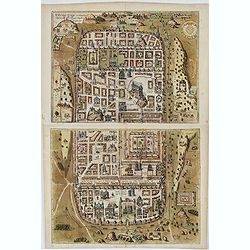
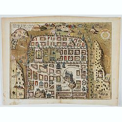
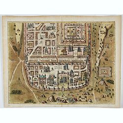
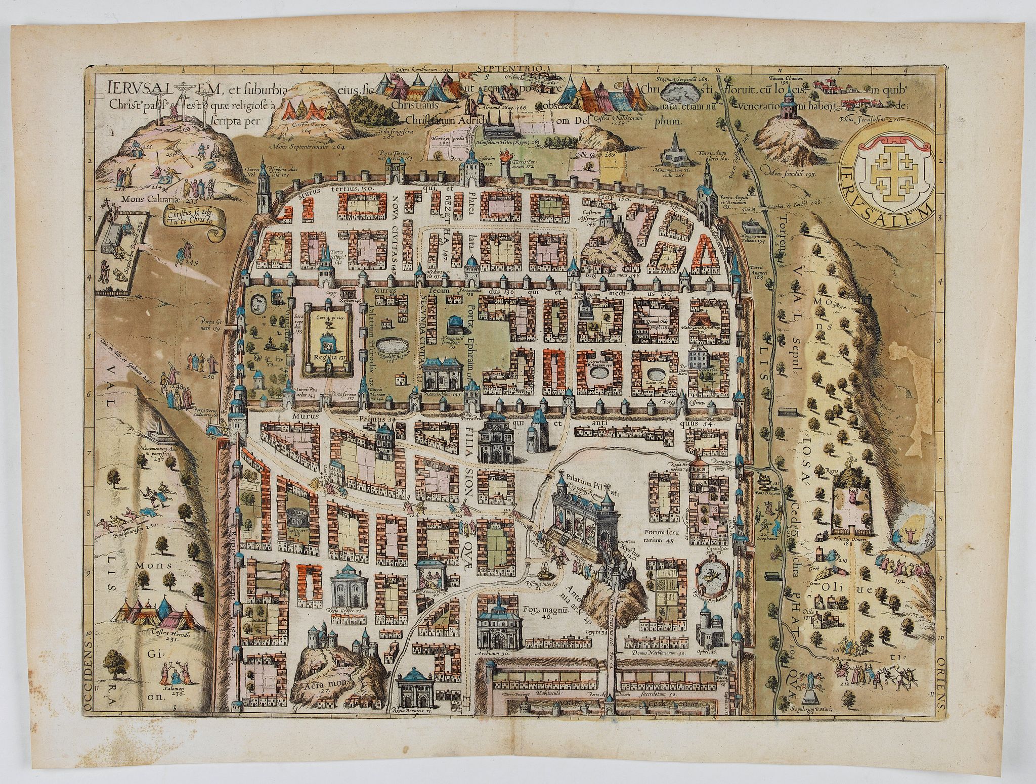
Ierusalem, et suburbia eius. . . |
||||||||||||||||||||
|
||||||||||||||||||||
|
|
||||||||||||||||||||
|
Selling price: $ Please login to see price!
Sold in 2022 Missed this item! Add your name to our mailing list and be the first to get notified about our newly added listings. . |
My Collection +
Add this or any of your favorite items in one place. If you want to save the items permanently, you have to sign in or create an account first.
Watchers:
5
|
|||||||||||||||||||
Description
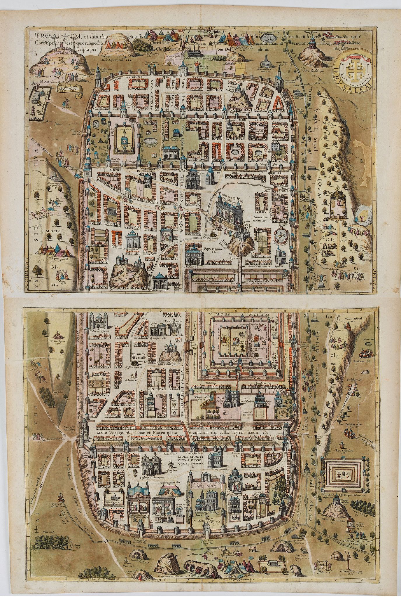
Plan of ancient Jerusalem and its suburbs as it looked at the time of Jesus Christ. TRANSLATION OF CAPTION: Jerusalem and its suburbs, as it flourished in the time of Christ; with the places where Christ suffered. Preserved with reverence by the Christians, they are still venerated today. Described by Christian Adrichom of Delft.
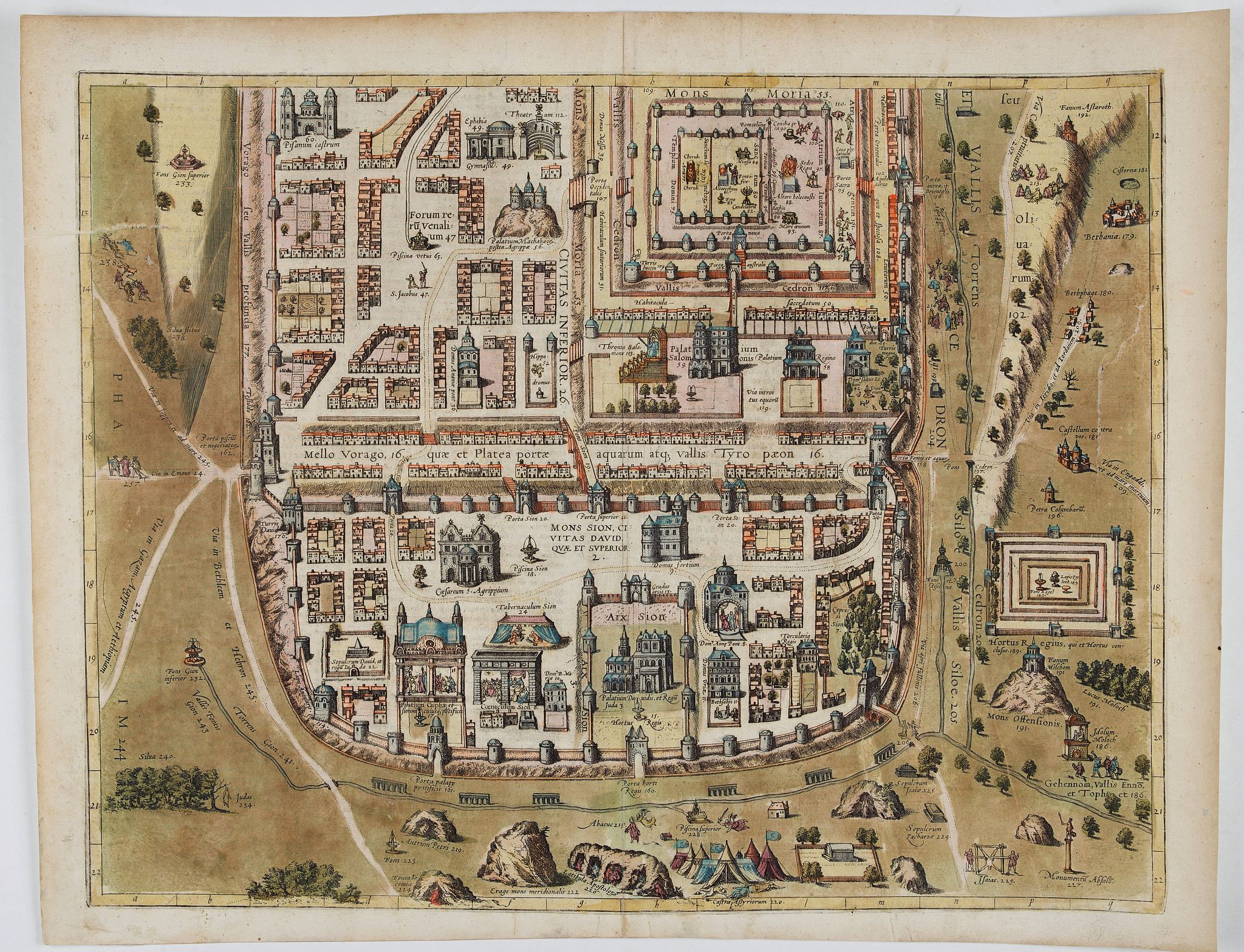
COMMENTARY BY BRAUN (on verso): "Dear Reader, three parts of the city of Jerusalem are distinguished. The first is called the City of Justice (Isaiah 1), the second the Holy City (Isaiah 52), the third the City of Truth (Zechariah 8). And because the City of Justice in times past [...] was also the Daughter of Zion, it has for this reason also been called the new and different city and was between the new enceinte and the old or first city wall.
The Holy City, however, was so named because of the Temple there, the holiest of sites. This extended from the old wall to the Valley of Mello, which was also called the Water Gate Road and the Valley of the Cheesemakers (Tyropoéon).
The City of Truth is the third section of the city. It was also called Mount Zion and the City of David (who had sworn to tell the truth to God), after David, the first king chosen from the tribe of Judah. Just as the Promised Land itself was divided into three parts in the time of Christ, namely Galilee, Samaria and Judea, so is the chief city at the center, situated like the center point in a circle drawn with compasses, divided into three parts."
Looking north, this view of Jerusalem has been schematically rendered as the scene of events in both the Old and the New Testament. The tripartite division of the city refers to the historical enlargements recorded in Josephus: in the south, the City of David with Mount Zion (3); at the center the city as it was enlarged in the 10th-8th centuries BC with Mount Moriah, the Temple Mount and in the north the extensions made in Hellenistic and Roman times.
The almost rectangular shape of the city as depicted here might be interpreted as an allusion to the Heavenly Jerusalem of the Revelation of St John the Divine. Similarly, the Temple is represented as a square, open complex encompassed by concentric ring walls. In the south is the Cenacle (6), with Jesus and the Disciples depicted at the Last Supper; to the left, the Palace of Caiaphas (17); south of the Temple Mount, the palace (59) and the throne (113) of Solomon. The Palace of Herod, built-in 23 BC, is shown (137) in the north.
In the east is the Mount of Olives with Gethsemane (210); north of the Temple is the Antonia Fortress (29), the seat of the Roman governor. From there the Via Dolorosa, with the Stations of the Cross indicated, runs before the city to Calvary, situated in the northwest (Golgota, 235), the site of the Crucifixion.
At first glance, this illustration would almost seem to draw on the symbolic allegory informing medieval depictions of cities. Here, however, an effort has obviously been made to link the events of the Passion and the holy places mentioned in the Bible with the actual topography of Jerusalem, thus elucidating the nature of the place as the scene of historical events.
The formulaic quality of the present representation expresses the principle of the divine order.
Hence the map might also have been intended for use by contemporary readers as a devotional image for meditation. (Taschen) From the greatest publication in this genre!. The Civitates was compiled and written by George Braun, Canon of Cologne Cathedral. Braun gathered together vast amounts of information and draft plans to produce over 500 city views/maps published in six parts between 1572 and 1617. Most of these engravings were made by Simon Novellanus and Frans Hogenberg, many after drawings by Joris Hoefnagel.
Reference: Taschen, Braun and Hogenberg, p.344.
FAQ - Guarantee - Shipping
Buying in the BuyNow Gallery
This item is available for immediate purchase when a "Add to Cart" or "Inquire Now" button is shown.
Items are sold in the EU margin scheme
Payments are accepted in Euros or US Dollars.
Authenticity Guarantee
 We provide professional descriptions, condition report (based on 45 years experience in the map business)
Paulus Swaen warrants the authenticity of our items and a certificate of authenticity is provided for each acquired lot.
Condition and Coloring
We indicate the condition of each item and use our unnique HiBCoR grading system in which four key items determine a map's value: Historical Importance, Beauty, Condition/Coloring and Rarity.
Color Key
We offer many maps in their original black and white condition. We do not systematically color-up maps to make them more sellable to the general public or buyer.
Copper engraved or wood block maps are always hand colored. Maps were initially colored for aesthetic reasons and to improve readability. Nowadays, it is becoming a challenge to find maps in their original colors and are therefor more valuable.
We use the following color keys in our catalog:
Original colors; mean that the colors have been applied around the time the map was issued.
Original o/l colors; means the map has only the borders colored at the time of publication.
Colored; If the colors are applied recently or at the end of the 20th century.
Read more about coloring of maps [+]
Shipping fee
A flat shipping fee of $ 30 is added to each shipment by DHL within Europe and North America. This covers : International Priority shipping, Packing and Insurance (up to the invoice amount).
Shipments to Asia are $ 40 and rest of the world $50
We charge only one shipping fee when you have been successful on multiple items or when you want to combine gallery and auction purchases.
Read more about invoicing and shipping
FAQ
Please have a look for more information about buying in the BuyNow gallery
Many answers are likely to find in the general help section.
My Collection+
![]()
With My Collection+ you can collect all your favorite items in one place. It is free, and anyone can create his or her virtual collection.
Unless you are logged in, the item is only saved for this session. You have to be registed and logged-in if you want to save this item permanently to My Collection+.
Read More[+]
Register here, it is free and you do not need a credit card.
Add this item to
My Collection+
or click the following link to see My Collection+.
| Digital Image Download | |
|
Paulus Swaen maintains an archive of most of our high-resolution rare maps, prints, posters and medieval manuscript scans. We make them freely available for download and study. Read more about free image download |
Click the image for a free small image download. |
In accordance with the EU Consumer Rights Directive and habitually reside in the European Union you have the right to cancel the contract for the purchase of a lot, without giving any reason.
The cancellation period will expire 14 calendar days from the day after the date on which you or a third party (other than the carrier and indicated by you) acquires, physical possession of the lot. To exercise the right to cancel you must inform Paulus Swaen Inc, of your decision to cancel this contract by a clear statement (e.g. a letter sent by post, or e-mail.
To meet the cancellation deadline, it is sufficient for you to send your communication concerning your exercise of the right to cancel before the cancellation period has expired.
