Subscribe to be notified if similar examples become available.
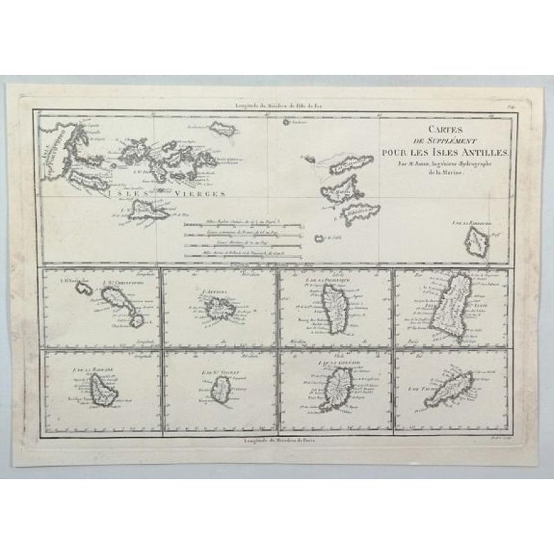
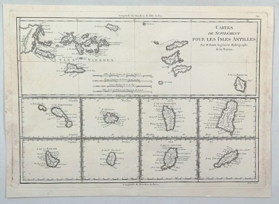
1787 BONNE, R. - Cartes de supplément pour les Isles Antilles.
Cartes de supplément pour les Isles Antilles. |
||||||||||||||||||||
|
||||||||||||||||||||
|
|
||||||||||||||||||||
|
Selling price: $ Please login to see price!
Sold in 2023 Missed this item! Add your name to our mailing list and be the first to get notified about our newly added listings. . |
My Collection +
Add this or any of your favorite items in one place. If you want to save the items permanently, you have to sign in or create an account first.   Add/Remove
Watchers:
5
|
|||||||||||||||||||



Description
An interesting map of the Antilles Islands including: Isles Vierges / Isle St Christophe / Isle Antigoa / Isle de la Dominique / Isle Ste Lucie / Isle de la Barbade / Isle de la St Vincent / Isle de la Grenade / Isle de Tabago [Islands of the West Indies / Virgin Islands / Saint Kitts / Antigua / Dominica / Barbados / Saint Vincent / Grenada / Tobago, by Bonne in Paris in 1787.
Rigobert Bonne (1727–1794) was a French cartographer, widely considered to be one of the most important cartographers of the late 18th century. In 1773, Bonne succeeded Jacques Nicolas Bellin as Royal Cartographer to France in the office of the Hydrographer at the Depôt de la Marine. Working in his official capacity, Bonne compiled some of the most detailed and accurate maps of the period.
Bonne's work represents an important step in the evolution of the cartographic ideology away from the decorative work of the 17th and early 18th century towards a more detail oriented and practical aesthetic.
Rigobert Bonne (1727-1795)
Rigobert Bonne was Royal Cartographer to France in the office of the Hydrographer at the Depot de la Marine. He was largely self-taught as a mathematician, initially gaining practical experience by serving as a military engineer for the French Army during the War of the Austrian Succession. Although Bonne did not come from a family of mapmakers, his son, Charles-Marie Rigobert, carried on his legacy and pursued a successful career in the field.Bonne reached his professional peak when he succeeded Jacques Nicolas Bellin, serving as First Hydrographer of the Dépôt de Cartes et Plans de la Marine from 1775 to 1789. His work represents a vital paradigm shift in late 18th-century cartography, moving decisively away from the highly ornate, decorative style of the 17th century toward a strictly practical, scientific, and detail-oriented aesthetic that abandoned ornamental hand-coloring, elaborate cartouches, and decorative compass roses. Though he did not invent the equal-area mathematical projection that bears his name, his application of the “Bonne Projection” in his 1762 Atlas Maritime des Côtes de France modified and popularised the method for widespread navigation. His key publications include the map contributions for Guillaume Raynal’s Atlas de toutes les parties connues du Globe Terrestre (1780) and the multi-volume Atlas Encyclopédique (1787-1788), which he produced in collaboration with the geologist Nicolas Desmarest.
Rigobert Bonne will be remembered as a pioneer of utilitarian cartography who embedded Enlightenment ideals of precision and scientific objectivity into the physical charting of the world.
FAQ - Guarantee - Shipping
This item is available for immediate purchase when a "Add to Cart" or "Inquire Now" button is shown.
Payments are accepted in Euros or US Dollars. We accept most major credit cards, PayPal and bank transfer.
Authenticity Guarantee
 We provide professional descriptions, condition report and HiBCoR rating (based on 45 years experience in the map business)
We fully guarantee the authenticity of items we sell. We provide a certificate of authenticity for each purchased item.
Condition / Coloring
We indicate the condition of each item and use our unnique HiBCoR grading system in which four key items determine a map's value: Historical Importance, Beauty, Condition/Coloring and Rarity.
We offer many maps in their original black and white condition. We do not systematically color-up maps to make them more sellable to the general public or buyer.
Copper engraved or wood block maps are always hand colored. Maps were initially colored for aesthetic reasons and to improve readability. Nowadays, it is becoming a challenge to find maps in their original colors and are therefor more valuable.
We use the following color keys in our catalog:
Original colors; mean that the colors have been applied around the time the map was issued.
Colored; If the colors are applied recently or at the end of the 20th century, then "colored", or "attractive colors" will be used.
Original o/l colors; means the map has only the borders colored at the time of publication.
Read more about coloring of maps [+]
FAQ
Please have a look for more information about buying in the BuyNow gallery.
Many answers are likely to find in the general help section.
My Collection+

With My Collection+ you can collect all your favorite items in one place. It is free, and anyone can create his or her virtual map collection.
Unless you are logged in, the item is only saved for this session. You have to be registed and logged-in if you want to save this item permanently to My Collection+. Read More [+]
If you want to save the items permanently, please sign in
or create account first.
Registering Here, it is and you do not need a credit card.
Add this item to My Collection+ or click the following link to see My Collection+.
Invoice
The invoice and certificates of authenticity are available in the client center >Invoices
|
Digital Image Download Paulus Swaen maintains an archive of most of our high-resolution rare maps, prints, posters and medieval manuscript scans. We make them freely available for download and study. Read more about free image download |
Click the image for a free small image download. |
YOUR RIGHT TO CANCEL THE PURCHASE OF A LOT
In accordance with the EU Consumer Rights Directive and habitually reside in the European Union you have the right to cancel the contract for the purchase of a lot, without giving any reason.
The cancellation period will expire 14 calendar days from the day after the date on which you or a third party (other than the carrier and indicated by you) acquires, physical possession of the lot. To exercise the right to cancel you must inform Paulus Swaen Inc, of your decision to cancel this contract by a clear statement (e.g. a letter sent by post, or e-mail.
To meet the cancellation deadline, it is sufficient for you to send your communication concerning your exercise of the right to cancel before the cancellation period has expired.
