Browse Listings
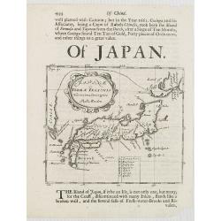
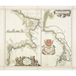
Japonae ac Terrae Iessonis Novissima Descriptio.
Hokkaido is shown as being connected to Korea. With a description in English giving brief information on Japan and Korea and a rather detailed description of Taiwan (Form...
Date: London, 1680
Selling price: ????
Please login to see price!
Sold in 2008
![[Title page] Plans, et Profils des principales villes des Duchez de Lorraine, et de Bar, avec la carte générale, et les particulières de chaque gouvernement.](/uploads/cache/17249-250x250.jpg)
[Title page] Plans, et Profils des principales villes des Duchez de Lorraine, et de Bar, avec la carte générale, et les particulières de chaque gouvernement.
Decorative title page from Plans, et Profils des principales villes..
Date: Paris, 1680
Selling price: ????
Please login to see price!
Sold
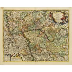
Juliacensis, Cliviensis,..Coloniensis Archiepiscopatus..
Detailed map covering the area in-between Maastricht, Weert, Nijmegen, Deventer, Dortmund, Olpe, Cologne and Bonn. Lower right inset map of river Rhine near Koblenz.
Date: Amsterdam 1680
Selling price: ????
Please login to see price!
Sold
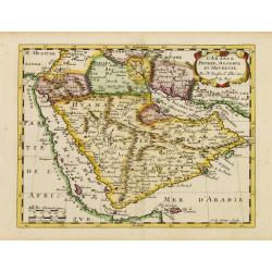
L'Arabie Petrée, Deserte et Hevreuse..
An attractive map of the Arabian Peninsula from a French text edition. Engraved by A.de Winter.
Date: Amsterdam 1680
Selling price: ????
Please login to see price!
Sold
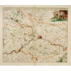
Comitatus Namurci Tabula in Lucem..
Centred on Namen, with decorative title cartouche upper right.
Date: Amsterdam 1680
Selling price: ????
Please login to see price!
Sold
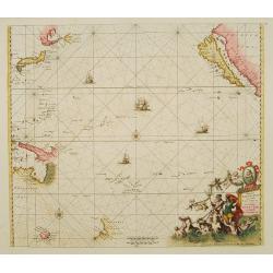
Magnum Mare del Zur.
Based on Goos' 1666 chart, California depicted with an indented northern coastline following the second Sanson model. Tasmania, NW Australia and Carpentaria appear, as do...
Date: Amsterdam 1680
Selling price: ????
Please login to see price!
Sold
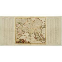
Accuratissima totius Asiae tabula..
The map includes a detailed depiction of South East Asia and the Far East. The northern tip of Australia (Hollandia Nova) is shown as are the important discoveries made t...
Date: Amsterdam 1680
Selling price: ????
Please login to see price!
Sold
Tabula Russia Vulgo Moscovia.
A detailed map including all western Russia and most of Finland. With very decorative title cartouche.
Date: Amsterdam 1680
Selling price: ????
Please login to see price!
Sold
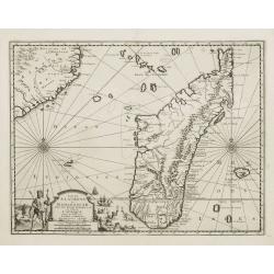
Insula S.Laurentii vulgo Madagascar.
Showing in great detail the island of Madagascar. In upper left hand corner part of Mozambique.
Date: Amsterdam, 1680
Selling price: ????
Please login to see price!
Sold
![[Hercules]](/uploads/cache/21578-250x250.jpg)
[Hercules]
Engraving showing Hercules, resting on club, with the skin of the lion of Nemesis.Signed in lefthand bottom GMF
Date: 1650-1680
Selling price: ????
Please login to see price!
Sold
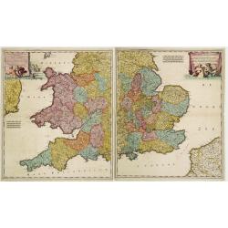
Lancaster Occidentalior Regni Angliae Districtus..., together with Orientalior Districtus Regni Angliae?
Decorative map of England and Wales on two sheets, ornamental title cartouche incorporating classical figures.
Date: Amsterdam 1680
Selling price: ????
Please login to see price!
Sold
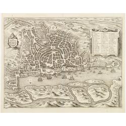
Goa.
A finely engraved, detailed plan of Goa. It also appeared in Gottfried?s Archontologia (1649). There is a cartouche identifying 43 buildings and the plan includes the har...
Date: Frankfurt 1680
Selling price: ????
Please login to see price!
Sold
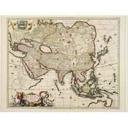
Asiae Nova Delineatio.
Superb map of the whole of Asia and the East Indies. The discoveries of Tasman, Janszoon and Cartensz are reflected in Australia and New Guinea.The delineation of Japan f...
Date: Amsterdam 1680
Selling price: ????
Please login to see price!
Sold
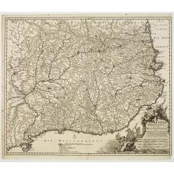
Cataloniae principatus nec non Ruscinonensis..
Map of the Spanish region of Catalonia with the Mediterranean coast line from the French border via Barcelona to Tortosa.. With decorative title cartouche.
Date: Amsterdam 1680
Selling price: ????
Please login to see price!
Sold
Nova Orbis Tabula in Lucem edita A.F.de Wit.
According to Shirley, De Wit's map is one of the most attractive of its time. The brilliant scenes in the corners combine images of the four seasons, the elements and the...
Date: Amsterdam 1680
Selling price: ????
Please login to see price!
Sold
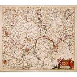
Marchionatus sacri imperii.. Mechelini Tabula. . .
Decorative map covering the area of Antwerp, Leuven, Brussels Aalst and Hulst.
Date: Amsterdam, 1680
Selling price: ????
Please login to see price!
Sold in 2018
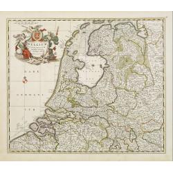
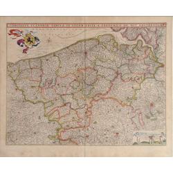
Belgium Foederatum emendate auctum et novissime editum.
Fine detailed map of the area of the modern Netherlands less the southern part of Limburg. Title cartouche representing the commerce, the arts and the sciences. The Lion ...
Date: Amsterdam, 1680
Selling price: ????
Please login to see price!
Sold in 2010
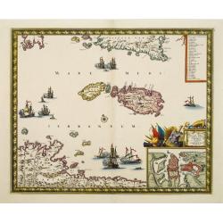
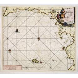
Insula Malta accuratissime Delineata, Urbibus, et Fortalitis..
With large inset of Valetta. Three large vignettes depicting sea battles, table contains key of 33 important places. Includes lower area of Sicily and north coast of Afri...
Date: Amsterdam 1680
Selling price: ????
Please login to see price!
Sold
Nieuwe Pascaart Voor een gedeelte van Barbaria Beginnende Van Susa tot Caap Mesurata Als Mede t'Eylandt Malta . . .
Detailed chart of the Barbary Coast, from Cape Mesurata to Golfo di Mahometa, including Tripoli. In lower part of the chart the Island of Malta.From his "De Nieuwe G...
Date: Amsterdam, 1680
Selling price: ????
Please login to see price!
Sold in 2013
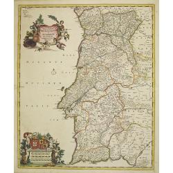
Novissima regnorum Portugalliae et Algarbiae descriptio.
Map of Portugal. Fine title and scale cartouche. With privilege of the State of Holland.
Date: Amsterdam, 1680
Selling price: ????
Please login to see price!
Sold in 2017
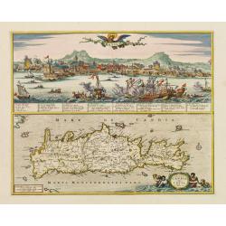
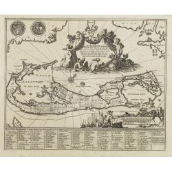
Candia./ Insula Candia olim Creta.
Richly engraved work, one of the most beautiful ever produced maps of Crete.Upper part showing the Turkish siege of the town of Candie.
Date: Amsterdam, 1680
Selling price: ????
Please login to see price!
Sold in 2009
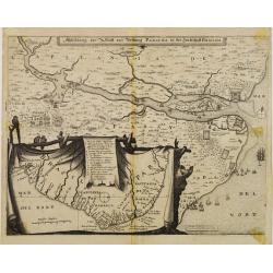
Abbildung der Statt und Vestung Parayba in der Landschaft Brasilia.
Detailed map of the region of Paraiba and the defending forts at the mouth of the River Paraiba.The map illustrates the Dutch incursion into the Portuguese territory and ...
Date: Frankfurt, 1680
Selling price: ????
Please login to see price!
Sold in 2013
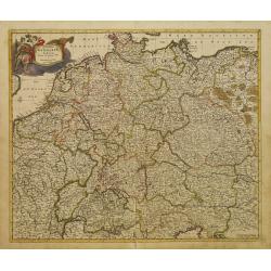
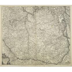
Accuratissima Germaniae Tabula Denuo in lucem edita.
A very detailed map of central Europe, centred on Germany. It extends from Belgium and The Netherlands through Pomerania in the north, and from eastern France to Croatia ...
Date: Amsterdam 1680
Selling price: ????
Please login to see price!
Sold
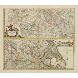
Totius Fluminis Rheni Novissima Descriptio ex officina.
Two maps on one sheet, one above the other, charting the course of the Rhine River.Beginning on the top map, from its spring at the Bodensee in Switzerland, through the e...
Date: Amsterdam, 1680
Selling price: ????
Please login to see price!
Sold in 2016
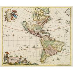
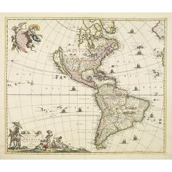
Novissima et Accuratissima Totius Americae descriptio..
One of the classic Dutch maps of the Americas and one of the most often copied.Lower right hand corner F. de Wit excudit. Several editions would appear through the end of...
Date: Amsterdam 1680
Selling price: ????
Please login to see price!
Sold
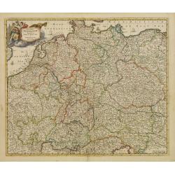
Accuratissima Germaniae Tabula Denuo in lucem edita.
A very detailed map of central Europe, centred on Germany. It extends from Belgium and The Netherlands through Poland and from eastern France to Croatia in the south.The ...
Date: Amsterdam 1680
Selling price: ????
Please login to see price!
Sold in 2011
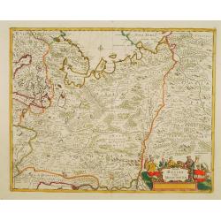
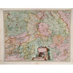
Moguntini Archiepiscopat' et Electoratus..
Map depicting part of western Germany, focusing on Rhineland-Palatinate and Hessen and orientated with north to the left.Marking Frankfurt and Heidelberg.The title cartou...
Date: Amsterdam 1680
Selling price: ????
Please login to see price!
Sold
Nova Totius Terrarum Orbis Tabula. . .
Sometime after 1684, when a privilege was granted to the Danckerts firm, a new plate was engraved to replace the single-sheet world map of 1680. The outer decoration is v...
Date: Amsterdam, 1680
Selling price: ????
Please login to see price!
Sold in 2013
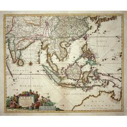
Indiae Orientalis nec non Insularum Adiacentium Nova Descriptio.
This superb map of South East Asia presents a detailed image of the sphere of operations and Asian trading empire of the Dutch East India Company. The map extends from In...
Date: Amsterdam, 1680
Selling price: ????
Please login to see price!
Sold
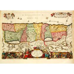
Het Beloofde Landt Canaan door wandelt van onsen Salichmaecker Iesus Christo, neffens syne Apostelen.
Dutch so-called ' Staten' bibles, published between 1637 and c. 1760, contained 5 maps: The World, ' Paradise', The Perigrinations, The Promised Land Canaan, The Travels ...
Date: Amsterdam, 1680
Selling price: ????
Please login to see price!
Sold in 2008
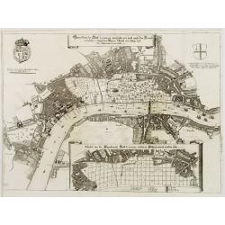
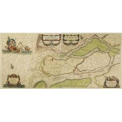
Dithmarsia, Rendesburgum, Kiel et Bordesholm in Occodentali parte Holsatiae.
Moses Pitt (d.London,1696), planned to publish together with Janssonius' son-in-law, Janssonius van Waesbergen, a 12 volume atlas. Only 4 vol. 1680-83. Vol. I ' World &am...
Date: London, 1680
Selling price: ????
Please login to see price!
Sold in 2019
Perigrinatie ofte Veertich-Jarige Reyse der Kinderen Israëls
Dutch so-called ' Staten' bibles, published between 1637 and c. 1760, contained 5 maps: The World, ' Paradise', The Perigrinations, The Promised Land Canaan, The Travels ...
Date: Amsterdam, 1680
Selling price: ????
Please login to see price!
Sold in 2015
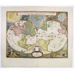
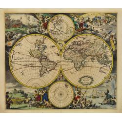
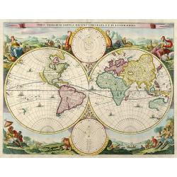
Orbis Terrarum Tabula Recens Emendata Et In Lucem Edita.
A world map in two hemispheres, decorated in the corners with the representations of the four continents in allegorical form.
Date: Dordrecht / Amsterdam, ca. 1680
Selling price: ????
Please login to see price!
Sold in 2018
Ducatus Lutzenburgi Novissima et Accuratissima Delineatio.
West to the top. Very detailed and fine map of Luxembourg, including the towns of Namur, Liege, Trier and Metz.
Date: Amsterdam 1680
Selling price: ????
Please login to see price!
Sold
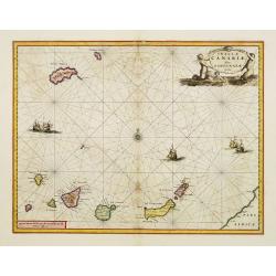
Insulae Canariae Alias Fortunatae dictae.
A well engraved and highly detailed chart including the Canary islands.
Date: Amsterdam, 1680
Selling price: ????
Please login to see price!
Sold
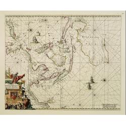
Orientaliora Indiarum Orientalium cum Insulis Adjecentibus.
Oriental figures in title piece bottom left. Orientated with East at the top of the map.A splendid sea chart of the Southeast Asia illustrating the Dutch sphere of influe...
Date: Amsterdam, 1675-1680
Selling price: ????
Please login to see price!
Sold
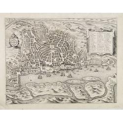
![Abbildüng der Statt LONDON, sambt dem erschröcklichen brandt [?] A° 1666 ..](/uploads/cache/23991-250x250.jpg)
Abbildüng der Statt LONDON, sambt dem erschröcklichen brandt [?] A° 1666 ..
Decorative view of London, showing the great fire of 1666. Very decorative and of the highest standing of engraving.
Date: Frankfurt 1680
Selling price: ????
Please login to see price!
Sold
Gründtriss der Statt LONDON, wie folche vor und nach dem Brand anzüseher s..
Decorative plan of London. With inset map showing the future design after the great fire. Very decorative and of the highest standing of engraving.
Date: Frankfurt 1680
Selling price: ????
Please login to see price!
Sold
Mappa Aestivarum Insularum alias Barmudas..
A very decorative map. The large title cartouche shows Neptune with mermaids and a sea-monster.The map includes the arms of England and Bermuda, and lists proprietors of ...
Date: Amsterdam, 1680
Selling price: ????
Please login to see price!
Sold in 2008
Tractus Australior Americae Meridionalis a Rio de la Plata per Fretum Magellanicaum ad Toraltum . . .
A decorative chart of the southern coast of Chile and Argentina from Toral to Rio del Plata. A large vignette battle scene occupies the South Atlantic and the title is se...
Date: Amsterdam, 1680
Selling price: ????
Please login to see price!
Sold in 2009
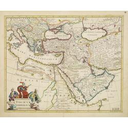
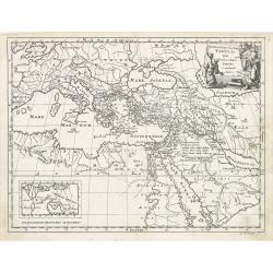
Turcicum Imperium.
Detailed map of the Turkish Empire by Holland's leading mapmaker at the end of the seventeenth century. The cartouche shows an Ottoman administrator or possibly the Sulta...
Date: Amsterdam, 1680
Selling price: ????
Please login to see price!
Sold in 2011
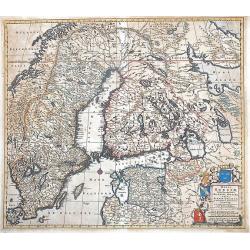
Regni Sueciae Tabula Generalis, divisa in Sueciae, Gotiae, Regna Finlandiae Ducatum Lapponiam...
Nice example of De Wit map of Scandinavia.
Date: Amsterdam, 1680
Selling price: ????
Please login to see price!
Sold in 2013
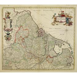
Novissima et accuratissima XVII Provinciarum Germaniae. . .
Showing present-day The Netherlands, Belgium, and Luxembourg. West to the top. Great cartouche. An interesting explanation is that Dr. Iohanni Munter was consulted in the...
Date: Amsterdam, 1680
Selling price: ????
Please login to see price!
Sold in 2008
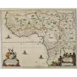
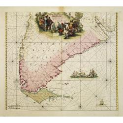
Nigritarum regnum.
Rare and beautiful map of the West coast of Africa with a dedication to Otto Schwerin of Brandenburg. The signature reads Apud Heredes Joannis Janssonii Only a small numb...
Date: Amsterdam, 1680
Selling price: ????
Please login to see price!
Sold in 2010
Geographiae Sacrae Tabula, que totius orbis partes continent.
Attractive map of the Mediterranean and countries bordering, extending eastwards to include the Arabian Peninsula. Including the Black Sea up to the Caspian Sea.
Date: Amsterdam / Utrecht, 1680
Selling price: ????
Please login to see price!
Sold in 2022
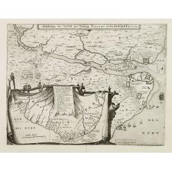
Abbildung der Statt und Vestung Parayba in der Landschaft Brasilia.
In lower part map inset of general map of Brazil.
Date: Frankfurt, 1680
Selling price: ????
Please login to see price!
Sold in 2008
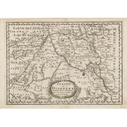
Syrien en Diarbeek verdeelt in hunne Scheidingen.
Engraved map of the Near East, including Cyprus, Palestine, Syria, Iraq, bordered by Greece, Turkey and Iran. The map shows great detail of towns, cities and topography, ...
Date: Utrecht, 1680
Selling price: ????
Please login to see price!
Sold in 2016
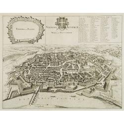
Vienna Austriae Wien in Oostenreyk.
Panoramic view of Vienna by Frederik de Wit. With a numbered key (A-Z), (1-51) & (a-p) to principal places in town. In upper left corner an inset of the town with its...
Date: Amsterdam, ca. 1680
Selling price: ????
Please login to see price!
Sold in 2008
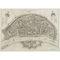
Colonia Agrippa.
Rare panoramic view of Cologne by Frederik de Wit. With a numbered key (A-Q) & (1-33) to principal places in town.
Date: Amsterdam, ca. 1680
Selling price: ????
Please login to see price!
Sold in 2008
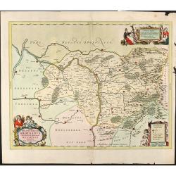
Ducatus Silesiae Grotganus cum Districtu Episcopali Nissensi Delineatore Iona Sculteto, Silesio
Attractive colored map of Upper Silesia from J. Scultetus by J. Janssonius. Showing the area around Nysa and Grodkow. With three beautiful colored cartouches. Without tex...
Date: Amsterdam, 1680
Selling price: ????
Please login to see price!
Sold in 2008
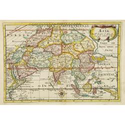
Asia.
Engraved map of Asia, after N.Sanson. Engraved by Anthonie d'Winter.
Date: Utrecht, 1680
Selling price: ????
Please login to see price!
Sold in 2015
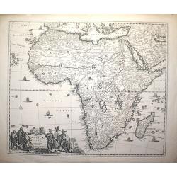
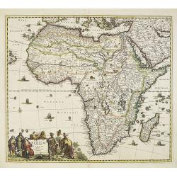
Totius Africae Accuratissima Tabula authore Frederico de Wit
Date: Amsterdam, c. 1680
Selling price: ????
Please login to see price!
Sold in 2008
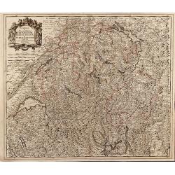
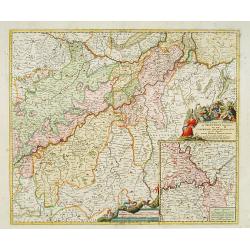
Novissima et Accuratissima Helvetiae, Rhaetiae, Valesiae et Partis Sabaudiae Tabula
Detailed map of Switzerland including South Germany with the Lake of Constance and Liechtenstein. Map from Jeremias Wolff by J. Danckerts.
Date: Amsterdam, 1680
Selling price: ????
Please login to see price!
Sold in 2009
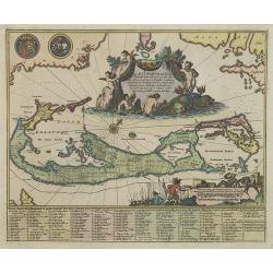
Mappa Aestivarum Insularum alias Barmudas. . .
A very decorative map. The large title cartouche shows Neptune with mermaids and a sea-monster.The map includes the arms of England and Bermuda, and lists proprietors of ...
Date: Amsterdam, 1680
Selling price: ????
Please login to see price!
Sold
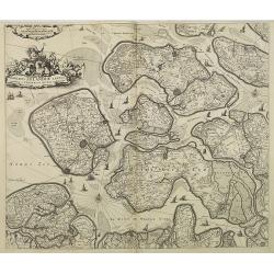
Comitatus Zelandiae tabula emendata a Frederico de Wit amstelodami.
Fine map covering Zeeland. Fine title cartouche and extensive shipping on Westerschelde and other waterways. Shows five islands: Walcheren, Schouwen, Duyvelant, Noort Bev...
Date: Amsterdam, 1680
Selling price: ????
Please login to see price!
Sold in 2009
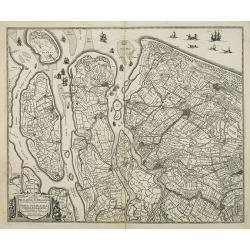
Novissima Delflandiae, Schielandiae et circumiacentium insularum ut Voornae, Overflackeae Goerea, Iselmondae aliarumque tabula Auctore Balthazaro Florentio a Berckenrode Amstelodami. Apud Fredericum De Witt.
A very nice map showing the southern part of the province of Holland, prepared by B.F. Van Berckenrode.Originally the plate was published by Janssonius. This is the much ...
Date: Amsterdam, 1680
Selling price: ????
Please login to see price!
Sold in 2009
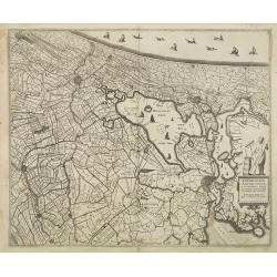
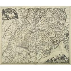
Rhinolandiae, Amstelandiae et circumiacent. Aliquot territor . . .
Map centered on The Hague, Leiden, Haarlem, Amsterdam, Gouda, etc. West to the top. Prepared by Balthasar Floris van Berkenrode.BR>Originally the plate was published b...
Date: Amsterdam, 1680
Selling price: ????
Please login to see price!
Sold in 2009
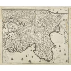
Noordt Hollandt.
A detailed map of the northern part of Holland. At that time practically all polders -with the exception of the IJ-polder- had already been reclaimed.
Date: Amsterdam, 1680
Selling price: ????
Please login to see price!
Sold in 2009
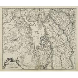
Nova atque emendata descriptio Suydt Hollandiae edita a Frederico de Wit.
A detailed map of the southern part of Holland with the cities of Breda, Dordrecht and Gorinchem. The map is oriented with west at the top. Superb detail of roads, canals...
Date: Amsterdam, 1680
Selling price: ????
Please login to see price!
Sold in 2009
Tabula Ducatus Brabantiae continens Marchionatum Sacri Imperii et Dominium Mechliniense emendate à F. de Wit 1666
Shows present-day Belgium and Dutch province of Brabant. Including the Maas and Waal rivers. Shows Antwerp, Brussels, Namur, Liege and Venlo among other towns and cities....
Date: Amsterdam, 1680
Selling price: ????
Please login to see price!
Sold in 2012
Ultraiectini Dominii Tabula Multo aliis auctior et corrector, per Nic. Visscher.
Orientated south to the top. With two very decorative cartouches etched by Mr. Romeijn de Hooghe. In Latin. Taken from the atlas Germania Inferior, sive XVII Provinciarum...
Date: Amsterdam, 1680
Selling price: ????
Please login to see price!
Sold in 2009
Ducatus Lutzenburgici Tabula Nuperrime In Lucem Edita Per Fredericum De Wit.
Popular map of Luxembourg, however this edition has the number "V" in the upper right corner. RARE.
Date: Amsterdam, 1680
Selling price: ????
Please login to see price!
Sold in 2013
Orbis Terrarum Tabula Recens Emendata et in Lucem Edita
World map from a Dutch bible of Daniel Stoopendael in beautiful hand coloring. The map is based on Nicolas Visscher's map of 1663. Showing double-hemisphere world map wit...
Date: Amsterdam / Rotterdam, 1680
Selling price: ????
Please login to see price!
Sold in 2009
Paskaerte van het inkoomen van de Maes.. (two sheets)
Uncommon chart of the river Maas from the entrance down to the Biesbosch. Including the towns of Dordrecht, Rotterdam, Schiedam, Willemstad, Vlaardingen, Den Briel, Helle...
Date: Amsterdam, ca.1680
Selling price: ????
Please login to see price!
Sold in 2009
Totius Africae . . .
The detail of the map includes the traditional depiction of Central Africa with the river Nile rising in two large central Lakes Zaire and Zaflan.
Date: Amsterdam, 1680
Selling price: ????
Please login to see price!
Sold in 2011

Nova Tabula Magni Ducatus Finlandiae.
The map is based on the archetypal map of the Swede Anders Bure. It is the first map to show the Grand-Duchy of Finland on its own. A remarkably beautiful cartouche displ...
Date: Amsterdam, 1680
Selling price: ????
Please login to see price!
Sold in 2009
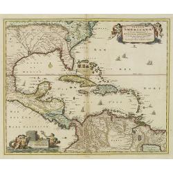
Insulae Americanae in Oceano ...
A beautiful map that includes the American Southeast, part of Mexico, Central America, and the northern part of South America.
Date: Amsterdam, 1680
Selling price: ????
Please login to see price!
Sold in 2014
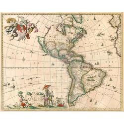
Novissima et Accuratissima Totius Americae descriptio.
Visscher's map of the Americas, this decorative map greatly influenced the cartography of the Americas both geographically and artistically.Although it did not provide mu...
Date: Amsterdam, 1658 - 1680
Selling price: ????
Please login to see price!
Sold in 2010
Nova et accurata Wolgae Fluminis olim Rha dicti delineatio Auctore Adamo Oleario.
Showing the Volga River in two parts based on the travels of Adam Olearius. The left side of the map begins at Nazhniy Novgorod and ends at Saratov. The right side contin...
Date: Oxford, 1680
Selling price: ????
Please login to see price!
Sold in 2009
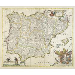
Totius Regnorum HISPANIAE et PORTUGALLIAE descriptio.
A very detailed map. At bottom right a beautiful cartouche with the coats of arms of Portugal and the Spanish provinces.
Date: Amsterdam, 1680
Selling price: ????
Please login to see price!
Sold
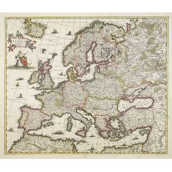
Nova et Accurata totius Europae descriptio. . .
General map of Europe richly ornamented with small compass rose and Europe shown riding Zeus in the form of a bull, and several putti holding the title banner aloft.
Date: Amsterdam, 1680
Selling price: ????
Please login to see price!
Sold in 2009
Goa.
A finely engraved, detailed town-plan of Goa, the main Portuguese trading post in India. It also appeared in Gottfried's Archontologia (1649). There is a cartouche identi...
Date: Frankfurt, 1680
Selling price: ????
Please login to see price!
Sold in 2011
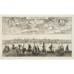
Amsterdam.
Beautiful panoramic town-view Amsterdam seen from the IJ. Extensive shipping in the foreground. Coats-of-arms of the town in top. A label has been pasted underneath the c...
Date: Paris, ca. 1680
Selling price: ????
Please login to see price!
Sold in 2009
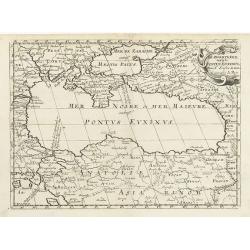
De Zwartezee, eertyts Pontus Euxinus . . .
Map encompassing part of the Near East and the area comprehended between the Black Sea and the Caspian Sea.Prepared by N.Sanson.
Date: Amsterdam, Utrecht, 1680
Selling price: ????
Please login to see price!
Sold in 2010
Novissima et Accuratissima Totius Americae descriptio..
One of the classic Dutch maps of the Americas and one of the most often copied. Lower right hand corner F. de Wit excudit.Several editions would appear through the end of...
Date: Amsterdam, 1680
Selling price: ????
Please login to see price!
Sold in 2013
Comitatus Flandria Tabula, in Lucem Edita a Frederico de Wit Amsterdami.
Frederick de Wit map of Flanders region showing from Arras, France on the south to Antwerp, Belgium in the north with beautiful gold leaf detail.
Date: Amsterdam, 1680
Selling price: ????
Please login to see price!
Sold in 2010
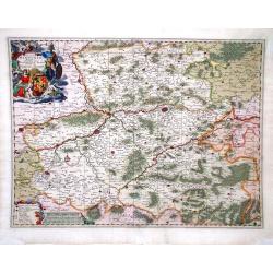
Leodiensis Episcopatus.
Visscher map of Belgium and Trier region of Germany with beautiful original color. Shows Antwerp in the upper left corner, Trier, Germany in lower right corner.
Date: Amsterdam, 1680
Selling price: ????
Please login to see price!
Sold in 2010
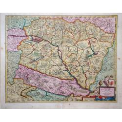
Regnum Hungaria in Omnes fuos Comitatus.
Frederick de Wit map showing Hungary and surrounding regions of Austria and Serbia. The city of Budapest is shown at the center of the map.
Date: Amsterdam, 1680
Selling price: ????
Please login to see price!
Sold in 2010
Comitatus Hannonia Tabula.
Nicolas Vissher map showing region of northern France and Belgium.
Date: Amsterdam, 1680
Selling price: ????
Please login to see price!
Sold in 2010
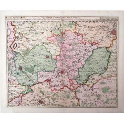
Flandria Comitatus Pars Media.
Nicolas Visscher map, with beautiful original color, showing region of Belgium with city of Gent in the top right corner.
Date: Amsterdam, 1680
Selling price: ????
Please login to see price!
Sold in 2010