Search Listings matching "cyprus"
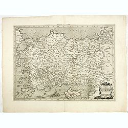
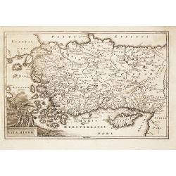
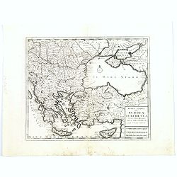
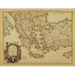
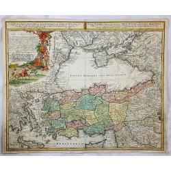
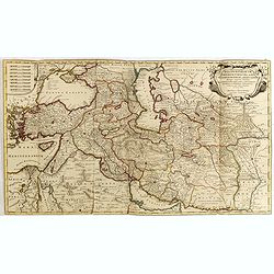
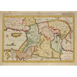
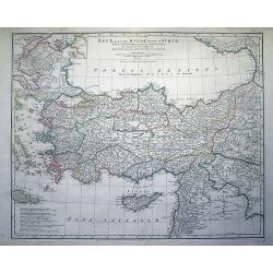
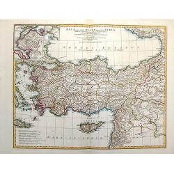
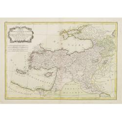
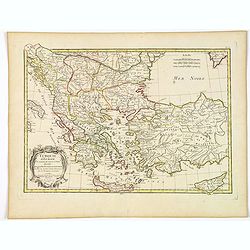
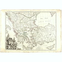
Tab. I. Asiae, in qua Galatia, Cappadocia, Pontus, Bithynia, Asia Minor, Pamphylia, Lycia, ac Cilicia... (With Cyprus)
A fine Ptolemaic map of Turkey and Cyprus showing its ancient political divisions. Two fierce sea monsters fill the Mediterranean Sea. Decorated with a strapwork title ca...
Date: Amsterdam, 1730
Selling price: ????
Please login to see price!
Sold in 2015
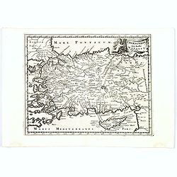
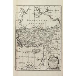
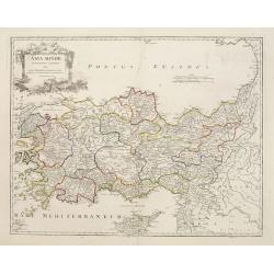
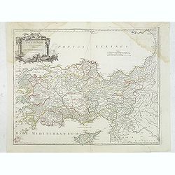
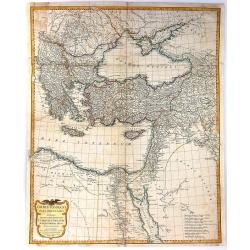
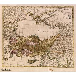
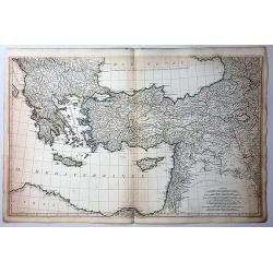
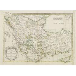
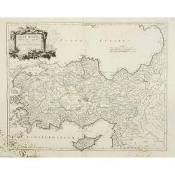
Chersonesi quae hodie Natolia Descriptio.
Lovely map of Asia Minor, with some parts of the eastern Greek Archipelago, plus Cyprus and northern Syria. Cherub holding banner title in top right corner.
Date: Amsterdam, ca. 1730
Selling price: ????
Please login to see price!
Sold in 2018
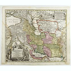
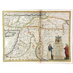
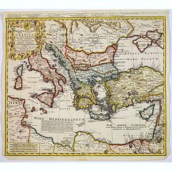
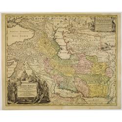
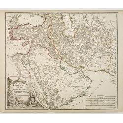
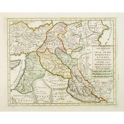
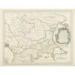
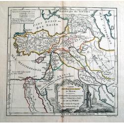
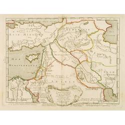
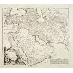
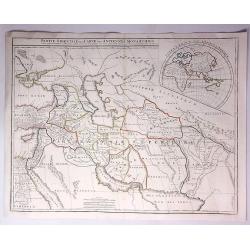
Imperii Persici in omnes suas Provincias . . . Exacte Divisi Nova Tabula Geographica. . .
Showing the eastern part of Turkey and Cyprus, Palestine, Persian Gulf, including Gulf of Oman, Caspian Sea, Iran and the north-west territories of India.Embellished with...
Date: Ausburg, 1730
Selling price: ????
Please login to see price!
Sold in 2017
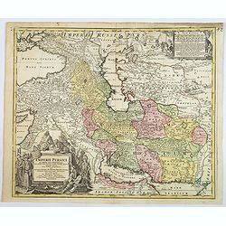
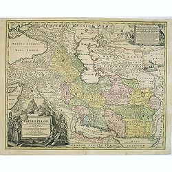
Imperii Persici in omnes suas Provincias . . . Exacte Divisi Nova Tabula Geographica. . .
A fine and handsome map showing the eastern part of Turkey and Cyprus,
Date: Ausburg, 1730
Selling price: ????
Please login to see price!
Sold in 2019
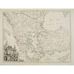
Asia Minor.
Christoph Cellarius (1638-1707). Geographia Antiqua, 1686.A map of Turkey and Cyprus. Embellished with a nice title-cartouche.
Date: Leipzig, Gledisch, 1732
Selling price: ????
Please login to see price!
Sold in 2008
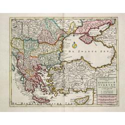
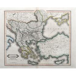
Nieuwe Kaart van Europisch Turkyen.
Izaak Tirion (d. 1769) Amsterdam publisher. His ' Nieuwe en beknopte handatlas' saw 6 editions between before 1740 and after 1784. Also ' Tegenwoordige staat van alle vol...
Date: Amsterdam, 1733
Selling price: ????
Please login to see price!
Sold
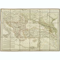
A New Map of the Eastern Parts of Asia Minor. Largely taken: As also of Syria, Armenia, Mesopotamia & c.
An interesting map of the Ottoman region from Eastern Turkey to the western shore of the Caspian Sea, and south to the Arabian Desert and Persian Gulf. Includes the moder...
Date: London, 1738
Selling price: ????
Please login to see price!
Sold in 2016
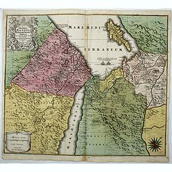
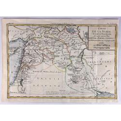
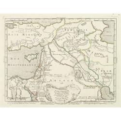
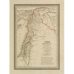
Regni Davidici et Salomonaei descriptio Geographica cum vicinis regionibus Syriae et Aegypti. . .
A rare map of the Near East region, extending from Turkey to Egypt. It includes Cyprus, Holy Land, and Mesopotamia, and illustrates the Kingdoms of David and Solomon. Myt...
Date: Nuremberg, ca 1739
Selling price: ????
Please login to see price!
Sold in 2020
Nuova Carta del Europa Turchesca.
Isaak Tiron's uncommon map of Asia Minor, Cyprus, Crete, the Black Sea, The Crimea, Greece and the Balkans. Although attributed to Tirion, the map was actually published ...
Date: Venice, 1740
Selling price: ????
Please login to see price!
Sold in 2021
Imperii Turcici Europaei Terra, in primis Graecia. . .
An unusual map showing the Turkish Empire, extending from Corsica and Sardinia in the west, to Asia Minor, Cyprus and the Black Sea in the east. Parts of North Africa als...
Date: Nuremberg, 1740
Selling price: ????
Please login to see price!
Sold in 2017
Imperii Turcici Europaei Terra, in primis Graecia. . .
An unusual map showing the Turkish Empire, extending from Corsica and Sardinia in the west, to Asia Minor, Cyprus and the Black Sea in the east. Parts of North Africa als...
Date: Nuremberg, 1740
Selling price: ????
Please login to see price!
Sold in 2020
Mesopotamia E Babilonia Coifmi Delineati Secondovna.
A fine copperplate map of current-day Armenia, Syria, Cyprus & Iraq. An Italian edition by Cellarius in 1740. It features a decorative cartouches including building...
Date: Amsterdam, 1740
Selling price: ????
Please login to see price!
Sold in 2023
Imperii Persici in omnes suas Provincias . . . Exacte Divisi Nova Tabula Geographica. . .
Showing the eastern part of Turkey and Cyprus, Palestine, Persian Gulf, including Gulf of Oman, Caspian Sea, Iran and the north-west territories of India.Embellished with...
Date: Nurenberg, 1740
Selling price: ????
Please login to see price!
Sold in 2010
Imperii Persici in omnes suas Provincias . . . Exacte Divisi Nova Tabula Geographica. . .
Showing the eastern part of Turkey and Cyprus, Palestine, Persian Gulf, including Gulf of Oman, Caspian Sea, Iran and the north-west territories of India.Embellished with...
Date: Nurenberg, 1740
Selling price: ????
Please login to see price!
Sold in 2014
Deserta Aegypti Thebaidis, Arabiae, Syriae etc.
An attractive map of Egypt, northern Arabia, the Holy Land, Syria and Cyprus. From Seutter's "Atlas Novus". Map shows many physical features, biblical scenes, s...
Date: Augsburg, 1741
Selling price: ????
Please login to see price!
Sold in 2017
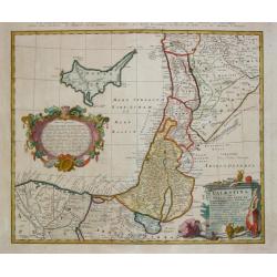
Palestina seu Terra olim Sancta.
Homann Heirs (of Johann Baptist and Johann Christof) published: Grosser Atlas, 1731, 1737. Geogr. Maior, 1759, Atlas Homannianus, 1762.A map of Palestine and the Libanon ...
Date: Nürnberg, 1744
Selling price: ????
Please login to see price!
Sold
Carte de la Grece dressée sur un grand nombre de memoires..
Detailed copper-engraved map of Greece with its neighbouring countries, including southern Italy and part of Cyprus. Relief shown pictorially. With large decorative title...
Date: Amsterdam c. 1745
Selling price: ????
Please login to see price!
Sold
Etats du Grand-Seigneur en Asie, Empire de Perse, Pays des Usbecs, Arabie et Egypte.
Detailed map of the region bounded by the Black Sea, Georgia, the Caspian, Uzbekistan, The Indian Ocean, Saudi Arabia ("Arabie Heureuse"), Egypt, and the Red Se...
Date: Paris, c.1745
Selling price: ????
Please login to see price!
Sold in 2010
Carte des voyages de Notre seigneur Jesus Christ..
Showing eastern part of the Mediterranean, including Cyprus, Italy. Lower right hand corner inset plan of Jerusalem. Lower left map of Palestine. Published by Vaugondy, a...
Date: Paris, 1747
Selling price: ????
Please login to see price!
Sold in 2009
Carte des voyages de Notre seigneur Jesus Christ. . .
Showing eastern part of the Mediterranean, including Cyprus, Italy. Lower right hand corner inset plan of Jerusalem. Lower left map of Palestine. Published by Vaugondy, a...
Date: Paris, 1747
Selling price: ????
Please login to see price!
Sold in 2011
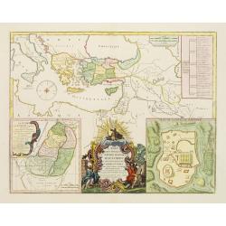
An Accurate Map of Asia Minor, as Divided into its Provinces, before it became Possess'd by the Turks
Engraved map of Turkey by Bowen from 'A Complete System of Geography'. Showing Asia Minor with the Black-sea region and the eastern part of the Mediterranean sea with Cyp...
Date: London, 1747
Selling price: ????
Please login to see price!
Sold in 2013
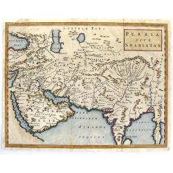
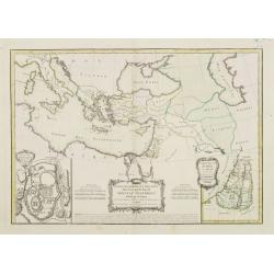
Persia Sive Shahistan.
Map of ancient western and southern Asia. The map is centered on Persia, but extends from Cyprus to east of the Ganges and as far north as the Caspian Sea. It uses the na...
Date: London, 1747
Selling price: ????
Please login to see price!
Sold in 2015
Carte des voyages de Notre seigneur Jesus Christ. . .
Showing eastern part of the Mediterranean, including Cyprus, Italy. Lower right hand corner inset plan of Jerusalem. Lower left map of Palestine. Published by Vaugondy, a...
Date: Paris, 1747
Selling price: ????
Please login to see price!
Sold in 2022
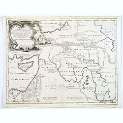
Afbeelding van all de Landen gelegen tusschen de Middellandsche, Zwarte, Caspische, Persische en Rode Zeën.
A map of the Near East, with an oversized Cyprus.Decorative, scrolled title cartouche to upper left corner. From a Dutch bible published by Nicolaas Goetzee. Willem Alber...
Date: Gorichem, Nicolaas Goetzee, 1748
Selling price: ????
Please login to see price!
Sold in 2020
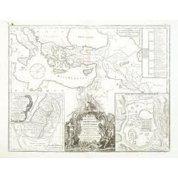
Carte de l'Asie Minevre. . .
A striking map centred on the Black Sea, and the geographical regions surrounding it. Map also shows Asia Minor, Crete, Cyprus, northern Syria, Iraq, Georgia, the Crimea,...
Date: Nuremburg, 1748
Selling price: ????
Please login to see price!
Sold in 2018
Nieuwe kaart van Irak Arabi, Kurdistan, Diarbek. . .
Detailed map including the northern part of the Arabian peninsular, Palestine, Iraq, Iran and the eastern part of Cyprus.
Date: Amsterdam, 1750
Selling price: ????
Please login to see price!
Sold in 2017
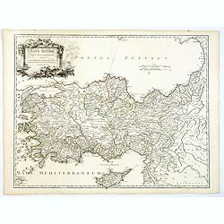
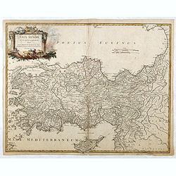
Asia Minor in suas partes seu provincias divisa..
Detailed map of Cyprus, Asia Minor and contiguous Islands and the Black Sea region.
Date: Paris 1751
Selling price: ????
Please login to see price!
Sold
Asia Minor in suas partes seu provincias divisa. . .
Detailed map of Ancient Turkey with Cyprus from his "Atlas Universel".Gilles Robert de Vaugondy (1688–1766), also known as Le Sieur or Monsieur Robert, and hi...
Date: Paris, 1751
Selling price: ????
Please login to see price!
Sold in 2012
Regnum Persicum Imperium Turcicum in In Asia Russorum Provinciae ad Mare Caspium . . .
Striking map of the region bounded by Cyprus and the Eastern Mediterranean, the Nile, Medina, the Persian Gulf and the Indus River in the south and the Black Sea, Circass...
Date: Amsterdam, 1751
Selling price: ????
Please login to see price!
Sold in 2015
Asia Minor in suas partes seu provincias divisa. . .
A detailed map of Ancient Turkey with Cyprus from his "Atlas Universel". With s decorative title cartouche.Gilles Robert de Vaugondy (1688–1766), also known a...
Date: Paris 1751
Selling price: ????
Please login to see price!
Sold in 2019
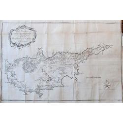
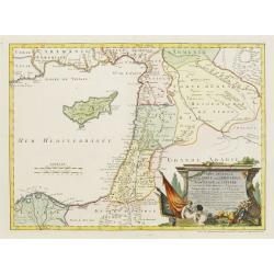
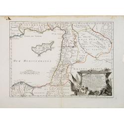
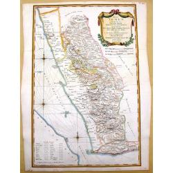
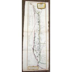
To George Wakeman Esq, Consul for his Majesty the King of Great Britain in the Island of Cyprus. This Map of the Island of Cyprus is dedicated by his friend and servant A. Drummond.
A rare large scale map Cyprus. It is one of the most important cartographic sources of Cyprus during the Turkish occupation in the 18th century. Curiously, some place-nam...
Date: London, 1754
Selling price: ????
Please login to see price!
Sold in 2018
Asia Minor in suas partes seu provincias divisa. . . (Turkey with Cyprus)
Detailed map of Ancient Turkey with Cyprus from his "Atlas Universel".Gilles Robert de Vaugondy (1688–1766), also known as Le Sieur or Monsieur Robert, and hi...
Date: Paris, 1756
Selling price: ????
Please login to see price!
Sold in 2015
De Gelegenheyt van 't Paradys en 't Landt Canaan, mitsgaders d, eerste bewoonde landen der Patriarchen?door C.D./Albert Schut Schulp.
Dutch so-called ' Staten' bibles, published between 1637 and c. 1760, contained 5 maps: The World, 'Paradise', The Perigrinations, The Promised Land Canaan, The Travels o...
Date: Amsterdam / Leiden, 1757
Selling price: ????
Please login to see price!
Sold
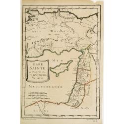
Terre Sainte et Partie des Provinces Voisines.
Uncommon map of Palestine, Turkey and an over-sized Cyprus. Engraved by Leparmantier.
Date: Paris 1760
Selling price: ????
Please login to see price!
Sold
Troisieme partie de la carte d'Europe, contenant le midi de la Russie, la Pologne, et la Hongrie, la Turquie y compris celle d'Asie presqu'entiere. . .
Wall map sized map of Russia, Crimea, Turkey, Cyprus and Holey Land. Centered on the Black Sea. Prepared by Jean Baptiste Bourguignon d'Anville (1697-1782). Ornamental ca...
Date: Paris, 1760
Selling price: ????
Please login to see price!
Sold in 2011
Nuova Carta del Europa Turchesca.
Nice Italian version of Tirion's detailed map of the Black Sea, Balkans, Cyprus and Asia Minor including Turkey. Includes a block cartouche. Published by Albrizzi. Giamb...
Date: venice, 1740-1762
Selling price: ????
Please login to see price!
Sold in 2015
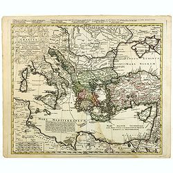
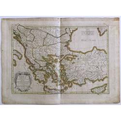
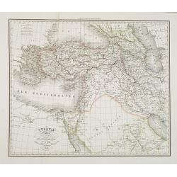
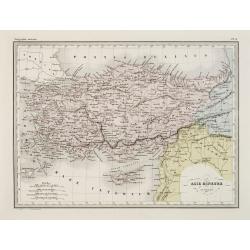
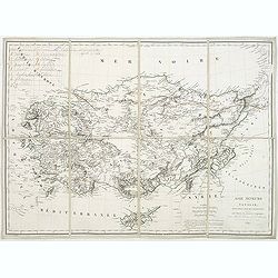
Asiae, quae vulgo Minor Dicitur, et Syriae...
Fantastic large copper engraved map, shows (parts of): Turkey, Black Sea, Mediterranean Sea, Aegean Sea and Greek islands, Crete, Cyprus, part of Armenia, Lebanon, and Sy...
Date: Paris, 1764
Selling price: ????
Please login to see price!
Sold in 2012
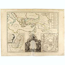
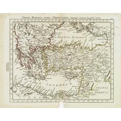
Orbis Romani Pars Orientalis Auspiciis Serenissimi Principis....
Large format map of the Eastern part of the Roman Empire, published by D'Anville. The map extends from Greece and the Balkans in the west to Iran in the east, and is cent...
Date: Paris, 1764
Selling price: ????
Please login to see price!
Sold in 2016
Carte Générale de la Syrie / Palestine / Isle de Chypre..
A very fine map of Syria, Palestine, and the island of Cyprus with part of the surrounding countries, prepared for the understanding of the history of the Crusades by Gui...
Date: Paris/ Bordeaux 1764
Selling price: ????
Please login to see price!
Sold
Carte Générale de la Syrie / Palestine / Isle de Chypre. . .
A very fine map of Syria, Palestine, and the island of Cyprus with part of the surrounding countries, prepared for the understanding of the history of the Crusades by Gui...
Date: Paris, ca. 1764
Selling price: ????
Please login to see price!
Sold
Asiae Quae Vulgo Minor Dicatur et Siriae.
Fine map of ancient Turkey featuring the Black Sea, Mediterannean Sea,and Aegean Sea and the islands of Cyprus and Crete. Also includes inserts of Troy & Bosphorus. ...
Date: Paris, 1765
Selling price: ????
Please login to see price!
Sold in 2016
![Turcia Asiatica exhibens Natoliam Modernam [shows Cyprus].](/uploads/cache/83655-250x250.jpg)
Turcia Asiatica exhibens Natoliam Modernam [shows Cyprus].
A beautifully colored, regional map, extending from Cyprus and Greece in the west to the Caspian Sea in the East and centered on Asia Minor, Aremenia, Iraq and Turkey. A ...
Date: Nuremberg, 1771
Selling price: ????
Please login to see price!
Sold in 2020
Mappa geographica Asiae Minoris Antiquae..
A detailed of Turkey, Black Sea and Cyprus.
Date: Germany c.1780
Selling price: ????
Please login to see price!
Sold
Carte de la Grece dressée sur un grand nombre de memoires..
Detailed copper-engraved map of Greece with its neighboring countries, including southern Italy and part of Cyprus. Relief shown pictorially. With large decorative title ...
Date: Paris, 1780
Selling price: ????
Please login to see price!
Sold in 2009
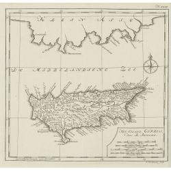
Het eiland cyprus door R.Pococke.
Rare map of Cyprus from a Dutch edition of ""Description Of The East And Some Other Countries" by R. Pococke. "Beschryving van het Oosten enz. Door de...
Date: Amsterdam/ Rotterdam, 1780
Selling price: ????
Please login to see price!
Sold in 2010
CARTE DES PREMIERS AGES DU MONDE
Beautiful ancient map, showing the eastern Mediterranean and the Near East. Includes parts of the present countries of Cyprus, Turkey, Russia, Black Sea, Caspian Sea, Arm...
Date: Paris, 1780
Selling price: ????
Please login to see price!
Sold in 2014
Bottom Part Only of Huge Map centering on Greece.
A large bottom portion of a huge map centering on Greece. The original map was about 41" x 32".This section covers the area between Libya and Iraq on the south ...
Date: Anon, ca. 1780
Selling price: ????
Please login to see price!
Sold in 2017
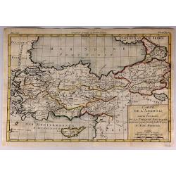
Carte de L'Anadoli et Autres Provinces de la Turquie Asiatique...
A striking, copper engraved map of Anatolia. The map covers Turkey, Armenia, Cyprus, a bit of Georgia, the northern tip of Syria, and the coast of Romania. The map provid...
Date: Paris, 1780
Selling price: ????
Please login to see price!
Sold in 2017
Carte de la Syrie et Autres Provinces Formant Aujourd'hui Partie de L'Empire Ottoman.
A fine map of Syria and other regions including; Roum, Irakarabia, Khosistan, Armemia, Kurdistan and Palestine. Also shown is most of the island of Cyprus. Louis Brion de...
Date: Paris, 1780
Selling price: ????
Please login to see price!
Sold in 2020
Orbis Romani Pars Orientalis. . .
Unusual map of Ancient Turkey, including a curiously shaped Cyprus, prepared by Nolin and published by L.J. Mondhare for his Atlas Général a l'usage des colleges et mai...
Date: Paris, 1781
Selling price: ????
Please login to see price!
Sold in 2023
Carte générale pour servir à l'Intelligence de l'Histoire Sainte..
Fine map of the Middle East, including the Holy Land, Cyprus, Iran and Irak, etc.Philippe Buache was one of the most active proponents of the so-called school of theoreti...
Date: Paris 1783
Selling price: ????
Please login to see price!
Sold
Carte de la Turquie d'Asie..
Attractive map of the Near East centered on Turkey, ornated with a rococo title cartouche. A curious shape for Cyprus. Boundaries outlined in hand color.From theAtlas mod...
Date: Paris ca 1783
Selling price: ????
Please login to see price!
Sold
Turquie d'Europe et partie de celle d'Asie..
Attractive map centered on the Aegean Sea, encompassing the whole Balkan Peninsula and part of Turkey.It includes also Crete and Cyprus. Decorated with a decorative title...
Date: Paris, ca 1783
Selling price: ????
Please login to see price!
Sold in 2011
Carte des Regions et des Lieux dont il est parlé dans le Nouveau Testament..
A map of the near East at the time of Christ. Ornated with a decorative title cartouche. Boundaries outlined in hand color.Inset plan of Jerusalem in the bottom left corn...
Date: Paris ca 1783
Selling price: ????
Please login to see price!
Sold
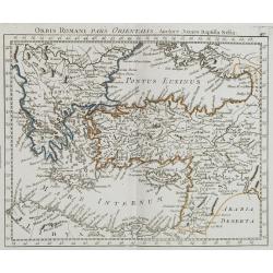
Orbi Romani Pars Orientalis. . .
Unusual map of Ancient Turkey, including a curiously shaped Cyprus, prepared by J.B.Nolin and published by Monhare for his Atlas Général a l'usage des colleges et maiso...
Date: Paris, 1783
Selling price: ????
Please login to see price!
Sold in 2009
Carte générale pour servir à l'Intelligence de l'Histoire Sainte..
Fine map of the Middle East, including the Holy Land, Cyprus, Iran and Iraq, etc.Philippe Buache was one of the most active proponents of the so-called school of theoreti...
Date: Paris, 1783
Selling price: ????
Please login to see price!
Sold in 2010
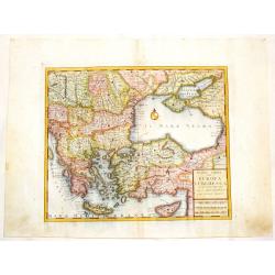
Turquie d' Europe
This finely engraved map is roughly centered on Greece, including the islands of Crete and Cyprus. The map covers the region from Bosnia and Serbia to the Black Sea and C...
Date: Paris, 1783
Selling price: ????
Please login to see price!
Sold in 2016
Turquie d'Europe et partie de celle d'Asie divisee. . .
An attractive map centered on the Aegean Sea, encompassing the whole Balkan Peninsula and part of Turkey.It includes also Crete and Cyprus. Decorated with a pretty title ...
Date: Paris, ca 1783
Selling price: ????
Please login to see price!
Sold in 2021
Asia Minor in suas partes seu provincias divisa.
Detailed map of Asia Minor and contiguous Islands and the Black Sea region, including Cyprus.With fine rococo title cartouche in the upper left corner.The map was prepare...
Date: Venice, 1776 - 1784
Selling price: ????
Please login to see price!
Sold
Etats du Grand-Seigneur en Asie, Empire de Perse, Pays des Usbecs, Arabie et Egypte.
Detailed map of the region bounded by the Black Sea, Georgia, the Caspian, Uzbekistan, The Indian Ocean, Saudi Arabia (here called "Arabie Heureuse"), Egypt and...
Date: Venice, 1776 - 1784
Selling price: ????
Please login to see price!
Sold in 2008
Turquie d'Europe..
Detailed map encompassing present day Greece and part of Turkey. In the lower right corner a large depiction of Cyprus. Venetian edition of the map by Bellin, to whom San...
Date: Venice, 1776 - 1784
Selling price: ????
Please login to see price!
Sold in 2008
Turquie d'Europe..
Detailed map encompassing present day Greece and part of Turkey. In the lower right corner a large depiction of Cyprus. With ornamental title cartouche and noteworthy top...
Date: Venice, 1776 - 1784
Selling price: ????
Please login to see price!
Sold in 2018
Terrae Yemen Imperii Imami Principatus Kaukeban.
Important detailed copper engraved map of Yemen with details of South-West Arabia, prepared by C. Niebuhr and was published in "Atlas universel pour l'étude de la g...
Date: Paris, Nyon, 1787
Selling price: ????
Please login to see price!
Sold in 2013
Mare Rubrum Sinus Arabicus Ad Observationes Maximam Partem ab Auctore Annis MDCCLXII et MDCCLXIII.
Important detailed copper engraved map of Arabian Gulf with details of The Red Sea, The Gulf of Arabia and Yemen prepared by C. Niebuhr and was published in "Atlas u...
Date: Paris, Nyon, 1787
Selling price: ????
Please login to see price!
Sold in 2013
Sinus Persicus Maximam Partem ad Observationes Proprias a MDXXLXV.
Important detailed copper engraved map of the Persian Gulf with details of Persia and Arabia prepared by C. Niebuhr and was published in "Atlas universel pour l'ét...
Date: Paris, Nyon, 1787
Selling price: ????
Please login to see price!
Sold in 2013
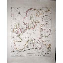
Uebersicht der Europaeischen Seeküsten verfasst von Herrn Caington Bowles. . .
A very decorative, very large map showing all European coasts: includes North sea, East sea, Atlantic ocean and the Mediterranean sea. On inset you see the eastern Medite...
Date: Vienna, 1791
Selling price: ????
Please login to see price!
Sold in 2020
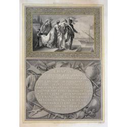
Richard I Leaving Cyprus
A beautifully engraved scene, Richard the 'Lion Heart' is about to board his ship leaving Cyprus in preparation for the Crusade. From Robert Bowyer's edition of Hume's 'H...
Date: London, 1794
Selling price: ????
Please login to see price!
Sold in 2015
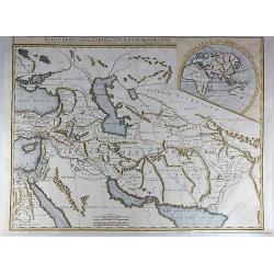
Partie Orientale de la Carte des Anciennes Monarchies.
This striking map depicts the eastern part of the Ancient World, including the Near East, Cyprus, Black Sea, Caspian Sea, Iran and Iraq. An inset map showing the eastern ...
Date: Paris, ca 1800
Selling price: ????
Please login to see price!
Sold in 2017
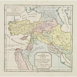
Cartes des premiers ages du monde. Géographie Ecclédiastique de la Turquie, d''Asie et de la Perse.
Map of ancient Turkey, Cyprus, Persia and Near and Middle East.By C. F. Delamarche, successor of Robert de Vaugondy, Geographer.
Date: Paris, ca.1806
Selling price: ????
Please login to see price!
Sold
Partie Orientale de la Carte des Anciennes Monarchies...
A striking map depicting the eastern part of the ancient world including the Near East, Cyprus, Black Sea Iran & Iraq by Gilles de Vaugondy, and later improved and re...
Date: Paris, 1822
Selling price: ????
Please login to see price!
Sold in 2017
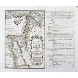
Syriae Mappa Generalis .. Paleaestina..
Detailed map of Syria, the Holy Land and the eastern tip of Cyprus. Prepared by Lud.Vivien and engraved in steel by Giraldon-Bovinet. Published by Menard and Desenne, rue...
Date: Paris 1824
Selling price: ????
Please login to see price!
Sold
Turquie d'Asie . . .
Detailed map of Turkey, Armenia, Cyprus, part of Arabia and Israel and Syria, prepared by A. H. Basset, rue Saint-Jacques, no. 64, Paris and published in Atlas classique ...
Date: Paris, A.H. Basset, 1828
Selling price: ????
Please login to see price!
Sold
Carte du théatre de la guerre comprenant la Turquie d'Europe et d'asie. . .
Map of Turkey, Greece, east of Europe, Cyprus, Palestine, and Crime with the Black Sea region. Detailed map in the lower left corner a description of principal cities of ...
Date: Paris, 1828
Selling price: ????
Please login to see price!
Sold in 2011

Asia-Minor Shewing the Seven Apocalyptic Churches of Asia.
Interesting map of Turkey and Cyprus, with ancient place names. Locates the Seven Churches and other places mentioned in the New Testament.With a vignette view of Tarsus.
Date: London, c1830
Selling price: ????
Please login to see price!
Sold in 2012
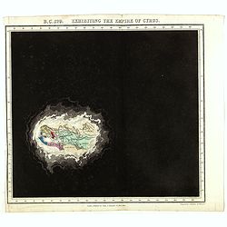
B.C. 529. Exhibiting the Empire of Cyprus.
Plate from An historical atlas: in a series of maps of the world as known at different periods constructed upon an uniform scale and colored according to the political ch...
Date: London, 1830
Selling price: ????
Please login to see price!
Sold in 2024
Turkey in Europe, Greece & the Ionian Islands.
A scarce and a highly detailed map of Turkey and Greece. Includes the Balkans, Cyprus, Crimea and the Black Sea. An attractive example.
Date: Edinburgh, ca 1835
Selling price: ????
Please login to see price!
Sold in 2020
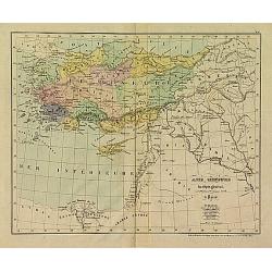
Asie mineure Ancienne.
Fine map of ancient Turkey with Cyprus.From Malte-Brun's Atlas Géographie Universelle.., revised by Jean Jacques Nicolas Huot.This very fine executed map has been printe...
Date: Paris, 1837
Selling price: ????
Please login to see price!
Sold
Asie Mineure..
Uncommon map of Turkey, Cyprus and Palestine. Lithography in very delicate hand colors with ,Route de Xenophon, marked in red.
Date: Paris, 1840
Selling price: ????
Please login to see price!
Sold
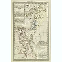
Egypte ancienne et Palestine.
Finely engraved map of Egypt and Palestine with Cyprus, prepared by A.H.Dufour and engraved by Giraldon-Bovinet. Published by Jules Renouard in his uncommon atlas "L...
Date: Paris, Jules Renouard, ca.1840
Selling price: ????
Please login to see price!
Sold in 2013
Asie mineure ou Natolie selon l'état actuel des connaissances. . .
Map of Turkey, including Cyprus prepared by Louis Vivien de Saint-Martin (1802-1897), who was French geographer born in Saint-Martin-de-Fontenay and died in Paris. He wro...
Date: Paris, 1845
Selling price: ????
Please login to see price!
Sold in 2021