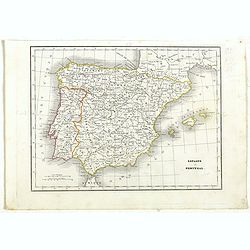
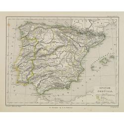
Espagne et Portugal.
Detailed map of Spain and Portugal, prepared by Charles V. Monin (fl.1830-1880) a French cartographer of Caen and Paris. Published in Atlas Universel de Géographie Ancie...
Date: Paris, 1845
Selling price: ????
Please login to see price!
Sold in 2019
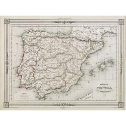
Espagne sous l'empire Romain.
Ancient map of Spain and Portugal, prepared by Auguste Henri Dufour (1798-1865). Published by Basset, rue de Seine 33, Paris. The engraver of the map was Ch.Smith. Includ...
Date: Paris, 1846
Selling price: ????
Please login to see price!
Sold in 2018
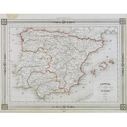
Espagne at Portugal par A.Vuillemin Géographe.
Decorative map of Spain and Portugal, prepared by J.G.Barbié du Bocage.Engraved by Ch.Smith, published by Basset who was established in Paris, rue de Seine 33. From atla...
Date: Paris, 1846
Selling price: ????
Please login to see price!
Sold in 2009
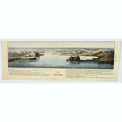
Stretto di Gibilterra.
The bottom half of a two view sheet by Corbetta. (The missing view is that of the Dardanelles in Turkey.) This colored view is that of the Strait of Gibraltar. With Itali...
Date: Milano, 1853
Selling price: ????
Please login to see price!
Sold in 2020
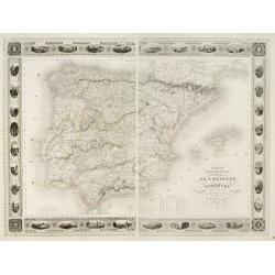
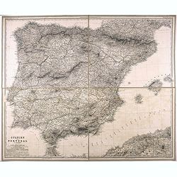
Carte Administrative, Physique et Routière De l'Espagne et du Portugal..
Steel engraving in 2 sheets representing the Iberian peninsula. Surrounded by a decorative frame composed by 32 views of Spanish towns.Title engraved by Ch. Simon.
Date: Paris, 1855
Selling price: ????
Please login to see price!
Sold
Spanje en Portugal.
Uncommon map of Spain and Portugal. Lithography by J.H. van Weijer, published in Atlas der geheele Aarde [?] in 24 kaarten.
Date: Groningen, ca. 1860
Selling price: ????
Please login to see price!
Sold in 2008
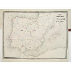
Carte des chemins de fer de l'Espagne et du Portugal. . .
Fine map of Spain and Portugal, showing the early railway system of the area. From Atlas des Chemins de Fer published by Napoléon Chaix and printed by Imprimerie et libr...
Date: Paris, 1863
Selling price: ????
Please login to see price!
Sold in 2011
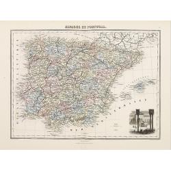
Espagne et Portugal
Decorative map of Spain and Portugal from Géographie Universelle, Atlas Migeon. published by J. Migeon. In lower right hand corner a view of Alhambra engraved by Schroed...
Date: Paris 1874
Selling price: ????
Please login to see price!
Sold
Spanien und Portugal.
Very detailed folding map of Spain and Portugal, by Vogel, C.
Date: 1875
Selling price: ????
Please login to see price!
Sold in 2021
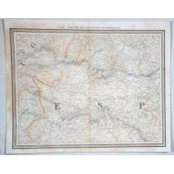
No 132 Parties de L'espagme et du Portugal.
Antique folio-sized lithographic atlas map, hand colored in outline, on a conical projection. This map by Vandermaelen was published within the first atlas ever to be pri...
Date: Brussells, 1880
Selling price: ????
Please login to see price!
Sold in 2021

Madrid Puerta Del Sol
The Puerta del Sol (Spanish for "Gate of the Sun") is one of the most well known and busiest places in Madrid. This is the centre of the radial network of Spani...
Date: Germany, c. 1900
Selling price: ????
Please login to see price!
Sold in 2013
