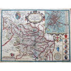
Browse Listings in Europe
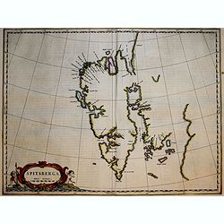
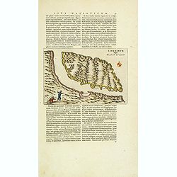
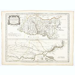
Spitsberga.
Blaeu's map of Spitsbergen was based on the Muscovy Company's map of 1625, but the north coast is completely new. It makes the heads of Wiche sound (Liefde bay) and Wyde ...
Date: Amsterdam, 1663
Selling price: ????
Please login to see price!
Sold in 2018
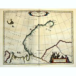
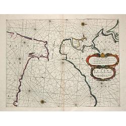
Nova Zemla.
The Dutch were the most persistent searchers after the north-east Passage, whether to the north of Novaya Zemlya (whose west coast is shown in detail) or through what the...
Date: Amsterdam, 1663
Selling price: ????
Please login to see price!
Sold in 2018
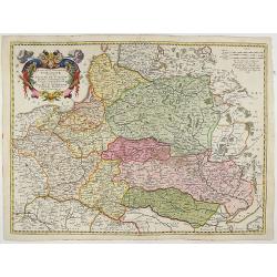
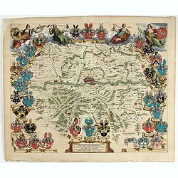
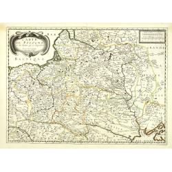
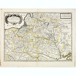
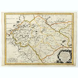
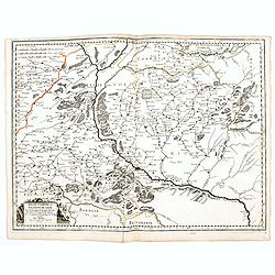
Estats De La Couronne De Pologne ou sont les Royaume de Pologne, Duches et Provinces De Prusse, Cuiave, Mazovie, Russie Noire &c Duches De Lithuanie, Volhynie Podolie &c. De L'Ukraine &c.
A very decorative and detailed map of Poland, Lithuania, Latvia, Belarus and Ukraine with decorative cartouche in the upper left corner showing two wind heads, a cheetah'...
Date: Amsterdam, 1663
Selling price: ????
Please login to see price!
Sold in 2018
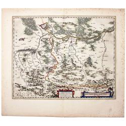
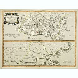
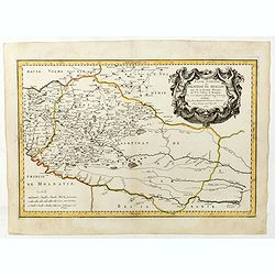
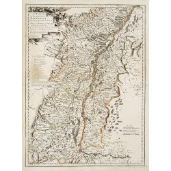
The Duchy of Oswiecim, in Original Color. Oswiecim (Auschwitz)/ Zator/ Poland. Ducatus Oswiezensis et Zatoriensis.
A beautiful example of Joan Blaeu’s map of the upper Vistula river valley, in beautiful original color in the characteristic style of the house of Blaeu. The region cen...
Date: Amsterdam, 1663
Selling price: ????
Please login to see price!
Sold in 2019
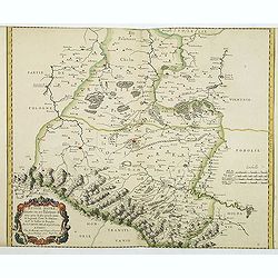
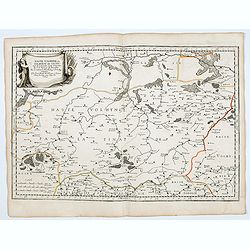
Estats De La Couronne De Pologne ou sont les Royaume de Pologne, Duches et Provinces De Prusse, Cuiave, Mazovie, Russie Noire &c.
Fine map of Poland, state with erased date. Engraved by J.Sommer.Nicolas Sanson was to bring about the rise of French cartography, although the fierce competition of the ...
Date: Paris, 1663
Selling price: ????
Please login to see price!
Sold in 2025
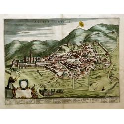
Assisi; Patria di St. Francesco
Folio-size hand-colored copper engraving with a city view of Assisi (semi bird’s eye view). Bottom left a scrolling cartouche (not filled in). Extensive legend at the ...
Date: Amsterdam, 1663
Selling price: ????
Please login to see price!
Sold in 2020
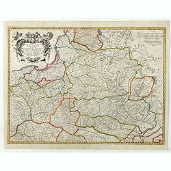
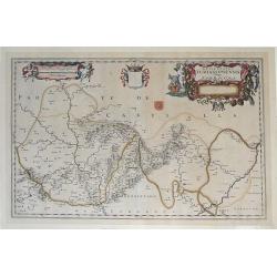
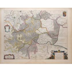
Novam Hanc TERRITORII FRANCOFURTENSIS Tabulam.
One of the most decorative maps of Hessen, centered on Frankfurt and the river Main, bordered by design with arms and titles of 33 dignitaries, allegorical figures and ca...
Date: Amsterdam, 1663
Selling price: ????
Please login to see price!
Sold in 2022
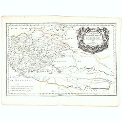
Costa di Spagna del Riode Siviglia fino a Malaga et La Costa di Barbaria de Larache fino al Penon de Velez.
A sea-chart of the Strait of Gibraltar and the opposite coasts of Spain from the Rio Sevilla to Malaga and of North Africa. Embellished with a large title / distances car...
Date: Genoa, 1664
Selling price: ????
Please login to see price!
Sold
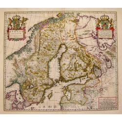
Sveciae Regnum.
An attractive map of the Kingdom of Sweden from the famous Blaeu company.
Date: Amsterdam, 1664
Selling price: ????
Please login to see price!
Sold
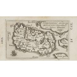
Hiberniae Insulae miraculis naturalibus pro digiosae delineatio.
Charming little map of Ireland made by Gabriel Bucelin (1599-1681). Bucelin was a Swiss genealogist and an author of several books and a number of manuscript maps of Germ...
Date: Ulm, Johannes Görlin, 1658-1664
Selling price: ????
Please login to see price!
Sold in 2008
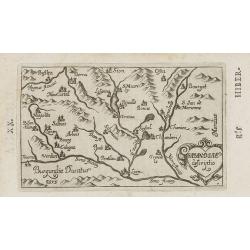
Sabaudiae descriptio.
Charming little map of south east France, including Basel, Genève, Lyon, etc. made by Gabriel Bucelin (1599-1681). South to the top. Bucelin was a Swiss genealogist and ...
Date: Ulm, Johannes Görlin, 1658-1664
Selling price: ????
Please login to see price!
Sold in 2008
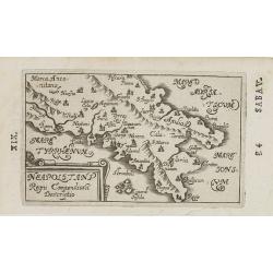
Neapolitani Regni Compendiosa Descriptio.
Charming little map of southern part of Italy, centered on Naples made by Gabriel Bucelin (1599-1681). Bucelin was a Swiss genealogist and an author of several books and ...
Date: Ulm, Johannes Görlin, 1658-1664
Selling price: ????
Please login to see price!
Sold in 2008
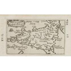
Siciliae. . .
Charming little map of Sicily made by Gabriel Bucelin (1599-1681). Bucelin was a Swiss genealogist and an author of several books and a number of manuscript maps of Germa...
Date: Ulm, Johannes Görlin, 1658-1664
Selling price: ????
Please login to see price!
Sold in 2008
![[ Malta ]](/uploads/cache/26001-250x250.jpg)
[ Malta ]
Charming little map of Malta made by Gabriel Bucelin (1599-1681). Bucelin was a Swiss genealogist and an author of several books and a number of manuscript maps of German...
Date: Ulm, Johannes Görlin, 1658-1664
Selling price: ????
Please login to see price!
Sold in 2008
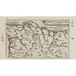
Portugalliae descriptio.
Charming little map of Portugal made by Gabriel Bucelin (1599-1681). Bucelin was a Swiss genealogist and an author of several books and a number of manuscript maps of Ger...
Date: Ulm, Johannes Görlin, 1658-1664
Selling price: ????
Please login to see price!
Sold in 2008
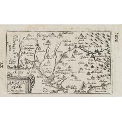
Andaluziae descriptio.
Charming little map of Andalusia made by Gabriel Bucelin (1599-1681). Bucelin was a Swiss genealogist and an author of several books and a number of manuscript maps of Ge...
Date: Ulm, Johannes Görlin, 1658-1664
Selling price: ????
Please login to see price!
Sold in 2008
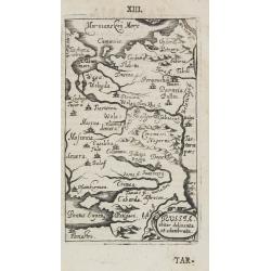
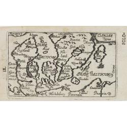
Russia obiter delineata et adunibrata.
Charming little map of Russia made by Gabriel Bucelin (1599-1681). Bucelin was a Swiss genealogist and an author of several books and a number of manuscript maps of Germa...
Date: Ulm, Johannes Görlin, 1658-1664
Selling price: ????
Please login to see price!
Sold in 2008
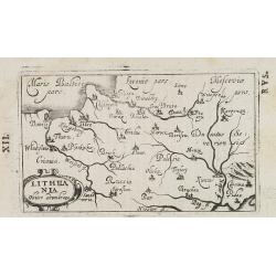
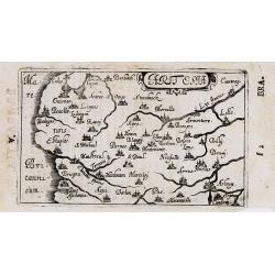
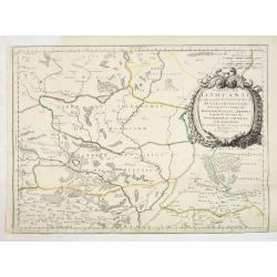
Lithuania obiter adumbrata.
Charming little map of Lithuania made by Gabriel Bucelin (1599-1681). Bucelin was a Swiss genealogist and an author of several books and a number of manuscript maps of Ge...
Date: Ulm, Johannes Görlin, 1658-1664
Selling price: ????
Please login to see price!
Sold in 2008
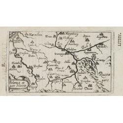
Polonia et pars Silesiae.
Charming little map of Poland made by Gabriel Bucelin (1599-1681). Bucelin was a Swiss genealogist and an author of several books and a number of manuscript maps of Germa...
Date: Ulm, Johannes Görlin, 1658-1664
Selling price: ????
Please login to see price!
Sold in 2008
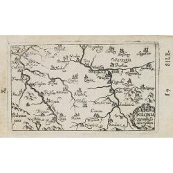
Polonia. . .
Charming little map of Poland made by Gabriel Bucelin (1599-1681). Bucelin was a Swiss genealogist and an author of several books and a number of manuscript maps of Germa...
Date: Ulm, Johannes Görlin, 1658-1664
Selling price: ????
Please login to see price!
Sold in 2008
Daniae Typus.
Charming little map of Denmark made by Gabriel Bucelin (1599-1681). Bucelin was a Swiss genealogist and an author of several books and a number of manuscript maps of Germ...
Date: Ulm, Johannes Görlin, 1658-1664
Selling price: ????
Please login to see price!
Sold in 2008

Hollandiae superficialis descriptio.
Charming little map of Holland made by Gabriel Bucelin (1599-1681). Bucelin was a Swiss genealogist and an author of several books and a number of manuscript maps of Germ...
Date: Ulm, Johannes Görlin, 1658-1664
Selling price: ????
Please login to see price!
Sold in 2008
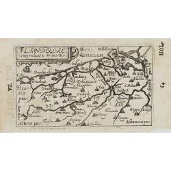
Flandriae. . .
Charming little map of Belgium made by Gabriel Bucelin (1599-1681). Bucelin was a Swiss genealogist and an author of several books and a number of manuscript maps of Germ...
Date: Ulm, Johannes Görlin, 1658-1664
Selling price: ????
Please login to see price!
Sold in 2008
Brabantiae.
Charming little map of Brabant made by Gabriel Bucelin (1599-1681). Bucelin was a Swiss genealogist and an author of several books and a number of manuscript maps of Germ...
Date: Ulm, Johannes Görlin, 1658-1664
Selling price: ????
Please login to see price!
Sold in 2008
Artesia. . .
Charming little map of French province of Artois made by Gabriel Bucelin (1599-1681). Bucelin was a Swiss genealogist and an author of several books and a number of man...
Date: Ulm, Johannes Görlin, 1658-1664
Selling price: ????
Please login to see price!
Sold in 2008
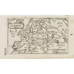
Europa.
Charming little map of Europe made by Gabriel Bucelin (1599-1681). Bucelin was a Swiss genealogist and an author of several books and a number of manuscript maps of Germa...
Date: Ulm, Johannes Görlin, 1658-1664
Selling price: ????
Please login to see price!
Sold in 2008
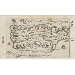
Candia olim Creta. . .
Charming little map of Crete made by Gabriel Bucelin (1599-1681). Bucelin was a Swiss genealogist and an author of several books and a number of manuscript maps of German...
Date: Ulm, Johannes Görlin, 1658-1664
Selling price: ????
Please login to see price!
Sold in 2008
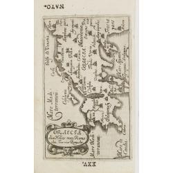
Graecia olim Hellas nunc Rome=ehi, Turris Romechi.
Charming little map of Greece, made by Gabriel Bucelin (1599-1681). Bucelin was a Swiss genealogist and an author of several books and a number of manuscript maps of Germ...
Date: Ulm, Johannes Görlin, 1658-1664
Selling price: ????
Please login to see price!
Sold in 2008
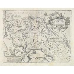
La Gran Penisola DELLA SCANDIA Madre d innumerabili Essercili e Regali Famiglie pertutta l'Europa diffuse.
Scarce map of Scandinavia with decorative cartouche and scale of miles, north orientated to the right. Engraved by Antonio de Piene for "Emmanuele Tesauro's Del Regn...
Date: Turin, 1664
Selling price: ????
Please login to see price!
Sold
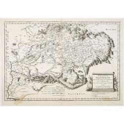
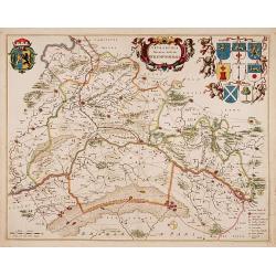
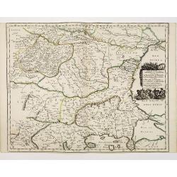
Principauté de Transilvanie tirée de W. Lazius, de I. Sambucus, et de G. Mercator. . .
Map of Hungary, based on map of Wolfgang Lazius. Belgrade in lower left corner. Numerous place-names of counties, cities, towns, physical features.
Date: Paris, 1664
Selling price: ????
Please login to see price!
Sold in 2010
Episcopatus Turiassonensis Vulgo Tarracona. . .
Beautiful map of the Catalonia and Aragon region of northeastern Spain by Joan Blaeu. Shows the cities of Daroca, Calatajud, Borja, and Tarragona, along with the mountain...
Date: Amsterdam, 1664
Selling price: ????
Please login to see price!
Sold in 2010
Episcopatus Balbastrensis, Ribagorca Comit. Et Sobrarbe. . .
Beautiful map of the Aragon and Catalonia regions of northeastern Spain, along the southern French border by Joan Blaeu. Shows the cities of Huesca and Lerida, along with...
Date: Amsterdam, 1664
Selling price: ????
Please login to see price!
Sold in 2010
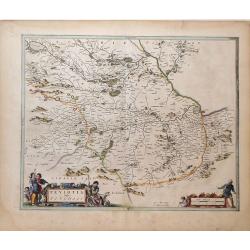
Teviotia Vulgo Tivedail
Beautiful map of Teviotdale, a region of Southeast Scotland, by Joan Blaeu. Shows the cities Selkirk and Kelso, along with the mountains, rivers and forests of the region...
Date: Amsterdam, 1664
Selling price: ????
Please login to see price!
Sold in 2010
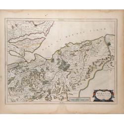
Moravia Scotiae provincial. . .
Beautiful map of Moray, a region of Northeast Scotland, by Joan Blaeu. Shows the towns of Inverness, Forres and Elgin, along with the mountains, rivers and forests of the...
Date: Amsterdam, 1664
Selling price: ????
Please login to see price!
Sold in 2010
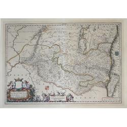
Regiones Inundata Infinibus comitatus Norfolcia, Suffolcia, Cantabrigia, Huntingtonia, Northhamtonia, et Lincolnia
Beautiful map of the East Anglia region of England, showing the counties of Norfolk, Suffolk, Cambridge, Huntington, Northampton and Lincoln, along with the mountains, ri...
Date: Amsterdam, 1664
Selling price: ????
Please login to see price!
Sold in 2010
Tetrachia Ducatus Gelriae Rurmundensis.
East to the top. Covering northern part of Limburg, including the towns of Gennip, Geldern, Venlo, Roermond, Weert. In top coats of arms of 8 cities and the province. Rar...
Date: Amsterdam, 1664
Selling price: ????
Please login to see price!
Sold in 2018
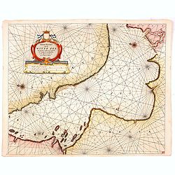
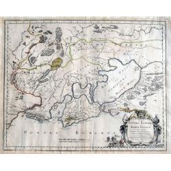
Nieuwe Pas Caert van de Witte Zee begrypende de custen van Laplandt, van Warsiga tot aen Kandalox, en de cust van Corelia tot aen de Riviere Dvina. . .
Beautifuland scarce chart from Nieuw Groot Stuermans Zee-Spiegel, Inhoudende De Zee-kusten van de Noorsche, Oostersche, en Westersche Schipvaert. Showing the White Sea.
Date: Amsterdam, 1664
Selling price: ????
Please login to see price!
Sold in 2014
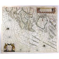
De Cust Van Zeelandt ....
A striking and highly detailed, beautiful copper engraved nautical chart of Zeeland, the westernmost province of Netherlands. Two beautiful compass roses radiating rhumb ...
Date: Amsterdam, 1664
Selling price: ????
Please login to see price!
Sold in 2016
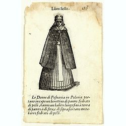
Libro Sesto - Le Donne di Posnania in Polonia . . . (double sided page)
On each side an wood cut engraving of an Polish lady. After Cesare Vecellio (Italian, Pieve di Cadore 1521–1601 Venice). Double sided portrait of Polish women, wood blo...
Date: Venice, Francesco Bodio, 1664
Selling price: ????
Please login to see price!
Sold in 2018
Lorn Wt the Yles and provinces bordering there-upon.
This is the lovely Blaeu map of Lorn, published in Amsterdam during the second half of the seventeenth century. The map is oriented to the west. Lorn is an area situated ...
Date: Amsterdam, ca 1664
Selling price: ????
Please login to see price!
Sold in 2019
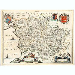
Montgomeria comitatus et comitatus Mervinia.
A beautifully engraved and presented map of the mid Welsh counties of Merionethshire and Montgomeryshire, as published in the Dutch edition of the Atlas Major.In addition...
Date: Amsterdam, ca 1664
Selling price: ????
Please login to see price!
Sold in 2020

Leogus et Haraia, insulae ex Aebudarum numero . . .
This is an uncommon and lovely map of Lewis and Harris in the Western Isles. The map is oriented with west at top and is richly embellished with decorative cartouches sur...
Date: Amsterdam, 1664
Selling price: ????
Please login to see price!
Sold in 2020
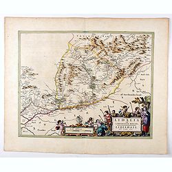
Lidalia el Lidisdalia Regio.
The region that this map covers is north-western England and the Scotland border. Solwat Forth is located in the lower left corner. The Hermitage Castle, built in 1244, i...
Date: Amsterdam, 1664
Selling price: ????
Please login to see price!
Sold in 2021
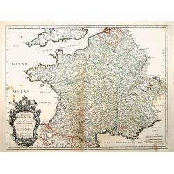
Le Royaume de France, et ses acquisitions..
"Fine map of France. The cartouche presents the address of Pierre Mariette; rue St.Jacques a L'Esperance"". Nicolas Sanson was to bring about the rise of F...
Date: Paris 1665
Selling price: ????
Please login to see price!
Sold
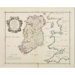
Irlande Royaume divisé en ses quatre provinces..
Covering Ireland. Nicolas Sanson was to bring about the rise of French cartography, although the fierce competition of the Dutch would last until the end of the century. ...
Date: Paris 1665
Selling price: ????
Please login to see price!
Sold
Tartarie Europeenne ou Petite Tartari où sont Les Tartares, Du Crim, ou de Perecop, De Nogais, D'Oczacow, et de Budziak . . .1665
Detailed map of Ukraine, the Crimea and the northern part of the Caspian Sea. Numerous place-names of counties, cities, towns, physical features.
Date: Paris, 1665
Selling price: ????
Please login to see price!
Sold in 2011
Cours du Danube, depuis Belgrade.. Transilvanie. . .
Eastern part of the River Danube, including parts of Macedonia, Bulgaria, Romania, Yugoslavia. Belgrade to the west. With original or early outline hand-color. Numerous p...
Date: Paris, 1665
Selling price: ????
Please login to see price!
Sold in 2010
Carte de Pologne et des Estats qui en dépendent Par du Val. . .
Uncommon map of Poland, Lithuania, Latvia, Estonia and a portion of Russia, extending from the Oder to the Black Sea and Smolensk, centered on Wilma. Includes all of Pola...
Date: Paris, ca 1665
Selling price: ????
Please login to see price!
Sold in 2010
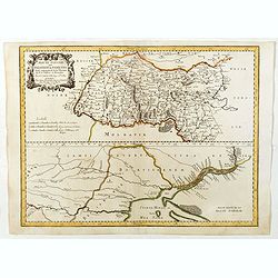
Haute Podolie ou Palatinat de Kamieniec tirée entièrement de la Gr. Ukranie. . .
Two maps on one sheet covering parts of Romania. Prepared by Guillaume Le Vasseur de Beauplan (1600-1685).
Date: Paris, 1665
Selling price: ????
Please login to see price!
Sold in 2011
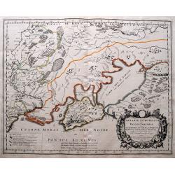
RUSSIE NOIRE. divisée en ses Palatinats. &c. tirée pour la plus grande partie de la grande Carte de l'Ukraine, du Sr. le Va??eur de Beauplan. Par le Sr SANSON d'Abbeville Geogrr ordre du Roy.
First state. Map of the Ukraine and centered on Lvov (Lemberg). The map was based on the map of Ukraine by Beauplan and Radziwill's map of Lithuania.
Date: Paris, 1665
Selling price: ????
Please login to see price!
Sold in 2011
Partie de Lithuanie ou sont les Palatinats de Poloczk, Witepsk...
Fine map of Lithuania. This edition carries the date 1665 and the publishers address "A Paris, chez l'Autheur". Nicolas Sanson was to bring about the rise of Fr...
Date: Paris, 1665
Selling price: ????
Please login to see price!
Sold in 2011
l'Ordinum vulgo Staten Eyland.
Important map of Vaygach Island (Staten Eyland), decorated by a small scene of a polar bear attacking two Dutch explorers.
Date: Amsterdam, 1665
Selling price: ????
Please login to see price!
Sold in 2012
Carte de Pologne et des Estats qui en dépendent Par du Val. . .
Uncommon map of Poland, Lithuania, Latvia, Estonia and a portion of Russia, extending from the Oder to the Black Sea and Smolensk, centered on Wilma. Includes all of Pola...
Date: Paris, ca 1665
Selling price: ????
Please login to see price!
Sold in 2012
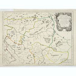
Partie de Lithuanie ou sonts les Palatinats de Minsk et Mseislaw.
Scarce and fine map of Lithuania. This edition carries the date 1666 and the publishers address "A Paris, chez l'Autheur". Engraved by A. Peyrounin . Nicolas Sa...
Date: Paris, 1665
Selling price: ????
Please login to see price!
Sold in 2013
Partie de Lithuanie où sont les palatinats de Poloczk, Witepsk, Mseislaw, et partie de Minsk avec le duché de Smolensko.
Scarce and fine map of Belarus, including Smolensko in Russia and the region northeast of Minsk. This edition carries the date 1665 and the publishers address "A Par...
Date: Paris, 1665
Selling price: ????
Please login to see price!
Sold in 2013
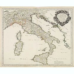
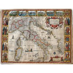
L'Italie et les Isles circomvoisines Sicile, Sardagne. . .
Map of Italy including the islands of Sicily, Sardinia and Corsica, with original or early outline hand-color. Numerous place-names of counties, cities, towns, physical f...
Date: Paris, 1665
Selling price: ????
Please login to see price!
Sold in 2016

Basse Volhynie ou palatinat de Kiow, tiré entièrement de la grande Ukraine du Sieur le Vasseur de Beauplan / par le Sr. . .
Scarce and fine map after Guillaume Le Vasseur de Beauplan (c. 1600 — December 6 1673), who was a French cartographer, engineer and architect. Beauplan served as artill...
Date: Paris, 1665
Selling price: ????
Please login to see price!
Sold in 2013
Basse podolie, Palatinat de Braclaw tiré de la grande Ukraine du Sieur le Vasseur de Beauplan / par le Sr. . .
Scarce and fine map of Ukraine after Guillaume Le Vasseur de Beauplan (c. 1600 — December 6 1673), who was a French cartographer, engineer and architect. Beauplan serve...
Date: Paris, 1665
Selling price: ????
Please login to see price!
Sold in 2013
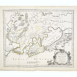
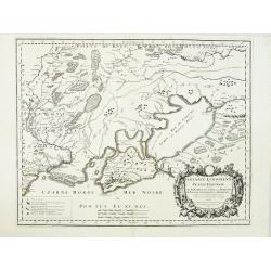
Cimmeria quae postea Scythia Europaea seu Parua Scythia / ex conatibus geographicis Gulielmi Sanson. . .
Ancient map of the region north of the Black Sea. Showing mountains, forests and cities and locates historical regions. The title cartouche includes a small vignette feat...
Date: Paris, 1665
Selling price: ????
Please login to see price!
Sold in 2013
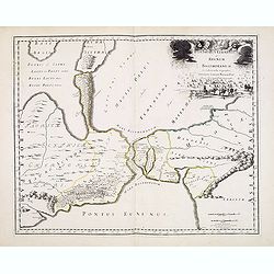
Bosphorus Cimmerius et regnum bosphoranum / ex collectionibus. . .
Historical map illustrating the Kerch Strait between the Sea of Azov in southern Ukraine and the Black Sea and not the Bosporus as indicated by the title. The map is fill...
Date: Paris, 1665
Selling price: ????
Please login to see price!
Sold in 2013
Tartarie Europeenne ou Petite Tartari ou sont Les Tartares, Du Crim, ou de Perecop; De Nogais, D'Oczacow, et de Budziak...
Detailed map of Ukraine, the Crimea, Sea of Azov, and the northern part of the Black Sea. Includes the cities of Kiev, Smolensk, Ryazan, Belgorod, and many more. With i...
Date: Paris, 1665
Selling price: ????
Please login to see price!
Sold in 2014
![Typus Montis Aetnae... [Mt. Aetna]](/uploads/cache/94034-250x250.jpg)
Typus Montis Aetnae... [Mt. Aetna]
Kircher witnessed the eruption of Etna and Stromboli, and had himself lowered into the active crater at Vesuvius. These adventures ignited an abiding interest in geograph...
Date: Amsterdam, Joannes Jansson and Eizeus Weyerstraten, 1665
Selling price: ????
Please login to see price!
Sold in 2014
Cimmeria quae postea Scythia Europaea seu Parua Scythia / ex conatibus geographicis Gulielmi Sanson. . .
Ancient map of the region north of the Black Sea. Showing mountains, forests and cities and locates historical regions. The title cartouche includes a small vignette feat...
Date: Paris, 1665
Selling price: ????
Please login to see price!
Sold in 2017
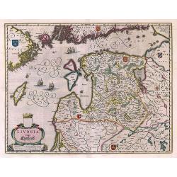
Livonia vulgo Lyefland.
Antique map of the Baltic States Estonia and Latvia.
Date: Amsterdam, 1662 - 1665
Selling price: ????
Please login to see price!
Sold in 2017
Italia Newly Augmented by J. Speede.
John Speed's map of Italy, from his famous atlas "Prospect of the Most Famous Parts of the World".This map is regarded as the most beautiful and decorative map ...
Date: London, Basset, 1662-1665
Selling price: ????
Please login to see price!
Sold in 2017
![[Set of 4 maps] Meklenburg Ducatus / Circulus Westphalicus / Thuringia Landgraviatus / Oldenburg Comitatus.](/uploads/cache/40529-250x250.jpg)
[Set of 4 maps] Meklenburg Ducatus / Circulus Westphalicus / Thuringia Landgraviatus / Oldenburg Comitatus.
The first map is of Mecklenburg, and it is a finely engraved map with a very decorative title cartouche adorned with a chain of fruits. A ship is sailing on the Baltic ne...
Date: Amsterdam, 1635 - 1665
Selling price: ????
Please login to see price!
Sold in 2017
The West Ridinge of Yorkeshyre with The most famous and fayre Citie Yorke described 1610.
Speed's important and decorative map of Yorkshire. The county is shown with many place names, hundreds, rivers, hills, forests, and much more. It features several coats o...
Date: London, ca. 1665
Selling price: ????
Please login to see price!
Sold in 2017
Cimmeria quae Postea Scythia Europaea Seu Parua Scythia. . .
A great map of Crimea, with parts of the Ukraine, and Russia. The map shows mountains, forests, regions and cities with their historical names. A strap work title cartouc...
Date: Paris, 1665
Selling price: ????
Please login to see price!
Sold in 2020
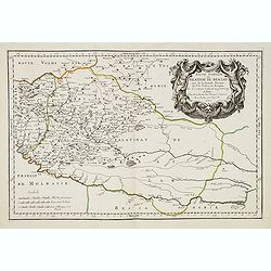
Basse ou Grande Pologne ou sont les Palatinats de Posna, Calisch, Strad, Lencici, Rava, Brest et Inowlocz.
Regional map of Poland, including Breslaw, Poznan, etc. Engraved by J.Sommer.Nicolas Sanson was to bring about the rise of French cartography, although the fierce competi...
Date: Paris, 1665
Selling price: ????
Please login to see price!
Sold in 2019
Haute Podolie ou palatinat de Kamieniec tirée entierement de la Gr. Vkraine . . .
Two maps on one sheet covering parts of Romania and Ukrania. Prepared by Guillaume Le Vasseur de Beauplan (1600-1685) , who was a French cartographer, engineer and archit...
Date: Paris, 1665
Selling price: ????
Please login to see price!
Sold in 2019
Basse Podolie, Palatinat de Braclaw tiré de la grande Ukraine du Sieur le Vasseur de Beauplan / par le Sr. . .
Scarce and fine map of Ukraine after Guillaume Le Vasseur de Beauplan (c. 1600 — December 6 1673), who was a French cartographer, engineer and architect. Beauplan serve...
Date: Paris, 1665
Selling price: ????
Please login to see price!
Sold in 2020
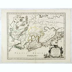
![RUSSIE NOIRE divisee en ses Palatinats &c. [Lviv]](/uploads/cache/83216-250x250.jpg)
RUSSIE NOIRE divisee en ses Palatinats &c. [Lviv]
A rare map of the so-called 'Black Russia' region in south-western Ukraine. With a cartouche and with mountains, forests and many names of cities, rivers and villages dep...
Date: Paris, 1665
Selling price: ????
Please login to see price!
Sold in 2020
Basse Volhynie ou palatinat de Kiow, tiré entièrement de la grande Ukraine du Sieur le Vasseur de Beauplan / par le Sr. . .
Scarce and fine map after Guillaume Le Vasseur de Beauplan (c. 1600 — December 6 1673), who was a French cartographer, engineer and architect. Beauplan served as artill...
Date: Paris, 1665
Selling price: ????
Please login to see price!
Sold in 2020
Haute Volhynie ou palatinat de Lusuc, tiré entièrement de la grande Ukraine du Sieur le Vasseur de Beauplan . . .
Scarce and fine map after Guillaume Le Vasseur de Beauplan (c. 1600 — December 6 1673), who was a French cartographer, engineer and architect. Beauplan served as artill...
Date: Paris, 1665
Selling price: ????
Please login to see price!
Sold in 2020
Haute Podolie ou palatinat de Kamieniec, tirée entièrement de la Gr. Ukraine du Sr Le Vaaseur de Beauplan / par le Sr Sanson. . .
Two maps on one sheet covering parts of Romania and Ukraine. Prepared by Guillaume Le Vasseur de Beauplan (1600-1685) , who was a French cartographer, engineer and archit...
Date: Paris, 1665
Selling price: ????
Please login to see price!
Sold in 2020
Basse Podolie, Palatinat de Braclaw tiré de la grande Ukraine du Sieur le Vasseur de Beauplan / par le Sr. . .
Scarce and fine map of Ukraine after Guillaume Le Vasseur de Beauplan (c. 1600 — December 6 1673), who was a French cartographer, engineer and architect. Beauplan serve...
Date: Paris, 1665
Selling price: ????
Please login to see price!
Sold in 2025
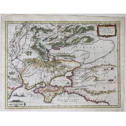
Taurica Chersonesus Nostra aetate Przecopsca et Gazara dicitur.
A map showing the area between the northern coast of the Black Sea, the present day Ukraine and part of Russia, with the Crimean including the mouth of the Danube River a...
Date: Amsterdam, 1662-1665
Selling price: ????
Please login to see price!
Sold in 2022
L'Alsace, ou Conquestes du Roy en Allemagne..
"Fine map of the French, German and Swiss region Alsace, engraved by R. Cordier d'Abbauil. Including the towns of Strasbourg, Basle, Colmar, etc. The cartouche is de...
Date: Paris 1666
Selling price: ????
Please login to see price!
Sold in 2009
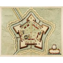
Arx Antverpiensis.
Detailed plan of the Castle and Fort near Antwerp.
Date: Amsterdam, 1666
Selling price: ????
Please login to see price!
Sold in 2022
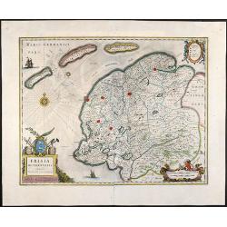
Frisia Occidentalis, Auctoribus Adriano Metio et Gerardo Freitag
Original old colored map of Friesland in northern Holland with 3 beautiful cartouches, two sailing ships and a compass rose. From \"Atlas Contractus\" published...
Date: Amsterdam, 1666
Selling price: ????
Please login to see price!
Sold in 2008