Browse Listings

Gallia.
Extremely rare map of France, Netherlands, Southern England, Switzerland, and Northern Spain. This map was never regularly included in the Theatrum; Denuce mentions the i...
Place & Date: Antwerp, ca 1598

Americae Nova Tabula.
An inset shows Greenland and Iceland. Decorative elements include ships, sea monsters, and vignettes of native Americans within South America. In addition, the map is bor...
- $7500 / ≈ €7018
Place & Date: Amsterdam, 1644

Carte d'Asie divisée en ses principaux Etats.
Uncommon and decorative "carte à figures" wall map, prepared by Clouet, with superb decoration including a wonderful rococo border with vignettes describing hi...
Place & Date: Paris, Mondhare, 1787
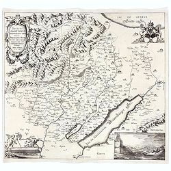
Incliti Cantonis Friburgensis Tabula, autore Francisco Petro VON DER WEID. Senatore et Commissario generale Friburgi. anno Domini 1668.
Very rare 2-sheet map and the first map of the canton Fribourg (Freiburg) in a scale of Scale 1:120.000. South to the top.The area shown on the map encompasses the whole ...
- $7500 / ≈ €7018
Place & Date: Fribourg, 1668
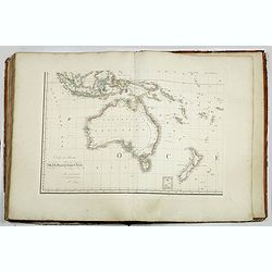
Grand atlas universel ou collection de cartes encyprotypes, générales et détaillées des cinq parties du monde.
Large folio atlas containing 8 general one-sheet maps, and 8 detailed four-sheet maps: Containing2 World maps- "Mappe-monde sur la projection de Mercator. Carte ency...
- $6000 / ≈ €5614
Place & Date: Paris, Desray, 1816
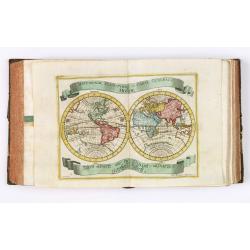
Der curiose und ... Nüssliche Dollmetscher..
Rare atlas and containing geographical descriptions of all continents. Illustrated with 30 very finely engraved and beautifully colored maps in attractive original strong...
- $6000 / ≈ €5614
Place & Date: Augsburg, 1748
![Le Isole di Sandwich delineate sulle osservazioni del Cap Cook. [Hawaii]](/uploads/cache/43195-250x250.jpg)
Le Isole di Sandwich delineate sulle osservazioni del Cap Cook. [Hawaii]
FIRST EDITION on laid paper. Cassini’s splendid map depicts Sandwich islands, old name for Hawaii islands, at the end of the eighteenth century. The splendid cartouche ...
Place & Date: Rome, 1798
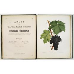
Atlas der für den Weinbau Deutschlands und Oesterreichs werthvollsten Traubensorten. Mit genauer Beschreibung der Eigenschaften, Cultur-Methoden und des Schnittes...
Atlas der für den Weinbau Deutschlands und Oesterreichs werthvollsten Traubensorten. Mit genauer Beschreibung der Eigenschaften, Cultur-Methoden und des Schnittes, der A...
Place & Date: Vienne, Wien, Faesy und Frick, 1873-1876
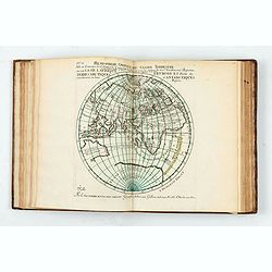
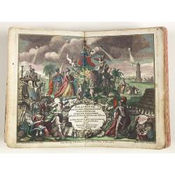
Introduction à la géographie en plusieurs cartes avec leur explication. Par les Srs Sanson Géographes Ordinaires du Roy. Dédiée à Monseigneur Jean Paul Bignon.
An extremely rare scientific atlas, published in 1707, followed by 29 maps published and or corrected by P. Moullart-Sanson, with 18 maps relating to the Americas.First p...
- $7500 / ≈ €7018
Place & Date: Paris, Dans le Cloître de St Nicolas du Louvre, 1707
Atlas Minor praecipua Orbis Terrarum Imperia, Regna et Provincias Germinae Potissimum, tabellis 50 exacte delineatis fiftens usui militiae ducum ac peregrinantium maxime accommodatus opera.
This collection of highly attractive maps were drawn by Georg Matheus Seutter and his son Albrecht Carl. Georg Matheus was one of the most important German Cartographers ...
- $5250 / ≈ €4913
Place & Date: Augsburg, 1744