Browse Listings in America > Caribbean & Atlantic Ocean > Atlantic ocean general
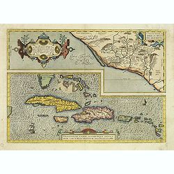
Culiacanae Americae regionis.. / Hispaniolae, Cubae..
Two separate virtually identically sized inset maps on one sheet, each with a decorative scroll title cartouche. Culiacanae depicts the coastal and inland western region...
Date: Antwerp 1598
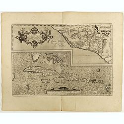
Culiacanae Americae regionis.. / Hispaniolae, Cubae..
Two virtually identically sized inset maps on one sheet, each with a decorative scroll title cartouche. Culiacanae depicts the coastal and inland western region in North ...
Date: Antwerp, 1598
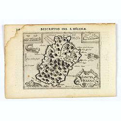
Sancta Helena.
An attractive small map of the south Atlantic island of St. Helena. Two years after the publication of the Itinerario, the first map of St. Helena appeared in 1598 in a m...
- $100 / ≈ €87
Date: Amsterdam, 1606
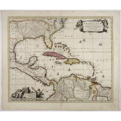
Insulae Americanae in Oceano Septentrionali..
A particularly handsome map portraying the south-eastern U.S., the Caribbean islands, part of Mexico, Central America, Florida (called tegesta Prov. ) and part of South A...
- $1500 / ≈ €1310
Date: Amsterdam, 1702
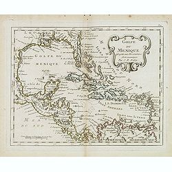
Golfe du Mexique Assujetti aux Observations Astronomiques Par J.B.Nolin.
Rare map of the Caribbean prepared by J.B.Nolin and published by L.J. Mondhare for his Atlas Général a l'usage des colleges et maisons d'education.. Louis Joseph Mondha...
- $200 / ≈ €175
Date: Paris, 1781
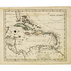
West indien.
Nice small map of The West Indies, with Cuba, Jamaica, S.Domingo, etc. Southern tip of Florida is included. Map by Johannes Walch in his rare Allgemeiner Atlas Nach den b...
Date: Augsburg, 1812
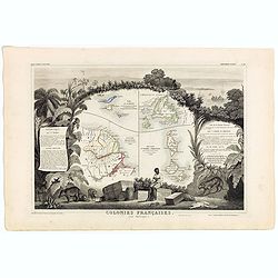
Colonies Françaises (en Amérique). N°92.
A very decorative 19th century map showing the islands of St Martin, St Pierre et Miquelon and Terra Nova. Includes also Guyana. The map is surrounded by portraits, anima...
Date: Paris, A. Combette, 1852
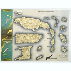
BWIA. North America - Caribbean Route Map.
An interesting double-sided brochure-type map of the routes flown by BWIA (British West Indian Airlines) between North America and the Caribbean. One side shows (not in t...
Date: USA, ca 1960-1965
