Search Listings matching "ukraine" in Europe
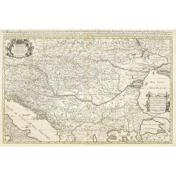
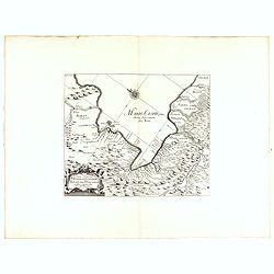
![[MANUSCRIPT] Carte nouvelle de la Crimée et des pays circonvoisins.](/uploads/cache/30484-250x250.jpg)
[MANUSCRIPT] Carte nouvelle de la Crimée et des pays circonvoisins.
A beautiful manuscript map on paper. Showing the northern part of the Black Sea region with Crimea.Interesting are the border lines of "New Serbia", shown in th...
Place & Date: ca. 1752-1764
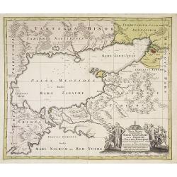
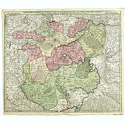
![[Crimea]. Carte de la Cromée.](/uploads/cache/25719-250x250.jpg)
[Crimea]. Carte de la Cromée.
Mapmaker, Captain Jan Hendrik van Kinsbergen (1735-1819). Published by H. Friesman in 1787. This map first appeared in 1776 and was the first Russian map of the newly ann...
Place & Date: Amsterdam, H. Frieseman, 1787

A Map of the Environs of Constantinople Drawn from a great number of accurate astronomical & geographical manuscripts and printed documents, by A. Arrowsmith 1801 and 1804.
Arrowsmith’s large and detailed map of the Ottoman Empire and the Black Sea, with Cyprus, Crete and the Greek Islands in the Mediterranean Sea, Albania, Bosnia and Herz...
Place & Date: London, No.10 Soho Square, 4th September 1804

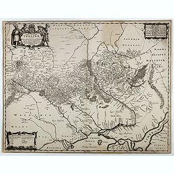
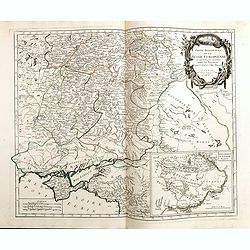
LA RUSSIE NOIRE ou POLONOISE qui Comprend les PROVINCES DE LA RUSSIE NOIRE de VOLHYNIE et de PODOLIE divisées en leurs Palatinats Vulgairement Connües sous le Nom D'VKRAINE ou PAYS DES COSAQUES.
Very rare map of the Ukraine and Poland, prepared by Sanson in 1675 in a third state, published by the heirs of Sanson, in Paris in 1706. The imprint changed to: Par les ...
Place & Date: Paris, 1706
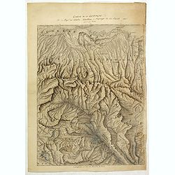
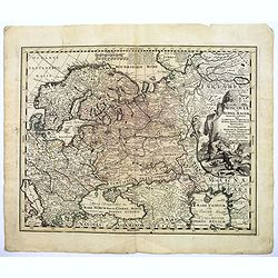
Carte de la Georgie et du Pays des Ossetes, Tcherkesses et Mitzdcheghi, Par Jules Klaproth (1823).
Detailed manuscript map of Georgia, based upon an 1823 map by Jules Klaproth. The map depicts the rugged terrain of Georgia and southern Russia in impressive detail from ...
- $4000 / ≈ €3743
Place & Date: Paris, ca. 1823
![.[Georgia (Republic), Sarmatia, Ukraine]](/uploads/cache/33870-250x250.jpg)
.[Georgia (Republic), Sarmatia, Ukraine]
Wood block printed map and one of earliest printed representation of Georgia (Republic), Sarmatia, Ukraine prepared by Martin Waldseemüller. Based on the slightly larger...
Place & Date: Vienna, Trechsel, G., 1525 -1541
![[Europe, Eastern, Sarmatia, Ukraine]](/uploads/cache/33854-250x250.jpg)
[Europe, Eastern, Sarmatia, Ukraine]
Wood block printed map and one of earliest printed representation of Europe, Eastern, Sarmatia, Ukraine prepared L. Fries after Martin Waldseemüller.Based on the slightl...
Place & Date: Vienna, Trechsel, G., 1525 -1541

Poloniae, Lituaniaeq descriptio.
Fine general map of Poland. Rare; the second plate appearing in the post-1595 edition of the Theatrum. Only used until 1612.Based on the now-lost map of Waclaw Grodecki. ...
Place & Date: Antwerp, 1612
Typus Generalis Ukrainae sive Palatinatuum Podoliae, Kioviensis et Braczlaviensis terras nova delineatione exhibens. . .
A key map engraved by Johannes Janssonius in about 1656 and based on Guillaume La Vasseur de Beauplan's map of the region published in "Description d'Ukraine". ...
- $2000 / ≈ €1871
Place & Date: Amsterdam, ca. 1657

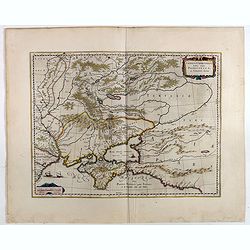
Nouveau théâtre de la guerre entre les Russes les turcs et les polonois confédérés.
A very rare separately published map of Crime region. With a large title cartouche lower left "Nouveau theâtre de la guerre entre les russes, les turcs et les polon...
- $2000 / ≈ €1871
Place & Date: Paris, 1769
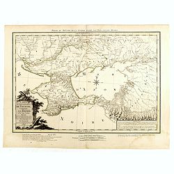
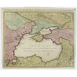
Carte du Gouvernement de Tauride, comprenant la Krimée et les pays voisins: dressée principalement d'après la carte faite sur les lieux pour le voyage de S.M. l'impératrice de Russie. . .
Rare map of southern Ukraine and the Crimea during the Second Russo-Turkish War (1787-92). Antique map of the Crimea during the Second Russo-Turkish War (1787-92), fought...
- $2500 / ≈ €2339
Place & Date: Paris, 1788
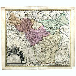
Regni Poloniae, ducatus Mazoviae et province Cujaviae / descriptio emendata per R. & I. Ottens
Very rare map of Poland Lithuania and Ukraine, etc. Engraved by A. Schut.Joachim Ottens (1663 - 1719) and his sons Renier and Joshua were prominent Dutch booksellers and ...
Place & Date: Amsterdam, 1725
Selling price: $1500
Sold in 2017
![[Manuscript] Plan du siege de la forteresse d'Oczakow avec les détails... aux ordres du Prince Potemkin, le 17 Decemb: 1788.](/uploads/cache/34599-250x250.jpg)
[Manuscript] Plan du siege de la forteresse d'Oczakow avec les détails... aux ordres du Prince Potemkin, le 17 Decemb: 1788.
Very detailed well executed manuscript plan of the Turkish Fortress Ochakov captured by Russian Troops on December 17, 1788 by the Maréchal Prince Potemkin. In lower lef...
- $2000 / ≈ €1871
Place & Date: ca. 1788
Ukrania quae et Terra Cosaccorum. . .
Homann's map is based upon Beauplan's general map of Ukraine but depicts the political changes of the preceding years. The cartouche portrays Hetman Mazepa with his follo...
- $1750 / ≈ €1638
Place & Date: Nuremberg, 1720

La Pologne Dressée sur ce qu'en ot donné Starovolsk, Beauplan, Hartnoch. . .
Large map of Poland, Lithuania, Belarus and part of Ukraine. The map is filled with detail and decorated with a title cartouche flanked by mythological figures.According ...
Place & Date: Paris, 1773 - 1780
Ichnographia munitissimae Arcis Otzakoff quae Ao. 1737, die 3 Iulÿ auspicÿs Supremi Campi Mareschalli Comitis de Münnich ab exercitu Russorum vi occupata . . .
A striking image of this fortified Russian outpost on the Black Sea at Otzakoff, northeast of Odessa.
- $1250 / ≈ €1170
Place & Date: Augsburg, 1737
Stati della Corona di Polonia Divisa nella sue Principali Provincie e Palatinati da Guglielmo Sansone. . .
Rare map of Poland, Lithuania and the Ukraine. Copies of his first edition of 'Mercurio Geografico', published in 1674, do not contain a map of Poland. Only added in late...
- $1250 / ≈ €1170
Place & Date: Rome, 1678

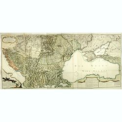
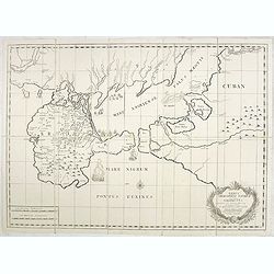
Carte de la Petite Tartarie Dresee par ordre de l'Imperatries de toutes las Russies.
The very rare first edition of De Leth's map of the southern part of Ukraine, with detailed annotations regarding the Cossacks and an explanatory key. Based on a Russian ...
- $1750 / ≈ €1638
Place & Date: Amsterdam, ca. 1785
To His Most Serene and August Majesty Peter Alexovitz Absolute Lord of Russia &c. This map of Moscovy, Poland, Little Tartary, and ye Black Sea &c. is most Humbly Dedicated by H. Moll Geographer
Magnificent large-scale, English map of Russia, Ukraine, Poland, Finland and the Baltic Countries and extending south to the Black Sea and the Balkans, with an ornate ded...
- $1500 / ≈ €1404
Place & Date: London, 1716
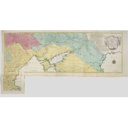
Carte géographique représentant le théâtre de la guerre entre les Russes, les Turcs et les Polonois confédérés. . .
Interesting and rare map showing the area of the Russo-Turkish Wars. To the right a large title cartouche and extensive text describing the different stages and the Wars ...
- $1500 / ≈ €1404
Place & Date: Augsburg, 1760
Geographische General Karte Der Gränzen zwischen denen dreyen Kaiserthümern und ihren nach und nach geschehenen Veränderungen vom Jahr 1718 bis heutigen Tags. . .
Detailed map of present-day Bulgaria, which is carved into the Ottoman provinces of Bulgaria, Macedonia, and Romania (Rumelia), the Crimea and the Black Sea. Prepared by ...
- $1250 / ≈ €1170
Place & Date: Vienna, 1788-1789
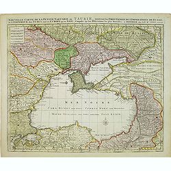
Nouvelle Carte de la Petite Tartarie et la Mer Noire, montrant les Frontieres de l'Impératrice de Russie et de l'Empereur des Turcs, tant en Europe qu'en Asie, Dessigné selon la proposition de G. De L'Isle et d'autres Auteurs.
The Ukraine and the Black Sea in a fine impression with original 18th-c. hand-coloring.
- $1250 / ≈ €1170
Place & Date: Amsterdam, 1730
Moscoviae seu Russiae Magnae Generalis Tabula. . .
A scarce and attractive, wide-ranging map of incorporating Scandinavia, the Baltic countries, parts of Germany and Czechoslovakia, Poland, Hungary, Ukraine, Bulgaria, Nor...
- $1500 / ≈ €1404
Place & Date: Augsburg, 1740

Nova Maris Caspii et Regions Usbeck..
A detailed map of part of Russia, Central Asia centered on the Caspian, Uzbek territory to the east of the Caspian and northern Persia. A finely engraved, uncolored title...
Place & Date: Nuremberg, 1735
![[2 maps and one text sheet] Theatrum Belli A° MDCCXXXVII. . . / Verus Chersonesi Tauricae Seu Crimea Conspectus adjacentium item Regionem itinerisq ab Exercitu Ruthemo...](/uploads/cache/27975-250x250.jpg)
[2 maps and one text sheet] Theatrum Belli A° MDCCXXXVII. . . / Verus Chersonesi Tauricae Seu Crimea Conspectus adjacentium item Regionem itinerisq ab Exercitu Ruthemo...
[2 maps and one text sheet] Theatrum Belli A° MDCCXXXVII. . . / Verus Chersonesi Tauricae Seu Crimea Conspectus adjacentium item Regionem itinerisq ab Exercitu Ruthemo A...
- $1100 / ≈ €1029
Place & Date: Amsterdam, c. 1744

Mapa Polski i Krajów Osciennych - Wydanie trzecie. Opracowal Stanislaw Max. Wydani M. Arcta.
‘The Birth of Modern Poland on a map’ - an excellent wall map of Poland and surrounding regions, published in Warsaw near the end of World War I, when Poland’s fate...
- $1000 / ≈ €936
Place & Date: Warsaw, [H. Sklodowski], 1918
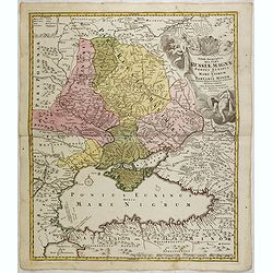
Tabula Geographica qua pars Russiae Magnae. . .
U unrecorded state Homann's map is based upon the works of George von Mengden (1628-1702), a Livonian cartographer who worked for Peter the Great and Count Jacob Bruce [G...
- $1000 / ≈ €936
Place & Date: Nuremberg, c. 1770
Theatrum belli Russorum Victoriis illustratum sive Nova et accurata Turcicarum et Tartaricum. . .
Uncommon and decorative map of Ukraine, showing the theatre of the Russo-Turkish War in the Ukraine in 1735-1739. The map gives detailed information of the fortifications...
- $1250 / ≈ €1170
Place & Date: Nuremberg, ca. 1757
Basse Podolie, Palatinat de Braclaw tiré de la grande Ukraine du Sieur le Vasseur de Beauplan / par le Sr. . .
Scarce and fine map of Ukraine after Guillaume Le Vasseur de Beauplan (c. 1600 — December 6 1673), who was a French cartographer, engineer and architect. Beauplan serve...
- $1000 / ≈ €936
Place & Date: Paris, 1665
Carte du Gouvernement de Tauride, comprenant la Krimée et les pays voisins: dressée principalement d'après la carte faite sur les lieux pour le voyage de S.M. l'impératrice de Russie. . .
Very rare map of the Crimea area published Jean-Claude Dezauche, who was active in Paris 1770-1824. The map includes borders and a road system.Dezauche is giving credit t...
- $1250 / ≈ €1170
Place & Date: Paris, 1788
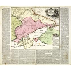
Charte der Kriegs Operationen am Donn u: Dnieper Ihro Russisch Kayserl Majestaet Glorieusen Armeen A: 1736.
Very rare separately published map of the southern part of Ukraine, with an explanatory key A-N in the lower right. The map is surrounded by letterpress German text givin...
- $900 / ≈ €842
Place & Date: Augsburg, 1750
Kriegstheater oder Graenzkarte Oesterreichs, Russlands, und der Türkey. . .
Map of the theatre of war in the Balkans, Ukraine and around the Black Sea, indicating the Austrian, Russian and Turkish spheres of influence. Printed on two sheets and j...
Place & Date: Artaria und Compagnie, Vienna, 1788
Nova et accuratissima Maris Caspii. . .
Original hand colored copper engraving of Matthaeus Seutter. Showing the Caspian Sea with the large Volga Delta in east orientation. Main towns / countries around the Cas...
- $1000 / ≈ €936
Place & Date: Augsburg, 1740
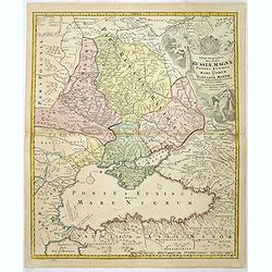
Tabula Geographica qua pars Russiae Magnae Pontus Euxinus seu Mare Nigrum et Tartaria Minor.
Homann's map is based upon the works of George von Mengden (1628-1702) a Livonian cartographer who worked for Peter the Great and Count Jacob Bruce [Graf Jakov Villimovic...
- $750 / ≈ €702
Place & Date: Nuremburg, after 1750

Military map of the countries between Odessa & Perekop with the stations of the Russian forces.
Rare colored linen-backed map showing Russian troop positions and Odessa Batteries. On the inside of the cover a list of "Wyld's list of recent publications : seat o...
Place & Date: London, ca. 1855
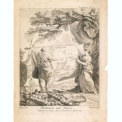
Britannia And Persia.
A finely engraved and unusual depiction of Britannia and Persia, two women with spears and shields holding a map between them. This map depicts a route through the Baltic...
- $800 / ≈ €749
Place & Date: London, 1753
Partie Méridionale de la Russie Européenne. . .
Detailed map of Ukraine, the Crimea and the northern part of the Caspian Sea.
- $650 / ≈ €608
Place & Date: Paris, 1752
Maris Assoviensis vel de Zabache et Paludis Maeotidis. . .
A very detailed map showing the Black Sea, Azow and Rostow area.
Place & Date: Augsburg, 1720
La Pologne Dressée sur ce qu'en ont donné Starovolsk, Beauplan, Hartnoch. . .
This is a late edition of the De L'Isle copper plate with a date of 1806. The copper plate was used many times and has several erased addresses. This one with address &qu...
- $750 / ≈ €702
Place & Date: Paris, 1806
Le Royaume de Hongrie.
Fine oversized map of Hungary, but including Bosnia and Herzegovina, Bulgaria, Croatia, Romania, Albania, European part of Turkey, and Ukraine. With a decorative title an...
Place & Date: Amsterdam, 1692
Maris Assoviensis vel de Zabache et Paludis Maeotidis. . .
A very detailed map showing the Black Sea, Azow and Rostow area. With a decorative allegorical cartouche, showing the costumes of the indigenous people of the region.
- $900 / ≈ €842
Place & Date: Augsburg, 1720
Carte marine de la mer Caspienne avec toutes ses Bayes Rivieres et Havres, dressée sur les observations des plus habiles Navigateurs,. . .
Strikingly engraved and attractive map of the Caspian Sea, showing major towns, ports, etc. Large decorative cartouche and compass rose.
- $1000 / ≈ €936
Place & Date: Leiden, 1710
Le Royaume De Pologne, divise selon les Partages faits en 1772, 1793 et 1795, etnre la Russie, la Prusse et l'Autriche . . .
The uncommon later edition of this detailed map of Poland, showing the lands lost to Russia, Prussia and Austria in 1772, 1793 and 1795. with a color key added underneath...
- $600 / ≈ €561
Place & Date: Paris, ca. 1796
Tabula Geographica qua pars Russiae Magnae Pontus Euxinus seu mare Nigrum et Tartaria Minor cum finitimis Bulgariae, et Romaniae et Natoliae. . .
Homann's map is based upon Beauplan's general map of Ukraine but depicts the political changes of the preceding years. Shows Constantinople. Extends north to Moscow and S...
- $700 / ≈ €655
Place & Date: Nuremburg, 1750

L'escadre alliée bombarde les forts extérieurs de Sébastopol. (18 octobre 1854)
Beautiful Crimean War lithography by Becquet after a painting by Louis Le Breton. The print illustrates the ships "Fort Constantin", "la ville de Paris&quo...
Place & Date: Paris, 1860
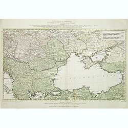
Verus Chersonesi Tauricae Seu Crimea Conspectus adjacentium item Regionem itinerisq ab Exercitu Ruthemo Ao MDCCXXXVI et MDCCXXXVII adversus Tattaros Susceptis . . .
Map of the environs of the Crimea, showing the route of the Russian Army in its expedition against the Tartars in 1736 and 1737. Showing detailed movements, including enc...
Place & Date: St Petersburg, Academy of Sciences, 1740
Selling price: $700
Sold in 2015
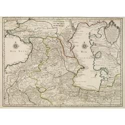
Carte des Pays Voisins de la Mer Caspiene dressee pour l' usage du Roy. . .
Detailed and attractive map focusing on Georgia, Azerbaijan and Armenia. It depicts roads, forts, cities, villages, topography and is filled with notations.Prepared by th...
- $750 / ≈ €702
Place & Date: Paris, 1723
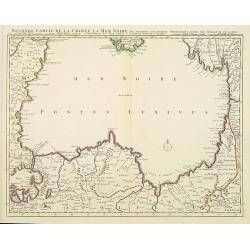
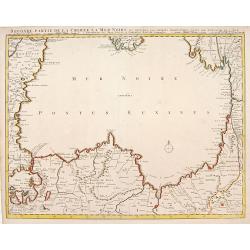
Seconde partie de la Crimee la Mer Noire. . .
The lower part of a set of two maps from the observations of Guillaume Delisle focusing on the Black Sea with wonderful detail of the surrounding regions. Includes Consta...
- $750 / ≈ €702
Place & Date: Amsterdam, 1720
Poloniae Regnum ut et Magni Ducatus Lithuaniae . . .
Detailed map of Poland and the Baltic regions, extending in the south to Ukraine and northern Hungary.Here in its second state, now with added letters to the border scale...
- $750 / ≈ €702
Place & Date: Augsburg, 1735
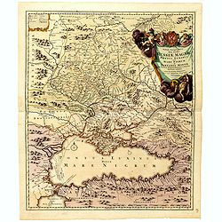
Taurica Chersonesus, Nostra aetate Przecopsca, et Gazara dicitur.
Detailed map of the Ukraine, Russia with in the north Smolensk and Moscow and in the south the Black Sea. Shows ports, fortified cities and the mouths of the Danube. Mino...
- $750 / ≈ €702
Place & Date: Amsterdam, 1645
Charte der Kriegs Operationen am Donn u: Dnieper Ihro Russisch Kayserl Majestaet Glorieusen Armeen A: 1736
Scarce separately published map of the southern part of Ukraine, with an explanatory key A-N in the lower right. The map is surrounded by letterpress German text giving a...
Place & Date: Augsburg, 1750
Selling price: $900
Sold in 2011
Partie Méridionale de la Russie Europeenne ou sont distinguees exactement toutes les Provinces, d'après le detail de l'Atlas Russien.
Detailed map of southern European Russia, including Yugoslavia. The map was first published by the Venetian cartographer and publisher François (Père) Santini and first...
- $750 / ≈ €702
Place & Date: Venice, 1784
Plan général des environs de Sébastopol avec indication de la disposition générale de l'armée alliée au 24 octobre / 5 novembre 1854 et du mouvement du prince Gortchakow vers le mont Sapoune.
A very rare panoramic town-plan of the siege of Sebastopol. In lower margin : "Gravé au Dépôt topographique de la Guerre". From "Défense de Sébastopol...
Place & Date: Saint-Pétersbourg / Paris, 1863-1874
Selling price: $750
Sold in 2014
Germano-Sarmatia in qua Populi maiores Venedi et Aetiaei Peucini et Bastarnae in minores Populos divisi ad hodiernam locorum et Regionum
Fine map of ancient Poland and the whole of Eastern Europe, showing part of the Baltic and Gulf of Riga, including the modern countries of Poland, Lithuania, Ukraine and ...
Place & Date: Paris, 1655
Selling price: $425
Sold in 2013
![Tabula III Asiae. [Caucass and Armenia.]](/uploads/cache/47571-250x250.jpg)
Tabula III Asiae. [Caucass and Armenia.]
Ptolemaic map of the region south of the Caucasus Mountains and between the Caspian Sea as far south as the headwaters of the Tigris River in the south and the Black Sea,...
- $750 / ≈ €702
Place & Date: Lyons, M. Servetus, 1525
Tabula Geographica qua pars Russiae Magnae. . .
Homann's map is based upon Beauplan's general map of Ukraine but depicts the political changes of the preceding years. With decorative cartouches. Giving good detail alon...
- $680 / ≈ €636
Place & Date: Nuremberg, 1720
La Bulgaria ela Romania con Parte di Marcedonia. . .
Scarce map of the region along the Danube River and to the south. Extends to include part of the Sea of Azov and the northern extreme of the Aegean Sea. Elaborate militar...
- $600 / ≈ €561
Place & Date: Rome, 1689
Nova Mappa Maris Nigris et Freti Constantinopolitani...
Map of the Black Sea with the Crimea and adjacent countries, inset map of the Bosporus with Constantinople at upper right.T.C. Lotter married M. Seutter's daughter in 174...
- $600 / ≈ €561
Place & Date: Augsburg, ca. 1760
Nova ac verissima Maris Caspii ante hac maximam fere partem nobis incogniti, ac Regionum adiacentium : Delineatio Iussu Invictissimi Principis Petri Alexii Fil. Magni Russorum Imperatoris / immenso labore et maximis sumptibus facta, atque ex ...
Covers portions of Iran, Turkmenistan, Kazakhstan, Russia and Azerbaijan. Relief is shown pictorially. Depth is shown by soundings. Oriented with north to the left. Rare.
- $750 / ≈ €702
Place & Date: Amsterdam, 1720
Tabula nova totius regni Poloniae. . .
Map of Poland, Lithuania, Latvia, Belarus and Ukraine with decorative cartouche in the upper left corner.Published by Nicolaas Visscher after N. Sanson.
- $900 / ≈ €842
Place & Date: Amsterdam, 1690

The Crimea, chiefly from surveys made by order of the Russian government. . .
Map of Crimea and the Sea of Azov. In lower right corner two inset maps showing Sebastopol inlet and harbour and a second one with the Black Sea. This second maps shows t...
Place & Date: London, 1854
Charte der Laender am Caucasus nach dem besten vorhanden Charten, Reisen, und astronomischen Ortbestimungen gezeichnet von I.C.Reinecke .
Scarce map of the Ukraine and Caucasus filled with great topographical detail, as well as numerous place names. According to the title the map has been drawn by Johann Ma...
- $750 / ≈ €702
Place & Date: Weimar, 1803
Partie Méridionale de la Russie Europeenne ou sont distinguees exactement toutes les Provinces, d'après le detail de l'Atlas Russien.
Detailed map of southern European Russia, including Yugoslavia. The map was first published by the Venetian cartographer and publisher François (Père) Santini and first...
- $600 / ≈ €561
Place & Date: Venice, 1784
Tabula Geographica qua pars Russiae Magnae. . .
Homann's map is based upon the works of George von Mengden (1628-1702), a Livonian cartographer who worked for Peter the Great and Count Jacob Bruce [Graf Jakov Villimovi...
- $600 / ≈ €561
Place & Date: Nuremburg, after 1750
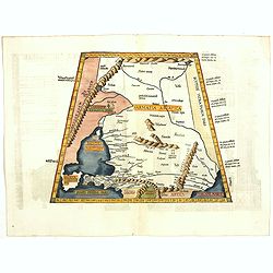
Tabula II Asiae.
A striking example of this wood-cut map depicts north of the Black Sea and west of the Caspian Sea (Ukraine, Russia, Georgia and Armenia). Ptolemy collected his data arou...
- $550 / ≈ €515
Place & Date: Lyons, 1535

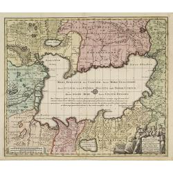
Tabula geographica Russiae Magnae pontus euxinus seu mare nigrum et tauriae regnum. . .
Decorative map of the Black Sea Region, with a large decorative cartouche. Shows Constantinople. Extends north to Moscow and Smolensko.
- $750 / ≈ €702
Place & Date: Nuremberg, 1720
Nouvelle Carte de la Petite Tartarie et la Mer Noire, montrant les Frontieres de l'Impératrice de Russie et de l'Empereur des Turcs, tant en Europe qu'en Asie, Dessigné selon la proposition de G. De L'Isle et d'autres Auteurs.
Shows Ukraine and the Black Sea in a fine impression with original 18th-c. hand-coloring. Elwe published an atlas in 1792, mainly using the copperplates of Joachim Ottens...
- $500 / ≈ €468
Place & Date: Amsterdam, 1792

The town & harbour of Sevastopol with the batteries & approaches. . .
Rare colored linen backed map showing the harbour and town of Sevastopol, with soundings. In upper left corner a inset map (65x150mm) of the Black Sea. In bottom part a l...
Place & Date: London, March 27th, 1854

Carte Marine De La Mer Caspiene levée suivant les ordres de S.M.Cz. En 1719, 1720 et 1721.
Detailed of the Caspian Sea, prepared by Karl van Verden in 1722. Van Verden was a Russian sailor and the Czar's Special Commander, who produced the first accurate map of...
Place & Date: Paris, ca. 1725
Taurica Chersonesus, Nostra aetate Prezecopsca, et Gazara dicitur.
Part of Russia with in the north Smolensk and including Moscow and in the south the Black Sea.More about Willem Blaeu. [+]Taurica, Tauric Chersonese, and Taurida were nam...
- $500 / ≈ €468
Place & Date: Amsterdam, 1645
The Russian Dominions in Europe ... with the Post Roads & New Governments from the Russian Atlas of 1806 by Jasper Nantiat.
A two-sheet wall map of Russia covering from the Artic Sea to the Black and Caspian Seas and from East Prussia and Moldova to the Aral Sea and Tobolsk. Modern day nations...
- $500 / ≈ €468
Place & Date: London, ca. 1843
Seconde partie de la Crimee la Mer Noire. . .
The lower part of a set of two maps from the observations of Guillaume Delisle focuses on the Black Sea with wonderful detail of the surrounding regions. Includes Constan...
- $500 / ≈ €468
Place & Date: Amsterdam, 1720
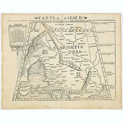
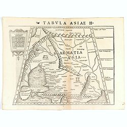
Tabula Asiae II (Black Sea and Caspian Sea)
The first edition of Munster's map of Ukraine and the region north of the Black Sea, based upon Claudius Ptolemy which appeared in his "Geographia Universalis",...
- $500 / ≈ €468
Place & Date: Basel, Heinrich Petri, 1545
Vera Delineatio Provinciae Fertilissimae Kilan olim Hyrcaniae ad Mare Caspium Sitae.
Uncommon map prepared by Adam Olearius showing the region of Azerbaijan and Iran. The map is oriented with north to the upper left corner and adorned with an attractive t...
- $400 / ≈ €374
Place & Date: Jean Dupuis in Paris, 1659
Imperii Moscovitici pars Australis.
A detailed map of the region around Moscow. Including the Ukraine and Cossack regions, to the west is Russian Poland and Lithuania, to the east Russian Tartary and Siberi...
- $500 / ≈ €468
Place & Date: Augsburg, 1730
Nova Mappa Maris Nigri et Freti Constantino Politani. . .
Decorative and uncommon map the Black Sea region. In upper left hand corner an inset map (200 x 280mm) of the Bosporus including Istanbul. Title engraved onto a drape-sty...
- $450 / ≈ €421
Place & Date: Augsburg, ca. 1760
Provincia ecclesiastica di Mohilow nell' Impero Russo (Tav XCII)
A large-format map of Russia, Georgie, Black Sea region with its different dioceses. The map is finely engraved and beautifully colored and was prepared by Girolamo Petri...
- $400 / ≈ €374
Place & Date: Rome, 1858
The Caspian sea Khivah and the surrounding country
Map of Ukraine published by John Arrowsmith (1790-1873) in his "The London Atlas of Universal Geography, Exhibiting the Physical & Political Divisions of the Var...
- $450 / ≈ €421
Place & Date: London, 2-1846
Tabula Asiae II (Black Sea and Caspian Sea).
The first edition of Münster's map of Ukraine and the region north of the Black Sea, based upon Claudius Ptolemy which appeared in his "Geographia Universalis"...
- $400 / ≈ €374
Place & Date: Basel, Heinrich Petri, 1545
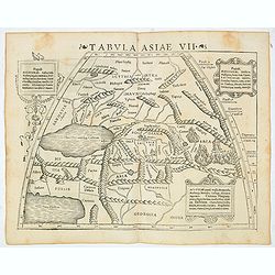
Tabula Asiae VII (Central Asia and Russia)
The first edition of Munster's map of the region north and east of the Black Sea and Caspian Sea, extending to the Imaus Mountains, based upon Claudius Ptolemy which appe...
- $400 / ≈ €374
Place & Date: Basel, Heinrich Petri, 1545