Search Listings matching "isle,"
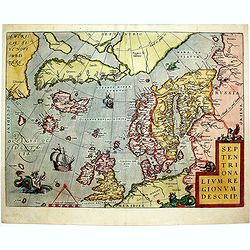
Septentrionalium Regionum Descrip.
1584 ORTELIUS, A. - Scandinavia, Iceland, Greenland and part of the North American continent, includes also the legendary islands of i.a. Drogeo, Frisland and Icaria.
Date: Antwerp, 1584

Le comte d'Artois dresse sur les memoires les plus nouveaux. . .
Map showing the north of France, showing St Omer, and Arras, etc. The map notes Nicolas Sanson as the mapmaker and claims that the map was published by Alexis-Hubert Jail...
Date: Amsterdam, 1693
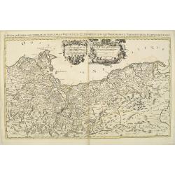
Le Duche de Pomeranie divise en ses principales parties. . .
Fine map of Pomerania with a decorative title and scale cartouche.The map notes Nicolas Sanson as the mapmaker and claims that the map was published by Alexis-Hubert Jail...
Date: Amsterdam, 1693
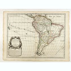
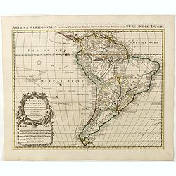
L'Amerique Meridionale Dressée sur les Observations de Mrs de l'Academie Royale des Sciences . . .
Rare state of " L’Amerique Meridionale. Chez l’Auteur sur le Quai de l’Horloge a la Courone de Diamans avec Privilege du Roy pour 20 ans, 1700".Fine map of Sout...
Date: Paris, 1700
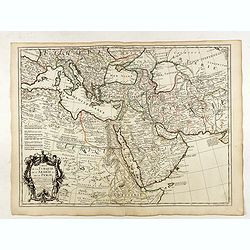
Carte de la Turquie de l'Arabie et de la Perse.
Very rare state with the address : Chez l’Auteur, Rue des Canettes prez St. Sulpice. Avec Privilège, 1701". This early state with "rue des Canettes" imprin...
Date: Paris, 1701
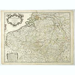
Carte Des Pays Bas Catholiques Dressée. . .
Rare with the address "Chez l’Auteur sur le Quai de l’Horloge a la Cour. ne de Diamans, 1702. Se trouve à Amsterdam chez L. Renard Libraire près de la Bourse."D...
Date: Paris, 1702
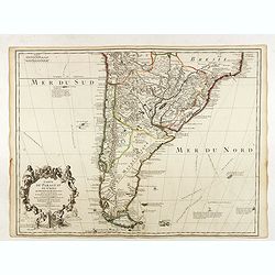
Carte du Paraguay du Chili.
A finely engraved, detailed map of the southern half of South America. Prepared by de l'Isle with the imprint "Chez l’Auteur sur le Quai de l’Horloge avec Privilege ...
Date: Paris, L. Renard, 1703
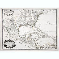
Carte du Mexique et de la Floride.
Third state, with "Quai de l'Horloge" imprint. Renard’s imprint has been erased”. It was the first printed map to portray accurately the course and mouth of the...
Date: Paris, 1703
Carte du Brabant.
Map of Brabant with the address : Chez l’Auteur sur le Quai de l’Horloge (address erased after Horloge). Avec privilege du Roy. 1705." Guillaume de l'Isle's (1675-17...
Date: Paris, 1705
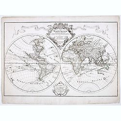
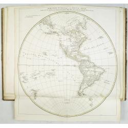
Mappe-Monde dressée sur les observations de M.rs. De L'Academie Royale des Sciences ..
Scarce and early state of the world map published c. 1707, by Delisles with the imprint "Chez l’Auteur sur le Quai de l’Horloge a la Couronne de Diamans, 1700"....
Date: Paris, 1707
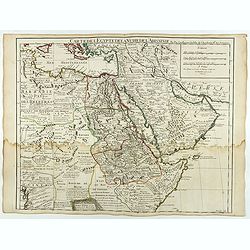
Carte de L'Egypte de la Nubie de L'Abissinie..
Including the Arabian Peninsula. Giving good detail on Egypt. Engraved by Desrosiers. Address and date changed, now with the imprint "A Paris Chez l’Auteur sur le Qu...
Date: Paris, November 1707
Carte du Diocese de Beziers . . .
Fine map of the diocese of Béziers with the address : A Paris Chez l’Auteur sur le Quai de l’Horloge a l’Aigle d’Or, avec Privil. Pr . 20 ans Mai 1708.In early 1708 Delis...
Date: Paris, 1708
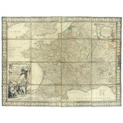
Le Royaume de France avec ses acquisitions ; Divisé en Provinces et en Gouvernemens etc. Dressé sur les Mémoires les plus Nouveaux et Dédié à Louis le Grand Roy de France et de Navarre / par son très Humble serviteur…
Impressive wall map of France decorated with a large figurative title cartouche, a dedication cartouche to the glory of the King of France Louis XIV, and plans of battles...
- $2500 / ≈ €2197
Date: Paris, à présent rue St. Jacques au-dessus de la rue des Mathurins à l'enseigne de la Place des Victoires et du Lion d'Argent, c. 1715
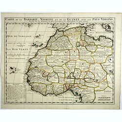
Carte de la barbarie, Nigritie et de la Guinée avec les pays voisins . . .
Showing the imaginary island of ''Borondon'' or Saint Brendan's Island, also known as Saint Brendan's Isle, supposedly situated in the North Atlantic somewhere west of No...
Date: Amsterdam, 1720
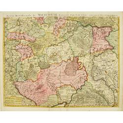
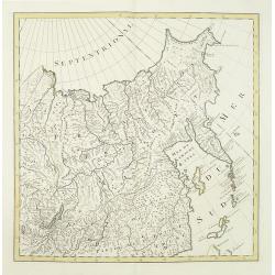
Partie Meridionale de Moscovie..
Centered on Moscow, including Azow in the bottom part of the map.The Amsterdam publishing firm of Covens and Mortier (1721 - c. 1862) was the successor to the extensive p...
Date: Amsterdam 1720
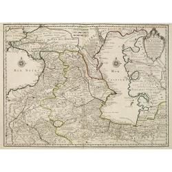
Carte des Pays Voisins de la Mer Caspiene dressee pour l' usage du Roy. . .
The map shows the area east of the Caspian Sea, including parts of Kazakhstan, Turkmenistan, Uzbekistan, and northern Iran. The area eastward from the Caspian is marked '...
- $750 / ≈ €659
Date: Paris, 1723
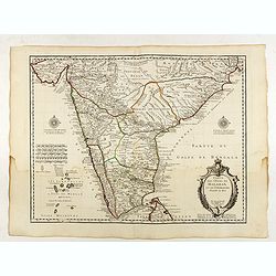
Carte des Cotes de Malabar et de Coromandel..
Detailed and attractive map of India and the northern tip of Sri Lanka. With decorative title cartouche and two compass roses.Rare edition with address : A Paris chez l’A...
Date: Paris, 1723
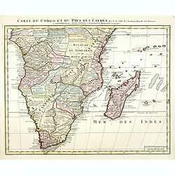
Carte du Congo et du Pays des Cafres. . .
Detailed copper-engraved map of southern Africa providing numerous particulars and comments concerning European trade, native kingdoms, and mineral wealth. Includes Madag...
Date: Amsterdam, c. 1730
![(Chatelain "Atlas Historique" in 7 volumes.]](/uploads/cache/47053X-250x250.jpg)
(Chatelain "Atlas Historique" in 7 volumes.]
Henri Abraham Chatelain, whose Atlas Historique was one of the most expansive encyclopedias of the age. First published in 1705, Chatelain's Atlas Historique was part o...
Date: Amsterdam: Chez Zacharie Châtelain, 1732 - 1739

Carte des Isles de Maiorque Minorque et Yvice dediée A.M. le Comte de Maurepas Ministre et secretaire d'Etat. . .
Fine map of the Baleares with much detail, in lower part inset "Plan du Port de Mahon du Fort St. Philippe et ses Fortifications". The map is dedicated to Jean ...
Date: Amsterdam, after 1740
![ATLAS RUSSICUS mappa una generali et undeviginti specialibus vastissimum Imperium Russicum cum adiacentibus regionibus [repeated in French].](/uploads/cache/27877-250x250.jpg)
ATLAS RUSSICUS mappa una generali et undeviginti specialibus vastissimum Imperium Russicum cum adiacentibus regionibus [repeated in French].
1745 AKADEMIE VON WISSENSCHAFTEN - The first complete printed atlas of Russia, illustrated with 22 regional maps and a folding general map (on 2 sheets). In stunning ori...
Date: St Peterburg, Akademie von Wissenschaften. 1745
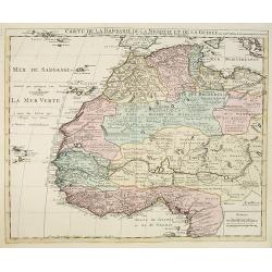
Carte de la Barbarie de la Nigritie et de la Guinée..
Showing the imaginary island of ''Borondon'' or Saint Brendan's Island, also known as Saint Brendan's Isle, supposedly situated in the North Atlantic somewhere west of No...
Date: Amsterdam c. 1745
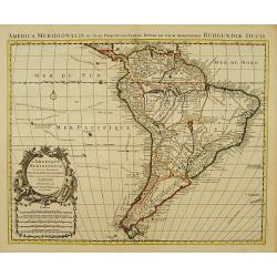
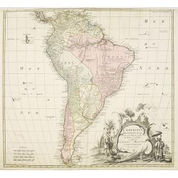
L'Amerique Meridionale Dressée sur les Observations..
Detailed map of South America prepared by De L'Isle, with fine title cartouche.The map is from a Dutch edition of De L'Isle's work entitled, Atlas Nouveau, Contenant Tout...
Date: Amsterdam c. 1745
L'Amerique Meridionale Dressée sur les Observations . . .
Detailed map of South America prepared by De L'Isle, with fine title cartouche.
Date: Amsterdam, ca. 1745
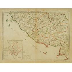
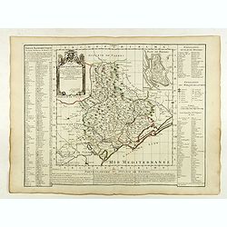
Regionum Italiae mediarum Tabula Geographica. . .
Fine historical map of central Italy with Tuscany, centered on Rome, in the south Pompeii, in the top the island of Giglio and the town Orbetello. Lower left inset plan o...
Date: Paris, 1745
No title (Carte générale de l'empire de Russie).
The right hand sheet of a map of the Empire of Peter the Great.This important map is based on maps from the Bering expedition and on De L'Isle's Akademiia nauk Atlas of 1...
Date: Amsterdam, ca.1748
L'amerique meridionale dressee sur les memoires le plus recens. . .
Rare and decorative map of South America with good detail and interesting notations concerning the explorations of the interior. With in the lower right corner a title ca...
- $550 / ≈ €483
Date: Amsterdam, 1757
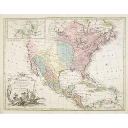
L'Amerique septentrionale, Dressée sur les memoires les plus recens. . . MDCCLVII
A rare map of North America, showing good detail, especially in the region between the Appalachians and the Mississippi and the course o the Mississippi to its source, wh...
Date: Amsterdam, 1757
![[manuscript plan] Siège de Schweidnitz en Silésie fait par les trouppes Imperial es commandées par Mr. le de Nadasti ...](/uploads/cache/39893-250x250.jpg)
[manuscript plan] Siège de Schweidnitz en Silésie fait par les trouppes Imperial es commandées par Mr. le de Nadasti ...
This fine manuscript shows the layout of the city of Swidnica with its surrounding defence wall, its advanced bastions and suburbs, roads and two nearby villages. In lowe...
- $2750 / ≈ €2417
Date: France, 1769
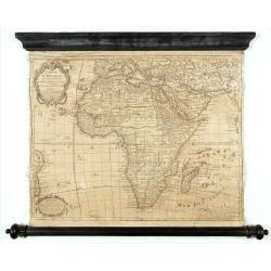
Carte D'Afrique Dressée pour l'usage du Roy. Par Guillaume Delisle, Premier Géographe de Sa Majesté, de l'Académie Royale des Sciences…
Curious late issue of De L'Isle's map of the African continent from 1722 map "Corrigée et Augmentée en 1781". - The decorative map shows the continent Africa wi...
- $1250 / ≈ €1099
Date: Paris, 1781
Atlas in elephant folio.
Most of D'Anville's atlases were made up for the individual customer, so no two appear alike. Many of the 59 pages are multi-sheet maps, so the actual map sheet count is ...
Date: Paris, 1771-1786
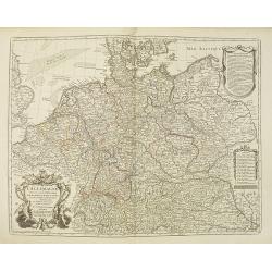
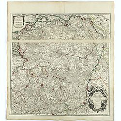
L'Allemagne dressée sur les observations. . .
Map of Germany, Low Countries, Poland, Switzerland, Northern Italy. Prepared by G.De L'Isle after observations by Kepler and Tycho Brahe.Engraved by Jean Batiste Liébaux....
Date: Paris, 1788

Le Royaume de Boheme, le Duché de Silesie, et les Marquisats de Moravie et Lusace, dresses d'apres les cartes de Muller . .
Map of Poland, Bohemia, Silesia, Moravia and Lusatia. Large decorative title cartouche in upper right. In upper left corner inset plan of Breslau and in lower right a ins...
Date: Paris, 1790
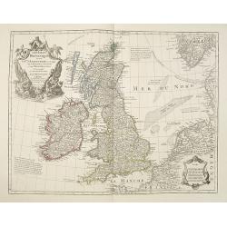
Les Isles Britanniques ou sont le Rme. D'Angleterre . . . Par G. De L'Isle. . . A Paris Chez Dezauche. . .
Uncommon late edition, (dated An 8, 1800 ) of this map of the British Isles prepared by DeL'Isle and published during the French Revolution by Dezauche / Buache. The bott...
Date: Paris, 1800

Carte d'Afrique Dressée pour l'instruction par Guillaume DeLisle. . .
The map is a rare re-issue of the Delisle map of 1722. In his first map of the continent in 1700, Delisle re-measured the Mediterranean, being the first to establish its ...
Date: Paris, J.Dezauche, 1819
