Browse Listings in America > North America
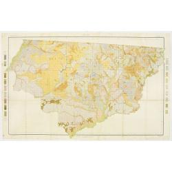
Soil map - Florida, Gadsden County sheet.
Early color lithographed soil map by Julius Bien & Co. in New York for the Department of Agriculture. Legends at the side give detail on soil type, etc. They also inc...
- $40 / ≈ €37
Place & Date: New York, 1903
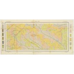
Soil map - Georgia, Fort Valley sheet.
Early color lithographed soil map by Julius Bien & Co. in New York for Department of Agriculture. Legends at side give detail on soil type, etc. They also include in...
- $50 / ≈ €47
Place & Date: New York, 1903
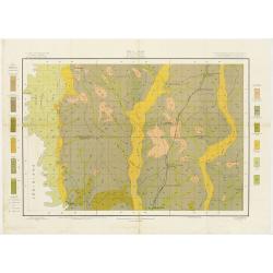
Soil map - Mississippi, McNeill sheet.
Soil map printed by Julius Bien & Co in New York for Department of Agriculture. The map is giving great detail of the area McNeill, Mississippi, in the year 1903. Soi...
- $50 / ≈ €47
Place & Date: New York, 1903
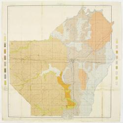
Soil map - Louisiana, Ouachita sheet.
Early color lithographed soil map by Julius Bien & Co. in New York for Department of Agriculture. Legends at side give detail on soil type, etc. They also include int...
- $40 / ≈ €37
Place & Date: New York, 1903
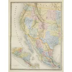
Etats Unis (Etats de l' Ouest).
Large format highly detailed map of the states and territories of the West, with Central America, included in a large inset titled "Etats de l'Amerique Centrale"...
- $400 / ≈ €374
Place & Date: Paris, 1889
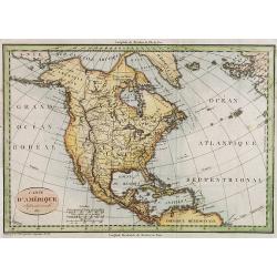
Carte d' Amérique Septentrionale 1817.
Map of North and Central America. Engraved by E.Collin, active at 23, quai des Augustins, Paris.
- $300 / ≈ €281
Place & Date: Paris, 1817
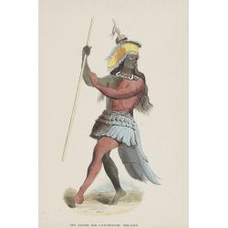
Een Danser der Californische Indiaanen.
Decorative, original hand colored, woodcut engraving illustrating a native American dancer from California.
- $35 / ≈ €33
Place & Date: Amsterdam, ca. 1860

Plan du Port de St Augustin dans la Floride.
This chart shows a plan of the Port of St. Augustine in Florida.The only issue of this version of Bellin's map, slightly larger than the common version. Depths shown by s...
Place & Date: Paris, 1764
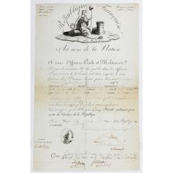
Passeport.
Passport for the United States in the name of Madeleine Lavit Femme Lory, issued by the Commission of Interior Relations and approved by the Committee of Public Safety.Th...
- $750 / ≈ €702
Place & Date: Paris, 1795
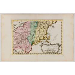
Carte de la Nouvelle Angleterre, Nouvelle York et Pensilvanie / Pour servir à l'Histoire Générale des Voyages.
Uncommon edition of this accurate map the east coast from Delaware River till Main.Left hand corner Lake Ontario. In lower right engraved "38."From Atlas Portat...
- $275 / ≈ €257
Place & Date: Amsterdam, 1773
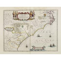
Virginiae Partis Australis, et Floridae Partis Orientalis.
Blaeu based this map on the Mercator-Hondius of 1606. A number of geographical improvements, however were incorporated, although two large fictions lakes accompanied by e...
- $1500 / ≈ €1404
Place & Date: Amsterdam, 1658

Polus Arcticus cum vicinis regionibus.
Map of the North Pole regions from the 1608 second edition of Jodocus Hondius' Atlas Minor.A reduction of the 1606 Mercator-Hondius folio map (which is a later state of t...
Place & Date: Amsterdam, 1608
Selling price: $500
Sold in 2012
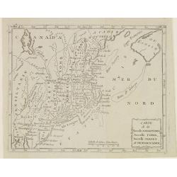
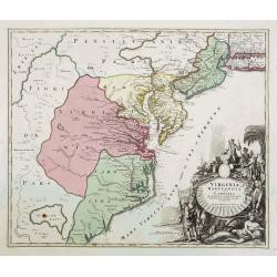
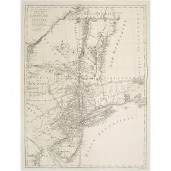
Carte de la Nouvelle Angleterre, Nouvelle York, Nouvelle Jersey, et Pensilvanie.
Map of the north eastern part of the United States, from Atlas de la Géographie de toutes les parties du monde .. Ouvrage destiné pour l'education, et nécessaire aux n...
Place & Date: Paris, Prudhomme, Levrault, Debray, 1806
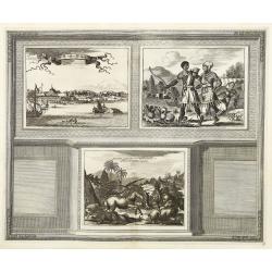
Novum Amsterodamum. . .
Three engravings on one page are set in a decorative, separately engraved border. - In the upper left is a good example of one of the earliest available views of New York...
- $1200 / ≈ €1123
Place & Date: Leiden, 1729
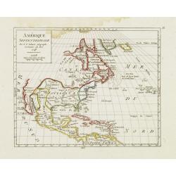
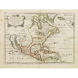
Amérique Septentrionale. . .
A fine small map of North America, extending from Hudsons' Bay to Panama, and including the West Indies. Dated 1748.From Atlas Portatif Universel, by Robert de Vaugondy.P...
- $200 / ≈ €187
Place & Date: Paris, later than 1748
Virginiae Partis Australis, et Floridae Partis Orientalis.
Blaeu based this map on the Mercator-Hondius of 1606. A number of geographical improvements, however were incorporated, although two large fictions lakes accompanied by e...
Place & Date: Amsterdam, 1640
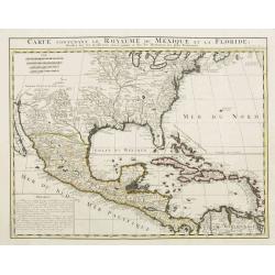
Carte contenant le Royaume du Mexique et la Floride.
This is a derivative of Delisle's landmark map of the southern part of North America. The detailed map shows many English settlements along the East Coast and carefully n...
- $900 / ≈ €842
Place & Date: Amsterdam, 1719
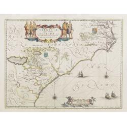
Virginia Marylandia et Carolina..
An attractive and detailed map, covering the coastline from Long Island in the north to just south of Cape Feare in Carolina, with the large fictitious Apalache Lacus in ...
- $2000 / ≈ €1871
Place & Date: Augsburg, 1740
Carte des troubles De L'Amerique Levée par Ordre du Chevalier Tryon. . . New-York.. Jersey..
A French edition of this uncommon Revolutionary War map describes the region from Salem Massachusetts to Buzzard's Bay south to the Delaware River and west to Lake Ontari...
- $1500 / ≈ €1404
Place & Date: Paris, 1778

Carte Générale du Canada, de la Louisiane, de la Floride, de la Caroline..
Map of the eastern part of the United States and Canada. With inset map of Hudson and Baffin bays. in the lower right corner.Venetian edition of d'Anville's map, from &qu...
- $750 / ≈ €702
Place & Date: Venice, 1776 - 1784
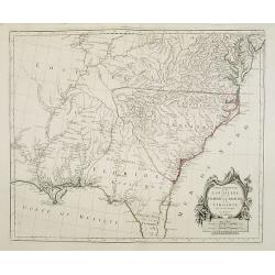
Partie Méridionale de la Louisiane, avec la Floride, la Caroline et la Virginie..
Fine map of southeastern part of the United States after d'Anville's, to whom Santini gives credit in the cartouche.It covers the Atlantic coastline between the Chesapeak...
Place & Date: Venice, 1776 - 1784
Selling price: $1500
Sold in 2008

Carte des côtes du Golfe du Mexique compris entre la pointe sud de la presqu'Ile de la Floride et la pointe nord de la presqu'Ile d'Yucatan: Dresée d'après le observations et las plans des espagnols, ...
Detailed and important early chart of the Gulf Coast and Florida and dated 1800. First French edition of "the first printed [map] to show and name Galveston Bay&qu...
Place & Date: Paris, 1800
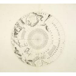
Partie de la Carte du Capitaine Cluny Auteur d'un ouvrage anglois intitulé American Traveller publié à Londres en 1769.
While the map covers the northern hemisphere from Asia through Europe, the focus of the map is the Arctic region of North America and is based on Cluny’s map of 1769.Th...
- $150 / ≈ €140
Place & Date: Paris, 1772
Americque Septentrionale. . .
A general map of North America shows California as an island but with few names and a flat northern coastline. Prepared by N. Sanson and engraved by A.Peyrounin. A first ...
- $1000 / ≈ €936
Place & Date: Paris, P. Marriete, 1667
Two polar calottes from a globe.
Two polar calottes from 110 centimeters in diameter globe of 1688 including the northern part of Baffin Bay, Greenland, Iceland, Nova Zembla. Coronelli elected to follow ...
Place & Date: Venice, 1696
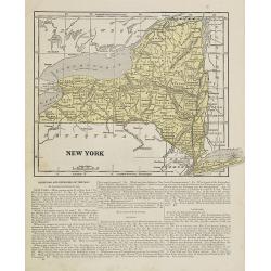
New York.
Map of New York. From Sidney E. Morse''s: System of Geography for the use of schools , published by Harper and brothers, 329 Pearl Street, New York.An 150 years old map w...
- $30 / ≈ €28
Place & Date: New York, 1855
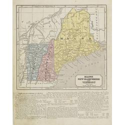
Maine, New Hampshire and Vermont.
Map of Maine, New Hampshire and Vermont.. On the verso, a world map of North and South America with its northern and southern hemispheres. From Sidney E. Morse''s: System...
- $30 / ≈ €28
Place & Date: New York, 1855
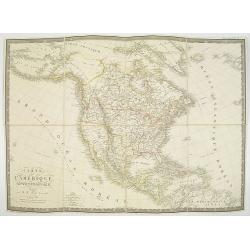
Carte de l'Amerique septentrionale Rédigée par A.H.Brué géographe.
Detailed dissected folding-map of North and Central America by Brué, originally published in Atlas Universel but here mounted on linen and intersected in 8 parts. Next t...
- $250 / ≈ €234
Place & Date: Paris, 1825
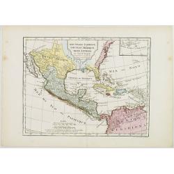
Nouvelle Espagne, Nouveau Méxique, Isles Antilles, par Robert de Vaugondy corrigés par le Cen. Lamarche Géog. Successeur de Vaugondy. l''An 3e.
Although dated 1794/95 [l'An 3e.], the map is a copy of an earlier map which appeared in Robert de Vaugondy's 1778 atlas. Hence, it does not show the newly independent Un...
- $300 / ≈ €281
Place & Date: Paris, 1794 - 1806

System of Penal Law, prepared for the State of Louisiana , comprising codes of offenses and punishments, of procedure, of prison discipline, and of evidence applicable as well to civil as to criminal cases.
The "Enquiries" of Rush and Bradford and the Pennsylvania movement toward abolition of the death penalty had a little immediate impact on the practices of other...
- $2500 / ≈ €2339
Place & Date: New-Orleans, Benjamin Levy, 1824
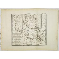
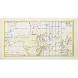
Carte de la Californie et des Pays Nord-Ouest. . . 4de Carte.
Diderot's famous 2 on 1 map shows the two early mappings of the west coast of North America, the first after Visscher, the second after Plancius' World map. Both show the...
- $200 / ≈ €187
Place & Date: Paris, 1779
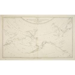
Karte von den N.W. Amerikanische und N.O.E. Asia. . .
German edition of Cook's explorations along the NW Coast of America and NE Coast of Asia, based upon the original work by Lieutenant Henry Roberts.A detailed large-scale ...
- $400 / ≈ €374
Place & Date: Vienna, 1788

Carte d'une Partie des Cotes de la Floride et de la Louisiane, Contenant le Cours du Mississipi...
A well engraved and highly detailed chart of part of the Gulf Coast, dated 1778 that was issued in Neptune americo-septentrionale. The chart covers the area between St. J...
Place & Date: Paris, 1778-1780
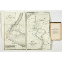
Map of Niagara Falls and viccinity.
This Fifth edition, revised and enlarged, is accompanied by 6 lithographs by Hall & Mooney depicting views of the falls and one map by H.A. Parsons entitled "Map...
- $150 / ≈ €140
Place & Date: Buffalo, 1838
![[North America]](/uploads/cache/25907-250x250.jpg)
[North America]
Uncommon map of North America. The young United States incorporates the upper Midwest, with the remaining western territories of Louisiana, Nouveau Mexique, Nouveau Albio...
- $1000 / ≈ €936
Place & Date: Augsburg, ca. 1790

P.les de Virginie.
Attractive copper engraving, depicting a couple of native people of Florida.From the French text edition of Description d'Univers, 1683. by Allain Manneson Mallet (1630-1...
- $110 / ≈ €103
Place & Date: Paris, 1683
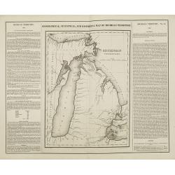
Geographical, statistical, and historical map of Michigan territory.
The first printed map of Michigan Territory. Text around the map describes the Topography, Climate, Animals, Civil Divisions, Population, Towns & Forts, Government, H...
- $500 / ≈ €468
Place & Date: Philadelphia, 1822
![[Lake George and the village of Caldwell.]](/uploads/cache/26087-250x250.jpg)
[Lake George and the village of Caldwell.]
A proof state without the text of Lake George and the village of Caldwell after Jacques Milbert, and lithographed by Sabartier.From Amérique Septentrionale. Printed by H...
- $100 / ≈ €94
Place & Date: Paris, 1829
![[ Road and Bridge over the Mohawk ].](/uploads/cache/26088-250x250.jpg)
[ Road and Bridge over the Mohawk ].
Uncommon proof state without the text of Road and Bridge over the Mohawk after Jacques Milbert, and lithographed by Sabartier.From Amérique Septentrionale. Printed by He...
- $150 / ≈ €140
Place & Date: Paris, 1829
![Noweav Mexiqve. [California as an Island]](/uploads/cache/26133-250x250.jpg)
Noweav Mexiqve. [California as an Island]
Scarce miniature map of California as a island, from Pierre Duval's La Geographie Universeille. The second earliest map to focus on just California and the contiguous coa...
- $800 / ≈ €749
Place & Date: Paris, 1672