
Belgii sive Germaniae Inferioris accuratissima tabula.
Very rare and very decorative map with in the right and left borders costumed figures and town plans alternately. In top and bottom border town plans and views.Separate p...
Date: Amsterdam, 1631

Belgium sive Inferior Germania post omnes..
Early map of the Low Countries, engraved by Abraham Goos and published for the first time in 1618. In the top border town-views of Amsterdam, Dordrecht, Antwerp, and Brus...
Date: Amsterdam, 1618/1631

Belgium, sive Inferior Germania post omnes…
Third state (only 3 recorded copies) of this scarce map of the 17 Provinces, published by Peter Verbiest in Antwerp. West at top. The maps by Pieter van den Keere in 1607...
Date: Antwerp, 1636
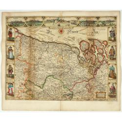
Comitatus Flandria.
Second state of this scarce Carte-a-Figures of Flanders, published by Peter Verbiest in Antwerp decorated with 3 side panels without bottom border (variant of the second ...
Date: Antwerp, 1637

Novissima Flandriae Comitatus tabula. . .
Rare issue of Theodorus Danckert's attractive map of eastern Belgium provinces, Flanders, with Brugge, Oostende, Gent, Mons, Antwerp, Cambray, etc..Decorative title carto...
Date: Amsterdam, 1700
