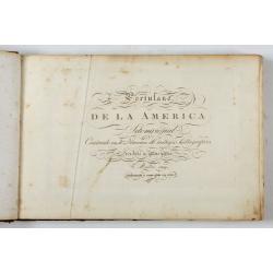
Portulano de la Ameririca Setentrional construido en la direccion de tabajos. |
||||||||||||||||||||
|
||||||||||||||||||||
|
|
||||||||||||||||||||
$45000 / ≈ €39310This item is available for immediate sale! Questions before Buying ?
We are happy to answer your questions.
45000.00
|
My Collection +
Add this or any of your favorite items in one place. If you want to save the items permanently, you have to sign in or create an account first. |
|||||||||||||||||||
Description
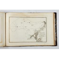
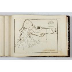
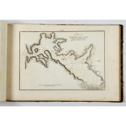
The "Portulano de la America Setentrional", is an exceedingly rare Spanish sea atlas featuring charts of the Caribbean and the Gulf of Mexico. It was developed by the astronomer and geographer José Joaquín de Ferrer y Cafranga, one of the leading figures of the Spanish Enlightenment. It was created as an integral part of the Spanish government's grand project to develop and publish a comprehensive scientific hydrography of the Americas. The "Portulano de la America Setentrional" was printed in Madrid by the Dirección de Hidrografía in 1809 and featured 106 charts of ports in the Caribbean and Gulf of Mexico. It was re-issued in Madrid in 1818; another edition was printed in Mexico City in 1825. The content of the 1818 Madrid edition has 10 extra maps and adding the line "Aumentado y corre-gido [sic] en 1818" to the title page.
The Mexico City edition was entirely re-engraved on new plates and each chart featured altered titles.
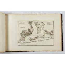
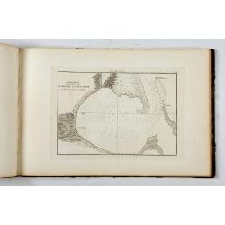
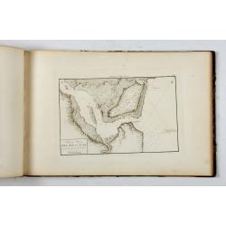
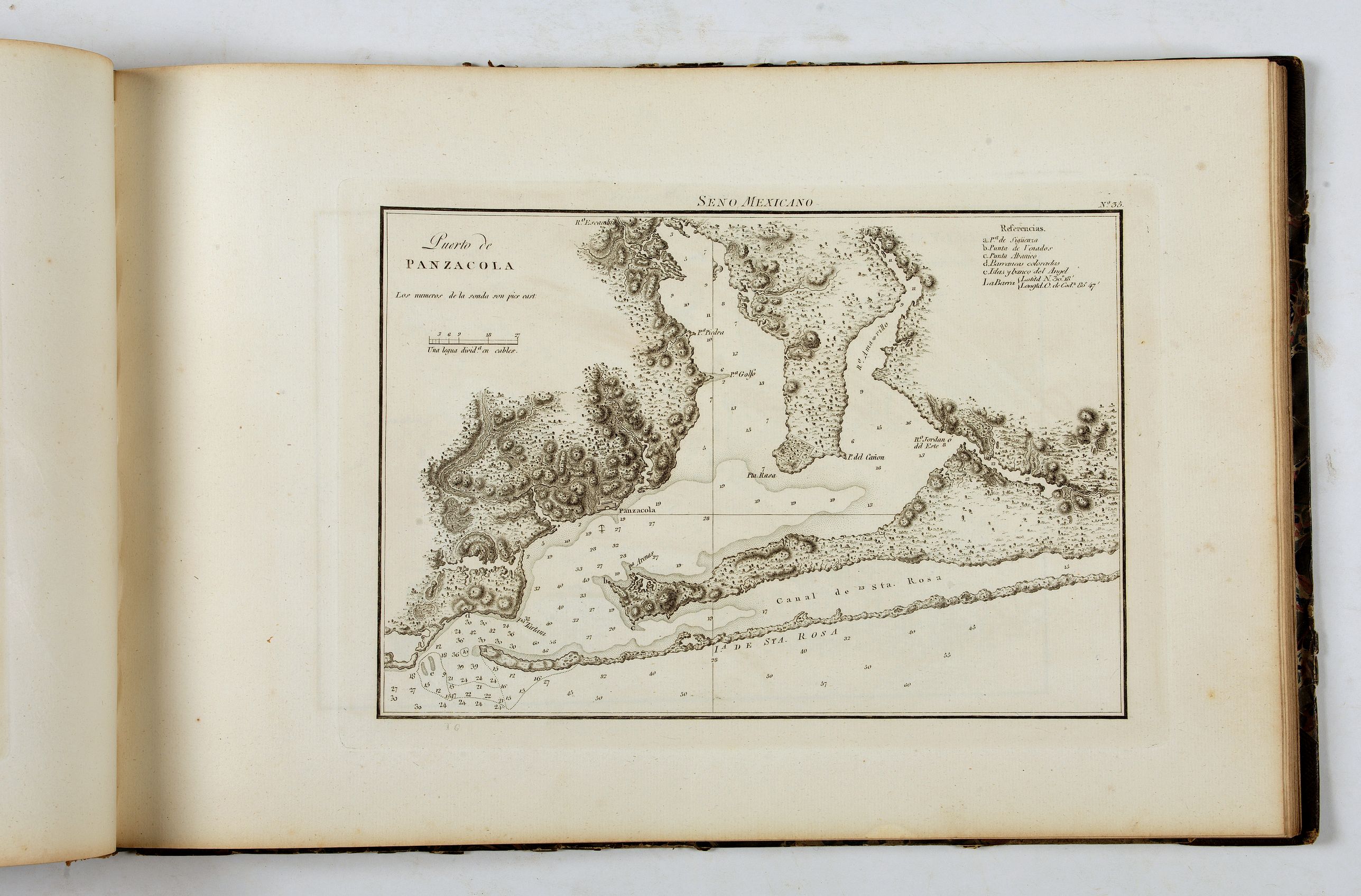
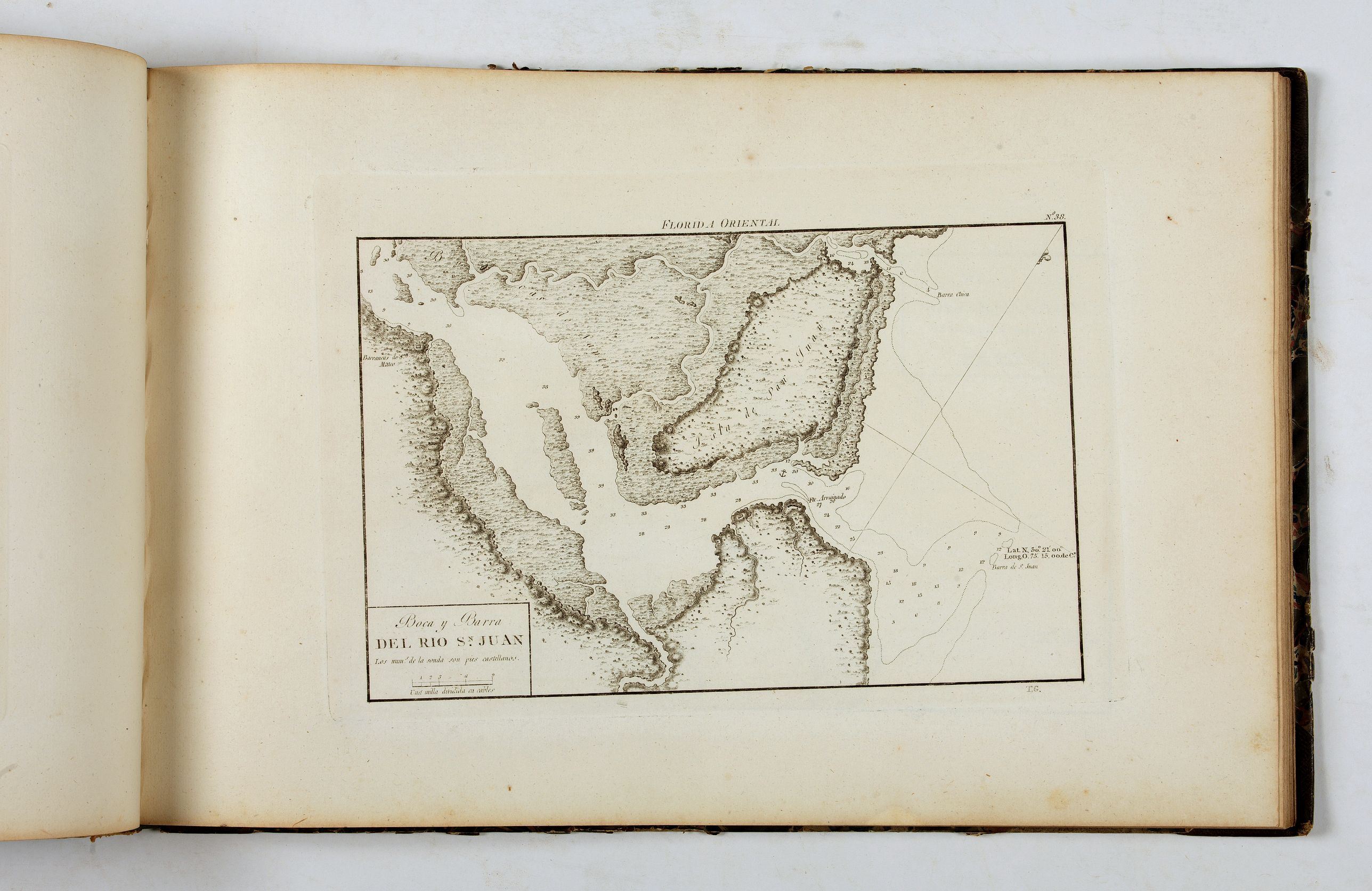
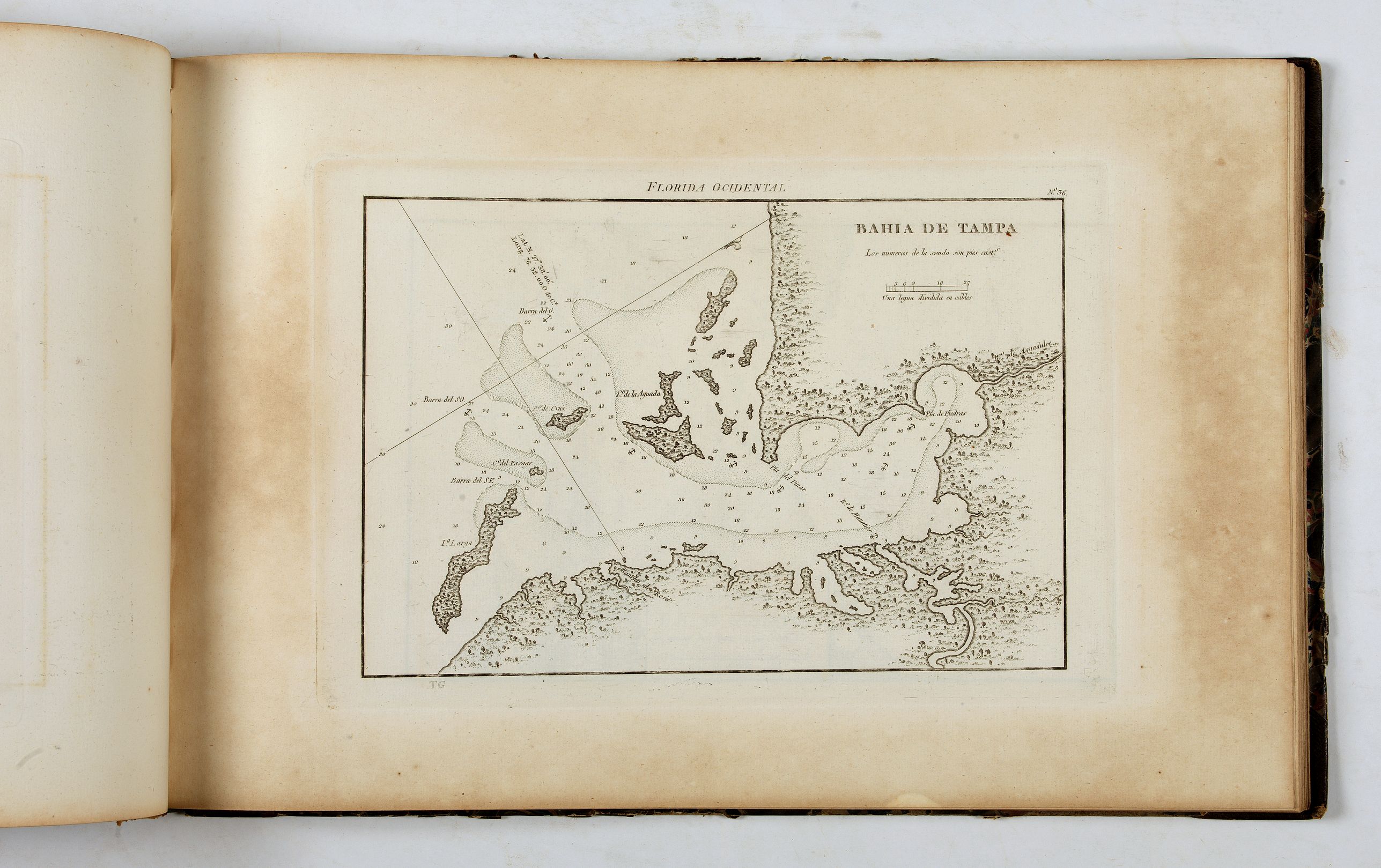
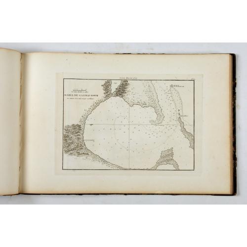 The atlas includes one of the earliest charts of Florida and Texas harbors, such as Bahía de S. Bernardo, Bahía de Galvez-Towm, Puerto de Panzacola, Bahía de Tampa, Barra y Puerto de Sn. Agustín, etc.
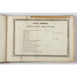
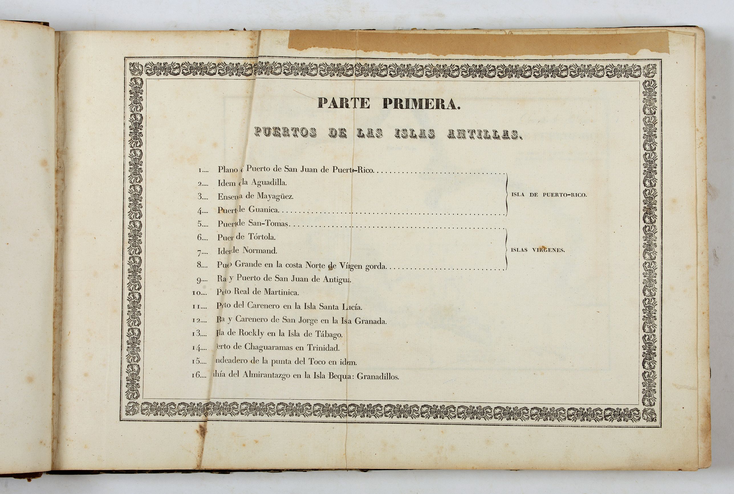
PARTE PRIMERA, Puertos de las Islas Antillas: 1. Puerto de S. Juan de Puerto Rico ; 2. Puerto de la Aguadilla ; 3. Plano de la Ensenada de Mayaguez ; 4. Plano del Puerto de Guanica ; 5. Plano del Pto. de San Tomas ; 6. Plano del Puerto principal de la Tortola ; 7. Plano del Puerto de Normand ; 8. Plano de Pto. Grande ; 9. Rada y Puerto de S. Juan de Antigua ; 10. Bahia de Fte. Real de Martinica ; 11. Plano del Puerto del Carenero ; 12. Plano de la Rada y Carenero de San Jorge ; 13. Plano de la Rada de Rockly ; 14. Plano del Puerto de Chaguaramas ; 15. Plano del Fondeadero de la Punta del Toco. 16. bahia del Almirantazgo en la Isla Bequa : Granadillos.
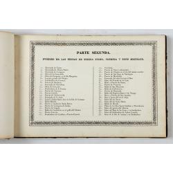
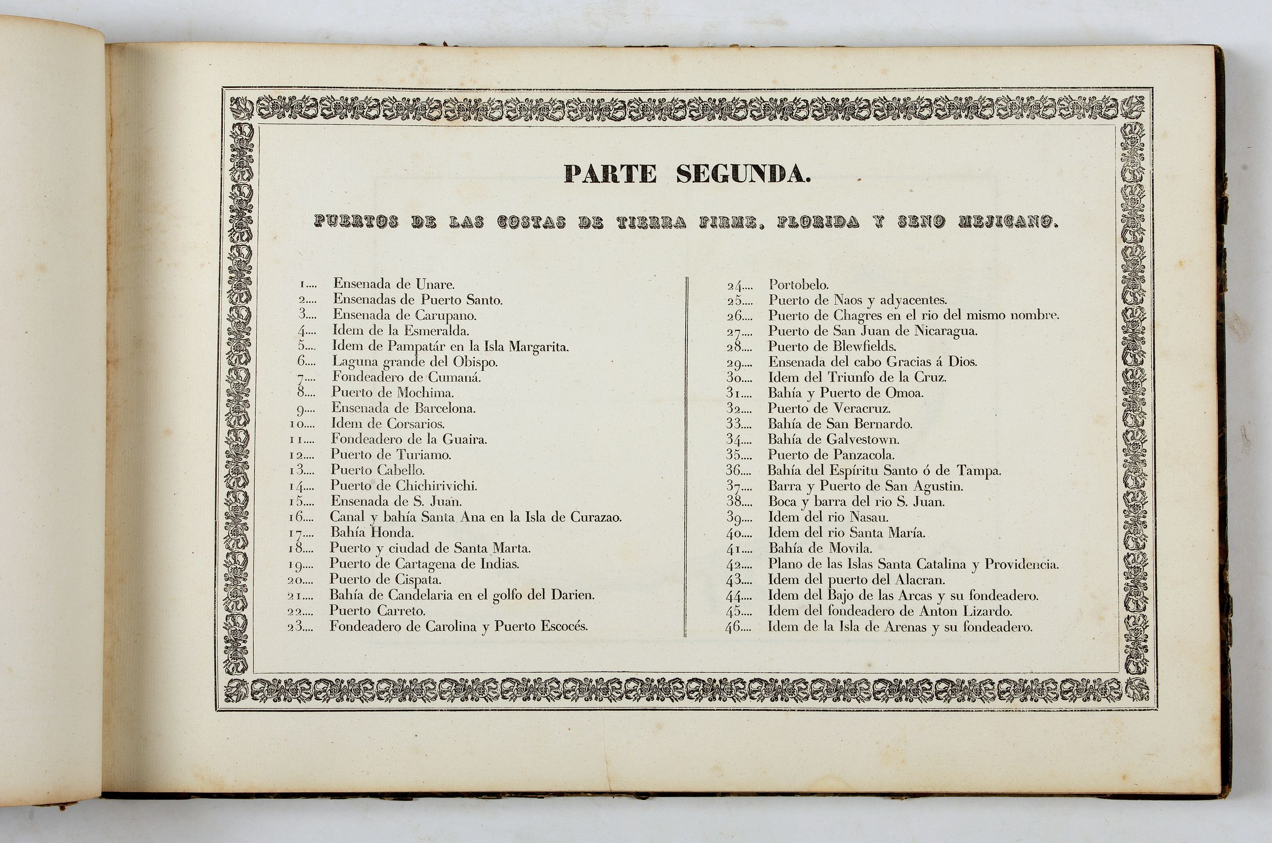
PARTE SEGUNDA, Puertos de las costas de tierra Firme, Florida y Seno Mexicano: 1. Ensena. de Unare ; 2. Ensenadas de Pto. Santo ; 3. Ensda. de Carupano ; 4. Ensenada de la Esmeralda ; 5. Plano de las Ensenadas de Pampatar y Pto. Moreno en la Ia. Margarita; 6. Plano del Puerto nombrado Laguna Grande del Obispo en el Golfo de Cariaco ; 7. Plano del Fondeadero de Cumaná ; 8. Puerto de Mochima ; 9. Ensenada de Barcelona ; 10. Plano del Fondeadero de Corsarios ; 11. Fondeadero de la Guayra ; 12. Pto. de Turiamo ; 13. Puerto Cabello ; 14. Puerto de Chichirivichi ; 15. Ensenada de San Juan ; 16. Plano del Canal y Bahia de Sta. Ana ; 17. Plano de Bahía Honda ; 18. Puerto de Sta. Marta ; 19. Plano del Puerto de Cartagena ; 20. Plano del Puerto de Chispata ; 21. Bahía de Candelaria en el Golfo del Darien ; 22. Plano del Puerto Carreto ; 23. Plano del Fondeadero de Carolina y del Puerto Escocés; 24. Porto-Velo ; 25. Plano del Puerto de Naos y sus adyacentes ; 26. Plano de la Boca del Río Chagres ; 27. Puerto y Boca del Rio de S. Juan de Nicaragua ; 28. Pto. de Blewfields ; 29. Ensenada del Cabo de Gracias a Dios ; 30. Plano de la Ensenada del Triunfo de la Cruz ; 31. Bahía y Puerto de Omoa ; 32. Pto. de Veracruz ; 33. Bahía de S. Bernardo ; 34. Bahía de Galvez-Towm ; 35. Puerto de Panzacola ; 36. Bahía de Tampa ; 37. Barra y Puerto de Sn. Agustín ; 38. Boca y Barra del Rio Sn. Juan ; 39. Boca y Barra del Rio Nasau ; 40. Boca y Barra del Rio Sta. Maria; 41. Bahia de Movila ; 42. Plano de las Islas Santa Catalina y Providencia ; 43. Idem del puerto del Alccran ; 44. Idem del Bajo de las Arcas y su fondeadero ; 45. Idem del fondeadero de Anton Lizardo ; 46. Idem de la Isla de Arnenas y su fondeadero.
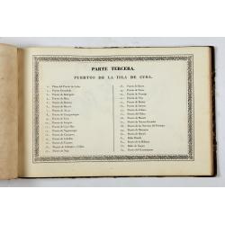
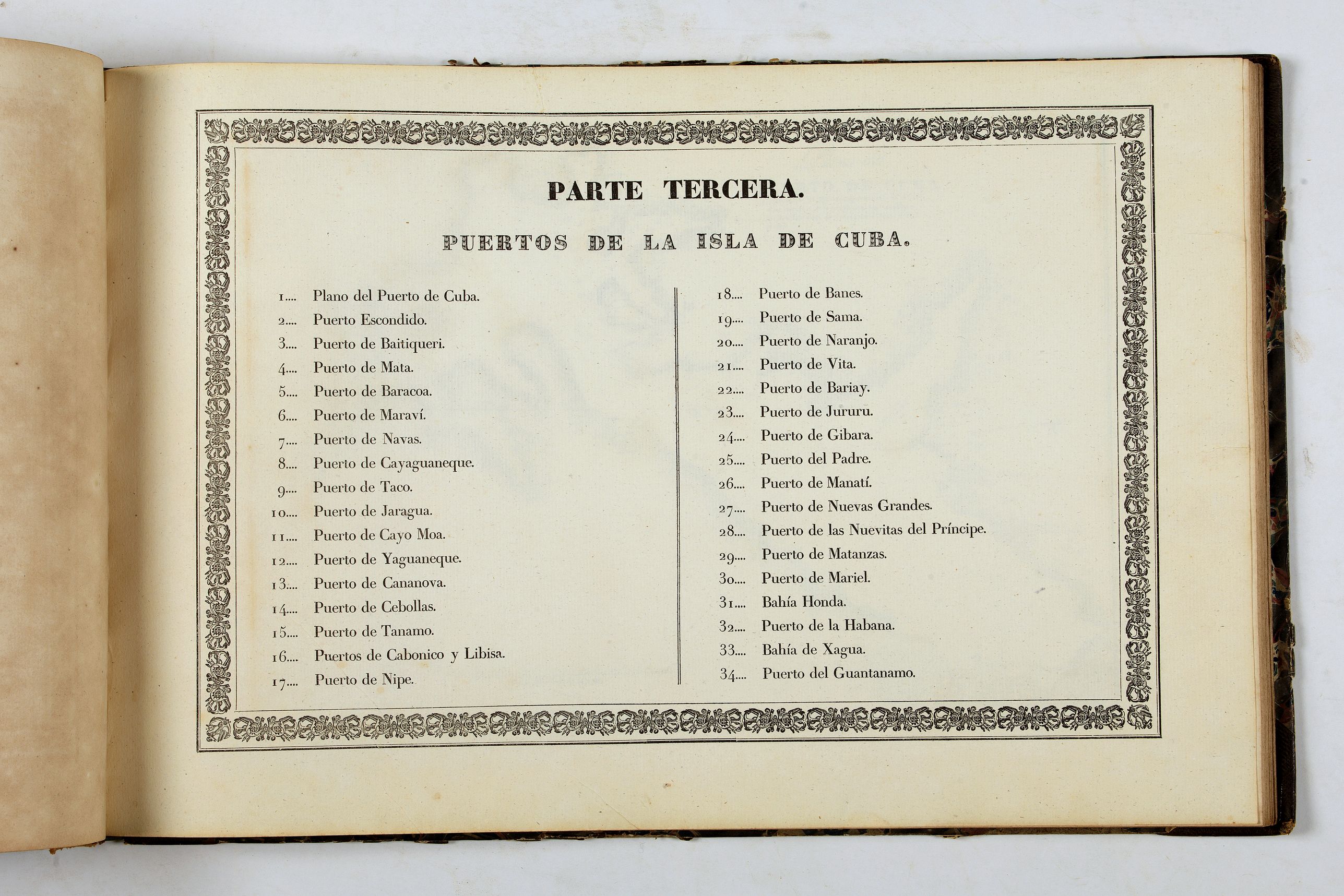
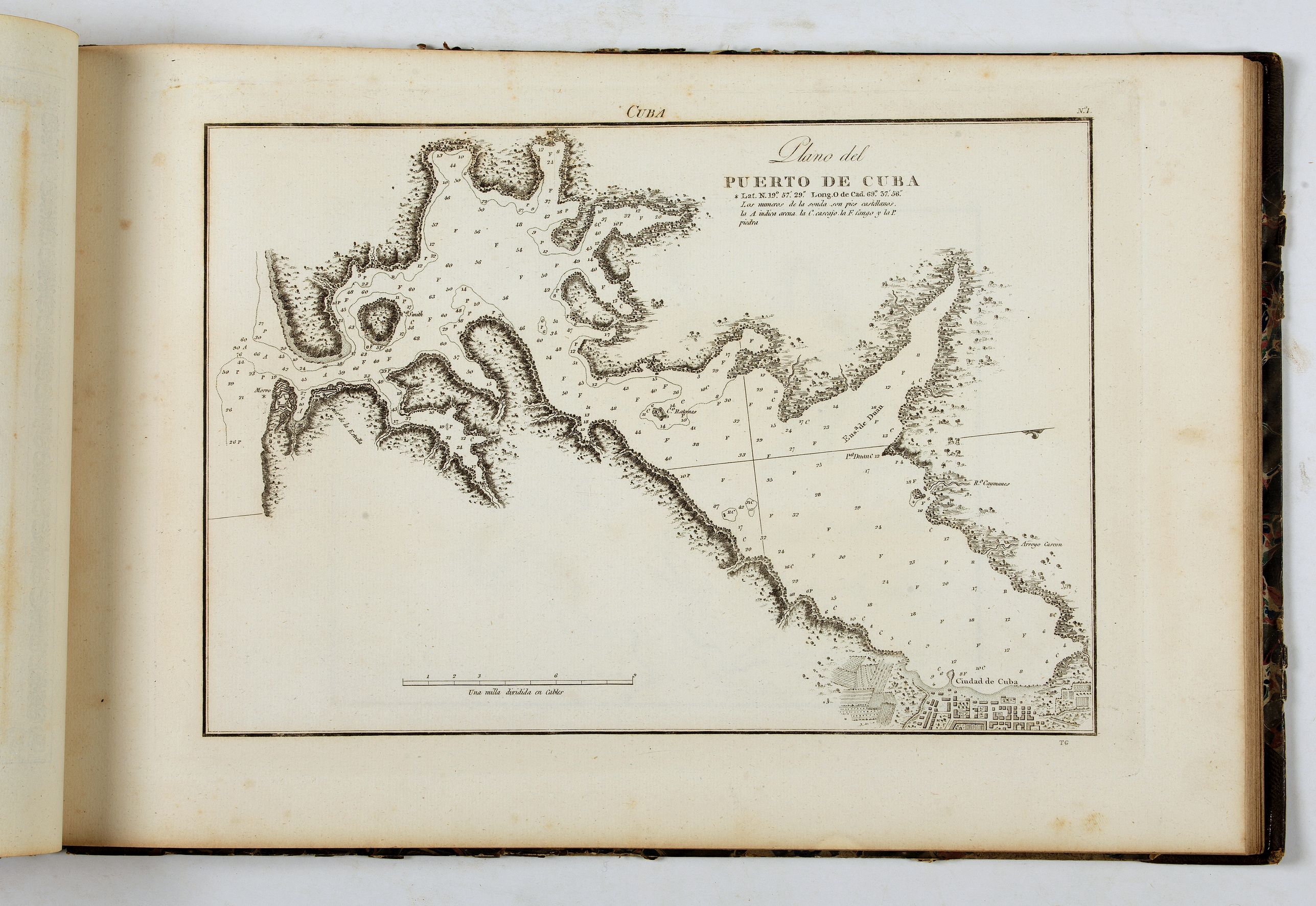
PARTE TERCERA, Puertos de la Isla de Cuba: 1. Puerto de Cuba ; 2. Puerto Escondido ; 3. Puerto de Baitiqueri ; 4. Pto. de Mata ; 5. Puerto de Baracoa ; 6. Puerto de Maraví ; 7. Puerto de Navas ; 8. Puerto de Cayaguaneque ; 9. Puerto de Taco ; 10. Puerto de jaragua ; 11. Puerto de Cayo Moa ; 12. Plano del Puerto de Yaguaneque ; 13. Puerto de Cananova ; 14. Plano del Puerto de Cebollas ; 15. Puerto de Tanamo ; 16. Plano de los Puertos de Cabinico y Livisa ; 17. Puerto de Nipe ; 18. Plano del Puerto de Banes ; 19. Puerto de Sama ; 20. Puerto de Naranjo ; 21. Plano del Pto. de Vita ; 22. Puerto de Bariai ; 23. Plano del Pto. de Jururu ; 24. Pto. de Gibara ; 25. Puerto del Padre ; 26. Puerto de Manatí ; 27. Puerto de Nuevas Grandes ; 28. Plano del Puerto de las Nuevitas del Principe ; 29. Puerto de Matanzas ; 30. Puerto del Mariel ; 31. Bahia Honda ; 32. Puerto de la Havana ; 33. Bahia de Jagua ; 34. Puerto del Guantanamo.
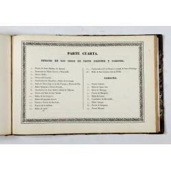
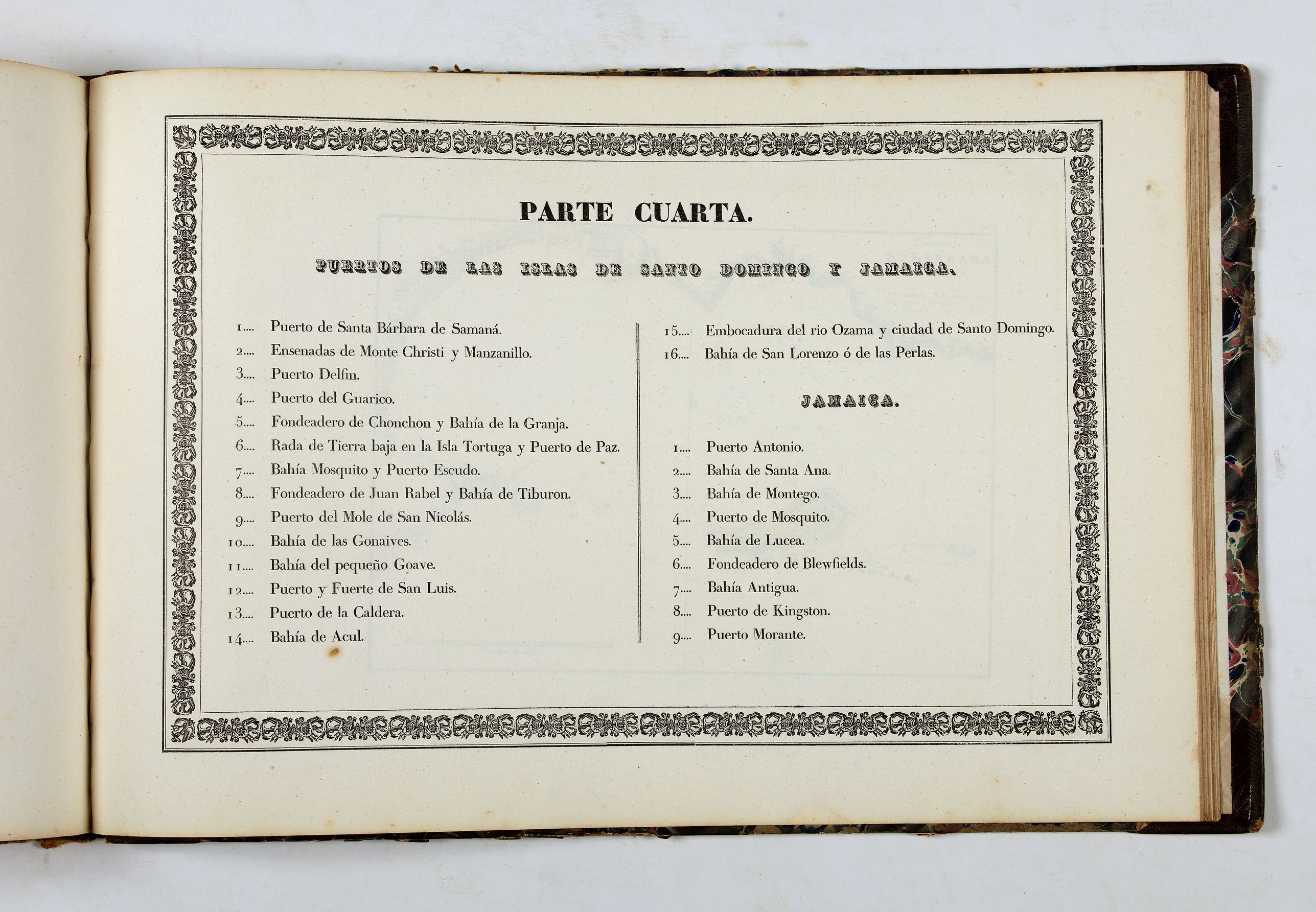
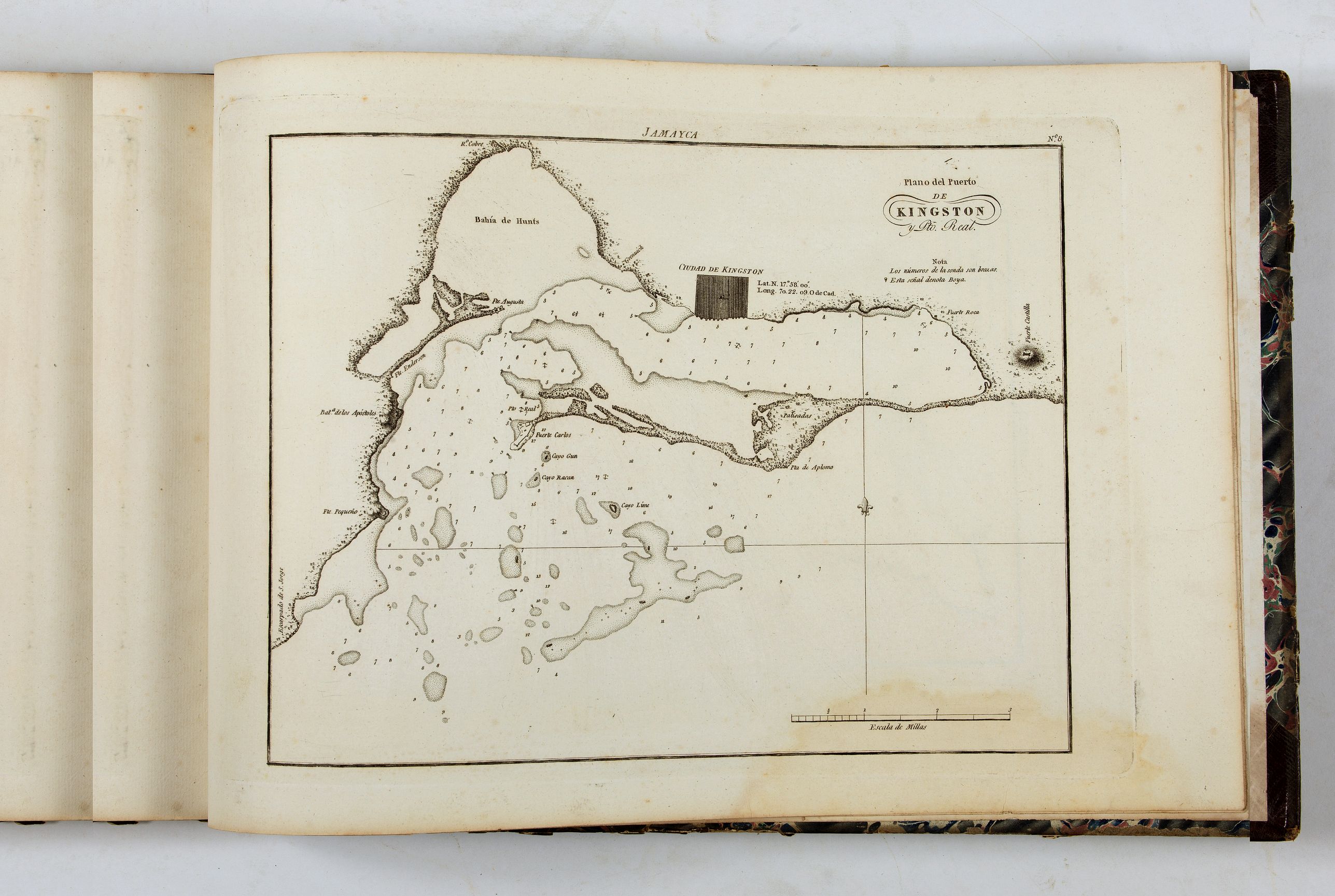
PARTE QUARTA, Puertos de las Islas de Santo Domingo y Jamayca: 1. Puerto de Sta. Barbara de Samaná ; 2. Plano de las Ensenadas de Monte-Cristi y Manzanillo y del Placer de los siete hermanos ; 3. Plano del Puerto del Delfin ; 4. Puerto del Guarico ; 5. Fondeadero de Chouchou. Bahia de la Granja ; 6. Rada de Tierra-Baja en la Isla Tortuga. Puerto de Paz ; 7. Bahía Mosquito. Puerto Escudo ; 8. Fondeadero de Juan Rabel. Baía de Tiburon ; 9. Puerto del Mole de Sn. Nicolas ; 10. Bahía de las Gonaives ; 11. Plano de la Bahía del prqueño Guave ; 12. Plano del Puerto y Fuerte de Sn. Luis ; 13. Pto. de la Caldera ; 14. Bahia de Acul ; 15.Embocadura del rio Ozama y ciudad de Santo Domingo ; 16. Bahia de San Lorenzo o de las Perlas.JAMAICA: 1. Puerto Antonio ; 2. Bahía de Sta. Ana ; 3. Bahía de Montego ; 4. Puerto de Mosquito ; 5. Bahia de Lucea ; 6. Plano del Fondeadero de Bleufields ; 7. Plano de Bahia Antigua ; 8. Plano del Puerto de Kingston y Pto. Real ; 9. Plano del Pto. Morante
In the early 1790s, José Joaquín Ferrer y Cafranga resided in Cadiz, the headquarters of the Armada Real. While he still worked as a merchant, he became attached to the Armada's San Fernando Observatory. Ferrer became closely acquainted with the leading Spanish explorers and cartographers of the era, including Dionisio Alcalá Galiano and Cosme Damián de Churruca y Elorza. He also gained the notice of Admiral Jose de Mazarredo y Salazar, who in addition to being a legendary battle commander was one of Spain's greatest Hydrographers.
Ferrer was recruited by Mazarredo and the explorer Vicente Tofiño de San Miguel to play a key role in creating a sea atlas of important New World harbors. Up to this time, due to Spain's official policies of cartographic secrecy, very few hydrographic surveys of Spanish colonial ports were ever published. The Armada relied on foreign and often very outdated maps, and Spain's participation in the American Revolution highlighted the urgency of acquiring accurate geographical and hydrographical intelligence.
In 1792, Mazarredo and Tofiño dispatched two scientific mapping expeditions to the Americas to gain the required intelligence necessary to realize the project. First, Churrucca was charged with mapping the coastlines of various islands and harbors between Trinidad and Cuba. Second, Joaquín Francisco Fidalgo was charted by surveying the coast of the Spanish Main and Central America from Trinidad to Coast Rica.
As Churrucca and Fidalgo made progress on their endeavors, they regularly sent manuscript charts to Cadiz. Ferrer helped to supervise the publication of many of these charts as separately issued 'Cartas Esfericas' until he left Spain for exile abroad in 1799. Amazingly, despite the turmoil caused by the ongoing Napoleonic Wars, the surveyors completed their respective missions by 1805.
The Portulano de la America Setentrional was printed in Madrid by the Dirección de Hidrografía in 1809 and featured 106 charts of ports in the Caribbean and Gulf of Mexico. It was re-issued in Madrid in 1818, and another edition was printed in Mexico City in 1825. The content of the 1818 Madrid edition has 10 extra maps.
José Joaquín Ferrer y Cafranga (1763-1818)
José Joaquín de Ferrer y Cafranga was a Spanish Basque cartographer and astronomer, and was one of the last great figures of the Ilustración Borbonica, or the Spanish Enlightenment. He was born into an affluent and well-connected family in Pasajes de San Pedro, in the Basque Country. He was the older brother of the politician Joaquín María de Ferrer y Cafranga (1777-1861), who served as Prime Minster of Spain and Mayor of Madrid.
Encouraged to seek his fortune as a merchant in the colonial trade, in 1780, he joined the Real Compañía Guipuzcoana, and set sail for Venezuela. While en route, his vessel was intercepted by Admiral Rodney's British naval squadron, and Ferrer was taken to England. He was paroled, and while in London, he had the opportunity to gain formal training in astronomy and surveying, as well as gaining a fluent command of the English language. Ferrer subsequently returned to Spain and reconnected with the mercantile communities.
In 1787, Ferrer sailed for Lima, Peru, and not long after his arrival, met with considerable success as a commercial trader. He took advantage of his extensive business travel to refine his skills in astronomy and surveying. While on a trip to Mexico, he notably calculated the precise geographic position and heights of several of the region's highest peaks, including Mounts Jalapa, Perote and Orizaba.
As already mentioned, Ferrer spent most of the 1790s in Cadiz assisting the Armada Real in their endeavors leading to the production of the Portulano de la America Setentrional. However, Ferrer, who held distinctly liberal beliefs, became disaffected with the political situation in Spain, and set sail for America in 1799.
For the next 14 years, Ferrer was based in New York, and while earning a lucrative living as a merchant, found ample time to pursue his passions in astronomy and geography, traveling widely through America and the Caribbean. In 1809, several of his papers were published in the prestigious Transactions of the American Philosophical Society.
In 1813, Ferrer traveled to London to study at the Greenwich Observatory, where he became acquainted with some of Britain's leading intellectuals. The following year he studied at the Institute de France in Paris. Shortly after that, Ferrer returned to Spain, where he commenced work on the Portulano de los Estados Unidos.
In 1814, Ferrer returned to Spain after 15 years abroad, and endeavored to complete the mapping project that had been commenced by the navy's Dirección de Hidrografía over 20 years earlier. The Spain that he had returned to had recently been liberated from the long French occupation and had seen the return of a conservative royalist government. However, since 1810, most of her colonial possessions in South and Central America had broken out into rebellion, which would result in their independence from Spain within the proceeding decade.
As a merchant facing the loss of these colonies, Ferrer realized that bolstering trade with the United States and British North America would be an increasingly important priority for the Spanish economy. Up to this time, there were virtually no printed Spanish charts of the harbors of these regions.
While the Portulano was in production in Madrid, Ferrer dedicated himself full-time to the pursuit of academic projects. He became a fellow of the Real Academia de la Historia and the Real Sociedad Vascongada (Royal Basque Society).
Ferrer retired to Bilbao in 1817, and died on May 18, 1818.
Examples of the Portulano with all the maps present and original title page and binding are rare in the market. Only 2 examples in RBH in the last 40 years. OCLC notes examples at Central Connecticut State University, Universidad Complutense de Madrid, University of Michigan, Boston Public Library, NYPL, Library of Congress, Stanford, Berkeley, Harvard, University of Virginia, University of Houston and Yale.
Reference: Only two extant copies in the Spanish CCPBE Seven copies in WorldCat at USA libraries. Philips, Atlases 1224. Palau 233679. Sabin 64441. Servies, Florida 806. Beinecke Lesser Antilles Collection at Hamilton College 627 (1809 ed.) Galveston map: Streeter, Texas, 1043A. Matagorda Bay map: 1044A.
FAQ - Guarantee - Shipping
Buying in the BuyNow Gallery
This item is available for immediate purchase when a "Add to Cart" or "Inquire Now" button is shown.
Items are sold in the EU margin scheme
Payments are accepted in Euros or US Dollars.
Authenticity Guarantee
 We provide professional descriptions, condition report (based on 45 years experience in the map business)
Paulus Swaen warrants the authenticity of our items and a certificate of authenticity is provided for each acquired lot.
Condition and Coloring
We indicate the condition of each item and use our unnique HiBCoR grading system in which four key items determine a map's value: Historical Importance, Beauty, Condition/Coloring and Rarity.
Color Key
We offer many maps in their original black and white condition. We do not systematically color-up maps to make them more sellable to the general public or buyer.
Copper engraved or wood block maps are always hand colored. Maps were initially colored for aesthetic reasons and to improve readability. Nowadays, it is becoming a challenge to find maps in their original colors and are therefor more valuable.
We use the following color keys in our catalog:
Original colors; mean that the colors have been applied around the time the map was issued.
Original o/l colors; means the map has only the borders colored at the time of publication.
Colored; If the colors are applied recently or at the end of the 20th century.
Read more about coloring of maps [+]
Shipping fee
A flat shipping fee of $ 30 is added to each shipment by DHL within Europe and North America. This covers : International Priority shipping, Packing and Insurance (up to the invoice amount).
Shipments to Asia are $ 40 and rest of the world $50
We charge only one shipping fee when you have been successful on multiple items or when you want to combine gallery and auction purchases.
Read more about invoicing and shipping
FAQ
Please have a look for more information about buying in the BuyNow gallery
Many answers are likely to find in the general help section.
My Collection+
![]()
With My Collection+ you can collect all your favorite items in one place. It is free, and anyone can create his or her virtual collection.
Unless you are logged in, the item is only saved for this session. You have to be registed and logged-in if you want to save this item permanently to My Collection+.
Read More[+]
Register here, it is free and you do not need a credit card.
Add this item to
My Collection+
or click the following link to see My Collection+.
| Digital Image Download | |
|
Paulus Swaen maintains an archive of most of our high-resolution rare maps, prints, posters and medieval manuscript scans. We make them freely available for download and study. Read more about free image download |
Click the image for a free small image download. |


In accordance with the EU Consumer Rights Directive and habitually reside in the European Union you have the right to cancel the contract for the purchase of a lot, without giving any reason.
The cancellation period will expire 14 calendar days from the day after the date on which you or a third party (other than the carrier and indicated by you) acquires, physical possession of the lot. To exercise the right to cancel you must inform Paulus Swaen Inc, of your decision to cancel this contract by a clear statement (e.g. a letter sent by post, or e-mail.
To meet the cancellation deadline, it is sufficient for you to send your communication concerning your exercise of the right to cancel before the cancellation period has expired.
