Please login to see price!.
Subscribe to be notified if similar examples become available.
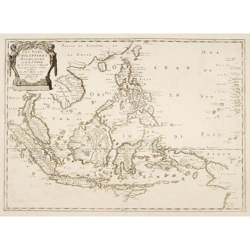
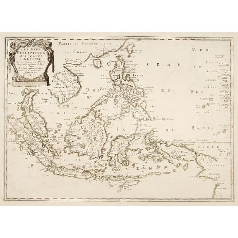
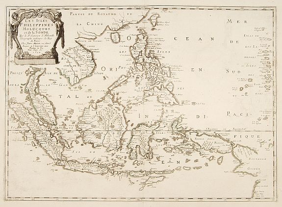
Les Isles Philippines Molucques et de la Sonde. |
||||||||||||||||||||
|
||||||||||||||||||||
|
|
||||||||||||||||||||
|
Selling price: $...
Please login to see price! Sold Missed this item! Be the first to get notified about our newly added listings. Add your name to our mailing list. Feel free to contact us if you have a question about this item. |
Virtual Collection - Save and collect this or any of your favorite items in one place.
If you want to save the items permanently, please sign in or create account first. |
|||||||||||||||||||
Description
An uncommon late printing of Sanson's important mid-seventeenth century map of the East Indies, covering modern Indonesia, the Philippines, Malaysia and parts of Southeast Asia and New Guinea. At a scale of about 1:10,000,000, it shows the cities and smaller settlements, rivers, mountain chains, and even forests.
Large single-sheet engraved map (plate size 40.5 x 56.5 cm) with title and imprint in a cartouche at upper right, decorated with 2 winged female figures; with the equator marked and latitude and longitude indications in the borders.
It was engraved by J. Somer for the elder Nicolas Sanson with a privilege for twenty years, and appeared in Sanson's 1658 Cartes generales de toutes les parties du monde and in later editions. Pastoureau's 1650 date appears to be an error for 1654. In spite of later developments in the cartography of the East Indies the map remained unchanged, with the original date and Pierre Mariette's name as publisher, for nearly a century. It therefore reflects the historical situation and the state of cartographic knowledge in the middle of the seventeenth century.
The paper of the present copy is watermarked "PI|[double heart]|GO M" = chaplet, a mark of P. Gourbeyre (similar to Heawood 240, of c. 1745), and the map was formerly bound with others dating from c. 1742-1745, including other late printings of seventeenth-century Sanson maps and maps by Gilles Robert (1688-1766) also on P. Gourbeyre paper. Robert, a great-grandson of the elder Nicolas Sanson, acquired some Sanson materials from his uncle Pierre Moullart-Sanson in 1730, reprinted Sanson's seventeenth-century maps from the original plates and added new ones of his own.
After nearly a hundred years of use, the plate was beginning to show signs of wear, but the map is nevertheless in very good condition, and of considerable historical interest for the state of European knowledge of the East Indies in the mid-seventeenth century.
Reference: BMC Printed Maps XII, col. 867; Cat. Nat. Mar. Mus. 271, map 15; Nordenskiöld 275, vol. 1, map 17; Pastoureau, Sanson V, map 12; Quirino, Philippine Cartography, p. 83; all recording earlier printings only.
FAQ - Guarantee - Shipping
Buying in the BuyNow Gallery
This item is available for immediate purchase when a "Add to Cart" or "Inquire Now" button is shown.
Items are sold in the EU margin scheme
Payments are accepted in Euros or US Dollars.
Authenticity Guarantee
 We provide professional descriptions, condition report (based on 45 years experience in the map business)
Paulus Swaen warrants the authenticity of our items and a certificate of authenticity is provided for each acquired lot.
Condition and Coloring
We indicate the condition of each item and use our unnique HiBCoR grading system in which four key items determine a map's value: Historical Importance, Beauty, Condition/Coloring and Rarity.
Color Key
We offer many maps in their original black and white condition. We do not systematically color-up maps to make them more sellable to the general public or buyer.
Copper engraved or wood block maps are always hand colored. Maps were initially colored for aesthetic reasons and to improve readability. Nowadays, it is becoming a challenge to find maps in their original colors and are therefor more valuable.
We use the following color keys in our catalog:
Original colors; mean that the colors have been applied around the time the map was issued.
Original o/l colors; means the map has only the borders colored at the time of publication.
Colored; If the colors are applied recently or at the end of the 20th century.
Read more about coloring of maps [+]
Shipping fee
A flat shipping fee of $ 30 is added to each shipment by DHL within Europe and North America. This covers : International Priority shipping, Packing and Insurance (up to the invoice amount).
Shipments to Asia are $ 40 and rest of the world $50
We charge only one shipping fee when you have been successful on multiple items or when you want to combine gallery and auction purchases.
Read more about invoicing and shipping
FAQ
Please have a look for more information about buying in the BuyNow gallery
Many answers are likely to find in the general help section.
Virtual Collection
![]()
With Virtual Collection you can collect all your favorite items in one place. It is free, and anyone can create his or her Virtual map collection.
Unless you are logged in, the item is only saved for this session. You have to be registed and logged-in if you want to save this item permanently to your Virtual Collection.
Read More[+]
Register here, it is free and you do not need a credit card.
Add this item to
Virtual Collection
or click the following link to see my Virtual Collection.
| Digital Image Download | |
|
Paulus Swaen maintains an archive of most of our high-resolution rare maps, prints, posters and medieval manuscript scans. We make them freely available for download and study. Read more about free image download |
Click the image for a free small image download. |
In accordance with the EU Consumer Rights Directive and habitually reside in the European Union you have the right to cancel the contract for the purchase of a lot, without giving any reason.
The cancellation period will expire 14 calendar days from the day after the date on which you or a third party (other than the carrier and indicated by you) acquires, physical possession of the lot. To exercise the right to cancel you must inform Paulus Swaen Inc, of your decision to cancel this contract by a clear statement (e.g. a letter sent by post, or e-mail (amsterdam@swaen.com).
To meet the cancellation deadline, it is sufficient for you to send your communication concerning your exercise of the right to cancel before the cancellation period has expired.
