Subscribe to be notified if similar examples become available.


Claudii Ptolemaei Geographiae... |
||||||||||||||||||||
|
||||||||||||||||||||
|
|
||||||||||||||||||||
|
|
Virtual Collection - Save and collect this or any of your favorite items in one place.
If you want to save the items permanently, please sign in or create account first. |
|||||||||||||||||||
Description
Claudii Ptolemaei Geographiae... Translated from the Greek into Latin by Jacobus Angelus.
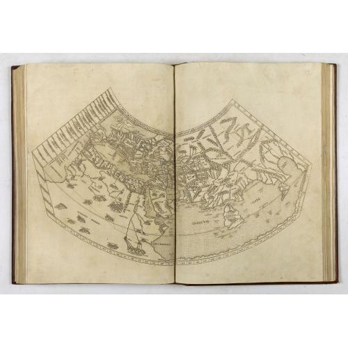
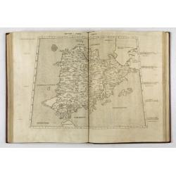
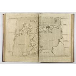
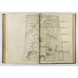
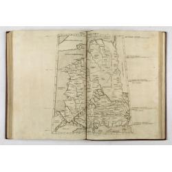
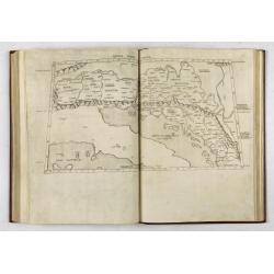
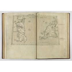
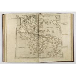
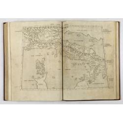
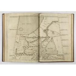
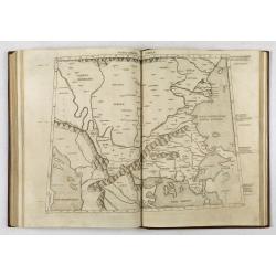
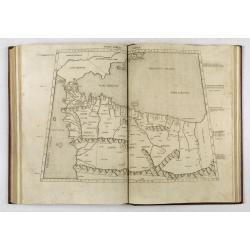
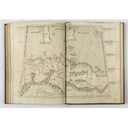
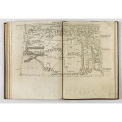
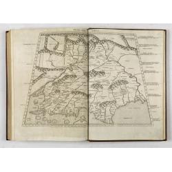
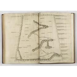
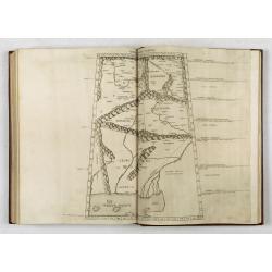
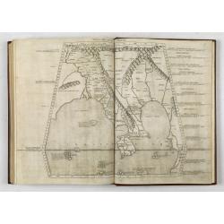
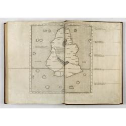
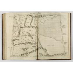
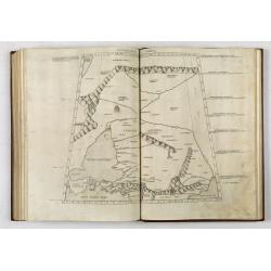
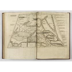
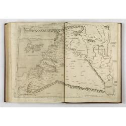
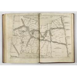
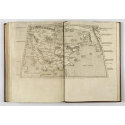
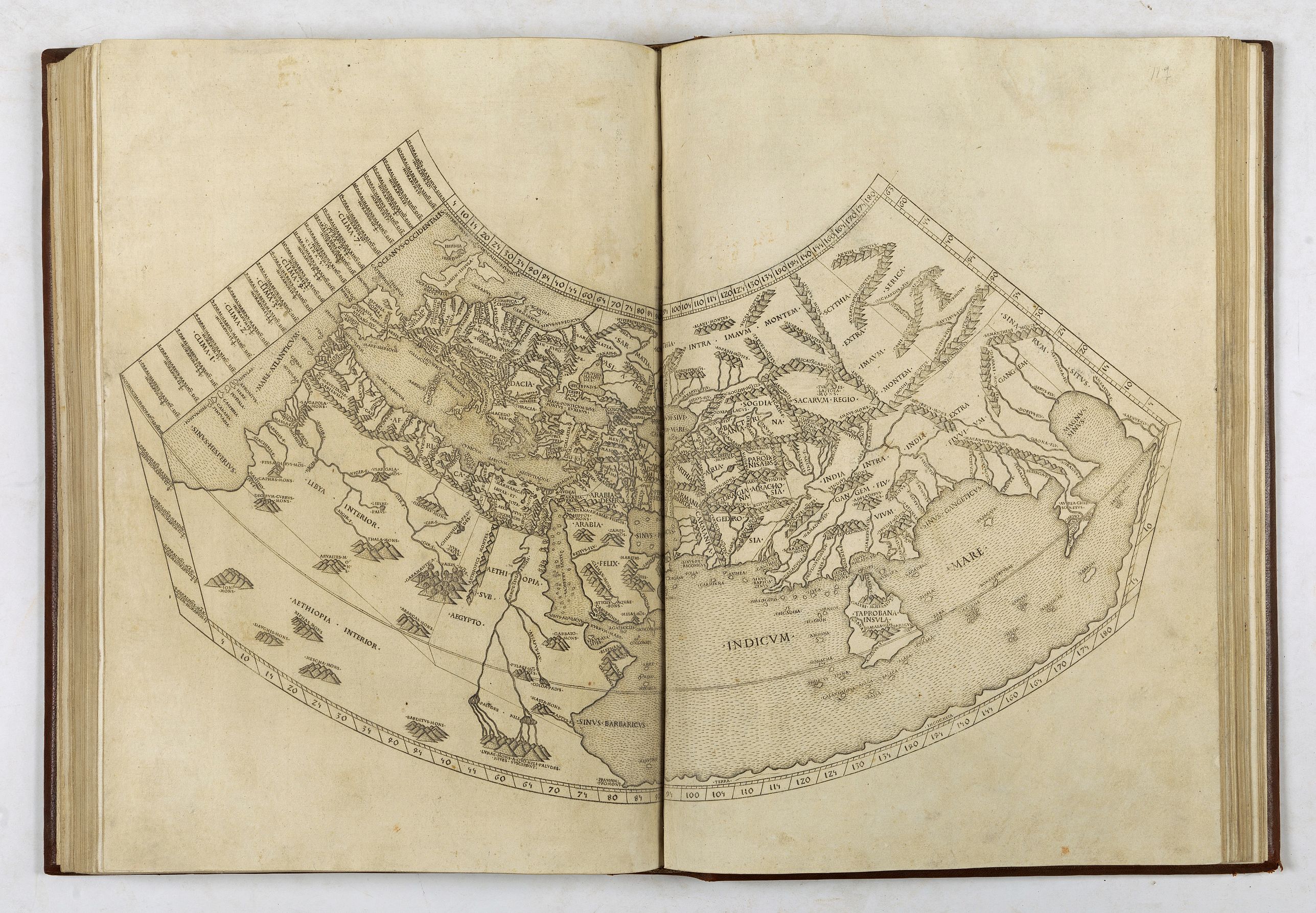
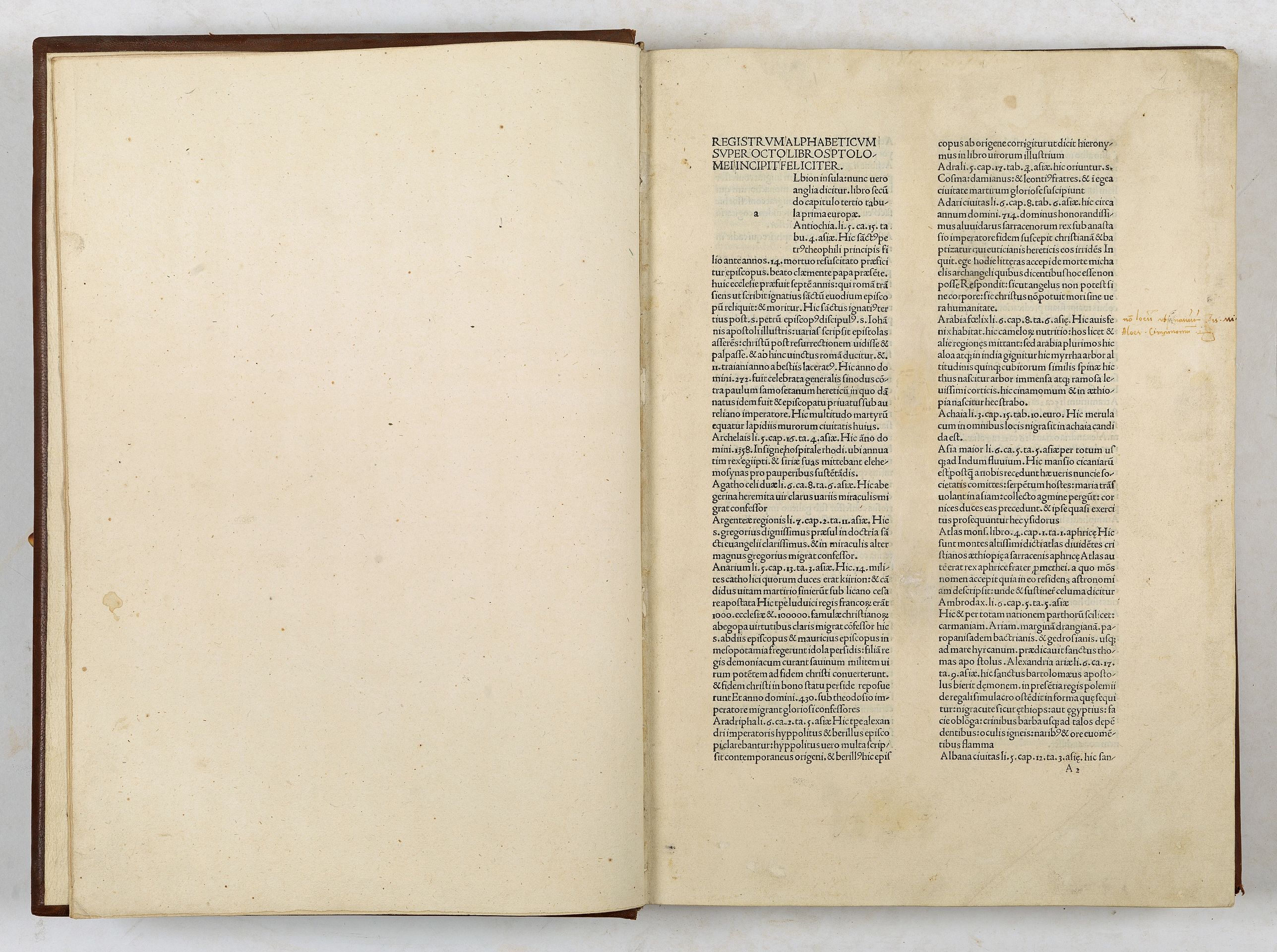
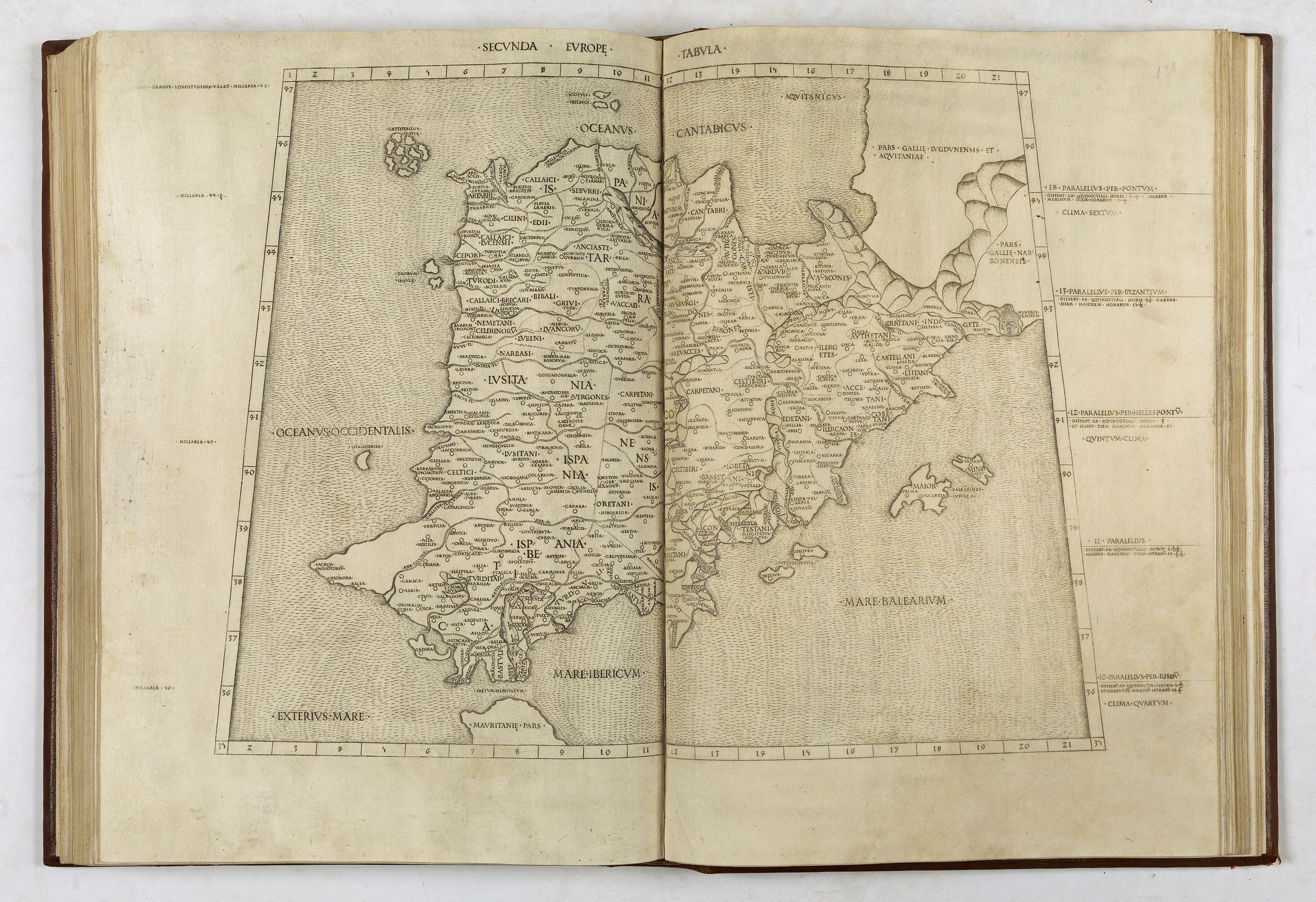
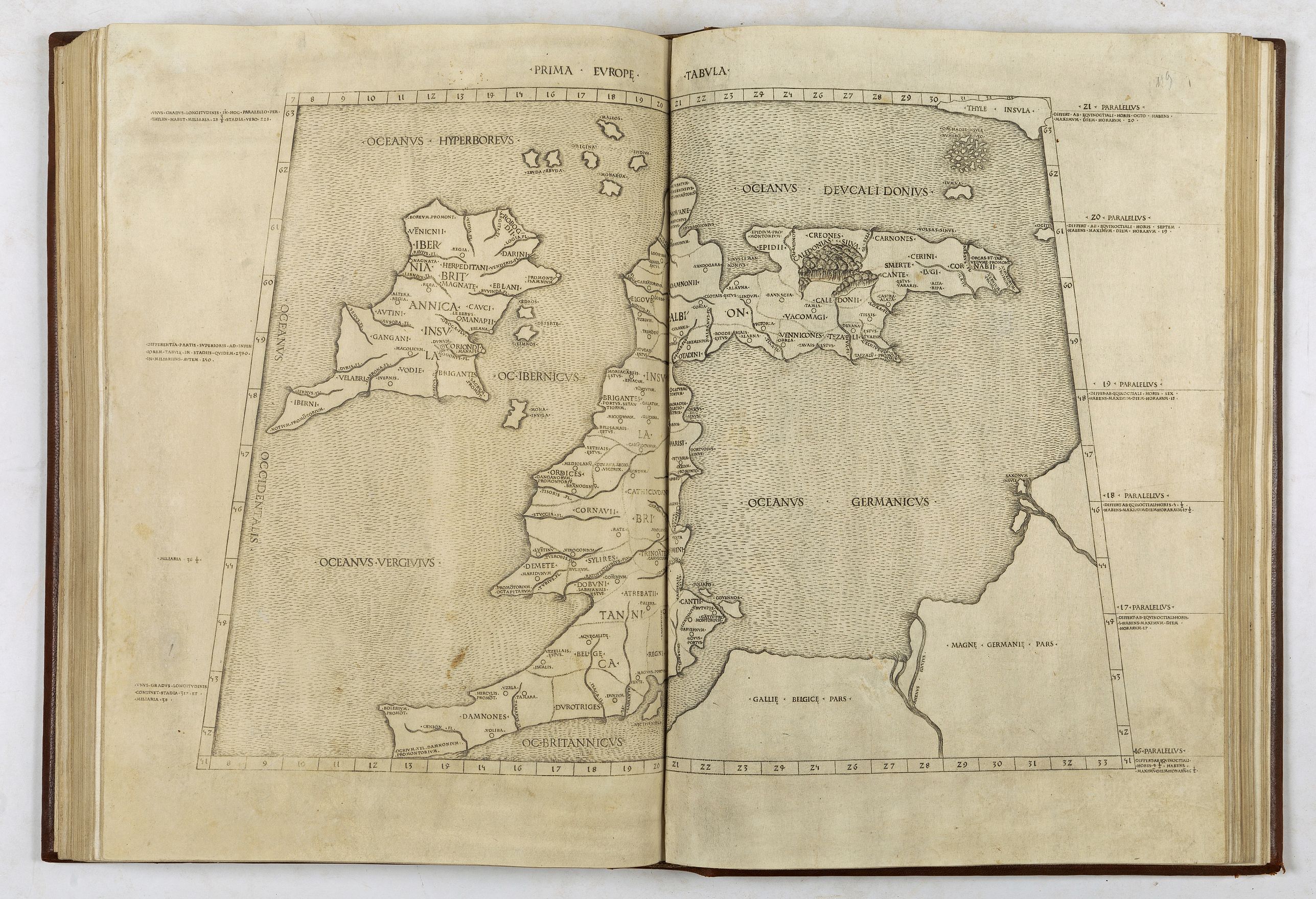
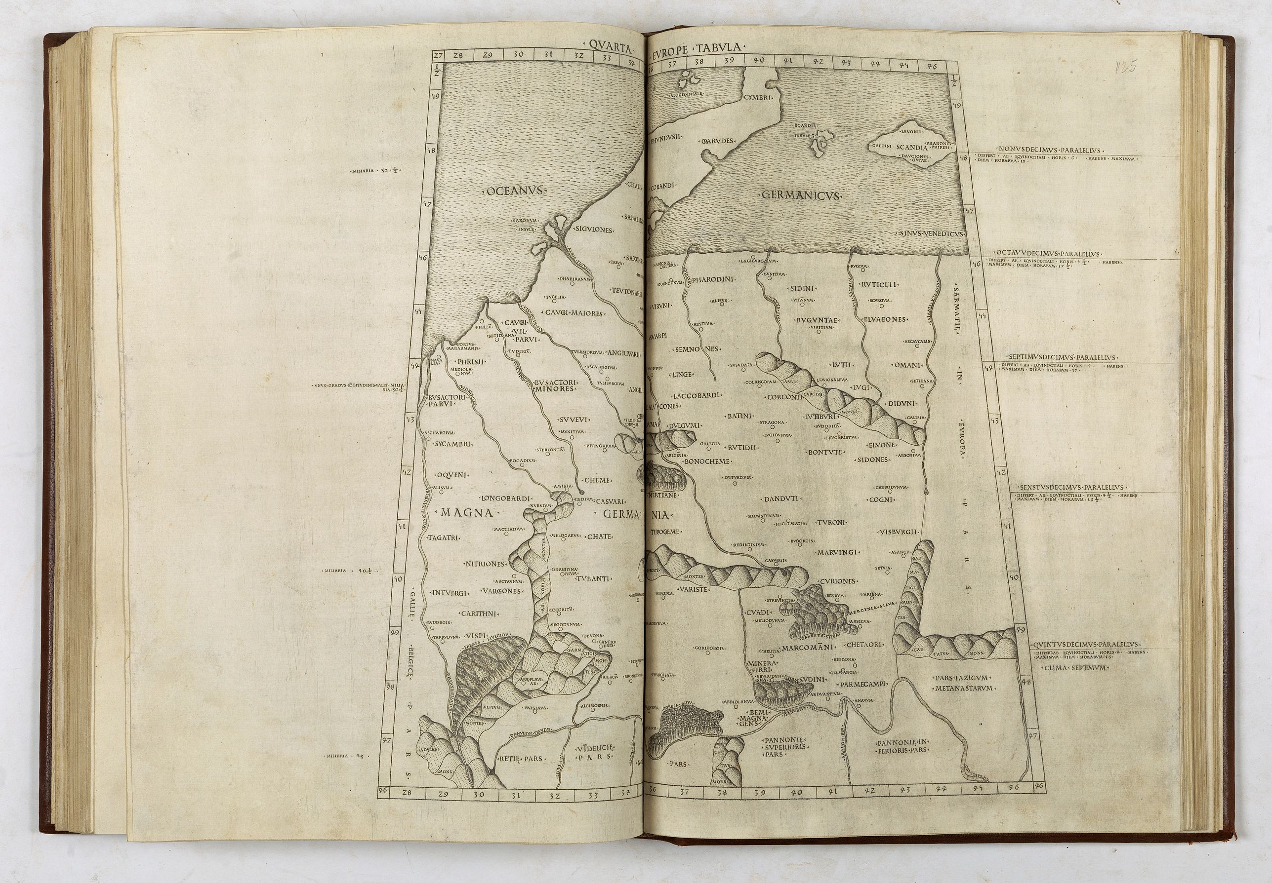
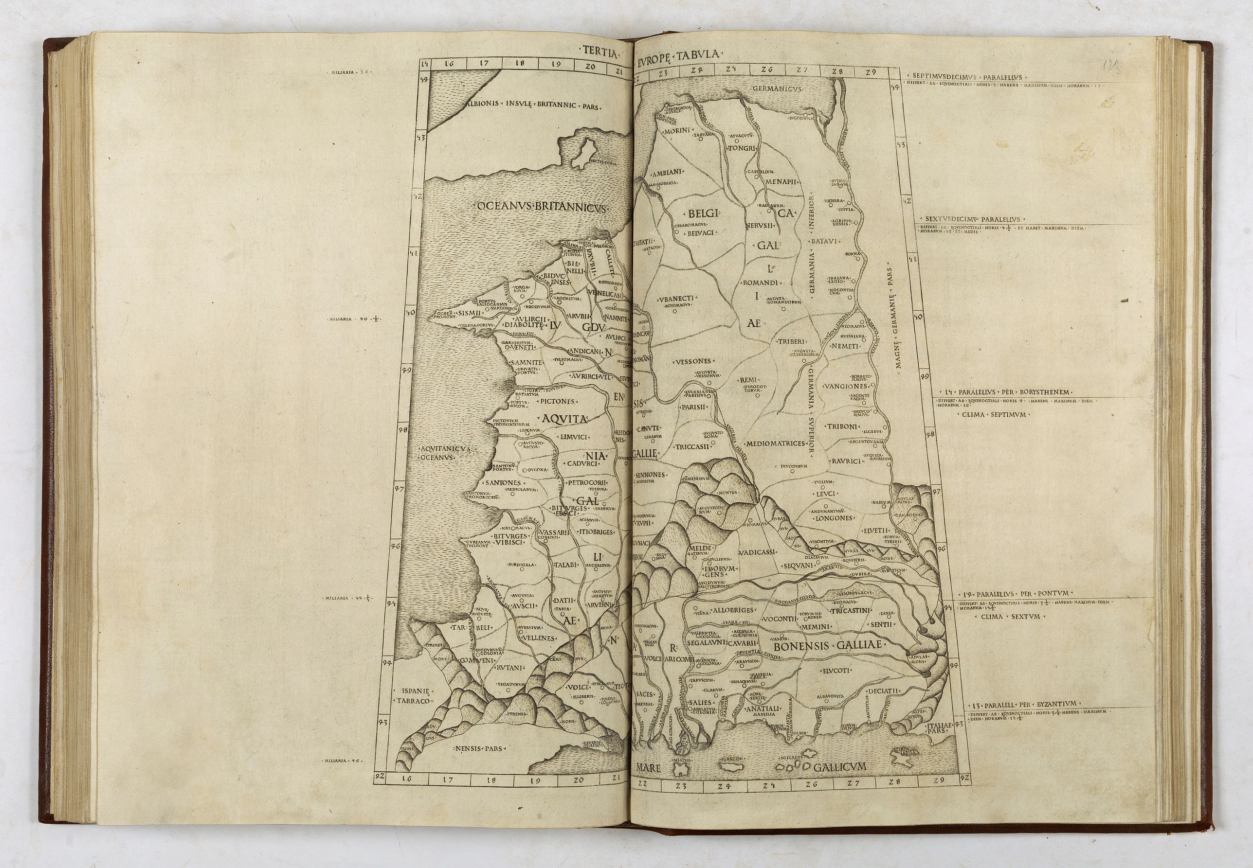
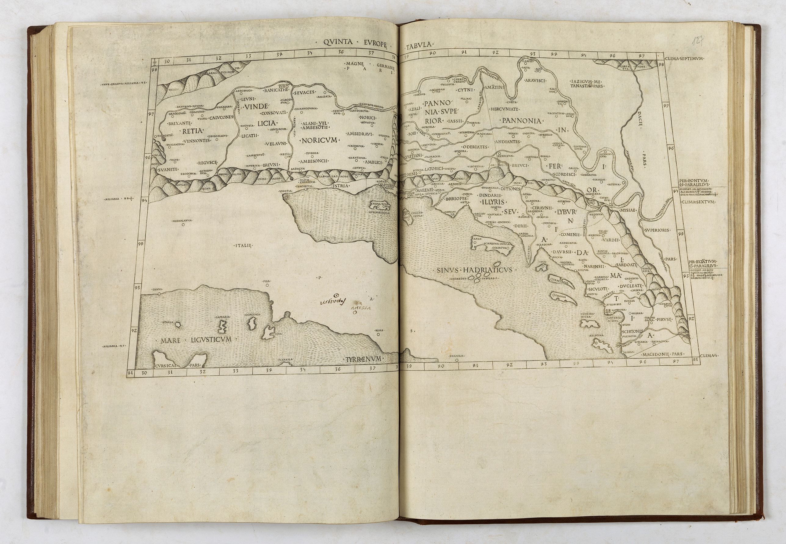
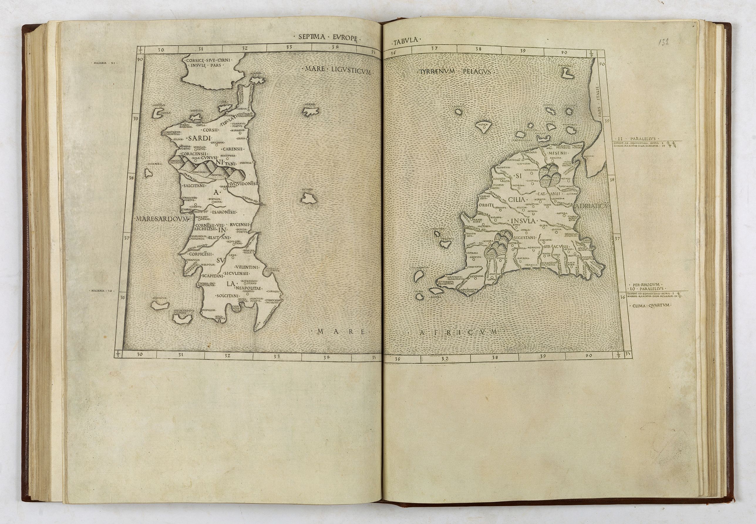
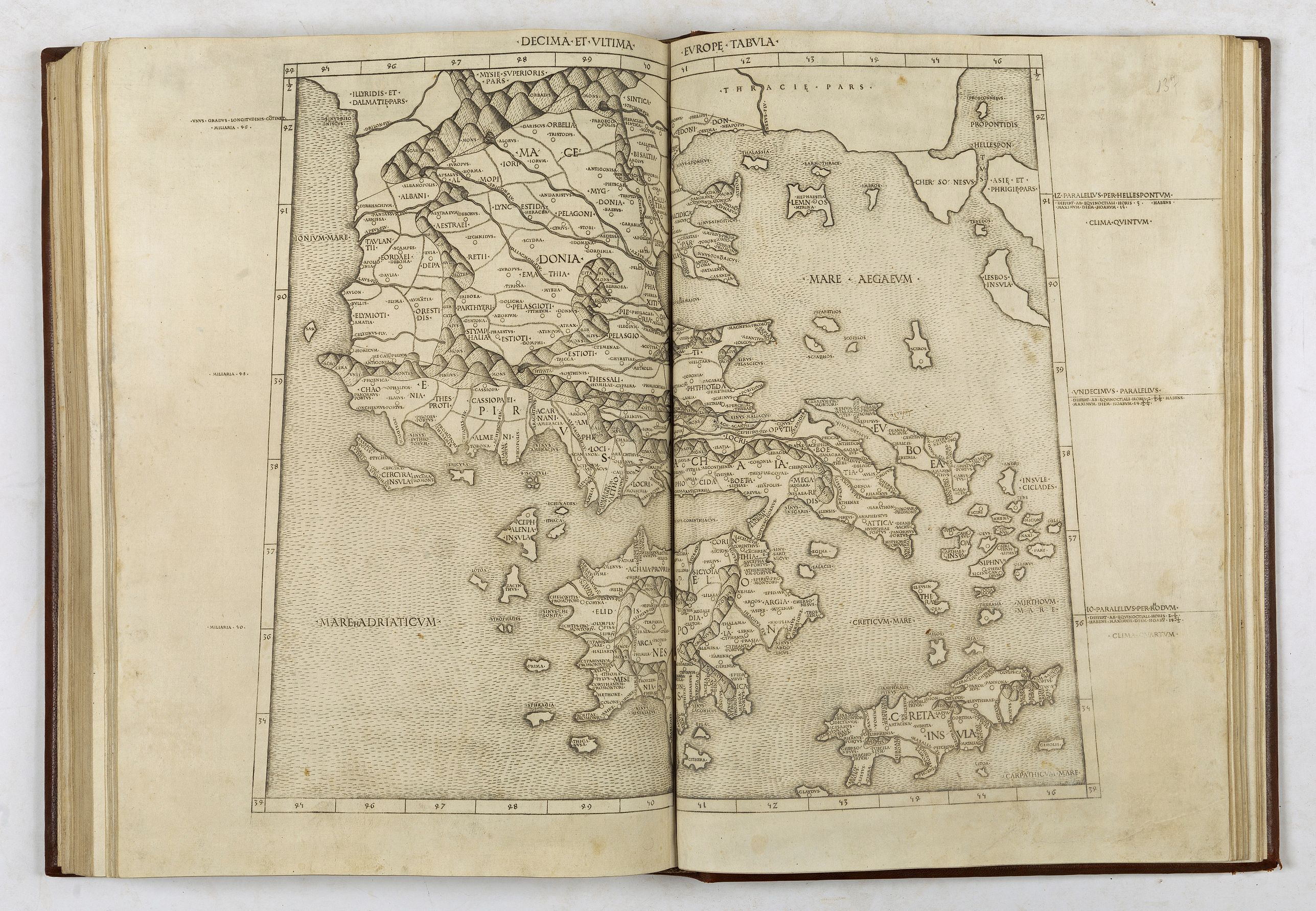
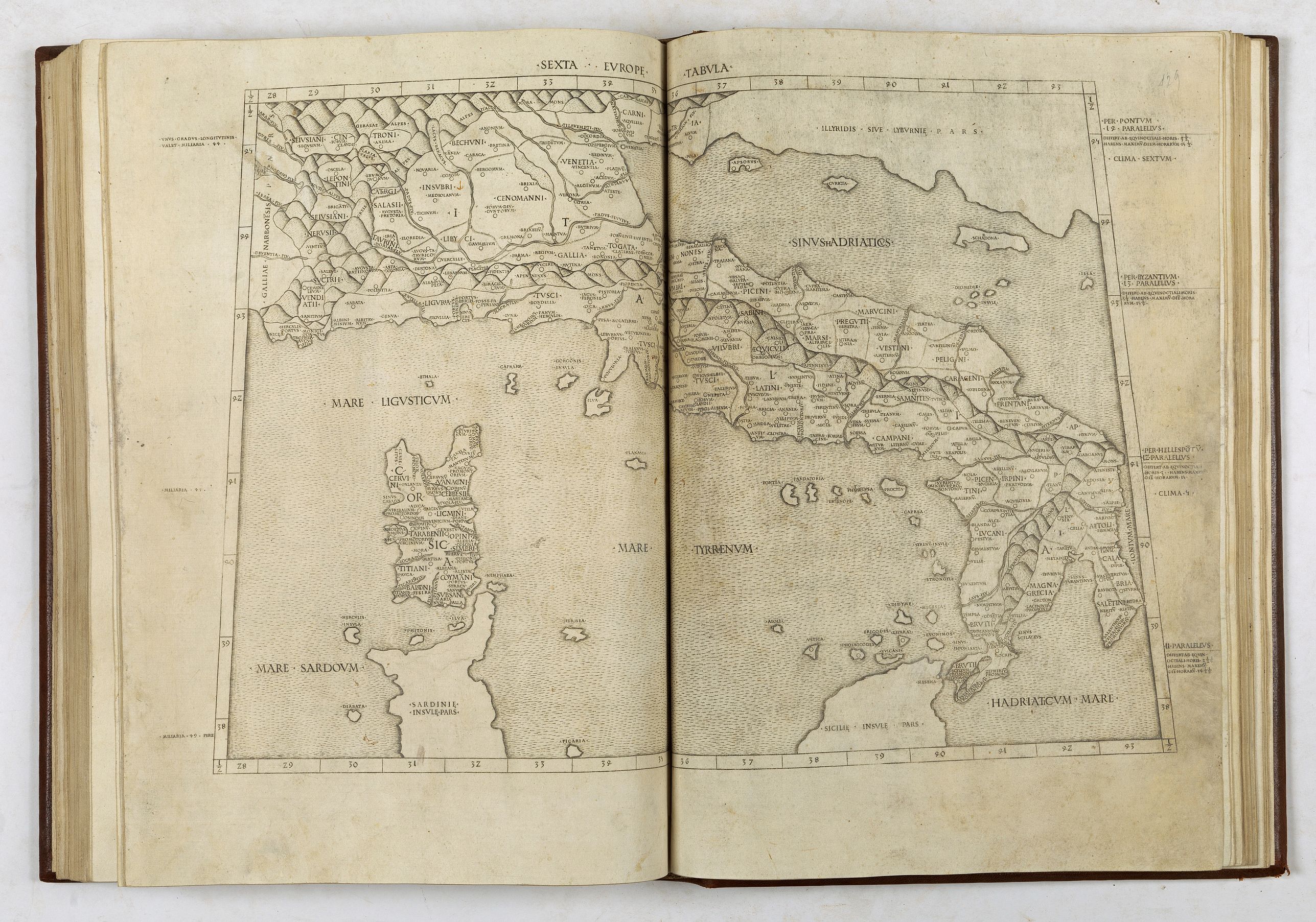
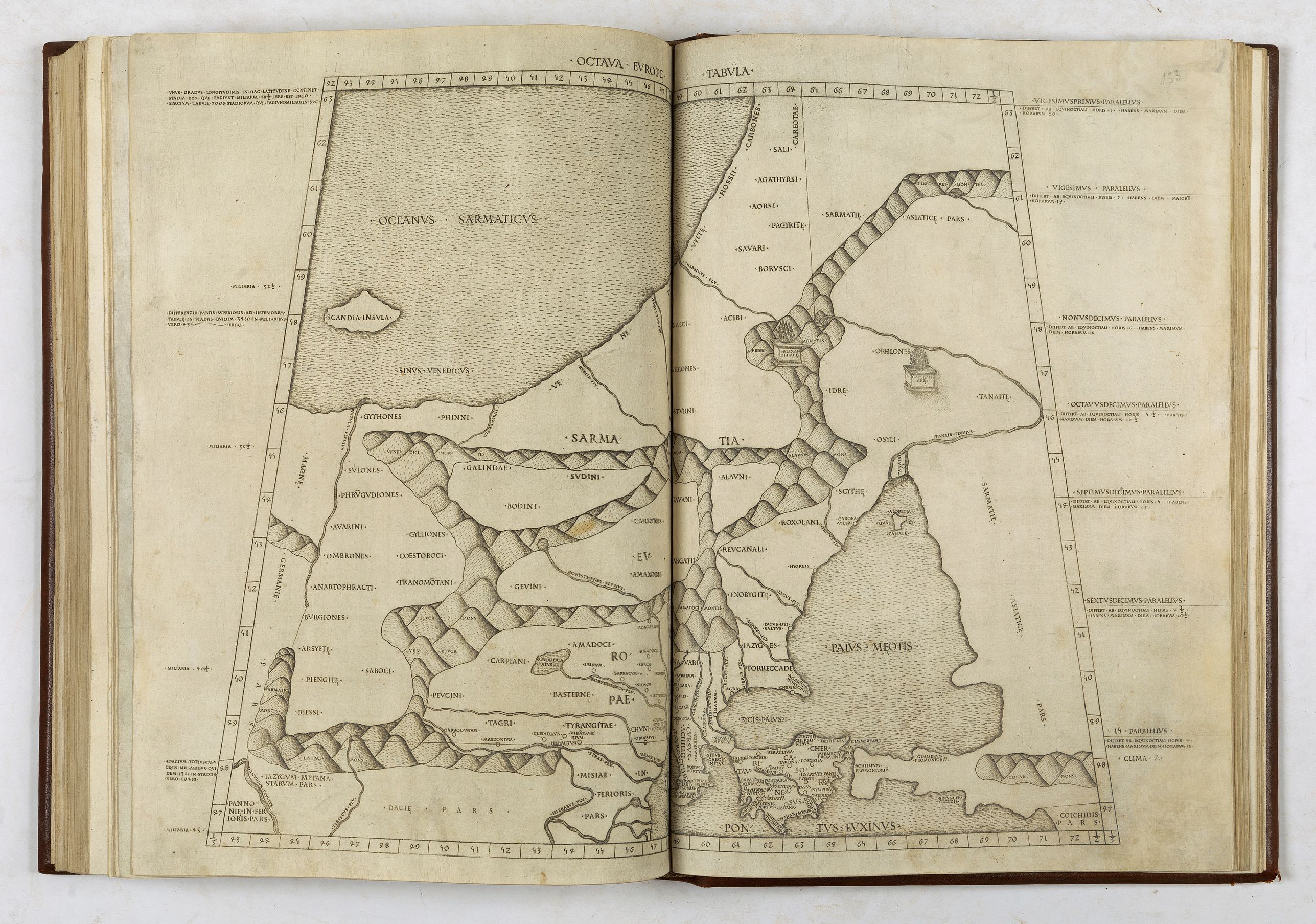
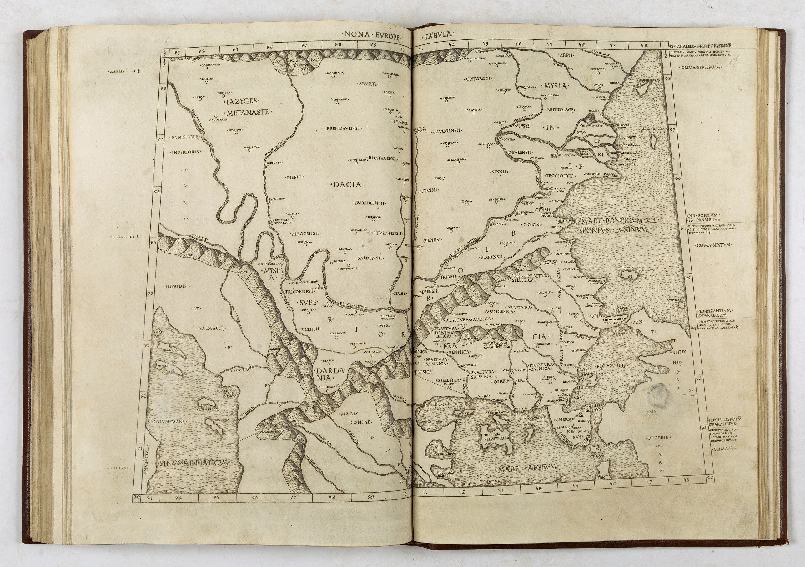
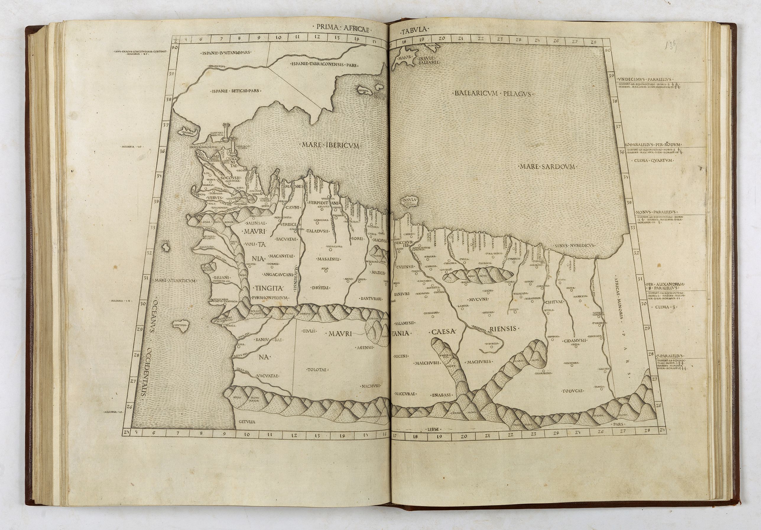
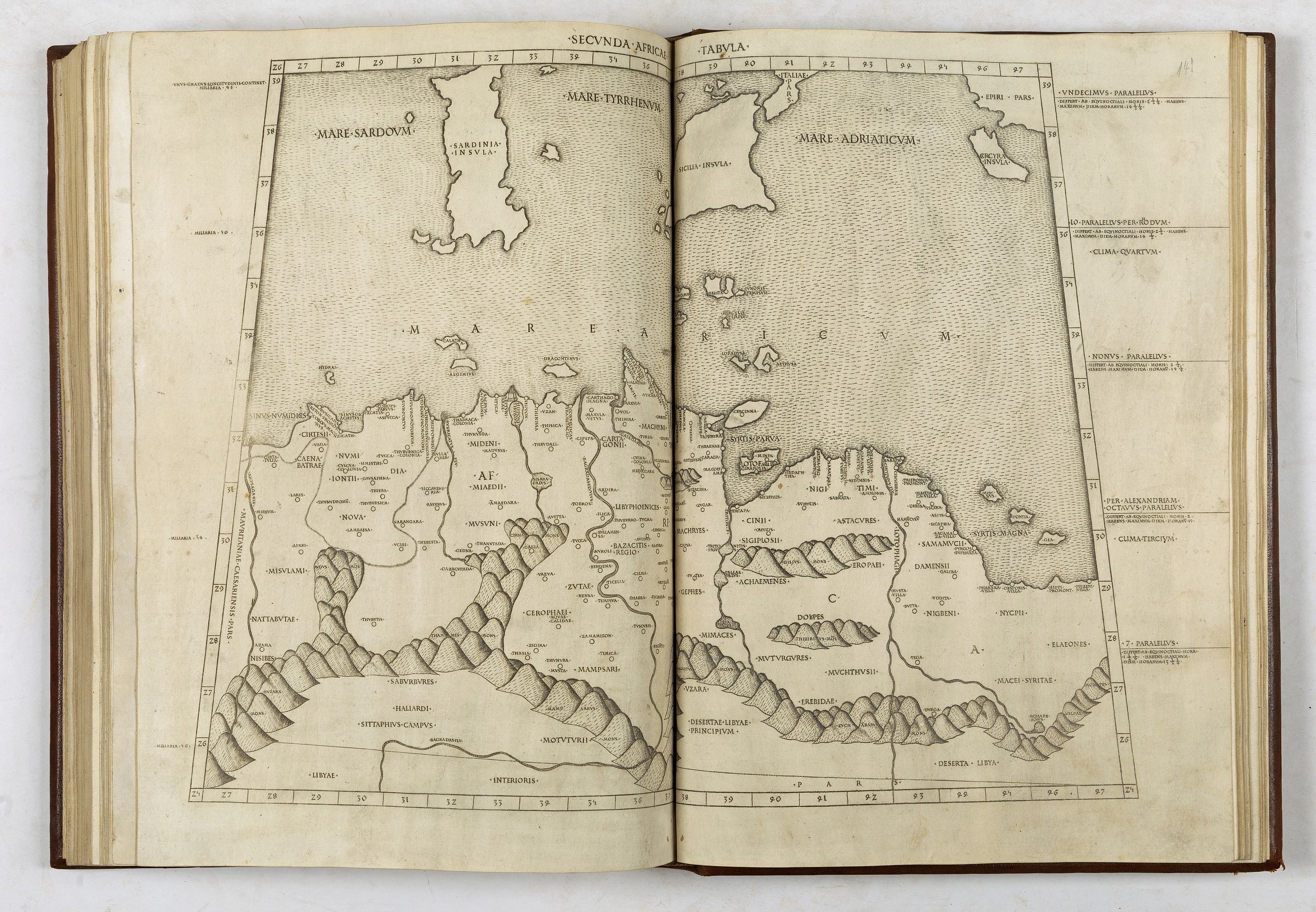
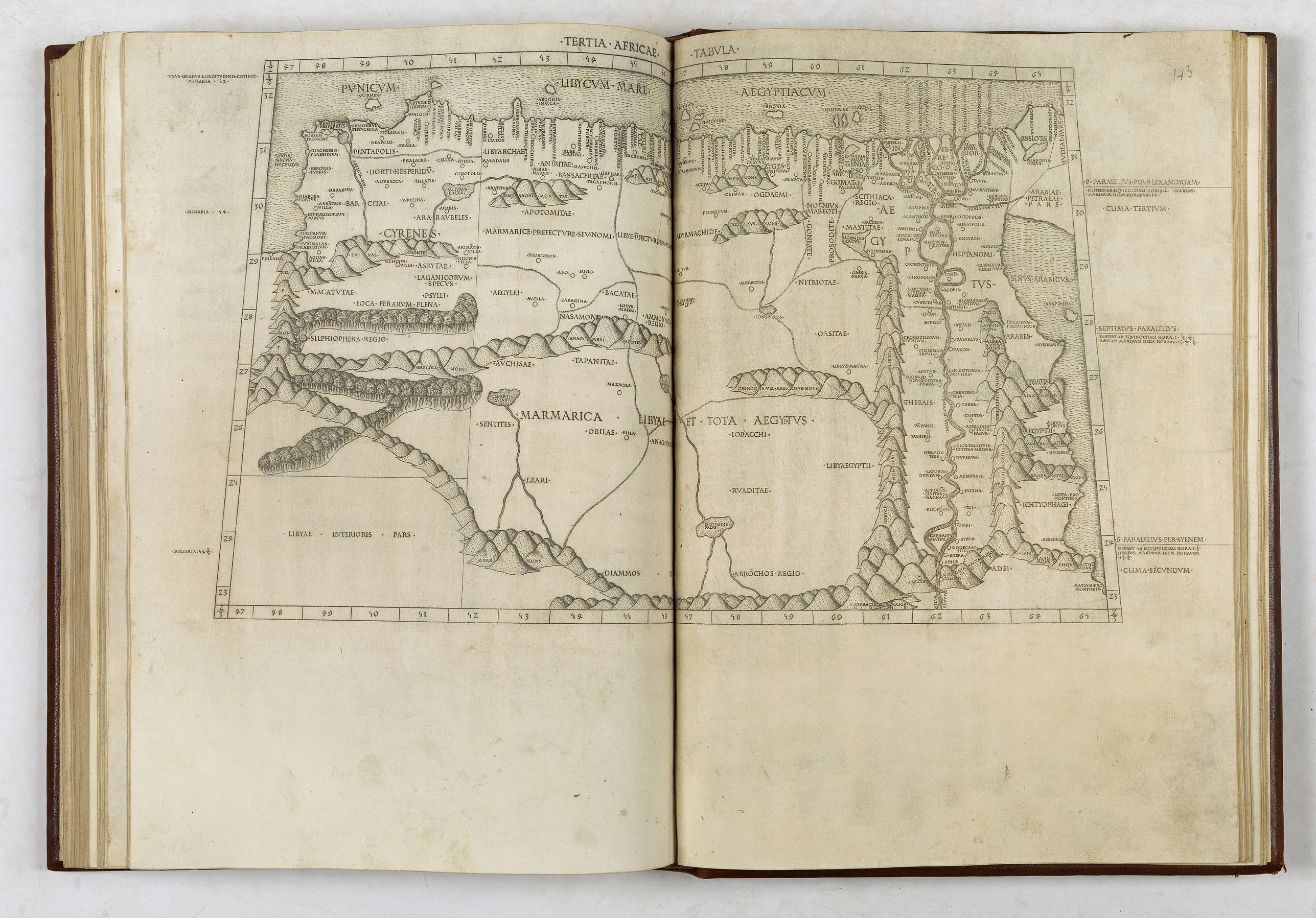
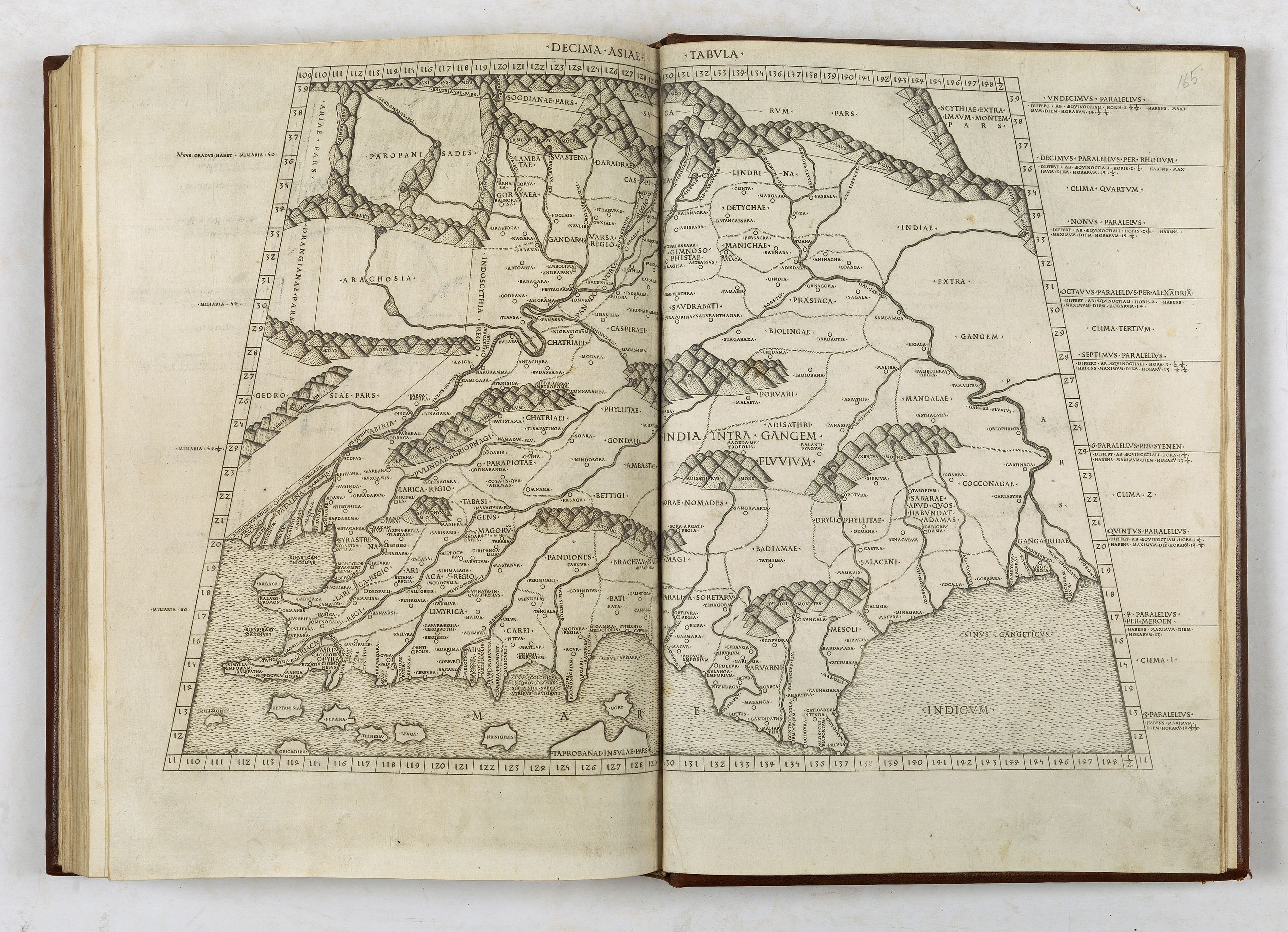
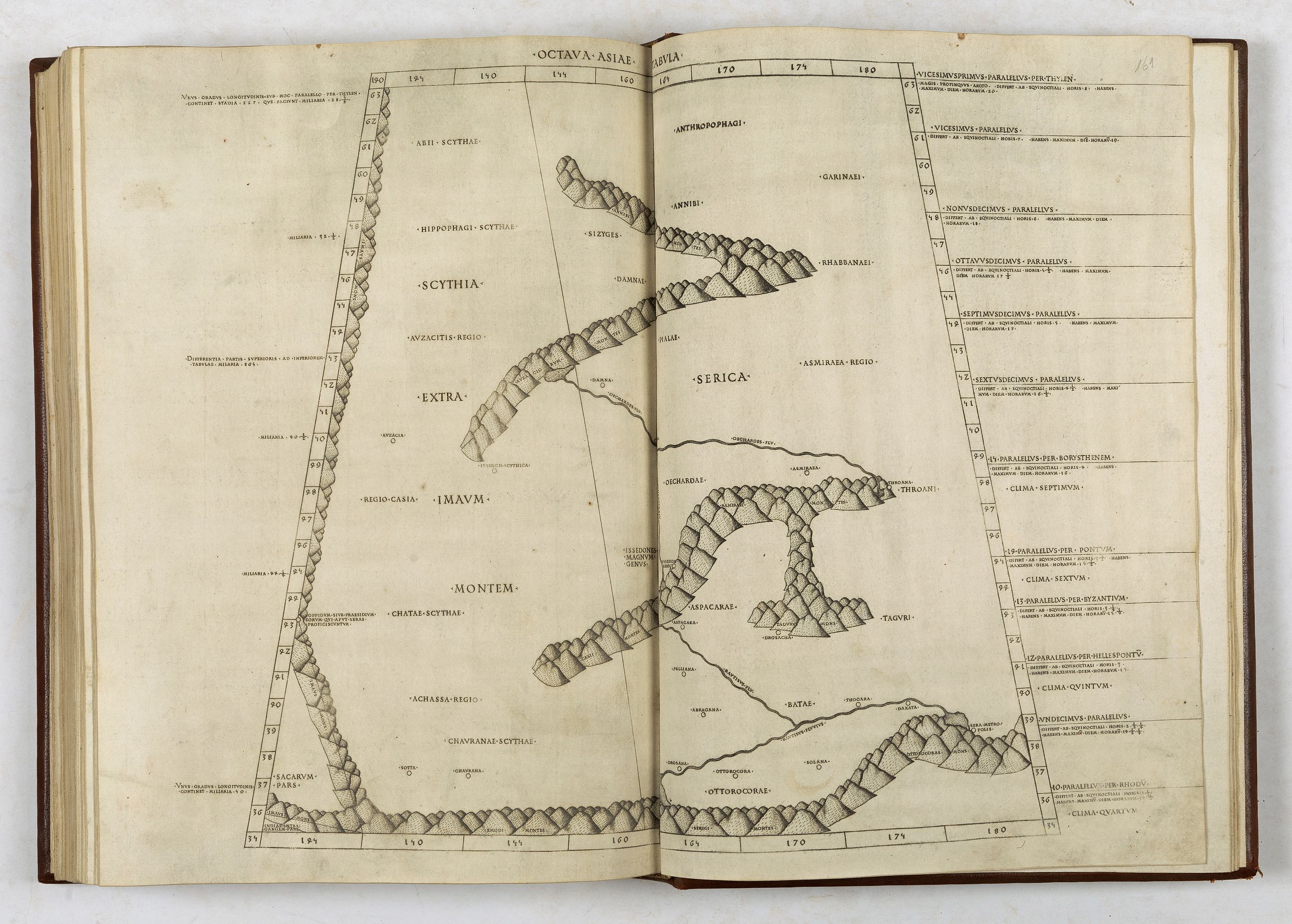
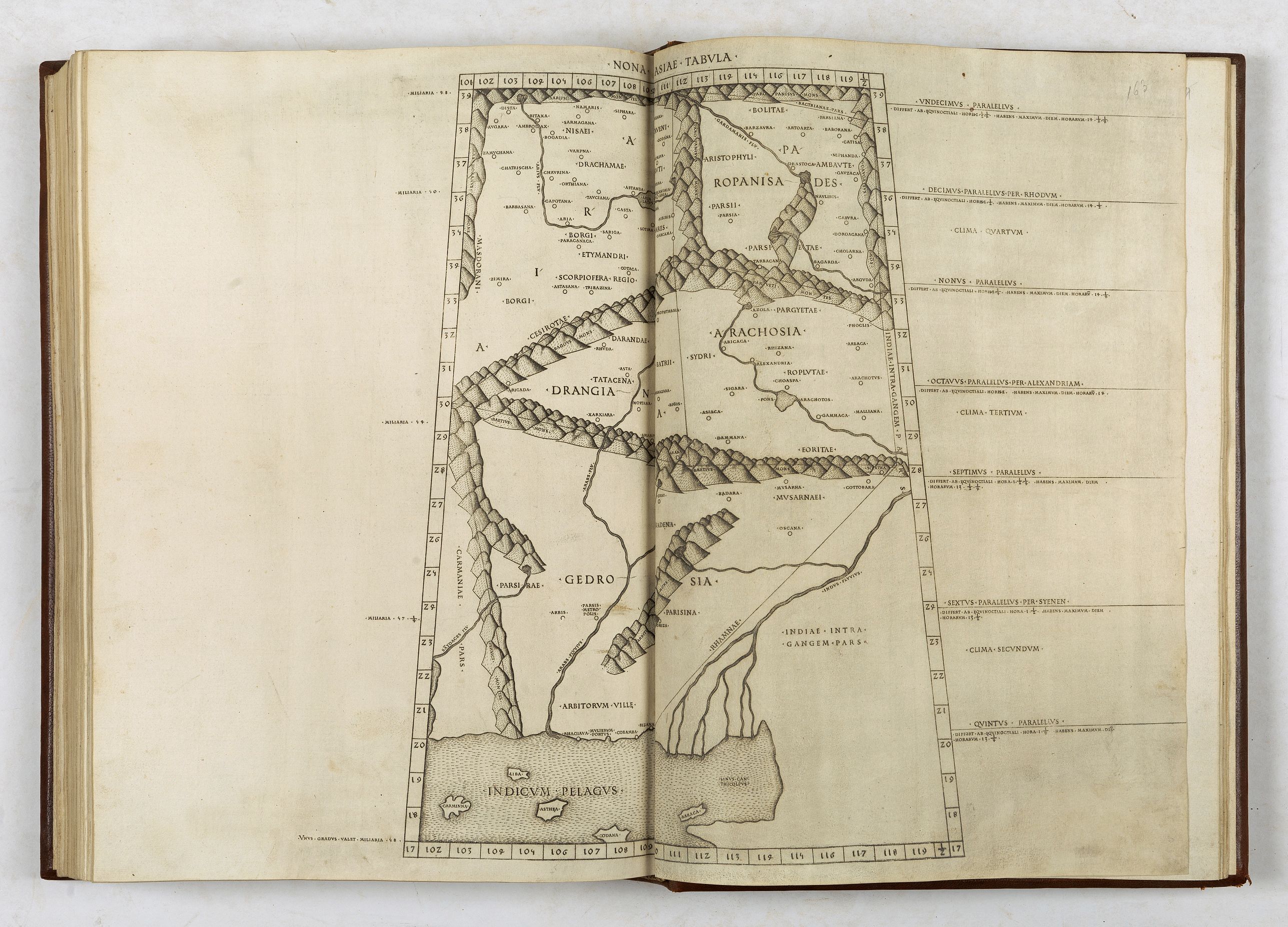
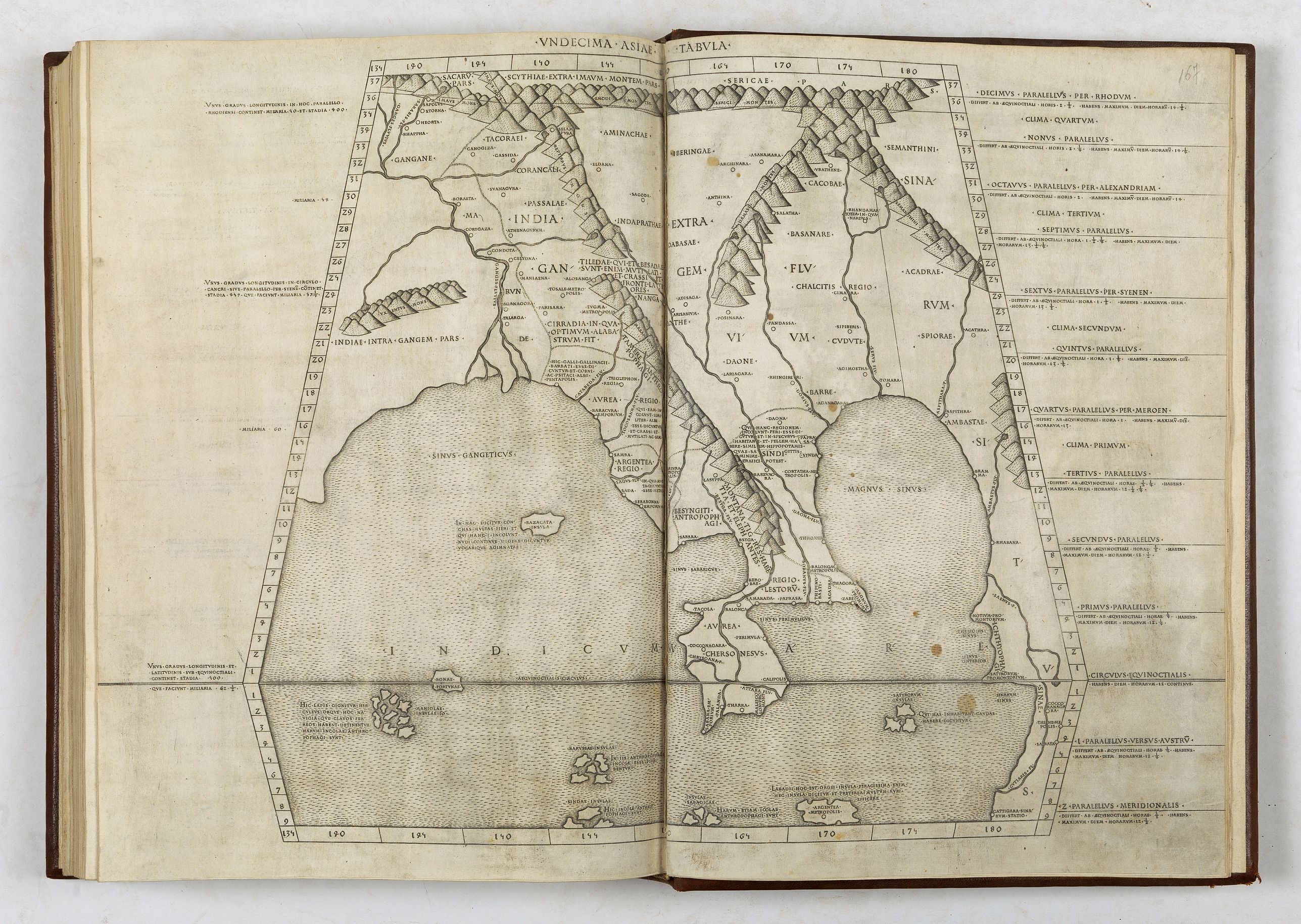
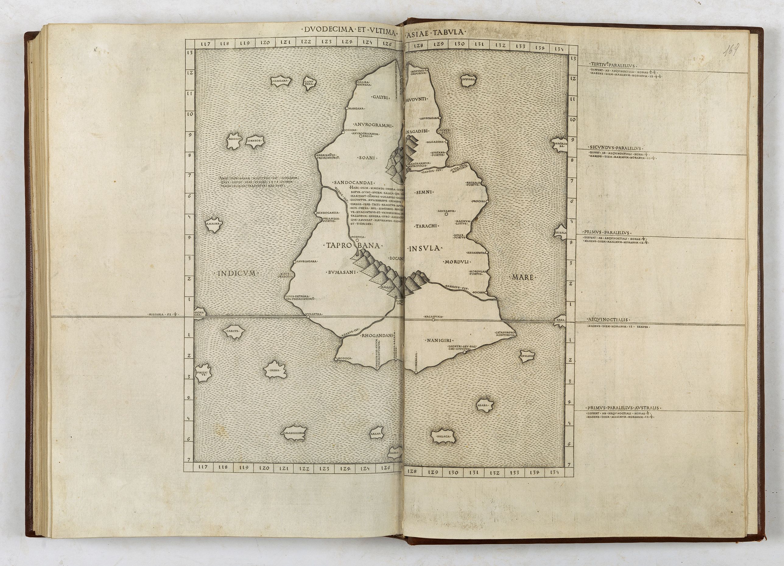
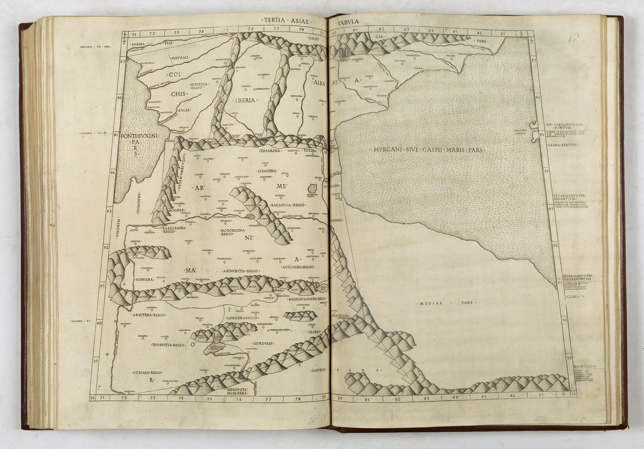
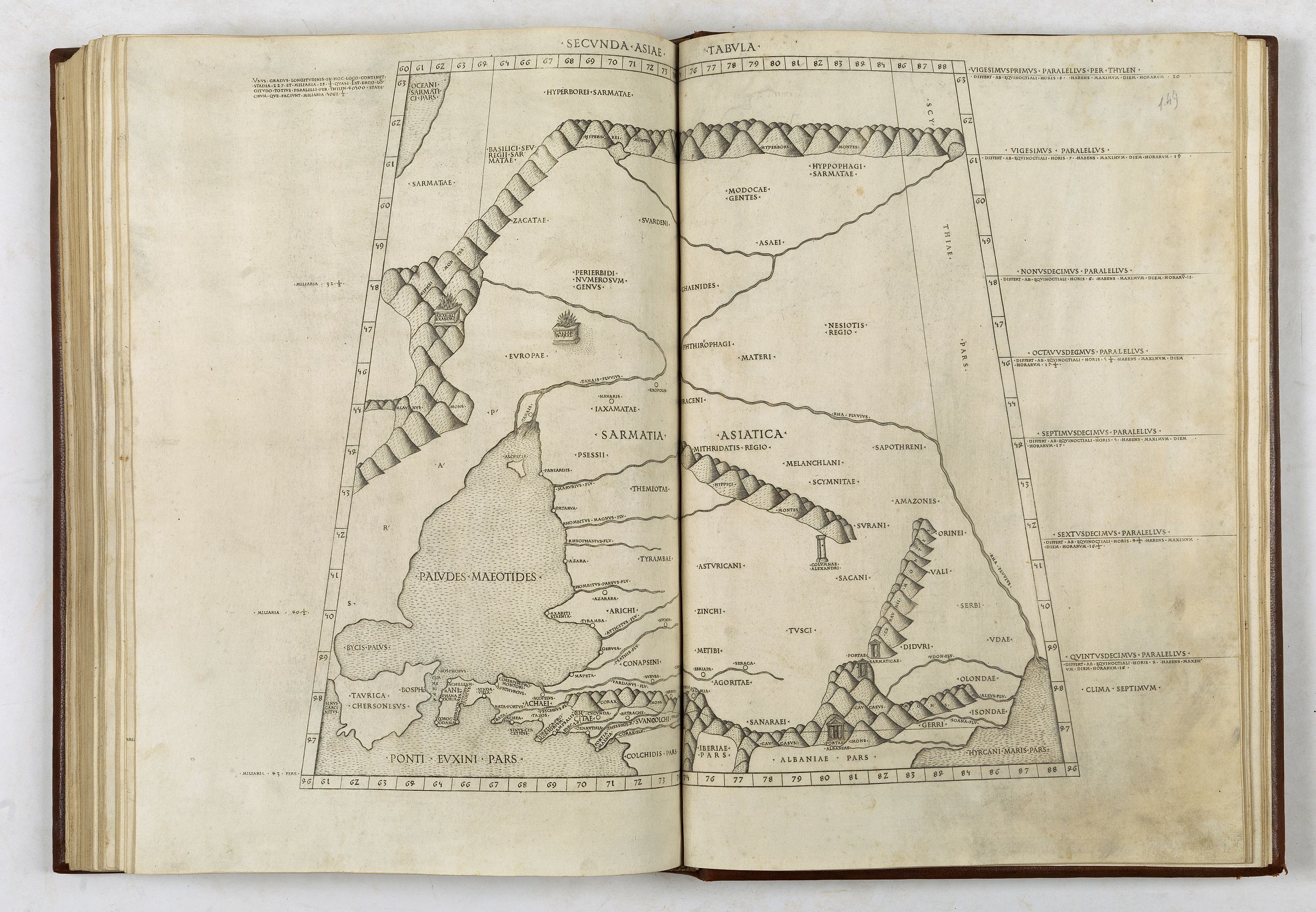
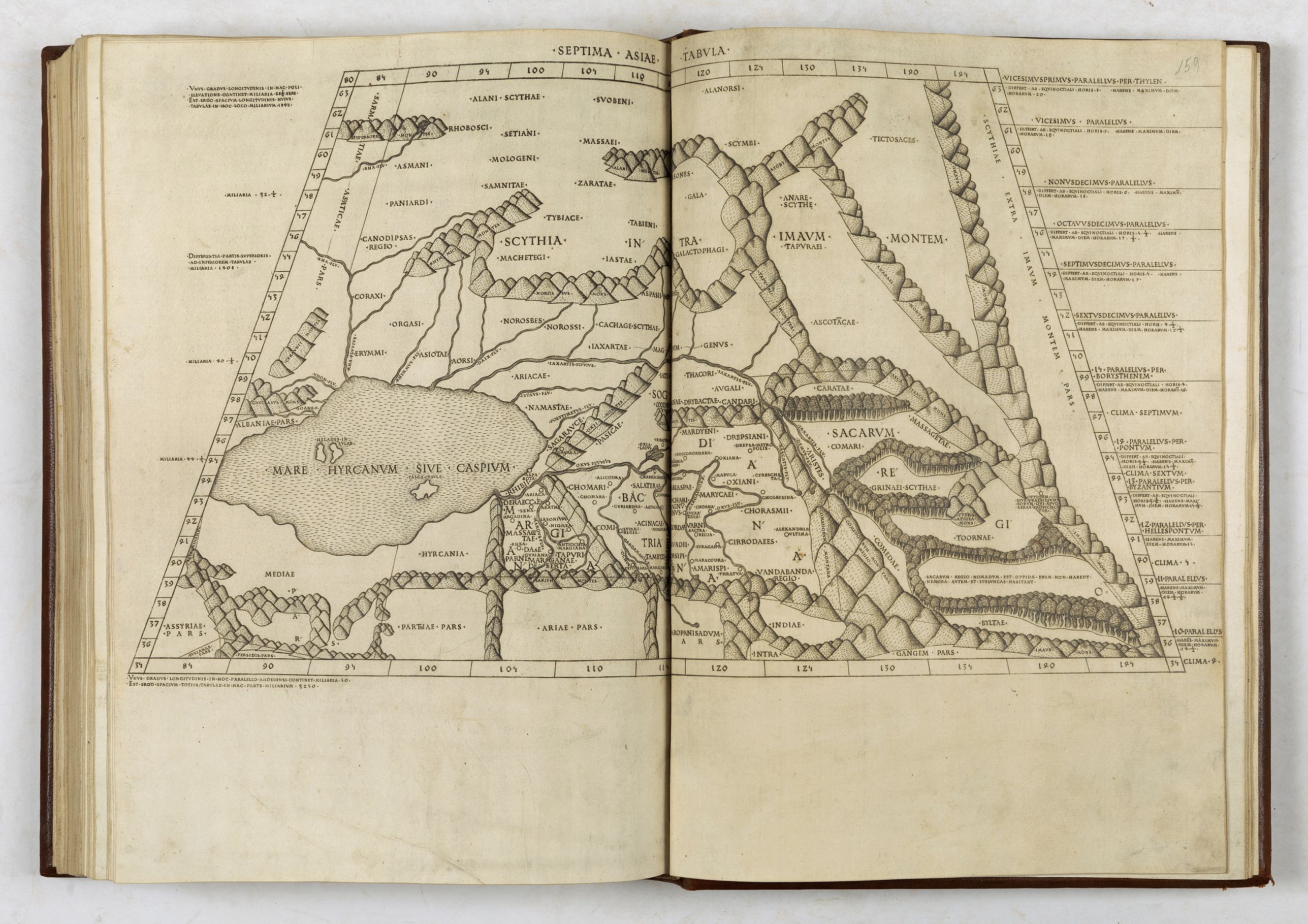
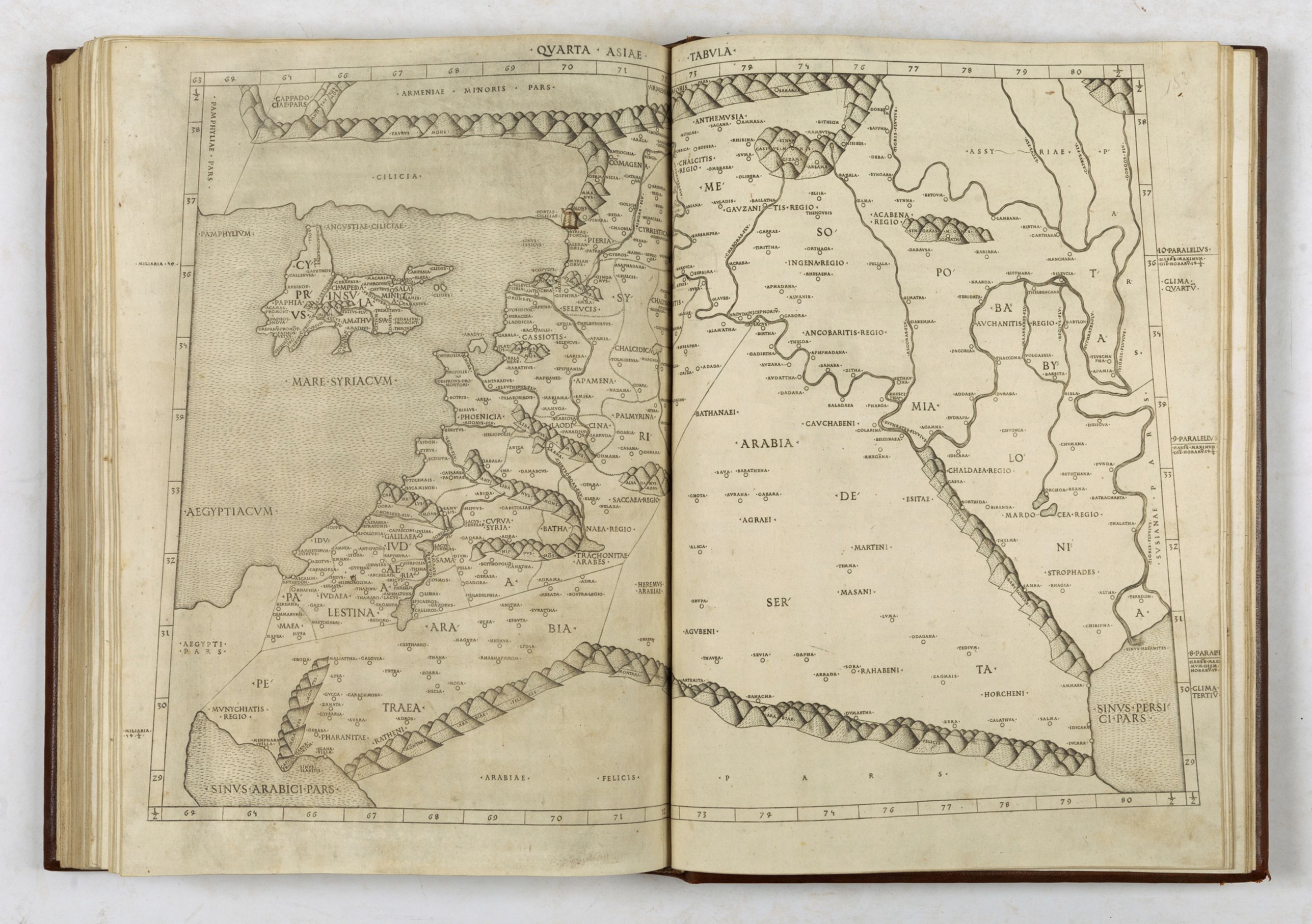
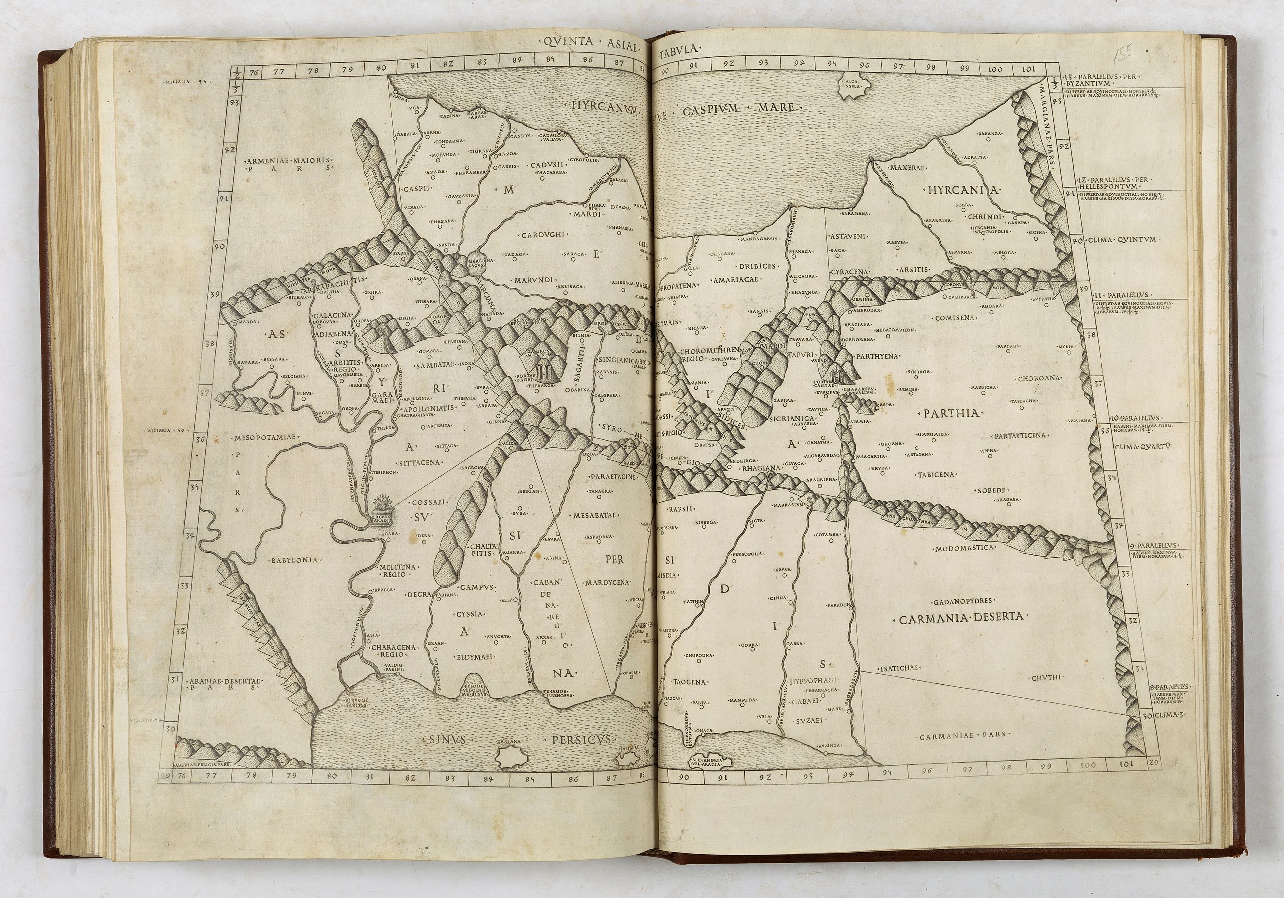
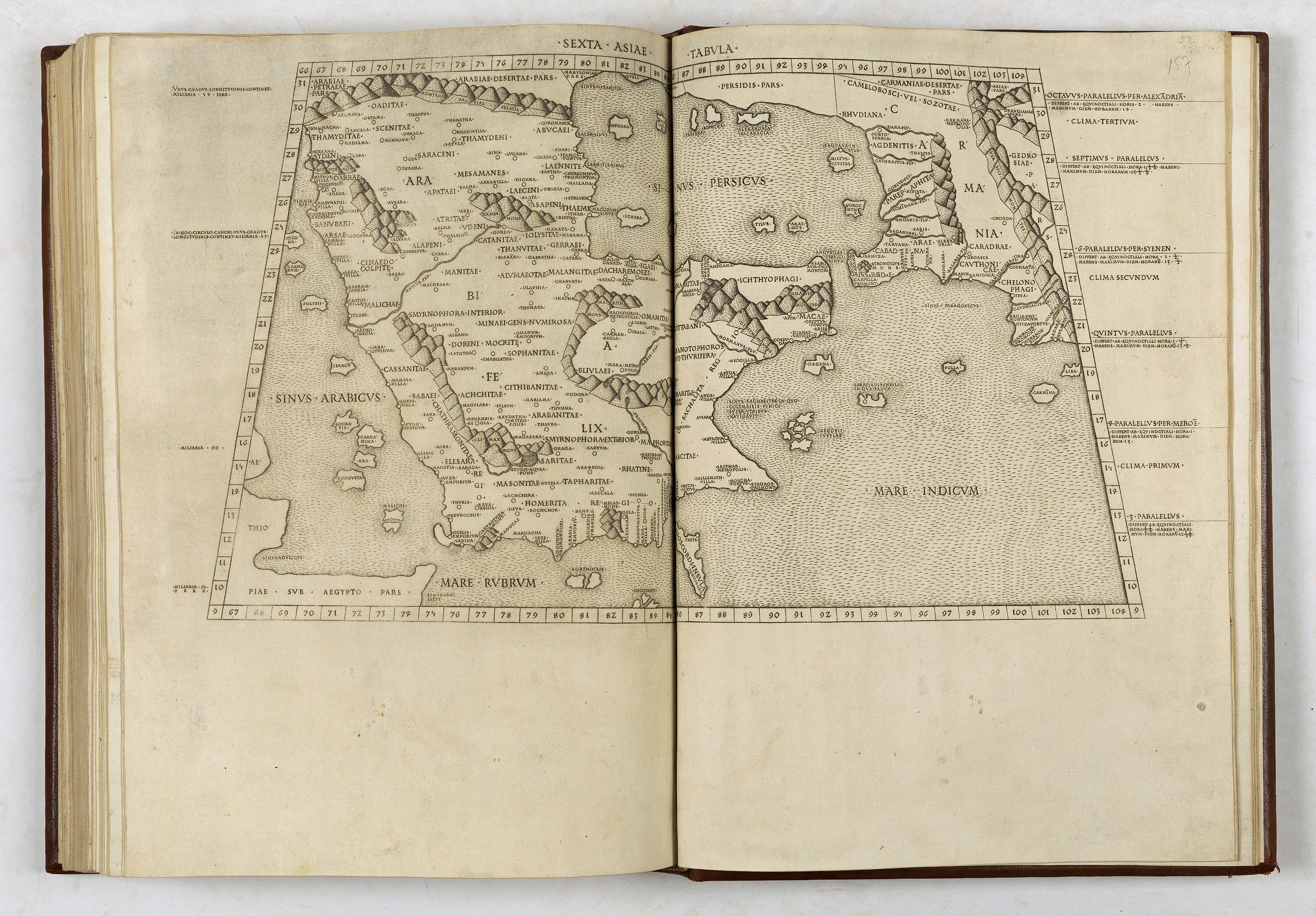
Collation: A-C8 D-E6 (A1 blank missing, A2r Registrum alphabeticum, E6 blank missing); a10 b-g8 h4 (a1 blank missing a2r text, h4 blank missing); 2a-b8 c6 (2a1r blank, 2a1v registrum super tractum de tribus orbis partibus, 2a2r-2c5r de locis ac mirabilibus mundi et primo de tribus orbis partibus, 2c5r colophon Hoc opus Ptholomei memorabile quidem et insigne exactissima diligentia castigatum iucondo quodam caractere impressum fuit et completum Rome anno a nativitate Domini .M.CCCC.LXXXX die .IV. Novembris. Arte ac impensis Petri de Turre, 2c5v-2c6 blank missing).27 DOUBLE-PAGE ENGRAVED MAPS, each printed from two copper plates. Type 1:111R. In total 115 text sheets, text on double column, 53 lines and headline. Initial spaces., 4 woodcut diagrams on a9v, a10r (2), and a10v.
Second Rome edition. "This handsome edition is a reprinting of the copper-plate maps of the 1478 Ptolemy [the first Rome edition by Conrad Sweynheym and Arnold Buckinck, whose] maps are considered the finest Ptolemaic ones produced up to the time that the great Mercator engraved his Ptolemy of 1578…
It is believed that Sweynheym was the one who first thought of applying the very new art of copper engraving to the printing of maps, and he might have taken a hand in the actual engraving of them himself" (World Encompassed).
While the Bologna edition of 1477 was the first atlas to use copperplate maps, the present series is generally regarded as superior for its clear captions, accurate projections and overall design and there are indications the Bologna edition was hurried through the press.
The captions were stamped into the plates, not engraved.
The watermarks: The text leaves are watermarked with a cross within a circle, and maps are watermarked with a cardinal hat. (cf. on the 'Cosmographia' editions: R. Peerlings, F. Laurentius & J. v.d. Bovenkamp, Quaerendo, vol. 47, nr. 3-4, (2017), p. 315 and also (at length): https://www.berlinghieri.eu by R. Peerlings and F. Laurentius).
"This handsome edition is a reprinting of the copper-plate maps of the 1478 Ptolemy [the first Rome edition by Conrad Sweynheym and Arnold Buckinck, whose] maps are considered the finest Ptolemaic ones produced up to the time that the great Mercator engraved his Ptolemy of 1578... It is believed that Sweynheym was the one who first thought of applying the very new art of copper engraving to the printing of maps, and he might have taken a hand in the actual engraving of them himself" (World Encompassed).
While the Bologna edition of 1477 was the first atlas to use copperplate maps, the present series is generally regarded as superior for its clear captions, accurate projections and overall design. Also, there are indications the Bologna edition was hurried through the press: the captions were not engraved but stamped into the plates.
The early Italian Ptolemys, particularly the Rome editions, are "superb testimonials of Italian craftsmanship without the picturesque but unscientific monsters of the medieval maps or the addition of the adventitious decoration of later work, relying for their beauty solely on the delicacy of their execution and the fineness of the material employed" (Tooley).
As Tooley observes, the maps in the atlas have no external border decorations or co-ordinate lines, relying instead on the clarity of the engraving.
The plates for the Rome editions of Ptolemy were several years in the making, and they are considered to be "the finest Ptolemaic plates produced until Gerard Mercator engraved his classical world atlas" a century later (Shirley). They were produced by two German printers, Conrad Sweynheym and Arnold Buckinck, and "it is believed that Sweynheym was the one who first thought of applying the very new art of copper-engraving to the printing of maps, and he might have taken a hand in the actual engraving of them himself" (Scammell).
References: BMC IV, 133; BSB-Ink P-861; Goff P-1086; HC 13541; Nordernskiöld 7; Sabin 66474; Shirley 4; The World Encompassed 40
Collation: A-C8 D-E6 (A1 blank missing, A2r Registrum alphabeticum, E6 blank missing); a10 b-g8 h4 (a1 blank missing a2r text, h4 blank missing); 2a-b8 c6 (2a1r blank, 2a1v registrum super tractum de tribus orbis partibus, 2a2r-2c5r de locis ac mirabilibus mundi et primo de tribus orbis partibus, 2c5r colophon Hoc opus Ptholomei memorabile quidem et insigne exactissima diligentia castigatum iucondo quodam caractere impressum fuit et completum Rome anno a nativitate Domini .M.CCCC.LXXXX die .IV. Novembris. Arte ac impensis Petri de Turre, 2c5v-2c6 blank missing).
27 DOUBLE-PAGE ENGRAVED MAPS, each printed from two copper plates. Type 1:111R. In total 115 text sheets, text on double column, 53 lines and headline. Initial spaces., 4 woodcut diagrams on a9v, a10r (2), and a10v.
Second Rome edition. "This handsome edition is a reprinting of the copper-plate maps of the 1478 Ptolemy [the first Rome edition by Conrad Sweynheym and Arnold Buckinck, whose] maps are considered the finest Ptolemaic ones produced up to the time that the great Mercator engraved his Ptolemy of 1578…
It is believed that Sweynheym was the one who first thought of applying the very new art of copper engraving to the printing of maps, and he might have taken a hand in the actual engraving of them himself" (World Encompassed).
While the Bologna edition of 1477 was the first atlas to use copperplate maps, the present series is generally regarded as superior for its clear captions, accurate projections and overall design and there are indications the Bologna edition was hurried through the press.
The captions were stamped into the plates, not engraved.
The watermarks: The text leaves are watermarked with a cross within a circle, and maps are watermarked with a cardinal hat. (cf. on the 'Cosmographia' editions: R. Peerlings, F. Laurentius & J. v.d. Bovenkamp, Quaerendo, vol. 47, nr. 3-4, (2017), p. 315 and also (at length): https://www.berlinghieri.eu by R. Peerlings and F. Laurentius).
"This handsome edition is a reprinting of the copper-plate maps of the 1478 Ptolemy [the first Rome edition by Conrad Sweynheym and Arnold Buckinck, whose] maps are considered the finest Ptolemaic ones produced up to the time that the great Mercator engraved his Ptolemy of 1578... It is believed that Sweynheym was the one who first thought of applying the very new art of copper engraving to the printing of maps, and he might have taken a hand in the actual engraving of them himself" (World Encompassed).
While the Bologna edition of 1477 was the first atlas to use copperplate maps, the present series is generally regarded as superior for its clear captions, accurate projections and overall design. Also, there are indications the Bologna edition was hurried through the press: the captions were not engraved but stamped into the plates.
The early Italian Ptolemys, particularly the Rome editions, are "superb testimonials of Italian craftsmanship without the picturesque but unscientific monsters of the medieval maps or the addition of the adventitious decoration of later work, relying for their beauty solely on the delicacy of their execution and the fineness of the material employed" (Tooley).
As Tooley observes, the maps in the atlas have no external border decorations or co-ordinate lines, relying instead on the clarity of the engraving.
The plates for the Rome editions of Ptolemy were several years in the making, and they are considered to be "the finest Ptolemaic plates produced until Gerard Mercator engraved his classical world atlas" a century later (Shirley). They were produced by two German printers, Conrad Sweynheym and Arnold Buckinck, and "it is believed that Sweynheym was the one who first thought of applying the very new art of copper-engraving to the printing of maps, and he might have taken a hand in the actual engraving of them himself" (Scammell).
References: BMC IV, 133; BSB-Ink P-861; Goff P-1086; HC 13541; Nordernskiöld 7; Sabin 66474; Shirley 4; The World Encompassed 40
FAQ - Guarantee - Shipping
Buying in the BuyNow Gallery
This item is available for immediate purchase when a "Add to Cart" or "Inquire Now" button is shown.
Items are sold in the EU margin scheme
Payments are accepted in Euros or US Dollars.
Authenticity Guarantee
 We provide professional descriptions, condition report (based on 45 years experience in the map business)
Paulus Swaen warrants the authenticity of our items and a certificate of authenticity is provided for each acquired lot.
Condition and Coloring
We indicate the condition of each item and use our unnique HiBCoR grading system in which four key items determine a map's value: Historical Importance, Beauty, Condition/Coloring and Rarity.
Color Key
We offer many maps in their original black and white condition. We do not systematically color-up maps to make them more sellable to the general public or buyer.
Copper engraved or wood block maps are always hand colored. Maps were initially colored for aesthetic reasons and to improve readability. Nowadays, it is becoming a challenge to find maps in their original colors and are therefor more valuable.
We use the following color keys in our catalog:
Original colors; mean that the colors have been applied around the time the map was issued.
Original o/l colors; means the map has only the borders colored at the time of publication.
Colored; If the colors are applied recently or at the end of the 20th century.
Read more about coloring of maps [+]
Shipping fee
A flat shipping fee of $ 30 is added to each shipment by DHL within Europe and North America. This covers : International Priority shipping, Packing and Insurance (up to the invoice amount).
Shipments to Asia are $ 40 and rest of the world $50
We charge only one shipping fee when you have been successful on multiple items or when you want to combine gallery and auction purchases.
Read more about invoicing and shipping
FAQ
Please have a look for more information about buying in the BuyNow gallery
Many answers are likely to find in the general help section.
Virtual Collection
![]()
With Virtual Collection you can collect all your favorite items in one place. It is free, and anyone can create his or her Virtual map collection.
Unless you are logged in, the item is only saved for this session. You have to be registed and logged-in if you want to save this item permanently to your Virtual Collection.
Read More[+]
Register here, it is free and you do not need a credit card.
Add this item to
Virtual Collection
or click the following link to see my Virtual Collection.
| Digital Image Download | |
|
Paulus Swaen maintains an archive of most of our high-resolution rare maps, prints, posters and medieval manuscript scans. We make them freely available for download and study. Read more about free image download |
Click the image for a free small image download. |

In accordance with the EU Consumer Rights Directive and habitually reside in the European Union you have the right to cancel the contract for the purchase of a lot, without giving any reason.
The cancellation period will expire 14 calendar days from the day after the date on which you or a third party (other than the carrier and indicated by you) acquires, physical possession of the lot. To exercise the right to cancel you must inform Paulus Swaen Inc, of your decision to cancel this contract by a clear statement (e.g. a letter sent by post, or e-mail (amsterdam@swaen.com).
To meet the cancellation deadline, it is sufficient for you to send your communication concerning your exercise of the right to cancel before the cancellation period has expired.
