Please login to see price!.
Subscribe to be notified if similar examples become available.
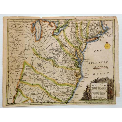
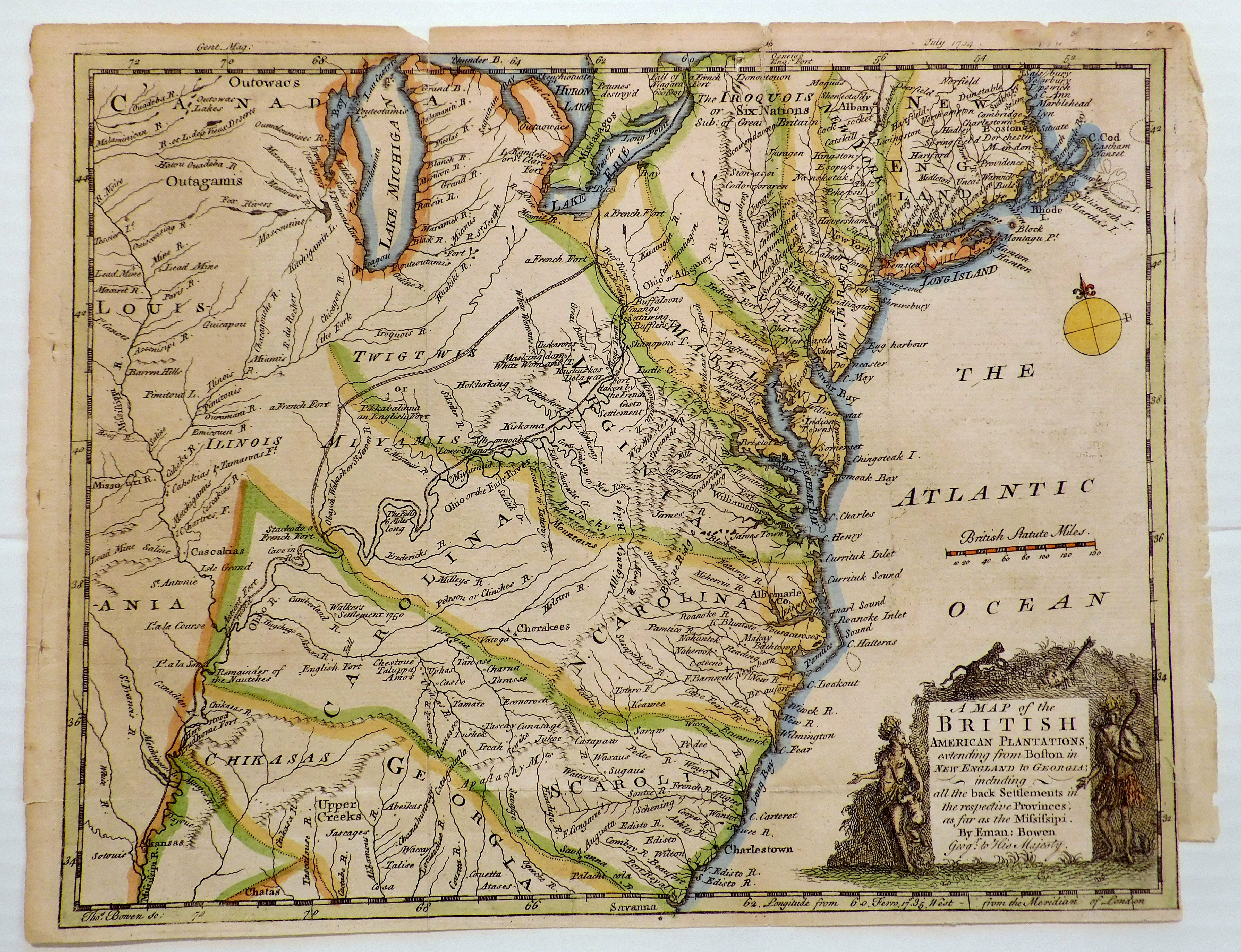
A MAP OF THE BRITISH AMERICAN PLANTATIONS, Extending From Boston.Including All The Back Settlements In The Respective Provinces, As Far As The Mississippi |
||||||||||||||||||||
|
||||||||||||||||||||
|
|
||||||||||||||||||||
|
Selling price: $...
Please login to see price! Sold in 2023 Missed this item! Be the first to get notified about our newly added listings. Add your name to our mailing list. Feel free to contact us if you have a question about this item. |
||||||||||||||||||||
Description
Covers New York and areas of New England, Pennsylvania, Maryland,
Virginia, North and South Carolina, Georgia and other states reaching to
the Mississippi River. Identifies Indian Nations and including all the black settlements in the provinces as far as the
Mississippi.
Elaborate cartouche depicting a monkey, slaves and child,
native people, arrow embedded in a head.
A Map of the British American Plantations, Extending from Boston, created by Emanuel Bowen in the 18th century, is a significant historical document that provides detailed information about the British colonies in North America during a crucial time in American history, just before the Revolutionary War. The map covers the northeastern coast of North America, including all the back settlements in the respective provinces, as far as the Mississippi River.
It includes information on the locations of towns, forts, and other important landmarks, as well as information on the natural features of the land, such as rivers and mountains. Additionally, it is significant for the detailed information provided on the Native American tribes in the region, providing an important glimpse into the diversity of the population of the region.
It is one of the first maps to include the back settlements in the respective provinces, which were not typically shown on maps of the time, giving us a glimpse into the lives of these people and the conditions under which they lived.
Furthermore, the map provides information on the political boundaries between the colonies and the Native American tribes, which was an important factor in the development of the colonies and their relationship with the surrounding indigenous people. Overall, A Map of the British American Plantations is an important primary source for researchers studying the history of early America and continues to be studied and referenced today.
FAQ - Guarantee - Shipping
Buying in the BuyNow Gallery
This item is available for immediate purchase when a "Add to Cart" or "Inquire Now" button is shown.
Payments are accepted in Euros or US Dollars. We accept most major credit cards, PayPal and bank transfer.
Authenticity Guarantee
 We provide professional descriptions, condition report and HiBCoR rating (based on 45 years experience in the map business)
We fully guarantee the authenticity of items we sell. We provide a certificate of authenticity for each purchased item.
Condition / Coloring
We indicate the condition of each item and use our unnique HiBCoR grading system in which four key items determine a map's value: Historical Importance, Beauty, Condition/Coloring and Rarity.
We offer many maps in their original black and white condition. We do not systematically color-up maps to make them more sellable to the general public or buyer.
Copper engraved or wood block maps are always hand colored. Maps were initially colored for aesthetic reasons and to improve readability. Nowadays, it is becoming a challenge to find maps in their original colors and are therefor more valuable.
We use the following color keys in our catalog:
Original colors; mean that the colors have been applied around the time the map was issued.
Colored; If the colors are applied recently or at the end of the 20th century, then "colored", or "attractive colors" will be used.
Original o/l colors; means the map has only the borders colored at the time of publication.
Read more about coloring of maps [+]
FAQ
Please have a look for more information about buying in the BuyNow gallery.
Many answers are likely to find in the general help section.
Collection
![]()
With Collection you can collect all your favorite items in one place. It is free, and anyone can create his or her virtual map collection.
Unless you are logged in, the item is only saved for this session. You have to be registed and logged-in if you want to save this item permanently to your collection.
Read More [+]
If you want to save the items permanently, please sign in
or create account first. ![]()
Registering Here, it is and you do not need a credit card.
Add this item to
Collection
or click the following link to see my Collection.
Invoice
The invoice and certificates of authenticity are available in the client center >Invoices
| Digital Image Download | |
|
Paulus Swaen maintains an archive of most of our high-resolution rare maps, prints, posters and medieval manuscript scans. We make them freely available for download and study. Read more about free image download |
Click the image for a free small image download. |
In accordance with the EU Consumer Rights Directive and habitually reside in the European Union you have the right to cancel the contract for the purchase of a lot, without giving any reason.
The cancellation period will expire 14 calendar days from the day after the date on which you or a third party (other than the carrier and indicated by you) acquires, physical possession of the lot. To exercise the right to cancel you must inform Paulus Swaen Inc, of your decision to cancel this contract by a clear statement (e.g. a letter sent by post, or e-mail (amsterdam@swaen.com).
To meet the cancellation deadline, it is sufficient for you to send your communication concerning your exercise of the right to cancel before the cancellation period has expired.
