Browse Listings
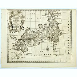
A New And Accurate Map Of The Empire Of Japan, Laid Down from The Memoirs of the Portuguese and Dutch, and particularly from the Jesuit Missionaries.
A beautiful example of Emmanuel Bowen's map of the Empire of Japan. The map clearly identifies Japanese provinces, towns, islands, lakes, mountains, etc. There are a numb...
Date: London, 1747
Selling price: ????
Please login to see price!
Sold in 2023
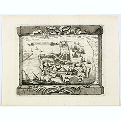
Ile Dormus ou de Jerun.
A beautiful rendition of the Iranian island of Hormuz, situated in the Persian Gulf. From the "Histoire generale des Voyages ou nouvelle collection de toutes les rel...
Date: Paris, 1747
Selling price: ????
Please login to see price!
Sold in 2021
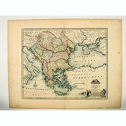
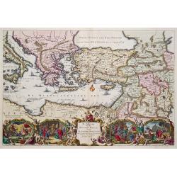
A new & accurate map of Turkey in Europe with the adjacent countries. . .
An excellent mid 18th century map of Greece, including Albania, Macedonia, Romania, Bulgaria, Serbia, Croatia, Hungary etc. the Black Sea and part of Turkey. An early imp...
Date: London, 1747
Selling price: ????
Please login to see price!
Sold in 2023
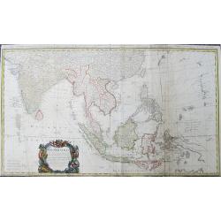
Carte des Indes Orientales...
Important and large size copper-engraved map from India until Australia. Including todays Burma, Thailand, Laos, Vietnam, Malaysia, Singapore, Sumatra, Bali, China, Taiwa...
Date: Nuremberg, 1748
Selling price: ????
Please login to see price!
Sold in 2019
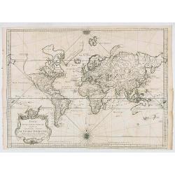
Essay d'une Carte reduite..du Globe Terrestre..
Detailed, and finely engraved large scale map of the World on Mercator's projection. Van Diemen still joined to New Holland, New Guinea has been split between Papous, the...
Date: Paris, 1748
Selling price: ????
Please login to see price!
Sold in 2020
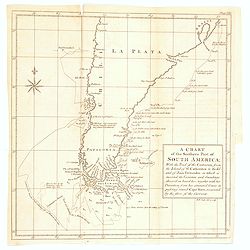
A Chart of the Southern Part of America, with the track of the Centurion. . .
A chart of the southern part of South America with the track of the Centurion from the Island of St Catherine to the Island of Juan Fernandes in which is inserted the var...
Date: London, 1748
Selling price: ????
Please login to see price!
Sold in 2020
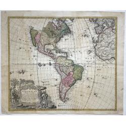
Americae Mappa generalis.
Full title and impressum in an extensive cartouche bottom left: 'Americae Mappa generalis Secundum legimitas projectionis Stereiographiae regulas (..) Homannianis Heredib...
Date: Nuremberg, 1748
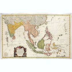
Carte des Indes Orientales. . .
A lovely two joined sheet map of the East Indies, drawn by Tobias Meyer for the Homann Heirs in 1748.The first sheet shows India as far north as Delhi, across to Assam, B...
Date: Nurenberg, 1748
Selling price: ????
Please login to see price!
Sold in 2021
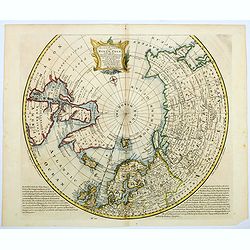
A NEW and Accurate Map of the North Pole, with all the Countries hitherto Discovered. . .
A spectacular Arctic and sub-Arctic map, showing excellent detail around Hudson Bay area, Greenland, Spitzbergen & the Northeast Coast of Europe & Asia. It depict...
Date: London, 1748
Selling price: ????
Please login to see price!
Sold in 2021
![[Lot of 3 maps] Pontus Euxinus anders Mare Maggiore](/uploads/cache/IMG_3162-250x250.jpg)
[Lot of 3 maps] Pontus Euxinus anders Mare Maggiore
[ Lot of 3 maps ]- De Beschryvingh van de Reysen Pauli, en van de Andere Apostelen (1702). - M. Heberers Ongelukkige Voyagie gedaan in Verscheyde gedeeltens van Asia en...
Date: 1748
Selling price: ????
Please login to see price!
Sold in 2023

Geographia Magnae Britanniae Or, Correct Maps Of All The Counties In England, Scotland, And Wales; With General Ones Of Both Kingdoms, And Of The Several Adjacent Islands
We believe this to be the 1st edition. A subsequent edition had the caption in the bottom left-hand corner of the title page with the following names: T. Osborne, D. Brow...
Date: London, 1748
Selling price: ????
Please login to see price!
Sold in 2023
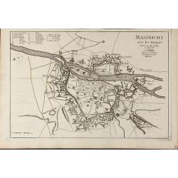
Mastricht avec les Attaques Leve sur les Lieux en Juin 1748. A Paris chez Le Sr. Le Rouge
A rare separate published plan of Maastricht by G. L. le Rouge. Showing the fortified city with important buildings named. With a key from a to x, a mileage scale and a c...
Date: Paris, 1748
Selling price: ????
Please login to see price!
Sold in 2011
Geographifche Beschryvinghe van de Wandeling..
Title: "Geographifche Beschryvinghe van de Wandeling der Apostelen ende De Reysen Pauli"This is an original map from a Dutch bible of 1748 made by Stoopendaal. ...
Date: Amsterdam 1748
Selling price: ????
Please login to see price!
Sold
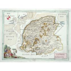
La Frise.
Map of the Dutch province Friesland, decorated with a nice title cartouche and a compass rose in the sea.
Date: Paris 1748
Selling price: ????
Please login to see price!
Sold
Carte du Brabant ou.. le Maesland.. de Ravenstein..
Covering north-eastern part of present day Noord-Brabant including towns of Grave, Gennep, Vlierlingsbeek, Venray, Bakel, Boxmeer, Heeswijk Dinther.
Date: Paris 1748
Selling price: ????
Please login to see price!
Sold
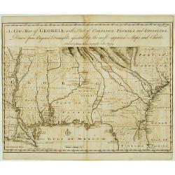
A New Map of Georgia with Part of Carolina, Florida and Loisiana..
Scarce and important early map of colonial Georgia. The map covers from Charles Town to the Mississippi River and extends into Florida to C. Canaveral. The coastal settle...
Date: London c.1748
Selling price: ????
Please login to see price!
Sold
![[Title page] Atlas Nouveau portatif à l'Usage des Militaires College et du Voyageur.](/uploads/cache/17252-250x250.jpg)
[Title page] Atlas Nouveau portatif à l'Usage des Militaires College et du Voyageur.
A decorative title page, showing winged puttee presenting four volumes to a reclining female figure on a rock. Other decoration includes a sailing vessel with somebody us...
Date: Paris, 1748
Selling price: ????
Please login to see price!
Sold in 2013
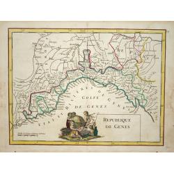
Republique de Genes.
Nice map of northwest Italy and the Gulf of Genoa, at left Nice and Monaco, there is a nice putti-scene in the sea.
Date: Paris 1748
Selling price: ????
Please login to see price!
Sold
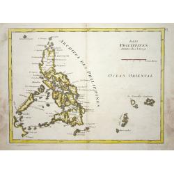
Isles Philippines.
Nice map of the Archipel des Philippines.
Date: Paris 1748
Selling price: ????
Please login to see price!
Sold
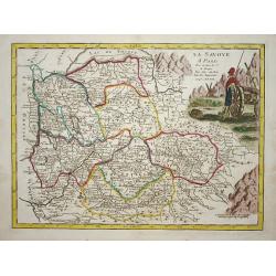
La savoye.
Nice map of the Savoie at the top the lake of Geneva and the Alps.
Date: Paris 1748
Selling price: ????
Please login to see price!
Sold
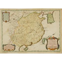
L'Empire de la Chine.
A fine map of China, Korea and Taiwan.Jacques Nicholas Bellin (1703-1772) was one of the most important and proficient French cartographers of the mid-eighteenth century....
Date: Paris 1748
Selling price: ????
Please login to see price!
Sold
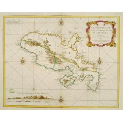
La Martinique une des Antilles Françoises de L'Amerique..
Fine map of Martinique. George Louis Le Rouge was active from 1740- till 1780 as a publisher, and was appointed engineer for the King of France.
Date: Paris 1748
Selling price: ????
Please login to see price!
Sold
Carte de la principauté de Liege et de ses environs..
Map of present-day Dutch and Belgium Brabant and Liege, with an imposing title cartouche Carte de la pricipauté de Liége et de ses environs tirée des observations fait...
Date: Liege, ca.1748
Selling price: ????
Please login to see price!
Sold
![[2 maps] Novissimum Silesiae Theatrum id est Exactissimus Superioris et Inferioris Silesiae.. (2 maps)](/uploads/cache/21439-250x250.jpg)
[2 maps] Novissimum Silesiae Theatrum id est Exactissimus Superioris et Inferioris Silesiae.. (2 maps)
Impressive, highly detailed map of Silesia adorned with 2 large superb cartouches on 2 opposite corners of the map. The title cartouche is decorated with little angels an...
Date: Amsterdam, c. 1748
Selling price: ????
Please login to see price!
Sold in 2008
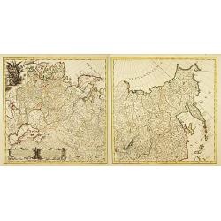
Carte Generale de l'Empire de Russie. (2 maps)
Highly decorative copper-engraved map representing the Russian empire. With superb title cartouche and two explanatory cartouches with text translated in Latin and French...
Date: Amsterdam c. 1748
Selling price: ????
Please login to see price!
Sold
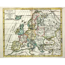
L' Europe.
Gilles Robert de Vaugondy (!686-1766) and son Didier (1723-86), Paris geographers and publishers. Gilles succeedded Pierre Moulart Sanson in 1730. ' Atlas Portatif', 1748...
Date: Paris, 1748
Selling price: ????
Please login to see price!
Sold
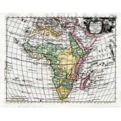
L´AFRIQUE Suivant les Nouvelles Observations
Le Rouge was an eighteenth-century French hydrographer and cartographer appointed Ingenieur Geographe du Roi to King Louis XV. He was a military engineer who specialized ...
Date: Paris, 1748
Selling price: ????
Please login to see price!
Sold
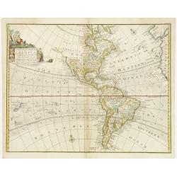
A New and Accurate Map of America..
An attractive map showing the full expanse of America. With decorative title cartouche featuring several Indians, one of whom casually rests his feet on an alligator.Alas...
Date: London ca 1744 - 1748
Selling price: ????
Please login to see price!
Sold
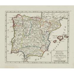
Royaumes d'Espagne et de Portugal.
Detailed map of Spain, Portugal and Baleares islands. Showing also south part of France and Gibraltar. Dated 1748.From Atlas Portatif Universel, by Robert de Vaugondy.Pag...
Date: Paris, ca. 1748
Selling price: ????
Please login to see price!
Sold in 2023
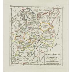
Russie Blanche ou Moscovie. . .
Nice small map of European Russia, framed by "Suede", "Pologne", "Ukraie" ou "Cosaquie", "...
Date: Paris, later than 1748
Selling price: ????
Please login to see price!
Sold in 2009
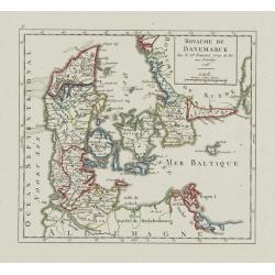
Royaume de Danemark.
Detailed map of Denmark, centered on Själland. Showing also the southernmost tip of the Scandinavian peninsula, Scania. Dated 1748.From Atlas Portatif Universel, by Robe...
Date: Paris, 1748
Selling price: ????
Please login to see price!
Sold
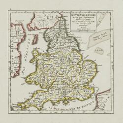
Roy.me d'Angleterre..
Nice small map of England, dated 1748. From Atlas Portatif Universel, by Robert de Vaugondy.Page 5 outside border top left.
Date: Paris, 1748
Selling price: ????
Please login to see price!
Sold
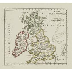
Carte des Isles Britanniques.
Nice small map of the British Isles, dated 1748. From Atlas Portatif Universel, by Robert de Vaugondy.Page 4 outside border top left.
Date: Paris, ca. 1748
Selling price: ????
Please login to see price!
Sold
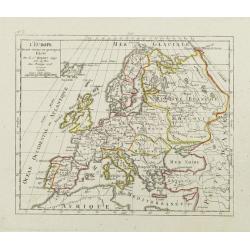
L'Europe. Divisée suivant ses principaux Etats.
Nice small map of Europe, dated 1748. From Atlas Portatif Universel, by Robert de Vaugondy.Page 3 outside border top left.
Date: Paris, ca.1748
Selling price: ????
Please login to see price!
Sold
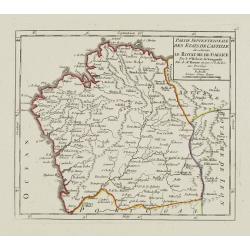
Partie Septentrionale des Etats de Castille où se trouve le Royaume de Gallice..
Detailed map of Galicia, in the northwestern tip of the Iberian Peninsula. From Atlas Portatif Universel, by Robert de Vaugondy.Page 43 outside border top left. Mary Spon...
Date: Paris, later than 1748
Selling price: ????
Please login to see price!
Sold
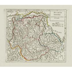
Duché de Savoye.
Detailed small map centered on Savoy, extending eastwards to include the Italian region Valle d'Aosta.From Atlas Portatif Universel, by Robert de Vaugondy. Page 53 outsid...
Date: Paris, later than 1748
Selling price: ????
Please login to see price!
Sold in 2019
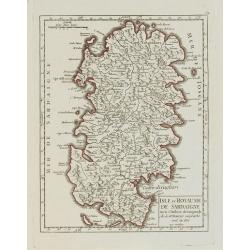
Isle et Royaume de Sardaigne.
Detailed small map of Sardinia. From Atlas Portatif Universel, by Robert de Vaugondy.Page 54 outside border top right. Mary Sponberg Pedley does not mention a state witho...
Date: Paris, later than 1748
Selling price: ????
Please login to see price!
Sold
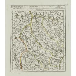
II. Cours du Po et Partie du Piémont où sont les environs de Turin..
Detailed small map showing the northwestern part of Piedmont and a short stretch of the river Po going through Turin.Relief shown pictorially. From Atlas Portatif Univers...
Date: Paris, later than 1748
Selling price: ????
Please login to see price!
Sold
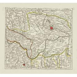
V. Cours du Po, où sont les environs de Parme, Guastalle, Mantoue, &c.
Detailed small map centered on the stretch of the river Po flowing through the region Lombardy, between Villanova sull'Arda and San Siro, southeast of Mantua.From Atlas P...
Date: Paris, later than 1748
Selling price: ????
Please login to see price!
Sold
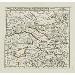
VI. Cours du Po, ou sont les environs de la Mirandole, partie du Veronese, Padouan, Ferrarese, Bolonois, &c.
Detailed small map centered on the stretch of the river Po flowing between Ostiglia and Ro, in the Province of Ferrara.From Atlas Portatif Universel, by Robert de Vaugond...
Date: Paris, later than 1748
Selling price: ????
Please login to see price!
Sold
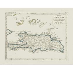
L'Isle St. Domingue.
Nice small map of Hispaniola. Including the Caicos Islands and the Great Inagua. From Atlas Portatif Universel, by Robert de Vaugondy.Page 535 and 95 outside border top r...
Date: Paris, later than 1748
Selling price: ????
Please login to see price!
Sold in 2012
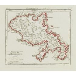
L\'Isle de la Martinique.
Nice small map of Martinique. From Atlas Portatif Universel, by Robert de Vaugondy.Page 563 and 96 outside border top right. To the left Pl. 110.Mary Sponberg Pedley does...
Date: Paris, later than 1748
Selling price: ????
Please login to see price!
Sold in 2008
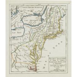
Nouvelle Angleterre N.lle York N.lle Jersey Pensilvanie Mariland et Virginie.
Charming small map showing the eastern States between New England and Carolina, including part of the Great Lakes area.Number 98 outside border top right. Mary Sponberg P...
Date: Paris, 1748
Selling price: ????
Please login to see price!
Sold in 2008
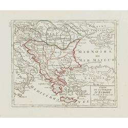
Carte de la Turquie d\'Europe des Isles de la Grece et de l\'Archipel.
Small detailed map encompassing the area between the Adriatic Sea and the Black Sea. Centered on Greece.From Atlas Portatif Universel, by Robert de Vaugondy. Page 63 and ...
Date: Paris, later than 1748
Selling price: ????
Please login to see price!
Sold in 2008
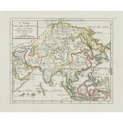
L'Asie Divisée selon ses differens Etats.
Small detailed map of Asia. From Atlas Portatif Universel, by Robert de Vaugondy.Edited by : "Au dépôt de Géographie, Rue Geoffroy Langevin, N° 328. Se trouve A ...
Date: Paris, 1748
Selling price: ????
Please login to see price!
Sold in 2013
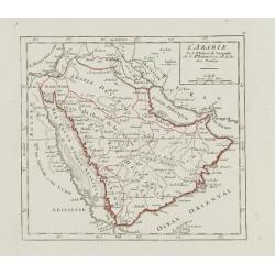
L'Arabie.
Small detailed map of the Arabian Peninsula. From Atlas Portatif Universel, by Robert de Vaugondy.Page 66 outside border top right. Mary Sponberg Pedley does not mention ...
Date: Paris, later than 1748
Selling price: ????
Please login to see price!
Sold
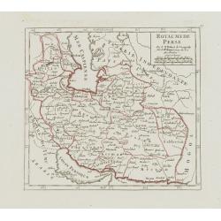
Royaume de Perse.
Small detailed map of Persia. From Atlas Portatif Universel, by Robert de Vaugondy.Page 67 outside border top right. Mary Sponberg Pedley does not mention a state without...
Date: Paris, later than 1748
Selling price: ????
Please login to see price!
Sold
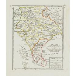
Indoustan ou Etats du Mogol Avec les établissements Français.
Small detailed map of India, including Sri Lanka and the Maldives. From Atlas Portatif Universel, by Robert de Vaugondy.Edited by : "Au dépôt de Géographie, Rue G...
Date: Paris, later than 1748
Selling price: ????
Please login to see price!
Sold
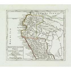
Partie Septentrionale du Perou. . .
Detailed small map encompassing the Ecuadorian seacoasts and the Peruvian shores as far as Lima.In the hinterland the first stretch of the River Amazon. From Atlas Portat...
Date: Paris, later than 1748
Selling price: ????
Please login to see price!
Sold in 2018
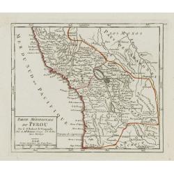
Partie Méridionale du Perou.
Detailed small map encompassing southern Peru, Bolivia and part of Chile. Centered on the lake Titicaca. Including the Atacama desert.From Atlas Portatif Universel, by Ro...
Date: Paris, later than 1748
Selling price: ????
Please login to see price!
Sold in 2017
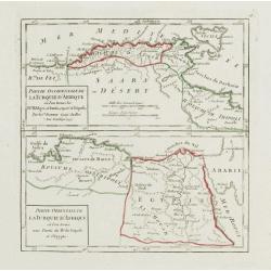
Partie Occidentale de la Turquie d'Afrique.. / Partie Orientale de la Turquie d'Afrique..
Two small detailed maps on one plate representing the seacoasts of North Africa. From Atlas Portatif Universel, by Robert de Vaugondy.Page 76 outside border top right.
Date: Paris, 1748
Selling price: ????
Please login to see price!
Sold in 2014
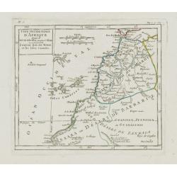
Cote Occidentale d'Afrique.. Canaries.
Nice small map illustrating the African shores of Morocco and Western Sahara. The Canary Islands and the Madeira Islands are also shown.From Atlas Portatif Universel, by ...
Date: Paris, later than 1748
Selling price: ????
Please login to see price!
Sold in 2017
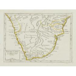
Pays des Cafres.
Charming small map of Southern Africa. From Atlas Portatif Universel, by Robert de Vaugondy.Page 82 outside border top right. Mary Sponberg Pedley does not mention a stat...
Date: Paris, later than 1748
Selling price: ????
Please login to see price!
Sold in 2023
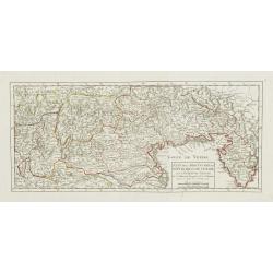
Etat de la Seigneurie et République de Venise avec l'Evêché de Trente.
Detailed small map of northern Italy. Including Istria in the East and extending westwards as far as Bergamo and Crema.From Atlas Portatif Universel, by Robert de Vaugond...
Date: Paris, 1748
Selling price: ????
Please login to see price!
Sold in 2010
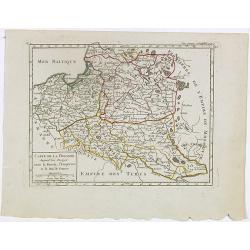
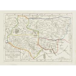
Carte de la Pologne. Aujourd'hui Partagée entre la Russie, l'Empereur et le Roi de Prusse.
Small detailed map showing Poland, Lithuania, the Kaliningrad Oblast, Belarus and part of Ukraine.From Atlas Portatif Universel, by Robert de Vaugondy. Page 35 and Tom. P...
Date: Paris, later than 1748
Selling price: ????
Please login to see price!
Sold in 2020
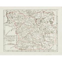
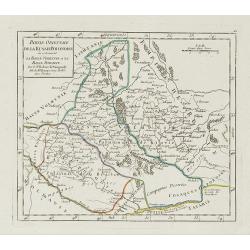
Grand Duché de Lithuanie divisé par Palatinats.
Small detailed map centered on Lithuania and Belarus. From Atlas Portatif Universel, by Robert de Vaugondy.Unrecorded state with erased date. Page 38 outside border top r...
Date: Paris, later than 1748
Selling price: ????
Please login to see price!
Sold
Partie Occidentale de la Russie Polonoise.. Haute Podolie.
Small detailed map showing the western part of Ukraine. From Atlas Portatif Universel, by Robert de Vaugondy.Unrecorded state with erased date. Page 40 outside border top...
Date: Paris, later than 1748
Selling price: ????
Please login to see price!
Sold in 2008
Partie orientale de la Russie Polonaise, où se trouvent la Basse Volhynie et la Basse Podolie.
Small detailed map showing the eastern part of Ukraine, with Volhynia and Podillia. Centered on the course of the Dnieper river.From Atlas Portatif Universel, by Robert d...
Date: Paris, later than 1748
Selling price: ????
Please login to see price!
Sold in 2021
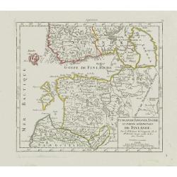
Curlande, Livonie, Ingrie et partie méridionale de Finlande.
Small detailed map showing Latvia, Estonia, part of Russia and southern Finland. With St. Petersburg in the right part.From Atlas Portatif Universel, by Robert de Vaugond...
Date: Paris, later than 1748
Selling price: ????
Please login to see price!
Sold in 2008
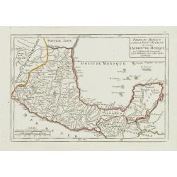
Partie du Mexique ou de la Nouv.lle Espagne où se trouve l'Audience du Mexique.
Nice small map showing the southern part of Mexico, from Guadalajara to the Yucatán Peninsula.From Atlas Portatif Universel, by Robert de Vaugondy. Page 90 outside borde...
Date: Paris, later than 1748
Selling price: ????
Please login to see price!
Sold
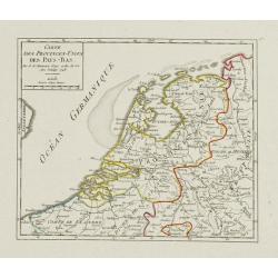
Carte des Provinces-Unies des Pays-Bas.
Attractive small map of the Low Countries. Dated 1748. From Atlas Portatif Universel, by Robert de Vaugondy.Page 17 outside border top right.
Date: Paris, 1748
Selling price: ????
Please login to see price!
Sold
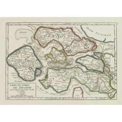
Carte du Comté de Zélande.
Attractive small map illustrating the northern part of Zeeland. From Atlas Portatif Universel, by Robert de Vaugondy.Page 18 outside border top right. Mary Sponberg Pedle...
Date: Paris, later than 1748
Selling price: ????
Please login to see price!
Sold
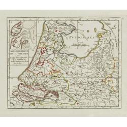
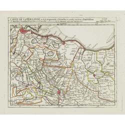
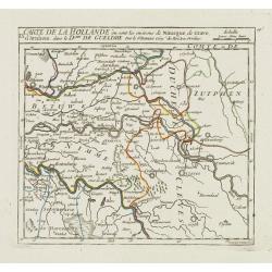
Carte Generale des Six de la Hollande, avec, la Seig? D'Utrecht, Partie de la Gueldre, &c.
Attractive small map illustrating part of the Netherlands, namely the provinces of Noord- and Zuid-Holland, Gelderland and Utrecht.With an inset map of the island of Texe...
Date: Paris, later than 1748
Selling price: ????
Please login to see price!
Sold in 2021
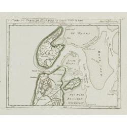
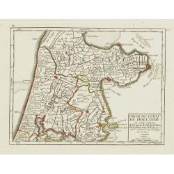
I. Carte du Comté de Hollande où se trouve l'Isle de Texel.
Attractive small map illustrating the northernmost tip of Noord-Holland and Texel. From Atlas Portatif Universel, by Robert de Vaugondy.Unrecorded state with erased date....
Date: Paris, later than 1748
Selling price: ????
Please login to see price!
Sold
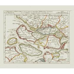
II. Partie du Comté de Hollande.. Edam &c.
Attractive small map illustrating the central part of Noord-Holland, between West Friesland and the IJ bay.From Atlas Portatif Universel, by Robert de Vaugondy. Unrecorde...
Date: Paris, later than 1748
Selling price: ????
Please login to see price!
Sold in 2020
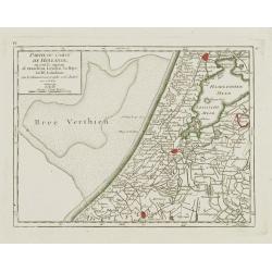
IV. Partie du Comté de Hollande.. Haarlem, Leyden, la Haye..
Attractive small map centered on Zuid Holland, including Leiden, Delft extending northwards as far as Haarlem.From Atlas Portatif Universel, by Robert de Vaugondy. Unreco...
Date: Paris, later than 1748
Selling price: ????
Please login to see price!
Sold in 2017
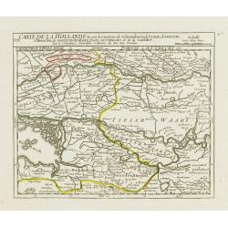
V. Carte de la Hollande et de la Seigneurie, d'Utrecht?
Detailed small map showing an area straddling the provinces of North Holland and Utrecht. Showing Amsterdam in the upper left corner.From Atlas Portatif Universel, by Rob...
Date: Paris, later than 1748
Selling price: ????
Please login to see price!
Sold
VII. Carte de la Hollande ou sont les environs de Rotterdam..
Attractive small map centered on the island of Voorne-Putten with Rotterdam and Dort[recht]. From Atlas Portatif Universel, by Robert de Vaugondy.Unrecorded state with er...
Date: Paris, later than 1748
Selling price: ????
Please login to see price!
Sold
VIII. Carte de la Hollande ou sont les environs de Schoonhove..
Nice small map showing an area straddling the provinces of North Holland, Gelderland and North Brabant, crossed by the rivers Lower Rhine and Meuse.From Atlas Portatif Un...
Date: Paris, later than 1748
Selling price: ????
Please login to see price!
Sold
IX. Carte de la Hollande ou sont les environs de Nimegue..
Attractive small map showing an area straddling the border between the Netherlands and Germany. Centered on Nijmegen.From Atlas Portatif Universel, by Robert de Vaugondy....
Date: Paris, later than 1748
Selling price: ????
Please login to see price!
Sold
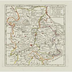
Carte Générale de la Seigneurie de Lyege, et du Duché de Limbourg.
Attractive small map showing an area straddling the border between the Netherlands, Belgium and Germany.Centered on Maastricht. Dated 1748. Divided into 6 sections. From ...
Date: Paris, 1748
Selling price: ????
Please login to see price!
Sold
I. Carte de l'Etat de Lyege ou se trouvent la Terre de Leon, et la Campine Lyegeoise.
Attractive small map encompassing the eastern part of the Flemish Limburg. It shows the town of Diest in the lower left corner. Dated 1748.From Atlas Portatif Universel, ...
Date: Paris, 1748
Selling price: ????
Please login to see price!
Sold in 2022
II. Carte de l'Etat de Lyege.. et partie du D.ché de Limbourg.
Attractive small map showing an area straddling the border between the Netherlands, Belgium and Germany. Centered on Roermond. Dated 1748.From Atlas Portatif Universel, b...
Date: Paris, 1748
Selling price: ????
Please login to see price!
Sold
IV. Carte du Duché de Limbourg.. Aix la Chapelle &c.
Attractive small map showing an area straddling the border between the Netherlands, Belgium and Germany.Delimited by the towns of Sittard, Aachen and Dalhem. Dated 1748.F...
Date: Paris, 1748
Selling price: ????
Please login to see price!
Sold in 2012
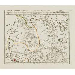
V. Carte de l\'Etat de Lyege.. ou se trouvent Lyege, Hannuye, Huy..
Attractive small map showing part of the Wallon region, south west of Liège. Dated 1748. From Atlas Portatif Universel, by Robert de Vaugondy.Page 15e outside border top...
Date: Paris, 1748
Selling price: ????
Please login to see price!
Sold in 2008
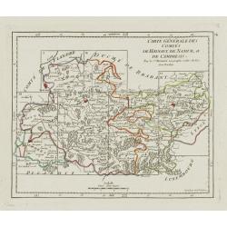
Carte Générale des Comtés de Haynaut, de Namur, et de Cambresis.
Attractive small map encompassing an area straddling the border between Belgium and France.Showing Cambrai, Tournai, Mons and Namur. Divided into 10 sections. From Atlas ...
Date: Paris, after 1748
Selling price: ????
Please login to see price!
Sold in 2008
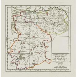
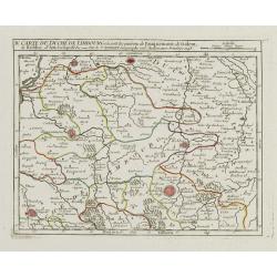
Carte Generale du Duché de Brabant.
Nice small map illustrating the Duchy of Brabant in the Low Countries. Divided into 10 sections. Centered on Herentals.The historical region consisted not only of the thr...
Date: Paris, later than 1748
Selling price: ????
Please login to see price!
Sold
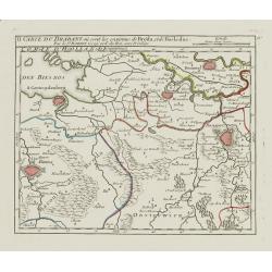
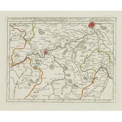
II. Carte du Brabant où sont les environs de Bréda, et de Bosleduc.
Nice small map illustrating part of North Brabant. Extending West to East from Breda to ?s-Hertogenbosch.From Atlas Portatif Universel, by Robert de Vaugondy. Unrecorded ...
Date: Paris, later than 1748
Selling price: ????
Please login to see price!
Sold
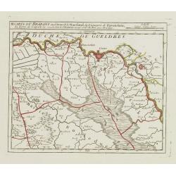
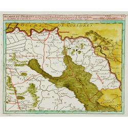
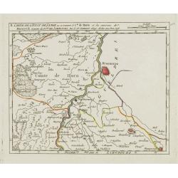
III. Carte du Brabant ou se trouvet le Maesland, la Seigneurie de Ravenstein, la Terre de Cuyck &c.
Nice small map illustrating a stretch of the river Meuse, flowing besides Alphen, Grave and Gennep.From Atlas Portatif Universel, by Robert de Vaugondy. Unrecorded state ...
Date: Paris, later than 1748
Selling price: ????
Please login to see price!
Sold
![[IV.] Carte du Brabant où se trouvét la Mairie de Santhoven.. Ryen.](/uploads/cache/24684-250x250.jpg)
[IV.] Carte du Brabant où se trouvét la Mairie de Santhoven.. Ryen.
Nice small map encompassing an area which straddles the border between Belgium and the Netherlands.Showing Antwerp in the central lower part. From Atlas Portatif Universe...
Date: Paris, later than 1748
Selling price: ????
Please login to see price!
Sold in 2008