Browse Listings
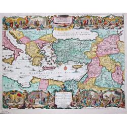
De Beschryving van de Reysen Pauli en Van de Andere Apostelen.
The Dutch so-called ' Staten' bibles published between 1637 and c. 1760, contained 5 maps: The World, ' Paradise', The Perigrinations, The Promised Land Canaan, The Trave...
Date: Amsterdam / Dordrecht, Pieter Keur, Pieter Rotterdam en Pieter Rotterd
Selling price: ????
Please login to see price!
Sold
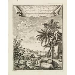
Raccolta del Cotone.
Attractive view on a cotton plantation. The scene is explained through a key index on top.It represents black people at work for the Europeans' supplying of cotton and il...
Date: [No Title]
Selling price: ????
Please login to see price!
Sold
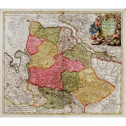
Ducatus Bremae et Ferdae nova tabula.
A very decorative and detailed map with Hamburg on the river Elbe. Also including Oldenburg and Bremen. With a very decorative title cartouche showing putti and allegoric...
Date: Nuremberg, 18th century
Selling price: ????
Please login to see price!
Sold
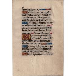
Book of Hours leaf
18 lines of text in Latin, with 4 one line initials and 1 two line initial, then 5 one line initials with line fillers.
Date: France, late fifteenth century
Selling price: ????
Please login to see price!
Sold
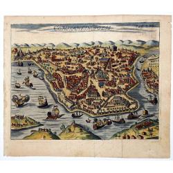
CONSTANTINOPOLIS.
A striking view of Constantinopolis showing ships and the town's discrits. Folded as issued. On upper right "Pag. 293".
Date: 18th century
Selling price: ????
Please login to see price!
Sold in 2020
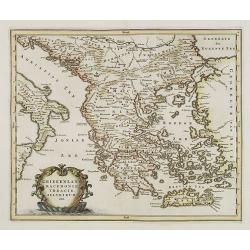
GREECE.
Map of Greece. Macedonia, western coast of Turkey and part of Italy. Cartouche in the left hand bottom with titles. From the book "History of the Jews" by Humph...
Date: The netherlands 18th. century.
Selling price: ????
Please login to see price!
Sold in 2008