Browse Listings
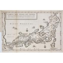
Carte des Isles du Japon Esquelles est remarque la Route ?
This uncommon map of Japan contains comments about the nature of the country. For instance, Ocsaqui (Okazaki, near Nagoya) is said to have the most beautiful women. Lake ...
Date: Paris, 1679
Selling price: ????
Please login to see price!
Sold in 2009
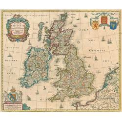
Magna Britanniae, tabula, angliam, scotiam, et hiberniam continens.
Decorative Visscher map of the British Isles
Date: Amsterdam, c.1679
Selling price: ????
Please login to see price!
Sold in 2010
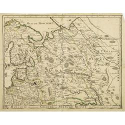
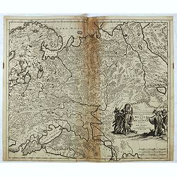
Moscovie dite autrement Grande et Blanche Russie.
Somewhat scarce map of Russia, Finland, Poland and the Baltic's.
Date: Paris, 1679
Selling price: ????
Please login to see price!
Sold in 2013
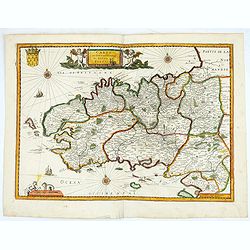
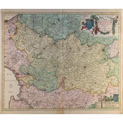
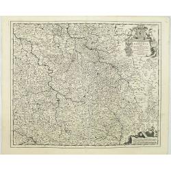
Carte du gouvernement du duché de Bretagne.
Map de Bretagne region. Published by H. Langlois, cartographers, publishers and booksellers at 12 rue de la Seine, Faubourg Saint Germain in Paris. Drawn up by Jean-Bap...
Date: Paris, 1679
Selling price: ????
Please login to see price!
Sold in 2020
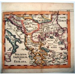
TURCICUM IMPERIUM IN EUROPA.
Rare copperengraved map of the Ottoman Empire's possessions in Europe - Greece and the Balkans, published by Hoffmann, Nuremberg 1679, in his 'Atlas Universalis' ,a pirat...
Date: Nuremberg, 1679
Selling price: ????
Please login to see price!
Sold in 2021
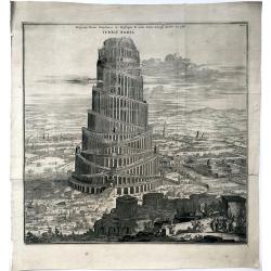
Prospectus Turris Babylonicae ex praescripto R. Adm. Patris Athanasy Kircheri Soc. Jesu.
A rare and large print showing the tower of Babylon. From Kircher's famous and rare "Turris Babel" published in 1679. The last of his books to be published duri...
Date: Amsterdam, 1679
Selling price: ????
Please login to see price!
Sold in 2021
![Kaert van Groen-Land [Map of Greenland]](/uploads/cache/48503-250x250.jpg)
Kaert van Groen-Land [Map of Greenland]
A very rare map of the Northern Atlantic Ocean, showing the North American coast, Greenland, Scotland and the coast of Norway. In the Atlantic are Iceland and the mythica...
Date: Nuremberg or Netherlands, after 1679
Selling price: ????
Please login to see price!
Sold in 2023
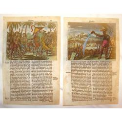
Florida (Two Copper Engravings)
Two Very interesting hand-colored copper engravings featuring Native American in Florida. One is titled ""Native Americans Walk Through Forest" and the oth...
Date: Amsterdam, 1679
Selling price: ????
Please login to see price!
Sold in 2013
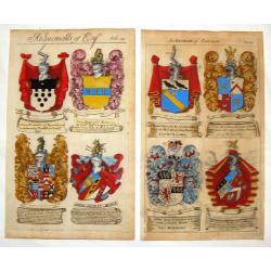
(2 Engravings) Achievements of Baronets & Achievements of Esquires.
Two stunning, hand-colored, copper engravings from Guillim's Heraldry which include the following names: VYNER, WOLSTENHOLME, GLEANE, IASON, BROUNCKER, VERNON, CUDMORE AN...
Date: London, 1679
Selling price: ????
Please login to see price!
Sold in 2017
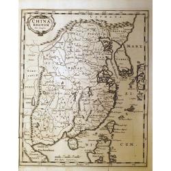
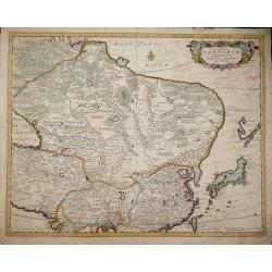
China Regnum.
Very rare German issue of Nicholas Sanson’s important map of China, Korea, and the northern Philippines first published in 1652. Johann David Zunner would later publish...
Date: Frankfurt, 1679
Selling price: ????
Please login to see price!
Sold in 2014
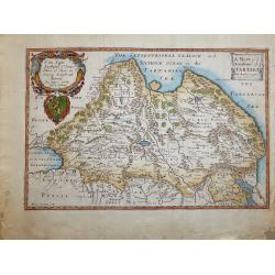
Regno di Persia. . .
Detailed map of Persia with a very decorative title cartouche surmounted by a native.The cartographer was Giacomo Cantelli da Vignola (1643-1695) who was active in Modena...
Date: Rome, 1679
Selling price: ????
Please login to see price!
Sold in 2015
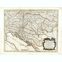
Il Regno d'Ungaria Transilvania, Schiavonia, Bosnia, Croatia, Dalmatia. . .
A uncommon late 17th century map of part of Balkans, based on the reports of Giacomo Cantelli da Vignola and published in Rome in Giacomo de Rossi's world atlas "Mer...
Date: Rome, after 1679
Selling price: ????
Please login to see price!
Sold in 2015

Four full portraits of English Noblemen.
Engravings of James Duke of York and Albany, Charles the second, Anthony Earl of Shaftsbury, - Portrait of Sir William de la More, full-length, standing to the right, in ...
Date: London, ca. 1679
Selling price: ????
Please login to see price!
Sold in 2016
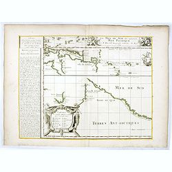
La Mer de Sud dite autrement Mer Pacific Par P. Du-val. . .
Lower left sheet of a 4 sheet map of the Pacific. This sheet showing part of the South Sea with Nova Guinea, Carpentaria, Van Diemen's Land, New Zealand and "Terres ...
Date: Paris, 1679
Selling price: ????
Please login to see price!
Sold in 2016
![[Title page] Topographia Helvetiae, Rhaetiae . . .](/uploads/cache/41396-250x250.jpg)
[Title page] Topographia Helvetiae, Rhaetiae . . .
Title page from "Topographia Helvetiae, Rhaetiae . . .".
Date: Frankfurt, Johann Görlin, 1679
Selling price: ????
Please login to see price!
Sold in 2018
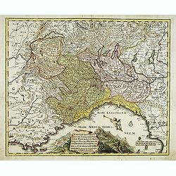
Nova et accurata Ducatus Sabaudiae, Principat. Pedemont. et Montferat., Ducatus Mediolan. et Reipub. Genuensis tabula cum adiacentibus Regionibus itemq. viis, ex Gallia, per Alpes in Italiam ducentibus . . .
Scarce and detailed map of Piedmont et Montferrat. Engraved by Joachim von Sandrart. The artist and art historian Jacob von Sandrart (1630-1708). The Mediterranean is fil...
Date: Nuremberg, c. 1680
Selling price: ????
Please login to see price!
Sold
Septemtrionaliora Americae & Groenlandia, per Freta Davidis.
Chart of Hudson Bay and Arctic Canada, from Wit's Orbis Maritimus ofte Zee Atlas, published in 1680 in Amsterdam. The chart shows some of the earliest, tentative mapping ...
Date: Amsterdam, 1680
Selling price: ????
Please login to see price!
Sold in 2012
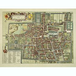
Haga Comitis Vulgo 'S Graven-Hage.
A very RARE bird's-eye town-plan of The Hague. The work was copied after Joan Blaeu.The plan is finely engraved and provides superb detail of the city's important buildin...
Date: Amsterdam, 1680
Selling price: ????
Please login to see price!
Sold in 2012
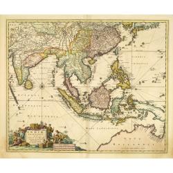
Indiae orientalis, nec non Insularum Adiacentium . . .
The north coast of Australia is shown at bottom right with some coastal names.
Date: Amsterdam, 1680
Selling price: ????
Please login to see price!
Sold in 2015
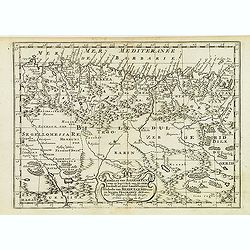
Gedeelte van Barbaryen, Waar in Legt 't Ryk van Algiers. . .
An attractive miniature map of North Africa prepared by N. Sanson. Engraved by A.de Winter.
Date: Amsterdam, Utrecht, F.Halma, 1680
Selling price: ????
Please login to see price!
Sold in 2022
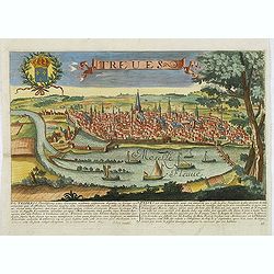
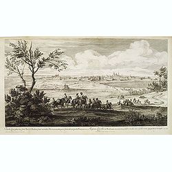
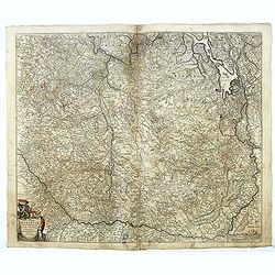
Treves. (Trier)
Rare and decorative view of Tier with the river Meuse in the foreground. Underneath a historical description of the town in Latin and French. The description mentions abo...
Date: Paris, 1680
Selling price: ????
Please login to see price!
Sold in 2024
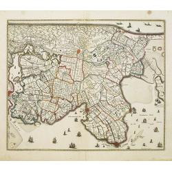
Noordt Hollandt.
A detailed map of the northern part of Holland. At that time practically all polders -with the exception of the IJ-polder- had already been reclaimed.
Date: Amsterdam, 1680
Selling price: ????
Please login to see price!
Sold in 2014
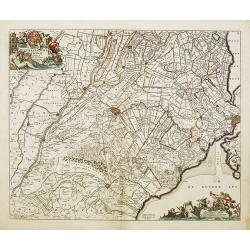
Ultraiectini dominii tabula. . .
Important map of Utrecht. Orientated south/west to the top. With two very decorative cartouches.
Date: Amsterdam, 1680
Selling price: ????
Please login to see price!
Sold in 2014
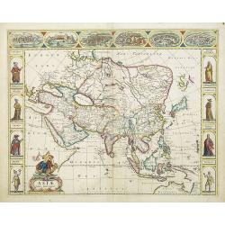
Asiae Nova Descriptio.
A fine "carte à figures"- map of Asia with in the margins views of Ormus, Aden, Jerusalem, Damascus, Rhodos, Famagusta and costumed figures of Asian people in ...
Date: Amsterdam, 1680
Selling price: ????
Please login to see price!
Sold in 2016
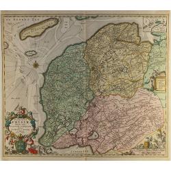
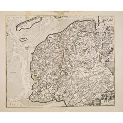
Dominii Frisiae..
This large copper engraved map details the coastline of Friesland and Terschelling. At east is a part of Groningen. The main cities are colored in red. The very decorativ...
Date: Amsterdam ca.1680
Selling price: ????
Please login to see price!
Sold in 2012
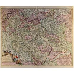
Exactissima Palatinatus Rheni.
Decorative map of the Rhine River valley includes Frankfurt, Manheim, Heidelberg, Ulm, and Durlach. The topography is noted pictorially, and a simple compass rose orients...
Date: Amsterdam ca.1680
Selling price: ????
Please login to see price!
Sold in 2014
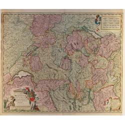
Exactissima Helvetiae..
Very detailed map of Switzerland graphically depicting the mountainous region. Hundreds of tiny villages are named. Decorated with two cartouches, a scale of miles, and a...
Date: Amsterdam ca.1680
Selling price: ????
Please login to see price!
Sold in 2012
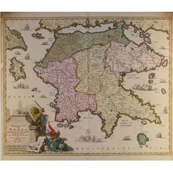
Peloponnesus hodie Morea..
Detailed map of the southern part of Greece, including Peloponnesus, Zakinthos, and Kefallinia. Good detail throughout. Large (colored) cartouche depicting a mythical lio...
Date: Amsterdam ca.1680
Selling price: ????
Please login to see price!
Sold in 2014
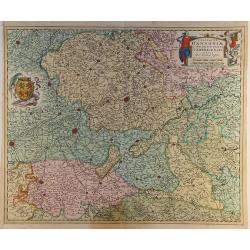
Mechelinia Dominium et Aerschot..
Detailed map of the southern part of The Netherlands and the northern part of Belgium with Antwerp and Brussels. Large (colored) cartouche with a coat of arms and putti.
Date: Amsterdam ca.1680
Selling price: ????
Please login to see price!
Sold in 2014
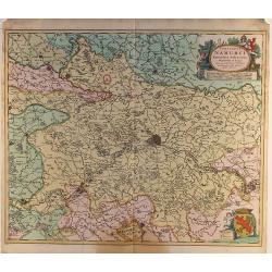
Comitatus Namurci..
Detailed map of a part of Belgium with Namur in the middle. Large (colored) cartouche with putti and one with a coat of arms.
Date: Amsterdam ca.1680
Selling price: ????
Please login to see price!
Sold in 2014
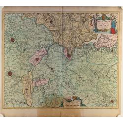
Comitatus Hannoniae..
Detailed map of a part of Belgium with Bergen/Mons in the middle. Large (colored) cartouche with putti and one with a coat of arms.
Date: Amsterdam ca.1680
Selling price: ????
Please login to see price!
Sold in 2014
Geographica Artesiae..
Detailed map of a part of France with Calais in the left top corner. Large (colored) cartouche with a coat of arms and putti.
Date: Amsterdam ca.1680
Selling price: ????
Please login to see price!
Sold in 2014
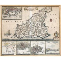
Insula sive Regnum Siciliae Urbibus praecipuis exornatum.
An old color example of De Wit's famous map of Sicily, with the view of Messina, Milazzo, Palermo Catania, and Trapani.It is one of the most decorative maps of Sicily fro...
Date: Amsterdam, 1680
Selling price: ????
Please login to see price!
Sold in 2012
Pascaert van Brasil-Littora Brasiliae.
Sea chart of the South American coastline from Guyana to Rio de la Plata. East to the top. Embellished with two compass roses and 5 sailing vessels.Oriented with north to...
Date: Amsterdam, 1680
Selling price: ????
Please login to see price!
Sold
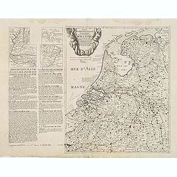
Cartes des provinces unies des Pays Bas connues sous les nom de Hollande. . .
Unrecorded map of the Low Countries, printed from two copper plates by François Jollain (ca. 1641 – 18 April 1704).To the left a detailed description of the Dutch prov...
Date: Paris, ca. 1680
Selling price: ????
Please login to see price!
Sold
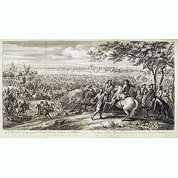
Veue de Leuve, place très-forte dans le Brabant, située au milieu d'un marais, attaquée et forcée de nuit par les François en l'année 1678. . . (Zoutleeuw)
Showing the siege of the town of Zoutleeuw. Showing the French cavalry advancing in the direction of the Sint-Truiden port. Giving a clear picture of the old Holy Cross C...
Date: Paris, ca. 1680
Selling price: ????
Please login to see price!
Sold
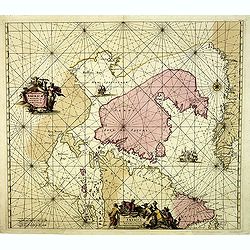
Tabula Comitatus Frisiae.
The map was prepared by B.Schotanus à Steringa.
Date: Amsterdam, 1680
Selling price: ????
Please login to see price!
Sold in 2013
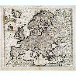
Accuratissima Europae tabula multis locis correcta. . .
Uncommon map of Europe with fine title cartouche.
Date: Amsterdam, c.1680
Selling price: ????
Please login to see price!
Sold in 2013
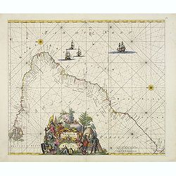
Paskaert waer in de graden.. custen van Africa en America..
Very fine , showing the points where the Dutch West India Company sailed: including Ireland, Portugal, Morocco, east coast of Africa, the Canary Islands, the Azores, Braz...
Date: Amsterdam, 1680
Selling price: ????
Please login to see price!
Sold in 2013
Le Rhin passé à la nage par les François, à la veuë de l'Armée de Hollande, 11 juin 1672.
Showing Louis XIV crossing the Rhine at Lobit at Tolhuis on 11 June 1672. Etching by C. Simmoneau after Adam Frans van der Meulen (1632-1690) who was a Flemish Baroque pa...
Date: Paris, ca. 1680
Selling price: ????
Please login to see price!
Sold in 2021
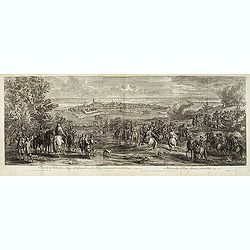
Veuë de la Ville et du Siège d'Oudenarde, ou le Roy commande en personne, en l'année 1667.
Showing the town of Oudenaarde. Etching after Adam Frans van der Meulen (1632-1690) who was a Flemish Baroque painter specializing in battle scenes. He was active first i...
Date: Paris, ca. 1680
Selling price: ????
Please login to see price!
Sold in 2017
Regnum Bohemia, eique Annexae provinciae uit Ducatus Silesia, Marchionatus Moravia et Lusatia.
Detailed map of Czechoslovakia including parts of Poland, Germany with the towns of Dresden, Prague, Breslau, etc. With fine title cartouche upper left, putti carrying th...
Date: Amsterdam, 1680
Selling price: ????
Please login to see price!
Sold in 2019
Tabula Tartariae et majoris partis Regni Chinae . .
Strapwork title cartouche with two putti and a compass rose embellish the map. De Wit's map of NE Asia, extending from the Island of Formosa, the Gandgers and the eastern...
Date: Amsterdam, 1680
Selling price: ????
Please login to see price!
Sold in 2014
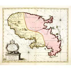
Insula Matanino vulgo Martanico in lucem edita / per Nicolaum Visscher cum Priviliegio Ordin: General Belgii Faederati.
Uncommon map, showing the portion of the island which had been taken from the Caribs up to that time. In lower left corner a title cartouche with fruit, tobacco, sugar.
Date: Amsterdam, ca. 1680
Selling price: ????
Please login to see price!
Sold
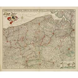
Comitatus Flandriae Tabula in lucem edita.
Map of Flanders, the whole Belgian region northwest of Brussels, confined by Antwerp, Brussels, Valenciennes, Arras, St. Omer and the Channel.Title heading above the map,...
Date: Amsterdam, 1680
Selling price: ????
Please login to see price!
Sold in 2018
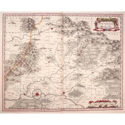
Wetteravia die Wetteraw.
Published in Oxford 1680 by Moses Pitt and Stephen Swart from the map plates by Joannes Janssonius. Uncommon and very beautiful map of the region around Frankfurt. Extre...
Date: Oxford,1680
Selling price: ????
Please login to see price!
Sold in 2016
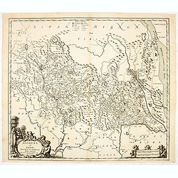
Suchuen et Xensi, Provinciae seu Praefecturae Regni Sinensis. . .
Map of the central China provinces of Sichuan and Shaanxi with two cartouches. North orientated to the right.
Date: Amsterdam, c. 1680
Selling price: ????
Please login to see price!
Sold in 2014
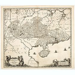
Iunnan, Queicheu, Quangsi, et Quantung. . .
A beautifully engraved map of Southern China covering Hainan and the Pearl River Delta with Macao and the islands around present-day Hong Kong.
Date: Amsterdam, c. 1680
Selling price: ????
Please login to see price!
Sold in 2014
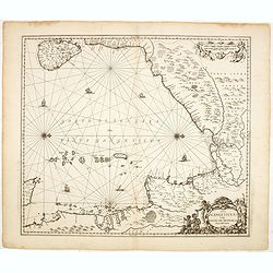
Sinus Gangeticus vulgo Golfo de Bengala Nova descriptio.
Showing the east coast of India and Sri Lanka. West to the top.
Date: Amsterdam, 1680
Selling price: ????
Please login to see price!
Sold in 2014
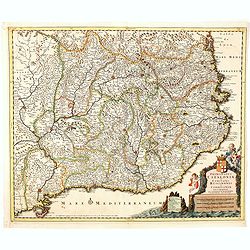
Principatus Cataloniae et Comitatus Ruscinonis et Cerretaniae descriptio
Follows the Mediterranean Coast from Alfactus and Tortosa to the Gulf of Lyon and Leucate. Including Barcelona, Gascogne and Balbastro. Barcelona. The map shows a Catalan...
Date: Amsterdam, 1680
Selling price: ????
Please login to see price!
Sold in 2014
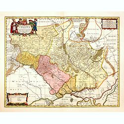
Typus Generalis Ukrainae sive Palatinatuum Podoliae, Kioviensis et Braczlaviensis terras nova delineatione exhibens. . .
Key map based on Guillaume La Vasseur de Beauplan's map of the region published in "Description d'Ukraine". The work described Ukraine as several provinces of t...
Date: Oxford, 1680
Selling price: ????
Please login to see price!
Sold in 2014
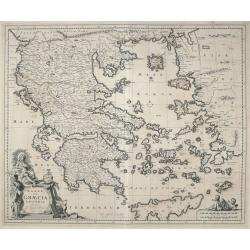
ΕΛΛΑΣ, Seu Graecia Universa Autore J. Laurenbergio.
Highly detailed map of the whole of Greece, the Greek Islands, the Aegean, Crete and part of Asia Minor.
Date: Amsterdam, 1680
Selling price: ????
Please login to see price!
Sold in 2016
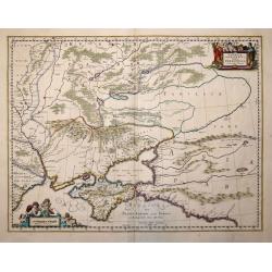
Taurica Chersonesus Hodie Przecopsca et Gazara dicitur. . .
Map shows the Ukraine with the island of Crimea.
Date: London,1680
Selling price: ????
Please login to see price!
Sold in 2014
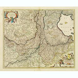
Ducatus Geldriae et Zutphaniae Comitatus.
Map of the Dutch provinces of Gelderland and Noord Brabant. Showing the Ijselmeer (Zuyder Zee), Zwolle, Wesel, Eindhoven and Utrecht. North orientated to the right. Decor...
Date: Amsterdam, ca. 1680
Selling price: ????
Please login to see price!
Sold in 2015
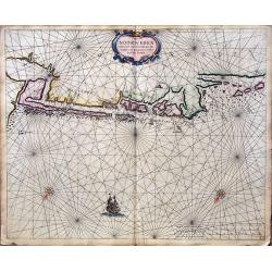
Caerte van Noorwegen vande hoeck van Horrel tot aen Momendael, waer in begrepen wert het Liet van Dronten.
A rare sea Chart shows part of the Norwegian coast, from Horrel to Trondheim. Nice original colors.
Date: Amsterdam, 1680
Selling price: ????
Please login to see price!
Sold in 2018
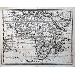
Afrique.
Interesting map of Africa, which includes also Arabia and a small part of the coast of Brazil. With two large lakes below the equator, and a rich river system connecting ...
Date: Paris, ca. 1680
Selling price: ????
Please login to see price!
Sold in 2014
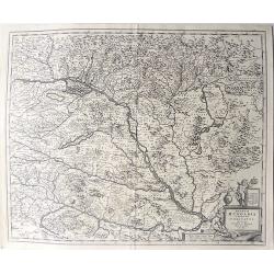
Regnum Hungaria in omnes suos comitatus accurate divisum et editum.
A rare map of the Kingdom of Hungary and surrounding regions of Austria and Serbia. The city of Budapest is shown at the centre of the map. Relief shown pictorially. Vers...
Date: Amsterdam, 1680
Selling price: ????
Please login to see price!
Sold in 2021
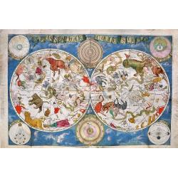
Planisphaerium Coeleste
An exceptionally decorative, oversized, very rare celestial chart, produced by Frederik de Wit around 1680, and depicts the two hemispheres surrounded by six supplementar...
Date: Amsterdam, ca. 1680
Selling price: ????
Please login to see price!
Sold in 2017
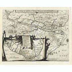
Abbildung der Statt und Vestung Parayba in der Landschaft Brasilia.
Detailed map of the region of Paraiba and the defending forts at the mouth of the River Paraiba.The map illustrates the Dutch incursion into the Portuguese territory and ...
Date: Frankfurt, 1680
Selling price: ????
Please login to see price!
Sold in 2015
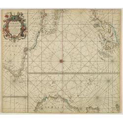
Pascaart van Europa. Alsmede een gedeelte van cust van Africa. . .
A rare chart of Europe's coastline from northern Russia to Yugoslavia in the south, also showing the West Coast of Africa as far as the Cape-Verdian islands.The uncommon ...
Date: Amsterdam, ca. 1680
Selling price: ????
Please login to see price!
Sold in 2015
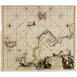
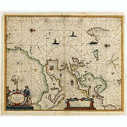
Paskaart Van 't Noordelykste deel der Noort Zee Beginnende van der Neus tot Nova Zembla. . . .
Very fine chart with Iceland to the left and reaching till Nova Zembla, including of Iceland, Spitzbergen, Northern Scotland, Russia and Scandinavia with just a hint of G...
Date: Amsterdam, 1680
Selling price: ????
Please login to see price!
Sold in 2016
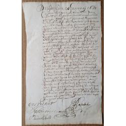
Cape of Good Hope Manuscript Landgrant, 1680.
A one-sheet 1680 Cape of Good Hope landgrant, in favour of Hans Calmbach(?), who had been a Corporal in the service of the VOC Company. Also mentions a Jacomina and Hend...
Date: Cape of Good Hope, 1680
Selling price: ????
Please login to see price!
Sold in 2015
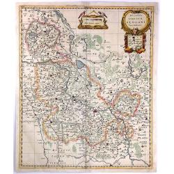
Ducatus Silesiae Glogani Vera Delineatio
A detailed map of Poland showing parts of Silesia with Glogau, Grünberg Guhrau and Schwiebus. Very detailed, especially showing different sizes of cities and towns, fore...
Date: Amsterdam, 1680
Selling price: ????
Please login to see price!
Sold in 2016
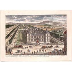
Le Chateau D'Ancy-Le Franc.
Fine hand-colored city view from the book "VIEWS OF THE MOST BEAUTIFUL PLACES OF VERSAILLES" published in Paris by Nicolas Langois in about 1680. The artist was...
Date: Paris, 1680
Selling price: ????
Please login to see price!
Sold in 2015
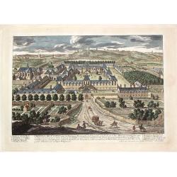
L'Hopital de St. Louis.
Fine hand-colored city view from the book "VIEWS OF THE MOST BEAUTIFUL PLACES OF VERSAILLES" published in Paris by Nicolas Langois in about 1680. The artist was...
Date: Paris, 1680
Selling price: ????
Please login to see price!
Sold in 2016
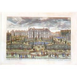
Les Eaux et les Environs de Chauille.
Fine hand-colored city view from the book "VIEWS OF THE MOST BEAUTIFUL PLACES OF VERSAILLES" published in Paris by Nicolas Langois in about 1680. The artist was...
Date: Paris, 1680
Selling price: ????
Please login to see price!
Sold in 2018
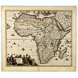
Totius AFRICAE Accuratissima Tabula.
The map became the standard for subsequent maps of Africa, and was reissued with minor changes over the next 30 years. The map is very detailed with a comprehensive netwo...
Date: Amsterdam, 1680
Selling price: ????
Please login to see price!
Sold in 2018
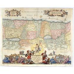
Het Beloofde Landt Canaan, Door Wandelt Onfen Salichmaecker Jesu Christo Neffens Fyne Apostelen.
Detailed map of the Holy Land, showing the travels of Christ and the Apostles, including Paul's travel's at sea and numerous sailing vessels. This map is derived from Ni...
Date: Rotterdam, 1680
Selling price: ????
Please login to see price!
Sold in 2019
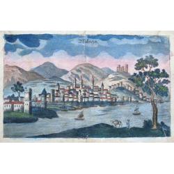
Malaga.
Curious early view of Malaga. Show the town across the river with numouers buildings and towers, the fort also shown on top of the hill. Several sailing ships are depicte...
Date: ca. 1680
Selling price: ????
Please login to see price!
Sold in 2015
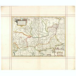
Walachia, Servia, Bulgaria, Romania.
Striking map of the region centered on the Lower Danube, Bulgaria, Romania, Serbia and Macedonia. Includes decorative cartouche, coat of arms, etc. Latin text on verso.Th...
Date: Oxford, 1680
Selling price: ????
Please login to see price!
Sold in 2015
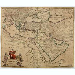
Turcicum Imperium.
Detailed map of the Turkish Empire by Holland's leading mapmaker at the end of the seventeenth century. The cartouche shows an Ottoman administrator or possibly the Sulta...
Date: Amsterdam, 1680
Selling price: ????
Please login to see price!
Sold in 2016
Novissima et Accuratissima Totius Russiae Vulgo Muscoviae Tabula at Iusto Danckerts . . .
Interesting map of Western Russia and Ukraine, published by Justus Danckerts. The map extends from the northern tip of the Black and Caspian Seas to the Mare Mosovia and ...
Date: Amsterdam, 1680
Selling price: ????
Please login to see price!
Sold in 2015
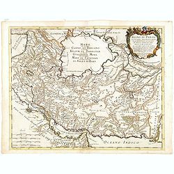
Kingdoms of Tartaria.
Titled Tartary in the cartouche ‘A General Mapp of the Kingdoms of Tartaria. Designed by Monsieur Sanson’ engraved by Thomas Burnford, after the map by Nicolas Sanson...
Date: London, 1680
Selling price: ????
Please login to see price!
Sold in 2018
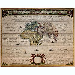
Orbis Terrarum Veteribus Cogniti Typus Geographicus.
A classic map of the ancient world based on Ortelius. Europe, Asia and Africa as far south as Madagascar are placed at the center of a much larger oval frame.The Climatic...
Date: Amsterdam, 1680
Selling price: ????
Please login to see price!
Sold in 2019
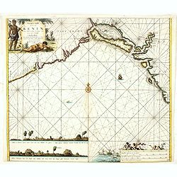
Pascaert vande Bocht van Benin..
Uncommon chart showing the coast of Nigeria from Accra (Ghana) till Douala in Cameroon.
Date: Amsterdam, 1680
Selling price: ????
Please login to see price!
Sold in 2016
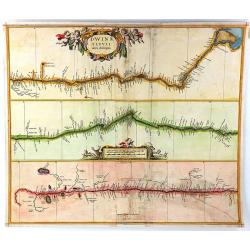
Dwinae Fluvii Nova Deseripio.
An unusual early map, showing the course of the Dvina River in three separate panels in strip map style. With the headwaters at bottom left, and with the mouth at Archang...
Date: Amsterdam, 1680
Selling price: ????
Please login to see price!
Sold in 2016
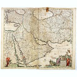
Nova Persiae Armeniae Natoliae et Arabiae.
East from Cyprus to Iran with numerous place names and ornamental cartouches below. There are vignettes of sailing ships in sea areas and the land divisions of the time a...
Date: Amsterdam, 1680
Selling price: ????
Please login to see price!
Sold in 2016
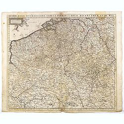
Belgii Regii Accuratissima Tabula Pluribus Locis recens emen: A F. DE Wit.
Covering present-day Belgium, Luxembourg, Noord Brabant an Limburg in the Netherlands, and northern part of France.
Date: Amsterdam, 1680
Selling price: ????
Please login to see price!
Sold in 2016
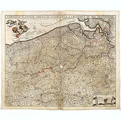
Comitatus Flandriae Tabula, In Lucem Edita A Frederico De Wit.
Double page map of Flanders, the whole Belgian region northwest of Brussels, confined by Antwerp, Brussels, Valenciennes, Arras, St. Omer and the Channel. Title heading a...
Date: Amsterdam, 1680
Selling price: ????
Please login to see price!
Sold in 2016
Tabula Ducatus Brabantiae continens Marchionatum Sacri Imperii et Dominium Mechliniense emendate à F. de Wit 1666
Shows present-day Belgium and Dutch province of Brabant. Including the Maas and Waal rivers. Shows Antwerp, Brussels, Namur, Liege and Venlo among other towns and cities....
Date: Amsterdam, 1680
Selling price: ????
Please login to see price!
Sold in 2016