Browse Listings in Europe > Eastern Europe
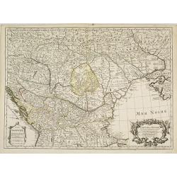
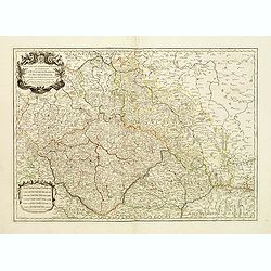
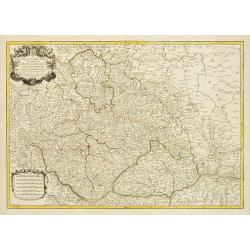
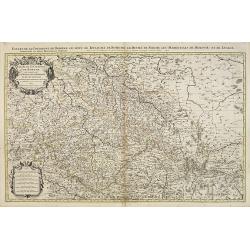
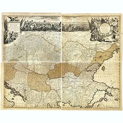
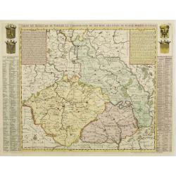
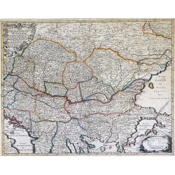
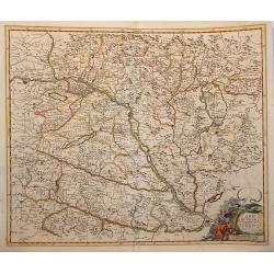
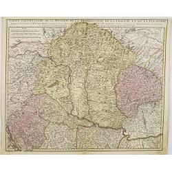
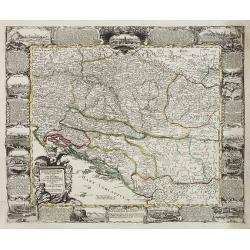
Carte de la Hongrie et des pays qui en dependoient autrefois. . .
The edition by Buache of Delisle's important map of Hungary and the Balkans. It is the first map depicting the Danube bend and the river fairly accurately. Fine decorativ...
Date: Paris, 1703
Selling price: ????
Please login to see price!
Sold in 2009
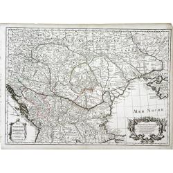
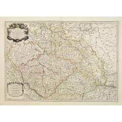
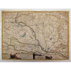
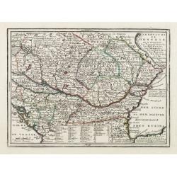
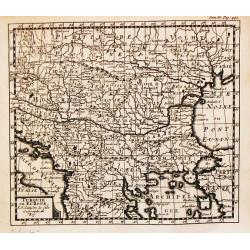
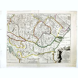
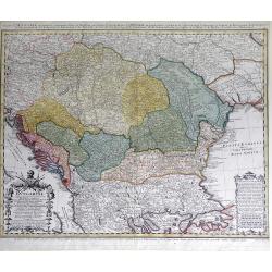
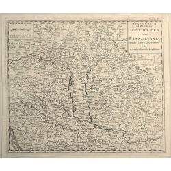
Carte de la Hongrie. . .
Finely detailed map of southeastern Europe, including the regions of Hungary, northern Greece, Bulgaria, Romania, Bohemia, Germany, Poland and the Ukraine by Guillaume de...
Date: Paris, 1703
Selling price: ????
Please login to see price!
Sold in 2010
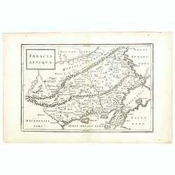
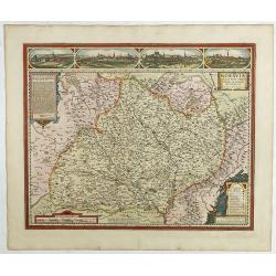
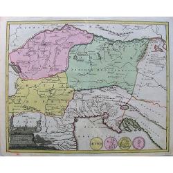
Thracia Antiqua.
This map depicts the historic and geographical region of Thrace in south eastern Europe, bordering on todays Greece, European Turkey and Bulgaria. Map shows parts of the ...
Date: Germany, 1703
Selling price: ????
Please login to see price!
Sold in 2015
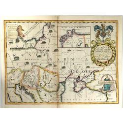
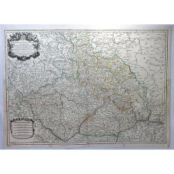
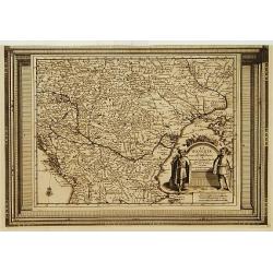
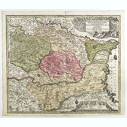
A New Map of Sarmatia Europaea Pannonia and Dacia...
A striking map of the land of ancient Sarmatia, Pannonia, and Dacia, extending from Hungary through the Ukraine. The cartouche is splendid, it includes the Gloucester coa...
Date: Oxford, 1703
Selling price: ????
Please login to see price!
Sold in 2017
Carte de la Hongrie et des pays qui en dependoient autrefois. . .
Map of Hungary and the Balkans with the address : Chez l’Auteur sur le Quai de l’Horloge avec Privilege du Roy pour 20 ans, 1703. Lower right, Renard’s imprint is e...
Date: Paris, 1703
Selling price: ????
Please login to see price!
Sold in 2018
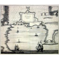
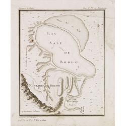
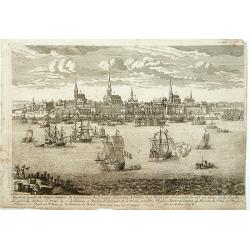
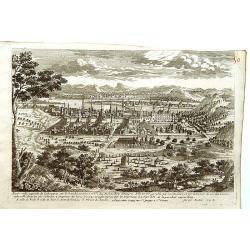
Spalato. Ville des Venetiens,...
Large decorative view of the forts and harbour of Split in Croatia. A few roads, buildings and hills are shown. Decorated with multiple large sailing ships, a distance sc...
Date: Amsterdam, c1704
Selling price: ????
Please login to see price!
Sold
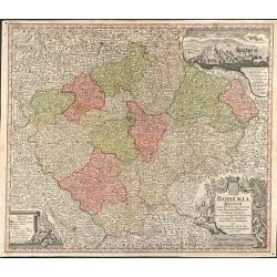
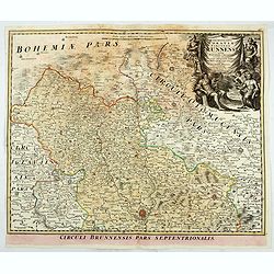
Estats de la couronne de Boheme qui comprennent le Royaume de Boheme..
Decorative map of Czech Republic with a nice title cartouche. Engraved by Cordier and prepared by N. Sanson. With the address "les grands Augustins, aux a globes&quo...
Date: Paris 1704
Selling price: ????
Please login to see price!
Sold
Estats de la Couronne de Boheme qui comprennent le Royaume de Boheme, le Duché de Silesie?
Centered on Prague. Engraved by Cordier.
Date: Paris, 1704
Selling price: ????
Please login to see price!
Sold
Estats de la couronne de Boheme qui comprennent le Royaume de Boheme..
Decorative map of Czech Republic, southwestern part of Poland and eastern parts of Germany with a nice title cartouche.Engraved by Cordier and prepared by N. Sanson. With...
Date: Paris 1704
Selling price: ????
Please login to see price!
Sold
Le Royaume de Hongrie Divise en Haute et Basse.
Coronelli's scarce map of Hungary & Serbia published by Nolin. The huge 45 cm. cartouche includes the title, scale and advertising by Nolin of his maps. It depicts th...
Date: Paris, 1704
Selling price: ????
Please login to see price!
Sold in 2014
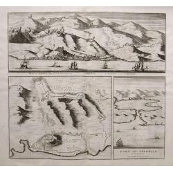
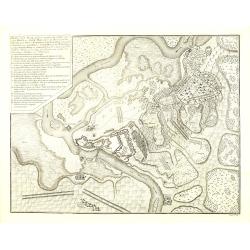
Veue de Sebenico... /Plan de Sebenico.../Port de Sebenico...
Rare large sheet with three maps/views of Šibenik in Croatia. The large panorama view shows the harbour with several sailing ships, the detailed city in the background, ...
Date: Amsterdam, 1704
Selling price: ????
Please login to see price!
Sold in 2015
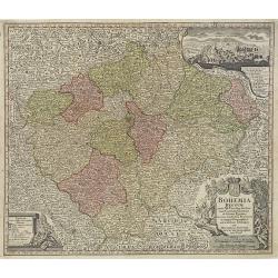
Estats de la Couronne de Boheme. . .
A large decorative map of Bohemia, with Silesia, Lusatia and Moravia. (currently the Czech Republic) centered on Prague, with an elaborate title cartouche featuring two h...
Date: Paris, 1704
Selling price: ????
Please login to see price!
Sold in 2018
Etats de la Couronne de Boheme qui comprennent le Royaume de Boheme . . .
Extensive map centered on the rivers Elbe and Oder with Prague, including the eastern part of Germany and a part of Poland. The map is fully and richly engraved. Large an...
Date: Amsterdam, c.1705
Selling price: ????
Please login to see price!
Sold in 2023
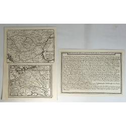
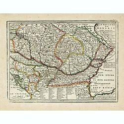
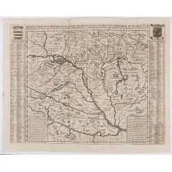
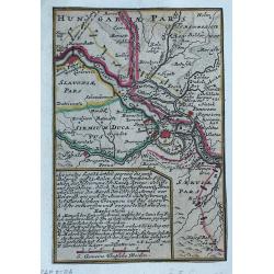
Hongrie ou Partie Septent de la Turquie. Estats du Grand Duc de Moscovie.
Two small maps by Nicolas de Fer, published in Paris in 1705. From his atlas ATLAS CURIEUX. Interestingly, it comes with description text.Nicolas de Fer (1646-1720) was ...
Date: Paris, 1705
Selling price: ????
Please login to see price!
Sold in 2018
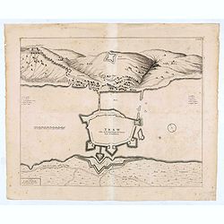
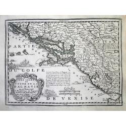
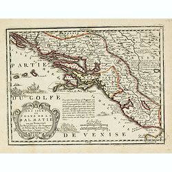
TRAW Ville de la Republique de Venise dans la Dalmatie.
Large view of the port city of Trogir (Trau) in Croatia with the fortress from a half bird's eye view. Joan Blaeu published during his life three town-books of Italy: Cit...
Date: Amsterdam, 1704- 1705
Selling price: ????
Please login to see price!
Sold in 2020
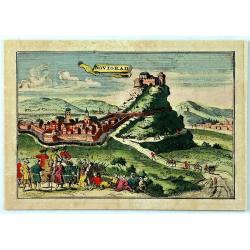
Novigrad.
An unusual panoramic view of Novigrad, Croatia. The view shows the city with his buildings, churches, town walls, Castle and surrounding landscape. In the foreground the...
Date: Paris, 1708
Selling price: ????
Please login to see price!
Sold in 2019
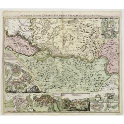
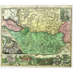
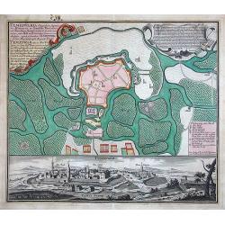
Neu Geographisch vorgestelltes Ungarisches Kriegs -Theatrum. . .
A rare map centered on Belgrade, including two plans of the battle of Belgrade and Temeswar in 1717 : underneath the map, two views of Belgrade and the Serbian city of Sm...
Date: Nuremberg, ca 1710
Selling price: ????
Please login to see price!
Sold in 2020
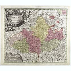
Moraviae Nova et post omnes priores accuratissima delineatio.
The cartographer of this map was Johan Amos Comenius (1592-1670), Czech cartographer and priest. In the upper part four views of Polna, Olmuts, Brin and Znaim.The sixth s...
Date: Amsterdam, between 1680 and 1713
Selling price: ????
Please login to see price!
Sold in 2021
Nova et accurata Tabula sedis belli in Regno Hungariae. Accendunt cetera Regna Sclavonia, Croatia, Bosnia, Servia, Dalmatia, Bulgaria et Romania . . .
Wall map in 4 separate sheets, if joined 915 x 1118mm. Map of Hungary, with Transylvania, Croatia, Poland and Slovenia after Conte Luigi Marsigli (1658-1730, an Italian m...
Date: Amsterdam, 1717
Selling price: ????
Please login to see price!
Sold in 2016
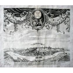
Bellogradum VI Capitur.
An extremely rare, large view of Belgrade. Just one copy found (in the Bayerische Staatsbibliotek, Munich, Germany). It seems to be made of two copper plates, the lower o...
Date: Augsburg / Amsterdam, 1717
Selling price: ????
Please login to see price!
Sold in 2017
SERBIA - BANAT. UNGARISCHES KRIEGS THEATRUM.
A large and detailed, very decorative map of the theatre of war between the Austrians and Ottoman Turks 1716-17, fought in Romania and Serbia. Under Prince Eugene of Savo...
Date: Nuremberg, 1718
Selling price: ????
Please login to see price!
Sold in 2022
Les Isles et coste de la Dalmatie.
Nice small map of the Balkan coast.
Date: Paris, 1719
Selling price: ????
Please login to see price!
Sold
Les Isles et Coste de la Dalmatie ou se Trouvent la Republique de Raguse..
Fine map of the Dalmatian coast with a decorative title cartouche.Presents vessels in the Adriatic Sea and some text containing information about the Republic of Ragusa, ...
Date: Paris, 1719
Selling price: ????
Please login to see price!
Sold in 2010
Le Royaume de Hongrie ou se trouvent La Transilvanie, La Moldavie, La Valaquie, L\'esclavonie, La Bosnie, La Servie, et la Bulgarie..
Map of Hungary including most part of southeastern Europe as far as Istanbul.It shows a text table at the bottom containing the names of Hungarian rulers.From Le Nouveau ...
Date: Paris, 1719
Selling price: ????
Please login to see price!
Sold in 2009
Les Isles et Coste de la Dalmatie. . .
An interesting map of the Dalmatian coast with the Republique of Raguse (Dubrovnik) at the centre. Based on Sanson's map from 1665. The area shown extends from Zadar in C...
Date: Paris, 1719
Selling price: ????
Please login to see price!
Sold in 2014
Le Royaume de Hongrie ou se trouvent La Transilvanie, La Moldavie, La Valaquie, L'esclavonie, La Bosnie, La Servie, et la Bulgarie..
Map of Hungary including most part of southeastern Europe as far as Istanbul.It shows a text table at the bottom containing the names of Hungarian rulers.From Le Nouveau ...
Date: Paris, 1719
Selling price: ????
Please login to see price!
Sold in 2016
Les Isles et Coste de la Dalmatie ou se Trouvent la Republique de Raguse..
Fine map of the Dalmatian coast with a decorative title cartouche.Presents vessels in the Adriatic Sea and some text containing information about the Republic of Ragusa, ...
Date: Paris, 1719
Selling price: ????
Please login to see price!
Sold in 2016
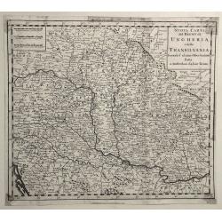
Nouvelle Carte De La Hongrie Divisee Selon ses Differents Etats, Avec une Chronologie De Ses Ducs et de ses Rois . . .
Detailed map of Hungary, extending to Bosnia, Slovenia, Temeswar, and the Saw River in the south to Moravia, and the Frontiers of Poland in the north, centered on the cou...
Date: Amsterdam, ca. 1719
Selling price: ????
Please login to see price!
Sold in 2020
Riga Capitale de la Province de Livonie.
A very RARE panoramic view of the city of Riga.The plate is numbered in red pencil in upper right corner.Engraved by Pierre Aveline (Paris, c.1656 - 23 May 1722). He was ...
Date: Paris 1690-1720
Selling price: ????
Please login to see price!
Sold
Carte du Royaume de Boheme. La chronologie de ses Rois..
Map centered on today Czech Republic, including part of Poland with a key table to the towns on both sides.Zacharie Chatelain (d.1723) was the father of Henri Abraham (16...
Date: Amsterdam, ca. 1720
Selling price: ????
Please login to see price!
Sold
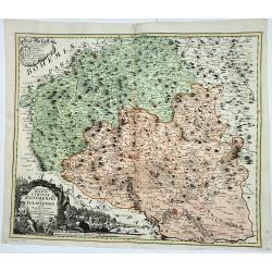
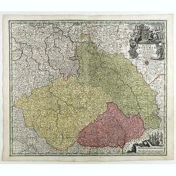
Bohemia Regnum juxta XII. Circulos divisum, cum Comitatu Glacensi et ditione Egrana, nec non confinibus Provinciis in mappa Geographica accurati¯ime delineatum per Matthaeum Seutter
Large original old colored map of Bohemia by M. Seutter. With two decorative cartouches and a city view of Carlsbad. Centered around Prague (Praha).
Date: Augsburg, 1720
Selling price: ????
Please login to see price!
Sold in 2009
Bohemia Regnum juxta XII. Circulos divisum, cum Comitatu Glacensi et ditione Egrana, nec non confinibus Provinciis in mappa Geographica accuratissime delineatum per Matthaeum Seutter.
Decorative and uncommon map of Bohemia by M. Seutter. With two decorative cartouches and a city view of Carlsbad, with a numbered key. Centered around Prague.
Date: Augsburg, 1720
Selling price: ????
Please login to see price!
Sold in 2010
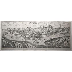
Bude Ville capitale de la Hongrie.
A rare panoramic of Budapest.The plate is numbered in red pencil in upper right corner.Engraved by Pierre Aveline (Paris, c.1656 - 23 May 1722). He was also a print-publi...
Date: Paris, 1690-1720
Selling price: ????
Please login to see price!
Sold in 2009
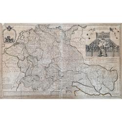
Vindelicia Rheti.
Nice original colored map with cartouche and coins on it. There are a few pencil lines on it.
Date: Nurnberg, 1720
Selling price: ????
Please login to see price!
Sold in 2010
Nova et Accurata Tabula Regnorium Sup. Et Inf. Hungariae It: Sclavoniae, Bosniae, Serviae, Albaniae, Bessarable, ut et Princip. Transylvaniae, Moldavie, Walachiae, Bulgar et Romanie ...
Finely detailed map of Southeastern Europe showing the countries of Hungary, part of Ukraine, Romania, Bulgaria, northern Greece, Albania, Bosnia, Serbia, Croatia and the...
Date: Augsburg, c. 1720
Selling price: ????
Please login to see price!
Sold in 2010
Plan van de Slag gelevert tuschen het Leger van zyne Keyz. . . pris Eugenius van Savoyen. . tusschen Petervaradin en Carlowitz. . .
Uncommon engraving showing the Battle of Petrovaradin or Battle of Peterwardein, which was a decisive victory for Austrian forces in the war between Austria and the Ottom...
Date: Amsterdam, ca. 1720
Selling price: ????
Please login to see price!
Sold in 2011
Carte de etats de la dependance de sa maieste imperiale et des anciens comtes d'Habsbourg.
This impressive engraving is a wonderful example of Chatelain’s elegant plates from his "Atlas Historique, Ou Nouvelle Introduction A L’Histoire …" Showin...
Date: Amsterdam, ca. 1720
Selling price: ????
Please login to see price!
Sold in 2012
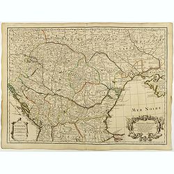
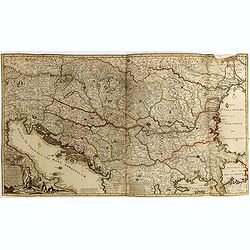
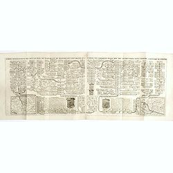
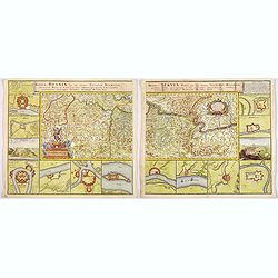
![[. . .] rte Ancienne et Moderne des Differents Etats et Pais situez au Long du Danube, pour servir a L'Intelligence De L'His [. . .]](/uploads/cache/34428-250x250.jpg)
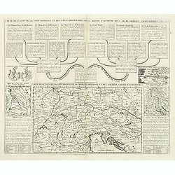
[. . .] rte Ancienne et Moderne des Differents Etats et Pais situez au Long du Danube, pour servir a L'Intelligence De L'His [. . .]
A striking and highly detailed copper engraved plate with a map of region north of the Adriatic Sea and centered on the Danube River, from Croatia to the Black Sea. Inclu...
Date: Amsterdam, 1720
Selling price: ????
Please login to see price!
Sold in 2014
Marchionatus Moraviae Circuli Znoymensis et Iglaviensis
Marchionatus Moraviae Circuli Znoymensis et Iglaviensis quos mandato caesareo accuratè emensus hac Mappa delineatos exhibit. (1720)cartographer: Johann Christoph Mülle...
Date: Nürnberg, 1720
Selling price: ????
Please login to see price!
Sold in 2023
Turquie en Europe.
A nice little map of Greece.
Date: Amsterdam, 1721
Selling price: ????
Please login to see price!
Sold
A Map of Hungary and Countries adjacent.
An uncommon English edition of De Wit's map of Scandinavia, 'revised by I.Senex' for inclusion in his atlas of 1721, re-engraved by John Harris. These revisions appear to...
Date: London, 1721
Selling price: ????
Please login to see price!
Sold in 2009
Accurates lankärtlein worine...Belgrad
Rare map, centered on Belgrade. With a lettered key, probably referring to the siege of Belgrade of 1717.
Date: Augsburg, ca.1722
Selling price: ????
Please login to see price!
Sold in 2023
Königreich Boehmen mit seinen..
Uncommon map of Bohemia. The originally colored title cartouche has a coat-of-arms. From Atlas Portatif.
Date: Nuremberg 1724
Selling price: ????
Please login to see price!
Sold
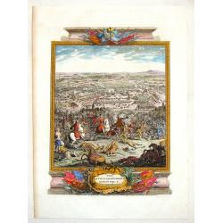
The Battle of Piterwaradin - August the V, 1716.
Antique hand-colored folio copper plate from Jean Dumont's book "The Military History of the Late Prince Eugene of Savoy and the Late John Duke of Marlborough"....
Date: London, 1727
Selling price: ????
Please login to see price!
Sold in 2015
La Hongrie, suivant les nouvelles observations..
Uncommon edition of this map of Eastern Europe with the river Danube. With decorative title cartouche lower right corner.This example is unusual in having the additional ...
Date: Amsterdam 1728
Selling price: ????
Please login to see price!
Sold
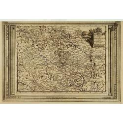
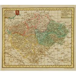
La Bohême, suivant les nouvelles observations..
Uncommon edition of this map of Czech Republic. With decorative title cartouche upper right corner.This example is unusual in having the additional separately engraved de...
Date: Amsterdam 1728
Selling price: ????
Please login to see price!
Sold
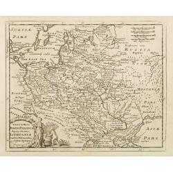
Veteris et Novae Regni Poloniae Magniq Ducatus Lithuaniae Cum Suis Palatinatibus ac Consinus Descriptio.
A simple map displays the region from the Baltic to the Black Sea, centered on Lithuania.It is filled with ancient place names. Presents a decorative title cartouche in t...
Date: Amsterdam, 1729
Selling price: ????
Please login to see price!
Sold in 2008
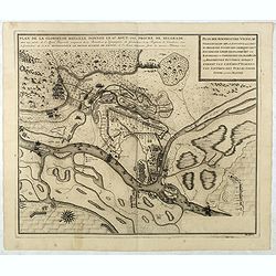
Plan de la Glorieuse Bataille donnee le 16 aout, 1717. Proche de Belgrade...
Title also in Dutch: ""Plan der Roemrugtige Veldslag Voorgevallen den 16 Augustus 1717 Digt by Belgrade ". Oriented to the southeast. Page placement in low...
Date: The Hague, van der Kloot, 1729
Selling price: ????
Please login to see price!
Sold in 2022
Plan de Temiswar … Plan van Temiswar.
Title also in Dutch: "Plan der Roemrugtige Veldslag Voorgevallen den 16 Augustus 1717 Digt by Belgrade ". Oriented to the southeast. Page placement in lower rig...
Date: The Hague, 1729
Selling price: ????
Please login to see price!
Sold in 2022
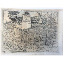
La Prusse. Suivant les Nouvelles Observations de Messrs. de l'Academie Royale des Sciences, etc. Augmentées de Nouveau. A Leide, chez Pierre vander Aa. - Avec Privilege.'
Decorative example of Van der Aa's map of Prussia, including Poland and Lithuania.
Date: Leiden, 1729
Selling price: ????
Please login to see price!
Sold in 2023
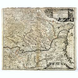
Novissima Tabula Regni Hungariae et Regionum . . . ut Transilvaniae. Valachiae. Moldaviae Serviae. Romaniae. Bulgariae Bessarabiae. Croatiae. Bosniae. Dalmatie. Slavoniae . . .
A large and impressive map of Central Europe including Hungary, the Danube Delta, Transylvania, Walachia, Moldavia, Croatia, Bosnia, Dalmatia, Slavonia, Morlachia and the...
Date: Amsterdam, 1730
Selling price: ????
Please login to see price!
Sold in 2015
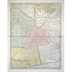
Transylvaniae, Moldaviae, Walachiae, Bulgariae nova et accurata Delineatio, Magnam Partem Hodierni Theatri Bellici ob oculos ponens opera et fumtibus .
Uncommon map showing Southeast Europe with Transylvania, Moldavia, Bulgaria and the Walachei. With the mouth of the river Danube into the Black Sea. In the upper right co...
Date: Nurember, 1730
Selling price: ????
Please login to see price!
Sold in 2016
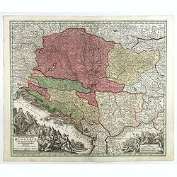
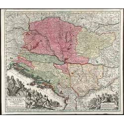
Nova et accurata Hungariae cum adiacentib. regn. et principatibus tabula. . .
Map of the Balkan showing Hungary, Serbia, Croatia, Bosnia and Herzegovina and Albania. With two beautiful cartouches. Shows cities and towns, place names, rivers, forest...
Date: Augsbourg, 1730
Selling price: ????
Please login to see price!
Sold in 2018
Transylvaniae, Moldaviae, Walachiae, Bulgariae, nova et accurata Delineatio, Magnam Partem Hodierni Theatri Bellici . . .
Map shows Southeast Europe with Transylvania, Moldavia, Bulgaria and the Walachia, with engraved detailed hand colored map. Includes decorative cartouche. Shows cities an...
Date: Augsbourg, 1730
Selling price: ????
Please login to see price!
Sold in 2017
Moravia marchionatus in sex circulos divisus . . .
Map of the county of Moravia, boarded by Bohemia, Silesia, Hungary and Austria, with engraved detailed hand colored map. Includes decorative cartouche. Shows cities and t...
Date: Augsbourg, 1730
Selling price: ????
Please login to see price!
Sold in 2018
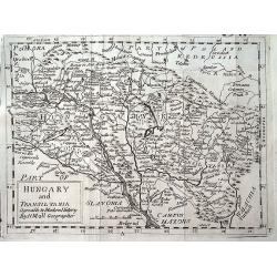
Hungary and Transilvania agreable to Modern History by H. Moll Geographer.
A scarce variant of Moll's map of Hungary and Transylvania, extending from Vienna to Belgrade.
Date: London, ca 1730
Selling price: ????
Please login to see price!
Sold in 2019
Prospect der Vestung Belgrad.
An exceptionally rare, unrecorded view of Belgrade, published around 1730.
Date: Unknown, ca. 1730
Selling price: ????
Please login to see price!
Sold in 2020
A New Map of Germany, Hungary, Transilvania...
Large scale map of central Europe from Moll, published J. & T. Bowles, P. Overton & J. King. Shows the area within Danzig, Denmark, Paris, Venice, Trieste, Pragu...
Date: London, ca. 1730
Selling price: ????
Please login to see price!
Sold in 2023
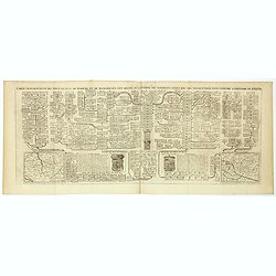
Carte genealogique des Ducs et Rois de Boheme et de Hongrie qui ont regné ou gouverné ces differents etats avec des instructions pour conduire à l'histoire de POLOGNE. . .
A genealogical tree of the Bohemian ducks and kings, from Chatelain's monumental 7 volume "Atlas Historique". This two sheet print features two maps (115 x 153m...
Date: Amsterdam, 1719-1732
Selling price: ????
Please login to see price!
Sold in 2017
Carte genealogique des Ducs et Rois de Boheme et de Hongrie qui ont regné ou gouverné ces differents etats avec des instructions pour conduire à l'histoire de POLOGNE. . .
A genealogical tree of the Bohemian Duchess and Kings, from Chatelain's monumental 7 volume "Atlas Historique". This two sheet print features two small maps (11...
Date: Amsterdam, 1719-1732
Selling price: ????
Please login to see price!
Sold in 2018
Fines Hungariae victoriis Caroli VI Caes. Aug. et pace Pasarovicensi ampliatos in hac tabula color flavus indicat.
A less common map of Hungary centered on Principatus Transillvaniae by Christoph Weigel highly detailed.
Date: Nuremberg,1735
Selling price: ????
Please login to see price!
Sold in 2012
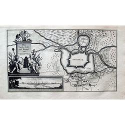
Plan Van de Stadt en't Kasteel Van TEMISWAR.
Unusual map of Temesvár or Timișoara. Shows the city fortifications being attacked. With a large decorative title with figures and weapons. Includes an inset vi...
Date: Amsterdam, 1735
Selling price: ????
Please login to see price!
Sold in 2020
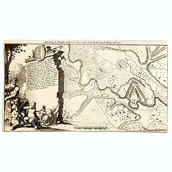
Afbeelding der Batallje tusschen de Moscoviters en de Turken aan de Rivier de Prut.
An attractive engraving showing the battle plan along the river Prut in Moldavie. Decorative lettered key A-R in left part.During the Russo-Turkish War of 1710–1711, on...
Date: Amsterdam, 1735
Selling price: ????
Please login to see price!
Sold in 2014
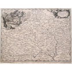
Marchionatus Moraviae Tabula.
Scarce map of Moravia, Czech Republic. Includes numerous towns, including the cities of Jihlava, Brno, Olomouc, and Uherské Hradiště. Extends to the borders of...
Date: Augsburg, ca. 1735
Selling price: ????
Please login to see price!
Sold in 2016
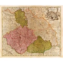
Regni Bohemiae Ducatus Silesiae..
"Johann Baptist Homann's well-engraved map of the Czechoslovakia and southern part of Poland. With fine decorative title cartouche. Johann Baptist Homann (1663-1724)...
Date: Nurnberg 1737
Selling price: ????
Please login to see price!
Sold
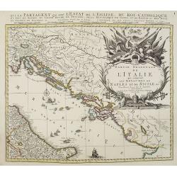
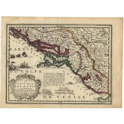
Partie orientale de L'Italie qui comprend les Royaumes de Naples et de Sicile. . .
Map of former Yugoslavia and the eastern part of Italy with a splendid baroque title cartouche with mythological figures. Title : Partie orientale de L'Italie qui compren...
Date: Amsterdam, ca. 1737
Selling price: ????
Please login to see price!
Sold in 2010
Le théâtre de la guerre sur les frontières des deux empires depuis Vienne jusques à Constantinople, où se trouvent la Hongrie, la Transilvanie,
Nicolas De Fer's map of the Theater of War showing the region between Vienna and Constantinople, included are Hungary, Bulgaria, Wallachia, Transylvania, Bosnia and Serbi...
Date: Paris, Bernard, 1737
Selling price: ????
Please login to see price!
Sold in 2019
Nova et Accurata Hungariae cum adiacentib. Regn. et Principatibus Tabula
Original old colored map of the Balkan by M. Seutter. Showing Hungary, Serbia, Croatia, Bosnia and Herzegovina and Albania. With two beautiful cartouches.
Date: Augsburg, 1740
Selling price: ????
Please login to see price!
Sold in 2009
Carte particuliere de la Hungarie de la Transivanie de la Croatie et de la Sclavonie. . .
A map showing Hungary, Serbia, Croatia.
Date: Amsterdam, 1740
Selling price: ????
Please login to see price!
Sold in 2008
Danubii Fluminis pars media in qua Hungaria, Sclavonia..
Very rare "carte à figures" map of former Yugoslavia. With decorative title cartouche and surrounded by four borders with 13 city views each accompanied by lar...
Date: Augsburg, 1740
Selling price: ????
Please login to see price!
Sold
Carte d'Hongrie en general contenant felon la Division ancienne & methodique, la Hongrie en particulier, la Croatie, la Dalmatie, la Bosnie, la Servie, la Boulgarie; la Principaute de Transylvanie, les Defpotats de Walacie & de Moldav...
A fine map of the Balkan region, including Hungary, Romania, Bulgaria, Bosnia, Serbia, Macedonia and the eastern regions of the Black Sea, by Johann Matthias Haas (Hasius...
Date: Nuremberg: c.1740
Selling price: ????
Please login to see price!
Sold in 2010
Temeswaria Oppidum superioris Hungariae. . .
Rare, large town-plan and view of the city of Timisoara, in Romania. In old original colors
Date: Augsburg, 1740
Selling price: ????
Please login to see price!
Sold in 2013
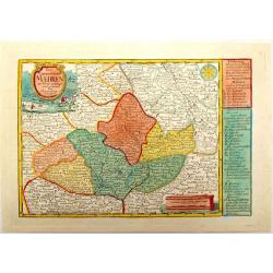
Das Marggrafthum Maehren.
Striking very detailed map of Moravia in the Czech Republic showing Brno, Austerlitz, Olomouc, Ostrava etc..It has two fancy cartouches, one with hunting and fishing scen...
Date: Leipzig, 1740
Selling price: ????
Please login to see price!
Sold in 2015
Regnum Bosnia, cum finitimis Croatiae, Dalmatiae. . ./ Regni Serviae pars, una cum finitimis Valechiae and Bulgariae. . .
A lovely pair of maps of Croatia, Dalmatia, and Serbia, Walachia, and part of Bulgaria. The first map 8 small inset maps of Ussitza, Brodt, Wihaz, Zwornek, ratscha, Sabat...
Date: Nuremberg, 1740
Selling price: ????
Please login to see price!
Sold in 2018
Nuovo Carta del Regno di Ungheria e Della Transilvania...
Detailed map of Hungary and Romania including hundreds of tiny villages. Title in block style.Copied after Isaak Tirion (1705 – 1765).
Date: Venice, 1740
Selling price: ????
Please login to see price!
Sold in 2019
Nuovo Carta del Regno di Ungheria, e della Transilvania ...
Detailed map of Hungary, Slovenia, Transylvania, and parts of Croatia, Bosnia, Serbia, Romania and Bulgaria, from an Italian edition of Thomas Salmon's , “Modern Histor...
Date: Venice, 1740
Selling price: ????
Please login to see price!
Sold in 2019
Marchionatus Moraviae circulus brunnensis. . .
Johann Baptist Homann's well-engraved map has a large decorative cartouche. Detailed map centered on Bruenn in Moravia. Prepared by Johann Chr. Mueller. Very decorative t...
Date: Nuremberg, 1740
Selling price: ????
Please login to see price!
Sold in 2020
Mappa Geographica Regnum Bohemiae Cum Adiunctis Ducatu Silesiae, . . .
Map of part of Germany, Czech Republic and Poland, with engraved detailed hand colored map. Includes decorative cartouche. Shows cities and towns, place names, rivers, fo...
Date: Augsbourg, 1741
Selling price: ????
Please login to see price!
Sold in 2018
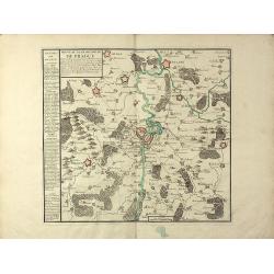
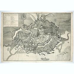
Nouveau Plan de la Ville de Prague Et de ses Environs, Capiltale de Bohème
A rare separately issued battle plan of Prague by Baillieul and Jombert. Showing the Siege of Prague in 1742 with deployment of troops. With one mileage scale, text carto...
Date: Paris, 1742
Selling price: ????
Please login to see price!
Sold in 2011
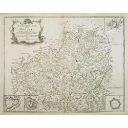
Carte Particuliere de la Moravie Divisée en six Cercles . . .
Detailed map of former Czechoslovakia now part of the province of Moravia and Silesia. From the original survey by Mr. Muller with inset plans of Olmutz, Iglaw, Neustatt ...
Date: Paris, 1742
Selling price: ????
Please login to see price!
Sold in 2023
