Browse Listings in Europe
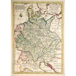
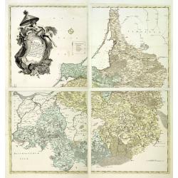
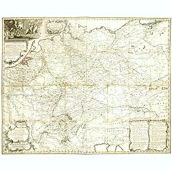
Kaart van Duitschland
Willem Albert Bachiene (1712-1783), Dutch geographer in Maastricht. Most important work ' Heilige Geographie', a work on the Holy Land. Mathijs Schalenkamp published in 1...
Date: Amsterdam, 1785
Selling price: ????
Please login to see price!
Sold in 2013
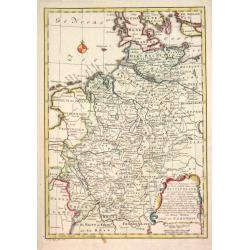
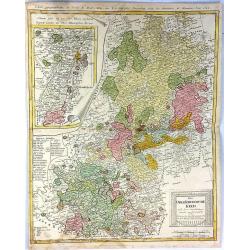
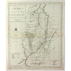
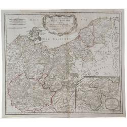
Kaart der Noord-westelijke deelen van Duitschland.
Willem Albert Bachiene (1712-1783), Dutch geographer in Maastricht. Most important work ' Heilige Geographie', a work on the Holy Land. Mathijs Schalenkamp published in 1...
Date: Amsterdam, 1785
Selling price: ????
Please login to see price!
Sold in 2013
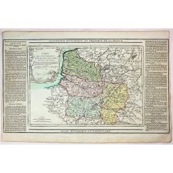
LIEGE,
Map of the princedom of Liege and part of the Dutch province Limburg, with the cities of Maastricht and Liege in the centerpart of the map. An inset map represents the e...
Date: Paris 1785
Selling price: ????
Please login to see price!
Sold
![[2 maps] Parte Occidentale del Regno di Boemia Di Nuova Projezione.. / Parte Occidentale del Regno di Boemia Di Nuova Projezione..](/uploads/cache/23642-250x250.jpg)
[2 maps] Parte Occidentale del Regno di Boemia Di Nuova Projezione.. / Parte Occidentale del Regno di Boemia Di Nuova Projezione..
Depicting what is now the Czech Republic as far East as Prague. Embellished with a title vignette lower left corner.Engraved by G. Zuliani after the drawing by G. Pitteri...
Date: Venice 1785
Selling price: ????
Please login to see price!
Sold
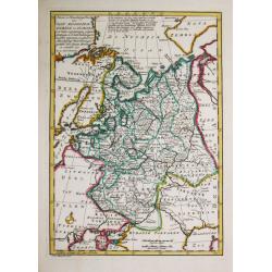
Het Russische gebied in Europa. 1778.
Willem Albert Bachiene (1712-1783), Dutch geographer in Maastricht. Most important work ' Heilige Geographie', a work on the Holy Land. Mathijs Schalenkamp published in 1...
Date: Amsterdam, 1785
Selling price: ????
Please login to see price!
Sold
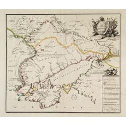
Carte de la Petite Tartarie Dresee par ordre de l'Imperatries de toutes las Russies.
Very rare first edition of De Leth's map of the southern part of Ukraine, with detailed annotations regarding the Cosaks and an explanatory key. Based on a Russian map, t...
Date: Amsterdam, ca. 1785
Selling price: ????
Please login to see price!
Sold in 2022
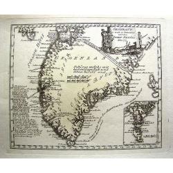
Grönland so weit es bekant ist mit den Inseln Faeröer No 77.
Unusual German map of Greenland, with parts of Iceland. A small inset map of the Faroe Islands. One of the most detailed map of Greenland at its time, with many place nam...
Date: Vienna, c1785
Selling price: ????
Please login to see price!
Sold in 2013
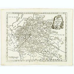
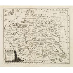
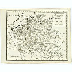
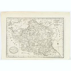
Carte Générale de la Pologne. . .
Map of Poland, from Atlas moderne portatif composé de vingt-huit cartes sur toutes les parties du globe terrestre .. A l'usage des Colléges, des Pensions & des Mais...
Date: Paris, 1785
Selling price: ????
Please login to see price!
Sold in 2013
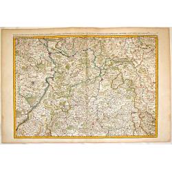
Partie du Palatinat du Rhein, le Duché de Wirtenberg les Partie du Palatinat du Rhein. Le Duche de Wirtenberg, Les Marquisats de Bade & Durlac, les Eveschés de Worms de Spire et le Comté de Linange.
Large, hand-colored, copperplate map of Rhineland Germany. It features the cities of Manheim, Hailbron, Stuttgart, Heidelberg & Baden. very detailed showing individua...
Date: Paris, 1785
Selling price: ????
Please login to see price!
Sold in 2016
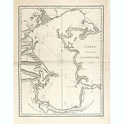
Carte de la Mer Caspienne 1785.
Large and detailed chart, with numerous soundings, as mapped by Jean Antoine Guldenstaedt (1745-1781), a Russian naturalist, who surveyed the area in 1771-1773. Engraved ...
Date: Paris, Dezauche, ca 1785
Selling price: ????
Please login to see price!
Sold in 2021
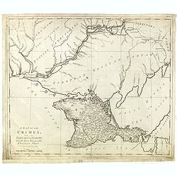
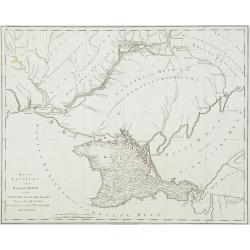
A Map Of The Crimea, And Of Tartary In Europe, From The Latest Surveys Of The Russian Army.
Shows "European Nogoyan Tartars" between well-detailed Crimea and the Dniepr River. To the north of that river there is "Part of the new acquired Russian T...
Date: London, June 30, 1785
Selling price: ????
Please login to see price!
Sold in 2015
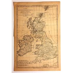
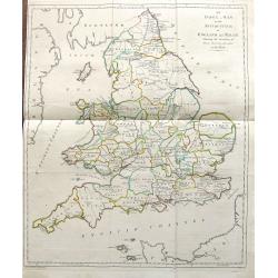
Carte des Isles Britanniques
Detailed map featuring all of Britain including the Shetland Islands. Rigobert Bonne (1727–1795) was one of the most important cartographers of the late 18th century. I...
Date: Paris, 1785
Selling price: ????
Please login to see price!
Sold in 2015
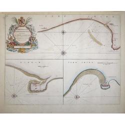
Burlington Bay, Scarbrough & Hartlepoole - To Capt. Ralph Sanderson this chart is dedicated and presented by Capt. Greenvile Collins, Hydrogr. to the King
From Great Britain's Coasting Pilot, by Captain Greenville Collins, Hydrographer in ordinary to the King's most Excellent Majesty.This sea chart is divided into three vie...
Date: London, 1785
Selling price: ????
Please login to see price!
Sold in 2018
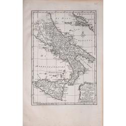
Naples en Sicilie
A rare map by Willem Bachiene, based on a previous map by R. Bonne. It depicts southern Italy, Sicily,and part of the coasts east of the Adriatic Sea.
Date: Amsterdam, 1785
Selling price: ????
Please login to see price!
Sold in 2018
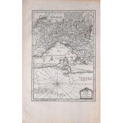
Plan van de Reede van Livorno
A rare map showing part of northern Italy and, in some detail, the sea area next to Livorno. From Willem Bachiene.
Date: Amsterdam, 1785
Selling price: ????
Please login to see price!
Sold in 2020
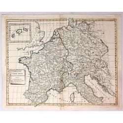
Imperium Caroli Magni Occidentis Imperatoris.
A detailed map of the Empire of Charlemagne covering Germany, France, Belgium, the Netherlands, Switzerland, Austria, Italy and Corsica. Issued as part of Antonio Zatta's...
Date: Venice, 1785
Selling price: ????
Please login to see price!
Sold in 2018
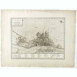
Varsovie.
Important early plan of Warsaw, based upon the 4-sheet plan of Warsaw by Pierre Ricaud de Tirregaille (1725-1770) who was a French Architect and Engineer. Tirregaille cam...
Date: Paris, ca. 1785
Selling price: ????
Please login to see price!
Sold in 2019
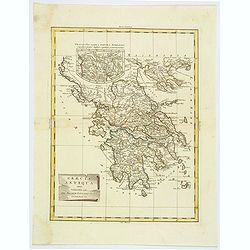
Graecia Antiqua.
A detailed map of Ancient Greece and contiguous Islands and countries. Issued as part of Zatta's Atlante Novissimo. Inset of northern Greece. Pretty title cartouche.
Date: Venice, 1785
Selling price: ????
Please login to see price!
Sold in 2019
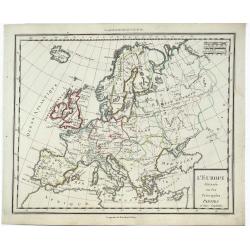
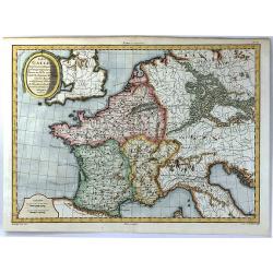
L'Europe Divissee en Ses Principales Parties et Leurs Capitales.
A striking, highly detailed, fine and unusual 1785 Mentelle copper engraved map of the whole European Continent. The map is filled with good topographic details as well a...
Date: Paris, 1785
Selling price: ????
Please login to see price!
Sold in 2019
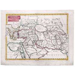
ALEXANDER THE GREAT, Imperium ALEXANDRI MAGNI Per Europam, Asiam, et Africam.
A detailed map of the Empire of Alexander the Great, extending from Asia Minor and Greece to the regions around the Black Sea and Capian Sea, reaching the Indus River in ...
Date: Venice, 1785
Selling price: ????
Please login to see price!
Sold in 2022
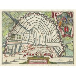
La ville D' Amsterdam.
Small bird's-eye plan of the city decorated with a vignette and title cartouche.
Date: Antwerp 1786
Selling price: ????
Please login to see price!
Sold
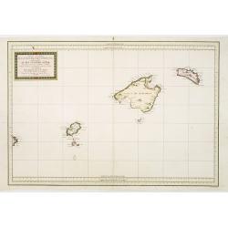
Carta Esferica de Las Yslas Baleares Y Pithyusas..
Rare chart of Majorca, Minorca and Ibiza. Prepared by Antonio Valdés. Engraved by Moreno Taxada. Detailed chart giving some soundings, place names and mountains.
Date: Madrid 1786
Selling price: ????
Please login to see price!
Sold
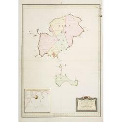
Carta Esferica de Las Islas de Iuizay.. (Ibiza)
Rare chart of Ibiza. Prepared by Antonio Valdés. Engraved by S.Brieva. Detailed chart giving soundings, place names and mountains. With inset plan Plano del Puerto de la...
Date: Madrid 1786
Selling price: ????
Please login to see price!
Sold
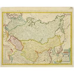
Charte das Russische Reich und die von den Tatarn..
Map showing the 'Russian Tartary' and as well the 'Asian Tartary', with French title in top.Title cartouche in the lower right corner and a table of explanations relating...
Date: Nuremberg, 1786
Selling price: ????
Please login to see price!
Sold in 2009
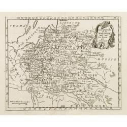
Carte de la Pologne avec tous les Etats, qui y son annexés.
Finely engraved small map of Poland. From Atlas Moderne ou Collection de Cartes sur Toutes les Parties du Globe Terrestre.
Date: Paris, 1786
Selling price: ????
Please login to see price!
Sold in 2008
Poland, Lithuania and Prussia Drawn from the latest Authorities by Thos. Kitchin Geogr.
Map showing the region along the Baltic Sea from Stettin to Riga. In the lower right is part of the course of the Dnieper river and part of Ukraine.To the right of the ti...
Date: Paris, 1786
Selling price: ????
Please login to see price!
Sold in 2008
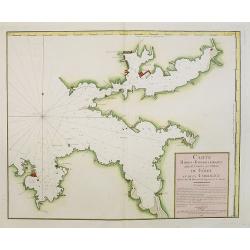
Carte Hidro-Topographique Des Entrées Et Ports du Férol Et De La Corogne..
Engraved by J. Dezauche.
Date: Paris, 1786
Selling price: ????
Please login to see price!
Sold in 2008
Neue und vollstaendige Postkarte durch ganz Deutschland. . . Carte des postes d'Allemagne partie du sud ouest. . .
The lower left part of a four sheet post road mapspost route map of Germany. Map showing the cities of Lyon, Chambery, Auxerre, Troyes, Luneville, Strasbourg, Basle, Bern...
Date: Nuremberg, 1786
Selling price: ????
Please login to see price!
Sold in 2017
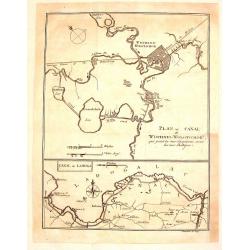
Plan du Canal de Wischnei-Wolotschok / Canal de Ladoga.
Two plans or maps on one page. The Canal Wischnei joins the Caspian and Baltic Seas. These canals are in European Russia.The map was engraved by Clauser and published by ...
Date: Geneva, 1786
Selling price: ????
Please login to see price!
Sold in 2015
Magna mappa geographica Borrussiae Regnum exacte ehibens. . .
A scarce separately published wall map in 4 sheets of Prussia. Including the towns of Gdansk, Kaliningrad, Klaipeda, etc. Prepared by Gerhard and engraved by von Sauerbre...
Date: Berlin, c. 1772 - 1786
Selling price: ????
Please login to see price!
Sold in 2011
Carte générale de la Pologne Avec tous les Etats qui y sont annexés.
Uncommon and detailed map of Poland prepared by C.Bertholon. Lithuania is shown and divided into Palatines. Plate No. 9 in: "Bibliotheque universelle des dames"...
Date: 1786
Selling price: ????
Please login to see price!
Sold in 2013
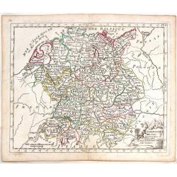
L'Allemagnedivissee par Cercles avec les Etats de Boheme et la Suisse.
A detailed map of the German states. Austria and Switzerland with Belgium part of Austria and Silesia as part of Prussia.
Date: Paris, 1786
Selling price: ????
Please login to see price!
Sold in 2016
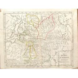
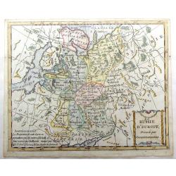
La Russie D'Europe, Divisee par Gouvernemens.
An interesting Russian map divided into its various provinces or oblasts. Note that Lapland was part of Russia at that time.The engraver was De La Porte and the map was p...
Date: Paris, 1786
Selling price: ????
Please login to see price!
Sold in 2016
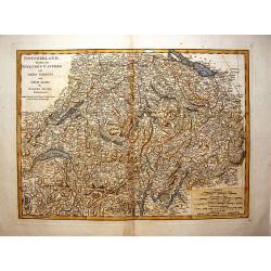
Switzerland Divided Into Thirteen Cantons.
A very detailed map of Switzerland by Samuel Dunn and published by Robert Sayer in London in 1786.
Date: London, 1786
Selling price: ????
Please login to see price!
Sold in 2016
La Russie d'Europe, Divisee par Gouvernemens.
A map of Russia in Europe divided into its various provinces. Interestingly, the map shows Lapland as being governed by Russia. Includes Lithuania and Estonia.
Date: Paris, 1786
Selling price: ????
Please login to see price!
Sold in 2016
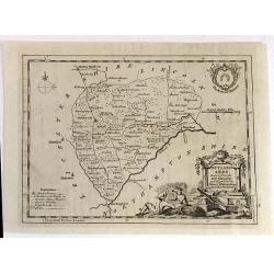
RUTLAND SHIRE, Drawn from the best Authorities
An attractive and neatly engraved 18th century map of Rutland, by Thomas Kitchin. It appeared in Henry Boswell's “Antiquities of England & Wales” in London publis...
Date: London, 1786
Selling price: ????
Please login to see price!
Sold in 2016
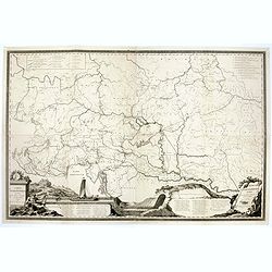
Carte Hydrographique des Etats de la Maison d'Autriche en deça du Rhin.
Rare wall map in four joined sheets which cover the Adriatic Sea north to Frankfurt and Dresden, from Dresden east to Prague and the Czech / Polish border and east from t...
Date: Vienna, ca.1786
Selling price: ????
Please login to see price!
Sold in 2016
Neue und vollstaendige Postkarte durch ganz Deutschland. . . Carte des postes d'Allemagne partie du sud ouest. . .
A folding post route map of Germany, The Low Countries, Poland, Switzerland, Austria and Northern Italy. Typical for a post-route map the mail routes with distances and p...
Date: Nuremberg, 1786
Selling price: ????
Please login to see price!
Sold in 2020
Der Ober Rheinische Kreis.
An antique map of The Oberrheinische Circle (Upper Rhine Germany Alsace France) the Holy Roman Empire with an inlaid map of Alsace, France, by F.L. Guessfeld (1744-1807, ...
Date: Nuremberg, 1786
Selling price: ????
Please login to see price!
Sold in 2017
![[Segment from] Neue und vollftaendige Postkarte durch ganz Deutschland. . . Carte des postes d'Allemagne partie du nord est.](/uploads/cache/30614-250x250.jpg)
[Segment from] Neue und vollftaendige Postkarte durch ganz Deutschland. . . Carte des postes d'Allemagne partie du nord est.
Upper right part of a post-map of Germany and Poland. This part largely covering part of Poland with Frankfurt, Danzig, Stettin, Cracow, Prague, Berlin, etc.More about po...
Date: Nuremberg, 1786
Selling price: ????
Please login to see price!
Sold in 2017
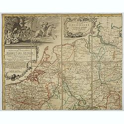
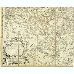
Nouvelle carte des postes d'Allemagne et des provinces limitrophes. . . Carte des postes d'Allemagne partie du nord est.
Upper left sheet of an important post route map of the Roman Empire with a dedication to Charles Anselme, prince de la Tour et Taxis (1733-1805). His section showing the ...
Date: Nuremberg, 1786
Selling price: ????
Please login to see price!
Sold in 2017
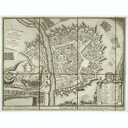
Plan de Wurtzburg résidence du prince évêque duc de Franconie.
Decorative plan of the fortified town of Wurzburg in Bavaria, adorned with a cartouche of 34 legends, topped with the coat of arms of the Prince-Bishop of Wurzburg and Du...
Date: Paris, 1786
Selling price: ????
Please login to see price!
Sold in 2019
Gouvernement D'Alsace avec les Grandes Routes.
An attractive and informative map of Alsace by French cartographer, Louis Brion de la Tour. It notes numerous towns, cities, rivers, forests, mountains and other topograp...
Date: Paris, 1786
Selling price: ????
Please login to see price!
Sold in 2018
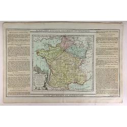
Carte Itineraire et Generaledes 18 Feuilles de l'Indicateur de France.
This is a striking 1786 Desnos and Brion map of France showing roads and the 18 administrative divisions. To the left and right of the map are paste downs of French text ...
Date: Paris, 1786
Selling price: ????
Please login to see price!
Sold in 2020
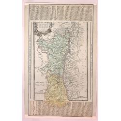
Carte des Departemens du Puy de Dome, du Cantel, du Rhone et Loire et de la Haute Loire.
This is a striking 1786 Desnos and Brion map of France showing four departments. To the left and right of the map are paste downs of French text with remarks and descript...
Date: Paris, 1786
Selling price: ????
Please login to see price!
Sold in 2018
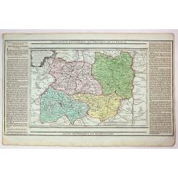
Carte des Departemensde la Manche, du Calvados de L'Orne, de L'Eure et de la Seine Inferieure.
This is a striking 1786 Desnos and Brion map of France showing five French departments. To the left and right of the map are paste downs of French text with remarks and d...
Date: Paris, 1786
Selling price: ????
Please login to see price!
Sold in 2017
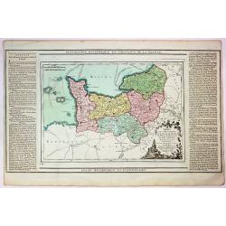
Carte des Deppartemens du Pas de Calais, de la Somme et de L'Oise dt de L'Aisne.
This is a striking 1786 Desnos and Brion map of three administrative divisions listed above. To the left and right of the map are paste downs of French text with remarks ...
Date: Paris, 1786
Selling price: ????
Please login to see price!
Sold in 2019
Carte de la Partie des Alpes Qui Avoisine le Mont Blanc.
A rare map featuring mountains in the Alps, mainly in Switzerland. This map is from the famous work by H. B. De Saussure "Voyages dans les Alpes" printed in Neu...
Date: Paris, 1786
Selling price: ????
Please login to see price!
Sold in 2017
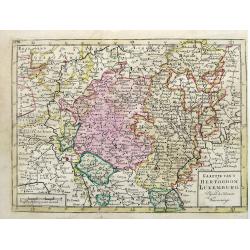
Kaartje van t Hertogdom Luxemburg, Volgens de Nieuwste Waarneminge.
An interesting map of Luxembourg after Isaac Tirion, engraved by Jacob Keizer and published by Elwe & Langeveld, in Amsterdam, 1786.
Date: Amsterdam, 1786
Selling price: ????
Please login to see price!
Sold in 2019
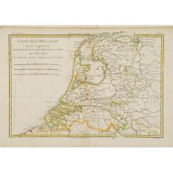
Carte de la Hollande prise en général..
Fine map of the Netherlands, prepared by R.Bonne and included in his Atlas Encyclopédique.. Rigobert Bonne (1727-1795) was engineer, mathematician and cartographer, acti...
Date: Paris 1787
Selling price: ????
Please login to see price!
Sold
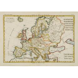
L'Europe.
Fine map of Europe. Elegant hand coloring, prepared by R.Bonne and included in his Atlas Ecyclopédique..Rigobert Bonne (1727-1795) was engineer, mathematician and cartog...
Date: Paris 1787
Selling price: ????
Please login to see price!
Sold
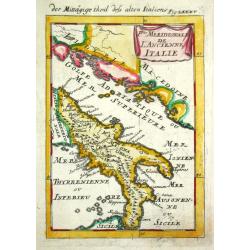
P.tie Meridionale de L' Ancien Italie.
Alain Manneson Mallet (1603-1706) published in 1683 his ' Description de l' Univers' in 5 volumes. In 1686 a German edition appeared.The southern part of classical Italy.
Date: Paris, 1787
Selling price: ????
Please login to see price!
Sold
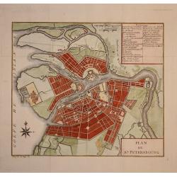
Plan de St. Petersbourg.
Nice town-plan of st. Petersburg.
Date: Paris, 1787
Selling price: ????
Please login to see price!
Sold in 2009
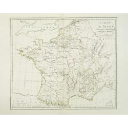
Carte de France historique et chronologique du regne de Henri IV. . .
Map of France during the regime of Henri IV. With a color key in lower left. Prepared by J.A. Dezauche, who was a publisher, map dealer and continued the publications of ...
Date: Paris, 1787
Selling price: ????
Please login to see price!
Sold
Karte TAURIENS oder der HALBINSEL KRIM und der WESTLICHEN NOGAYISCHEN TATAREI. . .
Map of the region north east of the Black sea, prepared by I.F.Schmid. Scale 1 : 900.000. Map 92 from this uncompleted Atlas by F.A.Schramble. With mileage in German (geo...
Date: Vienna, 1787
Selling price: ????
Please login to see price!
Sold in 2010
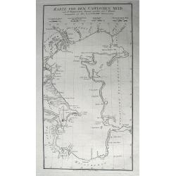
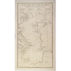
Karte Von Dem Caspischen Meer...
Excellent large-scale chart of the Caspian Sea, showing the harbors of Baku and Astrakan. Further with many towns, bays, small islands and peninsulas. After Johann Anto...
Date: Vienna, 1787
Selling price: ????
Please login to see price!
Sold in 2011

Plan de St. Petersbourg
A folding map of Saint Petersburg, from Voyage en Pologne, Russie, Suède, Danemark, &c. published by Barde, Manget & Cie.
Date: Geneva, 1787
Selling price: ????
Please login to see price!
Sold in 2012
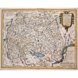
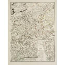
Chorographie du Cercle de Souabe d\'apres Vischer, Homan & Hubner.
Map of south-east Germany with two fancy floral Renaissance cartouches. It was published in "Atlas Universal" in 1787. The engraver was Moithey. Étienne Andr...
Date: Paris, 1787
Selling price: ????
Please login to see price!
Sold in 2013
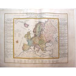
Neue Karte Von Europa
One of the first economic thematic maps of Europe containing a variety of symbols to show the cost of 56 commodities. Other symbols are of cities, ports, and natural and ...
Date: Vienna, 1787
Selling price: ????
Please login to see price!
Sold in 2013
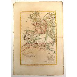
Imperium Romanum Pars Occidentalis.
Interesting map of the Roman Empire published in "Atlas Encyclopedique" and includes Britain, France, Germany, Spain, Italy & part of North Africa. Rigober...
Date: Paris, 1787
Selling price: ????
Please login to see price!
Sold in 2013
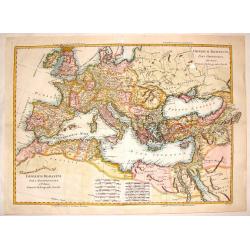
Imperium Romanum pars Occidentalis & pars Orientalis.
Interesting European map of the Eastern and Western parts of the Roman Empire. Two maps (East & West, that were meant to be make up the total)were professionally join...
Date: Paris, 1787
Selling price: ????
Please login to see price!
Sold in 2016
Duche de Silesie et Marquisat de Moravie.
A striking map of the duchy of Silesia and Moravia (currently part of Poland) from the "Atlas Moderne". Engraved by Gaspar Andre.Rigobert Bonne (1729-1795) was ...
Date: Paris, 1787
Selling price: ????
Please login to see price!
Sold in 2015
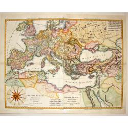
Imperii Romani Distracta pars Occidentalis & Orientalis.
Attractive hand colored map of the Mediterranean part of the Roman Empire. Issued as two maps (east & west), they have been joined resulting in an unusually large Bon...
Date: Paris, 1787
Selling price: ????
Please login to see price!
Sold in 2014
A Map of Middlesex: Engraved from an Actual Survey, with Improvements.
Pleasant copper engraved, hand colored map of Middlesex and envrons. Engraved by Sudlow for John Harrison in London in 1787.
Date: London, 1787
Selling price: ????
Please login to see price!
Sold in 2016
Les Environs de Paris...
A fine hand colored copperplate map of Paris featuring The Versailles Gardens. The map extends along the Seine. It was engraved by Herault in 1787.
Date: Paris, 1787
Selling price: ????
Please login to see price!
Sold in 2019
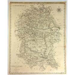
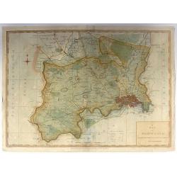
A Map of Wiltshire from the Best Authorities.
A fine and detailed map of the county of Wiltshire in Great Britain. It was engraved by John Cary. The map has a striking compass rose.John Cary (1754–1835) was an Engl...
Date: London, 1787
Selling price: ????
Please login to see price!
Sold in 2017
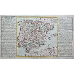
De l'Espagne divisee par provinces.
A large copper engraved sheet, with a map of the Iberian Peninsula and the Balearics, flanked with informative text about the regions and islands of Spain.
Date: Paris, 1787
Selling price: ????
Please login to see price!
Sold in 2019
A View, Accurate & Correct, Map of Nottinghamshire, Engraved From an Actual Survey
An uncommon, detailed map of Nottinghamshire, England from "Harrison's Atlas, Maps Of The English Counties", engraving by Haywood Sudlow. Although lacking decor...
Date: London, 1787
Selling price: ????
Please login to see price!
Sold in 2016
Les Gaulles Sous Les Trois Monarches
A detailed and attractive map of France at the time of Clovis in the 5th century. Featuring an interesting cartouche that partially covers Great Britain. By Philippe de P...
Date: Paris, 1787
Selling price: ????
Please login to see price!
Sold in 2016
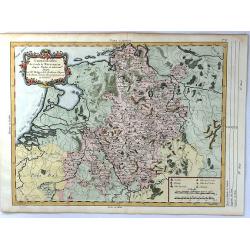
Chorographie du Cercle de Westphalie d'apres Visscher
An attractive map of present day Netherlands, and the North West part of Germany. With a decorative floral cartouche at top left, scales at lower right. Published by Phil...
Date: Paris, 1787
Selling price: ????
Please login to see price!
Sold in 2016
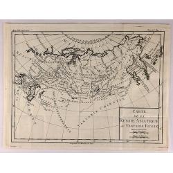
Carte de la Russie Asiatique ou Tartatie Russe.
A map of Asian Russia stretching from the Urals to the Pacific Ocean, divided into its various Provinces. From L’HISTOIRE DE RUSSE.Louis Brion de la Tour, (1743 – 180...
Date: Paris, 1787
Selling price: ????
Please login to see price!
Sold in 2018
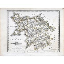
North Wales.
A small copper engraved map of north Wales issued by John Cary. Marks towns and cities and the main connecting roads.
Date: London, 1787
Selling price: ????
Please login to see price!
Sold in 2019
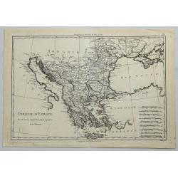
Turquie D'Europe.
A fine, detailed, antique map of Greece, by Bonne, published in the 1787 “Atlas Encyclopedique”.Rigobert Bonne (1727–1794) was one of the most important cartographe...
Date: Paris, 1787
Selling price: ????
Please login to see price!
Sold in 2018
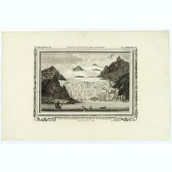
View of an Iceberg in the Island of Spitsbergen.
An attractive, and unusual engraving by C. Stalker, for Hervey's New System of Geography. The print shows a large Iceberg in between mountains on the Arctic island of Spi...
Date: London, 1787
Selling price: ????
Please login to see price!
Sold in 2018
Poland shewing the Claims of Austria, Russia & Prussia.
A plain and simple map of Poland highlighting the claims of Austria, Russia & Prussia. Various portions of Poland were carried out by Austria, Russia and Prussia in 1...
Date: London, ca 1787
Selling price: ????
Please login to see price!
Sold in 2019
An Index Map to the Antiquities; of England and Wales. Shewing the Situation of every building described in this work.
A large and unusual map showing the counties, rivers, major cities, castles, etc. Extends from Holy Island of Lindisfarne until the Channel Islands. Engraved by Francis V...
Date: London, 1787
Selling price: ????
Please login to see price!
Sold in 2019
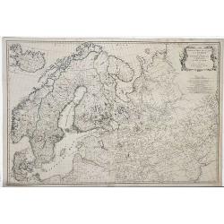
Zwieter Theil der Karte von Europe, Welcher Dænemark, und Norwegen, Sweden, und Russland Enthælt.
Detailed 1787 Schraembl map of the Scandinavian Peninsula, printed in two sheets which have now been joined. It covers Sweden, Denmark, Norway, Finland, Latvia, Estonia...
Date: Vienna, 1787
Selling price: ????
Please login to see price!
Sold in 2019
Partie Septentrionale de Cercle de la Haute Saxe.
A detailed map of northern Upper Saxony, in what is now Northeast Germany and Northwest Poland, by de Vaugondy. It includes the Duchy of Pomerania and Brandenburg, and ex...
Date: Paris, 1787
Selling price: ????
Please login to see price!
Sold in 2019
Karte Von Dem Caspischen Meer.
A simple chart of the Caspian Sea showing the harbours of Astrakan and Baku. Engraved by Johann Anton Guldenstadt od Riga, and published by Schraembl in 1787, and was in...
Date: Vienna, 1787
Selling price: ????
Please login to see price!
Sold in 2020
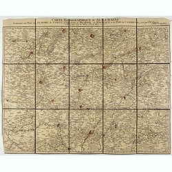
Carte Topographque D'Allemagne / Contenant une partie de Flandre, du Comté d'Artois, de Picardie, du Haynaut et le Pais de Cambresis.
Folding map of Northern France with part of Flanders, the County of Artois, Picardy, the Haynaut and Cambray, published by the German Military cartographer Johann Wilhelm...
Date: Frankfurt, 1787
Selling price: ????
Please login to see price!
Sold in 2021