Browse Listings in America > North America > North America

43 listings found. Showing results 1 to 43
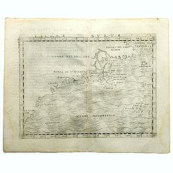
Terra Nueva

Gastaldi's map of Eastern USA from Giacomo Gastaldi's Atlas of 1548 which has been called the most comprehensive atlas, produced between Martin Waldseemüller's Geographi...

Maker / Publisher: GASTALDI, G.
Place & Date: Venice, 1548
Selling price: $3400
Sold in 2023


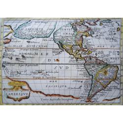
Nouvelle Description de l´Amerique

Extremely rare mid 17th century French map of North and South America (and Antarctica) by the French cartographer Tassin. Published in Paris by Berey in 1651 in ´Carte g...

Maker / Publisher: TASSIN, N.
Place & Date: Paris, 1651
Selling price: $550
Sold in 2023


Sanson North America

The first state of the Mariette edition of Nicolas Sanson's landmark map of North America.  Nicolas Sanson, known as the ‘father of French cartography,’ is one of th...

Maker / Publisher: SANSON, N. / MARIETTE, P.
Place & Date: Paris, 1669


America Septentrionalis.

A rare miniature map of North America, showing California aa an Island, with a letterpress text in German. Second state.From Johann Ulrich Müller’s pocket atlas “Neu...

Maker / Publisher: MÜLLER, J. U.
Place & Date: Frankfurt, 1702


Florida.

A rare miniature map of North America, Florida, Gulf Coast, Texas, the Mississippi Valley and the Mid-Atlantic, with a letterpress text in German. Second state.From Johan...

Maker / Publisher: MÜLLER, J. U.
Place & Date: Frankfurt, 1702


Amerique Septentrionalis Carte d'un Tres Grand Pays Entre le Nouveau Mexique et la Mer Glaciale

This map is a detailed and accurate depiction of North America, focusing on the vast region between New Mexico and the Arctic Ocean. The map showcases the natural fea...

Maker / Publisher: HENNEPIN, Louis
Place & Date: Leiden, Pierre van der AA, 1704


L'Amerique Septentrionale Dressee sur les Observations de Mrs. de l'Academie Royale des Sciences

"L'Amérique Septentrionale Dressee sur les Observations de Mrs. de l'Académie Royale des Sciences" is a map of North America created by French cartographer Gu...

Maker / Publisher: Guillaume de l’Ilse
Place & Date: Amsterdam 1708


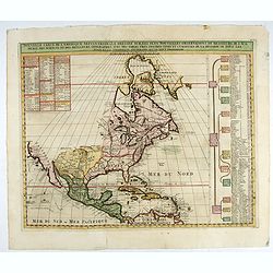
Nouvelle Carte de l'Amerique Septentrionale dressee sur les plus nouvelles observations...

Fascinating map of North America with some curiouse elements but also up to date cartography:It extends from Greenland to Central America and the West Indies.California i...

Maker / Publisher: CHATELAIN, H.
Place & Date: Amsterdam, ca. 1710


Amplissimae Regionis Mississipi Seu Provinciae Ludovicianae. . .

Homann’s important and highly decorative map of the Mississippi River Valley and the Southeast of the USA. It extends from the Great Lakes until the Bahamas, including ...

Maker / Publisher: HOMANN, J. B.
Place & Date: Nuremberg, 1720


Nouvelle Carte de l' Amerique Septentrionale Dressee sur les plus Nouvelles Observations de Messieurs de l' Academie. . .

Great map of North America with well developed cartography in the Great Lakes and Mississippi River.It includes all of Central America and the West Indies. The English se...

$275 / ≈ €257
Maker / Publisher: CHATELAIN, H.
Place & Date: Amsterdam, 1720
Selling price: $275
Sold in 2022


Carte du Mexique et de la Floride des Terres Angloises et des Isles Antilles du Cours et des Environs de la Riviere de Mississipi

This is the Covens & Mortier issue of Delisle's important map that is credited with accurately showing the course of the Mississippi River and its mouth for the first...

Maker / Publisher: Delisle / Covens and Mortier
Place & Date: Amsterdam, 1722


Avantures du Sr. C. Le Beau, avocat en parlement ou Voyage curieux et nouveau parmi les Sauvages de l'Amérique Septentrionale. Dans lequel on trouvera une Description du Canada… Ouvrage enrichi d'une Carte et des figures necessaires.

A description of Huron, Iroquois, and Algonquin customs, written in charming style and based, the Author claims, on observations made on a trip to America in 1729." ...

$2500 / ≈ €2339
Maker / Publisher: LE BEAU, C.
Place & Date: Amsterdam, 1738


Accurata delineatio celeberrimae Regionis Ludovicianae vel Gallice Louisiane ol Canadae et Floridae. . .

A beautiful map of North America from the East coast to Spanish-controlled New Mexico. The French territory of Louisiana spans the area between New Mexico and the Appalac...

Maker / Publisher: SEUTTER, M.
Place & Date: Augsburg, 1740


Dominia Anglorum in America Septentrionali.

Four maps on one sheet (New Found land/ New England/ Virginia and Carolina/Florida) based on J.B.Homann's map, showing British possessions in North America. At bottom of ...

$1500 / ≈ €1404
Maker / Publisher: HOMANN HEIRS.
Place & Date: Nuremberg 1740


Amerique Septentrionale Publiee sous les Auspices de Monseigneur le Duc d’Orleans Premier Prince du Sang. . .

A large map of North America and the West Indies was one of the best French maps of North America prior to the French & Indian War. This map provides good information...

Maker / Publisher: d'ANVILLE, J. B. B.
Place & Date: Paris, 1746


America Septentrionalis a domino d'Anville in Galiis edita nunc in Anglia. . .

A first edition of the Homann Heirs map of the British Colonies in North America, made during the French and Indian war. It covers from Newfoundland in the North to Flori...

Maker / Publisher: HOMANN, J. B.
Place & Date: Nurnberg, 1756


Carte des Possessions Françoises et Angloises dans le Canada, et partie de la Louisiane.

First state of this separately published map of the European Colonies in the New World east of the Mississippi River. This map was published in 1756 to provide informatio...

$2500 / ≈ €2339
Maker / Publisher: LONGCHAMPS, le Sieur.
Place & Date: Paris, 1756


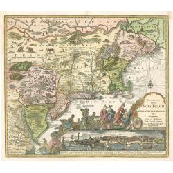
Recens Edita totius Novi Belgii, in America Septentrionali siti...

The exceptional antique map of Northeast of United States, with one of the earliest birds-eye view of New York (New Amsterdam), it shows celebrating of Dutch re-occupatio...

Maker / Publisher: LOTTER, T. C.
Place & Date: Augsburg, 1757


Recens Edita totius Belgii, in America

Arguably one of the most recognizable maps of the Northeastern American colonies this fifth state example of Novi Belgii by Tobias Conrad Lotter series does not disappoin...

Maker / Publisher: Tobias Conrad Lotter
Place & Date: Augsburg, Germany 1757
Selling price: $2300
Sold in 2023


America septentrionalis concinnata...

Interesting double-page copper engraved map of North America and Central America, after Guillaume De L'Isle's landmark map. Shows many settlements, rivers, lakes, native ...

Maker / Publisher: LOTTER, T. C.
Place & Date: Augsburg, c1770


Il Paese de Cherachesi, con la Parte Occidentale della Carolina Settentrionale, e della Virginia Country of the Cherokees, western part of North Carolina, and Virginia

This map by Zatta is a detailed depiction of the Country of the Cherokees, the western part of North Carolina, and Virginia. The map shows the mountainous terrain and the...

Maker / Publisher: ZATTA, Antonio
Place & Date: Venice, 1778


Carte des Déclinaisons et Inclinaisons de L'Aiguille Aimantée..Table 5.

Very large map, on strong paper. Shows magnetic properties in the Pacific Ocean, surrounding North America. It shows a large part of North America and part of the Caribbe...

Maker / Publisher: Buffon, G. L.
Place & Date: Paris, ca 1780


La Virginie, Pennsylvanie, Nouvelle Angleterre

The map of the eastern coast of the United States, covers Delaware, southern Pennsylvania, New Jersey, western Long Island, southwestern Connecticut and portions of adjac...

Maker / Publisher: NOLIN, J. B.
Place & Date: Paris, 1783


Partie méridionale des possessions Angloises en Amérique

The map of the eastern coast of the United States, covers Louisiana, Florida, Carolina and portions of adjacent areas.Comes from rarely seen Jean-Baptiste Nolin atlas “...

Maker / Publisher: NOLIN, J. B.
Place & Date: Paris, 1783


Carte du Mexique et des Etats Unis d'Amérique…

A later edition of De l'Isle's foundation map of 1703, widely regarded as one of the most influential maps in the history of American Cartography. This updated version o...

$1200 / ≈ €1123
Maker / Publisher: L'ISLE, G. de. / DEZAUCHE.
Place & Date: Paris, 1783


Amerique Septentrionale avec les Nouvelles Découvertes

The map of the North America in a quiet unusual shape.Comes from rarely seen Jean-Baptiste Nolin atlas “Atlas Général a l’usage des colleges et maisons d’educatio...

$300 / ≈ €281
Maker / Publisher: NOLIN, J. B.
Place & Date: Paris, 1783
Selling price: $300
Sold in 2022


Passeport.

Passport for the United States in the name of Madeleine Lavit Femme Lory, issued by the Commission of Interior Relations and approved by the Committee of Public Safety.Th...

$750 / ≈ €702
Maker / Publisher: République Française..
Place & Date: Paris, 1795


United States of North America. Carte des Etats-Unis de l'Amerique Septentrionale / copiée et gravée sur celle d'Arrowsmith, corrigée et considérablement augmentée... par P. F. Tardieu...

FIRST EDITION. An impressive wall map here in 4 unjoined sheets and large margins. RARE in these untouched, full sheets. Recorded examples are usually offered as folding ...

$5600 / ≈ €5240
Maker / Publisher: TARDIEU, P. A. F.
Place & Date: Paris: An XI - 1802
Selling price: $5600
Sold in 2022


[Official US Government Document.]

An official US government printed document, completed in manuscript. An attractive copper engraved broadside, signed by President James Madison, appointing Daniel Chandle...

$1550 / ≈ €1450
Maker / Publisher: US GOVT.
Place & Date: Washington D.C., 1812
Selling price: $1550
Sold in 2022


Le Provincie Settetrionale deqli Stati Uniti

This is a map created by Carlo Giuseppe Guglielmo Botta, an Italian historian, and published in his book of the same name in 1826. The map depicts the northern provinces ...

Maker / Publisher: BOTTA, Carlo
Place & Date: Rome, ca 1819


Le Provincie Meridionale' deq li Stati Uniti

Maker / Publisher: BOTTA, Carlo
Place & Date: Rome, ca 1819


La parte orientale dell' antico.. messico con la Florida..

A splendid two-sheet map of Mexico, including California, Arizona, New Mexico, part of Texas, Baja California and Mexico (west part) and of the Southeast Part of the US, ...

$2250 / ≈ €2105
Maker / Publisher: CASSINI, G.
Place & Date: Rome, Calcography, 1797-before 1839


Carte Generale des Etats-Unis 1840.

A large scale scale very detailed map of the U.S.A. highlighting the various ways of communication in 1840. Basically, the map focuses on the railroads, but it also depic...

Maker / Publisher: TARDIEU / CHEVALIER.
Place & Date: Paris, 1840


Nord-America und West-Indien

From the Stieler's Schul-Atlas, it shows Texas as an autonomous  republic. Scarce.

Maker / Publisher: STIELER, A.
Place & Date: Weimar, circa 1840


North America.

A detailed map of North America by William and Alexander Keith Johnston, a well-known publisher of maps who continually updated his maps. From his National Atlas of Geogr...

Maker / Publisher: JOHNSTON, W.& A.K.
Place & Date: Edinburgh, ca 1845
Selling price: $95
Sold in 2023


AMERICA SETTENTRIONALE con tutte le ultime scoperte

From the scarce Italian "Atlante Universale di Geografia Antica e Moderna" published in Turin around 1846. It shows a "Repubblica di Texas", although ...

Maker / Publisher: MAGGI, G. B.
Place & Date: Torino, circa 1846


[Official US Government Document.]

An official US government printed document, completed in manuscript. An attractive engraved broadside, signed by President Andrew Johnson appointing John G. Chandler Quar...

Maker / Publisher: US GOVT.
Place & Date: Washington D.C., 1867


[Official US Government Document.]

An official US government printed document, completed in manuscript. An attractive engraved broadside, signed by President Andrew Johnson appointing John G. Chandler with...

$350 / ≈ €328
Maker / Publisher: US GOVT.
Place & Date: Washington D.C., 1867
Selling price: $350
Sold in 2022


Carte de la guerre Hispano-Américaine.

Before the letter anti-American propaganda map of the eastern United States and the Caribbean, published during the Spanish-American War, in the French newspaper "La...

Maker / Publisher: IMP CASSAN FILS
Place & Date: Paris, 1898


[Official US Government Document.]

An official US government printed document, completed in manuscript and signed by President Theodore Roosevelt, appointing John G. Chandler Brigadier-General on the retir...

$500 / ≈ €468
Maker / Publisher: US GOVT.
Place & Date: Washington D.C., 1904
Selling price: $500
Sold in 2022


[Official US Government Document.]

An official US government printed document, completed in manuscript. An attractive engraved broadside, completed in manuscript and signed by President William Howard Taft...

$300 / ≈ €281
Maker / Publisher: US GOVT.
Place & Date: Washington D.C., 1910
Selling price: $300
Sold in 2022


Alabama. Official Highway map 1942.

Folding road map of Alabama. Published in Montgomery, Alabama by Paragon Press. Mileage chart and six city plans in margin; verso includes text and photos. Scale [ca. 1:8...

$100 / ≈ €94
Maker / Publisher: ALA STATE HIGHWAY DEPARTMENT
Place & Date: Alabama, Paragon Press, 1942


Arms Across America Waging Third World War.

This is a striking propaganda map, created by The War Registers League, founded 100 years ago in the U.S. it continues today as a secular, pacifist organization dedicated...

Maker / Publisher: WAR REGISTERS LEAGUE
Place & Date: New York, 1989
Selling price: $100
Sold in 2023