Browse Listings in Africa > Southern Africa
![[Lot of 7 map / prints of Madagascar] Parte de la Cote Orientale d' Afrique avec l' Isle de Madagascar et les Cartes particulières des Isles de France et de Bourbon.](/uploads/cache/18022-(1)-250x250.jpg)
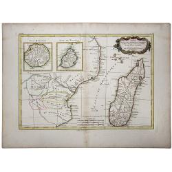
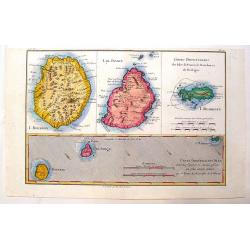
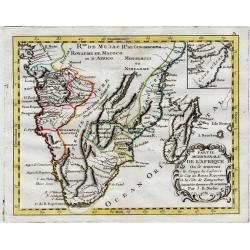
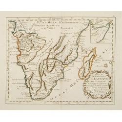
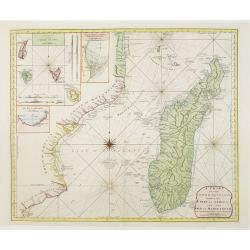
[Lot of 7 map / prints of Madagascar] Parte de la Cote Orientale d' Afrique avec l' Isle de Madagascar et les Cartes particulières des Isles de France et de Bourbon.
A map of Madagascar with 2 insets depicting Mauritius and RĂ©union. and the opposite mainland of Africa, nowadays Mocambique. The area around the Zambesi river, rich in g...
Date: Paris, c. 1750
Selling price: ????
Please login to see price!
Sold in 2022
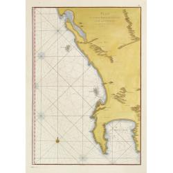
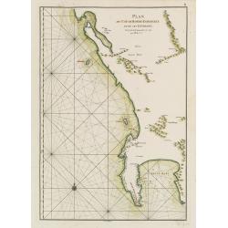
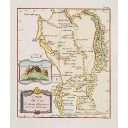
Plan du Cap de Bonne-Esperance et ses environs..
Large and detailed sea chart of the Cape of Good Hope from Saldahna Bay to False Bay. Probably from Neptune Oriental, published in 1745. Note that this version differs in...
Date: Paris, 1752
Selling price: ????
Please login to see price!
Sold
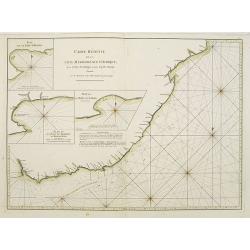
![Carte Reduite D'Une Partie Des Costes Occidentales et Meridionales De L'Afrique Depuis Cabo Frio ou Cap Froid . . . Jusque a la Bay S. Blaise . . . MDCCLIV [with view of Cape of Good Hope]](/uploads/cache/31261-250x250.jpg)
Carte Reduite D'Une Partie Des Costes Occidentales et Meridionales De L'Afrique Depuis Cabo Frio ou Cap Froid . . . Jusque a la Bay S. Blaise . . . MDCCLIV [with view of Cape of Good Hope]
Very large and detailed of the southern African coastline from Cape Fria in Namibia to Cape Agulhas. In lower left corner a rococo title cartouche and in top a profile o...
Date: Paris, DĂ©pĂ´t de la Marine, c.1754
Selling price: ????
Please login to see price!
Sold in 2011
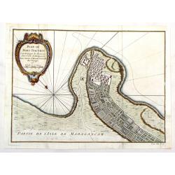
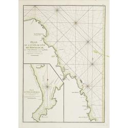
Plan du Fort Dauphin, Constuit par les François.
Fine copper engraved, hand colored map of Fort Dauphin on the Island of Madagascar of the east coast of Africa. After N. Bellin and engraved by van Schley. Features a bea...
Date: Paris, 1754
Selling price: ????
Please login to see price!
Sold in 2017
Carte Reduite d'Une Partie Des Costes Occidentales et Meridionales de l'Afrique.
A fine, beautiful colored sea chart of the Southwest Coast of Africa, published by Nicolas Bellin. With three insets showing vies of "Vue du Cap de Bonne Esperance&q...
Date: Paris, 1754
Selling price: ????
Please login to see price!
Sold in 2020
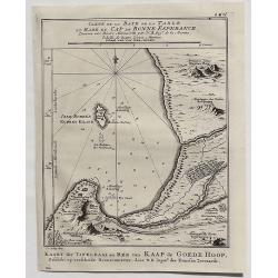
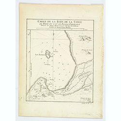
Carte de la Baye de la Table et Rade du Cap de Bonne Esperance. . .
A detailed map of the Table Bay and Robben Island at Cape Town, South Africa, extending north to Mountain Blue. Engraved by van der Schley.Jacques Nicolas Bellin (1703–...
Date: Paris, 1754
Selling price: ????
Please login to see price!
Sold in 2020
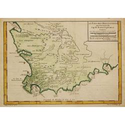
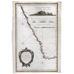
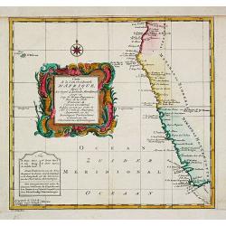
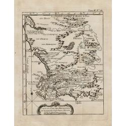
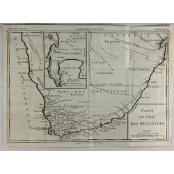
Le Pays des Hottentots.
Jaques Nicolas Bellin (1702-720) was the most important French hydrographer of the 18th century. Sea-atlas 'Hydrographique Français' , 1756-65, atlas to accompany Prévo...
Date: Paris, c. 1755
Selling price: ????
Please login to see price!
Sold in 2018
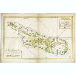
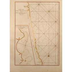
Carte de L'Isle de Madagascar. . .
A beautiful, large and quite detailed chart of the African island of Madagascar by Jacques Nicolas Bellin. The interior of the island is littered with forests, mountains,...
Date: Paris, ca 1756
Selling price: ????
Please login to see price!
Sold in 2018
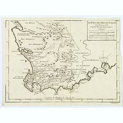
Le Pays des Hottentots aux environs du Cap de Bonne Espérance. . .
A good, competent, engraved map of Cape of Good Hope. The geographical features are typical, with somewhat exaggerated bays, inlets and prominent mountain ranges.The west...
Date: Paris, 1757
Selling price: ????
Please login to see price!
Sold in 2020
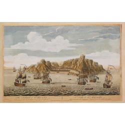
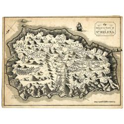
The Island of St.Helen.
A view of the island of St. Helena as seen from the sea. In the foreground English and Dutch V.O.C. ships.The island is well-known as after Napoleon Bonaparte was capture...
Date: London, c. 1760
Selling price: ????
Please login to see price!
Sold in 2008
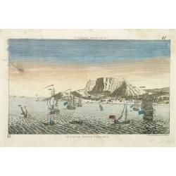
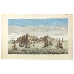
LE CAP DE BONNE ESPERANCE.
Optical view illustrating the Cape of Good Hope, a stop-over for the V.O.C., by Daumont who was a well-known publisher of optical prints, established in Paris.In the eigh...
Date: Paris 1760
Selling price: ????
Please login to see price!
Sold in 2010
Carte de la Coste Occidentale d' Afrique depuis le XIe. Degré jusqu'au Cap de Bonne Esperance.
A map of the west coast of South Africa with the Cape of Good Hope. With a nice title-cartouche. From a Dutch edition of Prevost's "Voyages".Jacques Nicolas Bel...
Date: Amsterdam, c. 1760
Selling price: ????
Please login to see price!
Sold in 2020
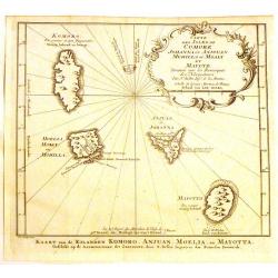
Carte des Isles de Comore Johanna.
Decorative map of the Comoros Islands, to the north of Madagascar.Includes the islands of Komoro, Mohilla, Anjuan and Mayotta. Adorned with a large fancy title cartouche....
Date: Paris, 1760
Selling price: ????
Please login to see price!
Sold in 2017
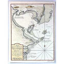
Carte de la Baye de Mosambique, Dressee sur Divers Manuscrits
A fine map of the Bay of Mozambique by Belling in Paris in 1763.Jaques Nicolas Bellin (1702-1772) was the most important French hydrographer of the 18th century. Some of ...
Date: Paris, 1763
Selling price: ????
Please login to see price!
Sold in 2016
Nieuwe Kaart van de KAAP DER GOEDE HOOPE en der na by gelegen Landen.
An old colored map of the Cape of Good Hope in South Africa showing mountains and naming towns, rivers and shore locations. With large margins.
Date: Amsterdam, 1763
Selling price: ????
Please login to see price!
Sold in 2019
Carte du pais des Hottentots aux environs du Cap de Bonne Esperance.
Bellin\'s scarce vertical edition of the Cape of Good Hope. A finely colored engraving of the south-eastern coast of Africa around Cape Town. From the Le Petit Atlas Mari...
Date: Paris, 1764
Selling price: ????
Please login to see price!
Sold in 2008
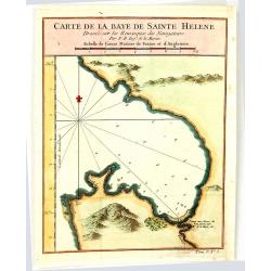
Carte de la Baye de Sainte Helene
An attractive outline chart of the coast of St Helena Bay, northwest of Cape Town, on the Atlantic coast of South Africa, by Bellin, the leading French hydrographer of th...
Date: Paris, 1764
Selling price: ????
Please login to see price!
Sold in 2016
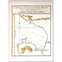
Carte de la Baye de Sainte Helene.
A map of St. Helena Bay on the Atlantic coast of South Africa. From the Dutch edition of Prevost's' Voyages'.Jaques Nicolas Bellin (1702-1772) was the most important Fren...
Date: Paris, 1764
Selling price: ????
Please login to see price!
Sold in 2016
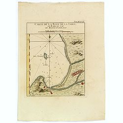
Carte de la Baye de la Table, et Rade du Cap de Bonne Esperance.
This nicely hand colored map is a copperplate map of the Cape of Good Hope, and of Cape Town, in South Africa. This map was issued both in Bellin's Le Petit Atlas Maritim...
Date: Paris, 1764
Selling price: ????
Please login to see price!
Sold in 2018
Carte de la Baye de la Table, et Rade du Cap de Bonne Esperance.
A nice copperplate map of the Cape of Good Hope, and of Cape Town, in South Africa. This map was issued both in Bellin's Le Petit Atlas Maritime and in the French edition...
Date: Paris, 1764
Selling price: ????
Please login to see price!
Sold in 2021
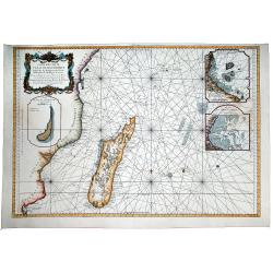
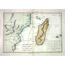
Carte Reduite de CANAL DE MOZAMBIQUE et des Isles de Madagascar de France de Bourbon, de Rodrigues et autres. Dressee au Depost des Cartes et Plans de Marine Pour Servir aux Vaisseau du Roy . . .
A beautiful large sea chart of the Mozambique Channel, published by the French Hydrographical Department. It includes a detailed treatment of Madagascar and the contiguo...
Date: Paris, 1767
Selling price: ????
Please login to see price!
Sold in 2020
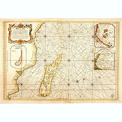
Carte réduite du canal de Mozambique et des isles de Madagascar de France de Bourbon, de Rodrigues et autres. . .
Very large and detailed chart depicting Southern Africa, with Insets: Plan de l'isle de l'Assomption et de son mouillage. -- Plan du port de Secheyles dans l'isle de ce n...
Date: Paris, ca. 1768
Selling price: ????
Please login to see price!
Sold in 2014
Carte du canal de Mosambique, contenant l' Isle de Madagascar avec les CĂ´tes d' Afrique depuis le Cap de Bonne Esperance jusqu'a Melinde
Rigobert Bonne (1727-1795), French cartographer. His maps are found in a.o. Atlas Moderne (1762), Raynal's Histoire Philos. du Commerce des Indes (1774) and Atlas Encyclo...
Date: Paris, c. 1770
Selling price: ????
Please login to see price!
Sold
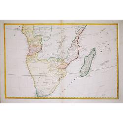
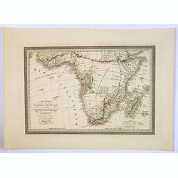
Africae Pars Meridionalis.
There are three detailed insets : the Cape Fort, Saldanda Bay and the Cape of Good Hope, all with a detailed identifying legend.
Date: Augsburg, 1770
Selling price: ????
Please login to see price!
Sold in 2008
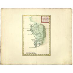
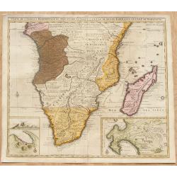
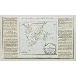
Partie de la Cote Orientale d'Afrique.
A striking 18th Century map of the east coast of Africa, Madagascar, Mauritius and Reunion Island. The map is divided into kingdoms and shows nice detail. Rigobert Bonne ...
Date: Paris, 1772
Selling price: ????
Please login to see price!
Sold in 2020
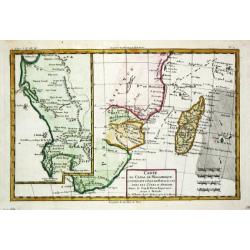
LE CANAL DE MOSAMBIQUE, L'ISLE DE MADAGASCAR, LES ETATS DU MONOMOTAPA ET LES ROYAUMES VOISINS
Detailed french map, by Bonne (Ingénieur-Hydrographique de la Marine de France) engraved by André. Many place-names and topographical detail on Madagascar, I. de Bourbo...
Date: Paris c. 1774
Selling price: ????
Please login to see price!
Sold
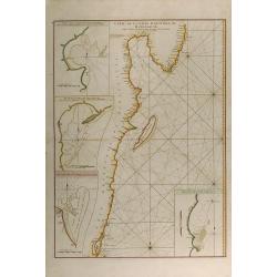
Carte de la Cote orientale de Madagascar, depuis la Pointe de l'Est jusques et compris le Lac Nossé Bé.
Large colored sea of Madagascar. Showing the northeast coastline of Madagascar and four inset maps of the harbours and anchorage of Tamatave, Foulpointe, Teintingue und ...
Date: Paris, 1775
Selling price: ????
Please login to see price!
Sold in 2015
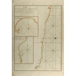
Carte de la Cote orientale de Madagascar depuis Mananzari jusques et compris l'anse du Fort Dauphin.
Large colored sea of Madagascar. Showing the southeast coastline of Madagascar and two inset maps of the harbours and anchorage of Tolanaro and the islands of Saite Luce...
Date: Paris, 1775
Selling price: ????
Please login to see price!
Sold in 2015
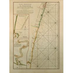
Cote Orientale de Madagascar Depuis la Riviere d'Ivondrou jusque Mananzari.
Finely colored sea of Madagascar. Showing the east coastline of Madagascar and two inset maps of the harbour and anchorage of Manourou and the River Mananzari titled Pla...
Date: Paris, 1775
Selling price: ????
Please login to see price!
Sold in 2015
Plan de la Cote de L'Est de Madagascar, depuis la Baye de Vohemare jusqu'au Cap d'Ambre
Original colored sea of Madagascar. Showing the east coastline of Madagascar and one inset map titled Plan du Port de Louquez. From the second revised and enlarged editi...
Date: Paris, 1775
Selling price: ????
Please login to see price!
Sold in 2015
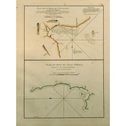
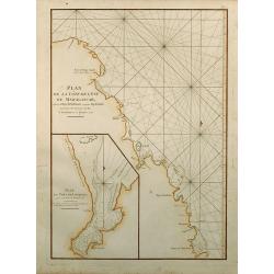
Plan de la Baye de St. Augustin en l'Isle de Madagascar / Plan du Port de l'Isle Ste. Marie.
Two finely colored plans of Madagascar on one sheet. Showing St. Augustin and the port of the island Ste. Marie at the east coast of Madagascar. From the second revised a...
Date: Paris, 1775
Selling price: ????
Please login to see price!
Sold in 2015
CĂ´te de L'Isle Madagascar depuis la Baye de Vohemare jusqu'Ă la Pointe de l'Est.
Finely colored sea chart of Madagascar. Showing the east coastline of Madagascar and one inset maps of the Cap de l'Est titled Plan du Port et de la Baye du Cap de l'Est....
Date: Paris, 1775
Selling price: ????
Please login to see price!
Sold in 2015
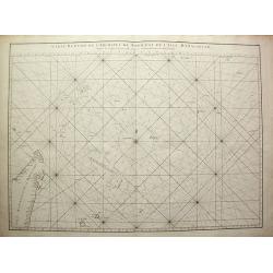
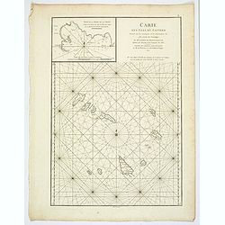
Carte réduite de l'Archipel du Nord-Est de l'Isle Madagascar depuis la lingne Equinoctiale jusqu'au 21d.30m. de Latitude Méridionale
Superb large original sea chart of the Indian Ocean by Mannevillette. Very detailed and large scale, showing the North of Madagascar with many place names, the Seychelle...
Date: Paris, 1775
Selling price: ????
Please login to see price!
Sold in 2011
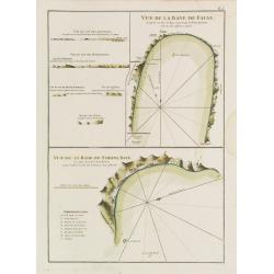
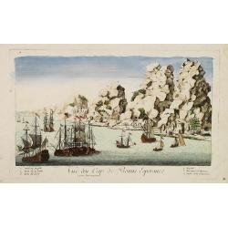
Vue de la Baye de False / Vue de la Rade de Simons-Baye. Vue du Cap des Aiguilles. Vue du Cap des Hottentots. Vue du Cap de Bonne Espérance.
Three French of Cape of Good Hope. Each chart has in addition profiles and a lettered key.Latitude and longitude scales, compass rose and system of rhumb lines, sounding...
Date: Paris, ca. 1775
Selling price: ????
Please login to see price!
Sold in 2012
Plan du Cap de Bonne-Espérance et de ses Environs.
French of Cape of Good Hope.Latitude and longitude scales, compass rose and system of rhumb lines, soundings near coast and in bay areas.D' Après de Mannevillette (1707...
Date: Paris, ca. 1775
Selling price: ????
Please login to see price!
Sold in 2015
Carte Réduite de l'Océan Orientale qui Contient la Côte d'Afrique, Avec l'Isle Madagascar et les Isles adjacentes.
French of South Africa with Cape Town and part of the south east coast . Insets of "Mossel Bay", "Plan de la rade st.Blaise" and "Plan de la Bay...
Date: Paris, Brest, chez Demonville, 1775
Selling price: ????
Please login to see price!
Sold in 2013
Plan de la CĂ´te de l'Est de Madagascar, depuis la Baye de Vohemare jusqu'au Cap d'Ambre. Plan du Port de Louquez.
French of the north east coast of Madagascar. With inset chart of the harbor of Louquez, discovered in October 1773.Latitude and longitude scales, compass rose and syste...
Date: Paris, Brest, chez Demonville, 1775
Selling price: ????
Please login to see price!
Sold
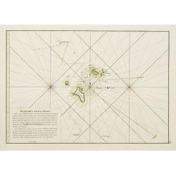
Plan des Iles de Mahé
From the second edition. French of Isle of Mahé in Seychelles. Prepared by Jacques-François L'Abbé Dicquemare (1733-1789). Latitude and longitude scales, compass rose...
Date: Paris, Brest, chez Demonville, 1775
Selling price: ????
Please login to see price!
Sold in 2014
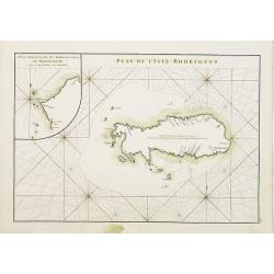
Plan de lIsle de Rodrigues. / Plan particulier du Nord de l'Isle de Madagascar depuis le Cap d' Ambre jusqu'Ă Infandria. Plan particulier du Nord de l'Isle de Madagascar depuis le Cap d'Ambre jusqu'Ă Infandria.
French of Isle Rodrigue on East coast of Madagascar. Latitude and longitude scales, compass rose and system of rhumb lines, soundings near coast and in bay areas.D' AprĂ...
Date: Paris, Brest, chez Demonville, 1775
Selling price: ????
Please login to see price!
Sold in 2011
Carte des Isles du Cap-Verd. . .
A nice large chart of the Cape Verde Islands off the N.W. coast of Africa in the Atlantic Ocean. The Cape Verde Islands are an archipelago of ten volcanic islands, that w...
Date: Paris, ca 1775
Selling price: ????
Please login to see price!
Sold in 2020
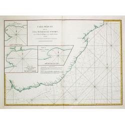
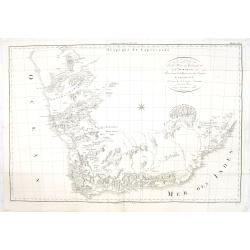
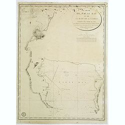
Carte Reduite de la Cote meridionale d' Afrique, depuis La Baye de Saldagne jusqu'au Cap des Courans.
A French sea chart of the southeast coast of South Africa from the 'Atlas Neptune Oriental' of 1775. It extends from Saldanha Bay to north of Cape Courans, including the ...
Date: Paris, Brest, 1775
Selling price: ????
Please login to see price!
Sold in 2021
CARTE DE L'ARCHIPEL AU NORD DE L'ISLE DE FRANCE. . . - REUNION,MAURITIUS,SEYCHELLES,DIEGO GARCIA.
A rare, large, and fine antique naval chart, depicting the Indian Ocean from as low as Mauritius to the southernmost Maldives islands, with an inset map of the Seychelles...
Date: Paris, 1776
Selling price: ????
Please login to see price!
Sold in 2021
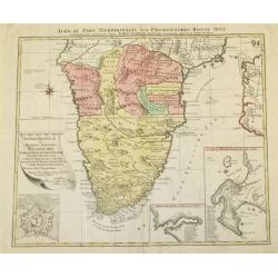
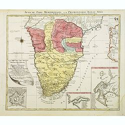
Africae Pars Meridionalis cum Promontorio Bonae Spei Accuratissime Delineato
A map of Southern Africa by T.Lotter [1717-1777]. The coastline still provides inaccurate information, while Hottentot tribes are illustrated throughout the mainland. The...
Date: Vienna, 1778
Selling price: ????
Please login to see price!
Sold
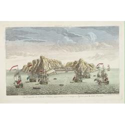
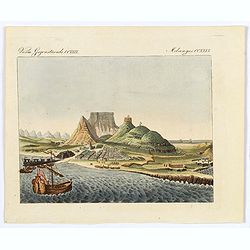
Vue du Cap de Bonne esperance de la baie / Gezigt van de Kaap der Goede hope van de reede.
A large rare panoramic view of Cape of Good Hope seen from the sea side with Dutch vessels in the foreground and Tafe-berg and the town in good detail. The fortress to th...
Date: Amsterdam, 1778
Selling price: ????
Please login to see price!
Sold in 2017
Vue perpective de l'Isle de St.Helene appartenant a la Compagnie Angloise pour les Indes Orientales.
Decorative optical view of St.Helena with in foreground British ships. The island is well-known as after Napoleon Bonaparte was captured by the Royal Navy, he was held ho...
Date: Paris, 1780
Selling price: ????
Please login to see price!
Sold in 2008
Vue du Cap de Bonne Esperance.
A fanciful, but rare optical print of the Cape of Good Hope". Published by Louis-Joseph Mondhare, who was a well-known publisher of optical prints, established from ...
Date: Paris, 1780
Selling price: ????
Please login to see price!
Sold in 2009
Cartes Particulieres des Isles de France, de Bourbon et de Rodrique.
An interesting map of islands east of Madagascar. From "Atlas de Toutes les Parties Connues du Globe Terrestre". Detailed with rivers, lakes, cities and mountai...
Date: Paris - 1780
Selling price: ????
Please login to see price!
Sold in 2013
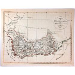
Carte du Pays des Hottentots.
A fine engraved map of The Cape of Good Hope in South Africa.It includes an inset of False Bay. Published in 1780 by Louis Brion de la Tour. Louis Brion de la Tour, (174...
Date: Paris, 1780
Selling price: ????
Please login to see price!
Sold in 2018
Vue perpective de l'Isle de St.Helene appartenant a la Compagnie Angloise pour les Indes Orientales.
Decorative optical view of St. Helena.
Date: Paris, 1780
Selling price: ????
Please login to see price!
Sold in 2018
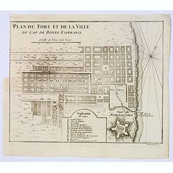
Plan du Fort et de la ville du Cap de Bonne Esperance.
Plan of the city, the fort and Good Hope Cape. With an explanation key to a list of 13 important sites and locations keyed to the plan with corresponding letters. Shows a...
Date: Paris, ca 1780
Selling price: ????
Please login to see price!
Sold in 2020
Partie Meridionale de L'Afrique.
An uncommon map of southern Africa, not listed in Tooley or Norwich. Scarce info on the interior, also has an inset of the horn of Africa top right. Large cartouche with...
Date: Paris, 1781
Selling price: ????
Please login to see price!
Sold
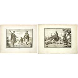
Hottentots. / Caffres. (A pair of costume plates of Cape of Good Hope)
Engravings by Poisson after two paintings by Pierre Sonnerat (1748-1814). In the "Caffres" showing a family from what is now South Africa. The term "Kaffir...
Date: 1782
Selling price: ????
Please login to see price!
Sold in 2019
Partie Méridionale de l'Afrique Ou se trouvent le Congo la Cafrerie le Cap de Bonne Espérance et la Côte de Zanguébar..
A rare map depicts Southern Africa from Mombasa on the east coast south to the Cape, and Isle St. Thomas on the west side, at the Equator southward to approximately 35deg...
Date: Paris, 1783
Selling price: ????
Please login to see price!
Sold
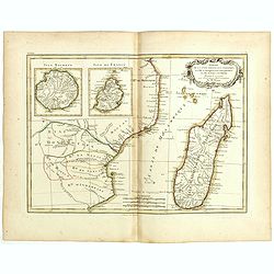
Carte de la Cote Orientale d'Afrique avec l'Ile de Madagascar et les Cartes particulières des Iles de France et de Bourbon . . .
Attractive map of Madagascar, Bourbon and Isle de France islands, ornated with a decorative title cartouche. Boundaries outlined in hand color.Prepared by Le Sieur Janvie...
Date: Paris, ca 1783
Selling price: ????
Please login to see price!
Sold in 2019
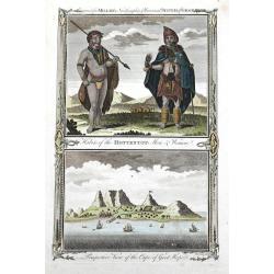
Habits of the Hottentot Men & Women. / Perspective view of the Cape of Good Hope.
Two fine views on one sheet. On top the view shows a native couple with their traditional clothing. The bottom view features the Cape of Good Hope, several houses and sai...
Date: London, 1784
Selling price: ????
Please login to see price!
Sold in 2016
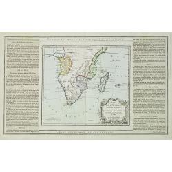
Carte de l'Afrique Méridionale, ou Pays entre la Ligne et le Cap de Bonne Espérance.
Africa south of the Equator, with insets of Table Mountain, Table Bay and the Cape of Good Hope (based on Valentyn). Originally the plate of De L'Isle of 1708, this image...
Date: Amsterdam, ca. 1785
Selling price: ????
Please login to see price!
Sold in 2008
Carte géographique du Cap de Bonne Esperance contenant les noms et positions . . .
Folding map of Cape of Good Hope, from " Voyage au Cap de Bonne-Esperance, et autour du Monde avec le Capitaine Cook, et principalement dans les pays des Hottentots ...
Date: Paris, 1787
Selling price: ????
Please login to see price!
Sold in 2022
Partie de L'Afrique..
Map showing Southern part of Africa. Left and right box with geographical information for each part country on the continent.Prepared by Louis Brion de la Tour and publis...
Date: Paris 1790
Selling price: ????
Please login to see price!
Sold in 2009
Partie de L'Afrique.. Le Congo, La Cafrerie &c.
Map showing the southern part of Africa with decorative rococo-style cartouche.Left and right box with geographical information for each part of the area. Printed on 2 pa...
Date: Paris, 1790
Selling price: ????
Please login to see price!
Sold in 2023
(Map of South Africa)
A large map of South Africa, engraved by Hieronymus Benedicti. Not in Norwich.
Date: Vienna, c. 1790
Selling price: ????
Please login to see price!
Sold in 2021
![[Lot of 2 maps] Afrique divisee en ses principeaux Empires et Royaumes.](/uploads/cache/18439-(2)-250x250.jpg)
[Lot of 2 maps] Afrique divisee en ses principeaux Empires et Royaumes.
This map of the African continent clearly shows the lack of knowledge of the interior of the continent in the 18th century. Only Morocco and Algeria, Egypt, Nubia and Aby...
Date: 1793
Selling price: ????
Please login to see price!
Sold in 2022
Carte de la Partie MĂ©ridionale de l'Afrique, pour servir d'intelligence aux deux voyages de Le Vaillant.
This map depict François Le Vaillant's (1753-1824) two journeys into the interior of Africa, during the years 1783, 1784 and 1785. The route through Namaqualand and alon...
Date: H. J. Jansen et Comp., Paris, 1795
Selling price: ????
Please login to see price!
Sold in 2013
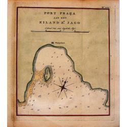
Port Praija aan het Eiland St. Jago.
Map of Porto Praya at the southern part of St. Jago Island, one of the Cape Verde Islands.
Date: The Hague, 1795
Selling price: ????
Please login to see price!
Sold in 2014
A chart of the Inner passage between the coast of Africa..
Detailed chart of the inner passage between the coast of Africa and the isle of Madagascar. In upper left hand corner inset of Comoros Islands. Another inset with the bay...
Date: London 1797
Selling price: ????
Please login to see price!
Sold
Carte du Cap de Bonne Esperance et de ses Environs.
A very nice map of the tip of South Africa, showing Cape of Good Hope, including an inset view of Cape Town and the Tafel Berg. Title cartouche on the lower left-hand cor...
Date: France c.1800
Selling price: ????
Please login to see price!
Sold
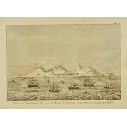
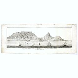
Vue des montagnes du Cap de Bonne-Espérance. . .
View of the Cape of Good Hope showing sailing ships foreground.
Date: Paris, 1800
Selling price: ????
Please login to see price!
Sold
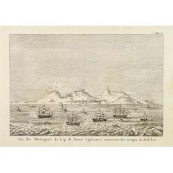
Vue des montagnes du Cap de Bonne-Espérance. . .
View of the Cape of Good Hope showing sailing ships foreground.
Date: Paris, 1800
Selling price: ????
Please login to see price!
Sold
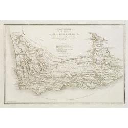
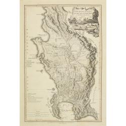
Carte générale de la colonie du Cap de Bonne Espérance.. Par John Barrow.
A very nice and rare map of the tip of South Africa, showing Cape of Good Hope. From Voyage dans la partie méridionale de l'Afrique: fait dans les années 1797 et 1798. ...
Date: France c.1801
Selling price: ????
Please login to see price!
Sold
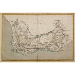
Cape of Good Hope.
Aaron Arrowsmith (1750-1833) , London-based, prolific cartographer and publisher, Hydrographer to His Majesty (1820).Map of the colony of the Cape of Good Hope. The bound...
Date: London, 1807
Selling price: ????
Please login to see price!
Sold
The Island & Forts of St. Helena.
Striking and extremely detailed map of St. Helena. Shows many individual buildings with their residents' last names. Including Farms, Napoleon Bonapartes Residence, an Al...
Date: England ?, c.1810
Selling price: ????
Please login to see price!
Sold in 2009
La Ville du Cap de Bonne Esperance.
A very pretty and attractive view of Cape Town in South Africa, from Bertuch's Bilderbuch fur Kinder.The view is beautifully hand colored and comes with original accompan...
Date: Weimer, 1810
Selling price: ????
Please login to see price!
Sold in 2018
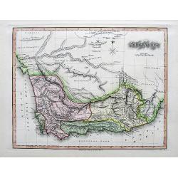
The Dutch colony of the Cape of Good Hope / by L.S. De La Rochette.
Uncommon detailed map of the Cape of Good Hope, showing kraals or villages, fountains, river crossings, early settlers, anchorages, etc. Prepared by Louis Stanislas d'Arc...
Date: London, 1795-1811
Selling price: ????
Please login to see price!
Sold in 2010
The Dutch colony of the Cape of Good Hope / by L.S. De La Rochette.
Uncommon detailed map of the Cape of Good Hope, showing kraals or villages, fountains, river crossings, early settlers, anchorages, etc. Prepared by Louis Stanislas d'Arc...
Date: London, 1795-1811
Selling price: ????
Please login to see price!
Sold in 2013
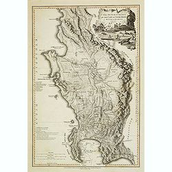
Charte der Sudspize von Africa oder des Hottentotten und Caplands.
A copper engraved map, published in 1811 in Prague. A rare Prague Issue of John Barrow's Map, originally published in 1802 for "An Account of Travels Into the Interi...
Date: Prague, 1811
Selling price: ????
Please login to see price!
Sold in 2016
![Plan du Port Napoleon a l'Ile de France [picture] / dresse sous la direction de Mr. L.F. par Mr. Hubert Brue, d'apres plusieurs plans inedits et les observations de l'Abbe de la Caille.](/uploads/cache/46809-250x250.jpg)
Plan du Port Napoleon a l'Ile de France [picture] / dresse sous la direction de Mr. L.F. par Mr. Hubert Brue, d'apres plusieurs plans inedits et les observations de l'Abbe de la Caille.
Map of Napoléon harbour, on Isle de France (Île de France in modern French). The island in the Indian Ocean island which is known as Mauritius and its dependent territo...
Date: Paris, 1812
Selling price: ????
Please login to see price!
Sold in 2021
South Africa.
A nicely engraved map with fine hand-coloring. Excellent detail with numerous place names. It also Includes several wells, missionary villages, and short notes.
Date: London, 1813
Selling price: ????
Please login to see price!
Sold in 2017
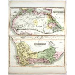
North Africa & South Africa.
Large hand-colored map of North & South Africa (two maps on one sheet). The interesting map include details of the locations of historic events, cave paintings and ca...
Date: Edinburgh, 1817
Selling price: ????
Please login to see price!
Sold in 2017
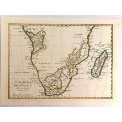
L'Africa Meridionale.
A fine map of southern Africa and Madagascar, by Borghi, from his atlas "Atlante Geograpfico". Bartolomeo Borghi (1750-1821) was an Italian cartographer, engrav...
Date: Florence, 1818
Selling price: ????
Please login to see price!
Sold in 2017
Carte de False Bay et de la Baie de la Table. . .
Very large and detailed of the South African coast from Robben Island to Cape of Good Hope, False Bay and False Cape.Upper right corner the title : CARTE DE FALSE BAY ET...
Date: Paris, DĂ©pĂ´t de la Marine, c.1824
Selling price: ????
Please login to see price!
Sold in 2014
Carte Generale de L'Afrique Meridionale. . .
An Interesting map of southern Africa by L.Vivien, with lots of map detail on the south and south east of Africa, and the Congo. Interior largely blank. Many small towns,...
Date: Paris, 1826
Selling price: ????
Please login to see price!
Sold in 2019
