Browse Listings in America > South America > Venezuela
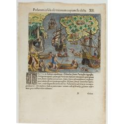
(Island of Pearls) Perlarum insula ob unionum copiam sic dicta.
A depiction of Cubagua as the Perlarum Insula (Island of Pearls), with in the foreground, two large ships send dinghies toward busy Native Americans collecting pearl oyst...
Date: Frankfurt, 1594
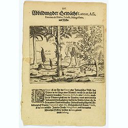
Plants Lantor, Assa, Pimenta, Mangostan and Pepper.
Lantor is a kind of coconut palm (or Indian nut) with fronds as long as a human body. These fronds are used as paper. Pimenta del Rabo (or cubebe) grows grape-like on tre...
- $80 / ≈ €68
Date: Frankfurt, 1598
![[How natives of Paria cope with illness] / Vespucci reaches Lake Maracaibo]..](/uploads/cache/41095-250x250.jpg)
[How natives of Paria cope with illness] / Vespucci reaches Lake Maracaibo]..
Two engravings. [421b] When the natives of those parts, they were bathed in a cold stream, then chased round a blazing fire until they had dried out. Then they were put t...
Date: Frankfurt, M.Merian, 1633
![[Ralegh arrives at Orocotona.]](/uploads/cache/40468-250x250.jpg)
[Ralegh arrives at Orocotona.]
On reaching the rapids of the Caroní, further up the Orinoco, Ralegh’s expedition was unable to proceed further by river, so they continued overland, eventually arriving ...
Date: Frankfurt, M.Merian, 1633

Venezuela cum parte Australi novae Andalusiae.
RARE. A finely engraved, decorative map with no text on the verso. The islands Trinidad, Margarita, Aruba and Curaçao are shown as well.
Date: Amsterdam, c. 1640
![[Murder of Dominican monks in Cumana or Cubagua Island].](/uploads/cache/40177-250x250.jpg)
[Murder of Dominican monks in Cumana or Cubagua Island].
Murder of Dominican monks in Cumana or Cubagua Island in what is now Venezuela. Scarce print (150x177mm.) on a German text sheet taken from a first edition of Johann Ludw...
Date: Frankfurt, M.Merian, 1633
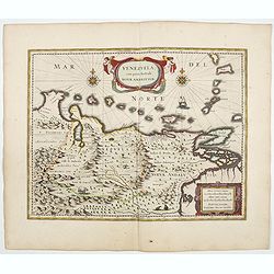
Venezuela cum parte Australi Novae Andalusiae.
A finely engraved, decorative map of Venezuela. The islands of Trinidad and Tobago, Margarita, Aruba and Curaçao are shown. Local animals are depicted, sheep, birds, monk...
- $800 / ≈ €684
Date: Amsterdam, ca. 1644
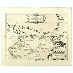
Venezuela, atque Occidentalis Pars Novæ Andalusiae.
The coastline of Venezuela with little interior development. Including Aruba, Bonaire, Curaçao, etc. This scarce map was prepared by Hessel Gerritsz (1581-1632), a former...
- $600 / ≈ €513
Date: Leiden, 1625
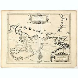
Venezuela, atque Occidentalis Pars Novæ Andalusiae.
Coastline of Venezuela with little interior development. Including Aruba, Bonaire, Curaçao, etc. Scarce map prepared by Hessel Gerritsz (1581-1632), former apprentice of ...
- $600 / ≈ €513
Date: Leiden, Elzevier, 1630
![[Sir Walter Ralegh meets the King of Arromaia].](/uploads/cache/39916-250x250.jpg)
[Sir Walter Ralegh meets the King of Arromaia].
Scarce print with a German text sheet. During Ralegh’s voyage up the Orinoco in search of El Dorado, he met an old man who said he was the king of Arromaia. He claimed to...
- $125 / ≈ €107
Date: Frankfurt, M.Merian, 1633
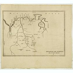
Descripcion del audiencia del Nuevo Reino 9.
The earliest map to include information from the previously secret manuscript maps of the Spanish cosmographer, Juan López de Velasco, showing present-day Colombia and Ve...
- $450 / ≈ €385
Date: Amsterdam, Michel Colin, 1622
