Search Listings matching "etats-unis"

Carte du Mexique et des Etats Unis d'Amérique...
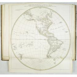
A later edition of De l'Isle's foundation map of 1703, is widely regarded as one of the most influential maps in the history of American Cartography. This updated version...
Date: Paris, 1783

ETATS-UNIS DE L'AMÉRIQUE SEPTENTRIONALE Avec LES ISLES ROYALE, DE TERRE NEUVE, DE S.T JEAN, L'ACADIE, &c. 1785. Supplement a l'Atlas de M. Robert de Vaugondy a Paris Ches Boudet Ingenieur du Roi.
A map of the eastern United States with "Supplément à l'atlas de M. Robert de Vaugondy à Paris chez Boudet Imprimeur du Roi", in place of the attribution to ...
Date: Paris, 1785

Amérique Septentrionale .. Les Etats Unis..
Very rare state: probably separately issued. Published the same year as the Treaty of Paris, this is one of the first maps to show printed boundary lines for the newly...
- $3000 / ≈ €2618
Date: Paris, 1786
Atlas in elephant folio.
Most of D'Anville's atlases were made up for the individual customer, so no two appear alike. Many of the 59 pages are multi-sheet maps, so the actual map sheet count is ...
Date: Paris, 1771-1786

United States of North America. Carte des Etats-Unis de l'Amerique Septentrionale / copiée et gravée sur celle d'Arrowsmith, corrigée et considérablement augmentée... par P. F. Tardieu...
FIRST EDITION. An impressive wall map here in 4 unjoined sheets and large margins. RARE in these untouched, full sheets. Recorded examples are usually offered as folding ...
Date: Paris: An XI - 1802
![Etats-Unis de L'Amerique Septentrionale. [Two sheets in manuscript ]](/uploads/cache/03972-250x250.jpg)
Etats-Unis de L'Amerique Septentrionale. [Two sheets in manuscript ]
Two sheets giving detailed information in French about the population in 1810, principal cities, products of industry and commerce, the financial situation for 1818, etc....
Date: France, ca. 1819
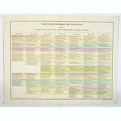
Carte Chronologiquedes Etats-Unis.
A hand colored historical timeline table (in French), highlighting "the main [historical] events in the years from their establishment to the declaration of independ...
- $100 / ≈ €87
Date: Paris, 1825
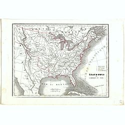
Etats-Unis de l'Amérique du nord.
Detailed map of North America, prepared by Charles V. Monin (fl.1830-1880) a French cartographer of Caen and Paris. Published in Atlas Universel de Géographie Ancienne &...
- $75 / ≈ €65
Date: Paris, 1845
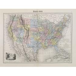
Etats-Unis.
Decorative map of the United States from Géographie Universelle, Atlas Migeon. Oklahoma is Indian Territory with Public Lands in the panhandle. With an engraving lower l...
- $75 / ≈ €65
Date: Paris, 1874
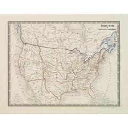
États-Unis et Nouvelle Bretagne.
A detailed map of the United States. All different States are divided by an orange border line.
- $120 / ≈ €105
Date: Paris, 1880
