Browse Listings in Maritime

Neptune des Côtes Occidentales de France.
Large maritime atlas illustrated with a handwritten title, a table and 47 single or double page charts. The charts show the western coasts of France as well as the Spanis...
- $12000 / ≈ €11229
Place & Date: Paris, 1776-1822

Carte de l'Ile de Java. . .
An inset plan of Batavia and clearly indicated rice fields, mountains, forests, towns in profile, and even elephants, suggesting the wealth of detail found on this map. M...
Place & Date: Amsterdam, 1720

Currus Veliferi Illmi. Pr. Mauritii Nassouvii. (Prince Maurits' sailing-carriage, designed by Simon Stevin. )
Prince Maurits' sailing carriages had been designed by Simon Stevin. The Prince, always accessible to new inventions of his old instructor, could not please the foreign a...
Place & Date: Amsterdam, 1649

A ship's hour glass
The element common to celestial position-finding, the calculation of speed for dead reckoning and even everyday life at sea is the time: hence ways of determining and kee...
Place & Date: ca. 1790

Pascaerte van Brazil en Nieu Nederlandt van Cuorvo en Flores.
A rare chart of the Atlantic Ocean from the first edition of Hendrick Doncker's Zee-Atlas, of which no surviving example is known.Although the idea of its unusual coverag...
Place & Date: Amsterdam, 1658
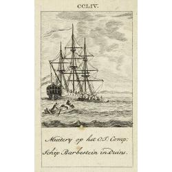
Muitery op het O:I: Comp. schip Barbestein in Duins.
Anonymous engraving of a mutiny of the VOC ship Barbestein .
Place & Date: Amsterdam c.1790
-250x250.jpg)
Vues du port de Llivourne. (set of 6 prints)
Sought-after complete suite of 6 engravings by S[tefano] Della Bella [1610-1664]. in a second state (of 2).Della Bella was born in Florence in 1610, and studied the art ...
Place & Date: 1654-1655
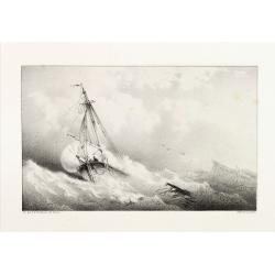
Shipping scene.
Attractive lithography showing Dutch vessels off the Dutch coast, by A.A.Nunnink after a painting by L.Meijer. Published in Kunst Kroniek .
- $60 / ≈ €56
Place & Date: The Hague, 1857
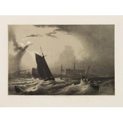
![[Ships at sea]](/uploads/cache/08213-250x250.jpg)
[Ships at sea]
Attractive lithography showing Dutch vessels off the Dutch coast, by F.H.Weissenbruch after a painting by L.Meijer. Published in Kunst Kroniek .
- $50 / ≈ €47
Place & Date: The Hague, 1862
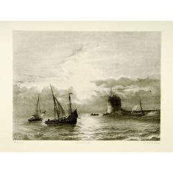
Shipping
Attractive lithography showing Dutch vessels off the Dutch coast, by F.A.Breuhaus de Groot. Published in Kunst Kroniek.
- $80 / ≈ €75
Place & Date: The Hague, 1849

De Cust van Barbaryen van out Mamora tot Capo Blanco..
Six charts on one sheet. The two upper charts covering an area from Cape Blanc to Casablanca. In lower part four insets with detailed charts of islands as Madera, Porto S...
Place & Date: Amsterdam, 1666

Pas-Caart van Guinea en den Custen daer aen gelegen Van C..
A decorative chart of the southwest coast of Africa, embellished with an elaborate, finely colored title-cartouche, and 2 compass-roses. Pieter Goos (ca. 1616-1675) was o...
Place & Date: Amsterdam, 1666

De Cust van Barbaria, Gualata, Arguyn, en Gene..heo, van Capo S.Vincente tot Capo Verde.
An eye-catching chart of the north western coast of Africa. Including Canary Islands, Cape Verde Islands and Azores.Pieter Goos (ca. 1616-1675) was one of the most import...
Place & Date: Amsterdam, 1666
![De Texel Stroom met de gaten vant Marsdiep. [with] Caarte van De Mase ende het Goereesche Gat.](/uploads/cache/12097-250x250.jpg)
De Texel Stroom met de gaten vant Marsdiep. [with] Caarte van De Mase ende het Goereesche Gat.
Two decorative charts on one sheet, one depicting Texel and the entrance of the Zuider Zee with an inset showing the north coast of West-Friesland, the other depicting th...
Place & Date: Amsterdam, 1660

Cust van Hollant Tussen de Maes ende Texel.
Uncommon chart of the coast of Holland, including the southern tip of Texel. East at the top. Two fine compass cards, soundings and a large Bree Veerthien offshore.Piete...
Place & Date: Amsterdam, 1666

Pascaerte Van't Westelyckste der Middelandsche Zee. . .
An eye-catching chart of the western part of the Mediterranean Sea.Pieter Goos (ca. 1616-1675) was one of the most important cartographer, engraver, publisher and print s...
Place & Date: Amsterdam, 1666

Paskaert vande Bocht van Vranckrijck Biscajen. . .
An eye-catching chart of the coast of Bretagne from Brest running south till the coast of Biscay in Northern Spain.Including the towns of Ferrol in the west, Gijon, Santa...
Place & Date: Amsterdam, after 1666
![[60] Porto de Ganea.](/uploads/cache/12832-250x250.jpg)
[60] Porto de Ganea.
Charming chart of the harbour of the Greek town of Ganea. Showing town and harbour plan, with soundings, anchorages, rocks, shoals, fortifications and lighthouses.Joseph ...
Place & Date: Marseille, 1764
![Flessingue Ville de l'Ile de Walcheren. [Vlissingen]](/uploads/cache/13105-250x250.jpg)
Flessingue Ville de l'Ile de Walcheren. [Vlissingen]
A very RARE panoramic view of the city of Vlissingen. The plate is numbered in red pencil in the upper right corner.Engraved by Jean Crepy (the father), who was active as...
- $400 / ≈ €374
Place & Date: Paris, 1690-1720

Carte de la Côte de Guzerat, Du Golf de Cambaye et des Côtes de Concan et De Canara.
French sea chart of West India from Gujarat to Mangalore. With inset chart Plan de la Rivière de Surate.Prepared by Jacques-François L'Abbé Dicquemare (1733-1789). La...
Place & Date: Paris, ca 1775
Kronborg et le Sund (Danemarck).
Uncommon and decorative lithography published by Carl Johan Billmark and printed by Lemercier in Paris, 55 rue de Seine, the leading firm in Europe at that time. From: It...
- $75 / ≈ €70
Place & Date: Paris, c.1859
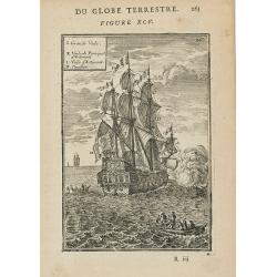
DU GLOBE TERRESTRE - Figure XC. 253
Finely engraved plate of various types of sailing ships.From the French text edition of Description d'Univers.. (5 volumes), 1683. By Allain Manneson Mallet (1630-1706), ...
Place & Date: Paris, 1683
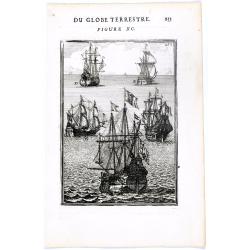
(Ships on full sea)
A fine engraving of different sailing vessels at full sea.From the French text edition of Description d'Univers.. (5 volumes), 1683. By Allain Manneson Mallet (1630-1706)...
Place & Date: Paris, 1683
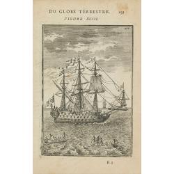
(Shipping)
Finely etched depiction of a vessel, with a lettered key. With explanatory text on verso.From the French text edition of Description d'Univers.. (5 volumes), 1683. By All...
Place & Date: Paris, 1683
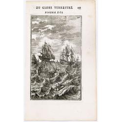
(Des Galeres - Shipping scene)
Miniature view of a vessel, showing the various types of sails. With key list in upper left corner.From the French text edition of Description d'Univers.. (5 volumes), 16...
Place & Date: Paris, 1683
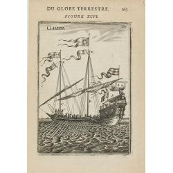
GALERE
Miniature view of a galley. From the French text edition of Description d'Univers.. (5 volumes), 1683. By Allain Manneson Mallet (1630-1706), a well travelled military en...
Place & Date: Paris, 1683
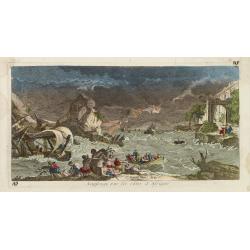
Naufrage sur les côtes d'Afrique.
So called optical print of a shipwrecking in a storm off the African shores.In the eighteenth and nineteenth centuries there were many popular specialty establishments in...
- $300 / ≈ €281
Place & Date: Paris, 1760
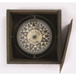
Compass.
A very nicely crafted sloop compass in original box. The compass is gimbaled and is executed in beautiful red copper. Made and signed by F.J. Kloos & Son of Rotterdam...
Place & Date: Rotterdam, 1850-1875
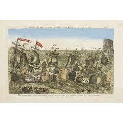
Vue perspective d'une rencontre des François avec les Anglois dans la Mediterranée.
Perspective view illustrating a battle between the French and the English fleets by Basset, a well-known publisher of optical prints, established in rue S. Jacques in Par...
- $300 / ≈ €281
Place & Date: Paris, 1760

Beschrijvinge vande de zee Cuften va Vlanderen en Picardien. . .
DUTCH TEXT EDITION. A detailed chart of the coast of Flanders and Normandy decorated by a large colorful baroque title cartouche, and the coat of arms of Flanders with a ...
Place & Date: Leiden, Plantijn, 1585

De zee cuften tufschen Dovere en Orfords nesse, daer de Teemse de Vermaerde Rivire van Lonen gelegens is. . .
A detailed chart of the English Channel coastland. Decorated by a colorful title cartouche and scale cartouche, one compass rose, several vessels and sea monsters. A very...
Place & Date: Leiden, Plantijn, 1585

Belchrijuinghe vande zee custen van Engelandt. . .
A rare Dutch text edition of this detailed early chart of the northern coast of England. West to the top. The mileage cartouche has no Latin captures. Decorated by a colo...
Place & Date: Leiden, Plantijn, 1585

Zee caerte vande Sondt tvermaerste van Danemarcke . . .
A detailed chart of the coast of Denmark and its islands, Copenhagen in the center of the chart. West to the top. It is decorated by a title, scale and descriptive cartou...
Place & Date: Leiden, Plantijn, 1585
![Le Capitaine Wallis est attaqué dans le Dauphin par les Otahitiens. [Tome II Pl. 1ère.]](/uploads/cache/26099-250x250.jpg)
Le Capitaine Wallis est attaqué dans le Dauphin par les Otahitiens. [Tome II Pl. 1ère.]
Scene of an attack by local Tahitians on Captain Wallis' Dolphin ship off Tahiti's shore. Samuel Wallis (1728-95), a Royal Navy Captain and a skilled navigator was given ...
- $150 / ≈ €140
Place & Date: Paris, 1773
![Vue de l'Isle d'Otahiti et de plusieurs Pirogues. [Tome II Pl. 11.]](/uploads/cache/26102-250x250.jpg)
Vue de l'Isle d'Otahiti et de plusieurs Pirogues. [Tome II Pl. 11.]
View of the Island of Tahiti and dugouts. From the French edition of James Cook's first voyage entitled Relation des voyages entrepris par ordre de sa Majesté Britanniqu...
- $75 / ≈ €70
Place & Date: Paris, 1773
![Vue de l'Isle d'Ulietéa avec une double Pirogue et un hangar où les Insulaires retirent leurs bâtiments de mer. [Tome III Pl. 5.]](/uploads/cache/26106-250x250.jpg)
Vue de l'Isle d'Ulietéa avec une double Pirogue et un hangar où les Insulaires retirent leurs bâtiments de mer. [Tome III Pl. 5.]
A view on the Island of Ulietea, French Polynesia, of a dugout boat house and a beautifully engraved pirogue at sea. From the French edition of James Cook's first voyage ...
- $50 / ≈ €47
Place & Date: Paris, 1773
![[Pirogues in the bay of the voyage of the Resolution. The Marquesas Islands ].](/uploads/cache/26373-250x250.jpg)
[Pirogues in the bay of the voyage of the Resolution. The Marquesas Islands ].
Aquatint depicting men in pirogues in the Bay of the Resolution from the Marquesas Islands engraved by Biasioli. Plate N° 91. HMS Resolution was a sloop of the Royal Nav...
- $50 / ≈ €47
Place & Date: Milan, 1827
![[Easter Island inhabitants ].](/uploads/cache/26375-250x250.jpg)
[Easter Island inhabitants ].
Aquatint depicting 2 portraits of Easter Island inhabitants and 2 men rowing in a pirogue. Engraved by Carlo Bottigella. Plate N° 88. From Giulio Ferrario's work Le Cost...
- $80 / ≈ €75
Place & Date: Milan, 1827

New York Ferry Boat. (Bac à vapeur de New York).
A very decorative print showing the New York Ferry Boat "Fulton," published by Currier & Ives. The Ferry boat "Fulton" sails to the right. A singl...
Place & Date: New York, ca. 1875

Saique batiment dont les turcs se servent. . .
A very decorative engraving of a Turkish vessel. From Mortier's famous maritime Atlas "Neptune François". Engraved by Jan van Vianen after a design by Henri Sb...
Place & Date: Amsterdam, 1690