Browse Listings in Map Types > Nautical Charts
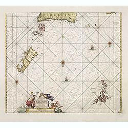
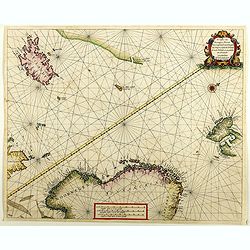
Paskaart Vande Noord Cust van Schotland als mede de Eylanden van Hitland en Fero. . .
Decorative chart, with south to the top. Latitude scale, compass rose and system of rhumb lines, soundings, anchorage's, etc. In the lower right corner, with added number...
- $500 / ≈ €468
Place & Date: Amsterdam, 1753

Singapore.
Chart of Southern part of Malaysian peninsular showing good detail on of Singapore. Map with legend and scale.
Place & Date: London, 1944
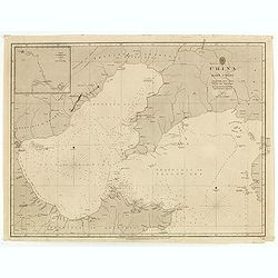
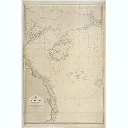
China east coast Yellow Sea and Gulf of Pechili
Very detailed chart of China's east coast with the Yellow Sea and Gulf of Pechili. Scale: circa 1:1m. Inscription: J & C Walker sculpt. One inset: Pekin to the Gulf o...
- $450 / ≈ €421
Place & Date: London, 1840 - 1859
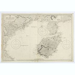
China sea. Tong King Gulf Compiled from the latest British and Foreign Government surveys to 1886. . .
Detailed Map of Chart of Annam Gulf or Tong King Gulf, in the China Sea. Chart with legend and scale. British Admiralty chart No. 2062, published June 1881, large correct...
- $400 / ≈ €374
Place & Date: London, 1881 updated to 1957
![Carte de la coste orientale de la Chine depuis Amoy, jusqu'à Chusan avec une partie de l'Isle Formose [with] Plan du port d'Amoy ou Emouy.](/uploads/cache/33583-250x250.jpg)
Carte de la coste orientale de la Chine depuis Amoy, jusqu'à Chusan avec une partie de l'Isle Formose [with] Plan du port d'Amoy ou Emouy.
Important French chart of the China Sea with the coast of Northern China, including a large depiction of Formosa.Latitude and longitude scales, compass rose and system of...
Place & Date: Paris, Jean-François Robustel, 1745

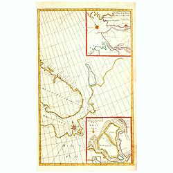
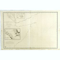
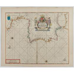
Plan du Cap de Bonne-Esperance et ses environs..
Large and detailed sea chart of the Cape of Good Hope from Saldahna Bay to False Bay.Engraved by Guillaume-Nicolas Delahaye (1727-1802).Latitude and longitude scales, com...
Place & Date: Paris, 1745

Carte particulière de la côte d'Afrique depuis le cap des Courans jusqu'à la baye de Ste Hélène. . .
Large and detailed sea chart of South Africa.Engraved by Guillaume-Nicolas Delahaye (1727-1802).Latitude and longitude scales, compass rose and system of rhumb lines, sou...
Place & Date: Paris, 1745

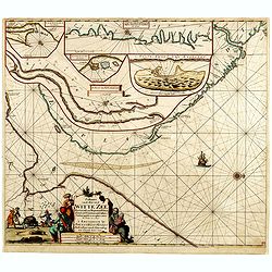
.Paskaart van de Mont van de Witte Zee,. Beginnende van Tiepena tot Pelitza, als mede van C. Cindenoes tot Catsnoes.
Fine sea chart of the southern part of the Barents Sea, oriented to the West. With five inset maps: - Swetenoes, de Kust van Laplandt, Lombascho, 'T Vaste Landt van Lapla...
Place & Date: Amsterdam, c.1710

Mare Balticum. . . / Nieuwe Pascaert van de Oost Zee. . .
Decorative chart showing the Baltic sea, with a splendid cartouche of royal figures. A re-issue of the De Wit copper plates, now with many improvements.
- $2500 / ≈ €2339
Place & Date: Amsterdam ca.1680
Paskaart van de Mont van de Witte Zee,. Beginnende van Tiepena tot Pelitza, als mede van C. Cindenoes tot Catsnoes.
Fine sea chart of the southern part of the Barents Sea, oriented to the West. With 5 inset maps: - Swetenoes, de Kust van Laplandt, Lombascho, "T Vaste Landt van Lap...
- $1000 / ≈ €936
Place & Date: Amsterdam, c.1710

Nieuwe Wassende Graadige Pas-kaart van de Kust van Guinea en Brasilia.
Rare two-sheet sea chart of the coasts of Brazil, West Africa and South Africa, published by Johannes Van Keulen (the younger), circa 1720.The chart shows the western coa...
Place & Date: Amsterdam, 1751
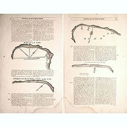
Two double sided pages No's 25 & 26 ‘Directions for the coast of Arabia.' 27 & 28 Directions for the Coast of Persia & ‘Directions for the coast of Arabia
Four woodblock chart’s on two double sided sheets by Samuel Thornton showing the approaching coast lines Arabia by John How and Samuel Thornton. Pages numbered 25,26,27...
- $500 / ≈ €468
Place & Date: London, 1711

A plat of the East Sea. By William Fisher and Richard Mount...
An important sea chart of the East Sea with coast lines of Poland, Russia, Sweden, published by William Fisher and Richard Mount in London.Richard Mount (1654-1722) was a...
- $1800 / ≈ €1684
Place & Date: London, 1795
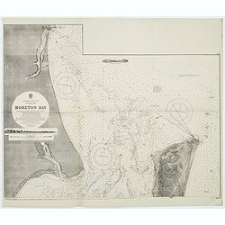
Australia, E. coast - Queensland Moreton Bay
Large chart representing East coast of Australia with Moreton Bay in Queensland.After a survey by Comr. J.Jeffery, etc. in 1865. New edition at the Admiralty 1870. With ...
Place & Date: London, 1882-1945

Kronstat From The Russian Survey . . .
Scarce chart of the Island of Kronstat, the primary defensive position for the Russian Navy in defense of Russia's Czarist Capital of St. Petersburg.Published on the eve ...
- $500 / ≈ €468
Place & Date: London, 1853
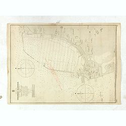
Colombo Harbour From Surveys supplied by Sir. John Coode. . .
Sir John Coode's highly detailed map of the Harbour at Colombo (Sri Lanka), with manuscript notations and corrections in pencil. With red pencil "INCORRECT".The...
- $500 / ≈ €468
Place & Date: London, 1885 -1896
China, Sheet IX, Yang-Tse-Kiang from the sea to Nanking . . .
A fine, large-scale chart. This chart depicts the last stretch of the Yangtse River before it meets the sea. It gives soundings and notes on the tides, and includes an in...
- $750 / ≈ €702
Place & Date: London, 1843-1859

Carte de la Baye et du Port de Trinquemalay Dans L'Isle de Ceylan.
French chart of the harbor of Trinquemalay on the island of Ceylon. Prepared after Samuel Cornish who was a vice admiral for the English East India company.Latitude and l...
- $350 / ≈ €328
Place & Date: Paris, Brest, chez Demonville, 1775
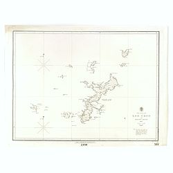
North Pacific Ocean LOO CHOO and adjacent Islands 1855.
Large scale chart of Okinawa in the Japan Sea. With scale and vignette of Typographical office. Map nr. 2416.An interesting note in lower right "The coast line of al...
- $300 / ≈ €281
Place & Date: London, 1855
A Chart of the Sound -- A Map of the rivers Elbe and Weser -- The River Dvina and the harbour of Archangel.
Scarce sea chart by John Harris (1667?-1719) and James Knapton (d. 1738). Chart 20 from "Atlas maritimus & commercialis", shows Lapland and part of the Russ...
- $400 / ≈ €374
Place & Date: London, J. Knapton, 1728

Carte des Isles d'Acores.
Uncommon and detailed map of the Azores. With inset maps of Port de St.Cruz and harbor and town of Angra on the island of Terceira. It was at the time an important port a...
Place & Date: Amsterdam, 1730
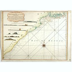
The Coast of India, from Point Gordeware to the Ganges Comprehending Part of the Coast of Golconda . . .
Detailed sea chart of the coast of India, from the mouths of the Ganges Rivers in the northeast to Point Gordeware in the south west. Includes numerous sailing channels a...
- $400 / ≈ €374
Place & Date: London, 1794
De custen van Noorwegen, Finmarcken, Laplandt, Spitsbergen . . .
Two sea charts on one sheet showing Norway, Finland, Iceland, Spitsbergen and part of Scotland. The chart includes a detailed plan of the coastlines, soundings, anchorage...
Place & Date: Amsterdam, 1666

Nouvelle carte des mers comprises entre le détroit de Banca et P°. Timon avec la partie orientale du détroit de Malacca.
Important French chart of the tip of Malaysia with Singapore. Latitude and longitude scales, compass rose and system of rhumb lines, soundings near coast and in bay areas...
Place & Date: Paris, 1745
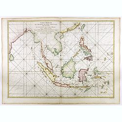
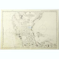
Carte réduite de l'archipel des Indes orientales avec les côtes du continent depuis le golfe de Manar jusqu'à Emoui à la Chine . . .
Important French chart of South East Asia with very good detail on Philippines. Latitude and longitude scales, compass rose and system of rhumb lines, soundings near coas...
Place & Date: Paris, 1745
Selling price: $3000
Sold in 2017

CARTE de la Côte Occidentale de COREE, Plan Croquis de la Rivière HAN-KANG ou de SEOUL, depuis son Embouchure jusqu'à Séoul, dressée en 1866 ...
Uncommon chart of the Han-Kang River from its mouth to Seoul, prepared in 1866 by order of C.A. ROZE, Commander-in-Chief of the French " la Station des Mers de Chine...
Place & Date: Paris, 1868

Pascaarte van een deel der Oost Zee, tusschen Bornholm ende der Memel, vertonende de ware gelegentheijt der Zeecusten van Pruijssen. . .
This very rare chart of the Northern Coast of Poland with Gdansk, appeared in the rare English edition of Willem Blaeu's 'Het Licht der Zeevaert', an atlas of sea charts ...
- $4000 / ≈ €3743
Place & Date: Amsterdam, 1608
![The Coast of New Found Land From Salmon Cove to Cape Bonavista. . . [together with] The Coast of New Found Land from Cape-Raze to Cape St-Francis.](/uploads/cache/40658-250x250.jpg)
The Coast of New Found Land From Salmon Cove to Cape Bonavista. . . [together with] The Coast of New Found Land from Cape-Raze to Cape St-Francis.
Two charts showing the coast of New Found Land from Salmon Cove to Cape Bonavista and from Cape-Raze to Cape St-Francis. With inset chart of Trinity HarborGrierson publis...
Place & Date: Dublin, 1767

The Harbour of Casco Bay and Islands Adjacent Bt Capt. Cyprian Southicke.
The earliest printed chart of Casco Bay, an inlet of the Gulf of Maine on the southern coast of Maine, New England. First issued in 1720 by Mount and Page, it remained in...
Place & Date: Dublin, 1767
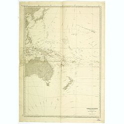
Ocean Pacifique Partie Ouest.
Large French sea chart featuring the western part of the Pacific Ocean with Australia, New Zealand, New Guinea, Philippines, till Korea and Japan, corrected in 1929.On th...
- $450 / ≈ €421
Place & Date: France, 1909-1929
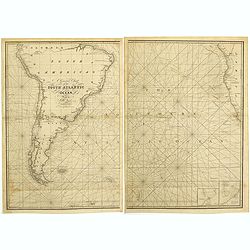
A general chart of the South Atlantic Ocean Drawn by J.W.Norie hydrographer. Revised & Corrected 1854.
A 2-sheet chart of the South Atlantic Ocean, showing the coast of South America from the mouth of the Amazon to Quito in Peru. The right hand part showing Africa's coast ...
- $600 / ≈ €561
Place & Date: London, 1854

Nieuwe gelyk Graadige Paskaart van de Kust van Guiana in West-Indien.
Detailed chart of Guiana in South America. Two scales are given in both maps: Dutch, French and English nautical miles.The inset chart provide detailed view of the Camopi...
- $650 / ≈ €608
Place & Date: Amsterdam, 1684 - 1704

Carte des pavillons accompagnée d'observations pour en faire comprendre le blazon et les différentes devises aussy bien que d'une table alphabétique pour les trouver facilement.?
Map of 88 marine flags, including Malta, Turkey, Middelburg, Amsterdam, Portugal, Monaco, Tuscany, China, Nanking, the French Royal flag, French admiralty flag and mercha...
Place & Date: Amsterdam, 1720
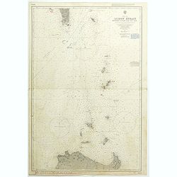
China Sea Luzon Strait between Luzon and Tai-Wan from the United States & Japanese Government chartsto 1929. . . (3804)
A highly corrected version of Admiralty chart 3804 originally published 18 September 1925 under the Superintendence of Captain P.H. Douglas. New Editions 18th December 19...
- $150 / ≈ €140
Place & Date: London, 1929 / 1992
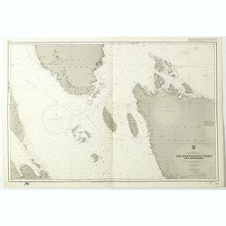
China Sea Philippine Islands - San Bernandino Strait and approaches. (3370)
A highly corrected version of Admiralty chart 3370 originally published 14th November 1924 under the Superintendence of Captain H.P. Douglas. Edition Date 1982 with furth...
- $150 / ≈ €140
Place & Date: London, 1924 / 1996

Philippine Islands - Semirara, Ilin and Ambulong 1.s with part of Mindoro. (971)
A highly corrected version of Admiralty chart 971 originally published 15th February 1866 under the Superintendence of Captain G.H. Richards. Edition Date 1991 with furth...
- $150 / ≈ €140
Place & Date: London, 1866 / 1999
Philippine Islands - Luzon - west and east coast. Cabra I. to S.n Fernando P.t. Diapitan B. to S.n Miguel B. . . (3806)
Detailed chart of Luzon Island with Manila Bay, Cabra Island to S. Fernando Point Diapitan Bay to S. Miguel Bay.A highly corrected version of Admiralty chart 3806 origina...
Place & Date: London, 1922 / 2006
Selling price: $100
Sold in 2018

Philippine Islands - Mindanao West Coast - Basilan Strait to Camiguin Island including Tubbataha Reefs. . . (3811)
A highly corrected version of this oversized Admiralty chart 3811 originally published 26th February 1925 under the Superintendence of Captain P.H. Douglas. Edition Date ...
- $150 / ≈ €140
Place & Date: London, 1925 / 2005
Carta esférica del Rio de la Plata : desde su embocadura hasta Buenos Aires.
Large nautical chart illustrating the estuary formed by the combination of the Uruguay River and the Paraná River. It forms part of the border between Argentina and Urug...
- $750 / ≈ €702
Place & Date: Madrid, 1812-1838
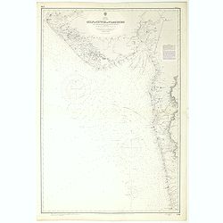
India west coast Gulf of Cutch to Vijaydurg . . .
Chart of India's west coast map surveyed by the hydrographer Captain JF Parry. A highly corrected version of Admiralty chart 2736 originally published 1st July 1915. Date...
- $200 / ≈ €187
Place & Date: London, 1915-1980
Carte de L'Entrée de la Mer Rouge. Dressée par M.Daussy. . .
Very large and detailed chart depicting the entrance of the Red Sea, including the coastline of Yemen with inset "Carte du détroit de Bab!el-Mandeb. . ." and &...
- $750 / ≈ €702
Place & Date: Paris, ca. 1840

Anamu Buru to Latakia including Iskenderun Körfezi.
A highly corrected version of Admiralty chart 2632 originally published 25 November 1955 under the Superintendence of Captain K.SB. Collins. Edition Date 1984 Detailed ch...
- $100 / ≈ €94
Place & Date: London, 1955 - 1984
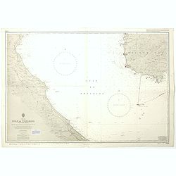
China sea Gulf of Tongking (Southern sheet).
A highly corrected version of Admiralty chart 3989 originally published 11 Mai 1962 under the Superintendence of Captain EG Irving. Detailed chart including the coasts of...
- $80 / ≈ €75
Place & Date: London, 1962 - 1992
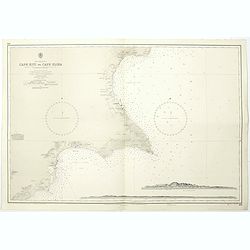
Cyprus south east coast Cape Kiti to Cape Eloea.
An British Admiralty chart of Cyprus south east coast. A highly corrected version of Admiralty chart 971 originally published 15th February 1866 under the Superintendence...
- $100 / ≈ €94
Place & Date: London, 1852

Mer de Chine - Detroit De Singapour Partie Comprise Entre Singaour et Le Dett. De Malacca d'apres les travaux du Commr. J.W. Reed de la Marine Royale d'Angleterr, ...
A detailed chart of Singapore Strait, drawn from an English Chart by J.W. Reed, who surveyed Singapore and environs between 1865 and 1869, aboard the H.M.S. Rifleman.The ...
Place & Date: Paris, 1873
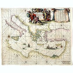
Orientalior districtus Maris Mediterranei.
Beautiful chart of the eastern part of the Mediterranean. Including Italy, the north coast of Africa and part of the Black Sea.The entire sheet is covered with rhumb line...
Place & Date: Amsterdam, 1675

Paskaart van Guinea van C.Verde tot R. deGalion.
Rare edition of Doncker's sea chart of Guinea coast. From an atlas printed in 1668, "l'Atlas de MER ou MONDE AQUATIQUE, Remontrant toutes lescôtes de la Mer…"...
- $1000 / ≈ €936
Place & Date: Amsterdam, 1660-1668

Nieuwe en Nette Afteekening van het Eyland Corsica en het Eyland Elba vertoonende alle desselfs Havenen, Steeden en Rivieren . . .
Highly decorative large sea chart of Corsica, Sardinia and Elba, including multiple sailing ships, compass roses, cartouche, coat of arms, rhumb lines, topographical deta...
Place & Date: Amsterdam, ca. 1710

De Zuydwest-Kust van Het Eyland Ceylon.
A finely engraved and detailed chart of Punta Gala harbour.Very rare: only included in 6th volume (so-called secret atlas) of Van Keulen's. A lettered key in upper left c...
- $1000 / ≈ €936
Place & Date: Amsterdam, 1753
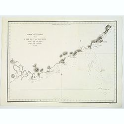
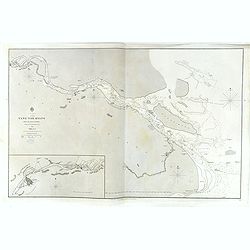
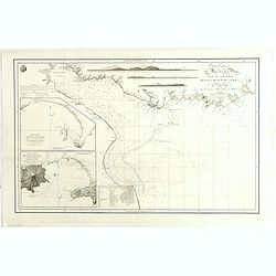
Carte Particuliere de la Cote de Cochinchine Depuis le cap Saint Jacques jusqu'au Faux Cap Varelle.
This is an impressive 1830 example of the French Depot-General de la Marine nautical chart or maritime chart of the southern coast of Vietnam. The chart extends from Saig...
- $1000 / ≈ €936
Place & Date: Paris, 1830
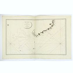
Carte Generale des Cotes de la Cochinchine et du Camboge.
A large, double-page French sea chart of part of the southern Cambodian coastline, and from Vietnamese Saigon up to Vung-Tau, Cap Varella, Cam Ranh Bay and Nha Trang. Wit...
- $1000 / ≈ €936
Place & Date: Paris, 1780
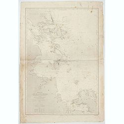
![[Lot of 4 charts] Plan de la Baie et du Port de Camraigne / Plan de la Baie de Niatrang et du Golfe de Binkang / Plan de la Cote de Cochinchine. . . / Plan des Ports de Xuandai, Vung-Lam. . .](/uploads/cache/44795A-250x250.jpg)
[Lot of 4 charts] Plan de la Baie et du Port de Camraigne / Plan de la Baie de Niatrang et du Golfe de Binkang / Plan de la Cote de Cochinchine. . . / Plan des Ports de Xuandai, Vung-Lam. . .
[A set of four French sea charts numbered consecutively]. A set of 4 basic coastal sea charts of parts of southern French Indochina (Vietnam).Chart 295 centers on the reg...
Place & Date: Paris ca 1780

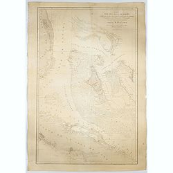
Mer de Chine - Detroit De Singapour Partie Comprise Entre Singaour et Le Dett. De Malacca d'apres les travaux du Commr. J.W. Reed de la Marine Royale d'Angleterr...
Mer de Chine - Detroit De Singapour Partie Comprise Entre Singaour et Le Dett. De Malacca d'apres les travaux du Commr. J.W. Reed de la Marine Royale d'Angleterr, execute...
- $2500 / ≈ €2339
Place & Date: London, 1871
Mer de Chine - Carte des Iles et Détroits entre Singapoure et le Détroit de Banca. Dréssée d'après le stravaux Anglais et Hollandais plus récents, par Mr. L. Manen . . . 1866
A nautical chart of Singapore and neighboring islands. The first edition of the chart was published in 1866 from French and English sources, this is the corrected version...
- $2000 / ≈ €1871
Place & Date: London, 1866-1871

Pas kaart Van Rio Oronoque Golfo De Paria met d'Eylanden Trinidad, Tabago, Granada, Granadillos, en Bequia . . .
A highly detailed and rare sea chart of the mouth of the Orinoco River, Trinidad, Tabago, St.Vincent and neighboring islands. Oriented with north to the right by two comp...
- $900 / ≈ €842
Place & Date: Amsterdam, 1684

Pas-Caart van de Oost Zee verthooende alle de ghelegenheydt tusschen t Eylandt Rugen ende Wyborg. . .
An eye-catching chart of the Baltic Sea. Engraved by Gerard Coeck.Pieter Goos (ca. 1616-1675) was one of the most important cartographers, engravers, publishers and print...
- $1500 / ≈ €1404
Place & Date: Amsterdam, 1666

The Sea Coasts of France from Olone to Cape Machicaca in Biscay . . .
Detailed chart of Biscay Bay, showing the Coast of Brittany. The chart is oriented with north-east at the top and includes two large insets of the Loire River with Nantes...
Place & Date: London, ca. 1680

The Sea Coast of France from Ushent to Olone.
Chart showing the Brittany coast from Ushent to Ollone, with Belle-Ile. In insets : Rade de Brest and Mouth of the Loire between St. Nazaire and Nantes.Originally engrave...
Place & Date: London, ca. 1680
Carta del Gran Banco de Bahama parte de la Isla de Cuba y Costa de la Florida.
A large marine chart, engraved by Juan Noguera and C.Marquerie, produced by the Direccion de Hydrografia, under the direction of Jose de Quesada, who was the then chief o...
- $1750 / ≈ €1638
Place & Date: Madrid, 1858-1866

Beschrijvinge vande de zee Cuften va Vlanderen en Picardien. . .
A detailed description of the coast of Picardie and Normandy decorated by a large colored baroque title cartouche, and the coat of arms of Flanders with a colorful scale ...
- $1750 / ≈ €1638
Place & Date: Amsterdam, 1585

Pascaart van de west cust van Engeland en Wales Van S. Davids Point tot de Moul van Dalway.
Rare Doncker's sea chart of the Irish Sea with the west Coast of England (Liverpool), the Island of Man and the western-most tip of Northern Ireland (Bangor) and Souther...
Place & Date: Amsterdam, 1660-1668
Pas-Caart van Hispangien vertoonde de Custen van Granade…
An eye-catching chart of Spain and Portugal, including a large part of Brittany and the southwestern coast of France, including Isle de Reé , Isle Saint Martin ...Pieter...
Place & Date: Amsterdam, 1669-1676

Paskaerte Vande Bocht van Vranckrijk Biscajen en Galissen
An eye-catching chart of Spain and France, including a large part of Brittany, including Isle de Reé , Isle Saint Martin ...Shows the gulf of the northeast Atlantic Ocea...
Place & Date: Amsterdam, 1669-1676

Nieuwe Paskaart van het Westerlykste Gedeelte van HET KANAAL strekkende aan de ENGELSCHE KUST van Poortland tot de Sorlinges. . .
Nieuwe Paskaart van het Westerlykste Gedeelte van HET KANAAL strekkende aan de ENGELSCHE KUST van Poortland tot de Sorlinges en aan de Fransche kust van het Eylandt Guern...
- $900 / ≈ €842
Place & Date: Amsterdam, 1760

Nieuwe Wassende Graade Zee Kaart over de Spaanse Zee Vant Kanaal tot 't Eyland Cuba In Westindia.
Rare two-sheet blue-back sea chart of the Atlantic and Eastern part of North America., published by Gerard Van Keulen. The map extends from the latitude of Newfoundland a...
- $2000 / ≈ €1871
Place & Date: Amsterdam, ca. 1728-1751
![Wusung River or Hwang Pu. / Wusung River Entrance [With Shanhhai]](/uploads/cache/48595-250x250.jpg)
Wusung River or Hwang Pu. / Wusung River Entrance [With Shanhhai]
A fine Survey chart no. 1601 showing Wusung River or Hwang Pu. / Wusung River Entrance [With Shanghai]
- $800 / ≈ €749
Place & Date: London, 1887 - 190, updated to 1903
China Sea Nothern Porton compiled from the latest survey to 1884
A fine Survey chart no. 2680 showing Tong King Gulf, Hanan Island up to Hong Kong, Macao and Canto River up to Canton (Being)
- $800 / ≈ €749
Place & Date: London, 1887, updated to 1897
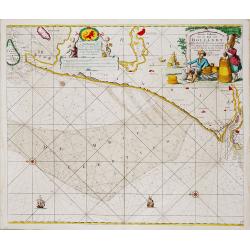
Nieuwe Paskaert van de Kust van HOLLANDT - Tussen Texel en de Maes.
Nieuwe Paskaert van de Kust van Hollandt Tussen Texel en de Maes. A very attractive sea chart off the coast of Holland by Johannes van Keulen with a pair of decorative c...
- $500 / ≈ €468
Place & Date: Amsterdam, ca 1685

Pas-Caart van de ZUYDER-ZEE, Texel ende Vlie-stroom.als mede 't Amelander gat (Hollandt/Vrieslandt)
An attractive chart of the Zuiderzee, now the inland water het IJselmeer.HOLLANDT / VRIESLANDTPas-Caart van de Zuyder-Zee, Texel ende Vlie-stroom.als mede 't Amelander g...
- $1200 / ≈ €1123
Place & Date: Amsterdam, c. 1665