Browse Listings in America > North America > Western America / Texas

La Florida/ Peruviae Auriferae regionis Typus/ Guastecan.
The Chaves map of Florida is a prime example of an explorer's map since it records the recent discoveries of Cabeza de Vaca, De Soto, and Moscoso. The map revealed little...
- $1400 / ≈ €1222
Date: Antwerp, 1592

La Florida/ Peruviae Auriferae regionis Typus/ Guastecan.
The Chaves map of Florida is a prime example of an explorer's map since it records the recent discoveries of Cabeza de Vaca, De Soto, and Moscoso. The map revealed little...
Date: Antwerp, 1592
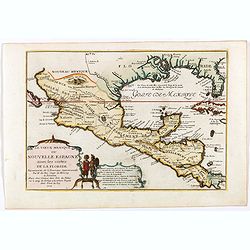
Le vieux Mexique ou nouvelle Espagne. . .
Attractive map covering the Gulf of Mexico through Central America also including parts of Cuba and Jamaica. It extends through Mexico to show the southern tip of Baja Ca...
Date: Paris, 1705

Carte des côtes du Golfe du Mexique compris entre la pointe sud de la presqu'Ile de la Floride et la pointe nord de la presqu'Ile d'Yucatan:...
Detailed and important early chart of the Gulf Coast and Florida and dated 1800. First French edition of "the first printed [map] to show and name Galveston Bay&qu...
Date: Paris, 1800/1803
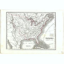
Etats-Unis de l'Amérique du nord.
Detailed map of North America, prepared by Charles V. Monin (fl.1830-1880) a French cartographer of Caen and Paris. Published in Atlas Universel de Géographie Ancienne &...
- $75 / ≈ €65
Date: Paris, 1845
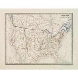
États-Unis et Nouvelle Bretagne.
A detailed map of the United States. All different States are divided by an orange border line.
- $120 / ≈ €105
Date: Paris, 1880

Dutton Map of the Grand Canyon, Arizona (in 4 joined sheets)
An important 1882 map of the Grand Canyon, Arizona, published in "Atlas To Accompany The Monograph On The Tertiary History Of The Grand Canon District By Capt. Clare...
Date: Julius Bien and Co., 1882
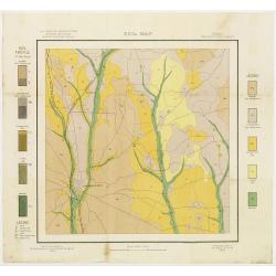
Soil map - Texas, Nacogdoches sheet.
Early color lithographed soil map by Julius Bien & Co. in New York for Department of Agriculture. Legends at side give detail on soil type, etc. They also include int...
- $75 / ≈ €65
Date: New York, 1903
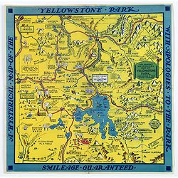
The Famous Hysterical Map of Yellowstone Park, including a few minor Changes.
A lovely whimsical map of America's Yellowstone Park, published about the time of President Franklin Roosevelt's "New Deal" for America in 1936. To emphasise th...
Date: America, ca 1936

A Hysterical Map of the Yellowstone Park. . .
A funny 1936 pictorial map of Yellowstone Park, that was 'hatched and scratched' by the American printer and humourist Jolly Elmer Lindgren. This wonderful map covers the...
Date: Spokane, 1936
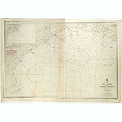
Gulf of Mexico. Ship Shoal to Brazos Santiago.
A large sea chart of the Gulf of Mexico, Ship Shoal to Brazos Santiago, 'from Admiralty Charts and US Government charts, corrected to 1943'. (In fact there are correction...
- $200 / ≈ €175
Date: London, 1943 updated to 1951
