
Composite atlas of the Low Countries. |
||||||||||||||||||||
|
||||||||||||||||||||
|
|
||||||||||||||||||||
$100000 / ≈ €87474
This item is available for immediate sale
100000.00
|
My Collection +
Add this or any of your favorite items in one place. If you want to save the items permanently, you have to sign in or create an account first. |
|||||||||||||||||||
Description
A unique, made-to-order atlas comprising 18 double-page engraved maps by or after Hessel Gerritsz, Theodoor Galle, Jacob van Deventer, Gerard Mercator, Peter Verbiest, Jean Surhon, Claes Janszoon Visscher, Jan Baptist Vrients, David Fabritius, Christiaan 's Grooten, Gerard de Jode and Abraham Ortelius, several dated between 1603 and 1633.
Provenance : Sotheby's London, 20 October 1988, lot 146.
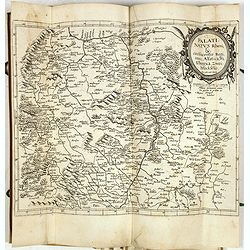
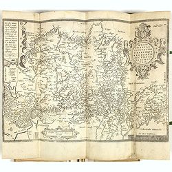
Genesis of the AtlasGalle also had the copper plates of Ortelius’s Theatrum and those of De Jode’s Speculum; the “Officina Plantiniana” acquired both sets after Vrients's death in 1612.
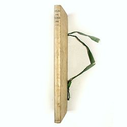
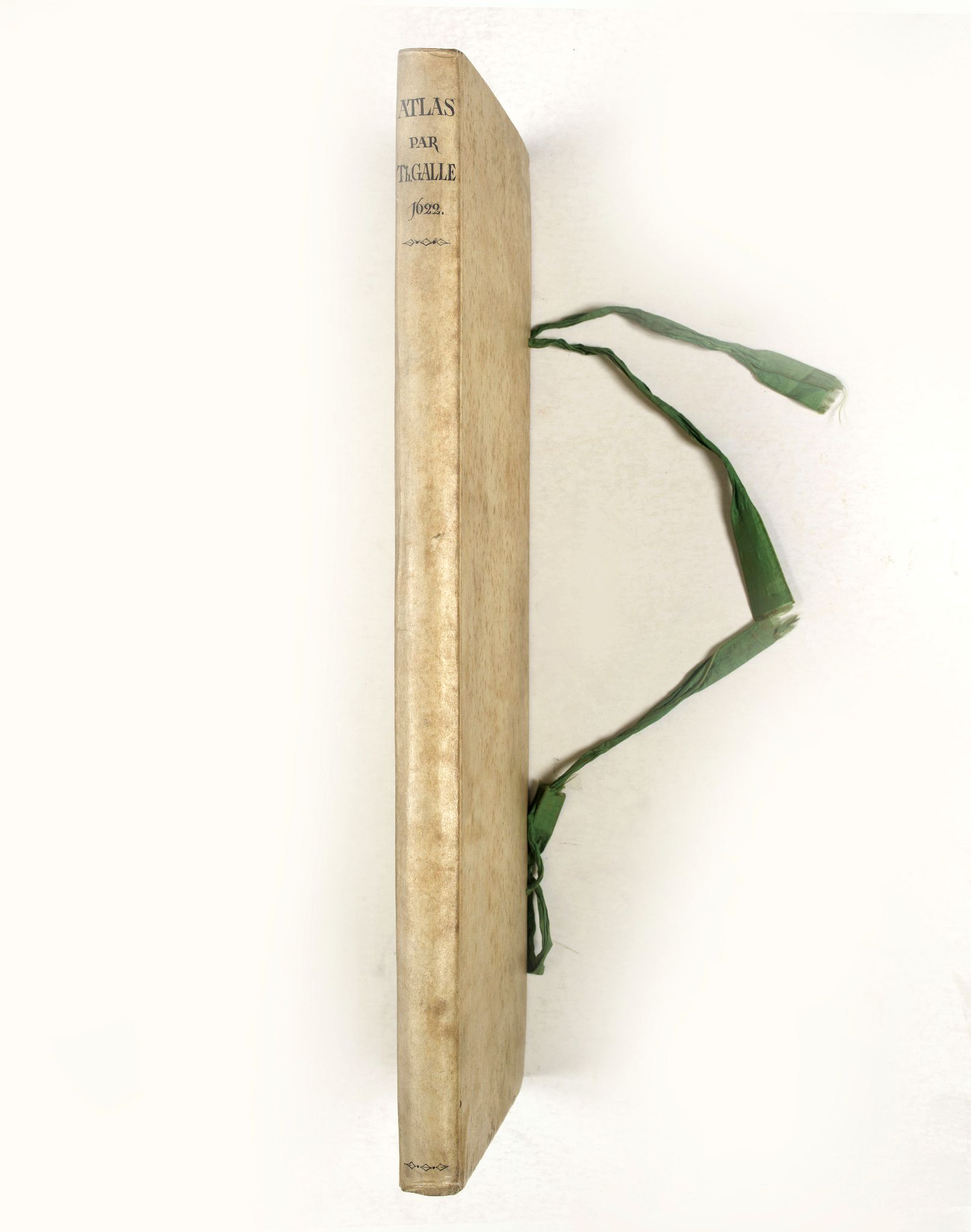
The compiler arranged the atlas in a slim and tall format (445 by 185mm), with each map double-folded to fit inside the tome. This very rare and unusual format was likely designed to make the atlas more compact and more accessible to carry.
The atlas was restored in the middle of the last century and before it was sold at Sotheby's London, 20 October 1988, lot 146.
The maps were laid on paper, bound in a vellum binding, and lettered on the spine in bown ink; "Atlas par Th. Galle 1622".
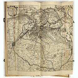
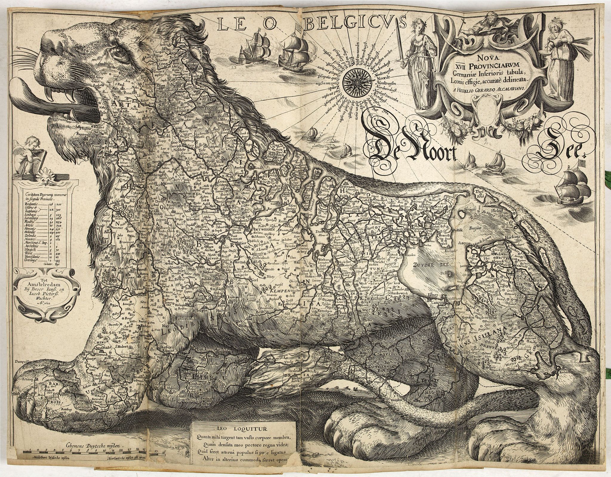
This early composite atlas includes the only known example of Hessel Gerritsz’ Leo Belgicus map in the third state of the copperplate.
This is the only known copy of the third state of copperplate II.
According to Günter Schilder, the first state was likely published by Cornelis Claesz. No example is known.
1 - This time the lion speaks for himself: “Leo loquitur”
2 - The lion’s limbs, the provinces, are truly strong
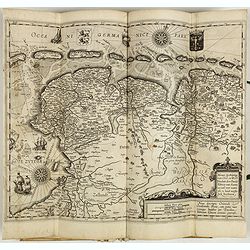
The Netherlands, depicted as a lion originated with the Austrian Michael von Aitzing (c. 1530-98), who inserted in his book "De Leone Belgico" (1583) a Leo Belgicus map engraved by Frans Hogenberg. In the preface of this work, von Aitzing explains why he chose this particular title and inserted the lion map.
He explains that Caesar mentioned in his "Commentaries" that the 'Belgae' were the strongest tribes, and he, therefore, decided - partly because of the religious conflicts in the war against Spain - to introduce the Netherlands in the shape of a lion. References: Schilder 7, Van der Heijden, Leo Belgicus, 16.3 Schilder, Monumenta Cartographica Neerlandica, II, pp. 155-159.
1 Hessel Gerritsz: Nova XVII Provinciarum Germaniae Inferioris tabula Leonis effigie, accurate delineata, with the imprint Tot Amstelredam Bij Broer Ianss. En Iacob Pieterss. Wachter A° 1622 (Schilder VII : # 15 copperplate II, third state ; V. d. Heiden, 16.3)
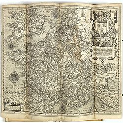
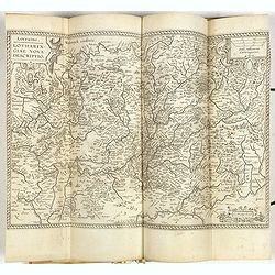
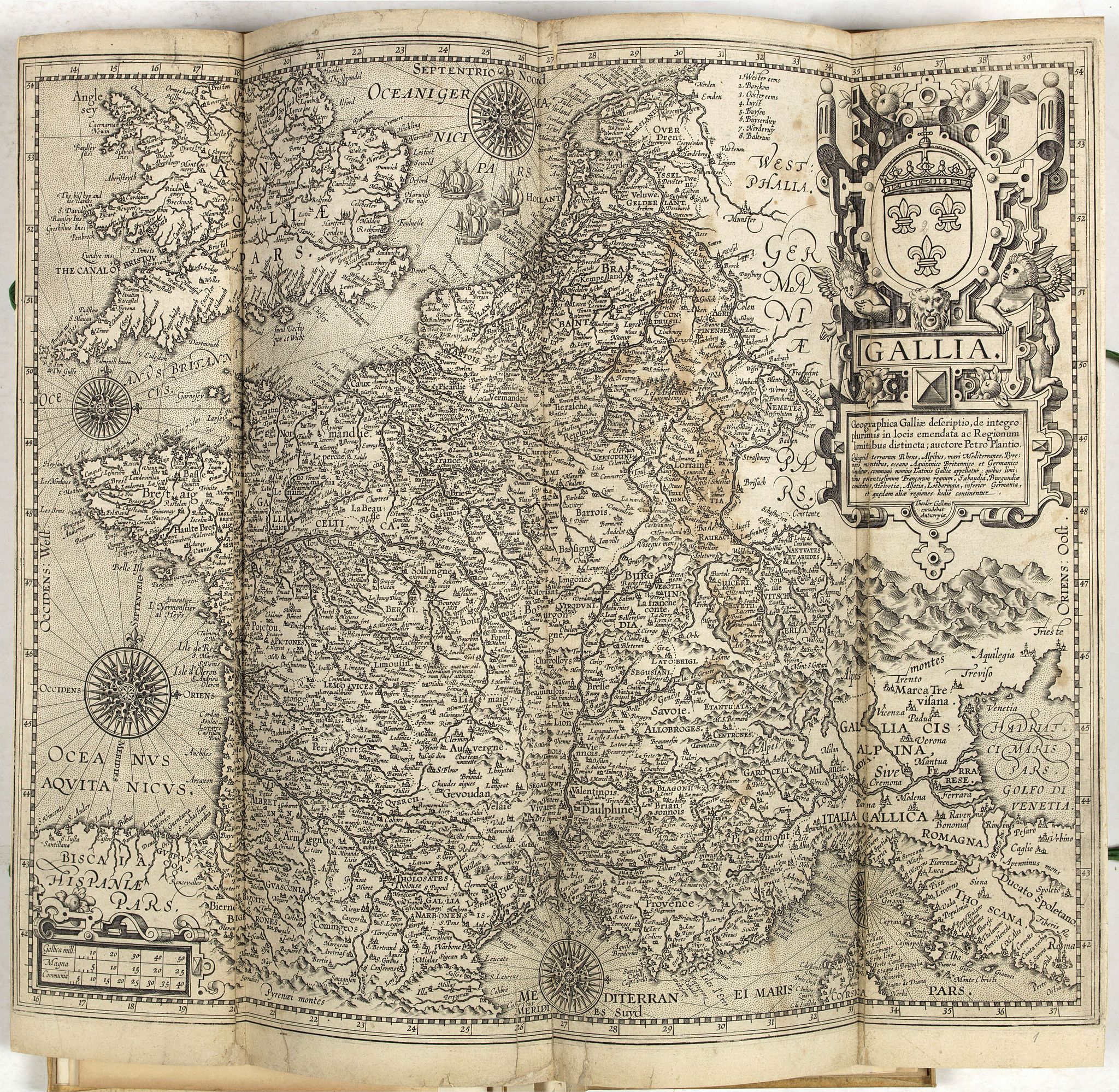
2 Theodore Galle: Gallia. Geographia Galliae description, de integro plurimus in locis.., with Galle's Antwerp imprint, after Pieter Plancius, First ûblished by Vrients in 1606 and after 1612 with the imprint of Theodor Gallaeus. (L. Bagrow, A. Ortelli Catalogus Cartographorum; C. Koeman, Atlantes Neerlandici; Peter H. Meurer, Fontes Cartographici Orteliani 150; M. Van den Broecke, Ortelius Atlas Maps, n. 36.2.)
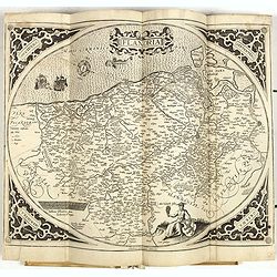
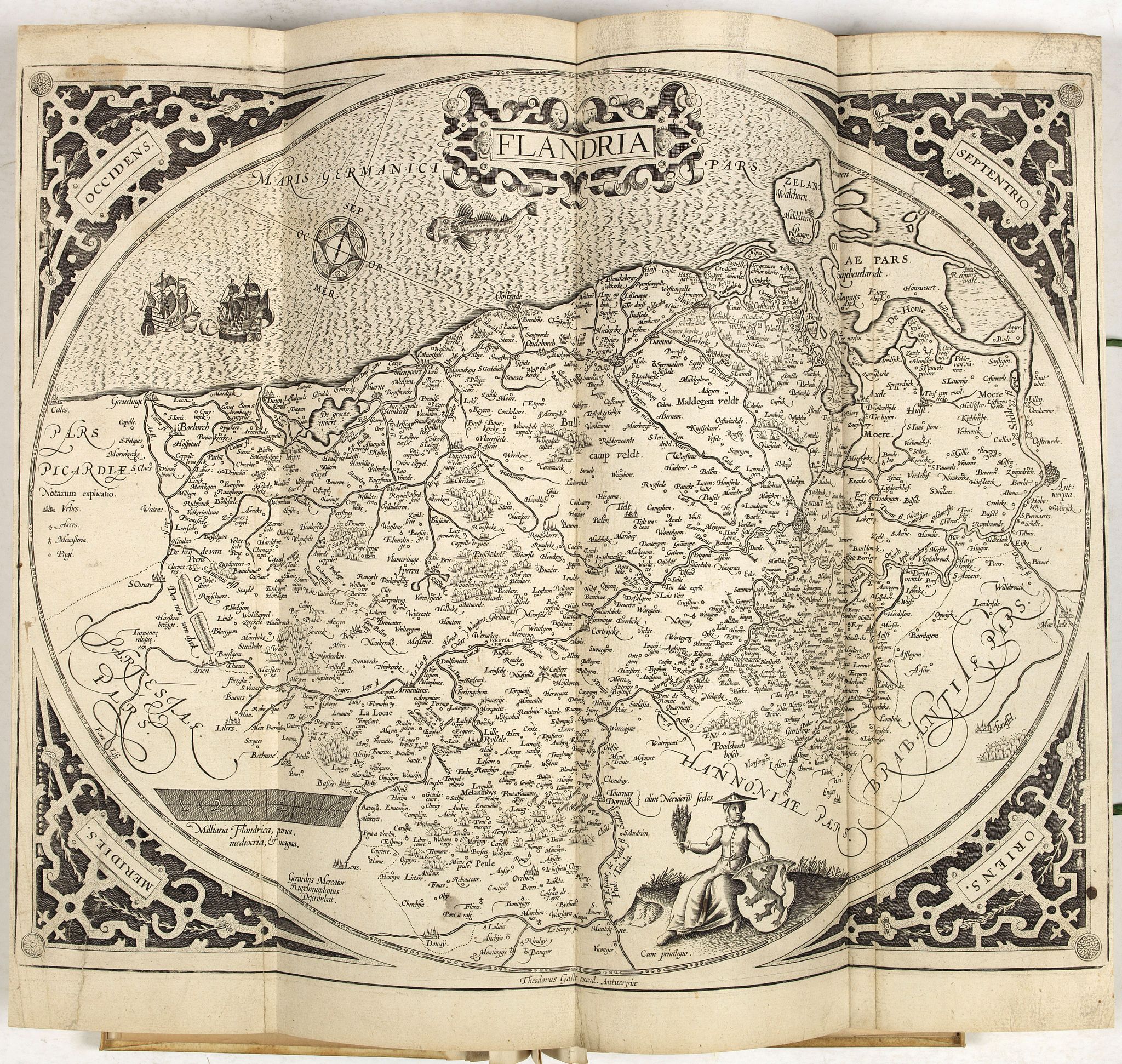
5 Gerard Mercator: Flandriae, without text, and with Galle's imprint,
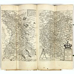
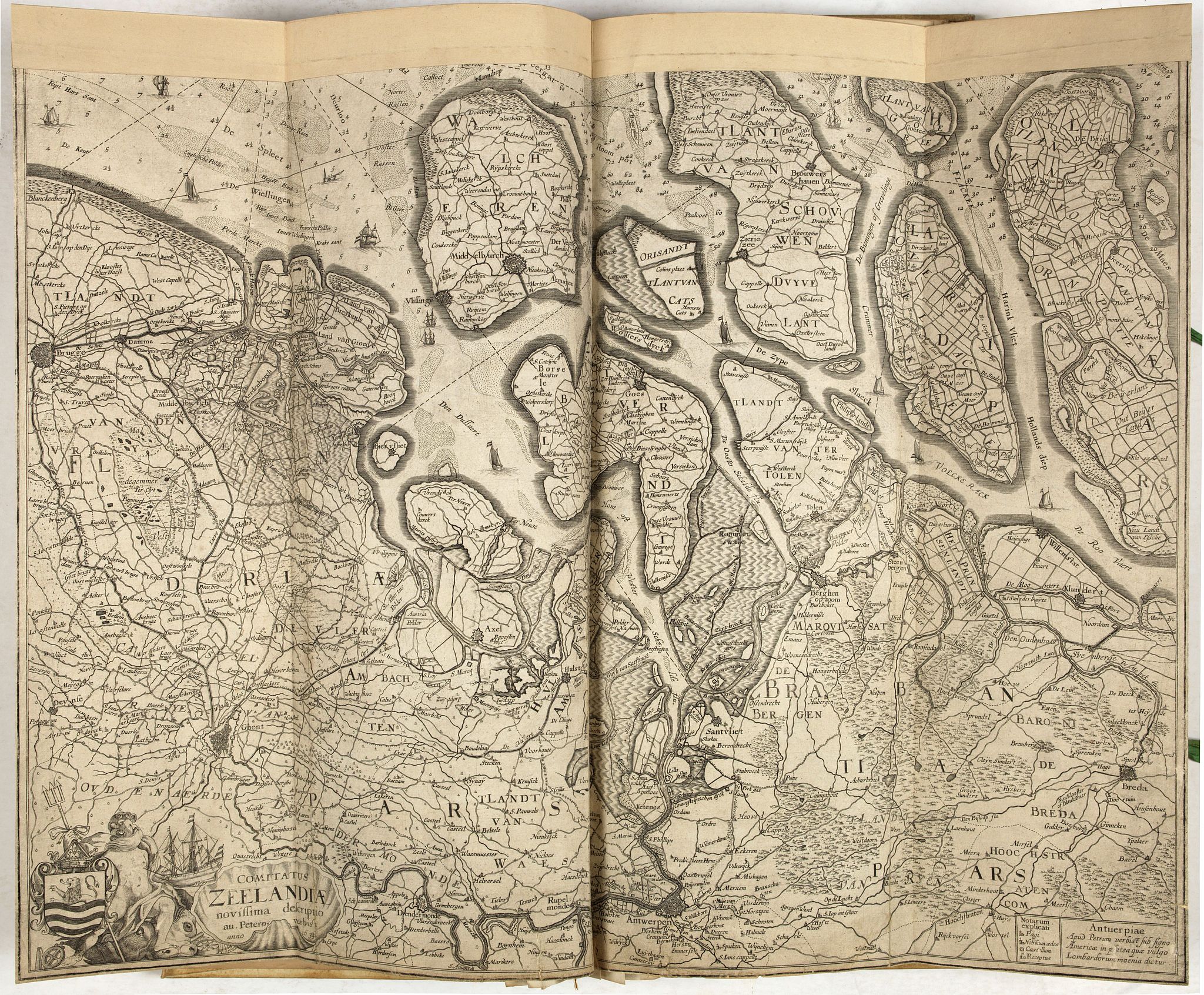
6 Pieter Verbiest: Comitatus Zeelandiae . . . anno 1633, with the imprint Antverpiae Apud Petrum verbist sub signo Americae in platea quae vulgo Lombardorum moenia dictur,
7 Abraham Ortelius: Artois, after Jean Surhon, without text, and with Galle's imprint,
8 Abraham Ortelius: Nobilis Hanoniae comitatus descrip., after Jean Surhon, without text, with Galle's imprint,
9 Abraham Ortelius: Namurcum comitatus, also after Surhon, without, and with Galle's imprint,
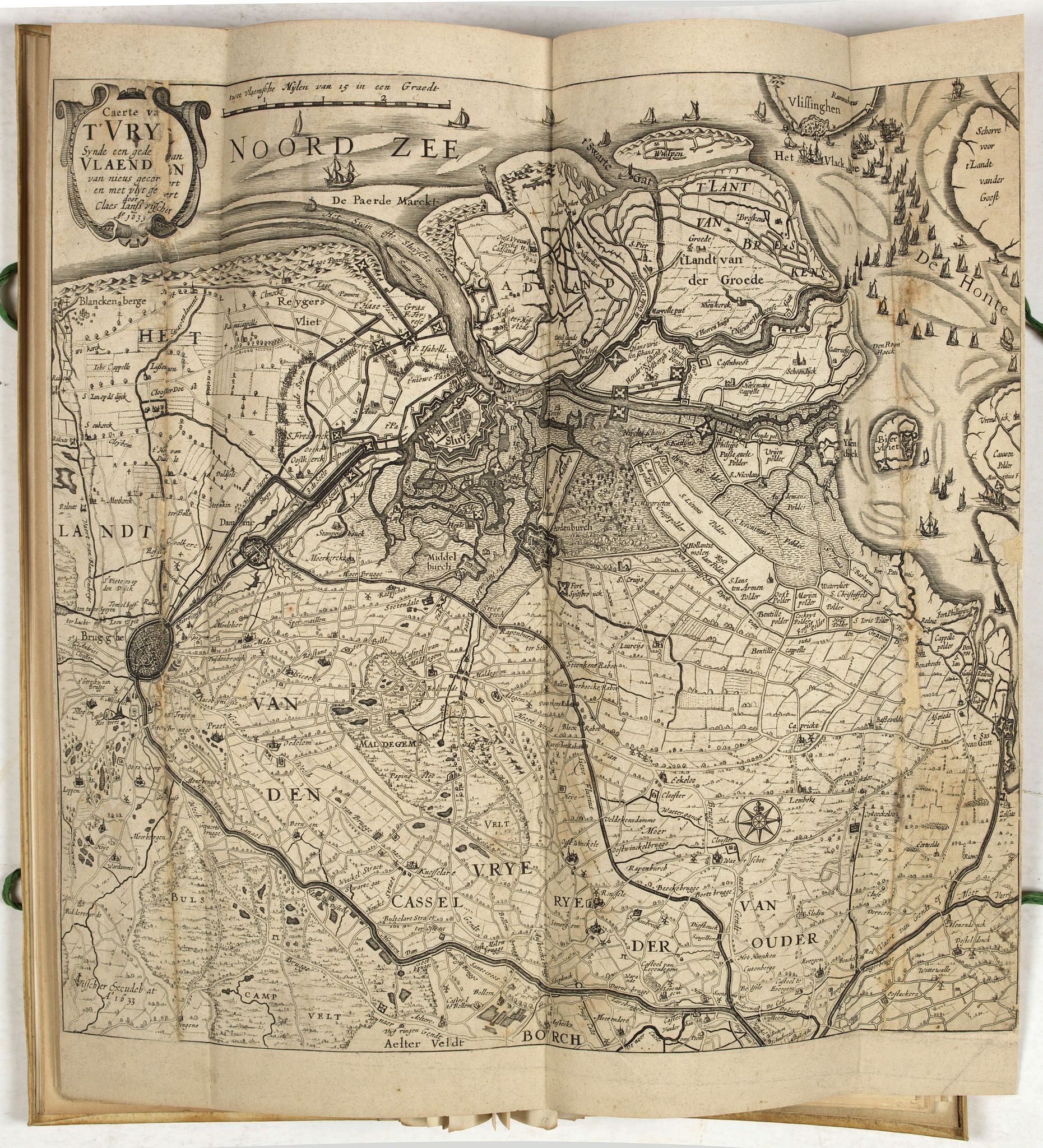
10 Claes Janszoon Visscher: Caerte van T'Vrye synde been gedeelte van Vlaendren van nieus gecorrigeert en met vlijt gebetert door Claes Jansz. Visscher A° 1633.
11 Jan Baptist Vrients: Limburgensis Ducatus tabula nova, as issued in the Ortelius Theatrum, from 1603 onwards, without text or imprint,
12 Abraham Ortelius: Lutzenburgensis . . . descript, after Jean Surhon, without text, and with Galle's imprint,
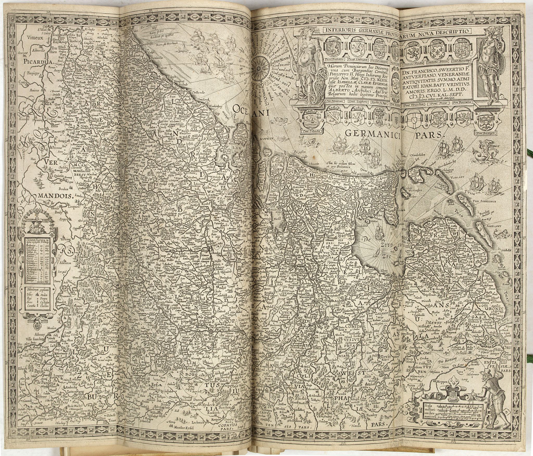
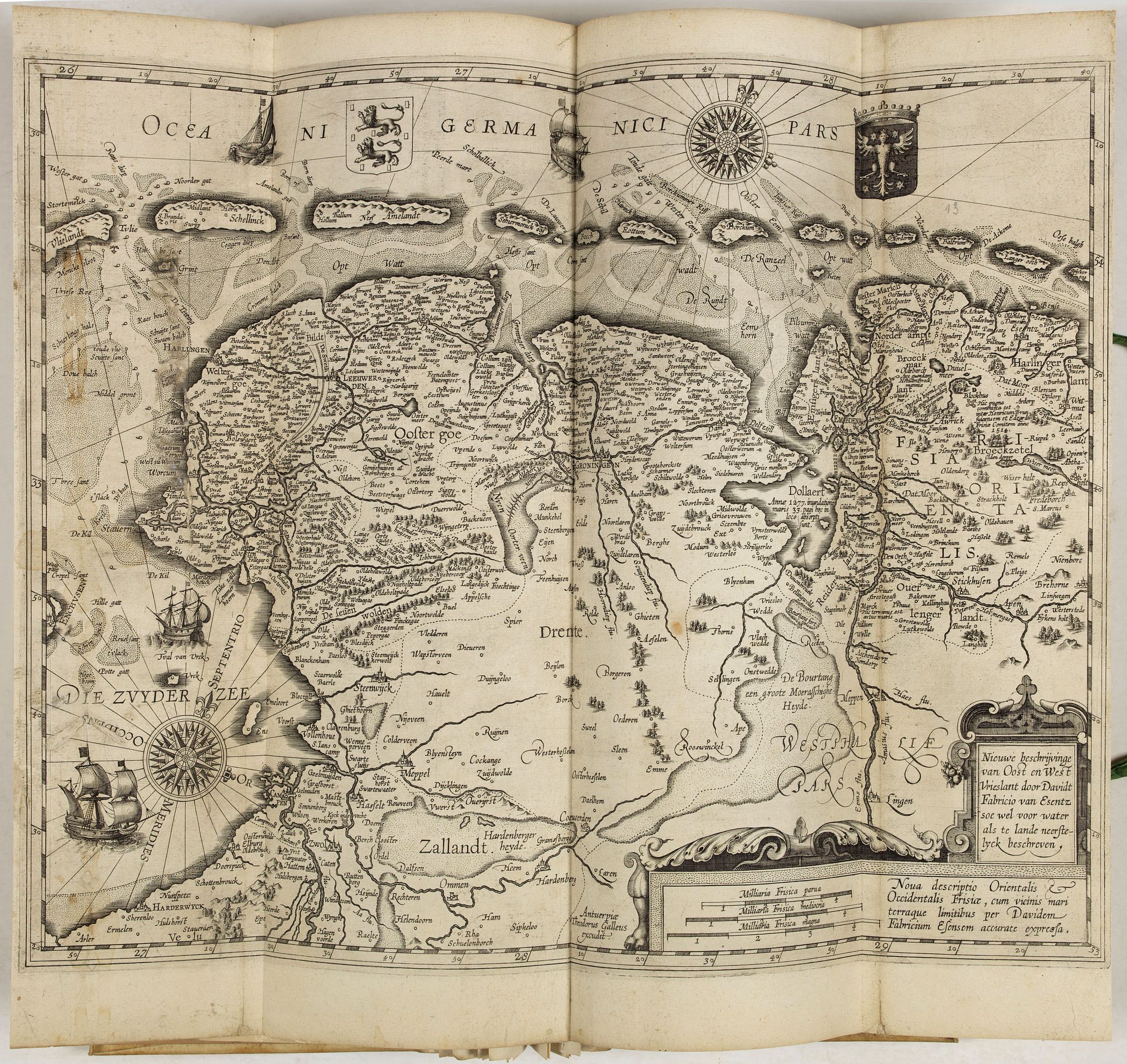
13 David Fabritius: Nieuwe beschrijvinge van Oost en West Vrieslant, issued by Galle, with his imprint,
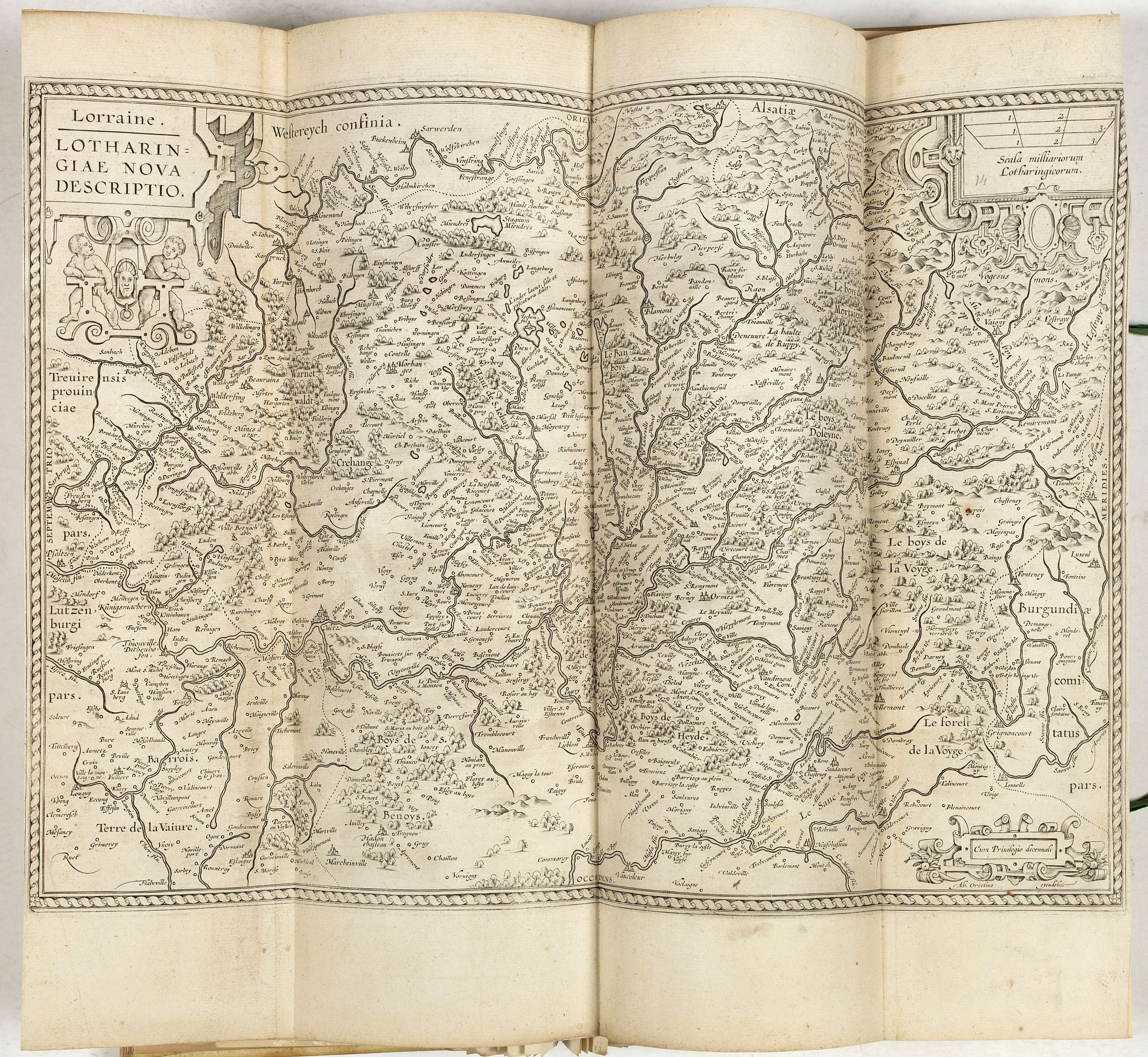
14 Abraham Ortelius: Lorraine. Lotharingiae nova descriptio, without text, no imprint except for that of Galle,
15 Abraham Ortelius: Gelriae, Cliviae. . . descriptio, after Christiaan 's Grooten, without text, and with Galle's imprint,
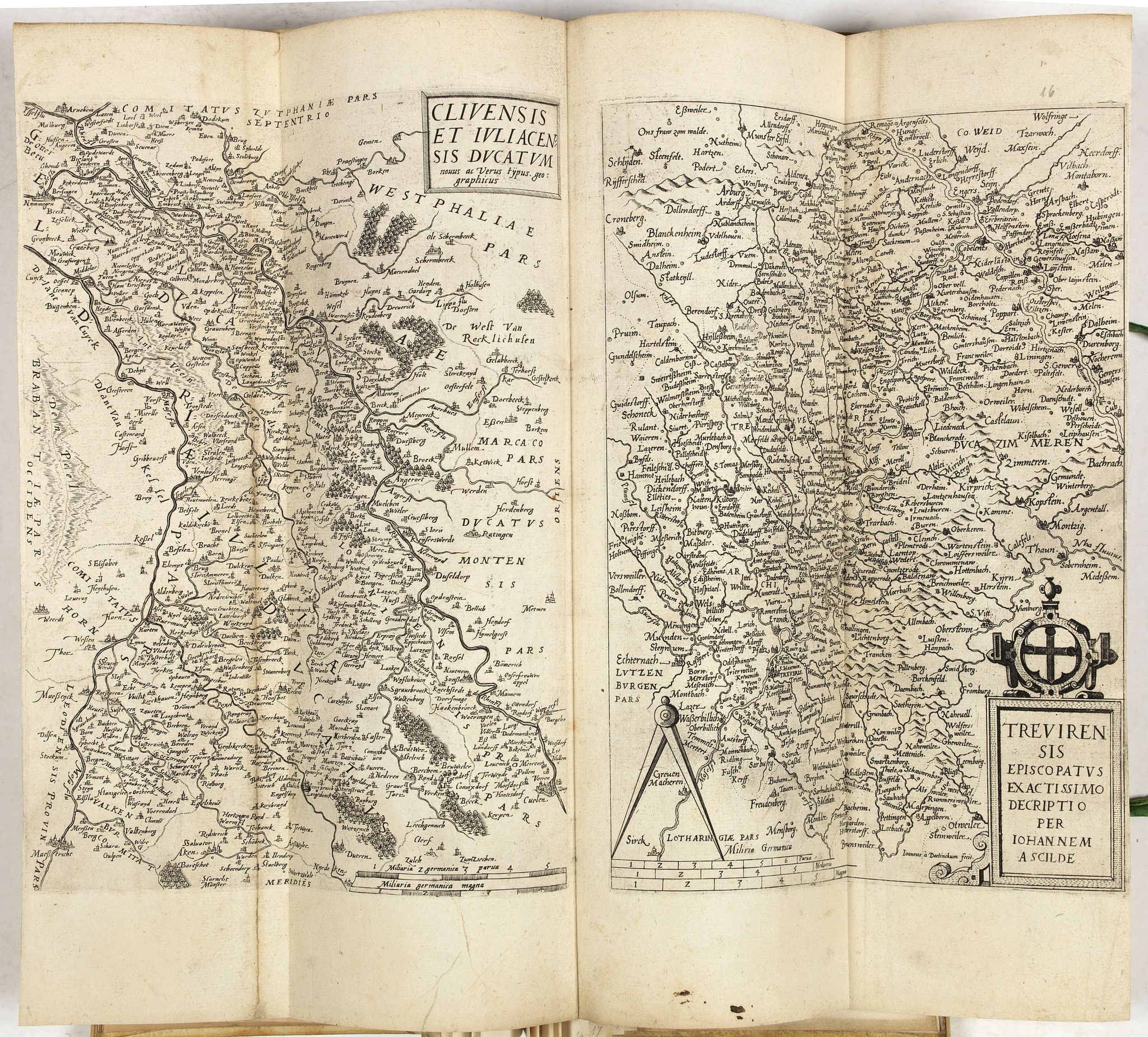
16 Gerard de Jode: Clivensis et Iuliacensis ducatuum, Trevirensis episcopatus, the two maps on one sheet, without text, no Galle imprint,
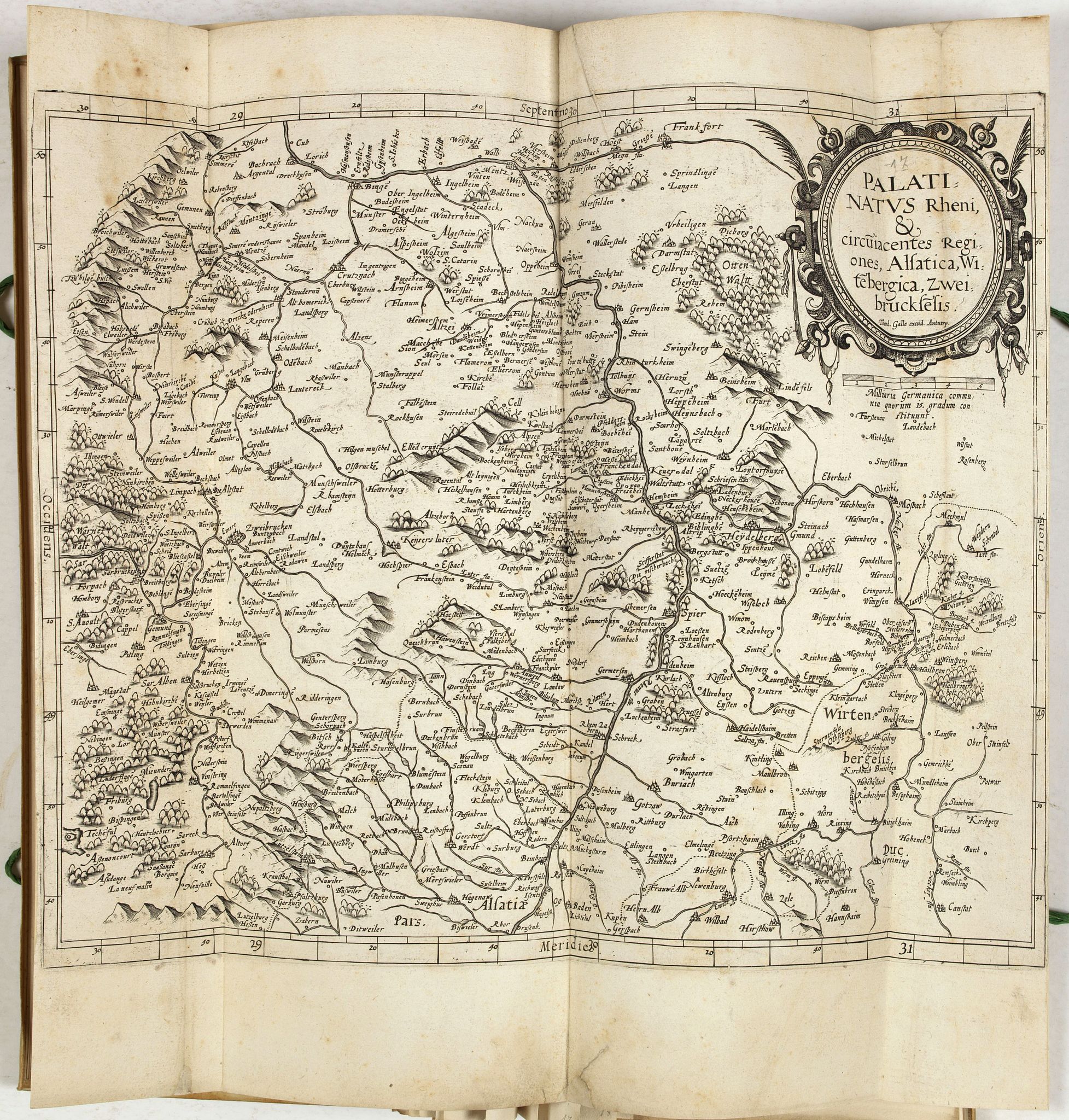
17 Gerard de Jode: Palatinatus Rheni, without text, this copy with the imprint of Galle, however,
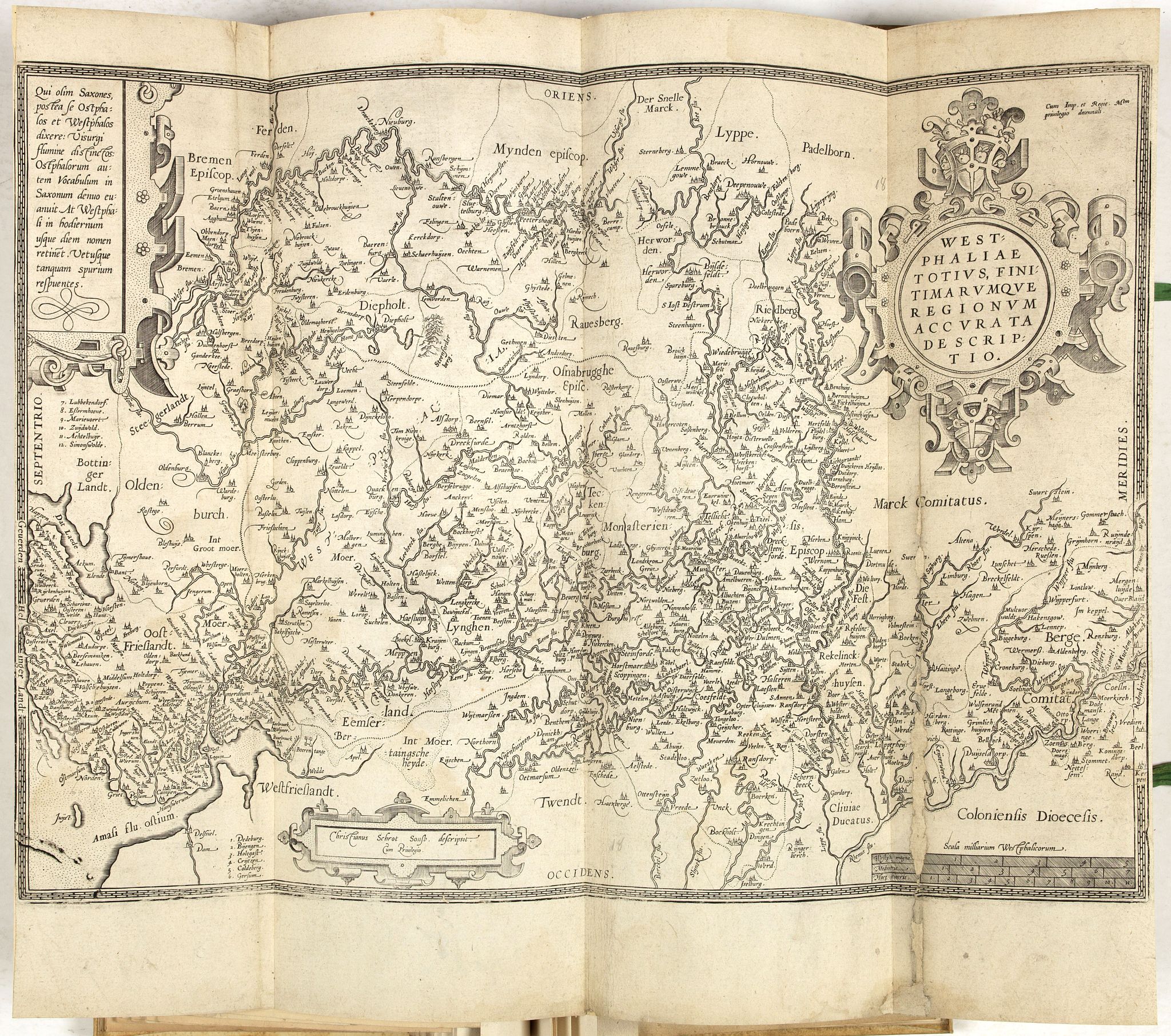
18 Abraham Ortelius: Westphaliae . . . descriptio, after Christiaan's Grooten, without text or the Galle imprint.

Reference: Schilder, Monumenta Cartographica Neerlandica, II, pp. 155-167, VII, p. 453 ; V. d. Heiden, 16.3
FAQ - Guarantee - Shipping
Buying in the BuyNow Gallery
This item is available for immediate purchase when a "Add to Cart" or "Inquire Now" button is shown.
Items are sold in the EU margin scheme
Payments are accepted in Euros or US Dollars.
Authenticity Guarantee
 We provide professional descriptions, condition report (based on 45 years experience in the map business)
Paulus Swaen warrants the authenticity of our items and a certificate of authenticity is provided for each acquired lot.
Condition and Coloring
We indicate the condition of each item and use our unnique HiBCoR grading system in which four key items determine a map's value: Historical Importance, Beauty, Condition/Coloring and Rarity.
Color Key
We offer many maps in their original black and white condition. We do not systematically color-up maps to make them more sellable to the general public or buyer.
Copper engraved or wood block maps are always hand colored. Maps were initially colored for aesthetic reasons and to improve readability. Nowadays, it is becoming a challenge to find maps in their original colors and are therefor more valuable.
We use the following color keys in our catalog:
Original colors; mean that the colors have been applied around the time the map was issued.
Original o/l colors; means the map has only the borders colored at the time of publication.
Colored; If the colors are applied recently or at the end of the 20th century.
Read more about coloring of maps [+]
Shipping fee
A flat shipping fee of $ 30 is added to each shipment by DHL within Europe and North America. This covers : International Priority shipping, Packing and Insurance (up to the invoice amount).
Shipments to Asia are $ 40 and rest of the world $50
We charge only one shipping fee when you have been successful on multiple items or when you want to combine gallery and auction purchases.
Read more about invoicing and shipping
FAQ
Please have a look for more information about buying in the BuyNow gallery
Many answers are likely to find in the general help section.
My Collection+
![]()
With My Collection+ you can collect all your favorite items in one place. It is free, and anyone can create his or her virtual collection.
Unless you are logged in, the item is only saved for this session. You have to be registed and logged-in if you want to save this item permanently to My Collection+.
Read More[+]
Register here, it is free and you do not need a credit card.
Add this item to
My Collection+
or click the following link to see My Collection+.
| Digital Image Download | |
|
Paulus Swaen maintains an archive of most of our high-resolution rare maps, prints, posters and medieval manuscript scans. We make them freely available for download and study. Read more about free image download |
Click the image for a free small image download. |
In accordance with the EU Consumer Rights Directive and habitually reside in the European Union you have the right to cancel the contract for the purchase of a lot, without giving any reason.
The cancellation period will expire 14 calendar days from the day after the date on which you or a third party (other than the carrier and indicated by you) acquires, physical possession of the lot. To exercise the right to cancel you must inform Paulus Swaen Inc, of your decision to cancel this contract by a clear statement (e.g. a letter sent by post, or e-mail.
To meet the cancellation deadline, it is sufficient for you to send your communication concerning your exercise of the right to cancel before the cancellation period has expired.
