Please login to see price!.
Subscribe to be notified if similar examples become available.
-800x800.jpg)
-800x800.jpg)
-800x800.jpg)
-800x800.jpg)
-250x250.jpg)


-250x250.jpg)
-250x250.jpg)
-250x250.jpg)
Atlas Universel Par M. Robert Geographe ordinaire du Roy |
||||||||||||||||||||
|
||||||||||||||||||||
|
|
||||||||||||||||||||
|
|
Virtual Collection - Save and collect this or any of your favorite items in one place.
If you want to save the items permanently, please sign in or create account first. |
|||||||||||||||||||
Description
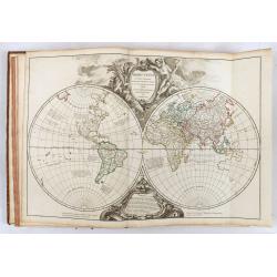
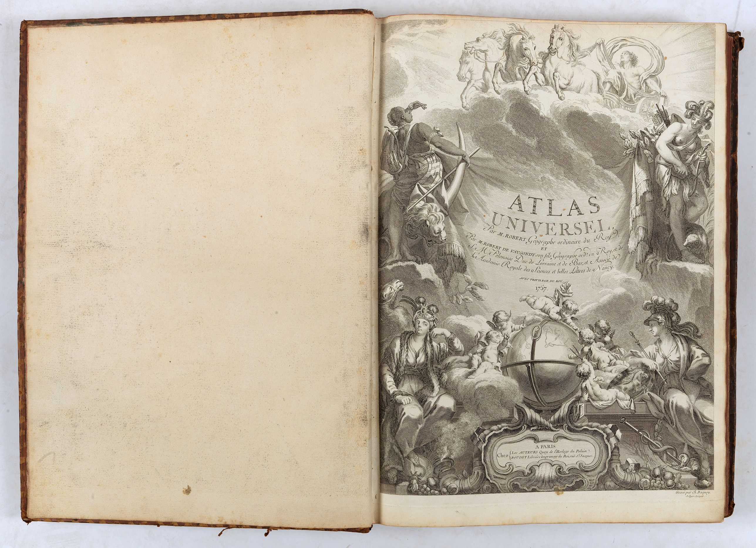
The first edition of one of the most important 18th-century atlases and one of the great achievements of the French Enlightenment and one of the first atlases based on scientific surveys, in the tradition of D'Anville and De L'Isle.
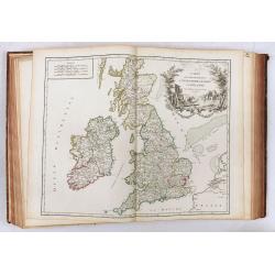
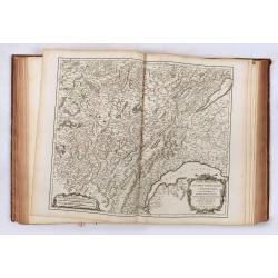
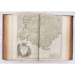
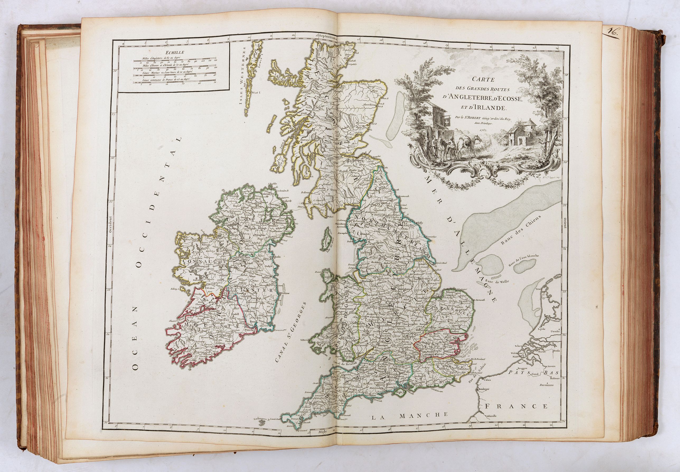
According to Pedley ; The Atlas Universel is the prime exemplar of the authors' geographic ideal- bel et utile- beautiful and useful. The corpus of their maps displays the finest of eighteenth-century French engraving on copperplate with fine line work and lettering and cleverly designed cartouches, which often represent the areas portrayed on the map.This is the first edition, the second issue of the atlas, with five post-road maps added, which was made available to the subscribers for the additional cost of 6 livres. The maps are: British Isles (1757), France (1758), Germany (1757), Spain and Portugal (1757) and Italy (1756).
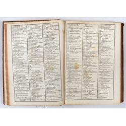
Expanding the contents to 108 maps. 34pp. geographical text with an index pageThis popular atlas was issued by subscription and 1,118 copies were applied for in all.
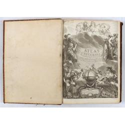
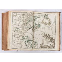
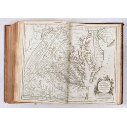
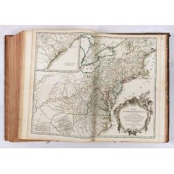
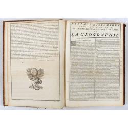
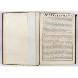
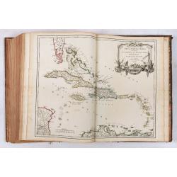
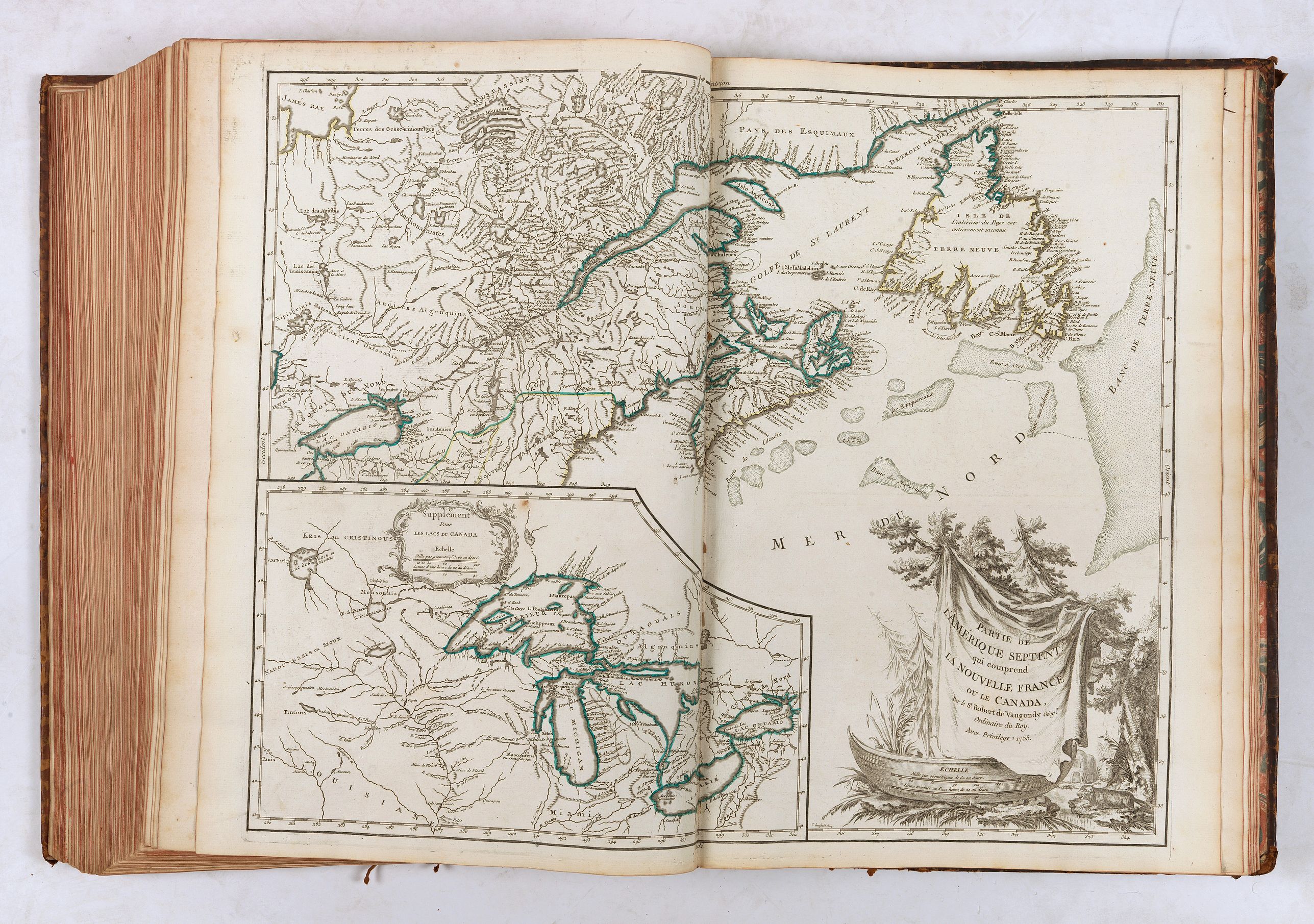
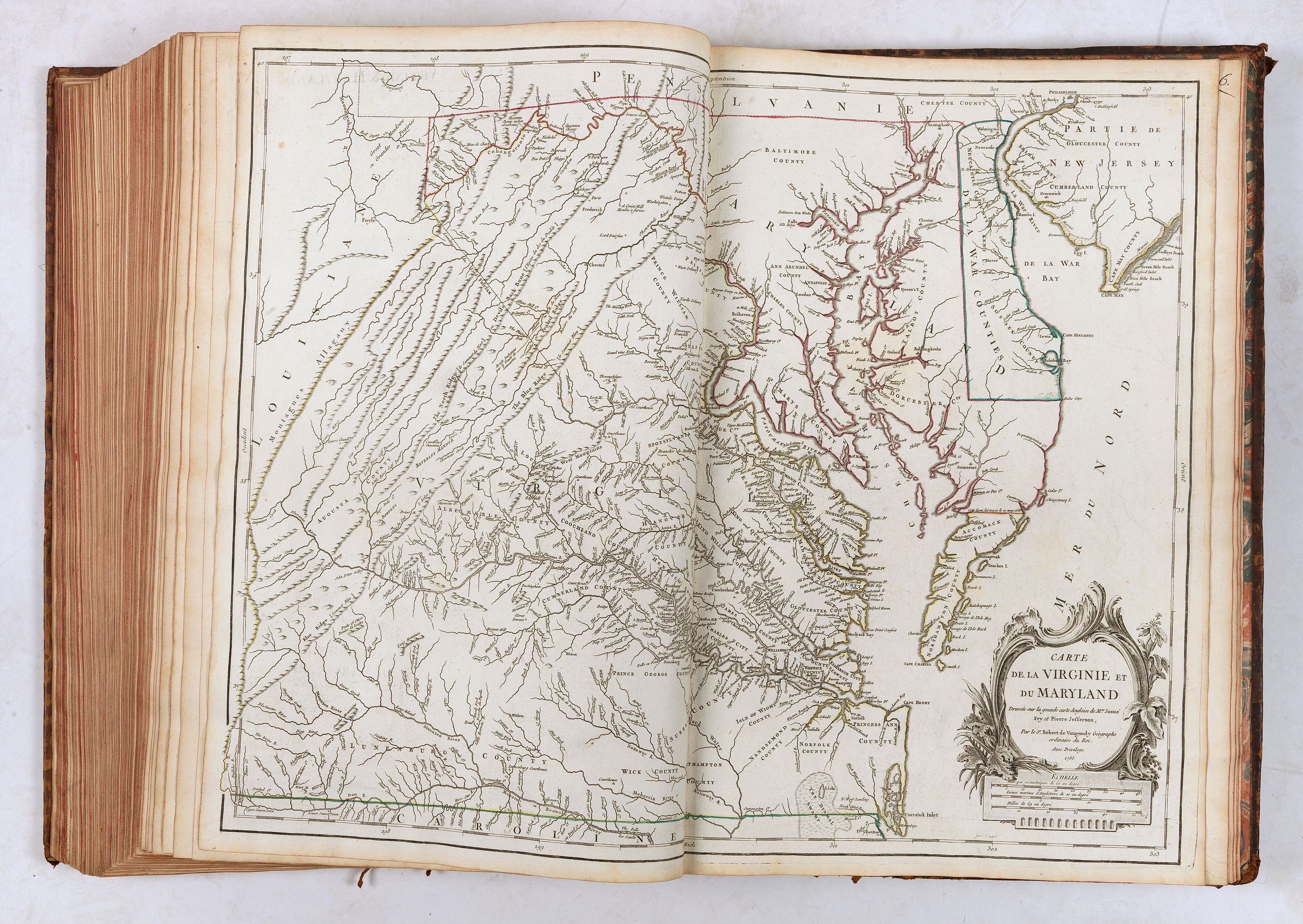
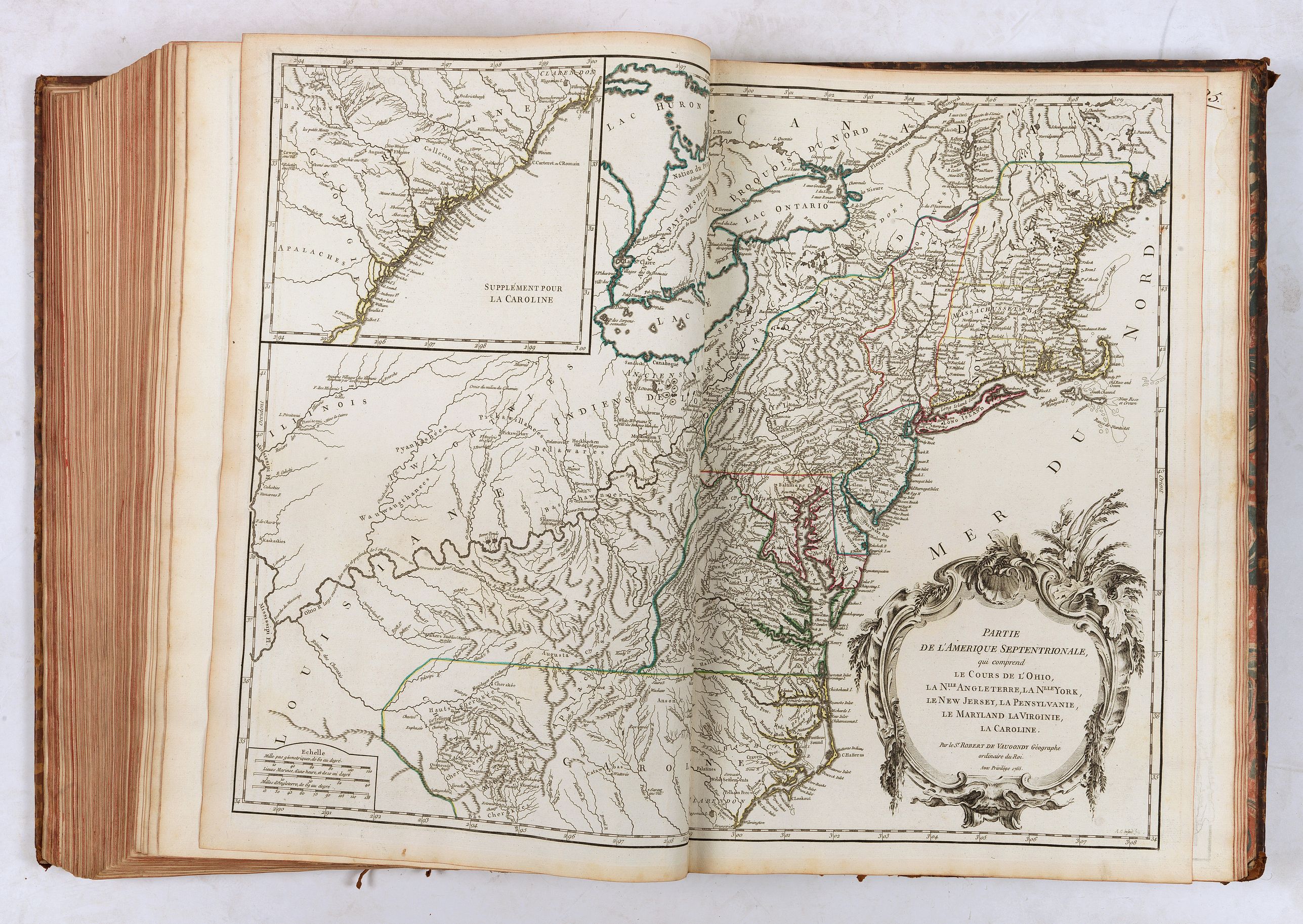
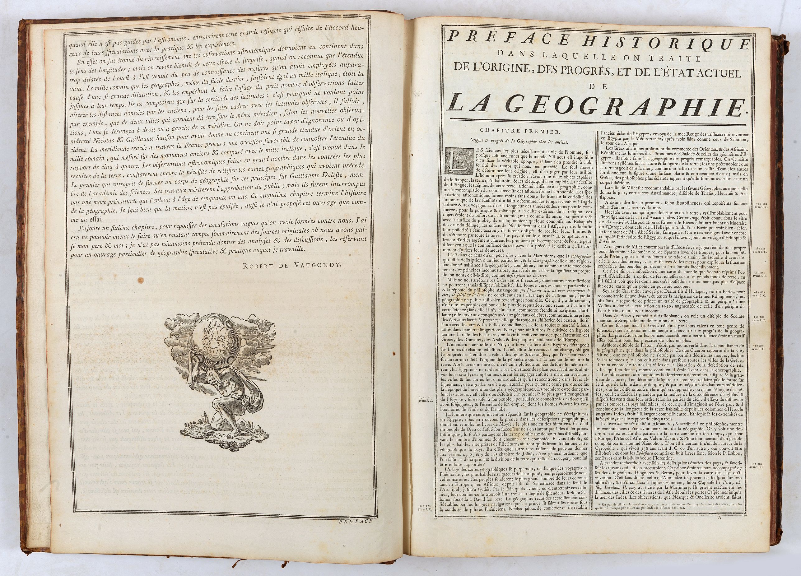
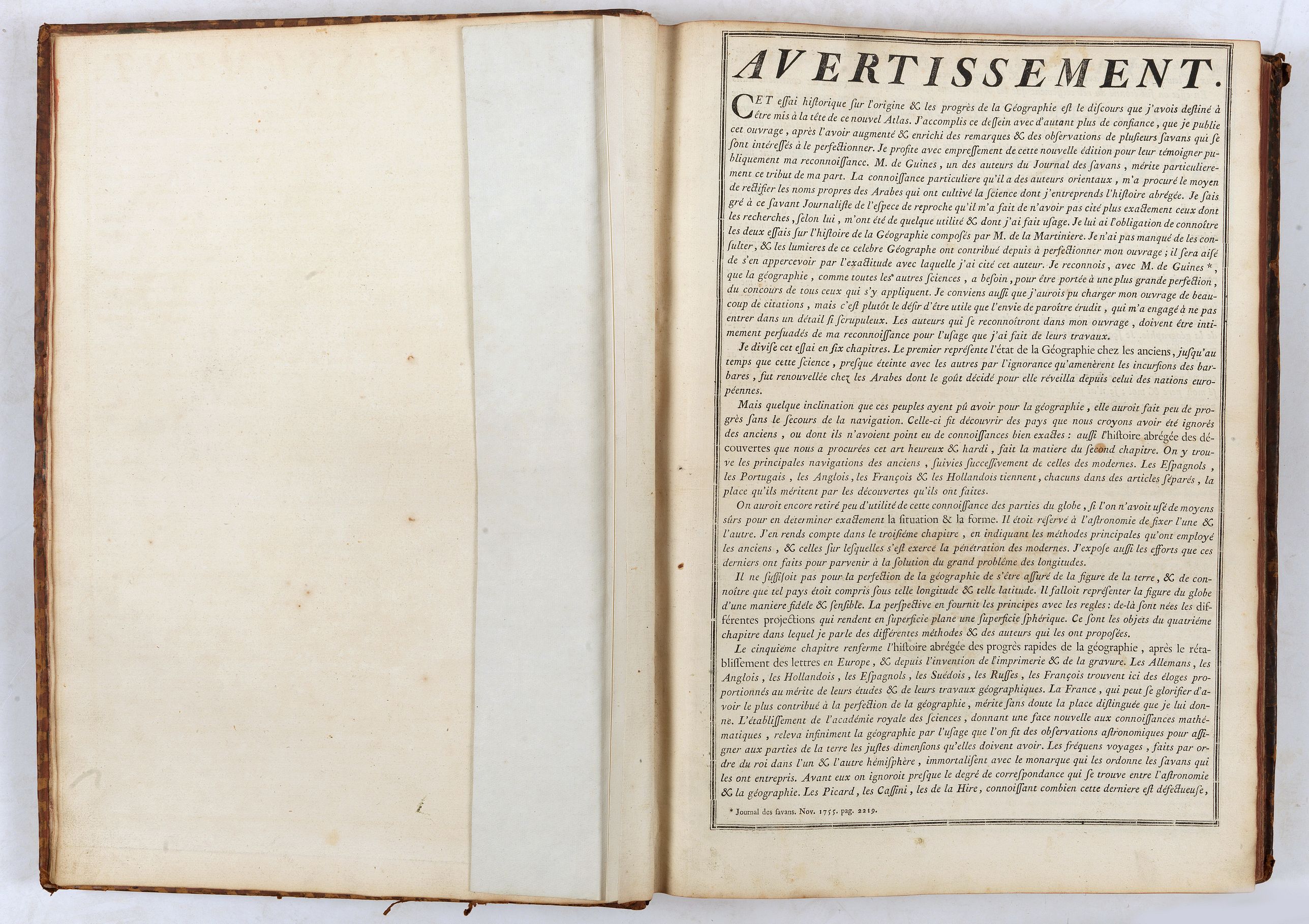
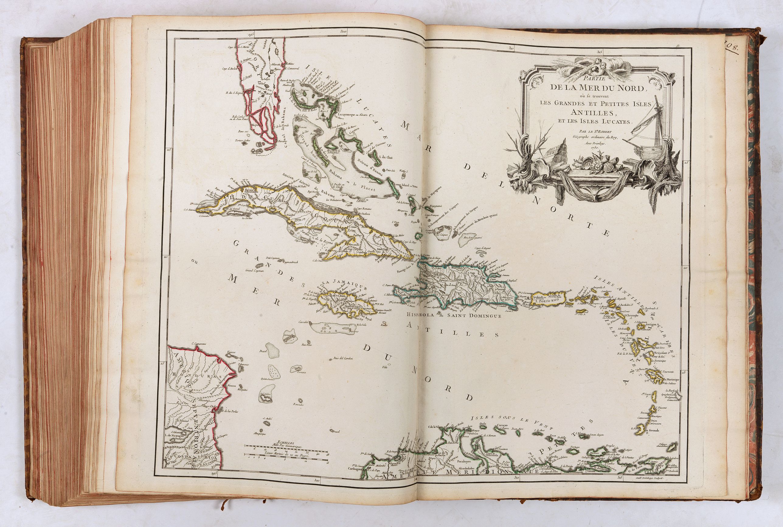
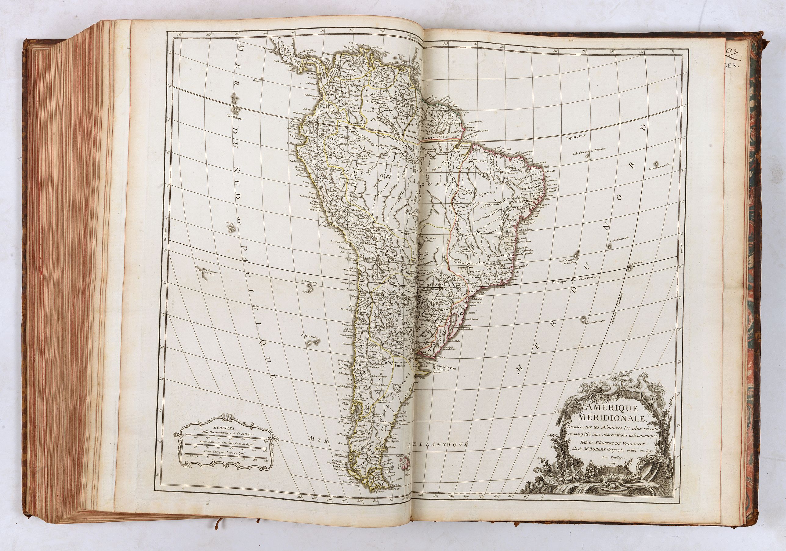
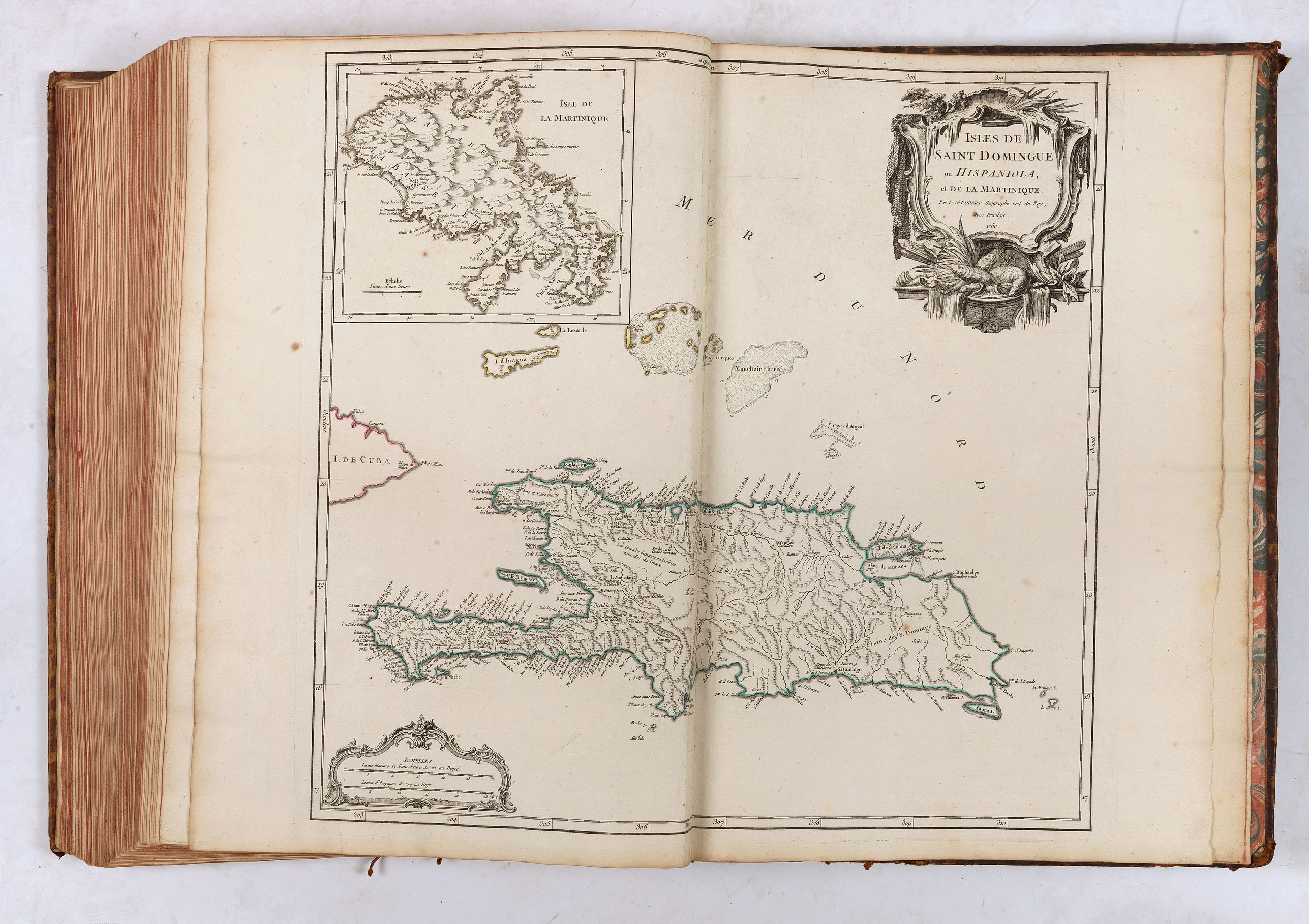
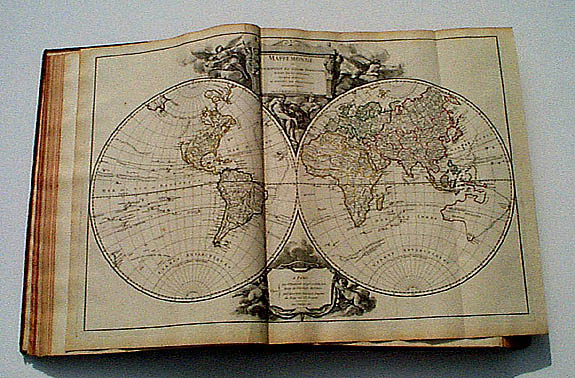
The first 12 maps are of the ancient world, and the 97 maps of the modern world were updated according to the latest explorations of the New World and the Pacific. The last seven maps of the modern world are related to the Americas: "Amérique septentrionale," "Canada" (based on records held by the Dépôt de la Marine), "Colonies Angloises en Amérique," "Virginie, Mariland, & Pensilvanie" (based on the map by Fry and Jefferson), "Amérique méridionale," "Les grandes & petites Antilles," and "Isles Saint-Domingue & la Martinique." The atlas is interesting because it presents the French view of the geographic boundaries between English and French possessions in North America, just as that rivalry developed into the French and Indian War. One of the notable American maps is the French version of Fry and Jefferson’s map of Virginia, in its first state with the boundaries of Lord Fairfax’s Grant shown.Including a frontispice engraved by Ch. Baquoy d'après J. Oger, Tables des Cartes, Avertissement, 40 pp.
Collation
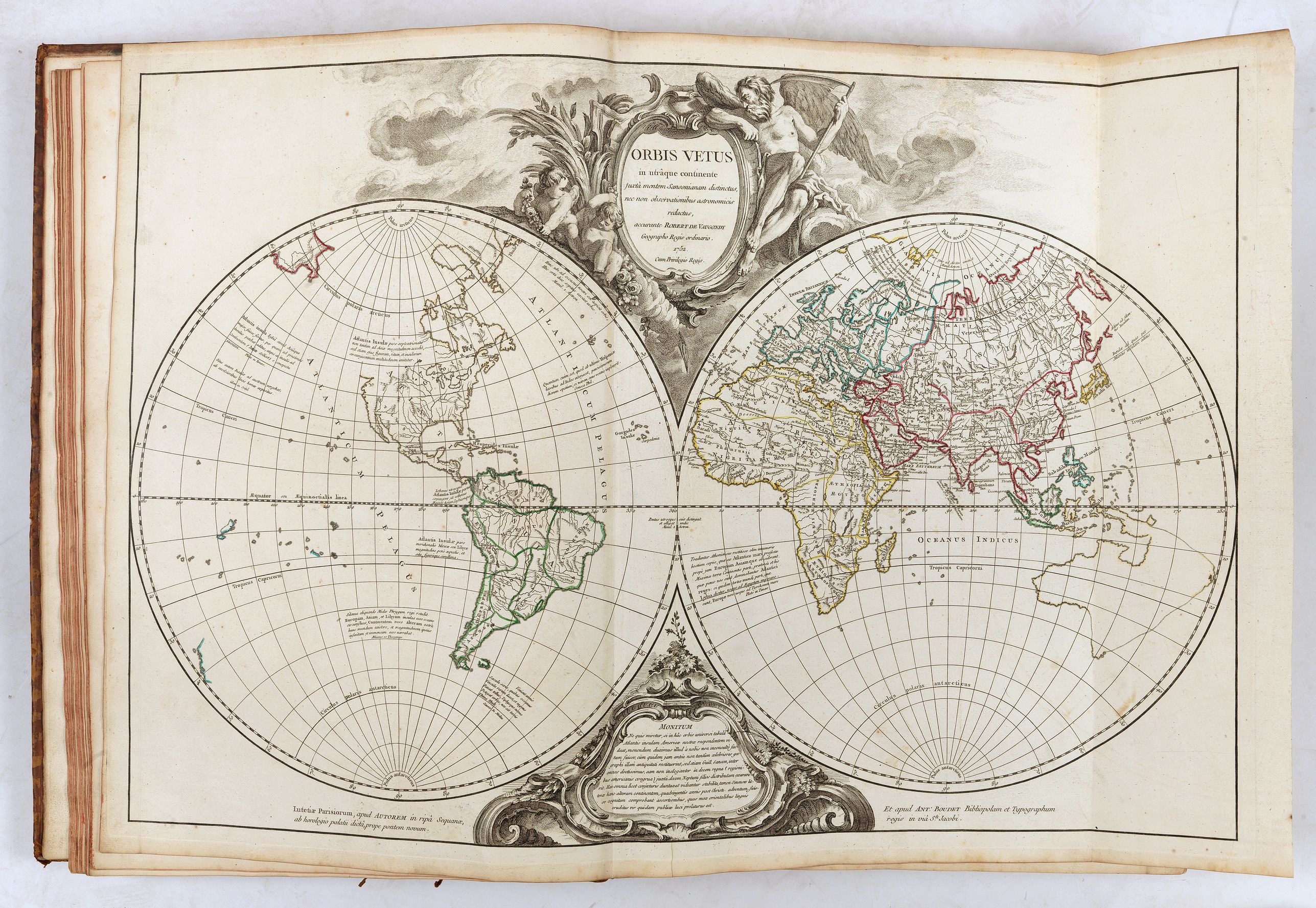
- Orbis vetus
- La Terre-Sainte
- Imperiorum antiquorum tabula in qua prae caetris Alexandi magni, &c.
- Imperium Romanum
- Britannicae insulae
- Gallia
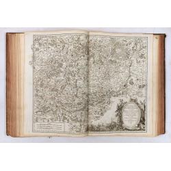
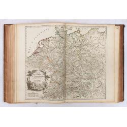
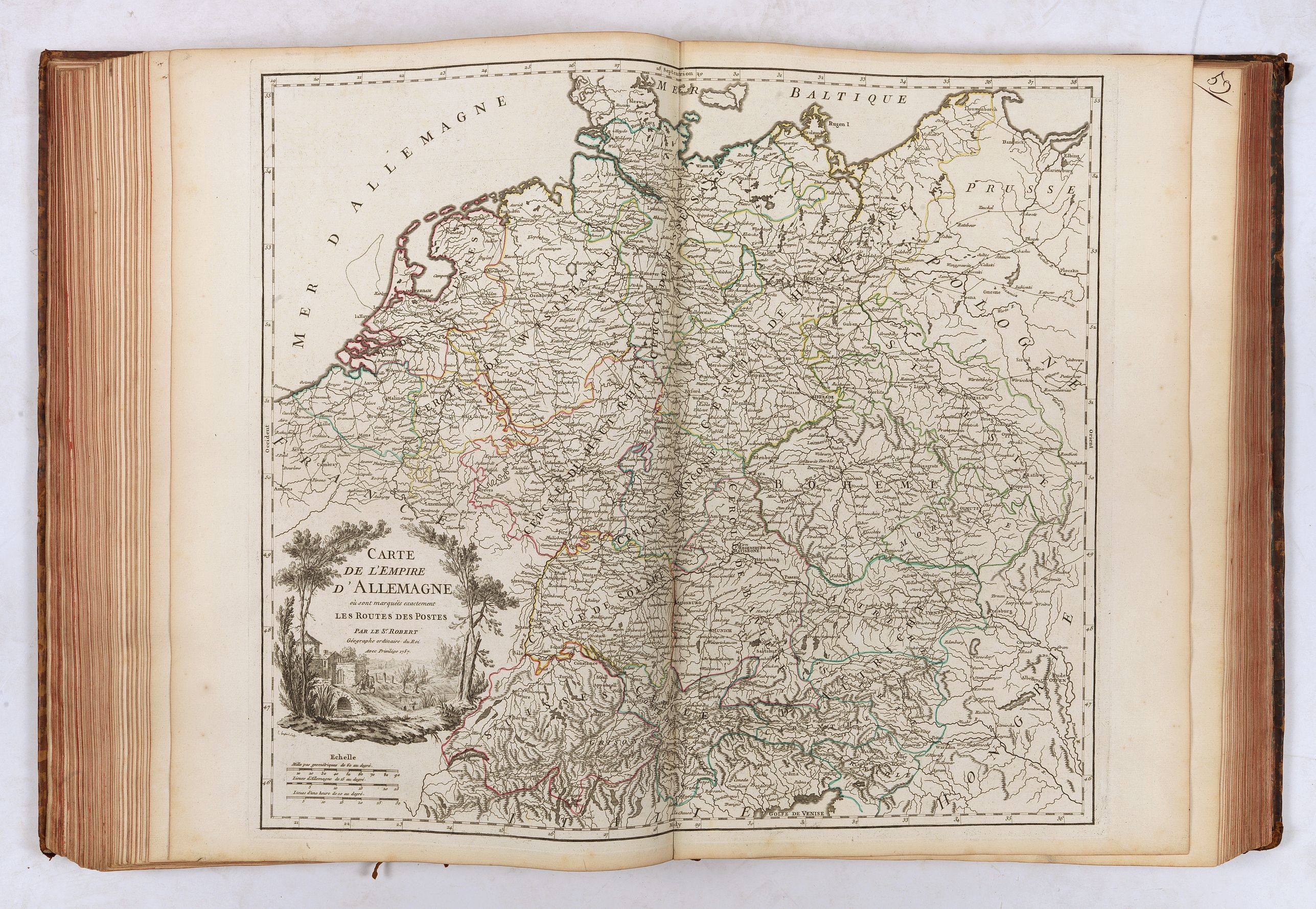
- Germania
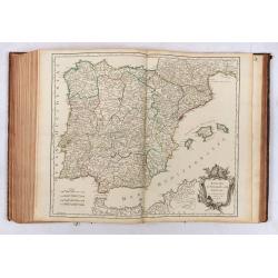
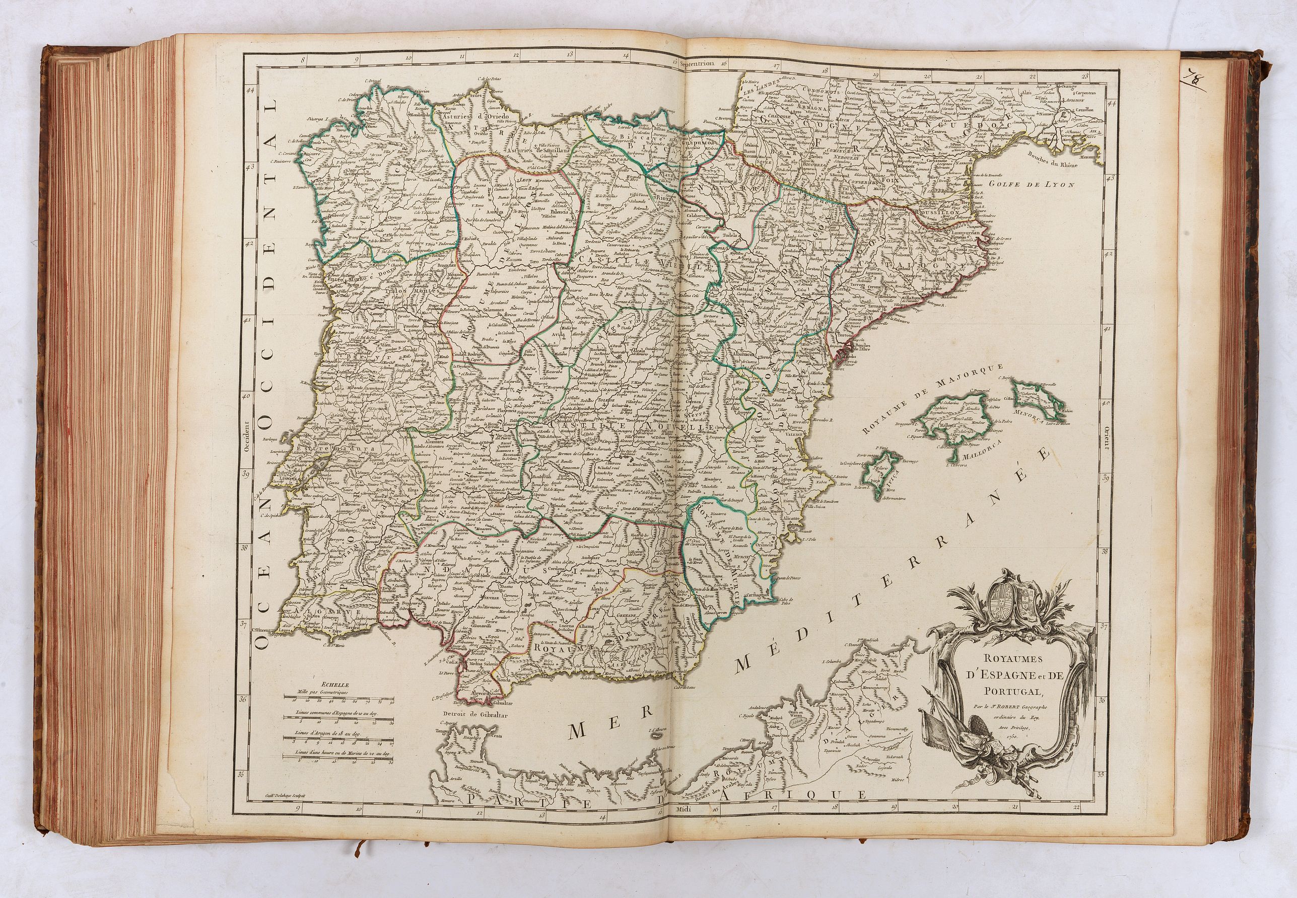
- Hispania
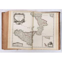
- Italia
- Graecia
- Asia minor
- Caroli magni Imperium
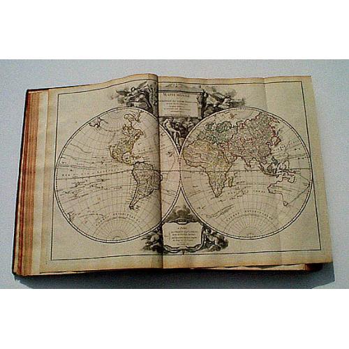
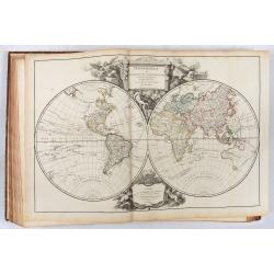
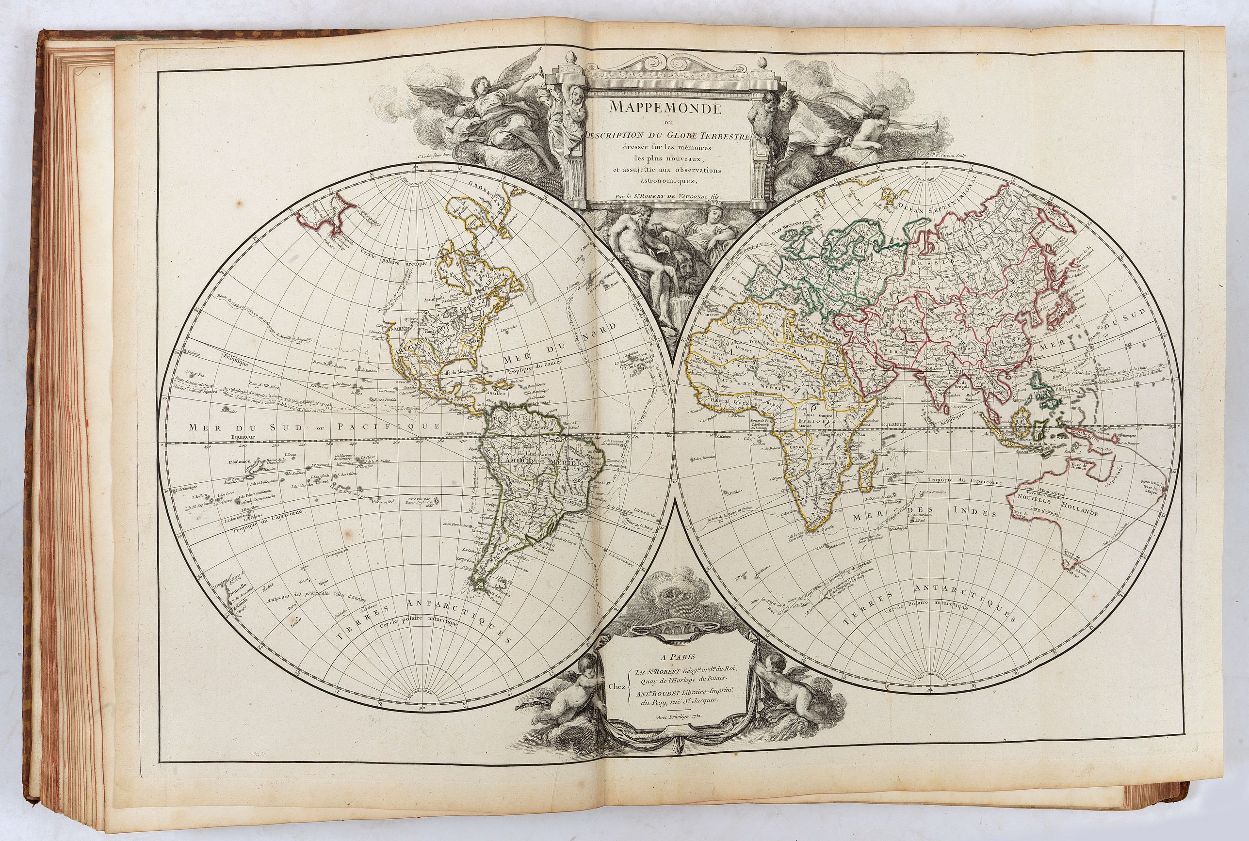
- Mappemonde (1752)
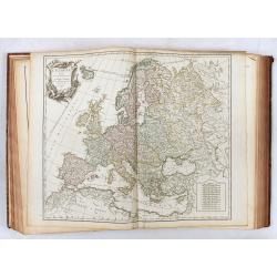
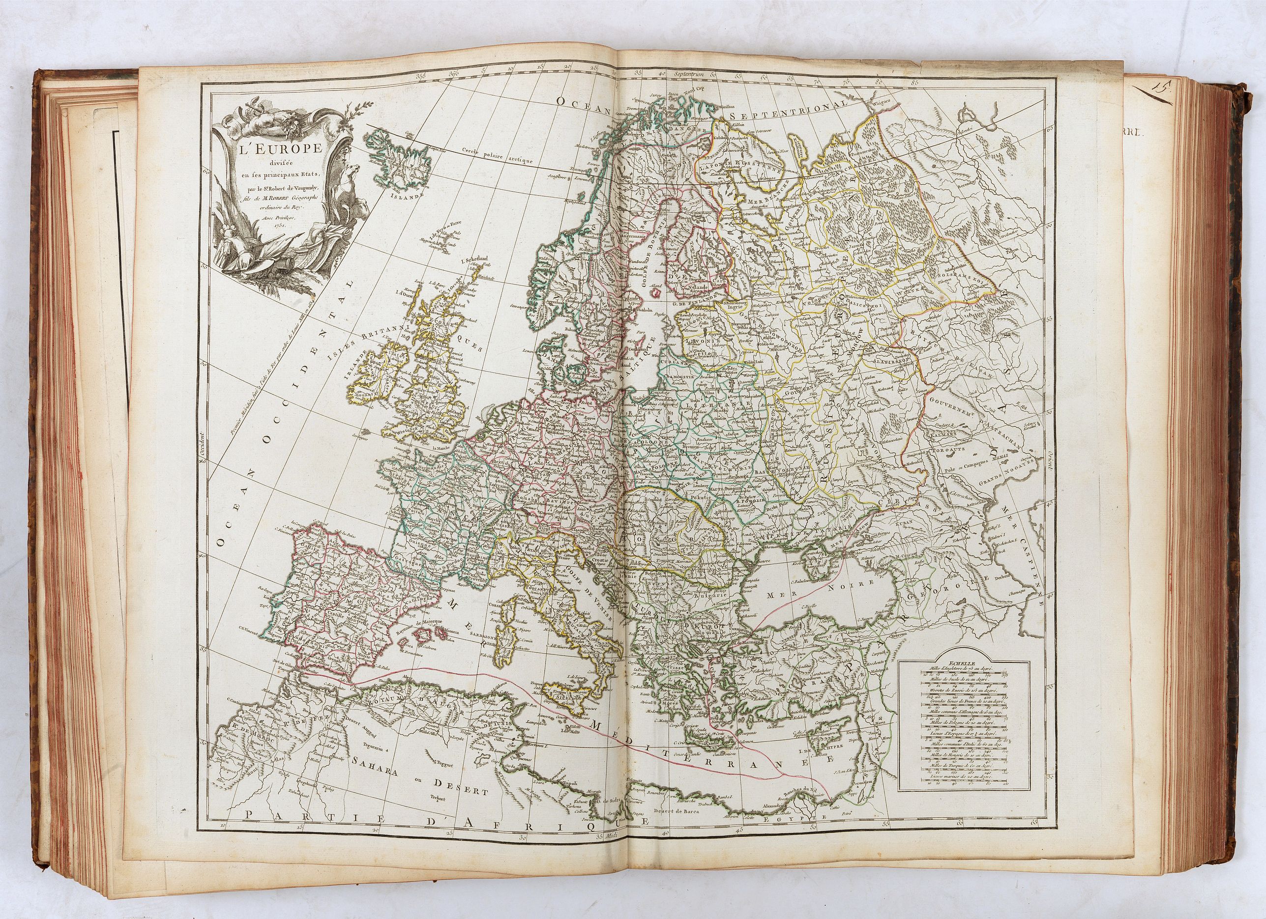
- Europe
- Grandes routes d'Angleterre d'Ecosse & d'Irlande
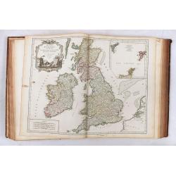
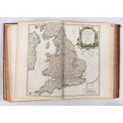
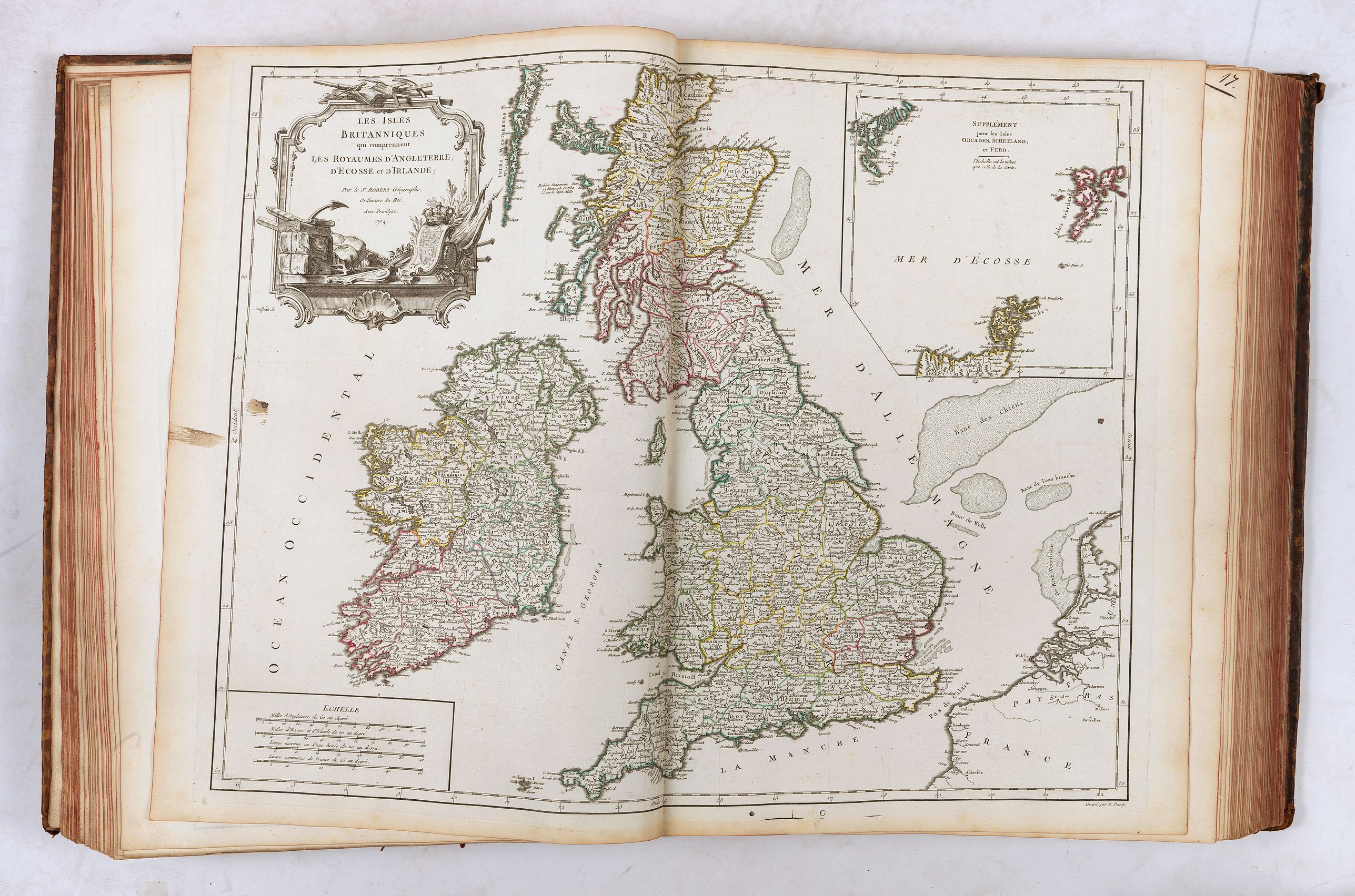
- Isles Britanniques
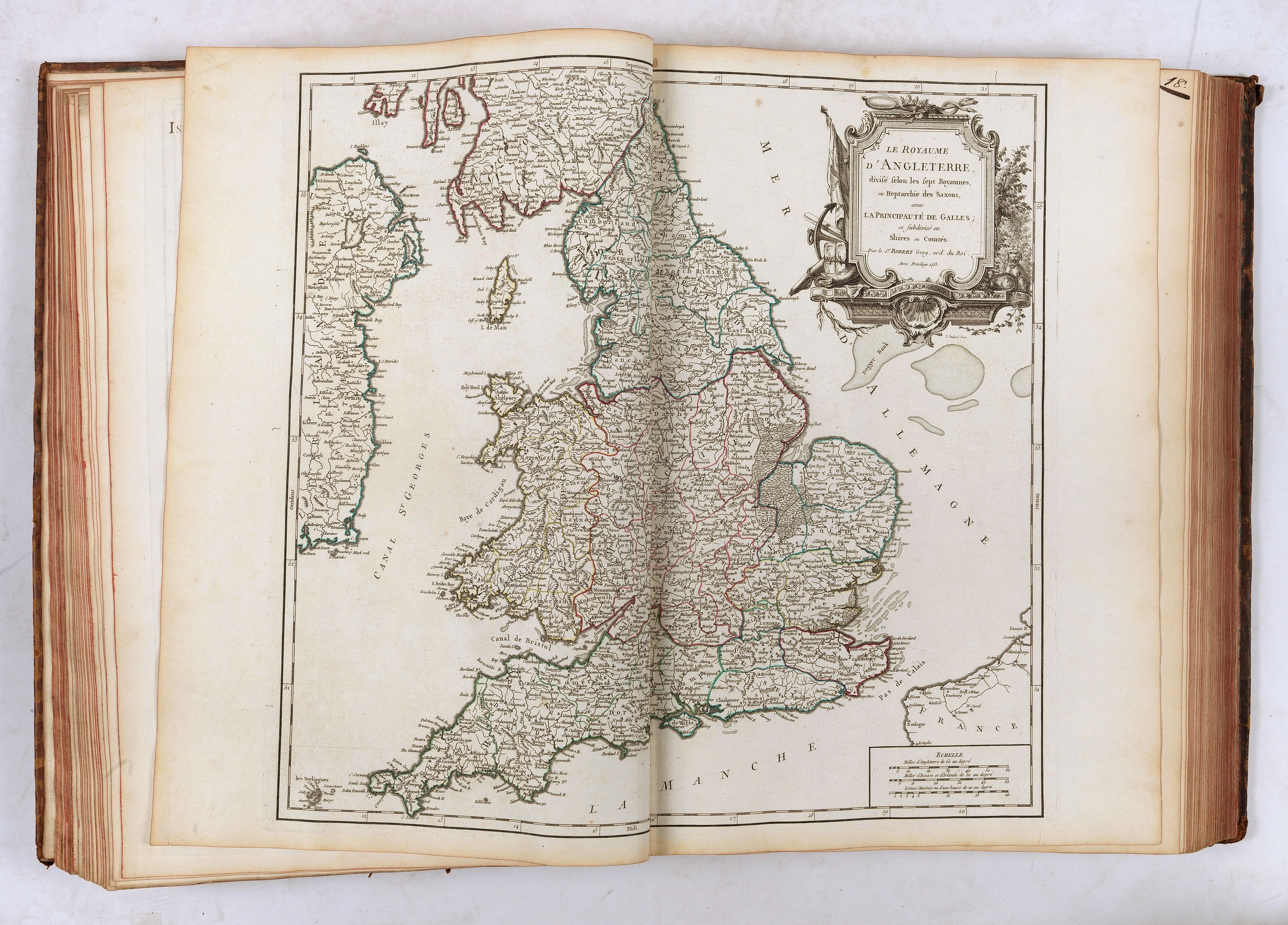
- Angleterre
- Ecosse
- Irlande
- Danemarck
- Suède et Norvège
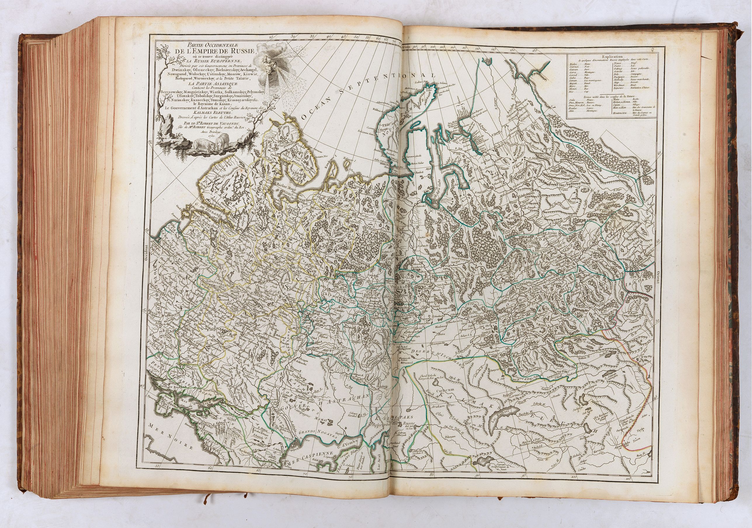
- Partie septentrionale Russie Européenne
- Partie méridionale Russie Européenne
- route des Postes de France
- France
- Picardie Artois
- Normandie
- Bretagne
- Maine Perche
- Orléanois
- Isle de France
- Environs de Paris
- Champagne septentrionale
- Champagne méridionale
- Lorraine & Barrois
- Alsace
- Poitou Aunis Saintonge Angoumois
- Marche Limousin
- Berry ...Nivernois... Bourbonois
- Partie septentrionale du gouvernement général de Bourgogne
- Partie méridionale du gouvernement général de Bourgogne
- Partie septentrionale du Comté de Bourgogne ou Franche-Comté
- Partie méridionale du Comté de Bourgogne ou Franche-Comté
- Partie septentrionale du gouvernement général de la Guienne
- Partie orientale du gouvernement général de la Guienne
- Partie méridionale du gouvernement général de la Guienne
- Languedoc
- Dauphiné
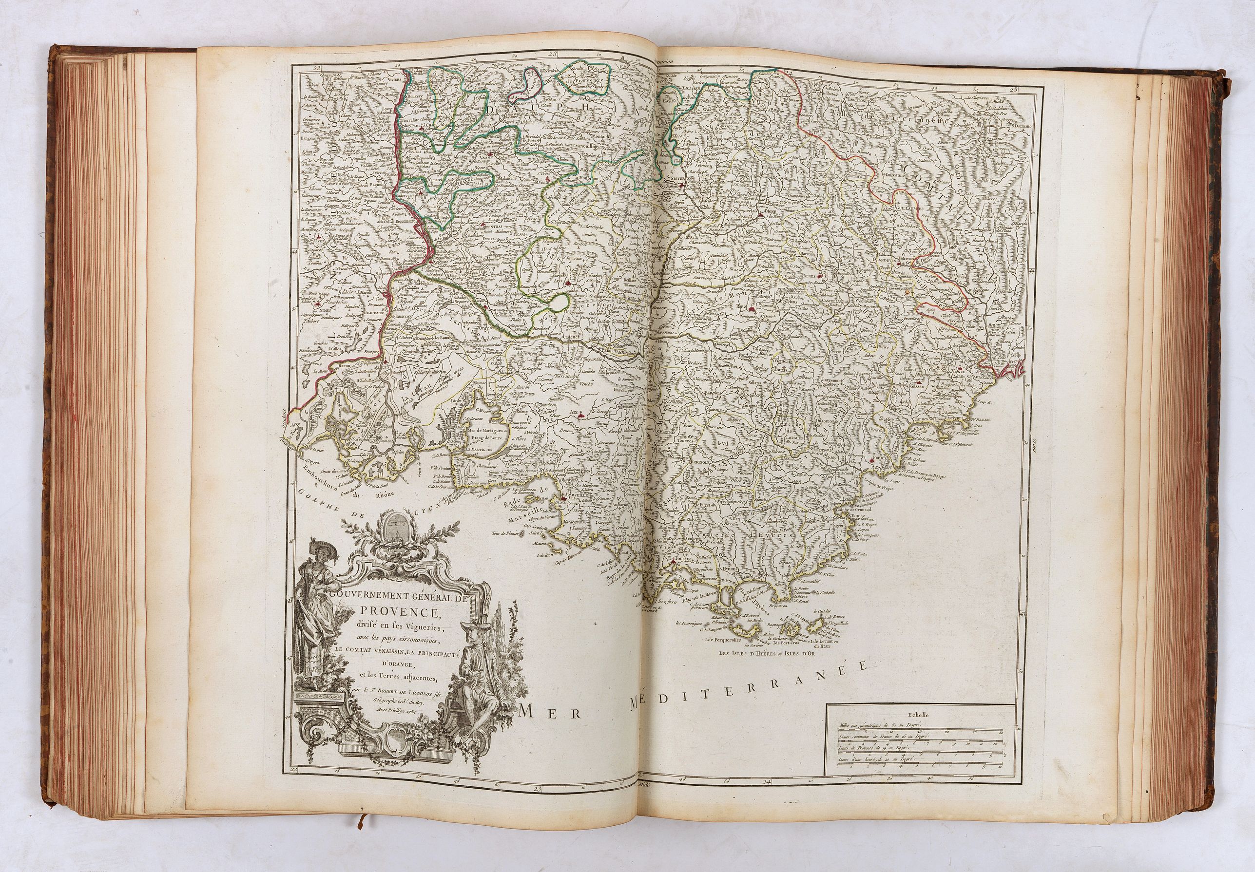
- Provence
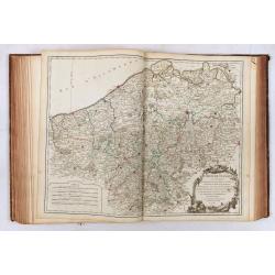
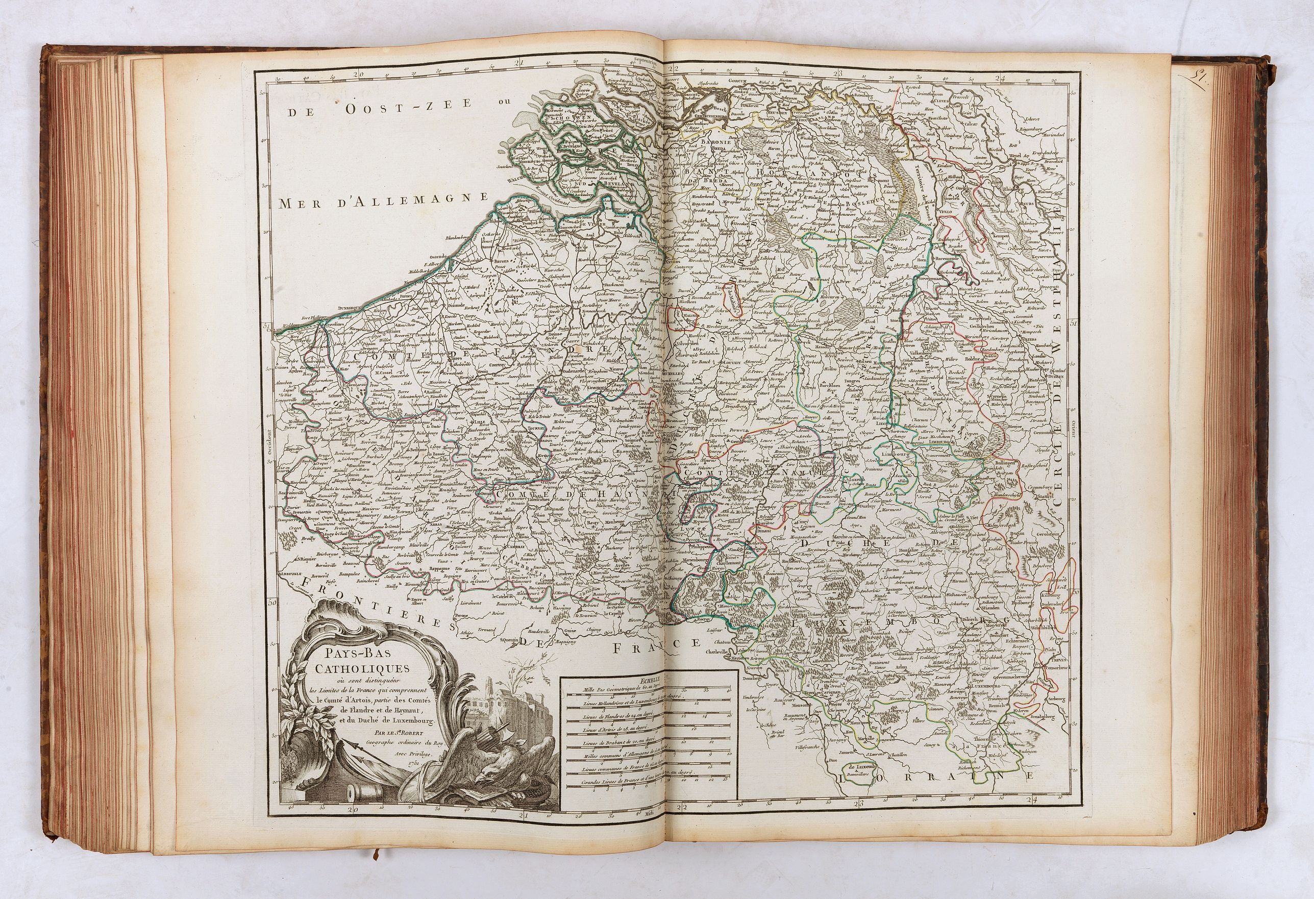
- Pays-Bas catholiques
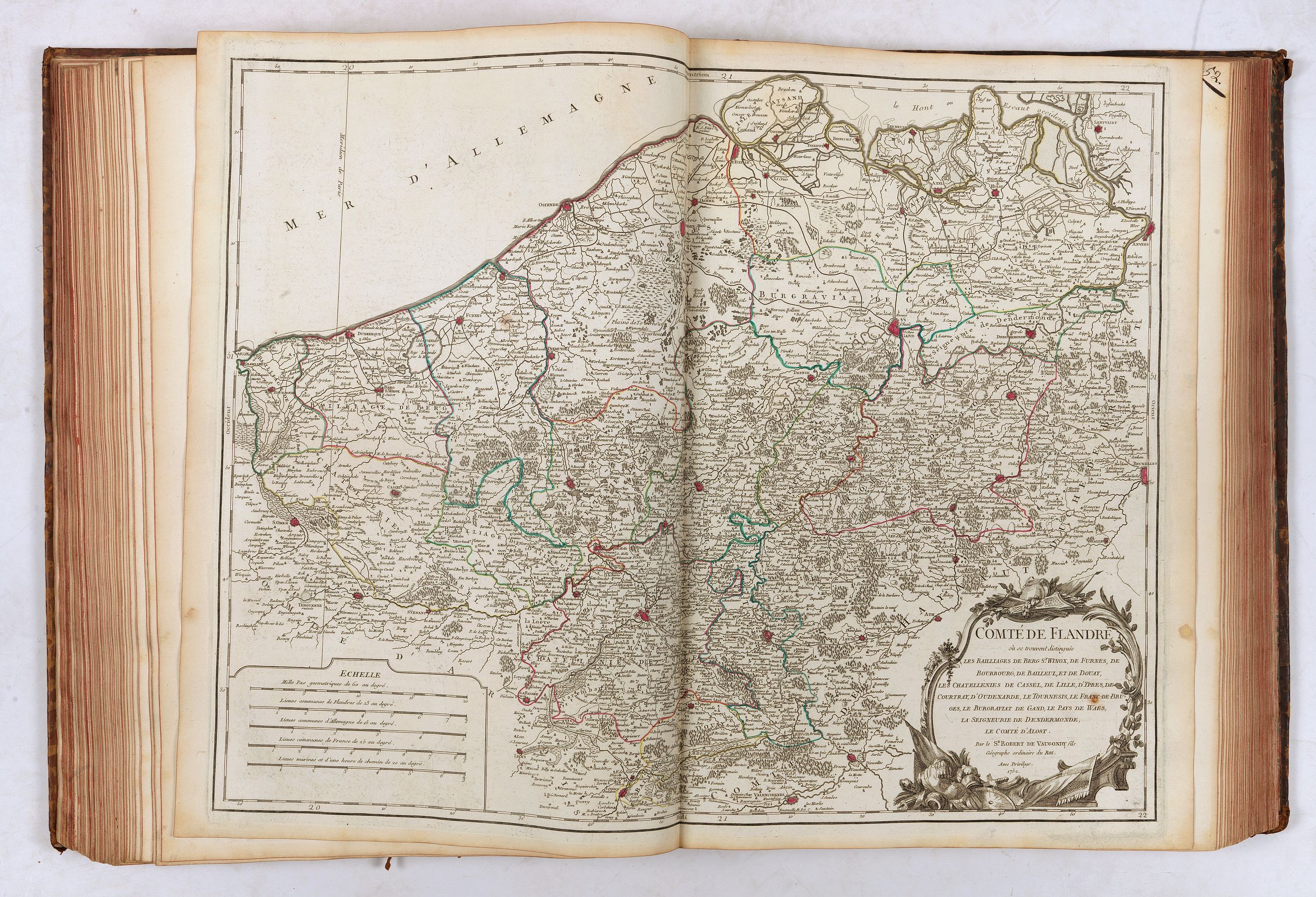
- Flandres
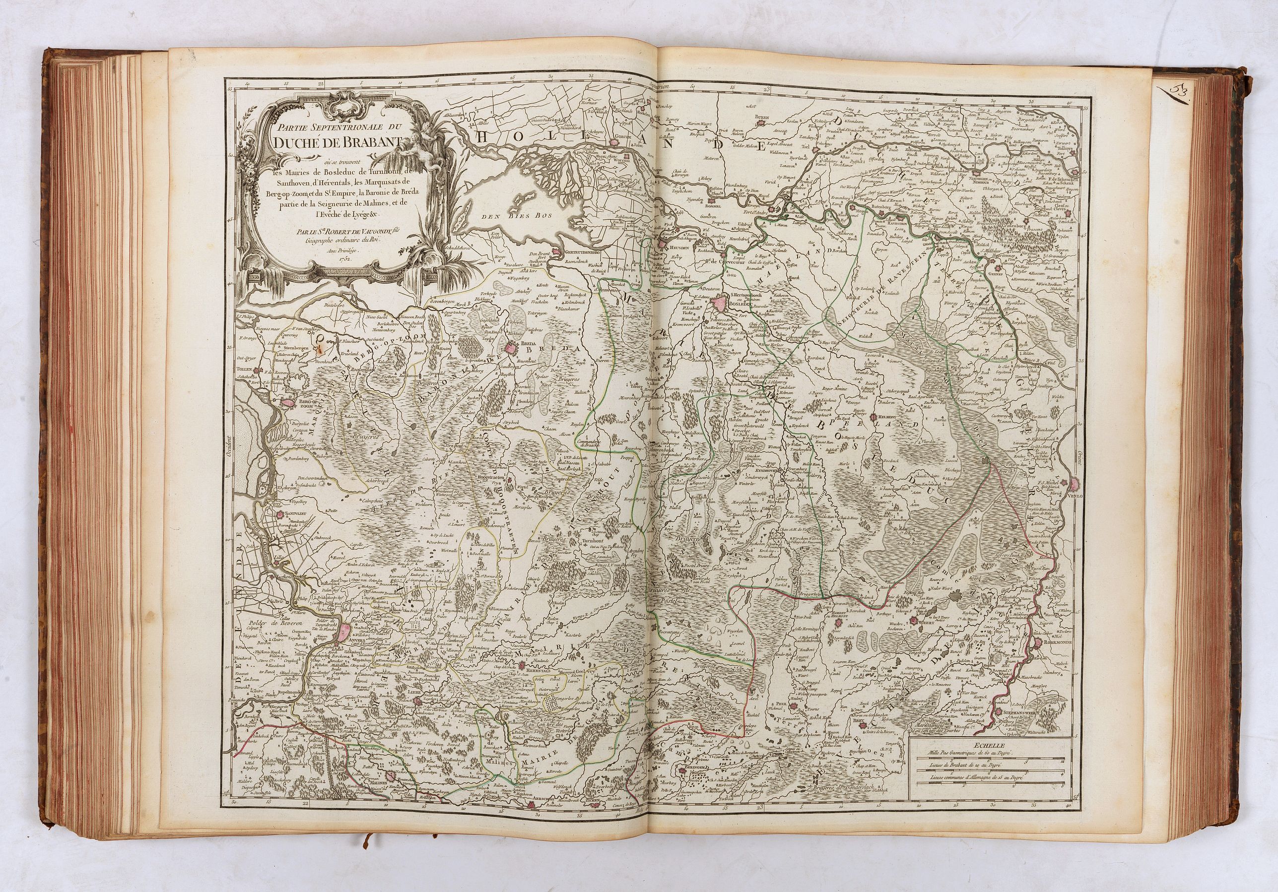
- Partie septentrionale du Duché de Brabant
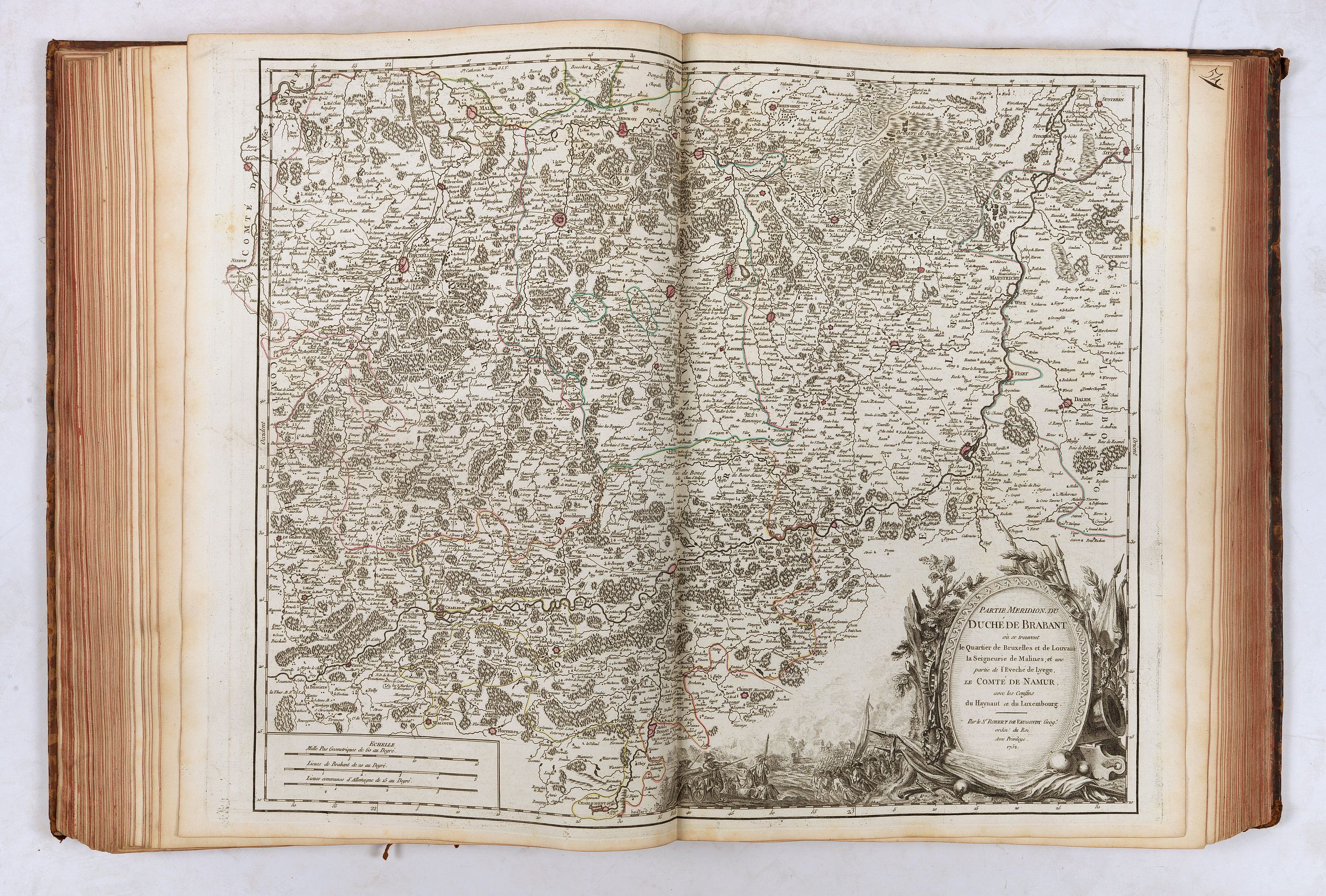
- Partie méridionale du Duché de Brabant
- Luxembourg
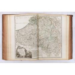
- Hainaut... Cambresis
- Lieège & Limbourg
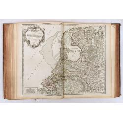
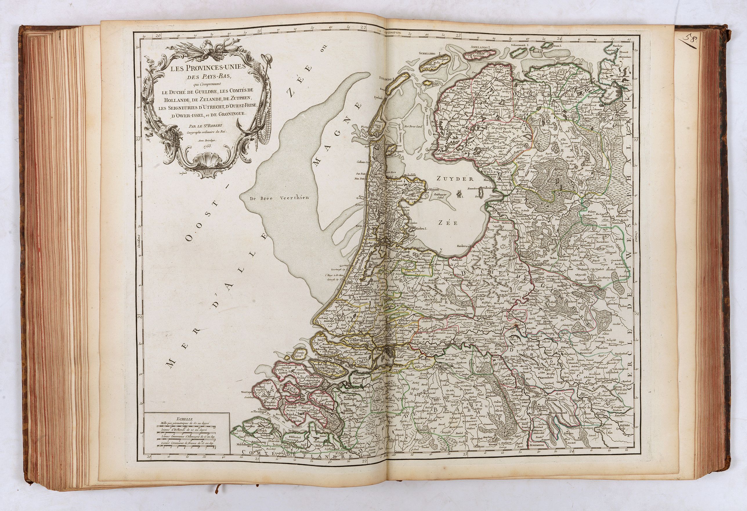
- Provinces-Unies des Pays-Bas
- Route des Postes Allemagne
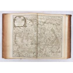
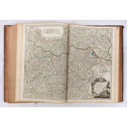
- Allemagne
- Suisse
- Westphalie
- Basse Saxe
- Haute Saxe septentrionale
- Haute Saxe méridionale
- Haut & Bas Rhin
- Franconie
- Souabe
- Bavière
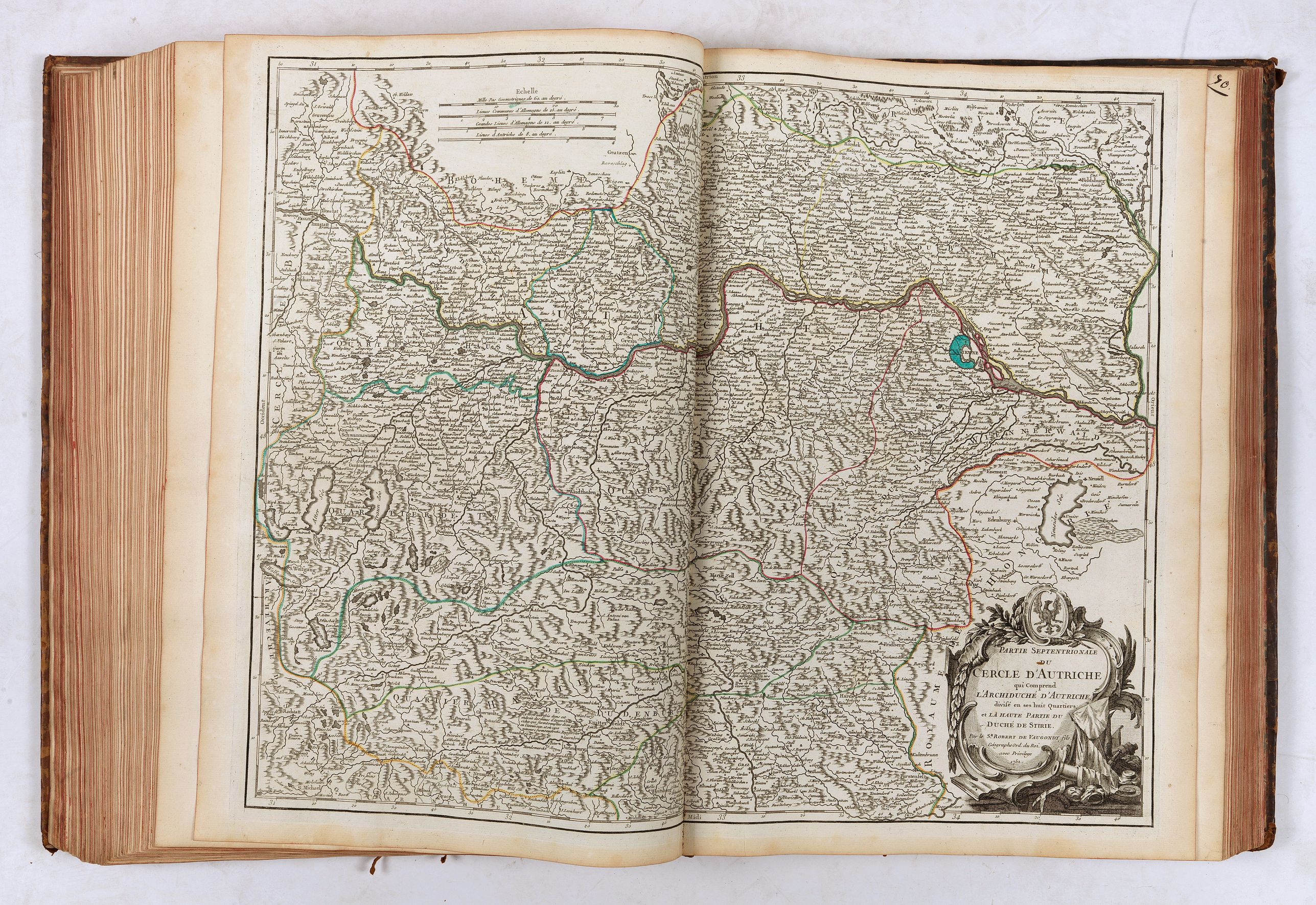
- Autriche septentrionale
- Autriche méridionale
- Tyrol
- Boheme Silésie
- Hongrie
- Pologne
- Prusse
- Route des Postes Espagne Portugal
- Espagne Portugal
- Castille septentrionale
- Castille méridionale
- Aragon
- Portugal septentrional
- Portugal méridional
- Route des Postes Italie
- Italie
- Lombardie occidentale
- Lombardie orientale
- Savoye
- Etat de l'Eglise... Grand-Duché de Toscane
- Naples septentrionale
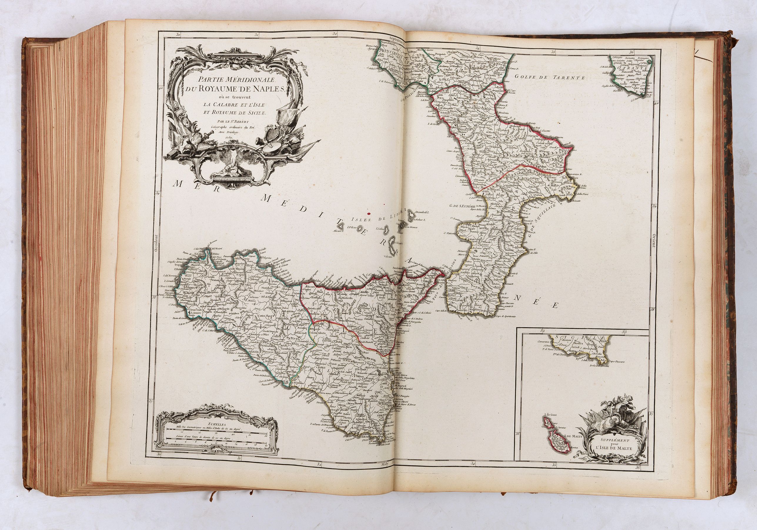
- Naples méridionale
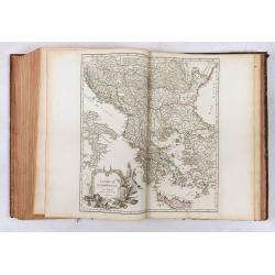
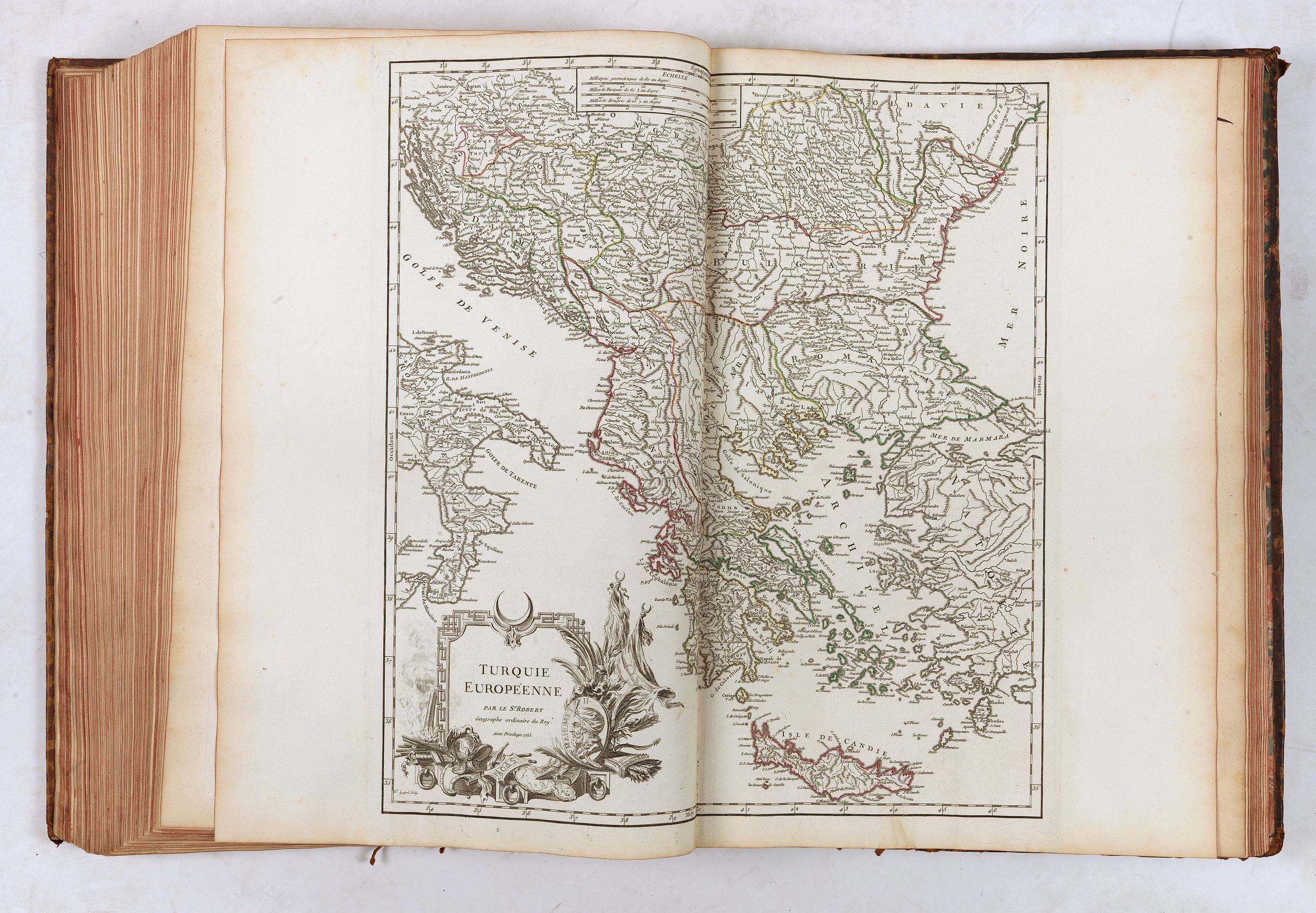
- Turquie Européenne
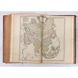
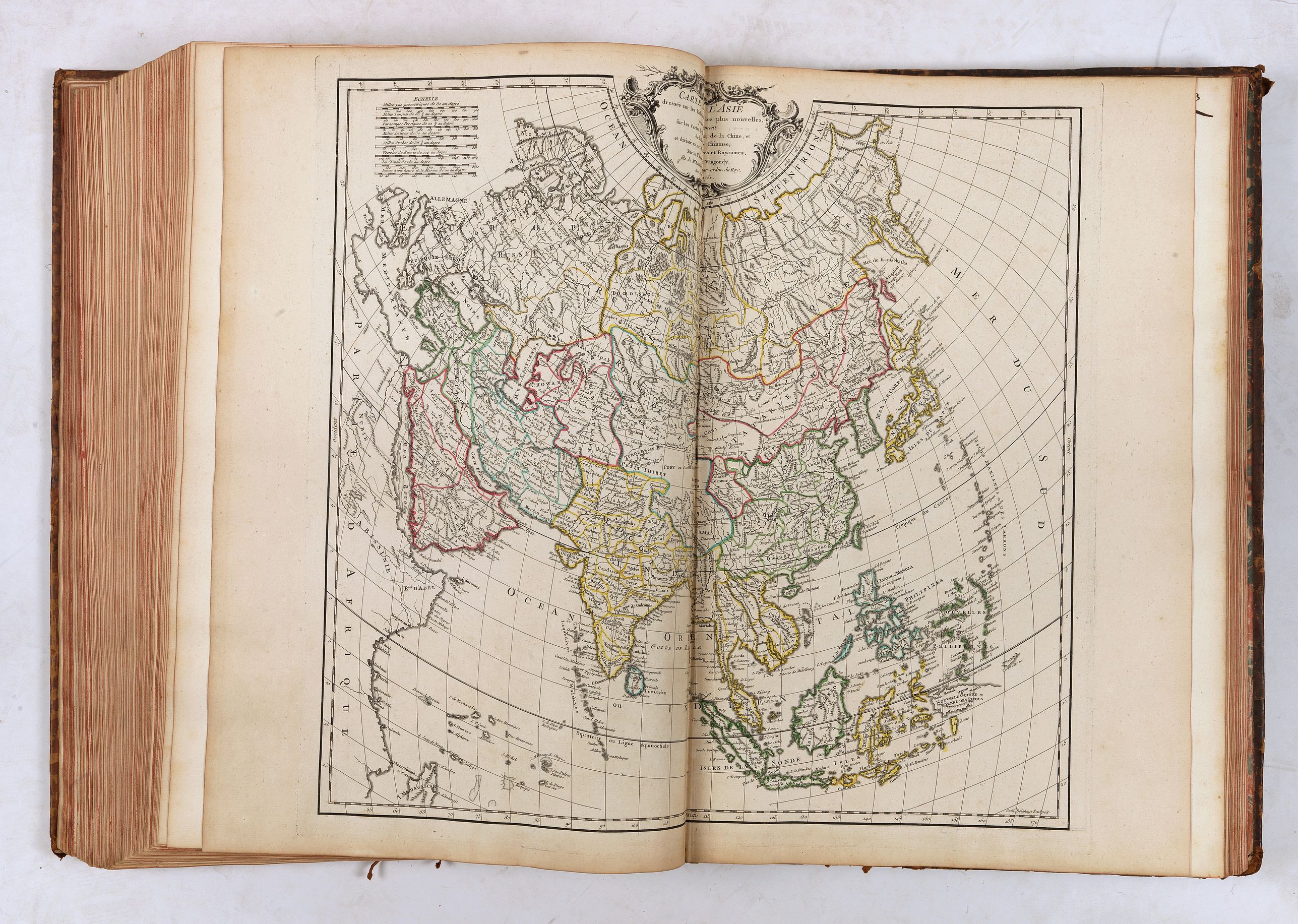
- Asie
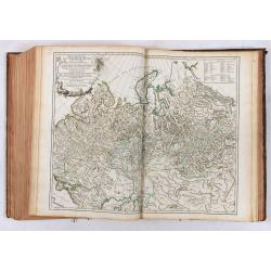
- Partie occidentale de l'Empire de Russie
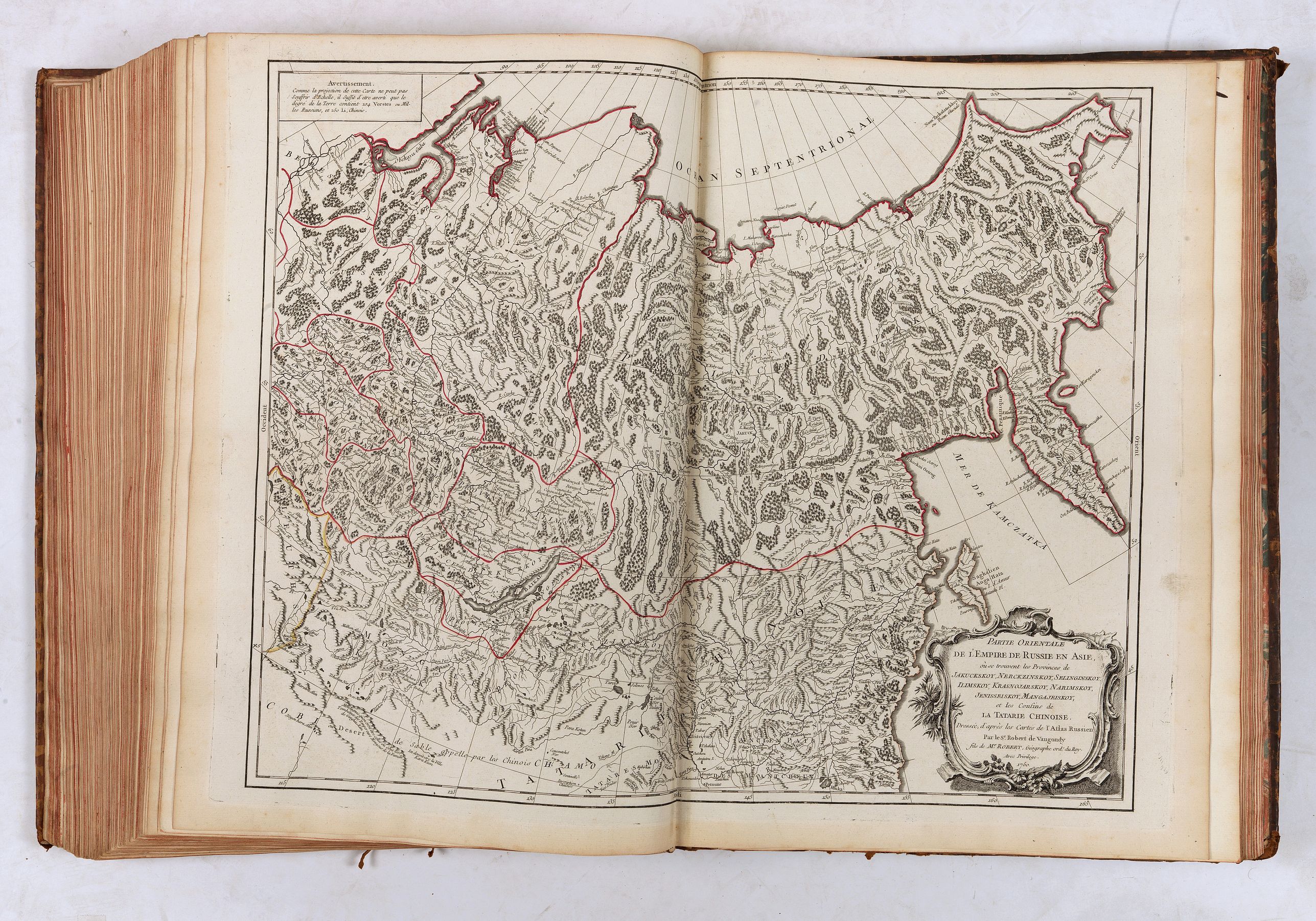
- Partie orientale de l'Empire de Russie en Asie
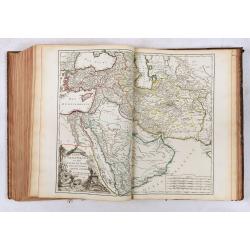
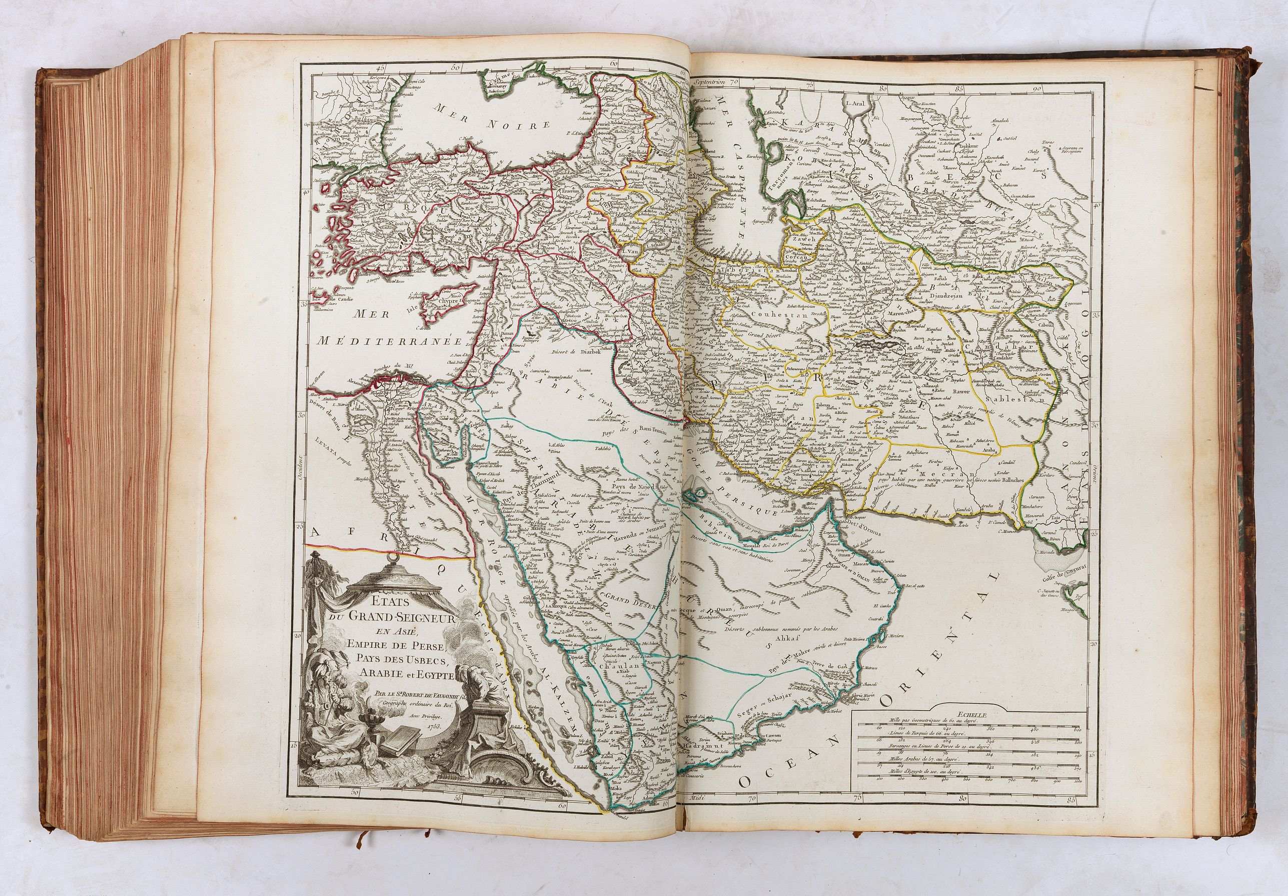
- Etats du Turc en Asie, & Perse
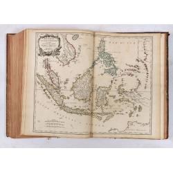
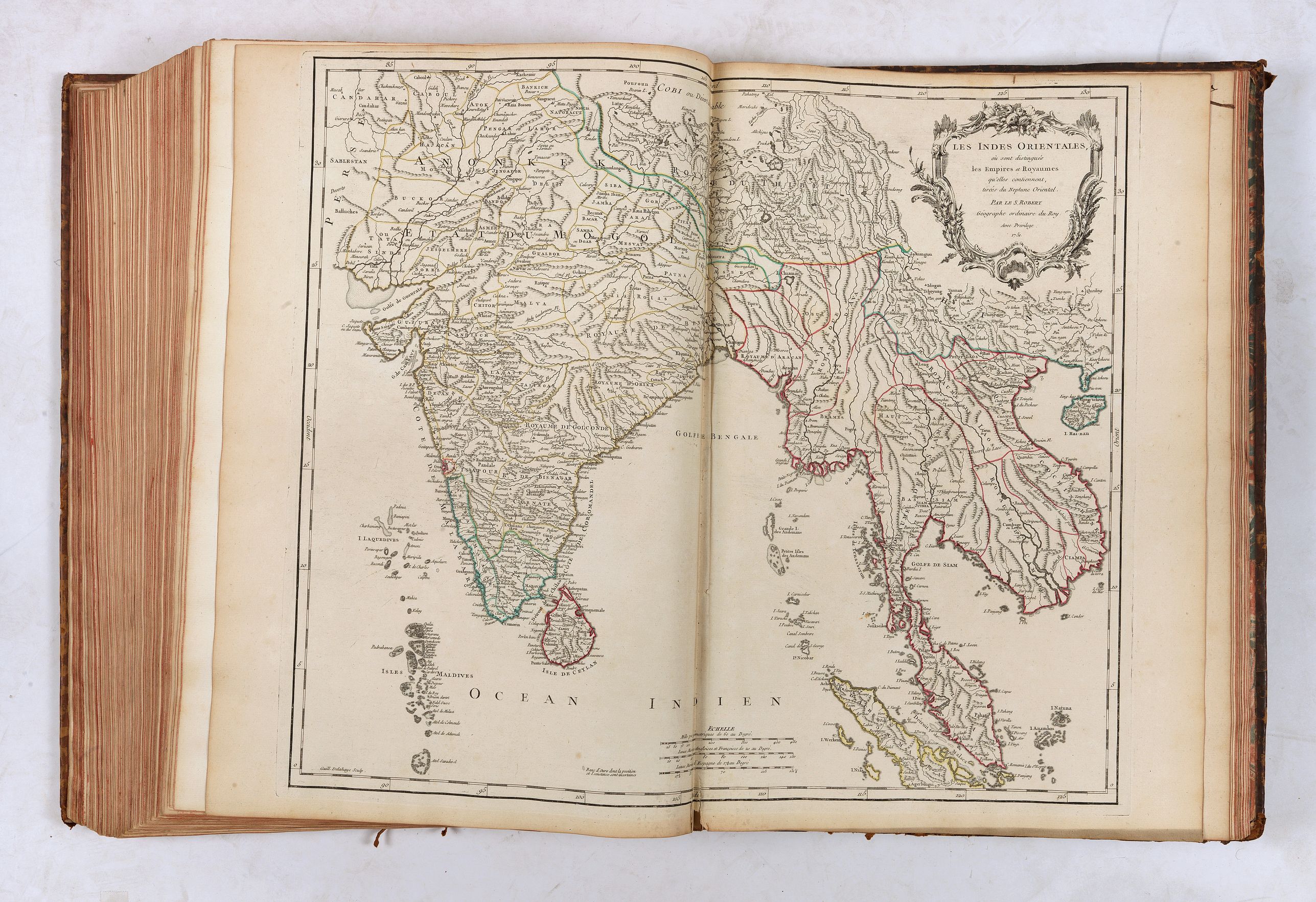
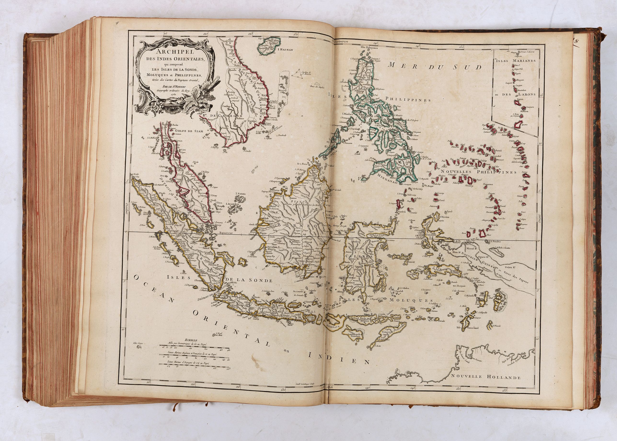
- Indes Orientales
- Archipel des Indes Orientales
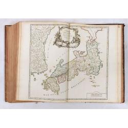
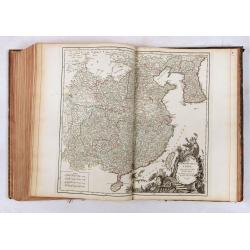
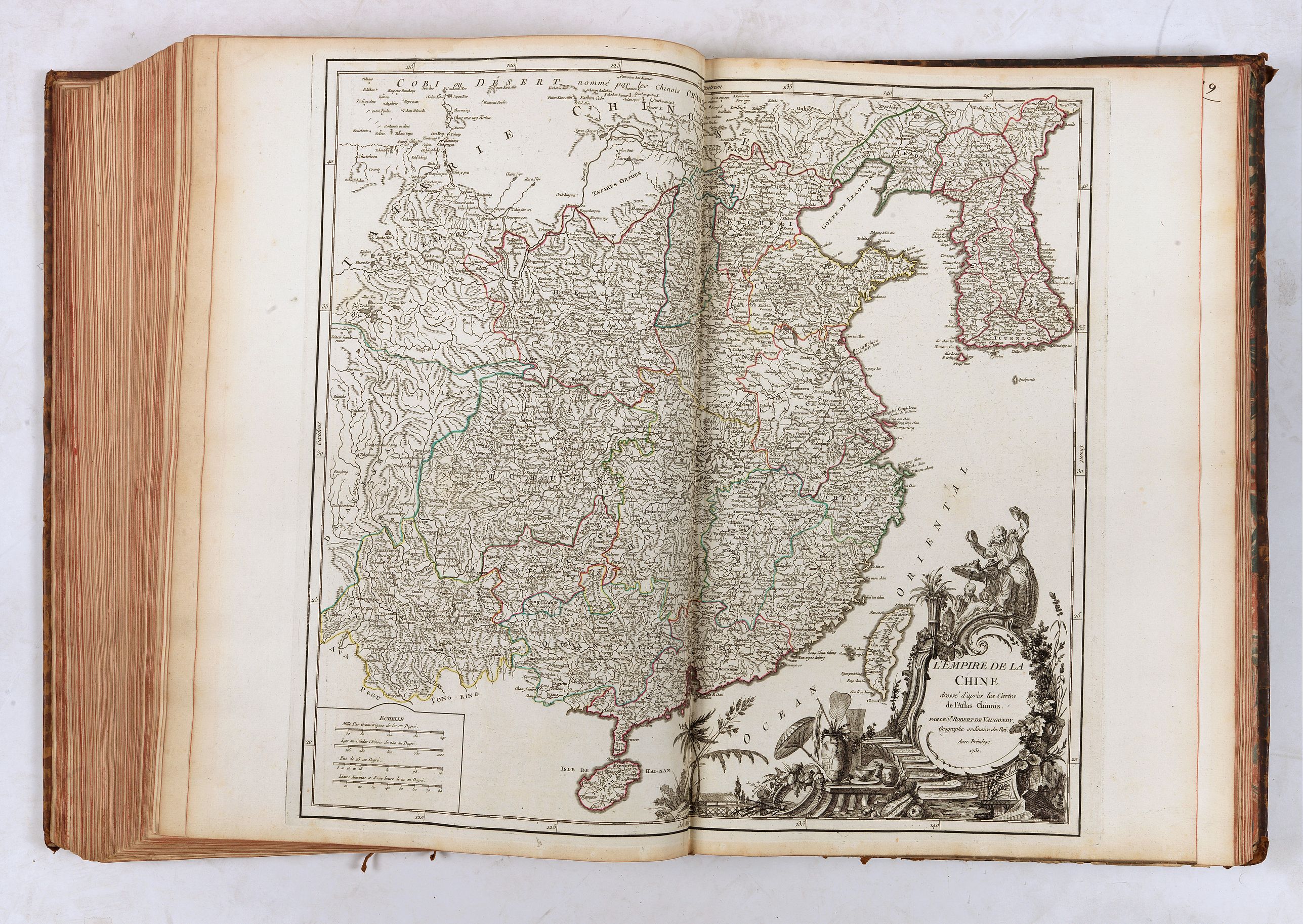
- Chine
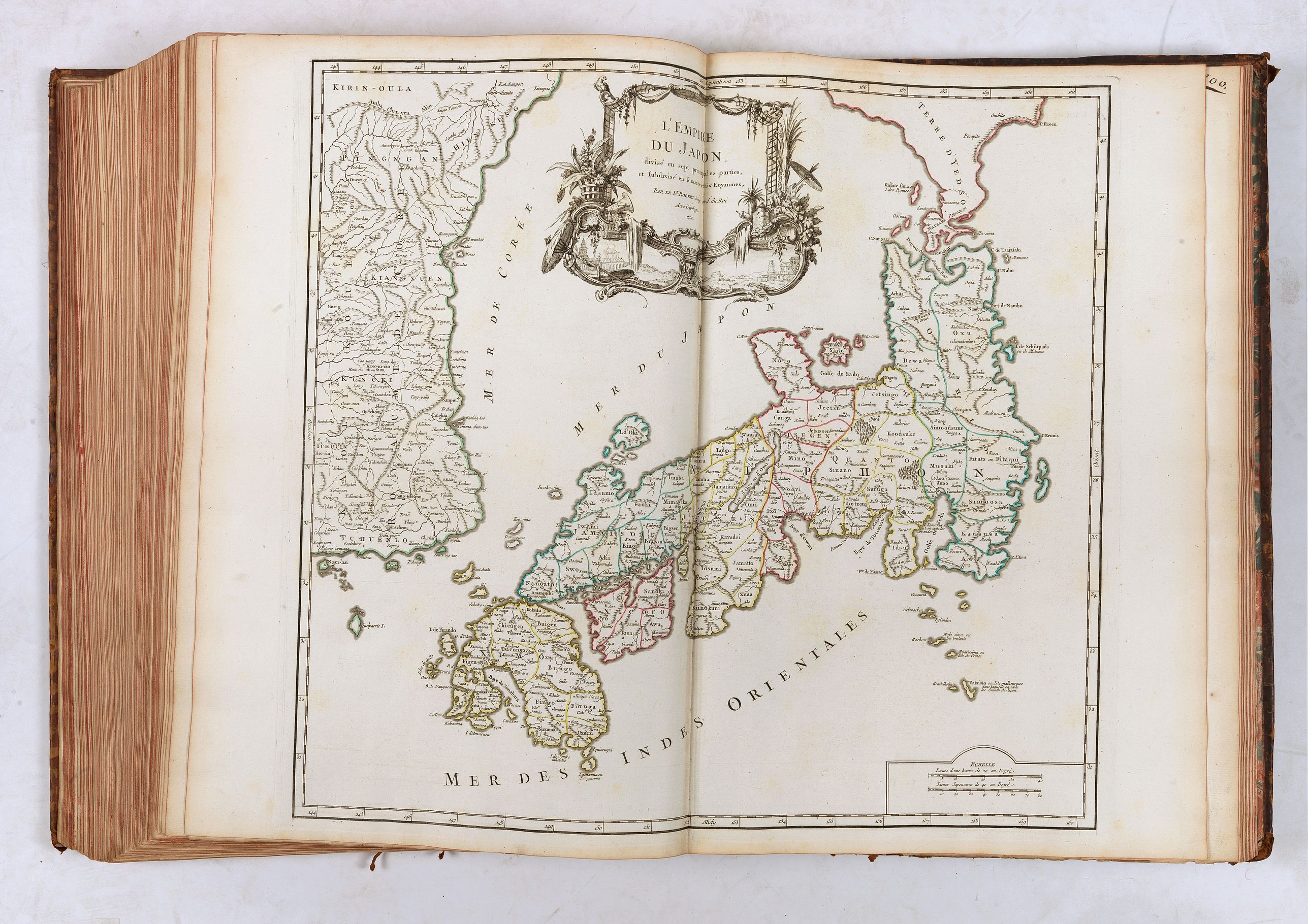
- Japon
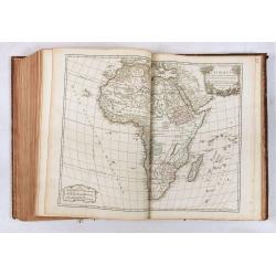
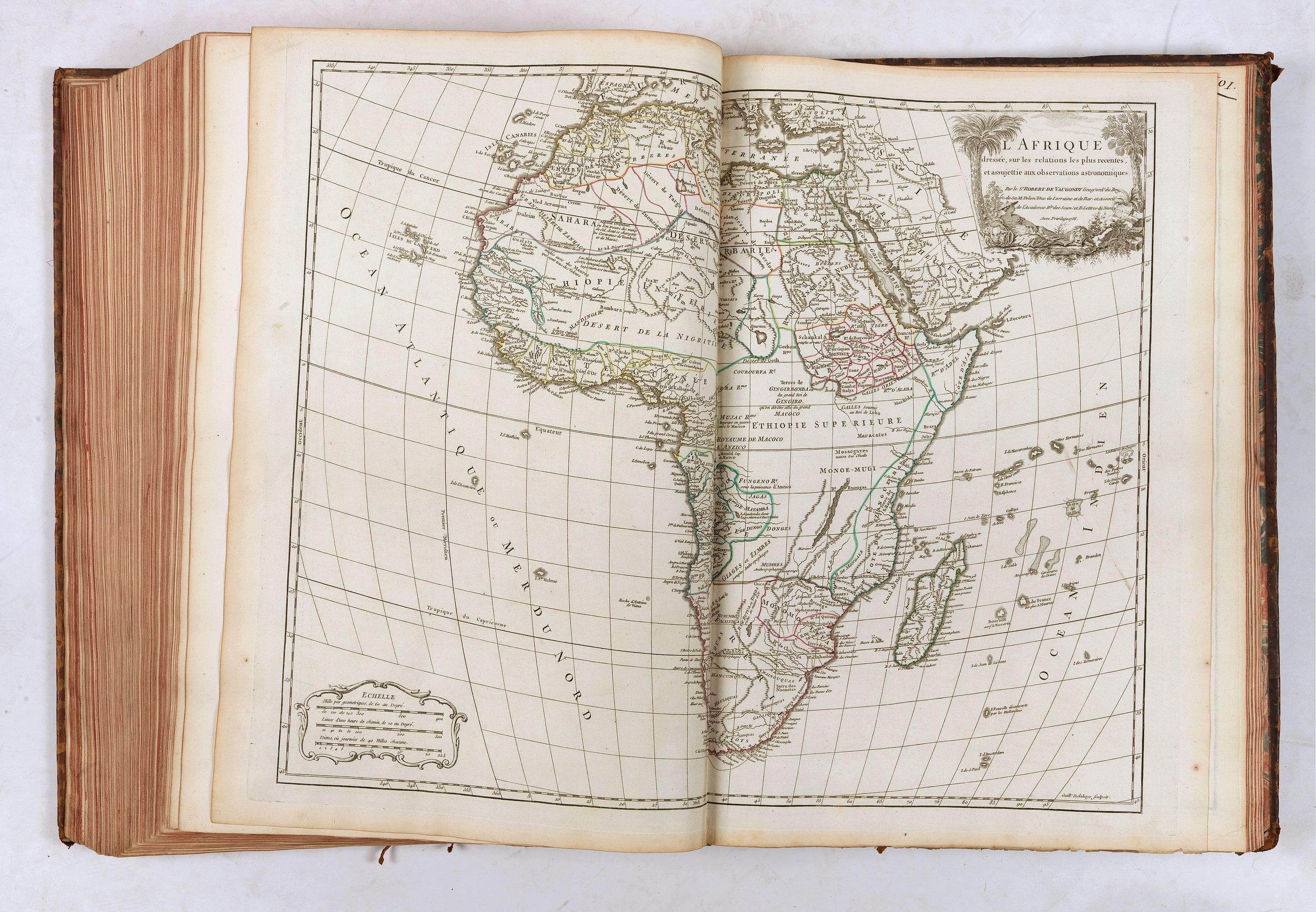
- Afrique
- Egypte ancienne & moderne
- Amerique Septentrionale (1750)
- Partie de l'Amérique Septent. qui comprend La Nouvelle France ou le Canada
- Partie de l'Amérique Septentrionale qui comprend le cours de l'Ohio (1755)
- Virginie & Maryland (1755)
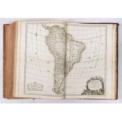
- Amérique méridionale
- Isles Antilles
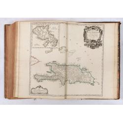
- Isles de S. Domingue & de la Martinique
Some copies have a list of subscribers, which is not present in our copy. In all, over 1.100 copies of this atlas were printed of which 601 in '' grand papier ''. Complete copies are now rare.
The Vaugondy's employed strict standards for including maps in this atlas and in many cases subjected them to astronomically derived readings for latitude and longitude. Moreover, 'their frequent use of eighteenth-century sources, often from the 1740s, provided their atlas with up-to-date information. Of American interest are included maps of Canada, Cours de l'Ohio, Virginia/Maryland, Amerique Meridionale, La Mer du Nord; for these maps, the Vaugondy's had access to sources held by the Depot de la Marine, the official French repository for maritime-related information.
The maps and globes produced by the Vaugondy's remain an enduring testament to the peak of French cartography during the Enlightenment. Their works, characterized by precision and the inclusion of contemporary findings, helped to shape our understanding of the world during a transformative period in European history.
Reference: Shirley, T.ROBV-1c / 1d; Nordenskiöld Collection Catalogue, 245.
According to Pedley ; The Atlas Universel is the prime exemplar of the authors' geographic ideal- bel et utile- beautiful and useful.
Collation
- Orbis vetus
- La Terre-Sainte
- Imperiorum antiquorum tabula in qua prae caetris Alexandi magni, &c.
- Imperium Romanum
- Britannicae insulae
- Gallia
- Germania
- Hispania
- Italia
- Graecia
- Asia minor
- Caroli magni Imperium
- Mappemonde (1752)
- Europe
- Grandes routes d'Angleterre d'Ecosse & d'Irlande
- Isles Britanniques
- Angleterre
- Ecosse
- Irlande
- Danemarck
- Suède et Norvège
- Partie septentrionale Russie Européenne
- Partie méridionale Russie Européenne
- route des Postes de France
- France
- Picardie Artois
- Normandie
- Bretagne
- Maine Perche
- Orléanois
- Isle de France
- Environs de Paris
- Champagne septentrionale
- Champagne méridionale
- Lorraine & Barrois
- Alsace
- Poitou Aunis Saintonge Angoumois
- Marche Limousin
- Berry ...Nivernois... Bourbonois
- Partie septentrionale du gouvernement général de Bourgogne
- Partie méridionale du gouvernement général de Bourgogne
- Partie septentrionale du Comté de Bourgogne ou Franche-Comté
- Partie méridionale du Comté de Bourgogne ou Franche-Comté
- Partie septentrionale du gouvernement général de la Guienne
- Partie orientale du gouvernement général de la Guienne
- Partie méridionale du gouvernement général de la Guienne
- Languedoc
- Dauphiné
- Provence
- Pays-Bas catholiques
- Flandres
- Partie septentrionale du Duché de Brabant
- Partie méridionale du Duché de Brabant
- Luxembourg
- Hainaut... Cambresis
- Lieège & Limbourg
- Provinces-Unies des Pays-Bas
- Route des Postes Allemagne
- Allemagne
- Suisse
- Westphalie
- Basse Saxe
- Haute Saxe septentrionale
- Haute Saxe méridionale
- Haut & Bas Rhin
- Franconie
- Souabe
- Bavière
- Autriche septentrionale
- Autriche méridionale
- Tyrol
- Boheme Silésie
- Hongrie
- Pologne
- Prusse
- Route des Postes Espagne Portugal
- Espagne Portugal
- Castille septentrionale
- Castille méridionale
- Aragon
- Portugal septentrional
- Portugal méridional
- Route des Postes Italie
- Italie
- Lombardie occidentale
- Lombardie orientale
- Savoye
- Etat de l'Eglise... Grand-Duché de Toscane
- Naples septentrionale
- Naples méridionale
- Turquie Européenne
- Asie
- Partie occidentale de l'Empire de Russie
- Partie orientale de l'Empire de Russie en Asie
- Etats du Turc en Asie, & Perse
- Indes Orientales
- Archipel des Indes Orientales
- Chine
- Japon
- Afrique
- Egypte ancienne & moderne
- Amerique Septentrionale (1750)
- Partie de l'Amérique Septent. qui comprend La Nouvelle France ou le Canada
- Partie de l'Amérique Septentrionale qui comprend le cours de l'Ohio (1755)
- Virginie & Maryland (1755)
- Amérique méridionale
- Isles Antilles
- Isles de S. Domingue & de la Martinique
Some copies have a list of subscribers, which is not present in our copy. In all, over 1.100 copies of this atlas were printed of which 601 in '' grand papier ''. Complete copies are now rare.
The Vaugondy's employed strict standards for including maps in this atlas and in many cases subjected them to astronomically derived readings for latitude and longitude. Moreover, 'their frequent use of eighteenth-century sources, often from the 1740s, provided their atlas with up-to-date information. Of American interest are included maps of Canada, Cours de l'Ohio, Virginia/Maryland, Amerique Meridionale, La Mer du Nord; for these maps, the Vaugondy's had access to sources held by the Depot de la Marine, the official French repository for maritime-related information.
The maps and globes produced by the Vaugondy's remain an enduring testament to the peak of French cartography during the Enlightenment. Their works, characterized by precision and the inclusion of contemporary findings, helped to shape our understanding of the world during a transformative period in European history.
Reference: Shirley, T.ROBV-1c / 1d; Nordenskiöld Collection Catalogue, 245.
FAQ - Guarantee - Shipping
Buying in the BuyNow Gallery
This item is available for immediate purchase when a "Add to Cart" or "Inquire Now" button is shown.
Items are sold in the EU margin scheme
Payments are accepted in Euros or US Dollars.
Authenticity Guarantee
 We provide professional descriptions, condition report (based on 45 years experience in the map business)
Paulus Swaen warrants the authenticity of our items and a certificate of authenticity is provided for each acquired lot.
Condition and Coloring
We indicate the condition of each item and use our unnique HiBCoR grading system in which four key items determine a map's value: Historical Importance, Beauty, Condition/Coloring and Rarity.
Color Key
We offer many maps in their original black and white condition. We do not systematically color-up maps to make them more sellable to the general public or buyer.
Copper engraved or wood block maps are always hand colored. Maps were initially colored for aesthetic reasons and to improve readability. Nowadays, it is becoming a challenge to find maps in their original colors and are therefor more valuable.
We use the following color keys in our catalog:
Original colors; mean that the colors have been applied around the time the map was issued.
Original o/l colors; means the map has only the borders colored at the time of publication.
Colored; If the colors are applied recently or at the end of the 20th century.
Read more about coloring of maps [+]
Shipping fee
A flat shipping fee of $ 30 is added to each shipment by DHL within Europe and North America. This covers : International Priority shipping, Packing and Insurance (up to the invoice amount).
Shipments to Asia are $ 40 and rest of the world $50
We charge only one shipping fee when you have been successful on multiple items or when you want to combine gallery and auction purchases.
Read more about invoicing and shipping
FAQ
Please have a look for more information about buying in the BuyNow gallery
Many answers are likely to find in the general help section.
Virtual Collection
![]()
With Virtual Collection you can collect all your favorite items in one place. It is free, and anyone can create his or her Virtual map collection.
Unless you are logged in, the item is only saved for this session. You have to be registed and logged-in if you want to save this item permanently to your Virtual Collection.
Read More[+]
Register here, it is free and you do not need a credit card.
Add this item to
Virtual Collection
or click the following link to see my Virtual Collection.
| Digital Image Download | |
|
Paulus Swaen maintains an archive of most of our high-resolution rare maps, prints, posters and medieval manuscript scans. We make them freely available for download and study. Read more about free image download |
Click the image for a free small image download. |
.jpg)

.jpg)
.jpg)
.jpg)
In accordance with the EU Consumer Rights Directive and habitually reside in the European Union you have the right to cancel the contract for the purchase of a lot, without giving any reason.
The cancellation period will expire 14 calendar days from the day after the date on which you or a third party (other than the carrier and indicated by you) acquires, physical possession of the lot. To exercise the right to cancel you must inform Paulus Swaen Inc, of your decision to cancel this contract by a clear statement (e.g. a letter sent by post, or e-mail (amsterdam@swaen.com).
To meet the cancellation deadline, it is sufficient for you to send your communication concerning your exercise of the right to cancel before the cancellation period has expired.

