Subscribe to be notified if similar examples become available.
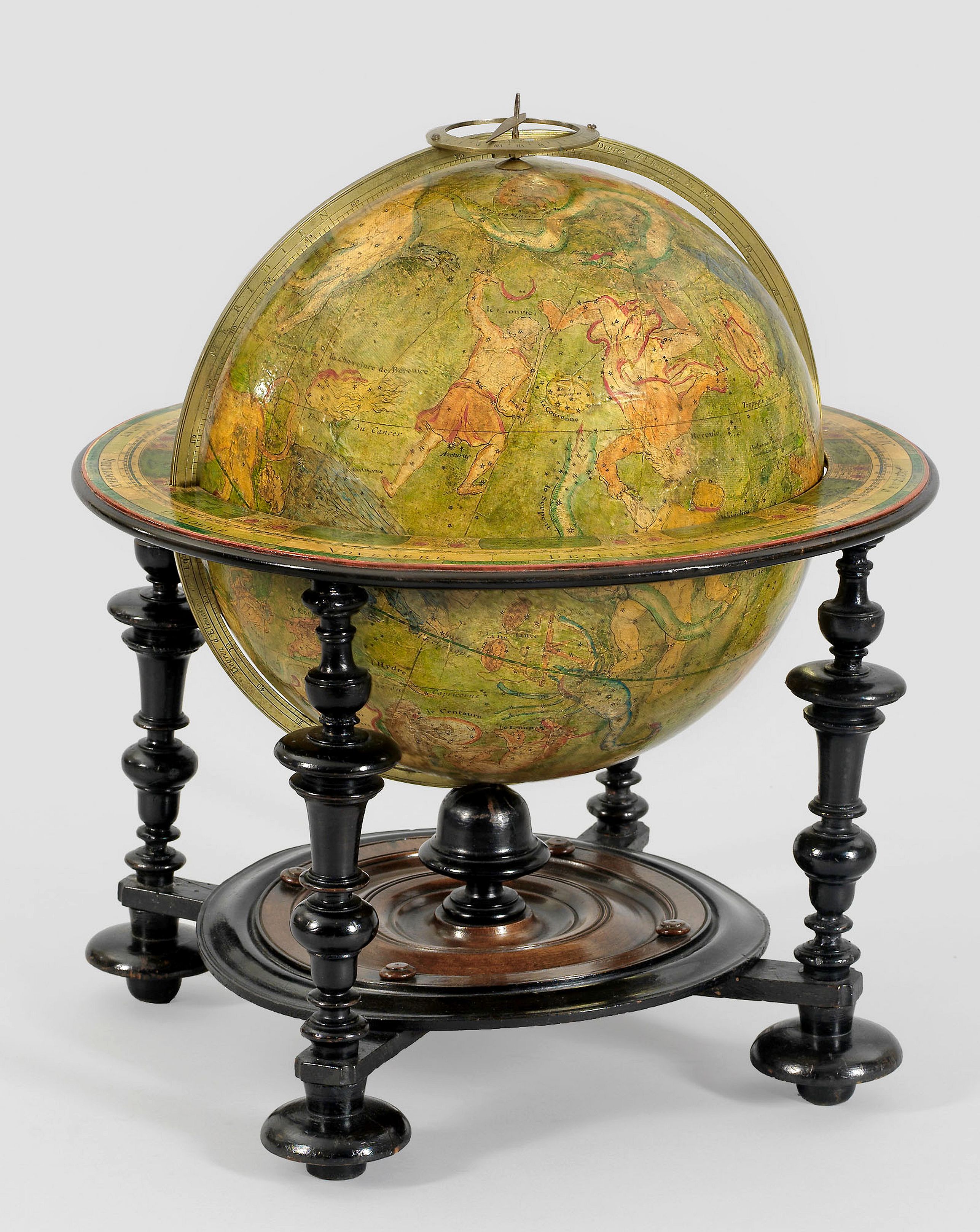
A very rare Louis XIV celestial globe by Guillaume De L'Isle, Paris, 1700, with his first address "Rue des Canettes". |
||||||||||||||||||||
|
||||||||||||||||||||
|
|
||||||||||||||||||||
|
|
My Collection +
Add this or any of your favorite items in one place. If you want to save the items permanently, you have to sign in or create an account first. |
|||||||||||||||||||
Description
A very rare Louis XIV celestial globe by Guillaume De L'Isle, Paris, 1700, with his first address "Rue des Canettes".
To our knowledge, the only known example of this 12-inch (32,5cm) celestial library globe, published by "one of the foremost cartographers of the age (Shirley), here in its scarce first address, "Rue des Canettes" and dated 1700.
Made up of two sets of twelve finely engraved and hand-colored gores and two polar calottes (70°) laid to the ecliptic poles of a papier-maché and plaster sphere, the axis through the celestial poles. Brass meridian circle, graduated on one face, brass meridian hour circle and pointer.
It is decorated with constellation figures, backgrounds in green, and constellation figures heightened in red and pale colours.
The northern and southern constellations comprise some additions to the Ptolemaic group, while those of the zodiac are the conventional ones. The engraver is not mentioned, but was most probably Charles Simmoneau, a member of the Académie Royale des Sciences. Also, Claude Auguste Berey (fl. 1689-1722) has worked for De L'Isle.
Title in a cartouche : GLOBE CELESTE Calcule pour l´an 1700 sur les observations les plus ... P. G. de l´Isle cartographe".
With address "A Paris chez l´auteur rue des Canettes Faubourg St. Germain prés de St. Sulpice Avec Privilege du Roy pour 20 ans. 1700".
With a dedication "A SON ALTESSE ROYALE MONSEGNIEUR LE DUC DE CHARTRES par son très humble et très obéissant
serviteur De l'Isle."
The title of duc de Chartres was given by Louis XIV of France to his nephew, Philippe II d'Orléans, at
his birth in 1674. Philippe II was the younger son and heir of the king's brother, Philippe de France, Duke of Orléans.
The horizon ring was graduated in individual days of the houses of the Zodiac, with sigils, and labelled every ten days with a facsimile horizon ring.
The globe is mounted on a tall, French ebonized oak stand, with a papered horizon ring supported by four turned legs united by plain stretchers that support the base plate and central pillars—height 52 cm. One leg has a repaired crack, but nothing is missing, and it is hardly noticeable. The globe's surface with the usual repairs and some minor areas restored or drawn in.
Recorded examples of his terrestrial globe.
- Terrestrial globe in Bibliothèque nationale de France, département Cartes et plans, GE A-1123 (RES), (ref.: 12148/btv1b550087149) This globe shows A Paris chez l´auteur rue des Canettes Faubourg St. Germain prés de St. Sulpice Avec Privilege du Roy pour 20 ans. 1699".
- This example with A Paris chez l´auteur rue des Canettes Faubourg St. Germain prés de St. Sulpice Avec Privilege du Roy pour 20 ans. 1700".
A few other examples exist, but they either list the address as "Quai de l'Horloge" or do not specify the address.
A handful of 1700-dated terrestrial globes are known, but as far as we could research, they all bear the later "Quai de l'Horloge" address.
- The Museo Galileo in Florence, Italy. (Medici collections, inv 974; donated by Grand Duke Peter Leopold to the Museo di Fisica e Storia Naturale of Florence at its foundation in 1775.) However, bearing the latter address "Quai de l'Horloge".
- A pair sold at Christie's, sale 5586, lot 147, 25 June 1997. The catalog description, unfortunately, does not mention the address.
- National Maritime Museum of Greenwich (GLB0146) bears the address "Quai de l'Horloge".
- Terrestrial printed globe gores in BNF, formerly at the Bibliothèque au Service hydrographic de la Marine, have "Quai de l'Horloge" and show clear treasure in the address.
- Arader Sale, New York 24 January 2015, lot 119, dated 1700, with "le quai de l'Horloge" address. Previously sold at Christie's on 7 December 2009.
- Musée national du château de Versailles, France. The catalog description (Nº d'inventaire: VMB 14751.1), with "Quai de l'Horloge a la Couronne".
- Stevenson mentions a terrestrial globe dated 1700 in the Real Biblioteca of Madrid. Publisher's address unknown.
Stevenson does not
make mention of a celestial, nor a terrestrial globe with the "Rue de Canettes" address in his book,
Terrestrial and celestial globes, volume 2.
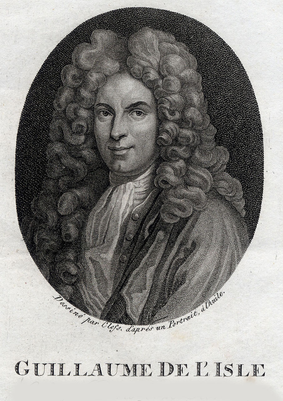 Guillaume De L'Isle (Paris, 1675 -1726 )
was one
of the most important cartographers of the early 18th century in France and removed the celestial errors that were copied from Ptolemy, and created a new and accurate celestial globe.
De L'Isle was the son of Marie Malaine and Claude De L'Isle (1644-1720), who later remarried Charlotte Millet de la Croyère after his first
wife died following childbirth. It is possible that the couple had as many as 12 children, but many of them died at a young age.
Although Claude De L'Isle had studied law, he also studied geography and history under Nicolas Sanson. He taught history and geography
and had such a good reputation in Paris’ intellectual circles that he educated lords, among them was the duke Philippe d’Orléans who later
became regent for the crown of France.
Guillaume and his two of half-brothers, Joseph Nicolas and Louis, ended up pursuing similar
careers in science.
While Claude certainly has to be given credit for Guillaume’s education, the latter showed early signs of being an exceptional talent.
He would soon contribute to the family workshop by drawing maps for his father’s historical works.
In order to perfect his skills, Guillaume De L'Isle became the student of the astronomer Jean-Dominique Cassini, who was the director of
the Paris Observatory.
Early on, he produced high-quality maps, the first of which was a manuscript map, "Carte de la Nouvelle-France et des Pays Voisins," in 1696.
As Guillaume was only twentyone years old in 1696, it is likely that his father, Claude, also a cartographer, influenced
this map.
In the year 1700, when he was but twenty-five years of age, there appeared under his name a world map and likewise maps of the several
continents and he issued the first edition of his globes, those having a diameter of about 32,5 cm. and those having a diameter of 15 cm.
These works appears to have established his reputation. In the year 1702 he became a member of the Académie des Sciences, not as a
geographer -this department was not established until the year 1730- but as an astronomer under Jean-Dominique Cassini. In fact, he had received
a joint training: one type with his father Claude, the historian/geographer for whom he prepared maps and globes, and another with
Jean-Dominique Cassini, who taught him astronomy.
It was necessarily the latter who persuaded him to use the figures of latitude and longitude set out by the Académie des Sciences, to
compile documents which would renew French cartography.
When he became a member of the Académie Royale des Scienes, he signed his maps with the title of "Géographe de l’Académie". Five years
later, he moved to the Quai de l’Horloge in Paris, a true publishing hub where his business prospered. De L'Isle’s ascension through the
ranks culminated in 1718 when he received the title of "Premier Géographe du Roi".
His new office consisted in teaching geography to the Dauphin, King Louis XIV’s son, a task for which he received a salary.
Rue des Canettes
Guillaume De L’Isle’s first printing shop was established on the "Rue des Canettes pres de St. Sulpice" in Paris. This address appears
only on editions of maps dated 1700-1707. This celestial globe dated 1700 is one of the few examples of maps and globes who were printed
at the "Rue des Canettes" shop. Most examples of his work were issued from the address where De L’Isle moved in
1707, the "Quai de L’Horloge".
A map of Piedmont dated 1707 informs us that by that date De L'Isle had moved to the "Quai de
l'Horloge à la Couronne de Diamans". The latest date on a map found bearing this address is January 1708.
In early 1708 De L'Isle changed the sign over the shop to "à l'Aigle d'Or", the golden eagle.
In 1718 he ads his newly
received title "Premier Geographe du Roy" to his address.
Maps bearing the Rue des Canettes address are the most desirable of De L’Isle’s works and are extremely rare. This is apparently the
only known example of a globe with the "Rue de Canettes" address and dated 1700.
Quai de l’Horloge
France was leading at the turn of the seventeenth century in the field of geographical and astronomical science, a fact in part due to
the generous subsidy allowed by royalty.
Many of the agents of cartography, including those involved in the creation, production and distribution of maps in Paris lived in the same
section of the capital city. Booksellers congregated along rue St-Jacques along the left bank of the Seine, while engravers and cartographers
lived along the Quai de l’Horloge on the Île de la Cité.
Regulations enacted by the communautés informed the location of the libraries.
These regulations included that each bookseller-printer was to have one shop, which had to be located in the University quarter or on the
quai de l’Horloge. These restrictions provided by easier inspection by the authorities to enforce other regulations such as: printer need to
register the number of presses they owned and any books that were printed had to be registered and approved by the royal court before it
could be sold.
Interesting reading :
- Stevenson Terrestrial and
celestial globes, volume 2.
- Dekker / van der Krogt , Globes from the Western World , pp. 70-73 . (For the terrestrial globe)
- "Les Nouvelles donations : huit musées se partagent cinquante objets précieux légués par un antiquaire français, don César de Haucke", Connaissance des Arts, n° 187, septembre 1967.
- "Splendors of Versailles", Jackson, Mississipi, 1998, n° 91.
- "Couleurs de la terre : des mappemondes médiévales aux images satellitales", Paris, Bibliothèque nationale de France, 8 octobre 1998-10 janvier 1999, p. 98-99 et 172.
- "Louis XIV, le Roi-Soleil ; trésors du château de Versailles", Pékin, Cité interdite, avril-juillet 2005, Musée de Shangaï, août-octobre 2005, cat. n°83, repr. p. 216.
- "Sciences et curiosités à la Cour de Versailles", château de Versailles, 26 octobre 2010-27 février 2011, p. 178 et 269.
FAQ - Guarantee - Shipping
Buying in the BuyNow Gallery
This item is available for immediate purchase when a "Add to Cart" or "Inquire Now" button is shown.
Items are sold in the EU margin scheme
Payments are accepted in Euros or US Dollars.
Authenticity Guarantee
 We provide professional descriptions, condition report (based on 45 years experience in the map business)
Paulus Swaen warrants the authenticity of our items and a certificate of authenticity is provided for each acquired lot.
Condition and Coloring
We indicate the condition of each item and use our unnique HiBCoR grading system in which four key items determine a map's value: Historical Importance, Beauty, Condition/Coloring and Rarity.
Color Key
We offer many maps in their original black and white condition. We do not systematically color-up maps to make them more sellable to the general public or buyer.
Copper engraved or wood block maps are always hand colored. Maps were initially colored for aesthetic reasons and to improve readability. Nowadays, it is becoming a challenge to find maps in their original colors and are therefor more valuable.
We use the following color keys in our catalog:
Original colors; mean that the colors have been applied around the time the map was issued.
Original o/l colors; means the map has only the borders colored at the time of publication.
Colored; If the colors are applied recently or at the end of the 20th century.
Read more about coloring of maps [+]
Shipping fee
A flat shipping fee of $ 30 is added to each shipment by DHL within Europe and North America. This covers : International Priority shipping, Packing and Insurance (up to the invoice amount).
Shipments to Asia are $ 40 and rest of the world $50
We charge only one shipping fee when you have been successful on multiple items or when you want to combine gallery and auction purchases.
Read more about invoicing and shipping
FAQ
Please have a look for more information about buying in the BuyNow gallery
Many answers are likely to find in the general help section.
My Collection+
![]()
With My Collection+ you can collect all your favorite items in one place. It is free, and anyone can create his or her virtual collection.
Unless you are logged in, the item is only saved for this session. You have to be registed and logged-in if you want to save this item permanently to My Collection+.
Read More[+]
Register here, it is free and you do not need a credit card.
Add this item to
My Collection+
or click the following link to see My Collection+.
| Digital Image Download | |
|
Paulus Swaen maintains an archive of most of our high-resolution rare maps, prints, posters and medieval manuscript scans. We make them freely available for download and study. Read more about free image download |
Click the image for a free small image download. |
In accordance with the EU Consumer Rights Directive and habitually reside in the European Union you have the right to cancel the contract for the purchase of a lot, without giving any reason.
The cancellation period will expire 14 calendar days from the day after the date on which you or a third party (other than the carrier and indicated by you) acquires, physical possession of the lot. To exercise the right to cancel you must inform Paulus Swaen Inc, of your decision to cancel this contract by a clear statement (e.g. a letter sent by post, or e-mail.
To meet the cancellation deadline, it is sufficient for you to send your communication concerning your exercise of the right to cancel before the cancellation period has expired.
