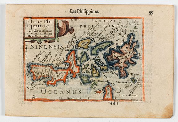
Insulae Philippinae [Philippines]
Sold
A miniature map of the Philippines, centered on Mindanao and Luzon. Title cartouche on the upper left corner. First published in 1598 in his Caert-Thresoor, the plates were executed by the most famous engravers in Amsterdam, including Petrus Kaerius and Jodocus Hondius I.An essential map for Philippine Collectors, here in stunning original colors.
The map is drawn from the Linschoten map of 1595, with its peculiar east-west orientation for Palawan, whereas the Bertius rendering is taken directly from the Plancius map of 1592, which in turn was based on Bartolomeo Lasso.
Luzon, here labeled Lucionia, dominates the left-hand portion of the map, with notable features including Manilha (Manilha), Pancvasion (Pampanga), and Siday (Zambales coast). The name Insulae Philippinae appears prominently in a decorative strapwork cartouche in the upper left corner, signifying one of the earliest printed uses of the Spanish colonial name in a map title. The atlas set a new standard for minor atlases. The small map is extremely well engraved.
The map reflects the level of cartography in Amsterdam at the turn of the century, where up-to-date information on newly discovered regions was readily available -- Koeman.
Reference: Koeman, Altantes Neerlandici, Volume II, Lan 9.
