Browse Listings
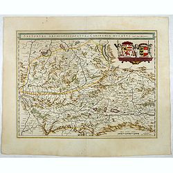
Saltzburg Archiepiscopatus, et Carinthia Ducatus.
Handsome map of the archbishopry of Salzburg and the Duchy of Carinthia.Title in banner form with two coats of arms and three cherubs decorating the map.More about maps b...
Date: Amsterdam, 1644
Selling price: ????
Please login to see price!
Sold in 2021
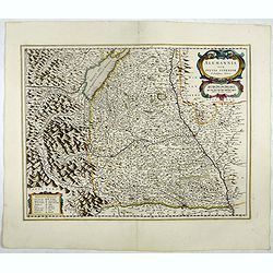
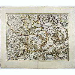
Alemannia sive Suevia Superior.
Detailed map of the Baden-Württemberg region filled with detailed information and a graphic depiction of the mountains to the east. With the Boden See in upper left corn...
Date: Amsterdam, 1644
Selling price: ????
Please login to see price!
Sold in 2019
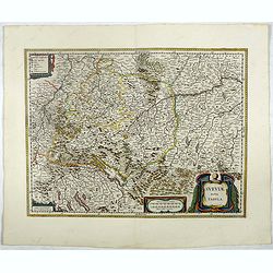
Sueviae nova tabula.
Beautiful map of Swaben, including some handsome cartouches. Cities shown include Ulm, Augsburg, Stuttgart, Zürich, Lucerne and Lake Constance.Originally, we owe the fir...
Date: Amsterdam, 1644
Selling price: ????
Please login to see price!
Sold in 2019
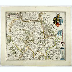
Palatinatus ad rhenum.
Detailed map of a province of Germany by one of the most famous map publishers. Covering southern part of the river Rhine. Including the towns of Frankfurt, Heidelberg. U...
Date: Amsterdam, 1644
Selling price: ????
Please login to see price!
Sold in 2017
Alpinae seu Foederatae Rhaetiae... (RAETIA)
Detailed map Graubünden Canton in Switzerland. Including Chur, Davos, St.Moritz, etc. Next to the title cartouche are St. Lucius and Rhaetus, with personifications of th...
Date: Amsterdam, 1644
Selling price: ????
Please login to see price!
Sold in 2018
Das Wiflispurgergow.
Detailed map of South-western Switzerland after Gerhard Mercator's map of the same. With ornamental title cartouche and German text on the verso.It shows Geneva, Lake Gen...
Date: Amsterdam, 1644
Selling price: ????
Please login to see price!
Sold in 2020
Argow cum parte merid. Zurichgow.
Map of the canton Argow and the southern part of Zurich based on the map by Gerard Mercator.More about maps by Willem Blaeu. [+]
Date: Amsterdam, 1644
Selling price: ????
Please login to see price!
Sold in 2018
![Zurichgow et Basiliensis Provincia [ Zurich].](/uploads/cache/39270-250x250.jpg)
Zurichgow et Basiliensis Provincia [ Zurich].
Finely engraved map including the towns of Basel, Lucerne, Zurich, etc. Physical features of the region are well delineated.More about maps by Willem Blaeu. [+]
Date: Amsterdam, 1644
Selling price: ????
Please login to see price!
Sold in 2020
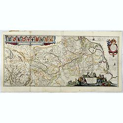
Danubius Fluvius Europae Maximus, a Fontibus ad Ostia. . .
This very large map depicts the course of the Danube River, from its sources in the Alps to the Black Sea..Because of the dimensions the map was printed from two copper p...
Date: Amsterdam, 1644
Selling price: ????
Please login to see price!
Sold in 2017
Rhenus Fluviorum Europae..
Shows the course of the River Rhine, showing parts of Switzerland, Austria, The Netherlands and part of Germany.The finest Dutch map publishers were the Blaeu family, and...
Date: Amsterdam, 1644
Selling price: ????
Please login to see price!
Sold in 2017
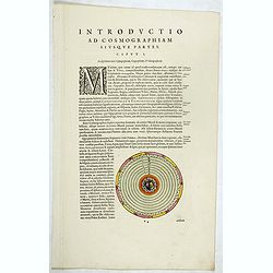
Introductio ad cosmographiam.
On each side a wood block printed Geocentric model of the Universe (130 x 130mm.) showing the Earth at the center. Under the geocentric model, the Sun, Moon, stars, and p...
Date: Amsterdam, 1644
Selling price: ????
Please login to see price!
Sold in 2017
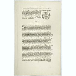
Introductio.
On the recto a celestial diagram and on the verso a climate, longitude and latitude table.
Date: Amsterdam, 1644
Selling price: ????
Please login to see price!
Sold in 2017
![[Text page with Compass card]](/uploads/cache/39276-250x250.jpg)
[Text page with Compass card]
On the recto a colored wind rose with a table of 32 winds (95 x 95mm.) On the verso a little celestial diagram.
Date: Amsterdam, 1644
Selling price: ????
Please login to see price!
Sold in 2018

Novam Hanc Territorii Francofvrtensis.
Without doubt the most elaborate map to appear in the Blaeu atlases. It features Frankfurt and its immediate environs, and is surrounded by a magnificent border containin...
Date: Amsterdam, 1644
Selling price: ????
Please login to see price!
Sold in 2017
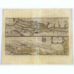
Celeberrimi Fluvis Albis nova delineatio. . .
The River Elbe is depicted in two sections from the mouth to Hamburg.
Date: Amsterdam, 1644
Selling price: ????
Please login to see price!
Sold in 2018
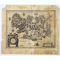
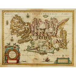
Tabula Islandiae. . .
Prepared by Georgio Carolo Flandrio. The map has a very decorative cartouche, and a very fine imprint.
Date: Amsterdam, 1639-1644
Selling price: ????
Please login to see price!
Sold in 2017
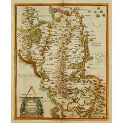
Ducatus Uplandia.
A beautifully engraved and executed map of the area of the modern Uppsala land in the vicinity of Stockholm, and includes most of Aland by Blaeu. With a Swedish coat of a...
Date: Amsterdam, ca. 1644
Selling price: ????
Please login to see price!
Sold in 2018
Ducatus Lunebur Gensis. . .
A striking map of the part of Germany that includes Hamborg, Lüneburg, Bremen, Hannover and Magdeburg. The map was based on the work of the 16th century German cartograp...
Date: Amsterdam, 1644
Selling price: ????
Please login to see price!
Sold in 2018
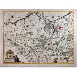
Brandeburgum Marchionatuscum Ducatibus.
A decorative map that is a part of Pomerania, Mecklenburg, Rugia and part of present Poland, with excellent detail of forests, rivers, towns and villages.Ornamented with ...
Date: Amsterdam, 1644
Selling price: ????
Please login to see price!
Sold in 2018
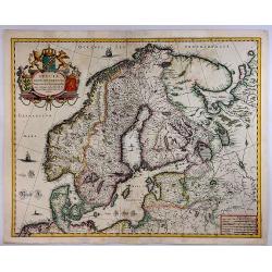
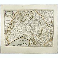
Svecia, Dania et Norvegia, Regna Europa Septentrionalia.
A striking map of the kingdoms of Sweden, Denmark and Norway (Scandinavia), attributed to Anders Bure (1571-1646), a Swedish cartographer and mathematician. Bure, also kn...
Date: Amsterdam, 1644
Selling price: ????
Please login to see price!
Sold in 2018
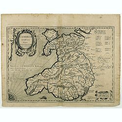
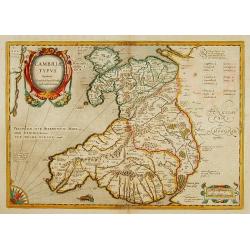
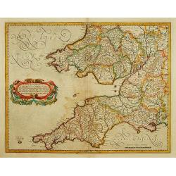
Cambriae Typus.
Ancient map of Wales, prepared by Humphrey Lhuyd. With fine cartouche, part of a compass-rose and a sea monster.No text on verso. From a French composite atlas.Read more ...
Date: Amsterdam, 1639-1644
Selling price: ????
Please login to see price!
Sold in 2018
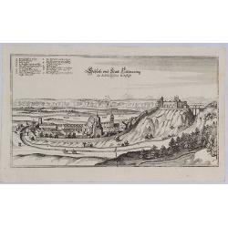
Schloss und Statt Tittmaning im Saltzburgischen Erzstifft.
A striking, highly decorative and unusual original copper engraved view of Tittmoning, a city located in Bavaria, Germany. The view shows the city with his buildings, chu...
Date: Frankfurt, ca. 1644
Selling price: ????
Please login to see price!
Sold in 2020
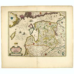
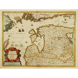
Livonia vulgo Lyefland.
Blaeu's map of Livonia, embellished with a decorative title-cartouche, vessels and 7 coats of arms.More about Willem Blaeu. [+]
Date: Amsterdam, ca. 1644
Selling price: ????
Please login to see price!
Sold in 2020
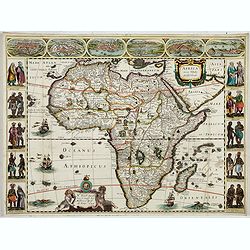
Africa nova Tabula.
Very rare map of Africa separately published. This derivative map by Nicolas Picart is based upon the second state of Janssonius' map of 1623, after the lower border had ...
Date: Paris, 1644
Selling price: ????
Please login to see price!
Sold in 2023
Udrone Irlandiae in Catherlagh Baronia.
Depicts present day County Carlow in Leinster Province & Catherlaugh which is now Carlow. The title is surrounded by a strap work design cartouche topped with caliper...
Date: Amsterdam 1639-1644
Selling price: ????
Please login to see price!
Sold
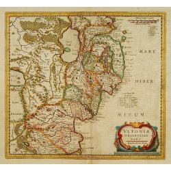
Ultoniae orientatlis pars.
Showing Northern Ireland with Lough Neagh and Belfast. Signed lower right hand corner Sumptibus Henrici Hondy.Henricus Hondius re-issued Mercator's map with a new title c...
Date: Amsterdam 1639-1644
Selling price: ????
Please login to see price!
Sold
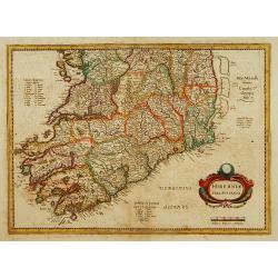
Two maps: Hiberniae pars Australis/..
Fine map of Ireland in two parts. Prepared by Mercator, published by Henricus Hondius. Mercator's name erased.
Date: Amsterdam 1639-1644
Selling price: ????
Please login to see price!
Sold
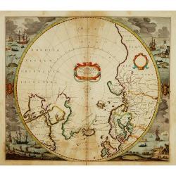
Poli Arctici et Circumiacentium Terrarum Descriptio.
A circular map showing north of Europe and United States. The map is surrounded by scenes of fishing whales.
Date: Amsterdam 1639-1644
Selling price: ????
Please login to see price!
Sold
Cambriae Typus.
Ancient map of Wales, prepared by Humphrey Lhuyd. With fine cartouche, part of a compass-rose and a sea monster.
Date: Amsterdam 1639-1644
Selling price: ????
Please login to see price!
Sold
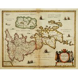
Insularum Britannicarum acurata delineatio..
A map of the Roman Britain as seen during the third and fourth centuries. Roman place names as well as Hadrian's Wall and the Wall of Pius appear on the map, identifying ...
Date: Amsterdam 1639-1644
Selling price: ????
Please login to see price!
Sold
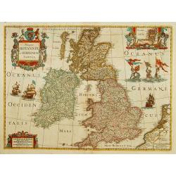
Magnae Britanniae et Hiberniae Tabula.
A finely engraved map from the most important Dutch map publishers of the 17th century.
Date: Amsterdam 1639-1644
Selling price: ????
Please login to see price!
Sold
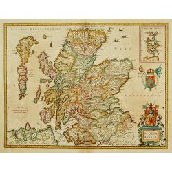
Scotia Regnum.
A attractive example of this fine map of Scotland. In upper right hand corner inset of Orkney Islands.
Date: Amsterdam 1639-1644
Selling price: ????
Please login to see price!
Sold
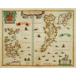
Orcadum et Schetlandiae insularum..
Two maps on one sheet. Showing the Orkney- and Shetland Islands.
Date: Amsterdam 1639-1644
Selling price: ????
Please login to see price!
Sold
Lot of 5 maps of the English counties.
Lot of 5 maps of the English counties.
Date: Amsterdam 1639-1644
Selling price: ????
Please login to see price!
Sold
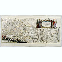
![Danubius Fluvius Europae Maximus, a Fontibus ad Ostia. [2 sheets]](/uploads/cache/16220-250x250.jpg)
Danubius Fluvius Europae Maximus, a Fontibus ad Ostia. [2 sheets]
2 sheets. Because of the dimensions the map was printed from two copper plates. Depicts the course of the river Danube and the surrounding countries from the place where ...
Date: Amsterdam 1639-1644
Selling price: ????
Please login to see price!
Sold
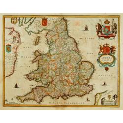
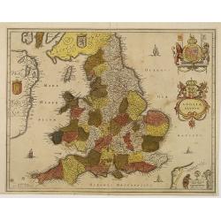
Anglia Regnum.
Janssonius' map of England and Wales was one of the new maps prepared by him in 1636. His map closely copies the similar map issued two years earlier by Willem Blaeu.. Th...
Date: Amsterdam 1639-1644
Selling price: ????
Please login to see price!
Sold
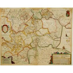
A general Plott and description of the Fennes..
Fine map depicting the area north of Cambridge, up to King's Lynn. West to the top. °
Date: Amsterdam, 1639-1644
Selling price: ????
Please login to see price!
Sold in 2011
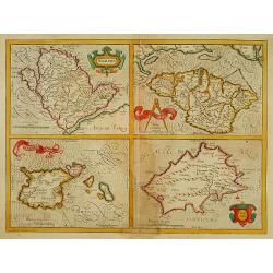
Anglesey./Iarsay./Garnesay./ Wight Vectis Olim.
Four maps on one sheet depicting the English islands Jersey, Guernsey, Wright and Alderney.
Date: Amsterdam 1639-1644
Selling price: ????
Please login to see price!
Sold
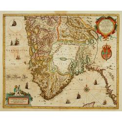
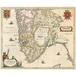
Nova ..Stavangriensis, Bergensis et Asloiensis..
Fine map of the southern part of Norway. Decorated with many ships and a compass rose.
Date: Amsterdam 1639-1644
Selling price: ????
Please login to see price!
Sold
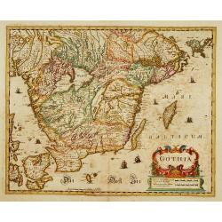
Gothia.
Southern part of Sweden including Stockholm, Uppsala, Gothenburg, Malmö. But also Copenhagen and Oslo.
Date: Amsterdam 1639-1644
Selling price: ????
Please login to see price!
Sold
Nova Totius Livoniae accurata Descriptio.
Decorative map of Estonia and Latvia. Including the southern tip of Finland and the south eastern tip of Sweden, including Stockholm.
Date: Amsterdam 1639-1644
Selling price: ????
Please login to see price!
Sold
Taurica Chersonesus...
One of the earliest detailed maps of the Crime and Ukraine.
Date: Amsterdam 1639-1644
Selling price: ????
Please login to see price!
Sold
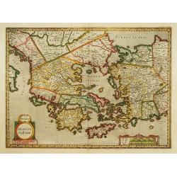
Graecia Sophiani.
Fine map of Greece based on Ortelius map. This is the second state. Imprint and date erased, sea filled with points, except for the spot where the imprint was.
Date: Amsterdam 1639-1644
Selling price: ????
Please login to see price!
Sold
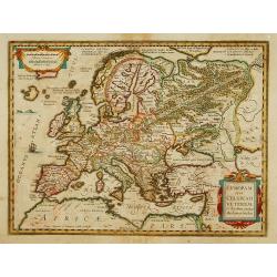
Europam sive Celticum Veterem.
Fine map of ancient Europe. Engraved by Everard Sijmonsz.van Hamersveldt.
Date: Amsterdam 1639-1644
Selling price: ????
Please login to see price!
Sold
Tabula Islandiae..
Early imprint before Blaeu bought the copper plate for his atlas. Prepared by Georgio Carolo Flandrio. The map has a very decorative cartouche. Very fine imprint.
Date: Amsterdam, 1639-1644
Selling price: ????
Please login to see price!
Sold
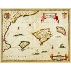
Insulae BALEARIDES et Pytissiae.
A map of Mallorca and Minorca. With Ibiza and Formentera, called the Pytuisae Islands. The coastline runs from Barcelona to Atalaia.
Date: Amsterdam 1639-1644
Selling price: ????
Please login to see price!
Sold
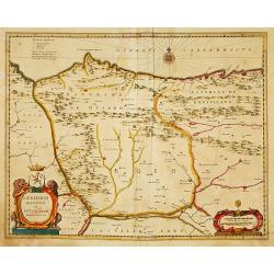
Legionis regnum et Asturiarum principatus.
Decorative map of the Spanish Province Asturias, Castile and Léon, including the towns of Oviedo, Leòn, Santander, Valladolid, etc. With two fine ti...
Date: Amsterdam 1639-1644
Selling price: ????
Please login to see price!
Sold
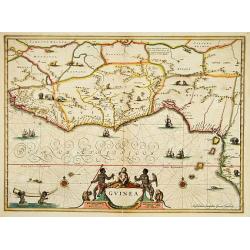
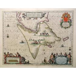
Guinea.
colorful cartouche on the lower border. Two natives sit at the sides of the title, above which is a scroll with flowers and fruit and, in the center, a very human-looking...
Date: Amsterdam, 1644
Selling price: ????
Please login to see price!
Sold in 2008
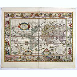
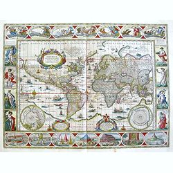
Nova Totius Terrarum Orbis Geographica Ac Hydrographica Tabula auct Guiljelmo Blaeuw.
Sought-after world map by one of the most famous Dutch mapmakers. The paneled borders show, at the top allegorical representations of the sun, moon and the five known pla...
Date: Amsterdam, 1644
Selling price: ????
Please login to see price!
Sold in 2017
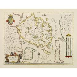
Fionia vulgo Funen
Fine map of Fyn, Langeland and Alsen decorated with three cartouches and a sailing ships.
Date: Amsterdam 1644
Selling price: ????
Please login to see price!
Sold
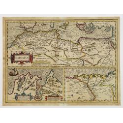
BARBARIA.
Charming map of the whole of North Africa and the famed Barbary coast. Two large insets at bottom, Carthaginensis Sinus with the city of Tunis, and a map of the Nile Delt...
Date: Amsterdam 1639-1644
Selling price: ????
Please login to see price!
Sold
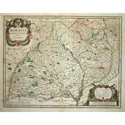
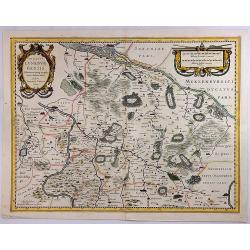
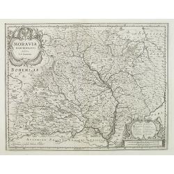
Moravia Marchionatus Auctore I.A. Comenio
Attractive map of the historic Moravia region of the Czech Republic roughly centered on the city of Olomouc (Olmutz). Finely engraved with mountains, forests and even the...
Date: Amsterdam 1644
Selling price: ????
Please login to see price!
Sold
A general Plott and description of the Fennes..
Fine map depicting the area north of Cambridge, up to Kings Lynn. West to the top.
Date: Amsterdam 1639-1644
Selling price: ????
Please login to see price!
Sold in 2008

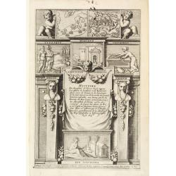
Titlepage: Histoire du Mareschal de Toiras..
Frontispiece from Histoire du Mareschal de Toiras, ou se Voyent les Effets de la Valeur et de la Fidélité : avec ceux de l'Envie et de la Jalousie de la Cour, ennemies ...
Date: Paris 1644
Selling price: ????
Please login to see price!
Sold
![[Text page] Histoire du Mareschal de Toiras..](/uploads/cache/22367-250x250.jpg)
[Text page] Histoire du Mareschal de Toiras..
Page from Histoire du Mareschal de Toiras, ou se Voyent les Effets de la Valeur et de la Fidélité : avec ceux de l'Envie et de la Jalousie de la Cou...
Date: Paris 1644
Selling price: ????
Please login to see price!
Sold
Titlepage: Histoire du Mareschal de Toiras..
Rare title page from Histoire du Mareschal de Toiras, ou se Voyent les Effets de la Valeur et de la Fidélité : avec ceux de l'Envie et de la Jalousie de la Cour, ennemi...
Date: Paris 1644
Selling price: ????
Please login to see price!
Sold
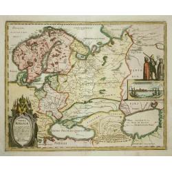
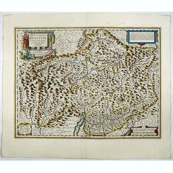
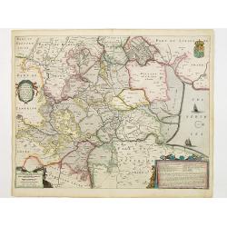
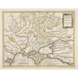
Tabula Russiae? Moscovia
An attractive map of the region including all of Scandinavia through to the Black and Caspian Seas. The map is based on Hessel Gerritsz' rare and significant map of Russi...
Date: Francfurt, 1644
Selling price: ????
Please login to see price!
Sold
Dioecesis Stavangriensis.
Stavanger by Blaeu. Latin text on verso.
Date: Amsterdam, 1640-1644
Selling price: ????
Please login to see price!
Sold in 2009
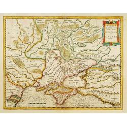
Taurica Chersonesus.
One of the earliest detailed maps of the Crimea and Ukraine between the northern coast of the Black Sea and Moscow in Russia.With the signature of Gerard Mercator in lowe...
Date: Amsterdam, 1639-1644
Selling price: ????
Please login to see price!
Sold in 2009
Nova Totius Terrarum Orbis Geographica Ac Hydrographica Tabula auct Guiljelmo Blaeuw.
Sought-after world map by one of the most famous Dutch mapmakers. The paneled borders show, at the top allegorical representations of the sun, moon and the five known pla...
Date: Amsterdam, 1644
Selling price: ????
Please login to see price!
Sold in 2018
Anglia Regnum.
Janssonius' map of England and Wales was one of the new maps prepared by him in 1636. His map closely copies the similar map issued two years earlier by Willem Blaeu.The ...
Date: Amsterdam, 1639-1644
Selling price: ????
Please login to see price!
Sold in 2012
Moravia Marchionatus Auctore I.A. Comenio
Attractive map of the historic Moravia region of the Czech Republic roughly centered on the city of Olomouc (Olmutz). Finely engraved with mountains, forests and even the...
Date: Amsterdam, 1644
Selling price: ????
Please login to see price!
Sold in 2010
Dioecensis Stavangriensis, Apud Joh. et Cornel. Blaeu.
Fine decorative map of southern Norway from 61 deg. N. Oslo, Stavanger and Bergen prominently shown. The map presents a vivid view of the fjords and mountains topography ...
Date: Amsterdam, 1644
Selling price: ????
Please login to see price!
Sold
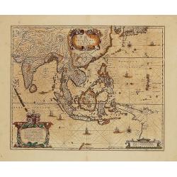
India quae Orientalis dicitur...
Map of South East Asia showing the area between India in the West and parts of Japan, the Marianas and New Guinea/Australia in the East. Copper engraving in original colo...
Date: Amsterdam, c. 1644
Selling price: ????
Please login to see price!
Sold in 2014
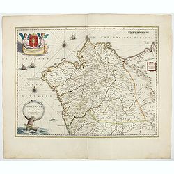
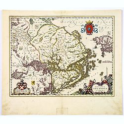
Gallaecia Regnum / descripta a F. Fer. Ojea Ord. praed. et postmodum multis in locis emandata et aucta.
A beautiful map of Galicia in north western Spain, decorated with finely engraved wind roses, sailing boats, a triton [supporter of the God Neptune] as bearer of the titl...
Date: Amsterdam, 1644
Selling price: ????
Please login to see price!
Sold in 2020
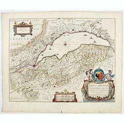
Lacus Lemanni Locorumque circumiacentium Accuratissima descriptio.
From the 1644 edition of Blaeu's Atlas Novus. RARE.A fabulous map depicting row boats and sailing vessels dotting the surface of Lake Geneva, which is further enchanted b...
Date: Amsterdam, 1644
Selling price: ????
Please login to see price!
Sold in 2021
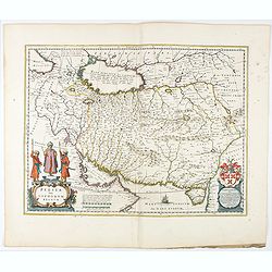
Persia sive Sophorum Regnum.
A finely designed map from the great Blaeu family of Amsterdam. With decorative title cartouche. The cartouches and decorations are colored artistically.There are very g...
Date: Amsterdam, 1644
Selling price: ????
Please login to see price!
Sold in 2021
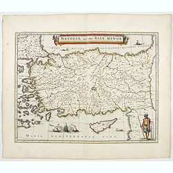
Natolia, quae olim Asia minor.
A finely designed map of Turkey and Cyprus from the great Blaeu family of Amsterdam.As Willem Blaeu died in 1638 most of his maps are actually published by his son Joan. ...
Date: Amsterdam, 1644
Selling price: ????
Please login to see price!
Sold in 2023
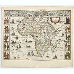
Africae nova descriptio.
Much of the geographical information is still based on the Ptolemaic maps, with the Nile shown with its source in the Lakes Zaire and Zaflan. Also included are various ot...
Date: Amsterdam, 1644
Selling price: ????
Please login to see price!
Sold in 2021
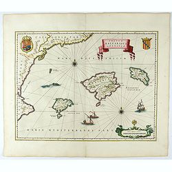
Insulae Balearides et Pytiusae.
A map of Mallorca and Minorca and with Ibiza and Formentera, called the Pytuisae Islands, with the coastline from Barcelona to Denia.From an incomplete example of the 164...
Date: Amsterdam, 1644
Selling price: ????
Please login to see price!
Sold
![[Title page from ] Le Theatre du Monde ou le nouvel atlas mis en lumière par Guillaume et Jean Blaeu.](/uploads/cache/47921-250x250.jpg)
[Title page from ] Le Theatre du Monde ou le nouvel atlas mis en lumière par Guillaume et Jean Blaeu.
Frontispiece of the second part of this fine atlas. At top, a coat of arms surmounted by a crown and surrounded by two golden chains, the bigger carrying a pendant which ...
Date: Amsterdam, 1644
Selling price: ????
Please login to see price!
Sold in 2023
Nova Europae Descriptio Auctoro Hondio.
Very rare map of Europe separately published. The first derivative of the map was issued separately by Hondius in 1618. This example is based upon the second state of Jan...
Date: Paris, 1644
Selling price: ????
Please login to see price!
Sold in 2023
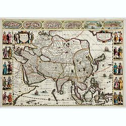
Asia recens Summa cura delineata.
Very rare map of Asia separately published. Derivative map by Picart of Hondius' rare separately issued map of 1618, with the lower panels removed. Surrounded with three ...
Date: Paris, 1644
Selling price: ????
Please login to see price!
Sold in 2023
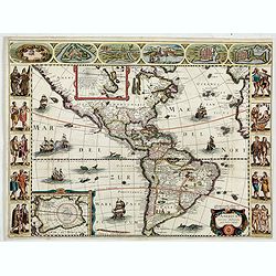
America noviter delineata.
Very rare map of America separately published. This derivative map by Nicolas Picart is based upon the second state of Janssonius' map of 1623, after the lower border had...
Date: Paris, 1644
Selling price: ????
Please login to see price!
Sold in 2023
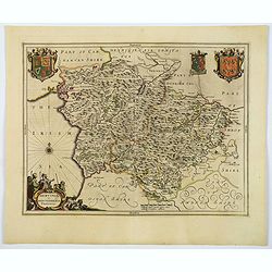
Mervinia et Montgomeria Comitatus.
A decorative Welsh counties map by Jan Jansson, published in Amsterdam during the first half of the seventeenth century. It shows the mid-western Welsh counties of Merion...
Date: Amsterdam, ca 1645
Selling price: ????
Please login to see price!
Sold in 2020
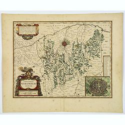
Territorium Norimbergense.
A lovely Blaeu map centered on Nuremberg the capital of the printing shop of Homann. Lower right hand corner has a delightful inset plan of Nuremberg, with a key above to...
Date: Amsterdam, 1645
Selling price: ????
Please login to see price!
Sold in 2020
![Perchensis Comitatus [together with] Comitatus Blesensis.](/uploads/cache/44784-250x250.jpg)
Perchensis Comitatus [together with] Comitatus Blesensis.
Two maps on one sheet, each with its own decorative title cartouche. These maps detail the region of the Loire River. Perchensis includes the cities of Mortagne, Nogent-l...
Date: Amsterdam , ca 1645
Selling price: ????
Please login to see price!
Sold in 2021
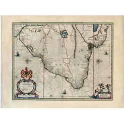
Brasilia.
An important map of Brazil by the famous Dutch publishing house of Blaeu.
Date: Amsterdam, 1645
Selling price: ????
Please login to see price!
Sold in 2019
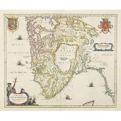
Tabula Magellanica Qua Tierrae del Fuego.
A magnificent map of Patagonia & Magellanica, in contemporary color. By far the most decorative map of the region. This map reveals many images of indigenous peoples,...
Date: Amsterdam, 1645
Selling price: ????
Please login to see price!
Sold in 2019
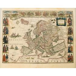
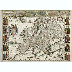
Europa recens descripta.
A classic carte-de-figures map of Europe produced during the golden age of the Dutch mapmaking. The map shows the entirety of Europe, as well as Northern Africa, Iceland,...
Date: Amsterdam, ca. 1645
Selling price: ????
Please login to see price!
Sold in 2019