Browse Listings
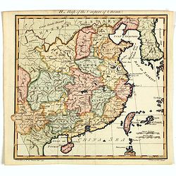
A Map of the Empire of China.
An attractive and uncommon map of China from Trusler's multi-volume work, "The Habitable World Described". In his Description of China, Trusler relied on the wr...
Date: London, 1788
Selling price: ????
Please login to see price!
Sold in 2020
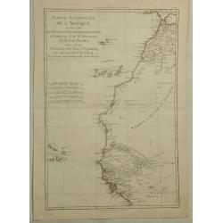
Partie Occidentale de L'Afrique. . .
A map of the north-western coast of Africa including the Canary Islands, by Bonne and Desmarest, published in the 1787 “Atlas Encyclopedique.”Rigobert Bonne (1727–1...
Date: Paris, 1788
Selling price: ????
Please login to see price!
Sold in 2019
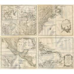
General Karte von Nord America samt den Westindischen Inseln Verfasst von Herrn Pownall.
A monumental map of North America, depicted shortly after the American Revolution. Printed on four sheets, not joined. Insets: Baffin & Hudson Bay. Engraver: J. Steng...
Date: Wien, 1788
Selling price: ????
Please login to see price!
Sold in 2019
![[Title page] Allgemeiner Grosser Atlass . . .](/uploads/cache/45001-250x250.jpg)
[Title page] Allgemeiner Grosser Atlass . . .
Title page of Grosser Atlass. Franz Anton Schraemble (1751-1803), was a Austrian cartographer. He is well known for his "Allgemeiner deutscher Atlas aller Länder&qu...
Date: Vienna, ca. 1788
Selling price: ????
Please login to see price!
Sold in 2023
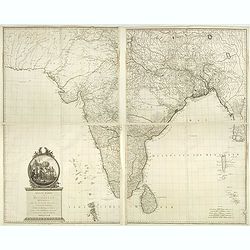
Neueste Karte von Hindostan, Bengalen etc. . .
Wall map of the Indian sub-continent after James Rennell, with large title cartouche of Britannia, native figures, a soldier and a merchant. Published by F. A. Schraembl...
Date: Vienna, 1788
Selling price: ????
Please login to see price!
Sold in 2019
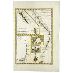
Australia, Van Diemen's Land, New South Wales, Queensland; Bonne / Desmarest - N.lle Galles Merid.le ou Cote Orientale de la Nouvelle Hollande . . .
Five maps in one sheet, showing coasts and natural ports of Australia. Folded as issued.
Date: Paris, 1788
Selling price: ????
Please login to see price!
Sold in 2020
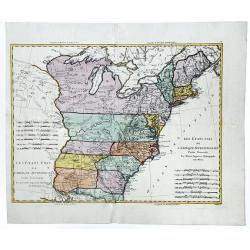
Les Etats-Unis de L'Amerique Septentrionale.
A detailed map of the region bounded by New England, Florida, Mississippi river, Louisiana and the Great Lakes of Canada. Includes towns, mountains, rivers, lakes, Indian...
Date: Paris, 1788
Selling price: ????
Please login to see price!
Sold in 2020
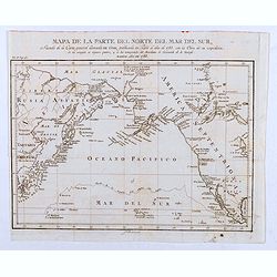
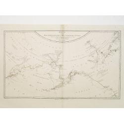
Mapa de la Parte del Norte del Mar del Sur, Sacado Dela Carta General Llamada de Cook, Publicada en Paris el Año de 1785. . .
Map of the Northern Part of the Pacific Ocean, taken from the "General Letter of Cook's Call. Published in Paris in the Year of 1785. With the Work of his Expedition...
Date: Madrid, 1788
Selling price: ????
Please login to see price!
Sold in 2020
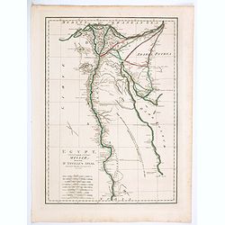
Egypt, Called in the Language of the Country Missir drawn from D'Anville's Atlas.
A map of Egypt after the French cartographer d'Anville, showing the Nile from source, south to Aswan. Quite detailed either side of the Nile and up in the Nile Delta to t...
Date: London, 1788
Selling price: ????
Please login to see price!
Sold in 2020
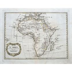
L'Africa divisa nelle sue principali parti.
A rare Italian map, published by Carli Pazzini in Siena. It shows the African continent with place names along the coasts, but large blank interior parts. Curious large l...
Date: Siena, 1788
Selling price: ????
Please login to see price!
Sold in 2020
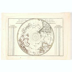
Mappe-Monde, sur le plan de l'Equateur, Hemisphere Septentrional.
An attractive small double-page hemisphere map on a (north) polar projection from the North Pole down to the Equator. From the Atlas Encyclopédique contenant la Géograp...
Date: Paris, 1788
Selling price: ????
Please login to see price!
Sold in 2021
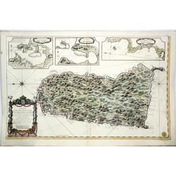
Carte de L'Isle de Sainte Lucie. Dressee au Depost des Cartes et Plans de la Marine. . .
A well engraved and highly detailed nautical chart of the island of Saint Lucia in Caribbean. It shows soundings, anchorage's, channels, shoals, navigational sightings. U...
Date: Paris, 1788
Selling price: ????
Please login to see price!
Sold in 2021
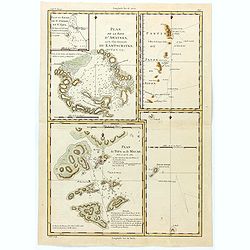
Plan de la Baye d'Awatska sur la Cote du Kamschatka
An interesting map of several countries along the east coast of Asia. In addition to Kamchatka, it includes Partie du Japon ou Nippon, Plan du Typa ou de Macao, Plan du H...
Date: Paris, 1788
Selling price: ????
Please login to see price!
Sold in 2023
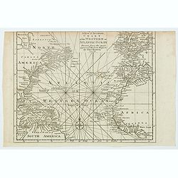
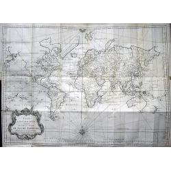
A New & Accurate Chart of the Western or Atlantic Ocean.
A map from 'Middleton's Complete System of Geography', from the Arctic Ocean in the north, south to the top of South America and across to the Slave Coast of Africa. Fro...
Date: London, 1788
Selling price: ????
Please login to see price!
Sold in 2021
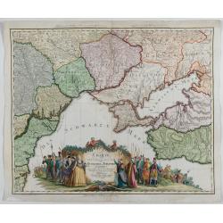
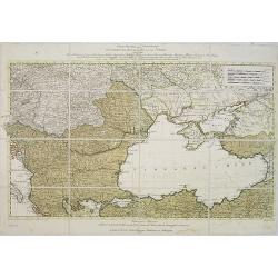
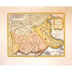
Charte von den oberhalb und seitwärts dem Schwarzen Meere gelegenen Russischen und Türkischen Ländern …
Very rare and detailed map of the black sea region, including parts of Ukraine, Turkey and Poland. In the lower part, a color key. Beautiful tittle cartouche with Empress...
Date: Berlin, 1788
Selling price: ????
Please login to see price!
Sold in 2023
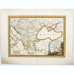
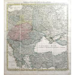
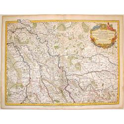
L'Ungheria e la Turchia Europea. . .
Cassini's beautiful map of Greece and the Balkans, but also including parts of Germany, today's Ukraine and Italy. It shows the eastern Mediterranean, the Gulf of Venice ...
Date: Rome, 1788
Selling price: ????
Please login to see price!
Sold in 2023
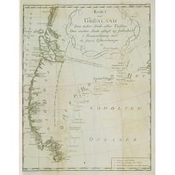
Kort over Gronland ..
Uncommon map of Greenland from: Efterretninger om Grønland, uddragne af en Journal holden fra 1721 til 1788.Prepared by Paul Egede, who was the son of the Lutheran missi...
Date: Copenhagen 1788
Selling price: ????
Please login to see price!
Sold
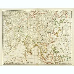
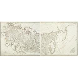
Carte d'Asie..
Detailed map of Asia with inset map of Siberia and the east coast of America.
Date: Paris, 1788
Selling price: ????
Please login to see price!
Sold
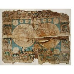
Carte Generale de la Terre ou Mappe Monde avec les quatres principaux systemes..
Uncommon and dramatically composed world map, prepared by Clouet..Two mythological figures supporting the two hemispheres.With superb decoration including a wonderful roc...
Date: Paris, 1788
Selling price: ????
Please login to see price!
Sold
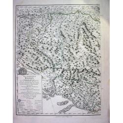
Das Koenigreich Bosnien, und die Herzegovina (Rama)
Large copper-engraved wallmap showing Bosnia and Herzegovina, large parts of Dalmatia, the Republic of Dubrovnik, parts of Croatia, Slavonia, Serbia, Albania and Macedoni...
Date: Vienna, 1788
Selling price: ????
Please login to see price!
Sold
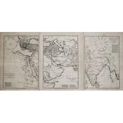
Imperia Antiqua. Pars Occidentalis/ Pars Media/ Pars Orientalis.
Rigobert Bonne (1727-1795), French cartographer. His maps are found in a.o. Atlas Moderne (1762), Raynal's Histoire Philos. du Commerce des Indes (1774) and Atlas Encyclo...
Date: Paris, 1787-1788
Selling price: ????
Please login to see price!
Sold
Karte von den N.W.Amerikanische und N.O.E. Asia..
German edition of Cook's explorations along the NW Coast of America and NE Coast of Asia, based upon the original work by Lieutenant Henry Roberts.A detailed large-scale ...
Date: Vienna 1788
Selling price: ????
Please login to see price!
Sold in 2008
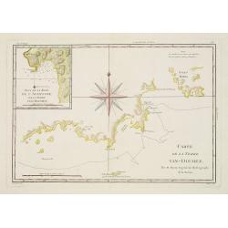
Carte de la Terre Van-Diemen.
Handsome chart of the southern coast of Tasmania with a detailed inset "Plan de la Baye de l'Aventure sur la Terre Van-Diemen." The chart is centered on a large...
Date: Paris 1787-1788
Selling price: ????
Please login to see price!
Sold
![Karte von Italien Verfasst von Herrn D' Anville.. [2 sheets]](/uploads/cache/22196-250x250.jpg)
Karte von Italien Verfasst von Herrn D' Anville.. [2 sheets]
Large two-sheet map of Italy, covering the entire peninsula, from the Alps as far as Apulia. It shows also Sicily, Sardinia, Corsica, Malta, Part of the Tunisian coast, I...
Date: Vienna 1788
Selling price: ????
Please login to see price!
Sold
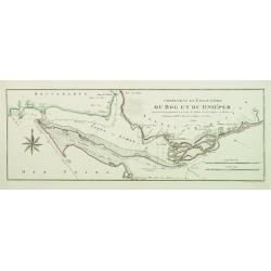
Confluent et Embouchure du Bog et du Dniéper..
Showing the mouth of the river Dnieper and the Black Sea, with border lines for the year 1787 and 1788 during the Russian, Turkish War.
Date: Vienna, c.1788
Selling price: ????
Please login to see price!
Sold
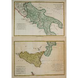
Partie Septentrionale du Royaume de Naples / Partie Méridionale du Royaume de Naples et celui de 'l' Isle de Sicile.
Rigobert Bonne (1727-1795), French cartographer. His maps are found in a.o. Atlas Moderne (1762), Raynal's Histoire Philos. du Commerce des Indes (1774) and Atlas Encyclo...
Date: Paris, 1787-1788
Selling price: ????
Please login to see price!
Sold in 2019
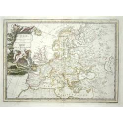
L' Europa Secondo Le ultime osservazioni divisa ne' suoi Stati Principali
Uncommon Italian map of Europe with considerable detail of both topography and place names. The large title cartouche features the allegorical female representation of Eu...
Date: Rome, 1788
Selling price: ????
Please login to see price!
Sold

Italia Vetus
Rigobert Bonne (1727-1795), French cartographer. His maps are found in a.o. Atlas Moderne (1762), Raynal's Histoire Philos. du Commerce des Indes (1774) and Atlas Encyclo...
Date: Paris, 1787-1788
Selling price: ????
Please login to see price!
Sold
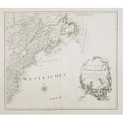
Generalkarte von Nord America samt den Westindischen Inseln . . .
Map of the North American coastal states from New Scotland to Pennsylvania. Sheet 20 of Schraembl's "Allgemeiner Grosser Atlas", this is one of the first maps i...
Date: Vienna, 1788
Selling price: ????
Please login to see price!
Sold in 2020
![[General map of the North American Caribbean Islands].](/uploads/cache/26128-250x250.jpg)
[General map of the North American Caribbean Islands].
General map of the Caribbean Islands, and part of the South American coast. Scale cartouche on the lower right corner.Sheet 23 of Schraembl's "Allgemeiner Grosser At...
Date: Vienna, 1788
Selling price: ????
Please login to see price!
Sold in 2008
![[Map of North West America with Great Lakes region.]](/uploads/cache/26129-250x250.jpg)
[Map of North West America with Great Lakes region.]
Map of New Mexico, Louisiana, parts of Georgia, North Carolina and the Michigan lakes. Inset map of Baffin and Hudson Bay.Sheet 21 of Schraembl's "Allgemeiner Grosse...
Date: Vienna, 1788
Selling price: ????
Please login to see price!
Sold in 2017

Select Views in Great Britain. Engraved by S. Middiman, from Pictures and Drawings by the most eminent Artists. With descriptions
36 engraved plates by Samuel Middiman. Between the plates a text leave with french and english description. Plates are dated 1784 - 1788. Copper-engraved calligraphic tit...
Date: London, 1788
Selling price: ????
Please login to see price!
Sold in 2009
Cartes des voyages [with 71 maps.
Superb atlas made for Prevost d'Exiles' Abrege de l'Histoire Generale des Voyages, consisting of 71 (mostly folding) maps by the French cartographer Nicolas Bellin. The m...
Date: Paris, 1746-1788
Selling price: ????
Please login to see price!
Sold in 2009

Pirogue du port des français. / Pirogue, trouvée au port des français.
From Atlas du Voyage de la Pérouse.Lituya Bay is a fjord located on the coast of the Southeast part of the U.S. state of Alaska. The bay was noted in 1786 by Jean-Franç...
Date: Paris, 1788
Selling price: ????
Please login to see price!
Sold in 2010
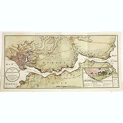
Kriegstheater oder graenzkarte Oestereichs, Russland,. . .
Uncommon map of the northern part of Turkey, Sea of Marmora, Black Sea, Hungary, Bosnia, Serbia and Caucasus.The map is in contemp. color, each color indicating the posse...
Date: Vienna, 1788
Selling price: ????
Please login to see price!
Sold in 2009
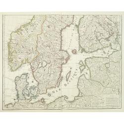
Carte des Courones du Nord comprenant la Suede, le Danemarc, &c. . .(2 maps)
Large and detailed map of Scandinavia after de l´Isle, G. It shows Norway, Sweden, Finland, Denmark and part of Russia.With a brilliant figurative armorial cartouche. 2-...
Date: Paris, 1788
Selling price: ????
Please login to see price!
Sold in 2018
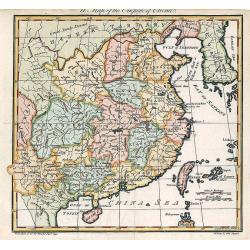
A Map of the Empire of China.
An attractive and uncommon map of China from Trusler's multi-volume work, "The Habitable World Described".
Date: London, 1788
Selling price: ????
Please login to see price!
Sold in 2018
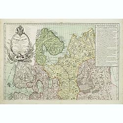
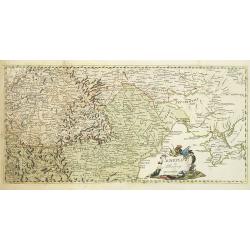
Carte générale de l'Empire de Russie comprise en Europe, pour l'intelligence de la guerre présente entre l'Impératrice de toutes les Russies et le Turc. . .
Uncommon and detailed map of the northern part of European Russia, Finland and Lapland with an ornamental title cartouche in the upper left corner. Prepared by Maurille A...
Date: Paris, 1788
Selling price: ????
Please login to see price!
Sold in 2011
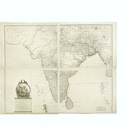
Neueste Karte von Hindostan, Bengalen etc. . .
Wall map of the Indian sub-continent after James Rennell, with large title cartouche of Britannia, native figures, a soldier and a merchant. Published by F. A. Schraembl ...
Date: Vienna, 1788
Selling price: ????
Please login to see price!
Sold
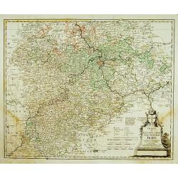
Charte das Erzstift u. Churfürstenthum Trier. . .
Centered on Trier. Prepared by F.L.Güssefeld. °
Date: Nuremberg, 1789
Selling price: ????
Please login to see price!
Sold in 2011

(Title page) Atlas Géographique et Universel par Guil.DeLisle et Phil. Buache Premiers Géographes De l'Académie des Sciences..
Dramatic title page engraved for Atlas Géographique.. published by Dezauche, as successors to De l'Isle & Buache.
Date: Paris, 1789
Selling price: ????
Please login to see price!
Sold in 2013
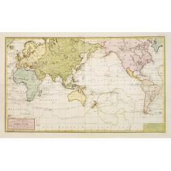
Generalkarte sämtlicher Entdeckungen..
An interesting world map centred on Australia depicting the 3 voyages of Capt. Cook. The southern coast of New Holland in outline joining van Diemen Land. Japan is shown ...
Date: Vienna 1789
Selling price: ????
Please login to see price!
Sold
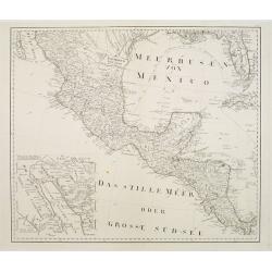
No title: Mexico & Central America.
A scarce Austrian map based on the important Bowen & Gibson map of North America and the West Indies (Sayer & Bennett 1783 edition). Covers Mexico southward from ...
Date: Vienna 1789
Selling price: ????
Please login to see price!
Sold
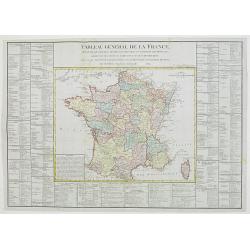
Tableau général de la France,..
Uncommon map of France, with inset map of Corsica. Surrounded by geographical information for each department along with useful statistical information.Prepared by Louis ...
Date: Paris, 1789
Selling price: ????
Please login to see price!
Sold in 2012
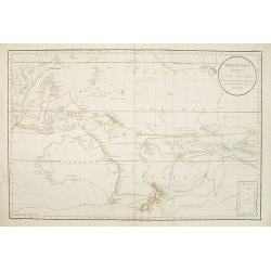
Polynesien (Inselwelt) oder der Fünfte Welttheil Verfasst von Herrn Djurberg. . .
One of the first maps to use the name Ulimaroa, originally published in Sweden in 1780. In the first state, it was the first map to use the Maori term Ulimaroa for Austra...
Date: Vienna, Schraembl, 1789
Selling price: ????
Please login to see price!
Sold in 2008
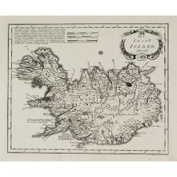
Die Insel Island Nro. 76.
An attractive map of Iceland based on the unpublished Knoff survey. The map locates villages and churches and graphically delineates the mountains, rivers, lakes and fore...
Date: Vienna, 1789
Selling price: ????
Please login to see price!
Sold in 2016
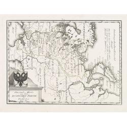
General = Karte von dem Russischen Reiche in Europa Nr. 60
Map of the European part of Russia, with a nice representation of coat of arms. Published by Franz Johann Joseph von Reilly, 1766-1820, who was a Viennese art dealer who ...
Date: Vienna, 1789
Selling price: ????
Please login to see price!
Sold in 2009
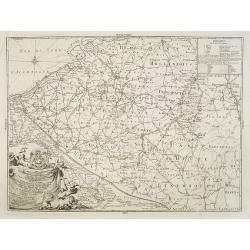
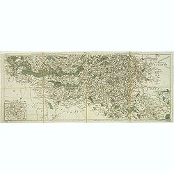
Carte générale des bureaux et ténances des Postes des Pays- Bas Autrichiens: dediée à Son Altesse Monseigneur Charles-Anselme, Prince de la Tour et Tassis et du St Empire, . . .
Postal route map of present-day Belgium and Dutch Brabant during Austrian occupation, prepared by Jean Baptiste de Bouge (1757-1833). Engraved by Philippe-Joseph Maillart...
Date: Brussels, 1789
Selling price: ????
Please login to see price!
Sold in 2013
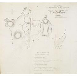
Sketch of Sydney Cove, Port Jackson in the County of Cumberland, New South Wales, July 1788.
Shows Sydney Cove with soundings and seven of the First Fleet ships at anchor: Sirius as guard ship at the mouth of the cove. It shows the positions of temporary and perm...
Date: London, 1789
Selling price: ????
Please login to see price!
Sold in 2010
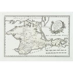
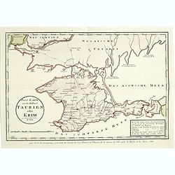
Special karte von dem königreiche Taurien oder der Haldinsel Krim. Nro. 61.
Clear engraving of Crimea, from Reilly's Postal Atlas, 1791. Including the cities of Praghtschisarai, Theodosia. The post road mapspost routes are indicated.
Date: Vienna, 1789
Selling price: ????
Please login to see price!
Sold in 2018
Carte de l'Empire de Russie. (2 maps)
Detailed map of Russia in two sheets, published at the outbreak of the French Revolution. Taken from the Atlas Géographique, published by Jean-Claude Dezauche (active 17...
Date: Paris, c. 1789
Selling price: ????
Please login to see price!
Sold in 2014
Schauplatz des Türkenkriegs von MDCCLXXXIX.
Map showing the region of the east of Europe including Crimea, Romania, Moldova, Hungary, Serbia. Nice cartouche, rare map.
Date: Germany, 1789
Selling price: ????
Please login to see price!
Sold in 2010
Charte von Ungarn Polen, Russland und der Turkey...
Exceptional folding map of Eastern Europe including the Black Sea published by the Schneider-Weigel firm in Nuremberg, Germany. Includes the countries of Greece, Bulgaria...
Date: Nuremberg, 1789
Selling price: ????
Please login to see price!
Sold in 2010
Nouvelle carte chorographique des Pays-Bas autrichiens.
COMPLETE Wall map of the Southern Low Countries (or Austrian Netherlands) published in 1789, composed of 16 leaves, each map ca. 320x395mm. and bound together.First map w...
Date: Bruxelles, 1789
Selling price: ????
Please login to see price!
Sold
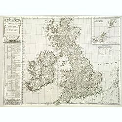
Carte des isles britanniques. . .
A charming map of England, based on a map of Thomas Kitchin. Published by Charles François Delamarche (1740-1817). As successor to the great DeVaugondy, the French publi...
Date: Paris, 1789
Selling price: ????
Please login to see price!
Sold in 2011
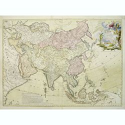
L'Asie divisée en ses regions et etats et subdivisée en ses principales parties. . .
Interesting wall map of Asia, with a decorative title cartouche upper right corner, showing Adam and Eve. The map is of interest for the use of East Sea, the sea between ...
Date: Paris, 1789
Selling price: ????
Please login to see price!
Sold in 2020
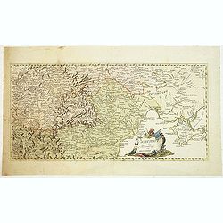
Les environs de Neufchateau, Virton, Montmedy. . .Les environs de Luxembourg, Arlon, Thionville.
Map of the east of France and Luxembourg.The map was prepared by Jean Baptiste de Bouge (1757-1833), who prepared one of the first very detailed maps of Belgium.Map 7 and...
Date: Bruxelles, 1789
Selling price: ????
Please login to see price!
Sold in 2012
Schauplatz des Türkenkriegs von MDCCLXXXIX.
Map showing the War scene region if the east of Europe including Crimea, Romania, Moldova, Hungary, Serbia during the year 1789 when the Austrians capture Belgrade from t...
Date: Austria, ca.1789
Selling price: ????
Please login to see price!
Sold in 2012
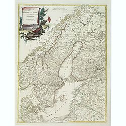
Teatro Della Guerra Nel Nord Tra La Russia, Svezia E Danimarca.
A large map of Scandinavia with the title contained within a martial cartouche. The war the map title refers to was waged from 1788-1790 between Russia and Sweden which e...
Date: Venice, 1789
Selling price: ????
Please login to see price!
Sold in 2012
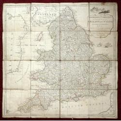
The Traveller's Companion or the Post roads of England and Wales: With the Distances in Measured Miles By the late John Rocque Chorographer to the King and it is laid on linen in sixteen sections.
Linen-backed folding map of England and Wales by John Rocque published by Robert Sayer of No 53 Fleet Street London. This map is the Robert Sayer published map of 1789 no...
Date: London, 1789
Selling price: ????
Please login to see price!
Sold in 2013
Die Landschaft Romanien, No 16.
Detailed copperplate map featuring parts of Turkey and Southern Bulgaria. Included is Constantinopel. Joseph von Reilly (1766 – 1820) was a Viennese art dealer who tu...
Date: Vienna, 1789
Selling price: ????
Please login to see price!
Sold in 2016
Les Duches de Cleves de Juliers, de Limbourg.
Striking large copper engraved map featuring Rhineland Germany and the Netherlands. Very decorative, large, figural cartouche. Detailed presentation of cities, towns, riv...
Date: Paris, 1789
Selling price: ????
Please login to see price!
Sold in 2016
Polynesien (Inselwelt) oder der Fünfte Welttheil Verfasst von Herrn Djurberg. . .
One of the first maps to use the name Ulimaroa, originally published in Sweden in 1780. In the first state, it was the first map to use the Maori term Ulimaroa for Austra...
Date: Vienna, Philipp Josef Schalbacher, 1789
Selling price: ????
Please login to see price!
Sold in 2013
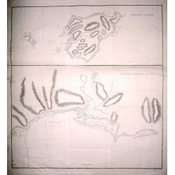
Norfolk Island ; S. end of Norfolk Island.
Norfolk Island ; S. end of Norfolk Island by W. Bradley delin. 1788. Published by J Stockdale August 10th 1789 printed by W. Harrison & J. Reid sc. Map of Norfolk Isl...
Date: London, 1789
Selling price: ????
Please login to see price!
Sold in 2014
Plan de Constantinople et du Bosphore: pour servir de renseignement à la carte des limites des trois empires, ou théatre de la guerre présente, 1788.
Detailed map of the Bosporus, with inset map "Plan du Serrail", 7 x 16 cm. Scale: [Ca. 1:60 000]. Prepared by François Joseph Maire (Vienna, 1738 - c.1800). F....
Date: Vienna, 1788-1789
Selling price: ????
Please login to see price!
Sold in 2014
Post Karte von der Halbinsel Taurien oder Krim 1788.
Detailed map of the Crimean Island. Prepared by François Joseph Maire (Vienna, 1738 - c.1800). F.J. Maire was a publisher, geographer and engineer active in Vienna. He p...
Date: Vienna, 1788-1789
Selling price: ????
Please login to see price!
Sold in 2014
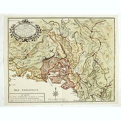
Carte de la partie d'Albanie occupée par le Bacha de Scutari. . . - Karte des Theils von Albanien so der Bascha von Scutari in besitze hat. . .
Detailed map of Albania. Prepared by François Joseph Maire (Vienna, 1738 - c.1800). F.J. Maire was a publisher, geographer and engineer active in Vienna. He published so...
Date: Vienna, 1788-1789
Selling price: ????
Please login to see price!
Sold in 2014
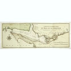
Confluent et embouchure du Bog et du Dniéper.
Detailed map of the mouth of the river Dnieper and the Black Sea, with border lines for the year 1787 and 1788 during the Russian, Turkish War. Prepared by François Jose...
Date: Vienna, 1788-1789
Selling price: ????
Please login to see price!
Sold in 2014
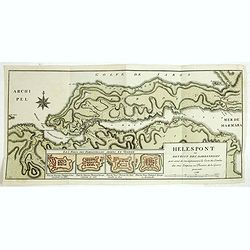
Hellespont ou Detroit des Dardanelles pour servir de renseignement a la Carte des Limites des trois Empires ou Théatre de la Guerre presente 1788.
Detailed map of the 65 km long strait of the Dardanelles between Aegean and Marmara Sea. In lower part four additional small plans (each 54x75 mm) entitled : "Les Fo...
Date: Vienna, 1788-1789
Selling price: ????
Please login to see price!
Sold in 2014

Portrait of Ferdinand IV, King of Naples & Sicily.
Hand-colored portrait of Ferdinand IV, King of Naples & Sicily - by Gulielmus Morghen published in Rome in 1789.
Date: Rome, 1789
Selling price: ????
Please login to see price!
Sold in 2017
Polynesien (Inselwelt) oder der Fünfte Welttheil Verfasst von Herrn Djurberg. . .
One of the first maps to use the name Ulimaroa, originally published in Sweden in 1780. In the first state, it was the first map to use the Maori term Ulimaroa for Austr...
Date: Vienna, Philipp Josef Schalbacher, 1789
Selling price: ????
Please login to see price!
Sold in 2019
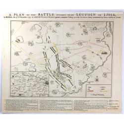
A PLAN OF THE BATTLE NEAR Fought Leuthen OR LISSA, / in SILESIA; the 5th. of December 1757. in Which his PRUSSIAN MAJESTY gained a compleat Victory over the AUSTRIAN Army Commanded by Prince Charles of Lorrain.
A plan the battle of Leuthen, between the Prussian troops, under the command of Friedrich II, and the Austrian troops under the command of Charles of Lorraine on December...
Date: The Hague, 1789
Selling price: ????
Please login to see price!
Sold in 2016
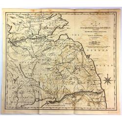
A Map of the Principal Roman Camps, Forts, Walls & c. Between the River Tyne in England and Tay in Scotland.
An antique county map published in "Britannia : or, a Chorographical Description of the flourishing kingdoms of England, Scotland and Ireland" by William Camden...
Date: London, 1789
Selling price: ????
Please login to see price!
Sold in 2016
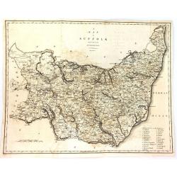
A Map of Suffolk from the Best Authorities.
An attractive and detailed late 18th century map of Suffolk engraved by John Cary and published in Richard Gough's new translation of Camden's Britannia (London: 1789). J...
Date: London, 1789
Selling price: ????
Please login to see price!
Sold in 2016
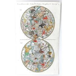
Constellations in the Northern & Southern Hemispheres
This exceptional, detailed, double hemisphere celestial map was engraved by C. Cooke. The northern and southern hemispheres are filled with hand colored figures depicting...
Date: London, 1789
Selling price: ????
Please login to see price!
Sold in 2016
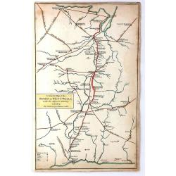
A General Map of the Roman or Picts Walls with the Adjacent Country including the Stations per Lineam Valli
A general Map of the Roman or Picts Walls, (Hadrian's Wall) in Cumberland and Northumberland, and Scotland. Engraved by John Cary for Richard Gough in London around 1789....
Date: London, 1789
Selling price: ????
Please login to see price!
Sold in 2018
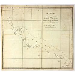
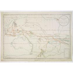
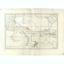
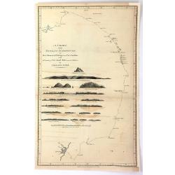
A chart of a track of land in the Southern Pacific Ocean Discovered by Lieut. John Shortland...
The full title is: A chart of a track of land in the Southern Pacific Ocean Discovered by Lieut. John Shortland on His Homeward Bound Passage from the Eastern Coast of Ne...
Date: London, 1789
Selling price: ????
Please login to see price!
Sold in 2018
A chart of the Track of the Scarborough, on Her Homeward Passage, from Port Jackson, on the E. Coast of New South Wales, towards China; by Captain John Marshall
A copper engraved chart showing the track of the 'Scarborough' back to China via China in 1789. The Scarborough was one of the ships of the First Fleet, which brought the...
Date: London, 1789
Selling price: ????
Please login to see price!
Sold in 2016
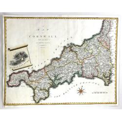
A Map of Cornwall from the Best Authorities
A fine map of Cornwall, in England by John Cary. Published in 'Camden's Britannia' in 1789. Interesting scroll insert featuring the Scilly Islands, with a fancy compass r...
Date: London, 1789
Selling price: ????
Please login to see price!
Sold in 2016
![[Titlepage] Grand Atlas d'Allemagne en LXXXI Feuilles, dedié a Sa Majesté Joseph II, Empereur des Romains.](/uploads/cache/38077-250x250.jpg)
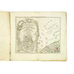
[Titlepage] Grand Atlas d'Allemagne en LXXXI Feuilles, dedié a Sa Majesté Joseph II, Empereur des Romains.
Very decorative title page showing underneath the title the rising sun with a military camp next to a city and in the right foreground emperor Joseph II . With officers, ...
Date: Frankfurt am Main, 1789
Selling price: ????
Please login to see price!
Sold