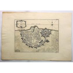
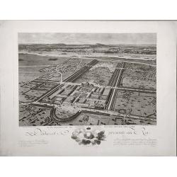
Plan of the Town and Citadel of St. Martin in the Isle of Re.
This print depicts the town and citadel of St. Martin.
Date: London, 1762
Selling price: ????
Please login to see price!
Sold in 2017
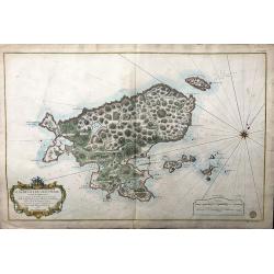
Saint Pierre, Plan de l'Ile de .., au Sud de Terre-Neuve.
A highly detailed map based on a survey by Fortin, and published by the 'Dépôt Général de la Marine' (the maritime chart printing office of the French government) in ...
Date: Paris, 1763
Selling price: ????
Please login to see price!
Sold in 2022
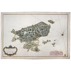
Plan de L'Ile de Saint Pierre au Sud de Terre-Neuve Levé en 1793 par le Sr. Fortin Ingénieur Géographe, et Publié au Dépôt Général des Cartes . . .
A very large, extremely decorative, detailed map of the island of St. Pierre, produced for the French 'Depot de la Marine'. kindly note the nice original colors.
Date: Paris, 1763
Selling price: ????
Please login to see price!
Sold in 2021
![Mt de Cette. [14]](/uploads/cache/12234-250x250.jpg)
Mt de Cette. [14]
Charming of the Mount of Cette. Showing town and harbor plan, with soundings, anchorages, rocks, shoals, fortifications, lighthouses.Joseph Roux (1725-1793) was a Marsei...
Date: Marseille 1764
Selling price: ????
Please login to see price!
Sold
![Grande Rade. [19]](/uploads/cache/12239-250x250.jpg)
Grande Rade. [19]
Charming of Grande Rade . Showing town and harbor plan, with soundings, anchorages, rocks, shoals, fortifications, lighthouses.Joseph Roux (1725-1793) was a Marseilles h...
Date: Marseille, 1764
Selling price: ????
Please login to see price!
Sold
![Plan de VillaFranche. [22]](/uploads/cache/12242-250x250.jpg)
Plan de VillaFranche. [22]
Charming of Villefranche. Showing town and harbor plan, with soundings, anchorages, rocks, shoals, fortifications, lighthouses.Joseph Roux (1725-1793) was a Marseilles h...
Date: Marseille, 1764
Selling price: ????
Please login to see price!
Sold
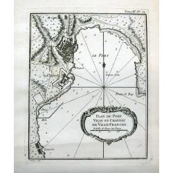
Plan du port ville et chateau de Ville-Franche.
Detailed chart which shows forts and buildings in Villefranche-sur-Mer . Decorative title cartouche. Relief shown pictorially. Depth shown by soundings. Engraved by Grois...
Date: Paris, 1764
Selling price: ????
Please login to see price!
Sold in 2015
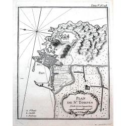
Plan de St. Torpés.
Detailed chart which shows the port, the fort and buildings in Saint-Tropez. Decorative title cartouche. Relief shown pictorially. Published in Bellin's famous "Le P...
Date: Paris, 1764
Selling price: ????
Please login to see price!
Sold in 2016
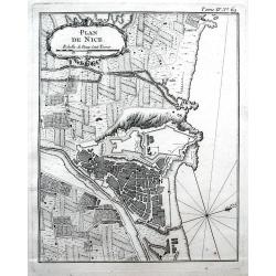
Plan de Nice.
Detailed chart of Nice and its surrounding area. Indicated the outline of buildings, streets, and the fortifications. Decorative title cartouche. Published in Bellin's fa...
Date: Paris, 1764
Selling price: ????
Please login to see price!
Sold in 2016
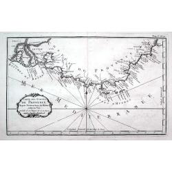
Carte des costes de Provence...
A detailed copper engraved map of Provence with the French Riviera, from the mouth of the Rhône, Arles and the Camargue to Nice. Including Marseille, Toulon, Saint-Trope...
Date: Paris, 1764
Selling price: ????
Please login to see price!
Sold in 2016
Galliae Veteris Tabula Populus. . .
This attractive copper-engraved map shows France with the ancient Roman names in Gaul. The detailed map depicts mountains, rivers, roads, and numerous towns. A beautiful ...
Date: Venice, 1764
Selling price: ????
Please login to see price!
Sold in 2020
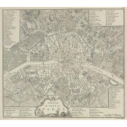
Collection of 9 eighteenth century maps including Paris, plus an attractive dedication page.
Taken from 'A MONSIEUR CASSINI DE THURY SEIGNIEUR DE VILLETANEUSE, Directeur de l'Observatoire Royal, Maitre des Comple[a] ASSOCIE Des Academies des Sciences de PARIS, LO...
Date: Paris, 1765
Selling price: ????
Please login to see price!
Sold in 2013
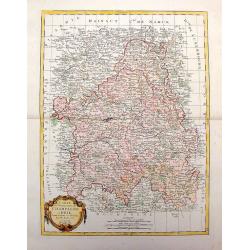
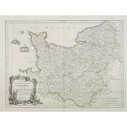
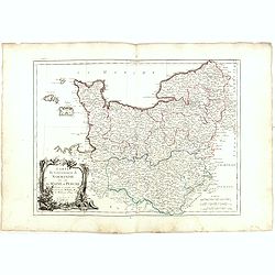
Carta Geographica del Governo della Normandie.
Engraved map of Normandy. The cartouche is remarkable and takes up more than one quarter of the space. Giambattista Albrizzi (1698-1777) was a Venetian publisher and jour...
Date: Venice, 1740-1765
Selling price: ????
Please login to see price!
Sold in 2013
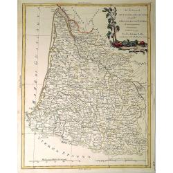
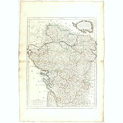
Carta geografica del governo di Guienna e Guascogna.
Detailed map of the south west coast of FranceAn uncommon pirate edition of the map originally published by Isaac Tirion. Taken from "Storia moderna di tutti I popol...
Date: Venice, 1740-1765
Selling price: ????
Please login to see price!
Sold
Carte Reduite du DETROIT DE DAVIDS. Faite an Depost des Cartes Plans et Journaux de la Marine, . . . MDCCLXV.
A beautiful, large chart of the French sea of the Davis Strait, published by Jacques Nicolas Bellin in Paris. The note at the bottom left indicates that the map was const...
Date: Paris, 1765
Selling price: ????
Please login to see price!
Sold in 2019
Carte Générale des Côtes de de France.
Index map of the French coasts with superb decorative cartouche depicting the sea landing of a boat.
Date: Paris, 1766
Selling price: ????
Please login to see price!
Sold in 2011
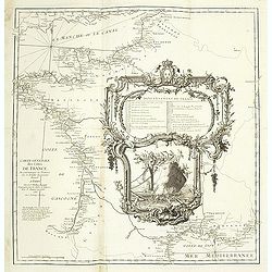
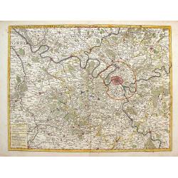
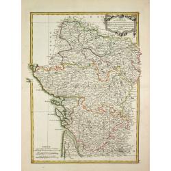
Nouv.lle Election et Environs de Paris très détaillés. . .
Charming small map centered on Paris, depicting a large area around the capital. Small title cartouche and scale cartouche in the upper corners.From the second edition of...
Date: Paris, 1766
Selling price: ????
Please login to see price!
Sold
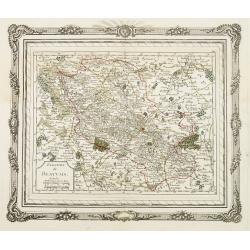
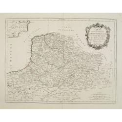
Election de Beauvais.
Charming small map depicting the area around Beauvais. Surrounded by a decorative frame embellished with floral patterns. From the second edition of the rare Atlas chorog...
Date: Paris, 1766
Selling price: ????
Please login to see price!
Sold
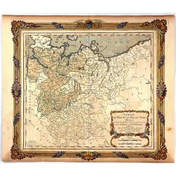
Cercles de Haute et Basse Saxe...
A decorative map of northern Germany with a fine title cartouche. The map is surrounded by a wide rococo-style frame. The map and decorative border were printed from two ...
Date: Paris, 1766
Selling price: ????
Please login to see price!
Sold in 2016
Carte géométrique du comté nantois dédiée à Monseigneur le duc d'Aiguillon par Ogée, sous-ingénieur des Ponts et Chaussées au comté de Nantes.
Very rare map of the Brittany coast with Belle Isle and the regions of Vannes, Nantes. In upper left the Morbian Bay. The map is engraved by P. N. Le Roy, who was a ingen...
Date: Paris, 1768
Selling price: ????
Please login to see price!
Sold
Nieuwe kaart der platte Grond van de Stad Parys en derzelve voorsteden
Izaak Tirion (d. 1769) Amsterdam publisher. His ' Nieuwe en beknopte handatlas' saw 6 editions between before 1740 and after 1784. Also ' Tegenwoordige staat van alle vol...
Date: Amsterdam, c. 1770
Selling price: ????
Please login to see price!
Sold
Nieuwe kaart van het Zuidelykste Gedeelte van Frankryk.
Izaak Tirion (d. 1769) Amsterdam publisher. His ' Nieuwe en beknopte handatlas' saw 6 editions between before 1740 and after 1784. Also ' Tegenwoordige staat van alle vol...
Date: Amsterdam, c. 1770
Selling price: ????
Please login to see price!
Sold
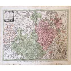
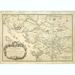
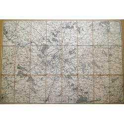
Partie Septentrionale du Duche de Bourgogne.
Map showing the Burgundy region of France. The cities of Auxonne and Dijon are shown in the lower right, Auxerre in the upper left and Chaumont in the upper right.
Date: Augsburg, 1770
Selling price: ????
Please login to see price!
Sold in 2010

Vue et Perspective de la Superbe Colomnade de Versailles.
Striking optical print featuring the columns and the gardens at Versailles, near Paris. France. In the eighteenth and nineteenth centuries many specialty establishments i...
Date: Paris, 1770
Selling price: ????
Please login to see price!
Sold in 2016

Vue de la Nouvelle Decoration de la Foire St. Germain.
A hand colored optical print published in Paris by Jacques Chereau in about 1770. During the 18th century there were several manufacturers of optical viewing devices and...
Date: Paris, ca. 1770
Selling price: ????
Please login to see price!
Sold in 2019
![Illumination en réjouissance du Mariage de Louis Auguste Dauphin de France avec l'Archiduchesse Marie Antoinette sœur de l'Empereur : [16 mai 1770].](/uploads/cache/37420-250x250.jpg)
Illumination en réjouissance du Mariage de Louis Auguste Dauphin de France avec l'Archiduchesse Marie Antoinette sœur de l'Empereur : [16 mai 1770].
J. Chereau was a publisher of optical print, established in Paris, rue St.Jacques. In the eighteenth and nineteenth centuries there were many popular speciality establish...
Date: Paris, ca. 1770
Selling price: ????
Please login to see price!
Sold in 2017
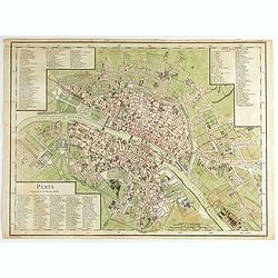
A Plan of the City of Paris.
Nicely detailed 18th century map of Paris, published in A collection of plans of the most capital cities of every empire, kingdom and electorate in Europe and some remark...
Date: London, 1771
Selling price: ????
Please login to see price!
Sold in 2009
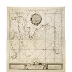
Le Ponant.
in two sheets. The chart depicts the Channel, including a detailed rendering of the south coast of England, the west coast of France and the north coast of Spain, includ...
Date: Le Havre, J.B. Patry, 1772
Selling price: ????
Please login to see price!
Sold in 2010
XVIII Fle L'indicateur fidele du voyageur François.
Fine post road mapsroad map of the Provence from "L'Indicateur fidèle ou guide des voyageurs, qui enseigne toutes les routes royales et particulières de la France,...
Date: Paris, 1772
Selling price: ????
Please login to see price!
Sold
Carte des environs de Paris, suivant les nouvelles observations par J. Laurent,...
Highly detailed map of Paris and environs printed by Mondhare. Includes many small villages which are now actually within the Paris city limits... Extends from Vernon an...
Date: Paris, 1773
Selling price: ????
Please login to see price!
Sold in 2013
3. Carte Particuliere Des Costes De Bretagne Qui comprend Morlaix Saint Paul de Leon les Sept Isles et l'Isle de Bas..
Large-scale sea chart covering the French coast Brittany.With compass rose, rhumb lines and distance scale.Published by the Depot Générale de la marine with stamp and P...
Date: Paris, c.1773
Selling price: ????
Please login to see price!
Sold
Li Governi di Guyenna e Guascogna con quello di Bearn e Bassa Navarra
Map of the Bourdeaux region of France, including the cities of Bourdeaux, Marmande, Tonneins, and Bayonne. To the south, the Navarra region of Spain along with the Pyrene...
Date: Venice, 1776
Selling price: ????
Please login to see price!
Sold in 2010
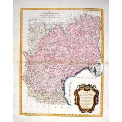
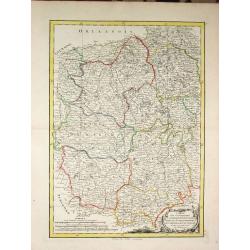
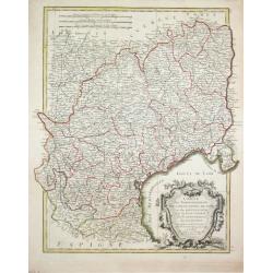
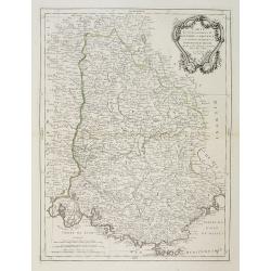
Li Governi del Limosin, Quercy, E Preigord Di Nuoca Projezione.
Map of the regions Limousin, Quercy and Périgord in southwest France different colors are used to outline the three regions and the titles in bold lettering further dist...
Date: Venice, 1776
Selling price: ????
Please login to see price!
Sold in 2010
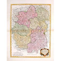
Li Governi del Berri, del Nivernois, della Marche, del Bourbonnois e dell \'Auvergne Di Nvoua Projezione.
Map of five regions in central France including the province Berry, most famous for the 14-15th century illuminated manuscript, "Les Trés Riches Heures du Dec de Be...
Date: Venice, 1776
Selling price: ????
Please login to see price!
Sold in 2010
Li Governi Di Lorenza, Barr, ed Alsazia Di Nuova Projecione.
Map of three regions in northeastern France: Barrois, Lorraine and Alsace. Barrois is a "pays" and in the Middle Ages the region was a part of the duchy of Bar....
Date: Venice, 1776
Selling price: ????
Please login to see price!
Sold in 2010
Li Governi dell\'Isola Di Francia ED Orleanois Di Nuova Projezione.
Map of the region surrounding Orleans France by Antonio Zatta. Map includes major cites such as Chartres, Fontainebleau and Beauvais and rivers systems. A bold cartouche ...
Date: Venice, 1776
Selling price: ????
Please login to see price!
Sold in 2010
Li Governi della Fiandra Francese, d\'Artois, di Picardia, del Boulonois di Nuova Projezione.
Map of Northern France by Antonio Zatta. This wonderfully detailed composition includes major cites such as Calais, Abbeville, and Dunkirk, and the northern coastline of ...
Date: Venice, 1776
Selling price: ????
Please login to see price!
Sold in 2010
Li Governi di Normandia del Maine e Perche di Nuova Projezione.
Map of the Normandy Coast of France by Antonio Zatta. This detailed map depicts major cities such as Rouen, Ambriere and Mortagne, and the off coast islands of Jersey, Gu...
Date: Venice, 1776
Selling price: ????
Please login to see price!
Sold in 2010
Carte du Gouvernement de Champagne et Brie
This large, very detailed, copper engraved map of French provinces is based on the earlier map by Bonne. It shows forests, cities, towns, mountains and roads and is decor...
Date: Venice, 1776
Selling price: ????
Please login to see price!
Sold in 2014
Li Governi di Guyenne e guascogna con quello de Bearn e Bassa Navarra. . .
A map of the Bordeaux region of France, including the cities of Bordeaux, Marmande, Tonneins, and Bayonne. To the south, the Navarra region of Spain along with the Pyrene...
Date: Venice, 1776
Selling price: ????
Please login to see price!
Sold in 2021
Plan routier de la Ville et Faubourg de Paris.
Grid plan. On both sides of the map, an alphabetical map of the streets Updates: North, opening of Thiroux Street, new name of St. Anne Street, which becomes rue Poissonn...
Date: Paris, 1776
Selling price: ????
Please login to see price!
Sold
Carte du Gouvernement de Normandie avec celui du Maine et Perche projettée et assujettie aux observat. À Paris par M. Bonne Mtre Mathémat. À Paris 1771.
A general map of Normandy, Maine and Perche describing these different regions. Published by P. Santini map, an Italian map publisher who worked in Venice. Notable works...
Date: Venice, 1777
Selling price: ????
Please login to see price!
Sold
Li Governi Di Sciampagna E Brie Di Nuiva Projezione
This map of France highlights the Champagne and Brie regions in the northeastern part of the country. Each of these cities derives their names from the sparkling wine and...
Date: Venice, 1777
Selling price: ????
Please login to see price!
Sold in 2010
Carte dy Gouvernement de L'Isle de France et de L'Orleanois
A large, beautiful map of France's most populous province, centered around Paris. It is decorated by a large title cartouche. Francois [Francesco] Santini was a Venetian...
Date: Venice, 1777
Selling price: ????
Please login to see price!
Sold in 2014
Carte des Gouvernements D'Anjou et du Saumurois.
A beautiful example of Rigobert Bonne's decorative map of the famous French "Chateau" wine-making region, hugging the Loire Valley. It was included in Santini's...
Date: Venice, 1777
Selling price: ????
Please login to see price!
Sold in 2015
Carte du Gouvernement de Guienne et Gascogne avec Celui de Bearn et Basse Navarre.
Striking Venetian edition of a copper engraved map of Guyenne and Gascogne in southwestern France, the home of Armagnac and Foie Gras. Bonne created the map. Francois or ...
Date: Vienna, 1777
Selling price: ????
Please login to see price!
Sold in 2014
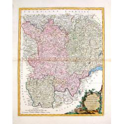
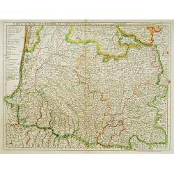
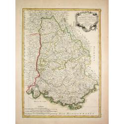
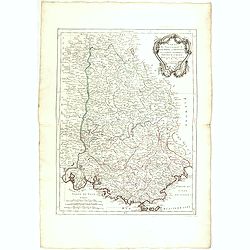
Carte des Gouvernements de Languedoc, de Foix et de Roussillon.
Striking large copper engraved map of the governments of Languedoc, Roussiloon de Foix and eastern Guienne. Lovely colorful floral title cartouche. Francois or Paolo Sa...
Date: Vienna, 1777
Selling price: ????
Please login to see price!
Sold in 2013
Carte des Gouvernements du Berri, du Nivernois, de la Marche, du Bourbonnois, du Limosin et de L'Auvergne.
Striking large map of central France including Limoges, Moulins. It was based on a smaller map by R. Bonne in 1771. It features a Rococco cartouche. Francois or Paolo San...
Date: Venice, 1777
Selling price: ????
Please login to see price!
Sold in 2016
Carte des Gouvernements de Bourgogne, de Franche Comte et de Lyonnois.
Impressive large map of French provinces, including Lyon, Dijon, and Besancon, and the border with Switzerland. It was based on a smaller map by Bonne in 1771. It feature...
Date: Venice, 1777
Selling price: ????
Please login to see price!
Sold in 2014

Li Governi di Normandia del Maine e Perche.
A pleasant map shows all of Normandie with its islands: Maine in the french province of Pays de la Loire and Berche in the region of Bourgogne-Franche-Comté. Features a...
Date: Venice, 1777
Selling price: ????
Please login to see price!
Sold in 2023
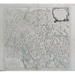
Duche de Savoye qui comprend le Chablais, le Fossigny, Le Genevois...
Fine map of the area, extending from Lake Geneva southwards, including Aosta, Aix-les-Bains, Chambéry, Annecy, Chamonix, etc. Very nice depiction of the mountains and va...
Date: Venice, 1778
Selling price: ????
Please login to see price!
Sold in 2012
Plan perspective de l'École royale militaire.
A decorative bird's eye view of the complex of the French military school in Paris.
Date: Paris, 1778
Selling price: ????
Please login to see price!
Sold in 2022
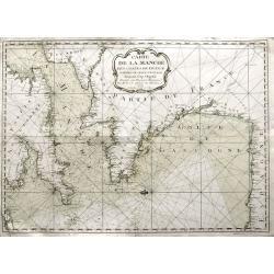
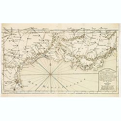
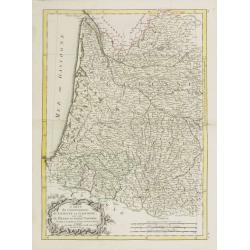
Carte de la Manche des costes de France parties de celle d'Espagne jusqu'au Cap Orgetal.
A very rare sea-chart of the Channel between England and France, including the Bay of Biscay with the coasts of northern Spain, and even a small tip of Ireland. A very ap...
Date: Bordeaux, 1779
Selling price: ????
Please login to see price!
Sold in 2021
Carte du Bearn de la Bigorre de l'Armagnac..
Map of south-west part of France covering the Landes country with Dax, Bayonne and Pau till Montauban and Toulouse on the right.
Date: Paris, ca. 1780
Selling price: ????
Please login to see price!
Sold
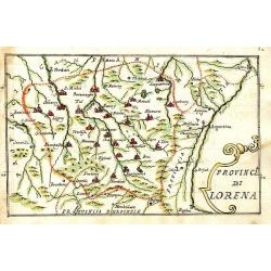
Provincia di Lorena.
Scarce manuscript map of the Lorraine region. Includes the cities of Metz, Verdun, Nancy,... Finely executed and detailed map by an Italian hand, showing the cities repre...
Date: 1740-1780
Selling price: ????
Please login to see price!
Sold in 2009
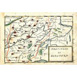
Provincia di Borgogna.
Rare manuscript map of the French border to Switzerland. Centered on Besancon, including the Lake de Geneva in Switzerland. Finely executed and detailed map by an Italia...
Date: c. 1740-1780
Selling price: ????
Please login to see price!
Sold in 2013
Montlouis.
Montlouis (Languedoc-Roussillon).
Date: Paris, ca. 1780
Selling price: ????
Please login to see price!
Sold in 2011
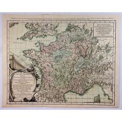
La France Divisee en Provinces et en Generalites Dont le plan est selui de l'ancienne Gaule. . .
A beautiful, large scale, highly detailed, 18th century map of France modeled on a plan of ancient Gaul by Jean Baptiste Bourguignon D'Anville, with major boundaries colo...
Date: Paris, 1780
Selling price: ????
Please login to see price!
Sold in 2010

Hotel des Monnoies, Projete sur le Terrein de l'Hotel de Conty
Very large copper engraving featuring a view of the Hotel de Monnaies, a C-shaped mansion with steps outside the courtyard. The engraver was Claude Rene Gabriel Poulleau ...
Date: Paris, c1780
Selling price: ????
Please login to see price!
Sold in 2020

Vue Perspective de la Place des Victoires.
Optical print of Place des Victoires in Paris.
Date: Paris, 1780
Selling price: ????
Please login to see price!
Sold in 2018

Vue General du Chateau de Monseigneur le Duc de Richelieu en Poitou.
Optical print of Place des Victoires in Paris. Basset was a well-known publisher of optical prints, established in rue St Jacques in Paris. In the 18th century the optica...
Date: Paris, 1780
Selling price: ????
Please login to see price!
Sold in 2018
Les Généralitez de Montauban et de Toulouse . . .
Detailed map of the southwest of France, including the towns of Carcassonne, Perpignan, including the Royal Canal.Avec Privilège du Roy.
Date: Paris, 1781
Selling price: ????
Please login to see price!
Sold
Carte de la Prevoste et Vicomte de Paris.
The large very detailed map of Paris was originally created by Guilliame Deslise or De L'Isle (1675-1726). Delisle is best known for his changes to cartography that resul...
Date: Paris, 1782
Selling price: ????
Please login to see price!
Sold in 2013
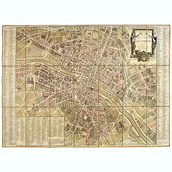
Paris Superficie 5,280,000 Toises.
FIRST EDITION of this finely engraved plan of Paris by P. F. Tardieu and prepared by DuBuisson. This detailed plan of Paris includes la Place Louis XV, la Bastille, but d...
Date: Paris, 1779-1782
Selling price: ????
Please login to see price!
Sold in 2020
Carte des Gouvernements de Dauphine et de Provence.
Jean Lattré, Paris-based engraver and publisher. Worked with Robert de Vaugondy, J. Janvier and R. Bonne. " Atlas Monderne', 1771, 1783 , 1793. Rigobert Bonne (1727...
Date: Paris, 1783
Selling price: ????
Please login to see price!
Sold
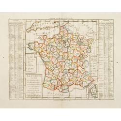
La France Divisée en IX Régions, 10 Métropoles, et 85 Départements ..
Rare map of France prepared after J.B.Nolin and published by Monhare for his Atlas Général a l'usage des colleges et maisons d'education.. Lower right inset map of Cors...
Date: Paris 1783
Selling price: ????
Please login to see price!
Sold
Carte des Gouvernements du Berri, du Nivernois, de la Marche, du Bourbonnois, du Limosin et de l\' Auvergne.
Jean Lattré, Paris-based engraver and publisher. Worked with Robert de Vaugondy, J. Janvier and R. Bonne. " Atlas Monderne', 1771, 1783 , 1793. Rigobert Bonne (1727...
Date: Paris, 1783
Selling price: ????
Please login to see price!
Sold in 2014
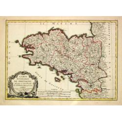
Carte du Gouvernement de Bretagne.
Jean Lattré, Paris-based engraver and publisher. Worked with Robert de Vaugondy, J. Janvier and R. Bonne. " Atlas Monderne', 1771, 1783 , 1793. Rigobert Bonne (1727...
Date: Paris, 1783
Selling price: ????
Please login to see price!
Sold
Carte des Gouvernements de Languedoc, de Foix et de Rousillon avec la Partie Oreintale du Gouvernement de Guienne.
Jean Lattré, Paris-based engraver and publisher. Worked with Robert de Vaugondy, J. Janvier and R. Bonne. " Atlas Monderne', 1771, 1783 , 1793. Rigobert Bonne (1727...
Date: Paris, 1783
Selling price: ????
Please login to see price!
Sold
Carte du Gouvernement de Guienne et Gascogne.. Navarre..
Attractive map of the south western part of France delimited by the Garonneoutfall, the town of Toulouse and the Pyrenees.Decorated with a rococo title cartouche. Boundar...
Date: Paris, ca 1783
Selling price: ????
Please login to see price!
Sold
Carte des Gouvernements de d' Anjou, et du Saumurois, de la Touraine, du Poitot, du Pays d' Aunis, Saintonge-Angoumois.
Jean Lattré, Paris-based engraver and publisher. Worked with Robert de Vaugondy, J. Janvier and R. Bonne. " Atlas Monderne', 1771, 1783 , 1793. Rigobert Bonne (1727...
Date: Paris, 1783
Selling price: ????
Please login to see price!
Sold in 2009
![[4 maps] Carte du Gouvernement de Bretagne . . . / Carte du Gouvernement de l'Isle de France . . . / Carte des Gouvernements de Flandre Françoise, / Carte du Gouvernement de Normandie...](/uploads/cache/42824-250x250.jpg)
[4 maps] Carte du Gouvernement de Bretagne . . . / Carte du Gouvernement de l'Isle de France . . . / Carte des Gouvernements de Flandre Françoise, / Carte du Gouvernement de Normandie...
Four attractive maps of French provinces, ornated with a decorative title cartouche. Boundaries outlined in hand color.Prepared by Le Sieur Janvier, Jean Denis [Robert], ...
Date: Paris, ca 1783
Selling price: ????
Please login to see price!
Sold in 2020
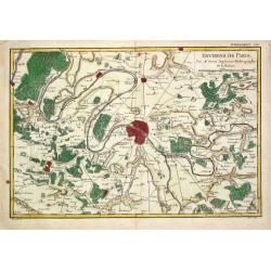
Environs de Paris.
Rigobert Bonne (1727-1795), French cartographer. His maps are found in a.o. Atlas Moderne (1762), Raynal's 'Histoire Philos. du Commerce des Indes' (1774) and 'Atlas Ency...
Date: Paris, 1784
Selling price: ????
Please login to see price!
Sold
Gouvernements de Flandre Françoise, d'Artois, de Picardie..
Detailed map encompassing northwestern part of France, with the Channel and tip of southern England.Venetian edition of the map by Bellin, to whom Santini gives credit in...
Date: Venice, 1776 - 1784
Selling price: ????
Please login to see price!
Sold in 2008
Carte des Gouvernements de Dauphiné et de Province. . .
Attractive map of part of France, covering the eastern part of the Gulf of Lyon with its hinterland. Extending as far as Nice and Grenoble.Decorated with a rococo title c...
Date: Venice, 1777 - 1784
Selling price: ????
Please login to see price!
Sold
Carte du Gouvernement de Normandie avec celui du Maine et Perche.
Map of Normandy, with ornate title cartouche in lower left bottom. With ornamental title cartouche and noteworthy topographical detail.The map was prepared by the Venetia...
Date: Venice, 1776 - 1784
Selling price: ????
Please login to see price!
Sold
Carte des Gouverneménts d'Anjou et du Saumurois, de la Touraine, du Poitou, du Pays d'Aunis Saintonge - Angoumois. . .
Attractive map of the south western part of France, including isle de Ré and Isle d'Oleron. The map was prepared by R. Bonne, who is given credit in the title cartouche....
Date: Venice, 1777 - 1784
Selling price: ????
Please login to see price!
Sold in 2015
Carte des Gouvernements de Dauphiné et de Province. . .
Attractive map of part of France, covering the eastern part of the Gulf of Lyon with its hinterland. Extending as far as Nice and Grenoble. With ornamental title cartouch...
Date: Venice, 1777 - 1784
Selling price: ????
Please login to see price!
Sold

Carte Réduite du Golphe de Gascogne. . .
Uncommon chart of the coast of Gascoigne from Brest in Brittany up to Santander in Spain.
Date: Paris, 1756 - 1784
Selling price: ????
Please login to see price!
Sold in 2018
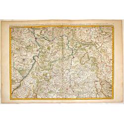
Partie du Palatinat du Rhein, le Duché de Wirtenberg les Partie du Palatinat du Rhein. Le Duche de Wirtenberg, Les Marquisats de Bade & Durlac, les Eveschés de Worms de Spire et le Comté de Linange.
Large, hand-colored, copperplate map of Rhineland Germany. It features the cities of Manheim, Hailbron, Stuttgart, Heidelberg & Baden. very detailed showing individua...
Date: Paris, 1785
Selling price: ????
Please login to see price!
Sold in 2016
