Browse Listings in Europe
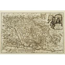
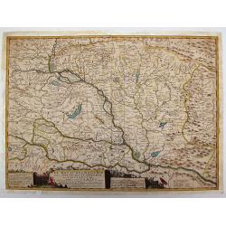
Imago b.v. Poetschensis ter Lachrimari visa toti nunc Hungariae propitia.
A map from the series of maps by the Jesuit mathematician. A general map of Hungary, produced by Scherer to show the spread of Catholicism in the country. Heinrich Schere...
Date: Munich c.1702
Selling price: ????
Please login to see price!
Sold
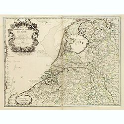
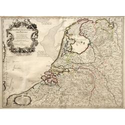
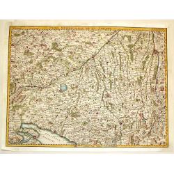
Carte des Provinces Unies des Pays Bas.
Rare first edition "Chez l'Auteur Rue des Canettes préz de St. Sulpice". "The "Rue des Canettes" address appears on the original versions of map...
Date: Paris, 1702
Selling price: ????
Please login to see price!
Sold in 2020
De Beschryving van de Reysen Pauli en Van de Andere Apostelen.
Dutch so-called ' Staten' bibles, published between 1637 and c. 1760, contained five maps: The World, ' Paradise', The Perigrinations, The Promised Land Canaan, The Trave...
Date: Amsterdam, H.,J.,P. Keur, M. Doornick en P. Rotterdam, 1702
Selling price: ????
Please login to see price!
Sold
La Moscovie meridionale..
Detailed map centered on Moscow. Charming title cartouche in lower right corner.
Date: Leiden, 1702
Selling price: ????
Please login to see price!
Sold in 2008
Carte des Provinces Unies des Pays Bas
Map of the United Provinces of the Netherlands and northern Belgium.
Date: Paris, 1702
Selling price: ????
Please login to see price!
Sold in 2010
Theatre de la Guerre dans les Pais-Bas, et Lieux circonvoisins, qui Represente les Electorates de Cologne, de Treves & de Mayence?
Detailed map showing northern French region of Champagne, Belgium and eastern Germany. Includes the cities of Frankfurt (on lower right edge), Luxembourg, Brugge, Brussel...
Date: Amsterdam, 1702
Selling price: ????
Please login to see price!
Sold in 2010
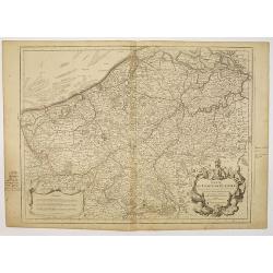
Carte des Pays Bas Catholiques. . .
Map of the Spanish, or Catholic Netherlands - a section of the Low Countries controlled by Spain from the 16th to 18th centuries. The map depicts areas from the Champagne...
Date: Paris, 1702
Selling price: ????
Please login to see price!
Sold in 2010
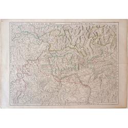
Le Cours De La Riviere Du Rhein depuis sa Source jusques a son Emboucheure ou sont distingues Tous Les Estats et Souverainetes
Colorful map of northeastern France and western Germany following the Rhine River from the North Sea and United Provinces (Netherlands) south, published by Pierre Mortier...
Date: Amsterdam, c. 1702
Selling price: ????
Please login to see price!
Sold in 2010
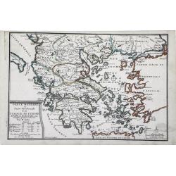
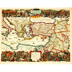
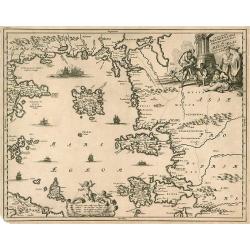
Grece Moderne ou Partie Meridionale de la Turquie en Europe. . .
Small scale, detailed map of Greece, the northern region of Crete, and the eastern coast of Asia Minor by French cartographer Nicholas de Fer.. A bordered title cartouche...
Date: Paris, 1702
Selling price: ????
Please login to see price!
Sold in 2010
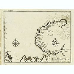
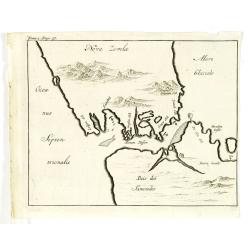
Nova Zemla.
Uncommon map of Novaya Zemlya with un unknown east coast. Based on info from Barentz. arctic voyage.From the French reissue of the account of early Dutch voyages first pu...
Date: Amsterdam, E. Roger, 1702
Selling price: ????
Please login to see price!
Sold in 2012
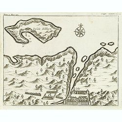
(Insula Kilduyn.)
Uncommon map of part of the coast along the Barents Sea with the island of Kildin, offshore of the river and town of Cola (Murmansk). Originally made to illustrate Willem...
Date: Amsterdam, E. Roger, 1702
Selling price: ????
Please login to see price!
Sold in 2012
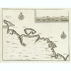
(Kegor.)
Uncommon map of part of the coast along the Barents Sea with the island of Kildin, offshore of the river and town of Cola (Murmansk). Originally made to illustrate Willem...
Date: Amsterdam, E. Roger, 1702
Selling price: ????
Please login to see price!
Sold in 2012
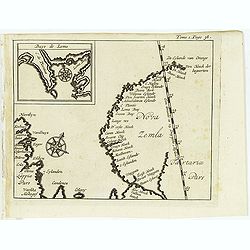
(Map of Nova Zembla with inset of Baye de Loms.)
Map of Nova Zembla with inset of Baye de Loms (5x7mm.).From the French reissue of the account of early Dutch voyages first published in 1608 by Commelin. The French trans...
Date: Amsterdam, E. Roger, 1702
Selling price: ????
Please login to see price!
Sold in 2012
Delineatio Spitsbergiae.
Map of Sipitsbergen.From the French reissue of the account of early Dutch voyages first published in 1608 by Commelin. The French translation was carried out by René Aug...
Date: Amsterdam, E. Roger, 1702
Selling price: ????
Please login to see price!
Sold in 2012
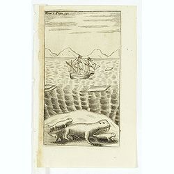
(Dutch ship in Arctic waters with 3 sea lions in the foreground)
From the French reissue of the account of early Dutch voyages first published in 1608 by Commelin. The French translation was carried out by René Augustin Constantin de ...
Date: Amsterdam, E. Rogers, 1702
Selling price: ????
Please login to see price!
Sold in 2012
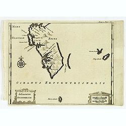
(Nova Zemla / Ocea nus Septen trionalis. )
Uncommon map of the Strait Nassau, between Nova Zembla and the Russian mainland. Originally made to illustrate Willem Barentz. arctic voyage. From the French reissue of t...
Date: Amsterdam, E. Roger, 1702
Selling price: ????
Please login to see price!
Sold in 2012
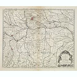
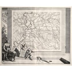
Le Cours du Po... / Les Duchez de Mantoue de Modene et de Parme. . .
Detailed and scarce map of the area of Mantua prepared by Placide de Sainte-Hélène (1648-1734). and published by Claude-Auguste Berey (1651-1732).This is the edition wh...
Date: Paris, 1702
Selling price: ????
Please login to see price!
Sold in 2016
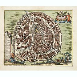
Middelburg, de Gelukkigste Koopstadt Van Geheel Zeelant.
A view of Middelburg, Netherlands, one of the three fortified towns erected to guard against the Viking raids. Petrus Schenck, (1660 – 1711) was a German engraver an...
Date: Amsterdam, 1702
Selling price: ????
Please login to see price!
Sold in 2013
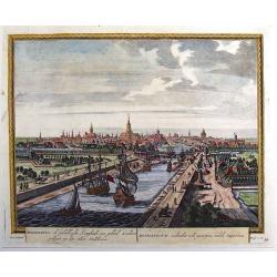
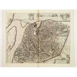
Moscou, Capitale de la Moscovie. . .
Detailed bird's-eye view of the town of Moscow with the Kremlin and old city, Kitay-gorod, at center. These are surrounded by successive rings of fortifications. The plan...
Date: Leiden, 1702
Selling price: ????
Please login to see price!
Sold
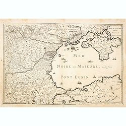
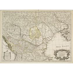
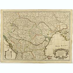
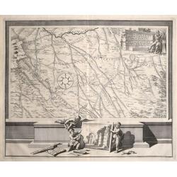
(Mer Noire ou Maieure, Pont Euxin.)
Very rare and detailed map of the Black Sea area prepared by Placide de Sainte-Hélène (1648-1734). and engraved by Claude-Auguste Berey (1651-1732).The map is of partic...
Date: Paris, 1702
Selling price: ????
Please login to see price!
Sold in 2014
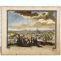
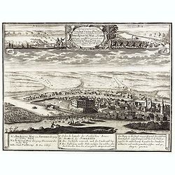
Koppenhaven, de hooftsadt van Denemarken. .
Nice panoramic view of Copenhagen. From Schenk's "Hecatompolis sive Totius Terrarum Oppida Nobiliora Centrum...", a collection of 100 views, dedicated to the 14...
Date: Amsterdam, 1702
Selling price: ????
Please login to see price!
Sold in 2016
Die Stadt und der See-Haven Ville franche oder Villa franca, welche im Jahr 1691, dem Herzog von Savoyen durch die Franzosen abgenommen worden.
Detailed map of Villefranche-sur-Mer, including Saint-Jean-Cap-Ferrat, Saint-Michel, and the borders of today's Nice. It shows forts, towers, a few buildings, roads, hill...
Date: Frankfurt, 1702
Selling price: ????
Please login to see price!
Sold in 2015
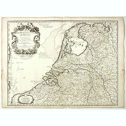
Carte des Provinces Unies des Pays Bas.
Rare state of the map of the Netherlands with the imprint "a la Courone de Diamans" and " a Amsterdam chez Louis Renard Libraire près la Bourse. Decorated...
Date: Paris, 1702
Selling price: ????
Please login to see price!
Sold in 2023
Belli Typus in Italia, Victricis Aquilae Progressus in Statu Mediolanensi et Ducatu Mantuae
Original hand-colored engraved map. (sheet size 53 x 59 cm.). .
Date: Nuremberg, 1702
Selling price: ????
Please login to see price!
Sold in 2023
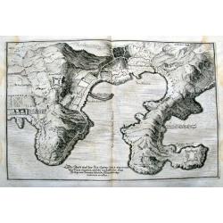
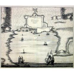
Castel di Finale.
Interesting 1702 engraved map featuring an aerial plan of Finale Ligure, Italy, with its fortifications.Published by Francis Maximilian Misson, originally François Maxim...
Date: London, 1702
Selling price: ????
Please login to see price!
Sold in 2020
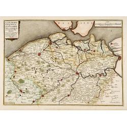
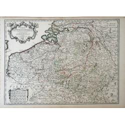
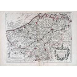
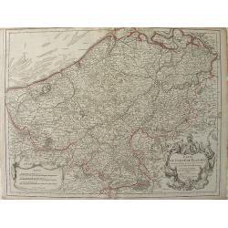
La Flandre espagnole, et la Flandre hollandoise..
Detailed map of Flanders distinguishing the part in the past under Spanish domination from that under Dutch domination. Showing Bruges, Gand, Antwerp.Engraved by F.Starck...
Date: Paris 1703
Selling price: ????
Please login to see price!
Sold
La Curlande duche et Semigalle autrsois de la Livonie
La Curlande duche et Semigalle autresois de la Livoniel / La Samogitie duche en Lituanie / Par le Sr. Sanson d?Abbeville Geogrordae de S.M. avecq Privilege Re pour vingt ...
Date: Paris, 1703
Selling price: ????
Please login to see price!
Sold in 2008
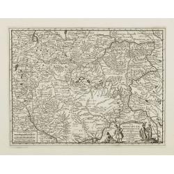
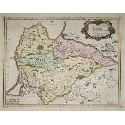
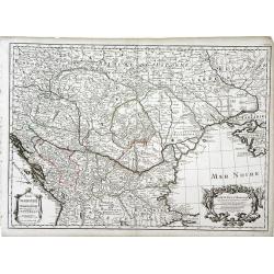
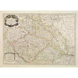
Carte de la Hongrie et des pays qui en dependoient autrefois. . .
The edition by Buache of Delisle's important map of Hungary and the Balkans. It is the first map depicting the Danube bend and the river fairly accurately. Fine decorativ...
Date: Paris, 1703
Selling price: ????
Please login to see price!
Sold in 2009
Insularum Archipelagi septentrionalis.
Aegean Islands (North)
Date: Amsterdam, 1703
Selling price: ????
Please login to see price!
Sold in 2010
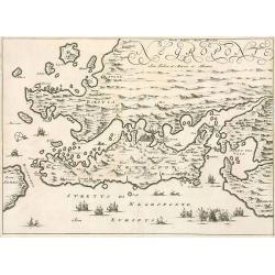
Negroponte.
Penisolur of Negroponte.
Date: Amsterdam, 1703
Selling price: ????
Please login to see price!
Sold in 2010
Carte de la Hongrie. . .
Finely detailed map of southeastern Europe, including the regions of Hungary, northern Greece, Bulgaria, Romania, Bohemia, Germany, Poland and the Ukraine by Guillaume de...
Date: Paris, 1703
Selling price: ????
Please login to see price!
Sold in 2010
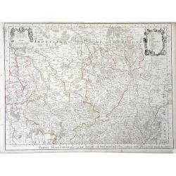
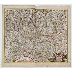
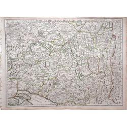
Partie Septrentionale Du Duche de Bourgogne. . .
Finely detailed map of the Duchy of Bourgogne, what is now the wine growing region of Burgundy in France by Guillaume de L'Isle. A beautifully illustrated distance key, f...
Date: Paris, 1703
Selling price: ????
Please login to see price!
Sold in 2010
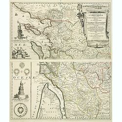
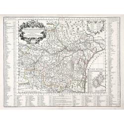
La Generalite de La Rochelle Comprenant le Pays d'Aunis, la Saintonge, &c., Divisee en Cinq Elections . . .
A stunning and strongly engraved map in two sheets and showing La Rochelle, Ile d'Orléron, Ile Ré and the entrance of the river Gironde. The map extends to include Roch...
Date: Paris, 1703
Selling price: ????
Please login to see price!
Sold in 2011

Le Nouveau Capitole ...
Nice view from Veües des plus beaux bâtimens de France, engraved by Perelle, published by Langlois.
Date: Paris, c. 1687-1703
Selling price: ????
Please login to see price!
Sold in 2011

Veüe de la Chambre des Comptes, la Ste. Chapelle et la Porte Ste. Anne.
Nice view from Veües des plus beaux bâtimens de France, engraved by Perelle, published by Langlois.
Date: Paris, c. 1687-1703
Selling price: ????
Please login to see price!
Sold in 2011

La Veüe du Monastere Royal du Val de Grace, ...
Nice view from Veües des plus beaux bâtimens de France, engraved by Perelle, published by Langlois.
Date: Paris, c. 1687-1703
Selling price: ????
Please login to see price!
Sold in 2012

La Maison de Vaux le Vicomte ...
Nice view from Veües des plus beaux bâtimens de France, engraved by Perelle, published by Langlois.
Date: Paris, c. 1687-1703
Selling price: ????
Please login to see price!
Sold in 2012

Autre Veüe de la Cour des Fontaines et de la Gallerie d'Ulisse à Fontaine-bleau.
Nice view from Veües des plus beaux bâtimens de France, engraved by Perelle, published by Langlois.
Date: Paris, c. 1687-1703
Selling price: ????
Please login to see price!
Sold in 2012
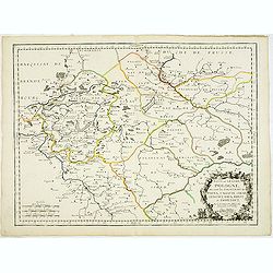
Basse ou Grande Pologne ou sont les Palatinats de Posna, Calisch, Sirad, Lencici, Rava, Brest, et Inowlocz. . .
Uncommon state of this map of Poland, covering much of present-day Poland and includes the cities of Grudziadz in the north, Warsaw in the east, Opole in the south and Gl...
Date: Paris, 1703
Selling price: ????
Please login to see price!
Sold in 2015
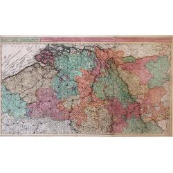
Carte pour la guerre dans les Pays-Bas Dedié et Presenté à monseigneur le Duc de Bourgogne. . . (Six sheet wall map)
Scarce six-sheet map of the southern provinces of the Low Countries and the most western provinces of Germany.Published by the heirs of Jean-Baptiste Nolin and also avail...
Date: Paris, 1703
Selling price: ????
Please login to see price!
Sold in 2015
Le Theatre de la Guerre sur le Haut Rhein Contenant l'Alsace. . . (Three sheet wall map)
Scarce three-sheet map of the Alsace province in France and Germany.Published by the heirs of Jean-Baptiste Nolin and also available with the Brussels book seller Leonard...
Date: Paris, 1703
Selling price: ????
Please login to see price!
Sold in 2015
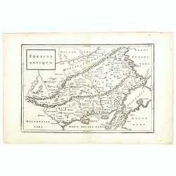
Thracia Antiqua.
This map depicts the historic and geographical region of Thrace in south eastern Europe, bordering on todays Greece, European Turkey and Bulgaria. Map shows parts of the ...
Date: Germany, 1703
Selling price: ????
Please login to see price!
Sold in 2015
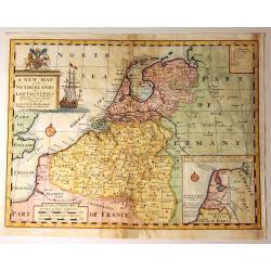
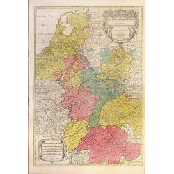
A New Map of the Netherlands or Low Countries.
Decorative map of the Netherlands, with a large sailing ship, and an inset of the Sea Coasts of Holland. Also included, is a fine coat of arms with a Unicorn and a Lion. ...
Date: London, 1703
Selling price: ????
Please login to see price!
Sold in 2015
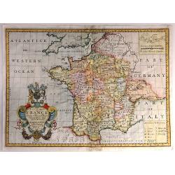
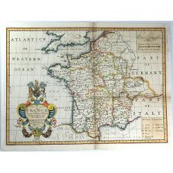
New Map of France Shewing its Principal Divisions, Chief Cities, Townes, Ports, Rivers, Mountains &c. Dedicated to His Highness William Duke of Gloucester...
A striking map of France divided by its provinces, including details such as mountains. The cartouche is splendid, and it includes the Gloucester coat of arms, fruit and ...
Date: Oxford, 1703
Selling price: ????
Please login to see price!
Sold in 2016
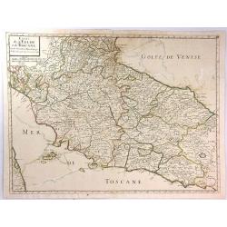
Estats de L'Eglise et de Toscane....
A fine and highly detailed map covering Tuscany, the States of the Church and neighbouring regions and the island of Elbe. This edition is dated 1703.Nicolas Sanson (1600...
Date: Paris, 1703
Selling price: ????
Please login to see price!
Sold in 2016
New Map of France Shewing its Principal Divisions, Chief Cities, Townes, Ports, Rivers, Mountains &c. Dedicated to His Highness William Duke of Gloucester....
A striking map of France divided into its provinces, including details such as mountains. The cartouche is splendid, and it includes the Gloucester coat of arms, fruit an...
Date: Oxford, 1703
Selling price: ????
Please login to see price!
Sold in 2016
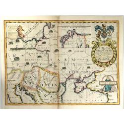
A New Map of Sarmatia Europaea Pannonia and Dacia...
A striking map of the land of ancient Sarmatia, Pannonia, and Dacia, extending from Hungary through the Ukraine. The cartouche is splendid, it includes the Gloucester coa...
Date: Oxford, 1703
Selling price: ????
Please login to see price!
Sold in 2017
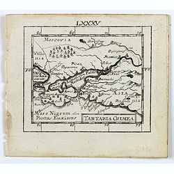
Tartaria Crimea.
A lovely miniature map of the region of Crimea. For such a small map it renders a wealth of detail, with mountains, forests, river, towns, cities all engraved in some det...
Date: Ulm, c 1703
Selling price: ????
Please login to see price!
Sold in 2016
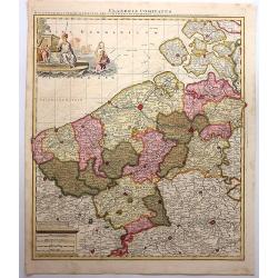
Flandriae Comitatus.
A scarce map of Belgium and neighbouring regions. With a decorative allegorical cartouche, with coat of arms, putti and queen. Published in Atlas Contractus Sive Mapparum...
Date: Amsterdam, 1703
Selling price: ????
Please login to see price!
Sold in 2018

Prospetto dell'anfiteatro Flavio . . . / Prospetto di Tutto l'Anfiteatro intiero . . . / Pianta dell' divisa nelli suoi / Spaccato, e veduta interiore dell' Anfiteatro.
Monumental engraving showing the Colloseum in Rome, in its setting, with below a ground-plan and elevation. Engraved and drawn by Alessandro Specchi (1668-1729), an engra...
Date: Rome, 1703
Selling price: ????
Please login to see price!
Sold in 2025
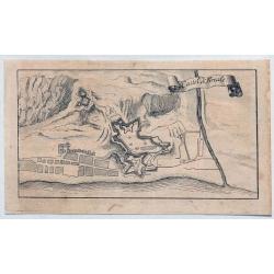
Representation Vonder Stadt Poltoski nebst der Action so geschehen zwischen Ihro Konichg. Maij. von Schweden unter eigene Hohe Commando, und Ihro Koniglg. Maij: von Pohln uner Commando des Feldt Marschal Steinau. . .
A rare print depicting the Battle of Pultusk, approximately 40 miles north of Warsaw, on April 21, 1703 during the Great Northern War.A very rare view--we are not able to...
Date: ca. 1703
Selling price: ????
Please login to see price!
Sold
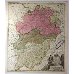
Superior Burgundiae Comitatus Vulgo la Franche Comte. . .
A detailed map of Upper Burgundy and its contiguous regions. Bottom right is a beautiful title cartouche featuring three putti.Gerard Valk (1652–1726) and his son Leona...
Date: Amsterdam, 1703
Selling price: ????
Please login to see price!
Sold in 2018
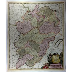
Superior Burgundiae Comitatus; Vulgo La Franche Comte.
A detailed map of Upper Burgundy and its contiguous regions. Bottom right is a beautiful title cartouche featuring three putti.Gerard Valk (1652–1726) and his son Leona...
Date: Amsterdam, 1703
Selling price: ????
Please login to see price!
Sold in 2018
Carte de la Hongrie et des pays qui en dependoient autrefois. . .
Map of Hungary and the Balkans with the address : Chez l’Auteur sur le Quai de l’Horloge avec Privilege du Roy pour 20 ans, 1703. Lower right, Renard’s imprint is e...
Date: Paris, 1703
Selling price: ????
Please login to see price!
Sold in 2018
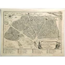
Le Bois de Boulagne.
A bird’s-eye view of Le Bois de Boulogne in Paris, detailed with paths, walls, trees, buildings, and a compass rose. It features a decorative title cartouche. Nicolas d...
Date: Paris, 1703
Selling price: ????
Please login to see price!
Sold in 2019
![[Nine plans on a sheet] Winochs-Bergen - Aras of Atrecht - Bethune - Grevelingen - Gent - Aath - Ostende - Yperen - Condee.](/uploads/cache/48112-250x250.jpg)
[Nine plans on a sheet] Winochs-Bergen - Aras of Atrecht - Bethune - Grevelingen - Gent - Aath - Ostende - Yperen - Condee.
An attractive plate reuniting 9 city plans of Winochs-Bergen, Aras of Atrecht, Bethune, Grevelingen, Gent, Aath, Ostende, Yperen, Condee. Printed in red. Rare.
Date: Amsterdam, 1703
Selling price: ????
Please login to see price!
Sold in 2023
Spalato. Ville des Venetiens,...
Large decorative view of the forts and harbour of Split in Croatia. A few roads, buildings and hills are shown. Decorated with multiple large sailing ships, a distance sc...
Date: Amsterdam, c1704
Selling price: ????
Please login to see price!
Sold
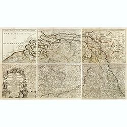
![[Lot af 6] maps of southern Germany](/uploads/cache/18164-250x250.jpg)
[Lot af 6] maps of southern Germany
[Lot of 6] maps Germany- Exactissima Tabula Sedis Belli Palatinatus ad Rhenum, Vormaciensis et Spirensis Episcopatus….- Le Cours du Rhin depuis Worms jusqu a Bonne…....
Date: Paris, 1704
Selling price: ????
Please login to see price!
Sold in 2022
AVENIO Vulgo AVIGNON.
Bird-eye view of Avignon. From the rare town book by Mortier.
Date: Amsterdam 1704
Selling price: ????
Please login to see price!
Sold
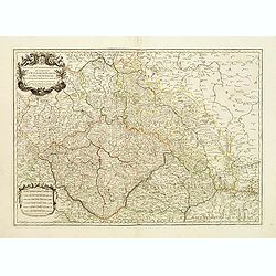
Estats de la couronne de Boheme qui comprennent le Royaume de Boheme..
Decorative map of Czech Republic with a nice title cartouche. Engraved by Cordier and prepared by N. Sanson. With the address "les grands Augustins, aux a globes&quo...
Date: Paris 1704
Selling price: ????
Please login to see price!
Sold
Estats de la Couronne de Boheme qui comprennent le Royaume de Boheme, le Duché de Silesie?
Centered on Prague. Engraved by Cordier.
Date: Paris, 1704
Selling price: ????
Please login to see price!
Sold
Die Süd-West Cüste von Gallicien.
Very decorative map from Bodenehr's "Atlas curieux" published in Augsburg. The detailed map shows the area around Vigo in Gallicia in north-west Spain and inclu...
Date: Augsburg, c1704
Selling price: ????
Please login to see price!
Sold
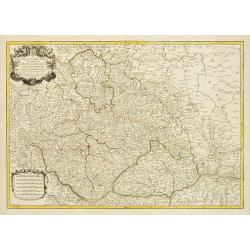
Estats de la couronne de Boheme qui comprennent le Royaume de Boheme..
Decorative map of Czech Republic, southwestern part of Poland and eastern parts of Germany with a nice title cartouche.Engraved by Cordier and prepared by N. Sanson. With...
Date: Paris 1704
Selling price: ????
Please login to see price!
Sold
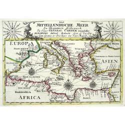
DAS MITTELLAENDISCHE MEER...
Very decorative copper-engraved map from Bodenehr's "Atlas curieux" published in Augsburg. Shows the Mediterranean Sea with many place names. Decorated with a...
Date: Augsburg, c1704
Selling price: ????
Please login to see price!
Sold
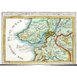
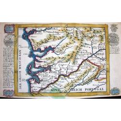
LISSABON MITT DERO GEGEND AUFF 10. STUNDT
Very decorative map from Bodenehr's "Atlas curieux" published in Augsburg. The detailed map shows the area around Lisbon/Lisboa with many towns and villages s...
Date: Augsburg, c1704
Selling price: ????
Please login to see price!
Sold
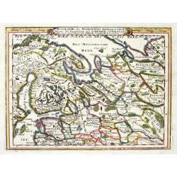
RUSSLANDS ODER MOSKOVIENS NORD-WEST THEIL...SCHWEDEN UND NORWEGEN...POLEN...
Very decorative map from Bodenehr's "Atlas curieux" published in Augsburg. The map shows parts of Norway, Sweden, Finland, the Baltic states and Russia in gre...
Date: Augsburg c1704
Selling price: ????
Please login to see price!
Sold in 2009
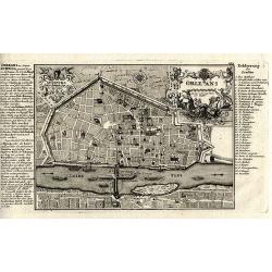
Orleans.
Superb copper-engraved city plan from Bodenehr's "Atlas curieux" published in Augsburg.
Date: Augsburg, c1704
Selling price: ????
Please login to see price!
Sold in 2012
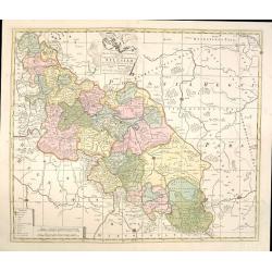
Mappa Geographica Exactissima, Continens Imperatoris Haereditarium Dominium Silesiam, nec non eiusdem Provincias interiores Ducatus, Comitatus, Baronatus etc. edente Petro Schenck Cum Privilegio Ord. General. Holland et West Frisiae
Map of part of Poland and Germany. The region along the river Oder. Cracow in lower right corner. Prague in lower left. Copper engraving, hand colored in outline and wash...
Date: Amsterdam, 1704
Selling price: ????
Please login to see price!
Sold in 2015
Carte du Comte de Flandre.
Guillaume de L'Isle map of Belgium, shows cities of Brugge and Antwerp.
Date: Paris, 1704
Selling price: ????
Please login to see price!
Sold in 2010
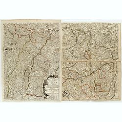
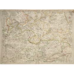
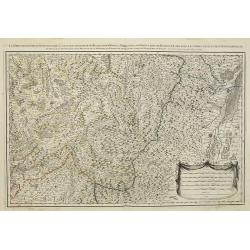
Partie Meridionale de la Souabe.
Guillaume del'Isle map of the region of Southern Germany, near the border of Switzerland.
Date: Paris, 1704
Selling price: ????
Please login to see price!
Sold in 2010
Partie Septentrionale de la Souabe.
Map of the Swabia region of Bavaria in Southern Germany, a very important historic and cultural region of Europe. Charlemagne's family is from the Swabia region, and as w...
Date: Paris, 1704
Selling price: ????
Please login to see price!
Sold in 2010
Le Cours du Rhin depuis Worms, jusqua Bonne, et Les Paysa Adjaces.
Map of the eastern Germany, showing the region surrounding the Rhine Rivers, or the Rhine Valley. Cities shown (from north to south) include Bonne, Cologne, Mainz, Frankf...
Date: Paris, 1704
Selling price: ????
Please login to see price!
Sold in 2010
Carte du Comte de Flandre Dressee Sur Differens Morceaux LevezSur Les Lieux Fixez Par Les Obfervations A Aftonomiques.
A map of Flanders by Guillaume De L'Isle depicting major cities such as Conde and Altervelt, and major river systems. In the bottom right hand corner lies a very detailed...
Date: Paris, 1704
Selling price: ????
Please login to see price!
Sold in 2010
Carte du Comté de Flandre. . .
Map of Flanders. The publishers address in the title cartouche partly erased. Some manuscript annotations in brown pen and ink in the margin and in the map. Engraved by L...
Date: Paris, c.1704
Selling price: ????
Please login to see price!
Sold in 2010
Carte Du Diocese de Narbonne. . .
Finely detailed map of the Diocese of Narbonne, a Catholic Diocese that existed in southwestern France until the French Revolution, by Guillaume de L'Isle. A nice inset m...
Date: Paris, 1704
Selling price: ????
Please login to see price!
Sold in 2010
Les prevotez, senechaussee, et comte, qui font partie des Balliages de Vosges ou Mirecour . . .
Map of Vosges including the city of Epinal, Colmar.
Date: Paris, 1704
Selling price: ????
Please login to see price!
Sold in 2011
Le Royaume de Hongrie Divise en Haute et Basse.
Coronelli's scarce map of Hungary & Serbia published by Nolin. The huge 45 cm. cartouche includes the title, scale and advertising by Nolin of his maps. It depicts th...
Date: Paris, 1704
Selling price: ????
Please login to see price!
Sold in 2014
Partie Meridionale de la Souabe.
Very detailed hand-colored, copperplate map of Swabia in Germany and Switzerland. Includes the Danube River and the cities of Nuremberg, Augsburg, Ulm, Marchdorf etc. Als...
Date: Paris, 1704
Selling price: ????
Please login to see price!
Sold in 2016
\'Urbis cum vicis seu Pagis adiacentibus Descriptio Dissertationi III de Aq. et Aqued et Aqued Veteris Romae Praemissa, authore Raph. Fabretto Gasp. f, Urbinate\'. by Jan van Vianen
Rare copper engraving map of Rome , that shows the water supply of Rome and its aqueducts.Engraved by Jan van Vianen after Jan Goeree published by Francois Halma in Amste...
Date: Amsterdam, 1704
Selling price: ????
Please login to see price!
Sold in 2014
PARTIS LAT II. A. ROMA. LABICUM. USQUR DESCRIPTO DESSERTATIONI LIDE AQUIS ET AQUAE DUCTIBUS VETERIS ROMAE PRAEMISSA authore Raph Fabretto Gasp f, Urbinate\'.by Jan van Vianen
Rare copper engraving map of Rome, that shows the water supply of Rome and its aqueducts, to the South with two beautifully ornate cartouche. Engraved by Jan van Vianen a...
Date: Amsterdam, 1704
Selling price: ????
Please login to see price!
Sold in 2014