Browse Listings in Europe > Scandinavia > Iceland
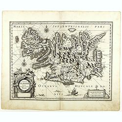
Tabula Islandiae. . .
With a very decorative cartouche, and a very fine imprint. No text on verso; included in the rare "Appendix" of 1630. VERY RARE. This handsome map of Iceland wa...
- $1200 / ≈ €1048
Date: Amsterdam, 1630
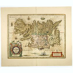
Tabula Islandiae..
This handsome map of Iceland was based on information from a Dutch navigator named Joris Carolus in about 1620. The map shows the influence of both versions of bishop Gud...
- $1100 / ≈ €961
Date: Amsterdam, 1645
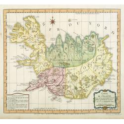
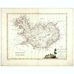
Carte de l'Islande pour servir á la continuation de l'histoire générale des voyages. Dressée sur celle de M. Horrebows.
A good engraved map of the island Iceland, prepared by Bellin after M. Horrebows, with rococo title cartouche in lower right. From l'Histoire générale des voyages.
- $300 / ≈ €262
Date: Paris, 1758
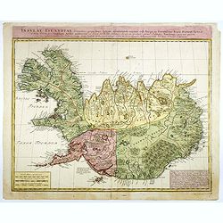
Insulae Islandiae delineatio : prout haec Solenni mensurandi negotio sub Auspiciis Potensissimi Regis Daniae facto . . .
Detailed and important map of Iceland, prepared by Th. H. Knoff and O. Ranzow and published by the Homann Heirs. The map is more scientific than many previous similar ver...
- $850 / ≈ €743
Date: Nuremberg, 1761
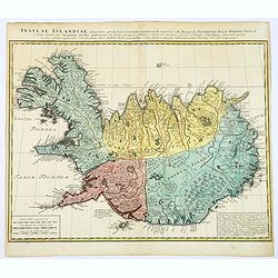
Insula Islandiae delineatio. . .
A nice large map of Iceland published by Homann Heirs. The country is divided up into four differently colored regions, lettered title to top of map, boxed mileage scales...
- $900 / ≈ €786
Date: Nuremberg, 1761
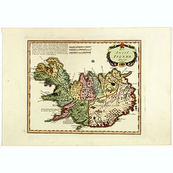
L'Isola d'Islanda divisa Ne Suoi Distretti Di nuova Projezione.
A finely engraved map of Iceland, with a decorative title cartouche to the bottom right hand corner illustrating a rural scene. Published in Zatta's "Atlante Novissi...
- $500 / ≈ €437
Date: Venise, 1781
Die Insel Island Nro. 76.
An attractive map of Iceland based on the unpublished Knoff survey. The map locates villages and churches and graphically delineates the mountains, rivers, lakes and fore...
- $600 / ≈ €524
Date: Vienna, 1789
